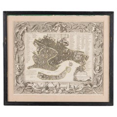
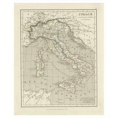
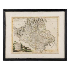
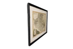
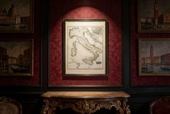
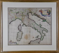
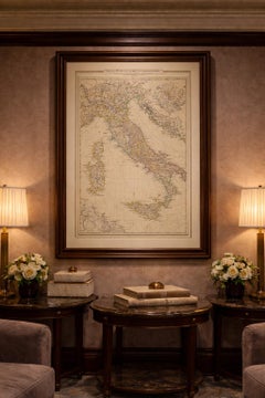
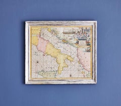
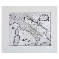
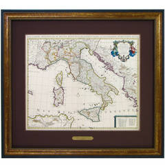
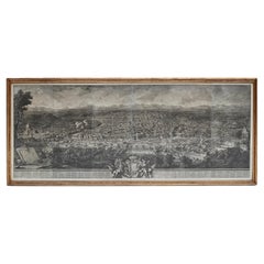
Italian Neo-Classic Map of Italy
Located in Queens, NY
Italian Neo-classic style black framed print of map of Italy
Category
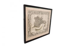
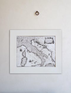
Italian Neo-Classic Map of Italy
Located in Queens, NY
Italian Neo-classic style black framed print of map of Italy

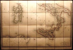
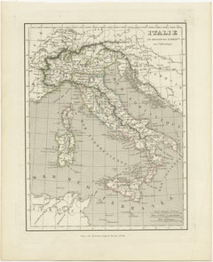
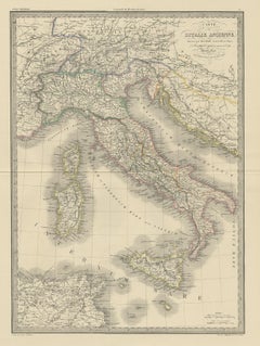
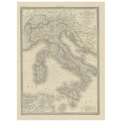
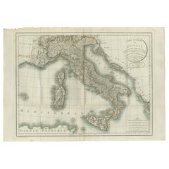
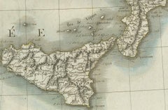
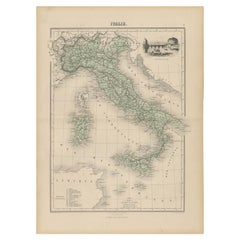
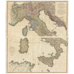
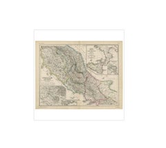
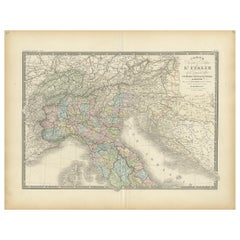
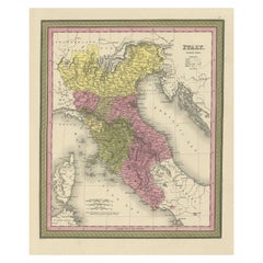
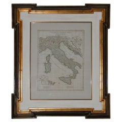
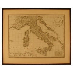
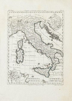
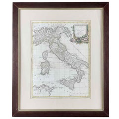
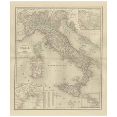
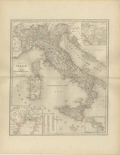
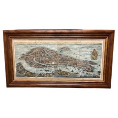
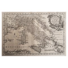
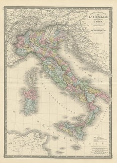
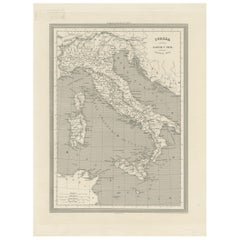
Antique Map of Italy by Andriveau-Goujon, 1843
By Andriveau-Goujon
Located in New York, NY
Antique Map of Italy by Andriveau-Goujon, 1843. Map of Italy in two parts by Andriveau-Goujon for the Library of Prince Carini at Palazzo Carini in Palermo, circa 1843.
Linen, Paper

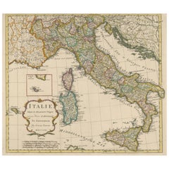
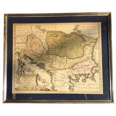
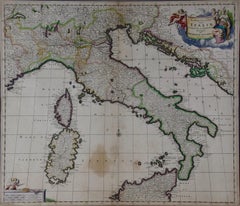
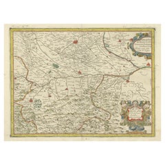
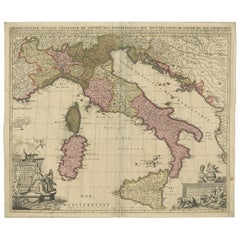
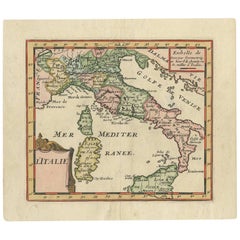
Antique Map of Italy by Keizer & de Lat, 1788
Located in Langweer, NL
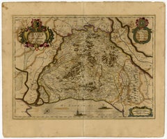
Antique map titled 'Kaart van Italie (..)'. Uncommon original antique map of Italy.
Paper
$159Sale Price|20% Off
H 12.05 in W 10.01 in D 0.02 in
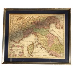
Antique Map of Italy and Other Regions Near the Adriatic Sea
Located in Langweer, NL
Original old map of Italy and surroundings. Also shows Sicily and Sardinia.
Paper
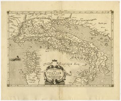
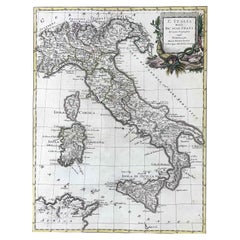
Detailed Antique Map of Italy and surrounding Islands, 1761
Located in Langweer, NL
Very detailed antique map, based on D'Anville's important map of Italy.
Paper
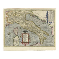
Antique Engraved Map of Italy in Roman Times, ca.1730
Located in Langweer, NL
Plain engr. map of Italy according to the division of Emperor Augustus by G.
Paper
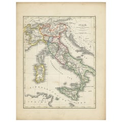

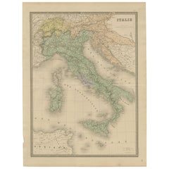
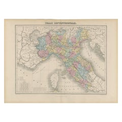
Antique Map of Italy with Hand-Colored Borders, 1852
Located in Langweer, NL
Antique map titled 'Italië'. Map of Italy. This map originates from 'School-Atlas van alle deelen der Aarde' by Otto Petri.
Paper

$470Sale Price|20% Off
H 26.78 in W 19.89 in D 0.02 in
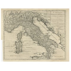
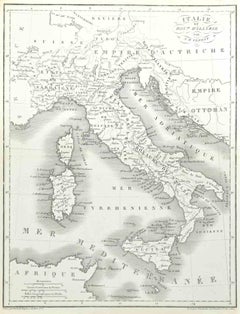
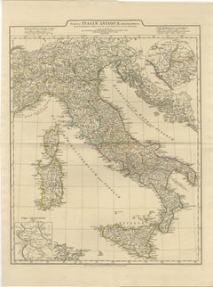
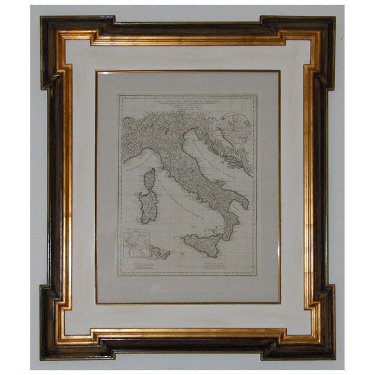
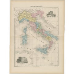
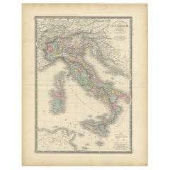
Antique Map of Italy by Pierre M. Lapie, Paper Print, Mid-19th Century
Located in Langweer, NL
Antique map titled 'Carte de l'Italie Ancienne'. Map of Italy.
Paper


$197Sale Price|20% Off
H 14.97 in W 22.45 in D 0 in
Original Antique Map of Italy with an Inset of Sardinia, 1882
Located in Langweer, NL
More than a map, it's a doorway to Italy's rich history and cultural heritage.
Paper

Antique Map of Italy from an Old French Atlas, 1842
Located in Langweer, NL
Antique map titled 'Carte de l'Italie'. Map of Italy.
Paper

$225Sale Price|40% Off
H 15.16 in W 10.24 in D 0 in
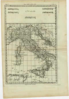
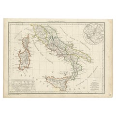
Antique Map of Italy, Corsica, Sardinia and Sicily, ca.1780
Located in Langweer, NL
Description: Antique map titled 'L'Italie.' Map of Italy, Corsica, Sardinia and Sicily.
Paper
$458
H 27.64 in W 20.91 in D 0.01 in
Antique Map of Italy – Pre-Unification Italy by Andriveau-Goujon, Paris 1861
Located in Langweer, NL
Antique Map of Italy – Pre-Unification Italy by Andriveau-Goujon, Paris 1861 This antique map of Italy, titled simply “Italie,” was published in Paris in 1861 by E.
Paper
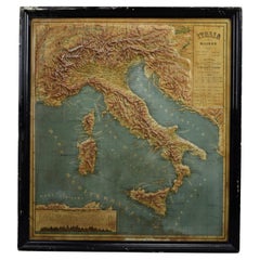
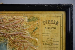
1889 Map of Italy in 3D Relief
Located in Weesp, NL
Don’t miss the opportunity to own a piece of Italian and cartographic history—this exceptional map is a true collector’s item!
Paper
$670
H 22.45 in W 31.7 in D 0.01 in
Map of Italy and Neighboring Regions by Delamarche – Antique Map, c.1800
Located in Langweer, NL
Antique Map of Italy and Surrounding Regions by Delamarche, circa 1800 This elegant and detailed antique map titled Carte Générale de l’Italie was drawn and engraved by the French g...
Paper

$188
H 18.71 in W 13.59 in D 0 in
Antique Map of Italy with Vignette of Saint Angu Castle in Rome, 1880
Located in Langweer, NL
Antique map titled 'Italie Septentrionale'. Old map of Italy with a decorative vignette of Saint Angu castle in Rome.
Paper

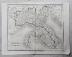
Antique Map of Italy and Corsica, c.1860
Located in Langweer, NL
Antique map titled 'North & Central Italy and the Island of Corsica'.
Paper
Italian Neo-Classic Framed Print of a Regional Map of Italy
Located in Queens, NY
Italian Neo-classic style print of a regional map of Italy in a black painted wooden frame.
Paint
$1,872Sale Price / set|20% Off
H 25.79 in W 36.23 in D 0 in
Very Large Double Page Detailed Map of Italy and Surrounding Regions, 1794
Located in Langweer, NL
This is a large (two seperate sheets) and detailed map of Italy, including the southern parts of Germany, Dalmatia, the adjacent countries, and the Illyric Islands.
Paper
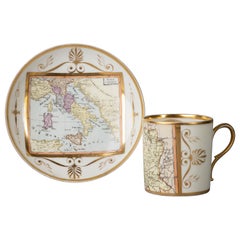
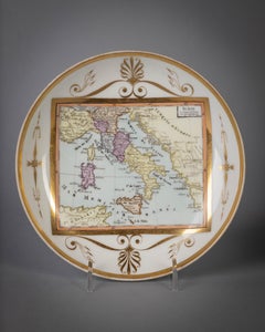
Large Paris Porcelain Map of Italy Cup and Saucer, circa 1810
Located in New York, NY
Large Paris porcelain map of Italy cup and saucer, circa 1810.
Porcelain

Antique Map of Italy with an Inset of Rome, 1812
Located in Langweer, NL
Antique map titled 'Italie Ancienne'. Old map of ancient Italy, with an inset map of the region of Rome.
Paper
$352
H 11.03 in W 8.47 in D 0.04 in
Map of Italy - Etching by Pierre François Tardieu - 1837
Located in Roma, IT
Map of Italy is an Etching realized in 1837. Good conditions.
Lithograph

$1,764
H 25.2 in W 21.07 in D 0 in
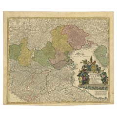
Unusual Benedictine Map of Italy, Showing Various States of the Church, C.1745
Located in Langweer, NL
Unusual Benedictine map of Italy, showing the various states of the church, with an elaborate cartouche.
Paper

Antique Map of Italy and Corse in Ancient Times, 1848
Located in Langweer, NL
Antique map titled 'Italia Superior et Corsica'. Old map of northern Italy and Corse originating from 'Orbis Terrarum Antiquus in usum Scholarum'.
Paper

Antique Map of Italy and Greece by H. Kiepert, circa 1870
By Heinrich Kiepert
Located in Langweer, NL
Antique map titled 'Italiae pars media'. This map originates from 'Atlas Antiquus. Zwölf Karten zur Alten Geschichte' by H. Kiepert. Published in Berlin, circa 187.
Paper


$423Sale Price|20% Off
H 21.78 in W 17.13 in D 0.01 in
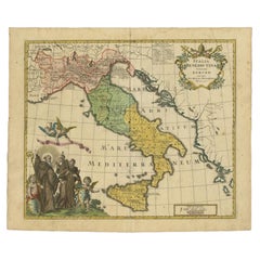
Antique Map of Italy, Showing Corsica, Sardinia, Croatia, Malta and More, C.1740
Located in Langweer, NL
Attractive detailed map showing Italy as well as Corsica, Sardinia, Minorca, Croatia, Albania, Dalmatia, a bit of Provence, Malta and the northern coast of Africa.
Paper

$1,258
H 30.52 in W 23.63 in D 0.79 in
Antique Map of Italy Drawn & Engraved by R. Scott for Thomsons, Edinburgh 1814
Located in London, GB
This is a magnificent museum quality antique hand-coloured map of Italy, dating from 1814. This historic and very rare antique map was drawn and engraved by R.
Other
$450 / item
H 15.75 in W 18.12 in D 0.79 in
Four 18th Century Engraved and Hand-Colored Maps by Weigel
By Christoph Weigel
Located in Copenhagen, K
Small collection of four engraved maps of Italy, Balkan and of Central Asia. Two are of Italy, one Corsica and Northern Italy and the other of the Southern Italian boot.
Paper
$1,475
H 28 in W 31.25 in D 1.38 in
17th Century Dutch Map of Italy, Sicily, Sardinia, Corsica and Dalmatian Coast
By Theodorus Danckerts
Located in Alamo, CA
The islands of Corsica and Sardinia and part of Sicily are also represented. At the time this map was made, most of Italy was under Spanish control.
Engraving
$282
H 17.92 in W 13.78 in D 0 in
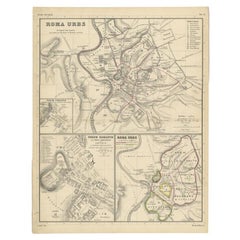
Detailed Original Antique Map of the Region of Rome in Italy, c.1870
By Heinrich Kiepert
Located in Langweer, NL
Antique map titled 'Roma Urbs'. Old map of Italy, it shows three inset maps of the region of Rome.
Paper

$1,646
H 14.3 in W 19.49 in D 0.01 in
Italia Antiqua Philippo Cluvero – 1603 Hondius Map of Ancient Italy, Handcolored
Located in Langweer, NL
This rare and historically significant map is a must-have for collectors of antique maps, scholars of classical geography, and enthusiasts of Italian history.
Paper
$398
H 24.1 in W 17.84 in D 0.02 in
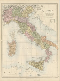
Antique Map Italy, Bartholomew for Black’s General Atlas, Edinburgh 1884
Located in Langweer, NL
Black, Edinburgh, 1884 Keywords Italy, antique map Italy, Italy map 1884, Bartholomew map Italy, Black’s General Atlas, Italian peninsula map, historical map Italy, Victorian map It...
Paper
$576
H 14.57 in W 21.26 in D 0.01 in
Northern Italy Map, Antique Hand-Colored Political Map, Italy Risorgimento 1860
Located in Langweer, NL
Northern Italy Map, Antique Hand-Colored Political Map, Italy Risorgimento 1860 Description: This finely detailed antique map depicts Northern Italy during the pivotal period of Ita...
Paper
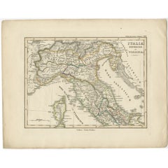
Antique Map of Northern Italy by Levasseur, 1875
Located in Langweer, NL
Antique map titled 'Carte l'Italie (..)'. Large map of Northern Italy.
Paper

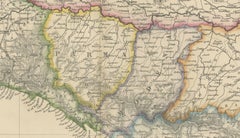
Antique Map of Northern Italy by Migeon, 1880
Located in Langweer, NL
Antique map titled 'Italie Septentrionale'. Old map of the northern part of Italy.
Paper
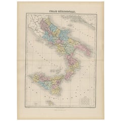

Antique Map of Southern Italy by Migeon, 1880
Located in Langweer, NL
"Antique map titled 'Italie Méridionale'. Old map of southern Italy including Sicily/Sicilia.
Paper
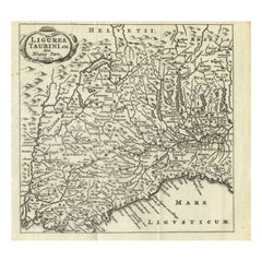

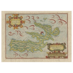
Antique Map of Northwest Italy by Cluver, 1685
Located in Langweer, NL
Antique map titled 'Ligures, Taurini, etc.' Miniature map of northwest Italy.
Paper
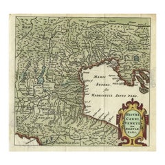
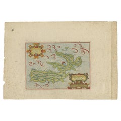
Antique Map of Northern Italy by Cluver, 1685
Located in Langweer, NL
Charming miniature map of northern Italy with the Adriatic or upper sea, now called the Gulf of Venice, from the pocket atlas 'Introductionis in Universam Geographiam tam Veterem qua...
Paper

$3,800 / set
H 17.75 in W 24.5 in D 0.5 in
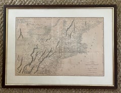
Pair Antique Italian Maps of the North American Eastern Seaboard
Located in New York, NY
Pair antique Italian maps of the North American Eastern Seaboard.
Wood, Paper

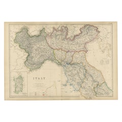
Old Antique Colourful Decorative Map of Northern Italy, 1846
Located in Langweer, NL
Description: Antique map titled 'Italy North Part'. Old map of Northern Italy.
Paper


$696Sale Price|20% Off
H 20.87 in W 25.2 in D 0 in
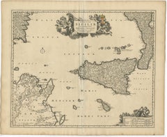
Antique Map of Southern Italy by Janssonius, C.1650
Located in Langweer, NL
Haec Italiae pars nunc primum de prica aerugine est abstersa (..)'. Beautiful map of Southern Italy, viewed from south to north.
Paper

$435
H 13.51 in W 8.55 in D 0.01 in
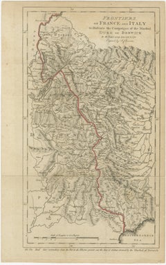
Frontiers of France and Italy – Duke of Berwick Campaigns Map, 1707–1712
Located in Langweer, NL
Title: Frontiers of France and Italy – Duke of Berwick Campaigns Map, 1707–1712 Description: This original antique map depicts the frontiers of France and Italy and was specifically...
Paper
$741
H 19.02 in W 24.22 in D 0.02 in
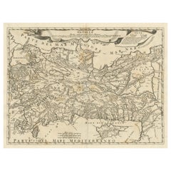
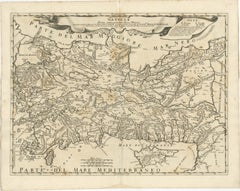
Original Italian Antique Map of Asia Minor, Cyprus, Neighboring Regions, 1686
Located in Langweer, NL
Antique map titled 'Natolia detta anticamente Asia Minor (..)'.
Paper

Antique 1803 Italian Map of Asia Including China Indoneseia India
Located in Amsterdam, Noord Holland
Antique 1803 Italian Map of Asia Including China Indoneseia India Very nice map of Asia. 1803.
Paper
$5,587
H 19.57 in W 23.23 in D 0.01 in
Blaeu Map of Savoy & Alps, Geneva Piedmont France Italy, c.1642
Located in Langweer, NL
Blaeu Map of Savoy & Alps, Geneva Piedmont France Italy, c.1642 Description: A finely detailed and highly decorative map of the Duchy of Savoy, encompassing the Alpine regions betwe...
Paper
$469
H 11.03 in W 13.47 in D 0.01 in
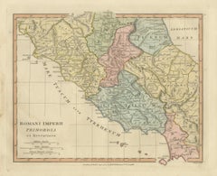
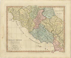
Antique Map of Central Italy & Early Roman Empire – Wilkinson c.1800
Located in Langweer, NL
Antique Map of Central Italy & Early Roman Empire – Wilkinson c.1800 This finely engraved and beautifully hand-colored antique map titled Romani Imperii Primordia et Recentiora pres...
Paper

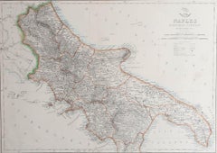
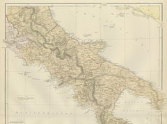
Large Original Antique Map of The South of Italy. John Dower, 1861
Located in St Annes, Lancashire
Great map of the South of Italy Lithograph engraving by John Dower Original colour Published, 1861 Unframed Good condition Free shipping
Paper

$178Sale Price|20% Off
H 7.09 in W 8.98 in D 0.02 in
Antique Map of South Italy, illustrating the Invasion of Naples in, 1806
Located in Langweer, NL
Antique battle map titled 'Map of South Italy, to illustrate the invasion of Naples in 1806 etc'.
Paper
$1,293
H 28.55 in W 21.46 in D 0.01 in
Antique Map of Ancient Italy – Roman Peninsula & Sicily, Engraving c.1818
Located in Langweer, NL
Antique Map of Ancient Italy – Roman Peninsula & Sicily, Engraving c.1818 Elegant antique map depicting ancient Italy, showing the Italian peninsula from the Alps to Sicily, includi...
Paper

$931Sale Price|20% Off
H 16.42 in W 21.54 in D 0.02 in
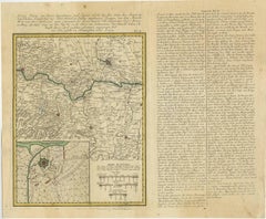
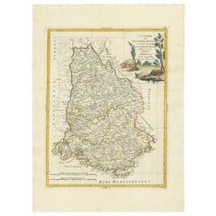
Antique Map of the Region of Pavia, Lodi, Novara, Tortona & Alessandria, Italy
Located in Langweer, NL
Original old map of the region of Pavia, Lodi, Novara, Tortona and Alessandria, Italy.
Paper

$94Sale Price|20% Off
H 19.49 in W 24.22 in D 0 in
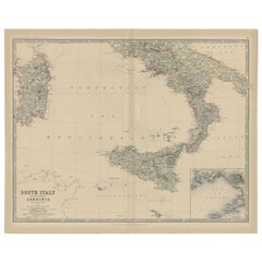
Antique Map of Southern Italy and Sardinia by Johnston, 1882
Located in Langweer, NL
"Antique map titled 'South Italy and the Island of Sardinia'.
Paper

$489Sale Price|20% Off
H 21.07 in W 24.89 in D 0 in
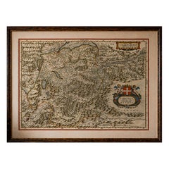
Antique Map of Northern Italy by Homann Heirs, c.1730
Located in Langweer, NL
Detailed map of northern Italy by J. B. Homann. This map shows Venice and its adjacent states Parma, Modena, Mantua and Mirandol.
Paper

$242Sale Price|25% Off
H 10.52 in W 14.57 in D 0.02 in
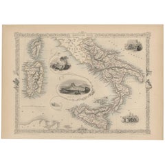
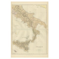
Antique Map of Southern Italy by J. Tallis, circa 1851
Located in Langweer, NL
Decorative and detailed mid-19th century map of Southern Italy which was drawn and engraved by John Rapkin (vignettes by A.
Paper


$517Sale Price|20% Off
H 20.79 in W 25.2 in D 0.02 in
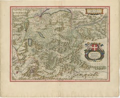
Antique Map of Northern Italy by F. de Wit, 1690
Located in Langweer, NL
A very decorative map centered on Genua, and including the towns of Milan, Torino, Parma, Cremona, etc.
Paper
$1,046 / set
H 19.49 in W 24.02 in D 0.02 in
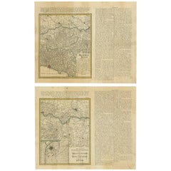
Set of Two Antique Maps of Northern Italy by Homann Heirs, 1754
Located in Langweer, NL
Set of two maps of northern Italy showing the position of troups during the war in April and March 1746.
Paper

$482
H 14.77 in W 17.88 in D 0.01 in
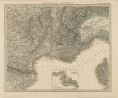
1858 Map of South France with Corsica – Marseille to Italian Border
Located in Langweer, NL
The Mediterranean coastline is carefully engraved, showing the Golfe du Lion, Golfe de Gênes, and parts of the Ligurian coast of Italy. The inclusion of Corsica in the southeast corn...
Paper
$856Sale Price|35% Off
H 31.5 in W 21.07 in D 0.01 in
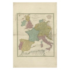
1788 Map of Europe - France, Italy, Spain, Germany, Great Britain & Ireland
Located in Langweer, NL
Title: "1788 Map of Europe - France, Italy, Spain, Germany, Great Britain & Ireland by D'Anville" Description: This detailed map of Europe, titled "First Part of the Map of Eu...
Paper
$60
H 9.25 in W 12.25 in D 0.07 in
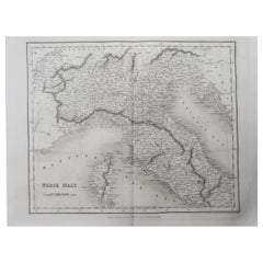
Original Antique Map of North Italy By J.Dower. Unframed, Circa 1835
Located in St Annes, Lancashire
Great map of North Italy Drawn and engraved by J.Dower Published by Orr & Smith.
Paper
An Antique Map Of Italy
Located in Toronto, ON
AN ANTIQUE MAP OF ITALY DRAWN AND ENGRAVED FROM D'ANVILLES MAP FOR J.HARRISON,A PRINTER AND PUBLISHER AT 115 NEWGATE STREET,LONDON.
Unavailable
H 17.33 in W 21.66 in
Ptolemaic map of Italy by Mercator - Engraving - 17th c.
By Gerard Mercator
Located in Zeeland, Noord-Brabant
.' - Nice example of Mercator's Ptolemaic map of Italy. Description: From the 1698 ed. of Mercator's Ptolemy Atlas: 'Claudii Ptolemaei Tabulae Geographicae Orbis Terrarum Veteribus ...
Engraving
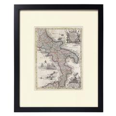
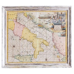
Hand-Colored Map of Southern Italy, circa 1744
By Matthew Seutter
Located in New York, NY
Seutter, Matthew. Neapolis Regnum... From Atlas minor praecipua Terrarum Imperia... Augsburg, circa 1744. Original engraving with old hand-coloring. Image size: 10 3/16 x 7 11...
Paper
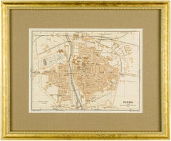
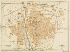
1928 Map of Parma, Italy
Located in New York, NY
1928 Map of Parma, Italy presented in a new gold wood frame with linen conservation mat and conservation acrylic.
Lithograph
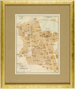
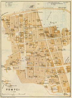
1928 Map of Pompeii, Italy
Located in New York, NY
1928 Map of Pompeii, Italy presented in a new gold wood frame with linen conservation mat and conservation acrylic.
Lithograph
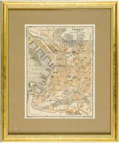
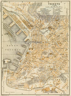
1928 Map of Trieste, Italy
Located in New York, NY
1928 Map of Trieste, Italy presented in a new gold wood frame with linen conservation mat and conservation acrylic.
Lithograph
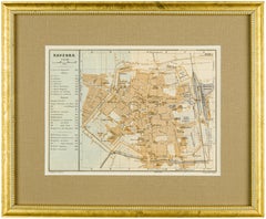
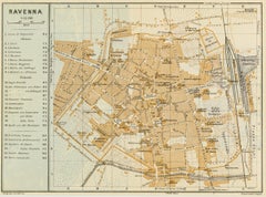
1928 Map of Ravenna, Italy
Located in New York, NY
1928 map of Ravenna, Italy presented in a new gold wood frame with linen conservation mat and conservation acrylic.
Lithograph
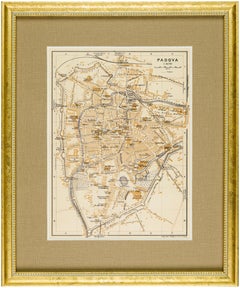

1928 Map of Padova (Padua), Italy
Located in New York, NY
1928 Map of Padova (Padua), Italy presented in a new gold wood frame with linen conservation mat and conservation acrylic.
Lithograph
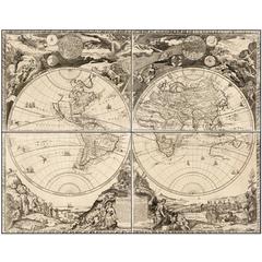
Highly Decorative Italian Wall Map of the World
By Paolo Petrini
Located in La Jolla, CA
Importantly, unlike much of Petrini’s work, this map is an original composition, although his cartographic sources can be traced to important French and Italian sources.
Paper
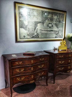
19th Century Big Italian Print Map and History of Naples
Located in Toledo, Castilla La Mancha
Beautiful 19th century big Italian print, map and history of Naples. Various framed prints depicting topographic map of the city of Naples and its surroundings, with a view to the...
Wood, Paper
Unavailable
H 23.23 in W 20.48 in D 1.19 in
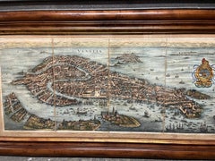
Antique Hand-Coloured Map of Venice with Vintage Frame, Italy, Late 18th Century
Located in Copenhagen K, DK
Italy, late 18th Century Antique hand-coloured map of Venice.
Other

Unavailable
H 40 in W 49 in D 1.5 in
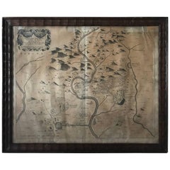
1680 Athanasius Kircher Map "Territorii Tiburtini Veteris Et Novi Descriptio"
By Athanasius Kircher
Located in Drottningholm, SE
A rare map of the northern parts of Italy, made by Athanasius Kircher in the late 17th century.
Unavailable
H 19.61 in W 23.23 in
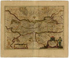
Ducatus Gelriae pars prima quae est Neomagensis.
By Johannes Janssonius
Located in Zeeland, Noord-Brabant
Renamed Atlas Novus, it had three volumes in 1638, one fully dedicated to Italy. 1646 a fourth volume came out "English County Maps", a year after a similar issue by Willem Blaeu.
Engraving, Etching
![Tabula Castelli ad Sandflitam, qua simul inundati agri, alluviones, [...].](https://a.1stdibscdn.com/archivesE/upload/a_5923/1509441013669/cb3408_master.jpg?width=240)
Unavailable
H 19.53 in W 23.31 in
Tabula Castelli ad Sandflitam, qua simul inundati agri, alluviones, [...].
By Johannes Janssonius
Located in Zeeland, Noord-Brabant
Renamed Atlas Novus, it had three volumes in 1638, one fully dedicated to Italy. 1646 a fourth volume came out with "English County Maps", a year after a similar issue by Willem Blaeu.
Engraving, Etching
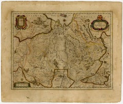
Trasisalania vulgo Overyssel.
Located in Zeeland, Noord-Brabant
Renamed Atlas Novus, it had three volumes in 1638, one fully dedicated to Italy. 1646 a fourth volume came out with "English County Maps", a year after a similar issue by Willem Blaeu.
Engraving, Etching
Unavailable
H 19.61 in W 23.35 in
Ducatus Gelriae pars quarta quae est Arnhemiensis, sive Velavia.
By Johannes Janssonius
Located in Zeeland, Noord-Brabant
Renamed Atlas Novus, it had three volumes in 1638, one fully dedicated to Italy. 1646 a fourth volume came out with "English County Maps", a year after a similar issue by Willem Blaeu.
Engraving, Etching

Map of Italy by Charles Francois Delamarche
By Charles Francois Delamarche
Located in San Francisco, CA
An attractive framed engraved map of Italy and surrounding areas by well-known French cartographer C.F.
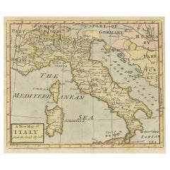
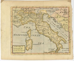
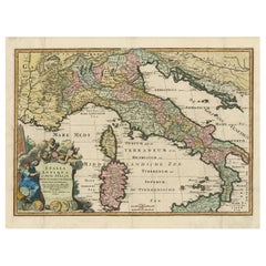
Nice Decorative Hand-Colored Antique Map of Italy, ca.1745
Located in Langweer, NL
Antique map Italy titled 'A New Map of Italy from the lastest observations'.
Paper
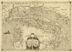
17th Century Geographical Map of Italy
By Matthäus Merian the Elder
Located in Florence, Tuscany
This beautifully detailed geographical map of Italy was printed in 1640. It was made by the expert Swiss engraver Matthaus Merian the Elder (1593-1650).
Parchment Paper

Sold
H 12.49 in W 9.85 in D 0 in
Antique Map of Italy, Sicily and Sardinia Based on Ancient Sources, 1848
Located in Langweer, NL
Old map of Italy, Sicily and Sardinia originating from 'Orbis Terrarum Antiquus in usum Scholarum'.
Paper
Sold
H 10.63 in W 8.27 in D 0.04 in
Ancient Map of Italy - Original Etching - 19th Century
Located in Roma, IT
This Map of Italy is an etching realized in the 19th century.
Etching
Sold
H 24.02 in W 20.08 in D 0.79 in
18th Century Map of Italy by Antonio Zatta 1782 Original Hand-Colored Etching
By Antonio Zatta
Located in Milano, MI
A rare map of Italy, an 18th century Italian etching and burin engraving set in a modern walnut frame within a passe-partout and glass.
Walnut, Paper
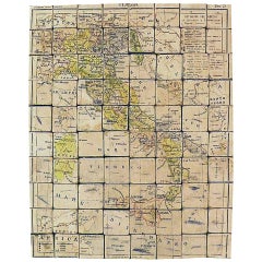

Puzzle Atlas with Maps, Italy, circa 1900
Located in Milan, IT
80 little wooden cubes covered with printed paper that depending on which side they form the maps of Italy, Europe, North America, South America, Asia and Africa.
Wood, Paper

Sold
H 24.81 in W 20.08 in D 0 in
Old Detailed Trade Route and Shipping Map from Italy to the Low Countries, c1671
Located in Langweer, NL
Detailed trade route and shipping map of the region from Italy to the Low Countries, showing the various trade routes, roads, etc.
Paper
Sold
H 21.66 in W 17.33 in D 0.01 in
Italy Map with Sardinia, Sicily and Rome Inset – Nieuwe Hand-Atlas, 1876
Located in Langweer, NL
Italy Map with Sardinia, Sicily and Rome Inset – Nieuwe Hand-Atlas, 1876 This detailed 19th-century map of Italy, titled “Italië,” was published in 1876 as part of the Nieuwe Hand-A...
Paper

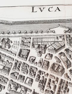
Italian Parchment Map of the City of Lucca Dated 1640
By Matthäus Merian the Elder
Located in Florence, Tuscany
An antique map of the Tuscan city of Lucca engraved for The 'Itinerarium Italiæ Nov-antiquæ' by Matthäus Merian the Elder and printed in 1640. The original paper from 1640 is well pr...
Paper, Parchment Paper
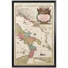
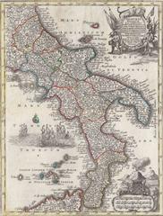
Hand-Colored Map of Southern Italy, circa 1720
Located in Colorado Springs, CO
This elegantly engraved, hand-colored map focuses on the Italian peninsula from Abruzzo down to the Northeastern section of Sicily.


Antique Map of Southern Italy, Hand-Colored, circa 1720
Located in Colorado Springs, CO
Presented is an original map of the Eastern Part of Italy, circa 1720. The map displays the kingdoms of Naples and Sicily, showing the southern half of Italy and much of the Balkans.
Paper
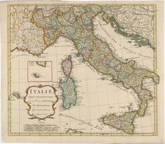
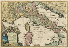
1730 Dutch Map of the Italian Pennisula and Mediterranean
Located in Colorado Springs, CO
Exceptional 1730 Dutch map, entitled: L'Italie Dressee sur les Observations de Mrs. de l'Academie Royale des Sciences..., which shows all of Italy, to include Sicily, Sardinia and Co...


1880s Map of The Italian Alps from Milan to Lake Garda
Located in Florence, Tuscany
Geographical Map of the Profile and Elevation of the Italian Alps from Milano to Lake Garda.
Parchment Paper

Sold
H 18.71 in W 13.59 in D 0 in
Antique Map of Ancient Italy with Inset of the Colosseum in Rome, 1880
Located in Langweer, NL
Antique map titled 'Italie Ancienne'. Old map of ancient Italy.
Paper
Sold
H 22.45 in W 14.97 in D 0 in
Original Antique Map of the South Part of Italy with an Inset of Malta, 1882
Located in Langweer, NL
More than a map, it's a portal to a bygone era and the distinctive allure of southern Italy.
Paper
Sold
H 10.83 in W 15.75 in D 0 in
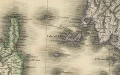
Antique Map of Elba in Tuscany, Italy, Site of Napoleon's First Exile, c.1620
Located in Langweer, NL
Antique map titled 'Elba Isola olim Ilua'. Old map of Elba, a Mediterranean island in Tuscany, Italy.
Paper
Sold
H 17.45 in W 23.04 in D 0.02 in
Antique Map of Ancient Italy and the Islands Corsica, Sicily and Sardinia
Located in Langweer, NL
Very decorative map of ancient Italy and the islands Corsica, Sicily and Sardinia after N.
Paper

Sold
H 21.07 in W 24.81 in D 0 in
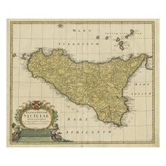
Detailed Antique Map of the Island Sicily, Italy with Nice Coat of Arms, 1747
Located in Langweer, NL
Detailed map of the island Sicily, Italy, published by Homann Heirs in 1747.
Paper
Sold
H 20.67 in W 25.2 in D 0 in
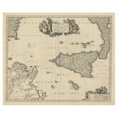
Decorative Map of Sicily, Malta and a Bit of Naples and Sardinia 'Italy', c.1680
Located in Langweer, NL
Decorative map of Sicily, Malta and a bit of Naples and Sardinia (Italy).
Paper

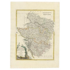
Antique Map of the Region of Dauphiné by Zatta, 1779
Located in Langweer, NL
Artists and Engravers: Antonio Zatta (active 1757-1797) was the most prominent Italian map publisher of the late 18th and early 19th century.
Paper
17th Century Hand Colored Prospect Map of Venice Engraving
Located in Houston, TX
A nice engraved, hand colored view of Venice, originally engraved in 1635. Highly detailed showing the important buildings, the course of the Grand Canal, the Rialto bridge, All in a...
Wood, Paper


Set of 4 Antique Geographical Maps French-German War 1870-71
Located in Casale Monferrato, IT
Elegant late 19th century set of four antique geographical maps relating to the positioning of the armies in the Franco-German War 1870-71. Author: Historical Section of the Great Ge...
Paper

Antique Map of the Region of Poitou and Saintonge by Zatta (1779)
Located in Langweer, NL
Artists and Engravers: Antonio Zatta (active 1757-1797) was the most prominent Italian map publisher of the late 18th and early 19th century.
Paper
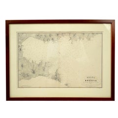

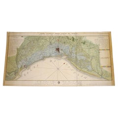
Golfo Della Spezia Genoa, Second Half of the 19th Century
Located in Milan, IT
Golfo Della Spezia, ancient portolano for use by seafarers with indications for anchoring in port made by the Litografia Armanino active in Genoa between 1843 and 1880, on behalf of ...

Sold
H 17.92 in W 22.52 in D 0 in
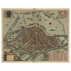
Original Antique Bird's Eye View Plan of Hoorn, The Netherlands by Blaeu, c.1700
Located in Langweer, NL
Renamed Atlas Novus, it had three volumes in 1638, one fully dedicated to Italy. 1646 a fourth volume came out with ""English County Maps"", a year after a similar issue by Willem Bl...
Paper
Antique Framed Lithograph Map of Venice
Located in Dallas, TX
Antique framed lithograph map of Venice is adorned with the family crests of the nobility who called the fabled city home, with a surprisingly detailed and relatively accurate drawin...

Map of the Lagoons of Venice, 1818, Paper
Located in Vicenza, VI
The work in question is a precious engraved map of the Venice Lagoon, made in the early nineteenth century.
Paper
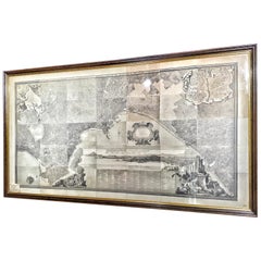
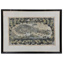
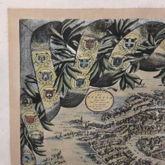
Giuseppe Agostino Vasi Giant Engraved Map of Rome
By Giuseppe Vasi
Located in Kastrup, DK
Giuseppe Agostino Vasi (b. Corleone 1710, d. Rome 1782), Italian printmaker and archaeologist. Important large scale panorama view of Rome, by Giuseppe Vasi, 1765. "Prospetto del...
Glass, Wood, Paper


Antique Map of Italy by Andriveau-Goujon, 1855
Located in Langweer, NL
Antique folding map of Italy titled 'Italie'. Detailed map of Italy.
Paper

Original Antique Map of Italy. C.1780
Located in St Annes, Lancashire
Great map of Italy Copper-plate engraving Published C.1780 Unframed.
Paper


Original Antique Map of Italy. Arrowsmith. 1820
Located in St Annes, Lancashire
Great map of Italy Drawn under the direction of Arrowsmith Copper-plate engraving Published by Longman, Hurst, Rees, Orme and Brown, 1820 Unframed.
Paper


Antique Map of Italy by Johnson, 1872
Located in Langweer, NL
Antique map titled 'Johnson's Italy (..)'. Original map of Italy.
Paper
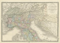
Antique Map of Italy by Levasseur, '1875'
Located in Langweer, NL
Antique map titled 'Carte générale de l'Italie (..)'. Large map of Italy.
Paper
Large Original Vintage Map of Italy, circa 1920
Located in St Annes, Lancashire
Great map of Italy. Original color. Good condition.
Paper


Antique Map of Italy by Wyld '1845'
Located in Langweer, NL
Antique map titled 'Italy'. Original antique map of Italy.
Paper

Antique Map of Italy by Schenk '1701'
Located in Langweer, NL
Old map of Italy, by Nicolas Sanson, published by Petrus Schenk.
Paper

Antique Map of Italy by Gaspar y Roig, 1852
Located in Langweer, NL
Antique map titled 'Italia Antigua'. Antique map of Italy by Gaspar y Roig, published in 1852.
Paper


Original Antique Map of Italy by Thomas Clerk, 1817
Located in St Annes, Lancashire
Great map of Italy Copper-plate engraving Drawn and engraved by Thomas Clerk, Edinburgh.
Paper

Antique Map of Italy by F. de Aefferden, 1725
Located in Langweer, NL
Rare and decorative map of Italy with Sicily, Sardinia and Corsica.
Paper


Antique Map of Italy by A & C, Black, 1870
Located in Langweer, NL
Antique map titled 'Italy'. Original antique map of Italy.
Paper
Antique and vintage collectibles and curiosities can bring whimsy and wonder to any interior.
Decorating with old scientific instruments, historical memorabilia and vintage musical instruments, as well as other authentic collectibles and curiosities that can be found on 1stDibs, presents an opportunity to create a unique, natural history museum-like atmosphere in your home that can provoke conversation as often as it pays tribute to how far we’ve come in understanding our world.
And bringing collectibles and curiosities into your space is actually on trend — Wunderkammern, or curiosity cabinets, were all the rage in Europe during the 1500s and continued to have adherents there and in the U.S. in the following centuries. Today, however, they’re experiencing a real surge in popularity and influencing how many interior designers are furnishing and decorating homes — combining contemporary with antique, scientific with tribal, earthly with extraterrestrial, Les Lalanne tables with Flemish tapestries.
The original Wunderkammern were entire rooms filled with objects demonstrating their owners’ worldly knowledge: A proper one included artificiala or preciosa (objets d’art); naturalia (such as skeletons, shells, minerals); exotica (taxidermy or dried plants); and scientifica (scientific instruments), frequently alongside religious relics and ancient artifacts.
Pay tribute to a history of rich and diverse musical traditions that have taken shape all over the world by decorating your home with a collection of antique and vintage musical instruments — with a little help from strong hanging wire or some wall hooks, vintage brass instruments such as a gong, French horn or trumpet can help elevate a home office or complement the efforts you’ve made to ensure a welcoming vibe in your home’s entryway. Bells or antique wind instruments can add provocative metallic contrasts to dark woods as tabletop decorative objects.
Create an intriguing focal point with Georgian scientific instruments, such as stick barometers with mahogany cases or lacquered brass telescopes. These items stem from an era named for the monarchies of the four King Georges, who ruled England in succession starting in 1714 (plus King William’s reign, which lasted until 1837). Just as there was beautiful jewelry produced during the period that today is coveted by collectors, there is much to be found in the collectibles and curiosities realm too.
Wanderlust, nostalgia and a shared love of good design are contributing factors to certain trends in decorating — just as vintage trunks and luggage have reappeared as furniture or home accents in a bedroom or foyer, decorating with globes, maps or nautical objects is similarly rooted in the allure of travel and a penchant for the stylish finishing touch that collectibles bring to our homes.
Find a wide range of antique and vintage collectibles and curiosities on 1stDibs.
It’s never too early for good design. These interiors combine elevated furnishings and a youthful spirit, resulting in spaces that are at once elegant and whimsical.
Produced in 1843, the well-preserved volume is evidence of the author's exacting specifications.
New or old, the coverlets add old-time charm to any space.
Get into the games! These items celebrate the events, athletes, host countries and sporting spirit.
French trendsetter and serial collector Daniel Rozensztroch tells us about his obsession with objects related to seafaring men.
It's hard to resist the allure of a beautiful pool. So, go ahead and daydream about whiling away your summer in paradise.
The sought-after designer worked with the team at Hoffman Creative to produce a monograph that beautifully showcases some of Studio Shamshiri's most inspiring projects.
Italian writer and collector Umberto Pasti opens the doors to his remarkable cave of wonders in North Africa.