John Speed Maps
to
3
1
4
1
4
4
2
1
1
1
4
4
2
4
4
4
4
102
62
26
24
Creator: John Speed
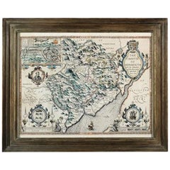
Countye of Monmouth, Dated 1610
By John Speed
Located in BUNGAY, SUFFOLK
The countye of Monmouth with the situation of the townshire described Anno, 1610
The reverse with Monmouthshire, Chapter VI and an alphabetical list of towns.
In a beautiful Flemish oak polished and gilded frame
Cartographer: John Speed...
Category
1610s English Baroque Antique John Speed Maps
Materials
Paper
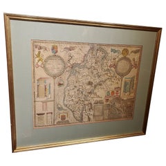
Framed 17th Century Map of Cumberland, England by John Speed, 1610
By John Speed
Located in Middleburg, VA
A fascinating and richly detailed antique map of Cumberland County in northwest England, drawn and published by the celebrated English cartographer John Spe...
Category
Early 17th Century English British Colonial Antique John Speed Maps
Materials
Copper, Gold Leaf
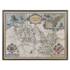
17th Century John Speed Map of Denbighshire, c.1610
By John Speed
Located in Royal Tunbridge Wells, Kent
Antique early 17th century British very rare and original John Speed, hand coloured map of Denbighshire, dated 1610, by John Sunbury and George Humble. John...
Category
17th Century British Antique John Speed Maps
Materials
Wood, Paper
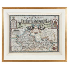
17th Century John Speed Map of the Barkshire Described, c.1616
By John Speed
Located in Royal Tunbridge Wells, Kent
Antique 17th century British very rare and original John Speed (1551-1629) map of the Barkshire Described, J. Sud and Georg Humble, publication (1616 or lat...
Category
17th Century British Antique John Speed Maps
Materials
Paper
Related Items
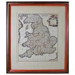
Large 17th Century Hand Colored Map of England and the British Isles by de Wit
By Frederick de Wit
Located in Alamo, CA
A large hand colored 17th century map of England and the British Isles by Frederick de Wit entitled "Accuratissima Angliæ Regni et Walliæ Principatus", published in Amsterdam in 1680. It is a highly detailed map of England, Scotland, the Scottish Isles...
Category
Late 17th Century Dutch Antique John Speed Maps
Materials
Paper
$940 Sale Price
20% Off
H 35 in W 30.5 in D 2 in
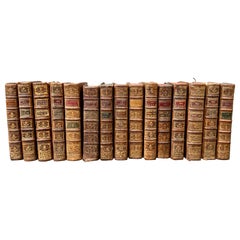
18th Century Set of 15 French Leather Bound Books
Located in Haddonfield, NJ
A rare set of 15 French decorative antique leather-bound library books. The books are wrapped in leather all around and are comprised of a selection of warm tones featuring gold leaf...
Category
18th Century French Baroque Antique John Speed Maps
Materials
Leather, Paper
Ciro Ferri Drawing Offering Scene Italie 17th Century
Located in Beuzevillette, FR
Italian lead pencil drawing, entourage of Ciro Ferri, depicting an offering scene in front of a temple, in the manner of the antiquity.
Measurements: 7.8/5.9 inches
...
Category
17th Century Italian Antique John Speed Maps
Materials
Paper
Early 19th Century Original Framed Land Indenture, England, 1810
Located in Lambertville, NJ
A large hand written land indenture document England, 1810, framed. The beautifully hand written document mounted on board with a red velvet border and ...
Category
1810s English Regency Antique John Speed Maps
Materials
Glass, Giltwood, Parchment Paper
Late 17th Century Oil Portrait of a Lady
Located in Lymington, GB
An oil on canvas portrait of a young French courtier, circa 1690.
This evocative antique French-school picture has been attributed to the portrait painter Jean-François de Troy (1679-1752).
De Troy was famous as a portrait painter of fashionable society women.
This is a very attractive late-17th century painting surviving in its original frame and stretcher. The canvas appears to be untouched.
References:
'Jean François de Troy, The Alarm, or the Gouvernante Fidèle', at the Victoria and Albert Museum, London.
'Jean François de Troy, Paris 1679 - Rome 1752', at the Thyssen-Bornemisza Museum.
Laurie G. Winters, Troy, de, Grove Art Online, Oxford Art Online, Oxford University Press, 6 May 2016.
Everett Fahy & Jayne Wrightsman...
Category
17th Century French Antique John Speed Maps
Materials
Canvas
Set of 6 Original Vintage Maps of American States, circa 1900
Located in St Annes, Lancashire
Wonderful set of 6 vintage maps.
Random American states including Maine, Utah, New Hampshire, Nevada, Vermont and New Mexico.
Monochrome with red color outline.
Published by Rand,...
Category
Early 1900s American Edwardian Antique John Speed Maps
Materials
Paper
$950 / set
H 23.75 in W 17.75 in D 0.75 in
Nativity of the Mother of God, 17th Century
Located in North Miami, FL
Late 17th Century Russian Orthodox Icon of the Nativity of the Mother of God painted over gold leaf and gesso laid on a wooden board. It has been framed with a gold gilded museum mou...
Category
17th Century Russian Baroque Antique John Speed Maps
Materials
Gold Leaf
19th Century Lithograph Map of Lower Manhattan, New York
Located in Haddonfield, NJ
1859 hand colored map of Lower Manhattan or New Amsterdam by George H. Moore.
Category
19th Century English Folk Art Antique John Speed Maps
Materials
Paper
$620 Sale Price
20% Off
H 25.5 in W 31 in D 1 in
Original Antique Map of the American State of Maine, 1903
Located in St Annes, Lancashire
Antique map of Maine
Published By A & C Black. 1903
Original colour
Good condition
Unframed.
Free shipping
Category
Early 1900s English Antique John Speed Maps
Materials
Paper
One of the most influential maps of America ever made, 17th Century Willem Blaeu
By Willem Blaeu
Located in ZWIJNDRECHT, NL
A rare and important 17th Century Italian Engraving of Willem Blaeu's Great Wall Map of America, "America quarta pars orbis quam plerunq, nuvum orbem apellitant primo detecta est ann...
Category
17th Century Dutch Dutch Colonial Antique John Speed Maps
Materials
Paper, Linen
$89,769
H 33.9 in W 43.3 in D 0.1 in
Bronze Bassin for Holy Water, Spain, 17th Century
Located in Madrid, ES
Holy wall font. Bronze. Spain, 17th Century.
Small font for holy water designed to be placed on a wall, which has a container decorated with moldings and architectural elements and...
Category
17th Century Spanish Baroque Antique John Speed Maps
Materials
Bronze, Other
Vintage Reproduction 17th Century Map of Europe, American, Cartography, Blaeuw
Located in Hele, Devon, GB
This is a vintage reproduction map of Europe. An American, paper stock cartography print in frame after the work by Blaeuw, dating to the late 20t...
Category
Late 20th Century Central American Mid-Century Modern John Speed Maps
Materials
Glass, Wood, Paper
$1,254
H 30.32 in W 38.39 in D 1.38 in
Previously Available Items
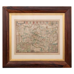
17th Century John Speed Map of Kent with Her Cities & Earles Described, C.1676
By John Speed
Located in Royal Tunbridge Wells, Kent
Antique 17th century British very rare and original John Speed (1551-1629) map of Kent with her Cities and Earles described and observed, Thomas Bassett & ...
Category
17th Century British Antique John Speed Maps
Materials
Paper
H 25.99 in W 34.65 in D 0.79 in
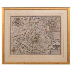
17th Century John Speed Map Of The Bishoprick & Citie Of Durham, c.1611
By John Speed
Located in Royal Tunbridge Wells, Kent
Antique 17th century British very rare and original John Speed (1551-1629) map of the Bishoprick and Citie of Durham, publication (1611 or later), hand-colo...
Category
17th Century British Antique John Speed Maps
Materials
Paper
H 22.45 in W 26.78 in D 0.79 in
John Speed maps for sale on 1stDibs.
John Speed maps are available for sale on 1stDibs. These distinctive items are frequently made of paper and are designed with extraordinary care. There are many options to choose from in our collection of John Speed maps, although brown editions of this piece are particularly popular. Many of the original maps by John Speed were created in the Baroque style in united kingdom during the 18th century and earlier. If you’re looking for additional options, many customers also consider maps by and John Ogilby. Prices for John Speed maps can differ depending upon size, time period and other attributes — on 1stDibs, these items begin at $758 and can go as high as $5,137, while a piece like these, on average, fetch $1,480.
