Original Antique Maps
558
to
588
4,791
606
2,537
2,492
1,501
841
561
540
500
500
242
226
215
157
157
157
144
144
144
138
107
95
83
78
65
60
59
58
58
52
46
44
41
38
36
33
30
26
25
21
21
20
20
19
19
18
13
13
10
9
7
6
86
74
41
30
29
Sort By
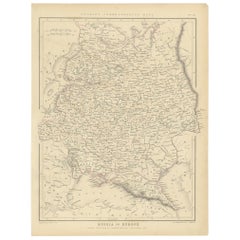
Old Original Map of Russia in Europe, 1849
Located in Langweer, NL
Antique map titled 'Russia in Europe'.
Old map of Russia in Europe. This map originates from
Category
1840s Original Antique Maps
Materials
Paper
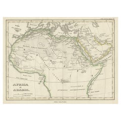
Old Original Map of Africa and Arabia, 1848
Located in Langweer, NL
Antique map titled 'Africa et Arabia'.
Old map of Africa and Arabia originating from 'Orbis
Category
1840s Original Antique Maps
Materials
Paper
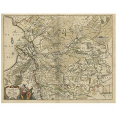
Attractive Original Map of the Province of Overijssel, the Netherlands, Ca.1700
Located in Langweer, NL
, topographical and architectural drawings and globes. Although they produced some original maps, most of their
Category
Early 1700s Original Antique Maps
Materials
Paper
H 20.67 in W 23.82 in D 0 in
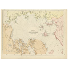
Arctic Exploration: An Original Map of the North Circumpolar Regions, 1882
Located in Langweer, NL
This map, extracted from the 1882 atlas by Blackie & Son, presents the North Circumpolar Regions in
Category
1880s Original Antique Maps
Materials
Paper
H 11.03 in W 14.97 in D 0 in
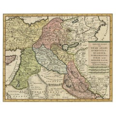
Original Map of The Northern Arabian Peninsula, Palestine, Iraq & Iran, 1732
Located in Langweer, NL
Antique map titled 'Nieuwe kaart van Irak Arabi, Kurdistan, Diarbek (..).'
Detailed map including
Category
1730s Original Antique Maps
Materials
Paper
H 11.66 in W 14.69 in D 0.01 in
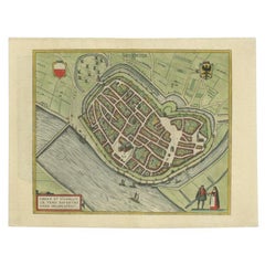
Antique Original Map of the City of Deventer, the Netherlands, 1588
Located in Langweer, NL
Antique map titled 'Liberae et Hanseaticae urbis Daventriensis delineatio'.
Original bird's eye
Category
16th Century Original Antique Maps
Materials
Paper
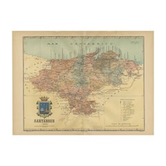
Maritime and Terrestrial Survey of Spanish Santander in 1901, An Original Map
Located in Langweer, NL
This antique map is a historical map of the province of Santander (currently known as Cantabria
Category
Early 1900s Original Antique Maps
Materials
Paper
Free Shipping
H 14.77 in W 20.08 in D 0 in
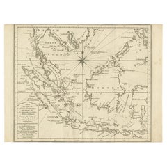
Original Map of the East Indies Including Sumatra, Java, Borneo & Malaysia, 1747
Located in Langweer, NL
Antique map titled 'Carte des Isles Java, Sumatra, Borneo (..) - Kaart van de Eilanden van Iava
Category
1740s Original Antique Maps
Materials
Paper
H 9.65 in W 13 in D 0 in
Old Original Map of Chormandel & Malabar, India & Ceylon, Now Sri Lanka, 1726
Located in Langweer, NL
Antique map titled 'Nieuwe Kaart van Choromandel ende Malabar'.
Antique map depicting the
Category
1720s Original Antique Maps
Materials
Paper
H 21.26 in W 24.02 in D 0 in
Original Map of the Kingdom of Bohemia, with Silesia, Moravia and Lusatia, 1804
Located in Langweer, NL
Antique map titled 'The Kingdom of Bohemia with the Duchy of Silesia and the Marquisates of Moravia
Category
Early 1800s Original Antique Maps
Materials
Paper
H 21.38 in W 27.37 in D 0 in
Old Original Map of the Philippines and Part of Indonesia 'Spice Islands', 1744
Located in Langweer, NL
Antique map titled 'Nieuwe Kaart van de Filippynsche, Ladrones, Moluccos of Specery Eilanden, als
Category
1740s Original Antique Maps
Materials
Paper
H 13.19 in W 20.67 in D 0 in
Original Map of the Military Situation After the Dutch Blockade of Antwerp, 1648
Located in Langweer, NL
Antique map titled 'Tabula Castelli ad Sandflitam (..)'.
This map depicts the complex military
Category
1640s Original Antique Maps
Materials
Paper
H 19.69 in W 22.05 in D 0 in
Original Map of Greece at the Time of the Dorian Migration, Published in 1880
Located in Langweer, NL
The map titled "GRAECIA TEMPORI MIGRATIONIS DORICAE," translates to "Greece at the Time of the
Category
1880s Original Antique Maps
Materials
Paper
No Reserve
H 15.56 in W 18.51 in D 0 in
Old Original Map of Pozzuoli Near Naples in the Campania Region, Italy, ca.1740
Located in Langweer, NL
Antique map titled 'Hic Jacent Puteolorum Bajarum (..)'. Old map of the region of Pozzuoli showing
Category
1740s Original Antique Maps
Materials
Paper
H 9.65 in W 13.19 in D 0 in
Original Map with Bird's-Eye View of Zutphen in the Netherlands by Blaeu, 1649
Located in Langweer, NL
. Around 1649 Joan Blaeu published a collection of Dutch city maps named Tooneel der Steeden (Views of
Category
1640s Original Antique Maps
Materials
Paper
H 20.16 in W 23.78 in D 0 in
Original Antique Map of Prussia, ca.1630
Located in Langweer, NL
Antique map titled 'Prussia - Preussen'. Original map of Prussia, a historically prominent German
Category
1630s Original Antique Maps
Materials
Paper
Antique Map of Illinois by Johnson, 1872
Located in Langweer, NL
Antique map titled 'Johnson's Illinois'. Original map of Illinois. This map originates from
Category
Late 19th Century Original Antique Maps
Materials
Paper
Antique Map of Europe by Johnson, '1872'
Located in Langweer, NL
Antique map titled 'Johnson's Europe'. Original map of Europe. This map originates from 'Johnson's
Category
Late 19th Century Original Antique Maps
Materials
Paper
Antique Map of Indiana by Johnson, 1872
Located in Langweer, NL
Antique map titled 'Johnson's Indiana'. Original map of Indiana. This map originates from
Category
Late 19th Century Original Antique Maps
Materials
Paper
Antique Map of Asia by Johnson, 1872
Located in Langweer, NL
Antique map titled 'Johnson's Asia'. Original map of Asia. This map originates from 'Johnson's New
Category
Late 19th Century Original Antique Maps
Materials
Paper
Antique Map of Eastern Persia, 1852
Located in Langweer, NL
Antique map titled 'Eastern Persia'. Original map of Eastern Persia. This map originates from
Category
Mid-19th Century Original Antique Maps
Materials
Paper
Antique Map of Austria by Lowry, 1852
Located in Langweer, NL
Antique map titled 'Austria'. Original map of Austria. This map originates from 'Lowry's Table
Category
Mid-19th Century Original Antique Maps
Materials
Paper
Antique Map of Denmark by Lowry, 1852
Located in Langweer, NL
Antique map titled 'Denmark'. Original map of Denmark. This map originates from 'Lowry's Table
Category
Mid-19th Century Original Antique Maps
Materials
Paper
Antique Map of Australasia by Lowry, 1852
Located in Langweer, NL
Antique map titled 'Australasia'. Original map of Australasia. This map originates from 'Lowry's
Category
Mid-19th Century Original Antique Maps
Materials
Paper
Antique Map of Europe by Lowry, 1852
Located in Langweer, NL
Antique map titled 'Europe'. Original map of Europe. This map originates from 'Lowry's Table Atlas
Category
Mid-19th Century Original Antique Maps
Materials
Paper
Antique Map of France by Lowry, '1852'
Located in Langweer, NL
Antique map titled 'France in Provinces'. Original map of France. This map originates from 'Lowry's
Category
Mid-19th Century Original Antique Maps
Materials
Paper
Antique Map of South America by Lowry, 1852
Located in Langweer, NL
Antique map titled 'South America'. Original map of South America. This map originates from
Category
Mid-19th Century Original Antique Maps
Materials
Paper
Antique Map of North America by Lowry '1852'
Located in Langweer, NL
Antique map titled 'North America'. Original map of North America. This map originates from
Category
Mid-19th Century Original Antique Maps
Materials
Paper
Antique Map of Northern Asia by Lowry, 1852
Located in Langweer, NL
Antique map titled 'North Asia'. Original map of Northern Asia. This map originates from 'Lowry's
Category
Mid-19th Century Original Antique Maps
Materials
Paper
Antique Map of the World by D'Urville '1853'
Located in Langweer, NL
Antique map titled 'Voyage Autour du Monde'. Original map of the world. This map originates from
Category
Mid-19th Century Original Antique Maps
Materials
Paper
Antique Map of Kentucky and Tennessee by Johnson, 1872
Located in Langweer, NL
Antique map titled 'Johnson's Kentucky (..)'. Original map of Kentucky and Tennessee. This map
Category
Late 19th Century Original Antique Maps
Materials
Paper
Antique Map of Iowa and Nebraska by Johnson, '1872'
Located in Langweer, NL
Antique map titled 'Johnson's Iowa and Nebraska'. Original map of Iowa and Nebraska. This map
Category
Late 19th Century Original Antique Maps
Materials
Paper
Antique Map of Georgia and Alabama by Johnson, 1872
Located in Langweer, NL
Antique map titled 'Johnson's Georgia and Alabama'. Original map of Georgia and Alabama. This map
Category
Late 19th Century Original Antique Maps
Materials
Paper
Antique Map of England and Wales by Johnson '1872'
Located in Langweer, NL
Antique map titled 'Johnson's England and Wales'. Original map of England and Wales. This map
Category
Late 19th Century Original Antique Maps
Materials
Paper
Antique Map of Ontario with an Inset Map of the Niagara River by Johnson, 1872
Located in Langweer, NL
Antique map titled 'Johnson's Ontario, of the dominion of Canada (..)'. Original map of Ontario
Category
Late 19th Century Original Antique Maps
Materials
Paper
No Reserve
H 18.12 in W 26.58 in D 0.02 in
Antique Map of the Bosporus and Dardanelles, 1852
Located in Langweer, NL
Antique map titled 'The Bosphorus and Dardanelles'. Original map of the Bosphorus and Dardanelles
Category
Mid-19th Century Original Antique Maps
Materials
Paper
Antique Map of the Arctic Regions by Lowry '1852'
Located in Langweer, NL
Antique map titled 'Arctic Regions'. Original map of the Arctic Regions. This map originates from
Category
Mid-19th Century Original Antique Maps
Materials
Paper
Antique Map of Arkansas, Mississippi and Louisiana by Johnson, 1872
Located in Langweer, NL
Antique map titled 'Johnson's Arkansas (..)'. Original map of Arkansas, Mississippi and Louisiana
Category
Late 19th Century Original Antique Maps
Materials
Paper
Antique Map of New York by Johnson '1872'
Located in Langweer, NL
Antique map titled 'Johnson's New York'. Original map showing New York, with an inset map of Long
Category
Late 19th Century Original Antique Maps
Materials
Paper
Antique Map of Spain and Portugal by Lowry, '1852'
Located in Langweer, NL
Antique map titled 'Spain and Portugal'. Original map of Spain and Portugal. This map originates
Category
Mid-19th Century Original Antique Maps
Materials
Paper
Antique Map of British North America by Lowry, '1852'
Located in Langweer, NL
Antique map titled 'British North America'. Original map of British North America. This map
Category
Mid-19th Century Original Antique Maps
Materials
Paper
Antique Map of Persia and Tartary by Lowry, '1852'
Located in Langweer, NL
Antique map titled 'Persia and Tartary'. Original map of Persia and Tartary. This map originates
Category
Mid-19th Century Original Antique Maps
Materials
Paper
Antique Map of Russia in Europe by Lowry, 1852
Located in Langweer, NL
Antique map titled 'Russia in Europe'. Original map of Russia in Europe. This map originates from
Category
Mid-19th Century Original Antique Maps
Materials
Paper
Antique Map of Holland and Belgium by Lowry, '1852'
Located in Langweer, NL
Antique map titled 'Holland and Belgium'. Original map of the Netherlands and Belgium. This map
Category
Mid-19th Century Original Antique Maps
Materials
Paper
Antique Map of New South Wales by Lowry, '1852'
Located in Langweer, NL
Antique map titled 'New South Wales north'. Original map of New South Wales, Australia. This map
Category
Mid-19th Century Original Antique Maps
Materials
Paper
Antique Map of Pennsylvania and New Jersey by Johnson, 1872
Located in Langweer, NL
Antique map titled 'Johnson's Pennsylvania and New Jersey'. Original map showing Pennsylvania and
Category
Late 19th Century Original Antique Maps
Materials
Paper
Antique Map of North America by Johnson, '1872'
Located in Langweer, NL
Antique map titled 'Johnson's North America'. Original map of North America, with an inset map of
Category
Late 19th Century Original Antique Maps
Materials
Paper
Antique Map of Virginia, Delaware, Maryland & West Virginia by Johnson, 1872
Located in Langweer, NL
Antique map titled 'Johnson's Viriginia (..). Original map of Virginia, Delaware, Maryland and West
Category
Late 19th Century Original Antique Maps
Materials
Paper
H 18.12 in W 26.38 in D 0.02 in
Antique Map of Prussia and Germany by Johnson, 1872
Located in Langweer, NL
Antique map titled 'Johnson's Prussia and Germany (..)'. Original map of Prussia and Germany, with
Category
Late 19th Century Original Antique Maps
Materials
Paper
Antique Map of Egypt and Arabia Petraea by Lowry, '1852'
Located in Langweer, NL
Antique map titled 'Egypt and Arabia Petrea'. Original map of Egypt and Arabia Petraea. This map
Category
Mid-19th Century Original Antique Maps
Materials
Paper
Antique Map of California, Utah, Nevada, Colorado, New Mexico & Arizona '1872'
Located in Langweer, NL
Antique map titled 'Johnson's California (..)'. Original map of California, Utah, Nevada, Colorado
Category
Late 19th Century Original Antique Maps
Materials
Paper
H 18.12 in W 26.38 in D 0.02 in
Antique Map of the Southern Hemipshere by Lowry '1852'
Located in Langweer, NL
Antique map titled 'Perspective Projection of The World on the horizon of London'. Original map of
Category
Mid-19th Century Original Antique Maps
Materials
Paper
Antique Map of the Northern Hemisphere by Lowry, '1852'
Located in Langweer, NL
Antique map titled 'Perspective Projection of the World on the horizon of London'. Original map of
Category
Mid-19th Century Original Antique Maps
Materials
Paper
Antique Map of France, Spain and Portugal by Johnson, 1872
Located in Langweer, NL
Antique map titled 'Johnson's France (..)'. Original map showing France, Spain and Portugal. With
Category
Late 19th Century Original Antique Maps
Materials
Paper
Antique Map of European Turkey and Greece by Lowry '1852'
Located in Langweer, NL
Antique map titled 'European Turkey and Greece with the Ionian Islands'. Original map of European
Category
Mid-19th Century Original Antique Maps
Materials
Paper
Antique Map of the West Indies and Central America by Lowry '1852'
Located in Langweer, NL
Antique map titled 'West Indies and Central America'. Original map of the West Indies and Central
Category
Mid-19th Century Original Antique Maps
Materials
Paper
Antique Map of Cologne with the duchies of Jülich and Berg, Germany
Located in Langweer, NL
Antique map title 'Archiepiscopatus Coloniensis ducatibus Iuliacensi et Montensi (..)'. Original
Category
Late 17th Century Original Antique Maps
Materials
Paper
Antique Map of New Brunswick, Nova Scotia and Surroundings by Johnson, 1872
Located in Langweer, NL
Antique map titled 'Johnson's Quebec, of the dominion of Canada (..)'. Original map of New
Category
Late 19th Century Original Antique Maps
Materials
Paper
H 18.12 in W 26.58 in D 0.02 in
Antique Map of the Area around the Abbey in Soligny-la-Trappe 'c.1710'
Located in Langweer, NL
Maison Dieu Nostre Dame de la Trappe (..)'. Rare, original map of the area around the Abbey in Soligny-la
Category
Early 18th Century Original Antique Maps
Materials
Paper
H 24.02 in W 20.08 in D 0.02 in
Antique Map of the Northern Part of Scotland by Black '1854'
Located in Langweer, NL
Antique map titled 'Scotland'. Original map of the northern part of Scotland. With an inset map of
Category
Mid-19th Century Original Antique Maps
Materials
Paper
- 1
- ...
Get Updated with New Arrivals
Save "Original Antique Maps", and we’ll notify you when there are new listings in this category.
Original Antique Maps For Sale on 1stDibs
At 1stDibs, there are several options of original antique maps available for sale. Each of these unique original antique maps was constructed with extraordinary care, often using paper, wood and fabric. Original antique maps have been made for many years, and versions that date back to the 18th Century alongside those produced as recently as the 20th Century. Original antique maps bearing Victorian or Georgian hallmarks are very popular at 1stDibs. There have been many well-made original antique maps over the years, but those made by Rand McNally & Co., Abraham Ortelius and Edward Weller are often thought to be among the most beautiful.
How Much are Original Antique Maps?
Prices for original antique maps can differ depending upon size, time period and other attributes — at 1stDibs, original antique maps begin at $25 and can go as high as $146,331, while the average can fetch as much as $283.
Questions About Original Antique Maps
- 1stDibs ExpertOctober 21, 2020
The design has changed over the years, but most antique carver chairs were made of wood. Antique carver chairs were wide chairs made in 17th century New England — with backs that featured several supporting spindles — although there were no spindles between the armrests and the seat. Antique carver chairs were typically topped with decorative ornaments.
More Ways To Browse
Antique Map Of Hawaii
Antique Map Peru
Antique Maps Of Maryland
Antique Hawaii Map
Antique Hawaii Maps
Antique Maps Hawaii
Antique Maps Of Hawaii
Antique Map Hawaii
Antique Map Of Jersey
Antique Maps Of Ancient Greece
Map Of Naples
Antique Maps Colorado
Antique Colorado Map
Prussia Map
Map Of Prussia
Map Of Colorado
Antique South East Asia Map
Antique Maps Of Pennsylvania
