Cornelis de Bruijn Prints and Multiples
to
1
Overall Width
to
Overall Height
to
1
2
1,221
961
928
835
1
1
1
1
1
1
1
1
1
1
1
1
1
Artist: Cornelis de Bruijn
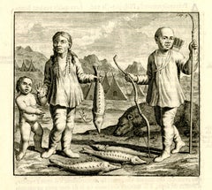
Ostiakes
By Cornelis de Bruijn
Located in Fairlawn, OH
Ostiakes
Engraving, 1718
From: Voyages de Corneille le Brun par la Moscovie, en Perse, et aux Indes Occidentales (French translation, 1718), Chapter XXI
The Ostyak are a member of an...
Category
1710s Old Masters Cornelis de Bruijn Prints and Multiples
Materials
Engraving
Related Items
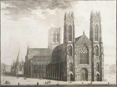
The West Prospect of the Cathedral of York /// "Britannia Illustrata" Engraving
By Johannes Kip
Located in Saint Augustine, FL
Artist: Johannes "Jan" Kip (Dutch, 1652/3-1722)
Title: "The West Prospect of the Cathedral of York" (Vol. 3, Plate 31)
Portfolio: Britannia Illustrata / Le Nouveau Théâtre de la Grande Bretagne
Year: 1715-1724 (Third edition)
Medium: Original Engraving and Etching on cream laid paper
Limited edition: Unknown
Printer: Joseph Smith, London, UK
Publisher: Joseph Smith, London, UK
Reference: "London Illustrated 1604-1850" - Adams No. 22; Crace No. 201; Brunet IV No. 114; Lowndes No. 1277; Lewine page 263-264
Sheet size: 19.25" x 24.19"
Image size: 16.75" x 22.5"
Condition: With centerfold as issued. Some light toning and foxing mainly in margins, and some light edgewear. Has been professionally stored away for decades. It is otherwise a strong impression in very good condition
Rare
Notes:
Provenance: private collection - Ross-on-Wye, UK. Engraved by Dutch artist Johannes "Jan" Kip (1652/3-1722) after a drawing by Dutch artist Leonard Knyff or Leendert Knijff (1650-1722). Comes from Kip's six volume (including Supplement and 'Atlas Anglois') "Britannia Illustrata" / Le Nouveau Théâtre de la Grande Bretagne", (1724-1728) (Third edition), which consists of 394 engravings and etchings. Printed in one color from one copper plate: black.
Biography:
Johannes "Jan" Kip (1652/53 in Amsterdam - 1722 in Westminster) was a Dutch draftsman, engraver and print dealer. Together with Leonard Knyff, he made a speciality of engraved views of English country houses.
Kip was a pupil of Bastiaen Stopendaal (1636–1707), from 1668 to 1670, before setting up on his own; his earliest dated engravings are from 1672. In April 1680, at the age of 27, he married Elisabeth Breda in Amsterdam. After producing works for the court of William of Orange in Amsterdam, Kip followed William and Mary to London and settled in St. John Street in Farringdon, where he conducted a thriving printselling business. He also worked for various London publishers producing engravings after such artists as Francis Barlow (c. 1626–1704) and Caius Gabriel Cibber (1630–1700), largely for book illustrations. He made several engraved plates for Awnsham & John Churchill's "A Collection of Voyages & Travels" (first published 1704). He signed the African scenes in volume V of the 1732 edition as "J. Kip".
His most important works were the large fold-out folio illustrations for "Britannia Illustrata", 1708; for the 65 folio plates he engraved for the antiquary Sir Robert Atkyns, "The Ancient and Present State of Glostershire", 1712 (1st edition); and for "Le Nouveau Théâtre de la Grande Bretagne ou description exacte des palais de la Reine, et des Maisons les plus considerables des des Seigneurs & des Gentilshommes de la Grande Bretagne", 1715, an extended reprint in collaboration with other artists.
The linked careers of Jan Kip and Leonard Knyff made a specialty of engraved views of English country houses, represented in detail from the bird's-eye view, a pictorial convention for topography. Their major work was "Britannia Illustrata: Or Views of Several of the Queens Palaces, as Also of the Principal seats of the Nobility and Gentry of Great Britain, Curiously Engraven on 80 Copper Plates", London (1707, published in the winter of 1708–9). The volume is among the most important English topographical publications of the 18th century. Architecture is rendered with care, and the settings of parterres and radiating avenues driven through woods or planted across fields, garden paths, gates and toolsheds are illustrated in detail. The images are staffed with figures and horses, coaches pulling into forecourts, water...
Category
1720s Old Masters Cornelis de Bruijn Prints and Multiples
Materials
Laid Paper, Engraving, Etching, Intaglio
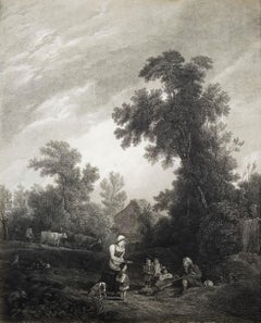
Benevolent Cottagers /// English Landscape Figurative Village Scene Engraving
Located in Saint Augustine, FL
Artist: (after) Sir Augustus Wall Callcott (English, 1779-1844)
Title: "Benevolent Cottagers"
Year: 1816
Medium: Original Etching and Engraving on laid paper
Limited edition: Unknown...
Category
1810s Old Masters Cornelis de Bruijn Prints and Multiples
Materials
Engraving, Etching, Laid Paper, Intaglio
$600
H 20.75 in W 15.5 in
Set of Four Engravings from Nash's "History of Worcestershire" /// Landscape Art
By Treadway Russell Nash
Located in Saint Augustine, FL
Artist: Treadway Russell Nash (English, 1724-1811)
Title: "A View of Stourbridge", "A View of Upton upon Severn, from Ryal Hill", "Bewdley", and "Tenbury"
Portfolio: Collections for the History of Worcestershire
Year: 1781-1782 (First edition)
Medium: Set of Four Original Engravings on watermarked laid paper
Limited edition: Unknown
Printer: John Nichols, London, UK
Publisher: T. Payne and Son, J. Robson, B. White, Leigh and Sotheby, London, UK; Fletcher, Oxford, UK; and Lewis, Worcester, UK
Reference: Upcott III, page 1330
Sheet size (each): approx. 10" x 16.5"
Image size (each): approx. 6.88" x 11.75"
Condition: A few light handling creases. Have been professionally stored away for decades. They are all strong impressions in excellent condition
Notes:
Provenance: private collection - Aspen, CO. All four works were engraved by English artist Thomas Sanders (Active: Mid-Late 18th Century) after drawings by himself. Comes from Nash's two volume "Collections for the History of Worcestershire", (1781-1782) (First edition), which consists of 75 engravings. Each work is printed from one copper plate in one color: black. There was a (Second edition) "with Additions" bound in with Volume II of this portfolio published by John White in 1799. And, both the First and Second editions of "Collections for the History of Worcestershire" are based off Thomas Sanders' 1779-1781 "Perspective Views of the Market Towns within the County of Worcester". Both "A View of Stourbridge" and "A View of Upton upon Severn, from Ryal Hill" have unidentified fleur-de-lis watermarks in the center of their sheets. "Bewdley" has an unidentified watermark in the center of its sheet resembling "XV" and "Tenbury" has no watermark.
Biography:
Treadway Russell Nash (24 June 1724 – 26 January 1811) was an English clergyman, now known as an early historian of Worcestershire and the author of Collections for the History of Worcestershire, an important source document for Worcestershire county histories. He was a fellow of the Society of Antiquaries of London.
Treadway Russell Nash was born on 24 June 1724 born at Clerkenleap, in Kempsey, Worcestershire. His family were from Ombersley. They had lands there and at Claines, and had later bought lands in the Reformation around St Peter's, Droitwich. He was related to James Nash and John Nash, both MPs for Worcester. His father Richard, a grandson of Sir Rowland Berkeley, died in 1740, and Richard's eldest son in 1757. As a result, Treadway Russell Nash inherited the Russells' Strensham estates from his brother, as well as the Nash estates, and took both names.
He was educated from the age of twelve at King's School, Worcester, and became a scholar at Worcester College, Oxford aged fifteen. In March 1749, he accompanied his brother on a trip to the continent, to aid Richard's health. They visited Paris for about six weeks, before spending the summer "on the banks of the Loire". They then visited "Bourdeaux, Thoulouse, Montpelier, Marseilles, Leghorn, Florence, Rome, Naples, Bologna, Venice, Padua, Verona, Milan, Lyons, and again Paris"; such expeditions are often known as the Grand Tour.
On his return in late summer 1751, Nash took up a post as Vicar of Eynsham through his friend and future brother-in-law, John Martin. He also had an income as a tutor at Oxford. He took his Doctor of Divinity degree and left Oxford, having "gone out grand compounder", following the death of his brother. He also left his benefice at Eynsham in 1757. While at Oxford he had proposed a road from there to Witney (now the A40 and B4022), and also stood for Parliament. Nash married Margaret Martin...
Category
1780s Old Masters Cornelis de Bruijn Prints and Multiples
Materials
Laid Paper, Engraving
Thorsby House in the County of Nottingham /// "Vitruvius Britannicus" Engraving
By Colen Campbell
Located in Saint Augustine, FL
Artist: Colen Campbell (Scottish, 1676-1729)
Title: "Thorsby House in the County of Nottingham" (Vol. 1, Plate 91)
Portfolio: Vitruvius Britannicus; or The British Architect, Contain...
Category
1710s Old Masters Cornelis de Bruijn Prints and Multiples
Materials
Laid Paper, Engraving, Etching, Intaglio
Powis House in Ormond Street London /// "Vitruvius Britannicus" Engraving
By Colen Campbell
Located in Saint Augustine, FL
Artist: Colen Campbell (Scottish, 1676-1729)
Title: "Powis House in Ormond Street London" (Vol. 1, Plate 42)
Portfolio: Vitruvius Britannicus; or The British Architect, Containing th...
Category
1710s Old Masters Cornelis de Bruijn Prints and Multiples
Materials
Laid Paper, Engraving, Etching, Intaglio
$425
H 13.82 in W 21.32 in
"St. Martin's Abbey" and "Lady's Chappel" from "Buck's Antiquities" /// British
By Samuel & Nathaniel Buck
Located in Saint Augustine, FL
Artist: Samuel and Nathaniel Buck (English, 1696-1779) and (?-1759/1774)
Title: "St. Martin's Abbey" (Plate 333) and "Lady's Chappel" (Plate 331)
Portfolio: Buck's Antiquities or Venerable Remains of Above 400 Castles, Monasteries, Palaces in England and Wales
Year: 1726-1739
Medium: Set of Two Original Engravings on watermarked laid paper
Limited edition: Unknown
Printer: Unknown
Publisher: Robert Sayer, London, UK
Reference: Lowndes page 303-304; Upcott page 33
Sheet size (each): approx. 11.13" x 18.25"
Image size (platemark) (each): approx. 7.5" x 14.5"
Condition: "St. Martin's Abbey" has a minor crease to upper left corner and repaired edge wear to lower right corner. "Lady's Chappel" has faint toning to sheet and minor soiling in margins. They are both otherwise strong impressions in excellent condition
Notes:
Comes from Samuel and Nathaniel Buck's three volume portfolio "Buck's Antiquities" or "Venerable Remains of Above 400 Castles, Monasteries, Palaces in England and Wales" (1726-1739), which consists of 428 engravings. Both "St. Martin's Abbey" and "Lady's Chappel" have unidentified watermarks in the center of their sheets. They both also have "Liverpool Free Public Library" chop mark/blind stamps at bottom center of their sheets. Old price pencil inscribed in margins.
Saint Martin's Abbey is a community of Roman Catholic Benedictine monks who follow the Rule of St Benedict...
Category
1720s Old Masters Cornelis de Bruijn Prints and Multiples
Materials
Laid Paper, Engraving, Intaglio
$480 Sale Price
20% Off
H 11.13 in W 18.25 in
Royal Hospital att Greenwich to the River /// "Vitruvius Britannicus" Engraving
By Colen Campbell
Located in Saint Augustine, FL
Artist: Colen Campbell (Scottish, 1676-1729)
Title: "Royal Hospital att Greenwich to the River" (Vol. 1, Plates 86, 87)
Portfolio: Vitruvius Britannicus; or The British Architect, Co...
Category
1710s Old Masters Cornelis de Bruijn Prints and Multiples
Materials
Laid Paper, Engraving, Intaglio, Etching
Set of Two Engravings from Campbell's "Vitruvius Britannicus" /// Architecture
By Colen Campbell
Located in Saint Augustine, FL
Artist: Colen Campbell (Scottish, 1676-1729)
Titles: "The Plan of this New Design to the Earl of Islay" (Vol. 1, Plate 53) and "This New Design to the Earl of Islay" (Vol. 1, Plate 5...
Category
1710s Old Masters Cornelis de Bruijn Prints and Multiples
Materials
Laid Paper, Engraving, Etching, Intaglio
St Peters Church at Rome /// "Vitruvius Britannicus" Architecture Engraving Art
By Colen Campbell
Located in Saint Augustine, FL
Artist: Colen Campbell (Scottish, 1676-1729)
Title: "St Peters Church at Rome" (Vol. 1, Plate 6)
Portfolio: Vitruvius Britannicus; or The British Architect, Containing the Plans, Ele...
Category
1710s Old Masters Cornelis de Bruijn Prints and Multiples
Materials
Laid Paper, Engraving, Etching, Intaglio
"Conisborough Castle" and "Morlashe Castle" from "Buck's Antiquities" /// UK Art
By Samuel & Nathaniel Buck
Located in Saint Augustine, FL
Artist: Samuel and Nathaniel Buck (English, 1696-1779) and (?-1759/1774)
Title: "Conisborough Castle" (Plate 323) and "Morlashe Castle" (Plat...
Category
1720s Old Masters Cornelis de Bruijn Prints and Multiples
Materials
Laid Paper, Engraving, Intaglio
$480 Sale Price
20% Off
H 11.07 in W 18.25 in
The New Athenaeum, Waterloo Place - Hand-Colored Engraving after Thomas Shepherd
By Thomas Hosmer Shepherd
Located in Long Island City, NY
Thomas Hosmer Shepherd, After by James Tingle, British (1793 - 1864) - The New Athenaeum, Waterloo Place, Medium: Hand Colored Engraving, Image Size: 3.75 x 5.75 inches, Frame Siz...
Category
Early 19th Century Old Masters Cornelis de Bruijn Prints and Multiples
Materials
Engraving
Set of Two Engravings from Nash's "History of Worcestershire" /// Landscapes Art
By Treadway Russell Nash
Located in Saint Augustine, FL
Artist: Treadway Russell Nash (English, 1724-1811)
Title: "Henbury Hall, late the Seat of Thomas Vernon, now of Henry Cecil Esq." and "Ombersley Court, the Seat of Lord Sandys"
Portfolio: Collections for the History of Worcestershire
Year: 1781-1782 (First edition)
Medium: Set of Two Original Engravings and Etching with Aquatint on watermarked laid paper
Limited edition: Unknown
Printer: John Nichols, London, UK
Publisher: T. Payne and Son, J. Robson, B. White, Leigh and Sotheby, London, UK; Fletcher, Oxford, UK; and Lewis, Worcester, UK
Reference: Upcott III, page 1330
Sheet size (each): approx. 10.13" x 16.88"
Image size (each): approx. 8.13" x 12.63"
Condition: "Henbury Hall, late the Seat of Thomas Vernon, now of Henry Cecil Esq." has scattered light foxmarks in margins. The top edge is unevenly trimmed and a small taped tear to lower right corner. "Ombersley Court, the Seat of Lord Sandys" has light toning to sheet and some faint discoloration in right margin. A small light water stain to lower left corner. Have been professionally stored away for decades. They are both otherwise strong impressions in good condition
Notes:
Provenance: private collection - Aspen, CO. "Henbury Hall, late the Seat of Thomas Vernon, now of Henry Cecil Esq." was likely engraved by English artist James Ross (1745-1821) after a drawing by himself. "Ombersley Court, the Seat of Lord Sandys" was engraved by English artist Valentine Green (1739-1813) and English artist Francis Jukes (1745-1812) after a drawing by an unknown, likely English artist. The first work is an engraving; the second work is an etching with aquatint. Comes from Nash's two volume "Collections for the History of Worcestershire", (1781-1782) (First edition), which consists of 75 engravings. Each work is printed from copper plates in one color: black. There was a (Second edition) "with Additions" bound in with Volume II of this portfolio published by John White in (1799). And both the First and Second editions of "Collections for the History of Worcestershire" are based off Thomas Sanders' 1779-1781 "Perspective Views of the Market Towns within the County of Worcester". "Ombersley Court, the Seat of Lord Sandys" has an unidentified watermark in the center of its sheet. "Henbury Hall" is actually incorrectly misnamed; its correct name is "Hanbury Hall".
"PLATES, Drawn and engraved by J. Ross, unless otherwise expressed." - "A Bibliographical Account of the Principal Works Relating to English Topography", (1818) - William Upcott.
Biography:
Treadway Russell Nash (24 June 1724 – 26 January 1811) was an English clergyman, now known as an early historian of Worcestershire and the author of Collections for the History of Worcestershire, an important source document for Worcestershire county histories. He was a fellow of the Society of Antiquaries of London.
Treadway Russell Nash was born on 24 June 1724 born at Clerkenleap, in Kempsey, Worcestershire. His family were from Ombersley. They had lands there and at Claines, and had later bought lands in the Reformation around St Peter's, Droitwich. He was related to James Nash and John Nash, both MPs for Worcester. His father Richard, a grandson of Sir Rowland Berkeley, died in 1740, and Richard's eldest son in 1757. As a result, Treadway Russell Nash inherited the Russells' Strensham estates from his brother, as well as the Nash estates, and took both names.
He was educated from the age of twelve at King's School, Worcester, and became a scholar at Worcester College, Oxford aged fifteen. In March 1749, he accompanied his brother on a trip to the continent, to aid Richard's health. They visited Paris for about six weeks, before spending the summer "on the banks of the Loire". They then visited "Bourdeaux, Thoulouse, Montpelier, Marseilles, Leghorn, Florence, Rome, Naples, Bologna, Venice, Padua, Verona, Milan, Lyons, and again Paris"; such expeditions are often known as the Grand Tour.
On his return in late summer 1751, Nash took up a post as Vicar of Eynsham through his friend and future brother-in-law, John Martin. He also had an income as a tutor at Oxford. He took his Doctor of Divinity degree and left Oxford, having "gone out grand compounder", following the death of his brother. He also left his benefice at Eynsham in 1757. While at Oxford he had proposed a road from there to Witney (now the A40 and B4022), and also stood for Parliament. Nash married Margaret Martin...
Category
1780s Old Masters Cornelis de Bruijn Prints and Multiples
Materials
Laid Paper, Engraving, Intaglio, Etching, Aquatint
Cornelis De Bruijn prints and multiples for sale on 1stDibs.
Find a wide variety of authentic Cornelis de Bruijn prints and multiples available for sale on 1stDibs.
Artists Similar to Cornelis de Bruijn
Georges-Louis Leclerc, Comte de Buffon


