Georg Braun and Frans Hogenberg Maps
to
2
2
1
1
2
1
1
2
1
2
2
2
1
104
58
29
21
Creator: Georg Braun and Frans Hogenberg
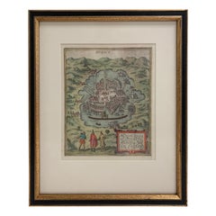
Mexico City by Braun & Hogenberg c. 1590
By Georg Braun and Frans Hogenberg
Located in Stamford, CT
Mexico by Braun & Hogenberg c. 1590
Category
Mid-19th Century European Spanish Colonial Antique Georg Braun and Frans Hogenberg Maps
Materials
Glass, Wood, Paper
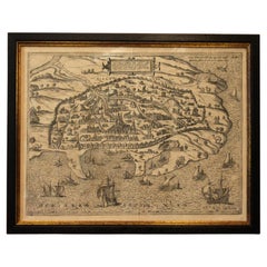
1597 German Map of Alexandria by Georg Braun and Frans Hogenberg
By Georg Braun and Frans Hogenberg
Located in Chapel Hill, NC
1597 Map of Alexandria by Georg Braun and Frans Hogenberg, Germany. From "Civitas Orbis Terrarum", part 2, published in Cologne by Bertram Buchholz. Printed in 2 parts. Title: "Alexa...
Category
16th Century German Renaissance Antique Georg Braun and Frans Hogenberg Maps
Materials
Paper
Related Items
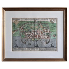
Antique Map of the City of Visby 'Sweden' by F. Hogenberg, 1598
Located in Langweer, NL
This is a wonderful bird's-eye plan/view of the oldest city in Sweden.
Visby, the largest city on the island of Gotland was an important Viking city and the main centre of the Hanseatic League...
Category
16th Century Antique Georg Braun and Frans Hogenberg Maps
Materials
Paper
$2,339 Sale Price
20% Off
H 23.04 in W 27.96 in D 0.99 in
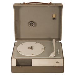
Braun PC3 Record Player by Wilhelm Wagenfeld and Dieter Rams
By Braun, Wilhelm Wagenfeld, Dieter Rams
Located in Vienna, AT
Record player Braun Pc3 Design in Germany in 1950s by Wilhelm Wagenfeld, Dieter Rams for Max Braun AG, Frankfurt a. M.,
Fully restored by a Brun specialist.
Category
1950s German Mid-Century Modern Vintage Georg Braun and Frans Hogenberg Maps
Materials
Steel
Rare 1572 Map of Ancient Rome with Monuments by Ligorio, Braun & Hogenberg
Located in Langweer, NL
Rare 1572 Map of Ancient Rome with Monuments by Ligorio, Braun & Hogenberg
This remarkable 16th-century map, *Urbis Romae Situs cum ils quae adhuc Conspiciuntur Veter. Monumet Rel...
Category
16th Century German Antique Georg Braun and Frans Hogenberg Maps
Materials
Paper
$2,268
H 16.62 in W 21.86 in D 0.01 in
BRAUN "RT 20", Tischradio, Dieter Rams
By Braun, Dieter Rams
Located in Neuss, NW
Design classic RT 20 by Dieter Rams for BRAUN from 1961. Table radio with veneered wooden corpus in ash and grey lacquered metal front. Made in Germany.
The front has been repainted...
Category
1960s German Mid-Century Modern Vintage Georg Braun and Frans Hogenberg Maps
Materials
Wood
Byzantium Nunc Constantinopolis – Braun & Hogenberg View of Istanbul, 1572
Located in Langweer, NL
Byzantium Nunc Constantinopolis – Braun & Hogenberg View of Istanbul, Cologne, 1572
This iconic 16th-century bird’s-eye view titled “Byzantium Nunc Constantinopolis” presents the ci...
Category
16th Century German Antique Georg Braun and Frans Hogenberg Maps
Materials
Paper
$2,148
H 15.75 in W 21.26 in D 0.01 in
Antique Map of Douai 'France' by Braun & Hogenberg, circa 1575
Located in Langweer, NL
Beautiful map in excellent condition. This map depicts the city of Douai (France) and originates from 'Civitates Orbis Terrarum'.
Category
16th Century Antique Georg Braun and Frans Hogenberg Maps
Materials
Paper
Antique Map of the City of Dordrecht by Braun & Hogenberg, c.1581
Located in Langweer, NL
Antique map titled 'Dordrecht'. Map of the city of Dordrecht, the Netherlands. Bird's-eye plan view of the city, with many ships and two coats of arms in upper corners. This map orig...
Category
16th Century Antique Georg Braun and Frans Hogenberg Maps
Materials
Paper
$401 Sale Price
20% Off
H 15.16 in W 20.08 in D 0 in
Bordeaux City View – Braun & Hogenberg Original Woodcut, ca. 1575
Located in Langweer, NL
Bordeaux City View – Braun & Hogenberg Original Woodcut, ca. 1575
Description:
This detailed and highly decorative bird’s-eye view of Bordeaux, titled Bovrdeavx, originates from the...
Category
16th Century German Antique Georg Braun and Frans Hogenberg Maps
Materials
Paper
Modigliani and his Models by Emily Braun & Simonetta Fraquelli (Book)
Located in North Yorkshire, GB
Drawing on the latest scholarship, some of the foremost authorities on the artist consider the sensual nudes that caused such a sensation at the time and the portraits and the figure...
Category
20th Century Georg Braun and Frans Hogenberg Maps
Materials
Paper
$325
H 11.57 in W 9.19 in D 0.75 in
Above Mexico City Hardcover 2004
Located in Moreno Valley, CA
Above Mexico City Hardcover 2004. In this book by Robert Cameron and Herb Lingl, taken from unusual angles and heights, with broad perspectives and close-ups, there is a unique visio...
Category
21st Century and Contemporary Mexican Expressionist Georg Braun and Frans Hogenberg Maps
Materials
Paper
Bird’s-Eye View of Basel from Braun & Hogenberg’s Civitates Orbis Terrarum, 1575
Located in Langweer, NL
Bird’s-Eye View of Basel from Braun & Hogenberg’s "Civitates Orbis Terrarum" (Circa 1572-1617)
This highly detailed map of Basel is a bird's-eye view, originally based on Sebastian Münster’s map...
Category
16th Century Antique Georg Braun and Frans Hogenberg Maps
Materials
Paper
$1,146 Sale Price
20% Off
H 16.15 in W 21.26 in D 0 in
Very Old Antique Map of the Persian Empire by Magini, c.1597
Located in Langweer, NL
Antique map titled 'Persiae Regnum sive Sophorum Imperium'. Old map of the Persian Empire. This map originates from 'Geografia cioe Descrittione Universale della Terra' by G.A. Magin...
Category
16th Century Antique Georg Braun and Frans Hogenberg Maps
Materials
Paper
Previously Available Items
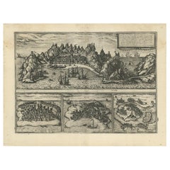
Antique Map of Aden, Mombasa, Kilwa and Sofala by Braun & Hogenberg, circa 1575
By Georg Braun and Frans Hogenberg
Located in Langweer, NL
Antique map of Africa titled 'Aden, Arabiae Foelicis Emporium Celeberrimi Nominis, quo ex India, Aethiopia (..)'. Four bird's-eye views on one sheet. The largest view shows Aden (Yem...
Category
16th Century European Antique Georg Braun and Frans Hogenberg Maps
Materials
Paper
H 16.15 in W 21.26 in D 0.02 in
Georg Braun And Frans Hogenberg maps for sale on 1stDibs.
Georg Braun And Frans Hogenberg maps are available for sale on 1stDibs.
