Robert Kipniss More Prints
b. 1931
Robert Kipniss was born in 1931 in New York City. He has studied at the Art Students League, Wittenberg University and the University of Iowa, where he received his BA and MFA in painting and art history. Kipniss spent many years making lithographs from stone, aluminum and Mylar plastic. He then switched to pre rocked mezzotint plates of copper, which create his signature soft and dreamy images. Kipniss's works are in the Metropolitan, Boston MFA and the Smithsonian, among many.
to
1
Overall Width
to
Overall Height
to
1
28
678
450
224
175
1
1
1
1
1
Artist: Robert Kipniss
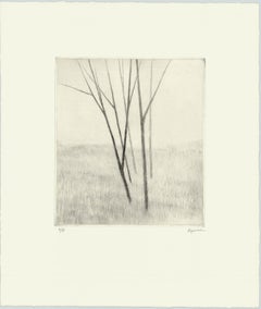
Slope w.five trees
By Robert Kipniss
Located in New York, NY
“Slope w/five trees” is a drypoint engraving created by Robert Kipniss in 2020. The paper size is 12.50 x 10.50 inches and the printed image size is 6.75 x ...
Category
21st Century and Contemporary Modern Robert Kipniss More Prints
Materials
Engraving, Drypoint
Related Items
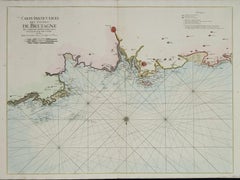
Carte Particuliere Des Coste De Bretagne qui Comprend Morlaix
By Pierre Mortier
Located in Paonia, CO
Carte Particuliere Des Costes De Bretagne qui Comprend Morlaix, Saint Paul de Leon, les Sept Isles, et L’Isle. Faite par ordre Exprez Du Roy de France is from the collection of ch...
Category
1690s Robert Kipniss More Prints
Materials
Engraving
$1,350
H 25 in W 37.5 in
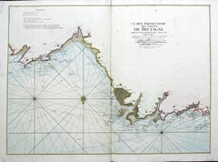
Carte Particular Des Costes De Bretagne Depuis le Cap de Frehel, Jusques a Perros
By Pierre Mortier
Located in Paonia, CO
Carte Particulaire Des Costes De Bretagne Depuis Le Cap de Frehel, Jusques a Perros, & L’Isle Tome. This large sea scale chart shows part of the northwestern co...
Category
1690s Robert Kipniss More Prints
Materials
Engraving
A View at Bolcheretzko (Russia) 1784 Captains Cook Final Voyage by John Webber
By John Webber
Located in Paonia, CO
A View at Bolcheretzko (Russia) is from the 1784 First Edition Atlas Accompanying Capt. James Cook and King; Third and Final Voyage of Captain James Cook.John Webber (1752-1793) was ...
Category
1780s Realist Robert Kipniss More Prints
Materials
Engraving
$540 Sale Price
40% Off
H 16.5 in W 13.5 in
Restaurant in Mott Street
By Charles Frederick William Mielatz
Located in New Orleans, LA
The image depicts a restaurant on New York's Mott Street with ornamental iron work on the balconies. There are six figures in the scene in various stages of contrast. Mott Street is considered the unofficial Main Street of New York's Chinatown. Ella Fitzgerald sang it best: “And tell me what street compares with Mott Street in July? Sweet pushcarts gently gliding by.”
CFW Mielatz was an early influence on the drypoints and etchings of Martin Lewis. This piece was created in 1906 and it is signed in pencil. It is part of the collection of New York's Metropolitan Museum of Art
C.F.W. Mielatz
American, 1860-1919
Born in Bredding, Germany in 1864, Mielatz emigrated to the United States as a young boy and studied at the Chicago School of Design. Mostly self-taught, his first prints were large New England landscapes reminiscent of the painter-etcher school of American Art. Around 1890 he started to produce prints of New York City and by the time of his death, the number totaled over ninety images. He was a master technician in the field of etching, reworking many of his plates to get the exact feeling he was seeking. Mielatz was a member of the New York Etching...
Category
Early 20th Century American Modern Robert Kipniss More Prints
Materials
Drypoint, Etching
$400 Sale Price
27% Off
H 9.88 in W 6.25 in
Plan of the Park, Garden and Plantations of Goodwood, 18th century engraving
By Colen Campbell
Located in Melbourne, Victoria
Plan of the Park, Garden and Plantations of Goodwood in Sussex the Seat of his Grace the Duke of Richmond and Lenox &c
Copper-line engraving with later hand-colouring by Hendrik Hul...
Category
18th Century English School Robert Kipniss More Prints
Materials
Engraving
$450
H 21.26 in W 27.56 in
Colossi of Memnon, Thebes, Egypt. Early 19th century engraving, 1820
Located in Melbourne, Victoria
'Vue des Deux Colosses. Thebes, Memnonium'
Elephant folio engraving, by Baltard after Dutetre, from 'Description de l'Egypte', published after Napoleon's expedition to colonize Egyp...
Category
Early 19th Century Other Art Style Robert Kipniss More Prints
Materials
Engraving
Canterbury: An Original 16th C. Framed Hand-colored Map by Braun & Hogenberg
By Franz Hogenberg
Located in Alamo, CA
This is a framed 16th century map and city view of Canterbury, England entitled "Cantuarbury" by Braun & Hogenburg, from their famous landmark atlas of city views 'Civitates Orbis Terrarum' (Atlas of the Cities of the World), which was first published in Cologne, Germany in 1572. The map of Canterbury was first published in 1588. It depicts a detailed birdseye view of the completely walled and fortified city of Canterbury, with its cathedral the most prominent feature. The coat of arms of England, Canterbury, and the Archbishop of Canterbury are included.
This beautifully hand-colored map is presented in a gold-colored wood frame with a beaded inner trim and a paprika-colored mat that highlights details in the map. The frame measures 18.75" high by 22.25" wide by 0.875" deep. There is a central vertical fold, as issued. The map is in excellent condition.
Braun and Hogenberg's 'The Civitates Orbis Terrarum' was the second atlas of maps ever published and the first atlas of cities and towns of the world. It is one of the most important books published in the 16th century. Most of the maps in the atlas were engraved by Franz Hogenberg and the text, with its descriptions of the history and additional factual information of the cities, was written by a team of writers and edited by Georg Braun. The work contained 546 bird-eye views and map views of cities and towns from all over the world. It gave graphic representation of the main features of the illustrated cities and towns, including the buildings and streets. Although the ordinary buildings are stylized, the principal buildings are reproduced from actual drawings created on location. The principal landmarks and streets can still be recognized today. In addition, the maps often include the heraldic arms of the city, the nature of the surrounding countryside, the important rivers, streams and harbors, even depicting stone bridges, wooden pontoons, flat-bottomed ferries, ships and working boats, wharves and jetties, as well as land-based activities, including horsemen, pedestrians, wagons, coaches, and palanquins. Small vignettes are often included which illustrate the trade, occupations and habits of the local inhabitants, such as agriculture, paper-making and textiles, as well as local forms of punishment, such as gibbets, wheels, floggings etc. Large figures dressed in their local costume are often presented out of proportion in the foreground. The aim of the authors was to give as much information as possible in a pleasing visual form. They succeeded in creating maps that were both informative and decorative works of art. The atlas is a wonderful glimpse of life in medieval Europe.
Georg Braun (1541-1622) was German Catholic...
Category
16th Century Old Masters Robert Kipniss More Prints
Materials
Engraving
$1,900 Sale Price
20% Off
H 18.75 in W 22.25 in D 0.88 in
Branches Purple, Limited edition print, Landscape, Tree, Nature art
By Fiona Hamilton
Located in Deddington, GB
Scots Pine drypoint etching printed onto Japanese gampi tissue and backed onto German Hahnemule printmaking paper. This print depicts a mature pine tree, standing proud from the rest...
Category
2010s Contemporary Robert Kipniss More Prints
Materials
Drypoint, Etching
$100
H 22.05 in W 14.97 in D 0.4 in
Autumn Light, Limited edition print, Landscape, Tree, Nature art
By Fiona Hamilton
Located in Deddington, GB
Drypoint print onto photolitho printed kitakata with subtle gold ink and mounted onto Hahnemule printmaking paper. This print of a tree uses litho printed kitakata chine collé to dep...
Category
2010s Contemporary Robert Kipniss More Prints
Materials
Drypoint, Etching
$382
H 24.81 in W 18.12 in D 0.4 in
Captain Cook's Exploration of Tahiti: 18th C. Hand-colored Map by Bellin
By Jacques-Nicolas Bellin
Located in Alamo, CA
This beautiful 18th century hand-colored copper plate engraved map is entitled "Carte de l'Isle de Taiti, par le Lieutenant J. Cook" was created by Jacques Nicolas Bellin and publish...
Category
Late 18th Century Robert Kipniss More Prints
Materials
Engraving
Jacques-Nicolas BellinCaptain Cook's Exploration of Tahiti: 18th C. Hand-colored Map by Bellin, 1780
$620 Sale Price
20% Off
H 11.38 in W 17.5 in
Greville Smyth Pine, Limited edition print, Landscape, Tree, Nature art
By Fiona Hamilton
Located in Deddington, GB
A very detailed drypoint etching of a Pine tree printed onto gampi Japanese tissue and backed onto Hahnemule printmaking paper. This print considers how we view the contemporary sublime landscape and how easy it can be to experience when we take the time to look. We often don’t have to travel far: parks in cities, the coastline and stars in the night sky. The mature Scots Pine tree pictured...
Category
2010s Contemporary Robert Kipniss More Prints
Materials
Drypoint, Etching
$382
H 24.81 in W 18.12 in D 0.4 in
Mont et Mervale (Mountains and Wonder)
By Christine Ravaux
Located in New Orleans, LA
Born in Charleroi, Belgium, Christine Ravaux is an artist who mirrors her surroundings in the mezzotints she creates. She has portrayed the black hills that dot the landscape of the ...
Category
1990s Contemporary Robert Kipniss More Prints
Materials
Mezzotint, Aquatint
$300 Sale Price
33% Off
H 15.75 in W 19.63 in
Previously Available Items
Easel and Tree with Moon
By Robert Kipniss
Located in New Orleans, LA
A hazy full moon casts a glow on bare trees juxtaposed against an artist's easel. This mezzotint by Robert Kipniss is referenced as GO56 in the Kipniss Catalogue Raissone and is sig...
Category
1990s Contemporary Robert Kipniss More Prints
Materials
Mezzotint
Robert Kipniss more prints for sale on 1stDibs.
Find a wide variety of authentic Robert Kipniss more prints available for sale on 1stDibs. You can also browse by medium to find art by Robert Kipniss in drypoint, engraving and more. Much of the original work by this artist or collective was created during the 21st century and contemporary and is mostly associated with the modern style. Not every interior allows for large Robert Kipniss more prints, so small editions measuring 11 inches across are available. Customers who are interested in this artist might also find the work of Emilio Sanchez, Valerio Adami, and Owen Miller. Robert Kipniss more prints prices can differ depending upon medium, time period and other attributes. On 1stDibs, the price for these items starts at $700 and tops out at $1,000, while the average work can sell for $850.


