Unknown Maps
to
3
5
6
1
1
4
2
1
4
2
2
1
3
1
1
1
1
6
6
6
164,283
104
58
28
21
Creator: Unknown
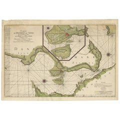
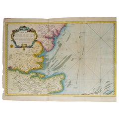
Antique Map: Carte du Détroit du Sond with Copenhagen Inset, 1693
Located in Langweer, NL
Antique Map: Carte du Détroit du Sond with Copenhagen Inset, Jaillot/Mortier, 1693
This rare and striking antique map, titled *Carte du détroit du Sond contenant les costes de l’Is...
Category
Late 17th Century Antique Unknown Maps
Materials
Paper
$2,137 Sale Price
20% Off
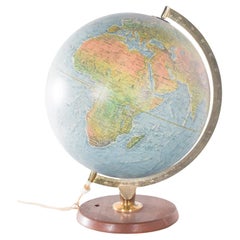
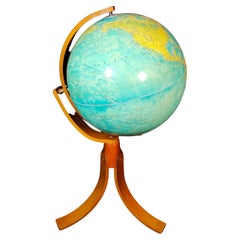
Mid-Century Earth Globe Electrified
Located in Lisboa, Lisboa
Earth globe, electrified. With polished wooden base and golden metal structure. This model presents a physical and political representation of the world, with reliefs that highlight ...
Category
Mid-20th Century Portuguese Mid-Century Modern Unknown Maps
Materials
Metal
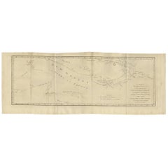
Antique Map of New Guinea and New Britain by P. Carteret, circa 1773
Located in Langweer, NL
Antique Map: A Chart of Captain Carteret's Discoveries at New Britain (1769)
This rare and historically significant 18th-century map, titled *A Chart of Captn Carteret's Discoveries at New Britain,* offers a fascinating glimpse into early European explorations of the Pacific. Published in 1769, the map meticulously charts Captain Philip Carteret's 1767 voyage through New Guinea and the islands of New Britain and New Ireland, showcasing his contributions to the understanding of the Bismarck Archipelago. Adding to its significance, the map traces the paths of earlier explorer William Dampier...
Category
Late 18th Century Antique Unknown Maps
Materials
Paper
$522 Sale Price
20% Off
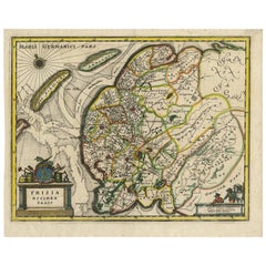
Original Antique Hand-Colored Map of Friesland by C. Merian, 1659
Located in Langweer, NL
This is a hand-colored engraving of the province of Friesland in the Netherlands, created by the Swiss-born engraver and artist Matthäus Merian (1593–1650) and included in "Topograph...
Category
Mid-17th Century Antique Unknown Maps
Materials
Paper
Map "Estuary- Mouth of the Thames"
Located in Alessandria, Piemonte
ST/426 - Antique French Map of the estuary of the Thames, map dated 1769 -
"Mape of the entrance of the Thames. Designed by filing of Navy cards fo...
Category
Mid-18th Century French Other Antique Unknown Maps
Materials
Paper
FRAME DRIVING SCHOOL 70 S 20th Century
Located in Madrid, ES
Large Globe 50S
THE GLOBE IS IN PLASTIC AND THE FOOT IN WOOD. 1950s. IT HAS LIGHT. GOOD CONDITION WITH CENTURIES OF USE. MEASUREMENTS: 110 CM IN HEIGHT AND 60 CM IN DIAMETER
good con...
Category
20th Century English Modern Unknown Maps
Materials
Plastic, Wood
$1,140 Sale Price
20% Off
Related Items
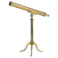
Library Telescope, United Kingdom, 20th century
Located in New York, NY
This remarkable telescope came from the personal collection of Thierry Despont (1948 - 2023). While best known for his architectural practice—which played integral roles in the resto...
Category
20th Century British Unknown Maps
Materials
Brass
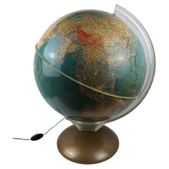
Mid-Century World Map Globe Table Light or Lamp
Located in Miami, FL
Good quality world map globe lamp.
If you are looking for stylish and beautiful quality item to upgrade your interior (whether at home or in your office) then this Parisian globe...
Category
Mid-20th Century French Mid-Century Modern Unknown Maps
Materials
Chrome
Mid Century Aviation Vintage Desk Airplane Over Globe Model, 1940s
Located in Buenos Aires, Olivos
Aviation Model. Vintage aluminium display airplane model. The model is a mixture of Art Deco and midcentury design. It is mounted over a silvered ball...
Category
Mid-20th Century American Mid-Century Modern Unknown Maps
Materials
Metal
$1,999
H 7.88 in W 7.49 in D 7.09 in
Clavichord, 20th Century
Located in Greding, DE
Clavichord housed in a veneered walnut case of simple rectangular form. Numbered "284" on the inside. The instrument is currently un-tuned but remains in playable condition. A charmi...
Category
20th Century Modern Unknown Maps
Materials
Walnut
20th Century G Lines Rocking Horse
Located in Gloucestershire, GB
Early 20th Century Lines Brothers tri-ang dapple grey rocking horse is a classic children’s toy from the early 1900s. Lines Brothers was a British toy manu...
Category
1920s English Vintage Unknown Maps
Materials
Tulipwood, Paint
Mid-20th Century Israeli Mezuzah
Located in New York, NY
Early Israeli Mezuzah on velvet mounting with ornate silvered body, and with gilded top and base. Decorated with colored glass and with gilded bell hangin...
Category
1940s Israeli Vintage Unknown Maps
Materials
Brass
Early 20th Century Desk Globe
Located in Firenze, FI
Beautiful physical and political terrestrial table globe on bronze base and plaster sphere with double rotary movement.
Designed by Prof. Guido Cora for G.B.Paravia Editori in the fi...
Category
Early 20th Century Italian Unknown Maps
Materials
Bronze
19th Century German Miniature Pocket Terrestrial Globe
By C. Abel-Klinger
Located in Essex, MA
A miniature 19th century 3.5 inch diameter pocket terrestrial globe by C. Abel-Klinger, Nuremberg, Germany, in English for the English speaking markets. Signed with cartouche reading...
Category
1880s German Antique Unknown Maps
Materials
Brass
Globe, Solid Rotating Brass Frame with Spinning Globe
Located in Dallas, TX
Globe, solid rotating brass frame with spinning globe, faux hardstone.
Category
Mid-20th Century French Unknown Maps
Materials
Brass
Circular Sextant, Decorative Piece, 20th Century
Located in Madrid, ES
The sextant is an instrument that allows to measure angles between two objects such as two points of a coast or a star, traditionally the sun of the earth and the horizon. Knowing th...
Category
Late 20th Century Spanish Other Unknown Maps
Materials
Metal, Other
20th Century String Puppet
Located in Los Angeles, CA
This oddly beautiful, in a tragic way, puppet was made somewhere in the 20th century, as we are uncertain of their specific creation date. The plexiglass case around them was custom made for them specially, and has kept them safe all these years. You are able to take the puppet out of the case and maneuver it around like any other string puppet. They are dressed in a white, silk suit with black pom poms decorating the gown. Their expression is dramatic in a way that you almost cannot tell what emotion they are expressing; it is up to your interpretation. Great as a collectors item.
PLEXIGLASS BOX Dimensions: 32.5"H x 10.5"W x 10.5"D
We do local delivery close or in Los Angeles for fee.
Will calculate shipping...
Category
Early 20th Century European Expressionist Unknown Maps
Materials
Silk, Plexiglass
Antique Map of Principality of Monaco
By Antonio Vallardi Editore
Located in Alessandria, Piemonte
ST/619 - "Old Geographical Atlas of Italy - Topographic map of ex-Principality of Monaco" -
ediz Vallardi - Milano -
A somewhat special edition ---
Category
Late 19th Century Italian Other Antique Unknown Maps
Materials
Paper
Previously Available Items
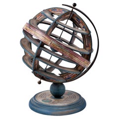
Spanish Armillary Sphere of Polychrome Wood, Paper and Iron, Early 20th Century
Located in Madrid, ES
Spanish armillary sphere of polychrome wood, paper and iron,
Early 20th century
Measures: 35 x 26cm
Good condition.
Category
20th Century Spanish Modern Unknown Maps
Materials
Iron
H 13.78 in Dm 10.24 in
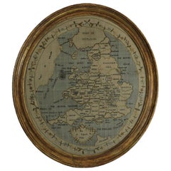
Georgian Map of UK Sampler by Elizabeth Kifft, 1797
Located in Chelmsford, Essex
1797 England & Wales Map Sampler by Elizabeth Kifft, Leacock School. The sampler is worked in silk on linen ground, in a variety of stitches. Meandering floral border. Titled, 'Map o...
Category
1790s English Folk Art Antique Unknown Maps
Materials
Linen, Silk
Panoramic Antique Lithographic Map for Louis Latour, Burgundy France Region
Located in Peabody, MA
Panoramic detailed map of the vineyards of the Bourgogne (Burgundy) region of France, made for the legendary Louis Latour winemakers. This rare framed lithograph is a circa 1920s, re...
Category
1920s French Other Vintage Unknown Maps
Materials
Paper
H 15.25 in W 114.75 in D 1.38 in
Antique Map of Oceania by V. Levasseur, 1856
By Victor Levasseur
Located in Langweer, NL
Hand-colored steel engraving showing local heros, products, landscapes, country boundaries, roads, towns and many more. Text shows local statistics, map leg...
Category
Mid-19th Century Antique Unknown Maps
Antique Map of the Turkish Empire by C.T. Lotter, circa 1750
Located in Langweer, NL
A spectacular map of the Turkish Empire, including Greece, Turkey, Persia, Egypt and Arabia. Depicts from Italy eastward to the Caspian Sea, which is depicted in its entirety. Includes Crimea and the Caucuses: Georgia, Circassia and Armenia. Extends south to include all of Arabia and the northern tip of the Horn of Africa. Generally accurate with a few cartographic anomalies. The Dead Sea is over-large and misshapen. A large and nonexistent lake appears just west of the Nile Delta. In the lower left hand quadrant there is a large decorative title cartouche attributed to the Augsburg silversmith Abraham Drentwet. Depicts the ottoman Emperor gloriously robed with and enthroned. On the ground before him two men bow...
Category
Mid-18th Century Antique Unknown Maps
Materials
Paper
Bett's Portable Terrestrial Globe, London, circa 1920
Located in San Francisco, CA
Bett's portable terrestrial globe, London, circa 1920. Very fine and strong silk like cotton fabric with exceptionally fine detail and coloration. The sections of the globe are hand-...
Category
1920s English Victorian Vintage Unknown Maps
Materials
Metal
Extraordinary 1930s Inlaid Wood Map of Italy by P. Ferrario for the Touring Club
Located in Milano, Lombardia
Extraordinary map of Italy realized by P. Ferrario for the Touring Club in the 1930s. The inlaid wooden map stands on a chromed tubular metal base and it's s...
Category
1930s Italian Vintage Unknown Maps
Materials
Chrome
H 71.46 in W 55.12 in D 12.6 in
Rare Antique Classroom Pull Down Map Cabinet In Oak Case
Located in Los Angeles, CA
Rare 19th century antique classroom pull down map cabinet in oak case. Key included. Brass tag labeled maps pull down and roll back up on a roller sy...
Category
19th Century American American Craftsman Antique Unknown Maps
Weber Costello Deco Airplane Base Black Oceans Globe
Located in Highland, IN
One of the most dynamic and desirable vintage globe designs, this wonderful piece has the striking black oceans and a chrome base in the form of a stylized airplane. It is in very go...
Category
1940s American Art Deco Vintage Unknown Maps
Materials
Stainless Steel, Chrome
Three Dimensional Wall Map
Located in Sagaponack, NY
An amazing and graphic Swiss-made three dimensional wall map of the United States rendered in molded and colored rubber attached to canvas and walnut ...
Category
1950s Swiss Mid-Century Modern Vintage Unknown Maps
Materials
Rubber, Canvas, Walnut
Two Harvard Business School Maps
Located in Essex, MA
A pair of City of Boston ward plot plans showing Harvard Business School, c. 1910, along with the Harvard Boat House, Stadium and Charles River. Perfect...
Category
Early 20th Century American Unknown Maps
Unknown maps for sale on 1stDibs.
Unknown maps are available for sale on 1stDibs. These distinctive items are frequently made of paper and are designed with extraordinary care. There are many options to choose from in our collection of Unknown maps, although beige editions of this piece are particularly popular. Prices for Unknown maps can differ depending upon size, time period and other attributes — on 1stDibs, these items begin at $363 and can go as high as $1,800, while a piece like these, on average, fetch $850.
Questions About Unknown Maps
- 1stDibs ExpertSeptember 9, 2024Yes, paintings by unknown artists may be worth something in some cases. When a painting’s maker isn't a well-known artist or is completely anonymous, factors like the visual appeal, historical significance, previous ownership and condition will determine the value of a painting. A certified appraiser or experienced art dealer can evaluate your piece using these criteria and provide you with an estimated value for your art. Shop a wide range of paintings on 1stDibs.
