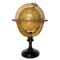
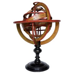
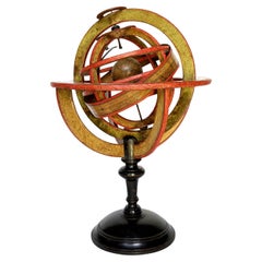
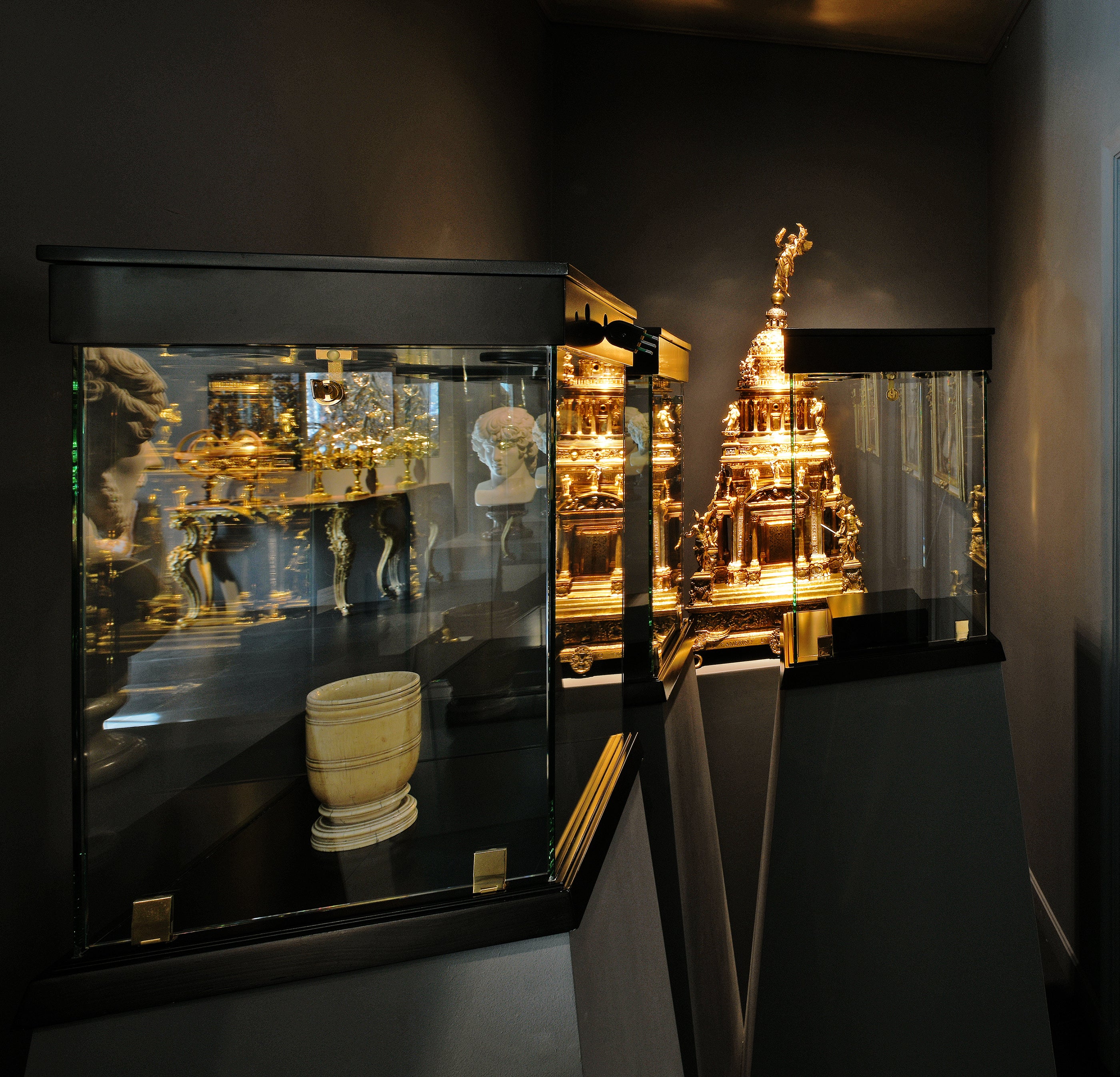
Ptolemaic armillary sphere
Charles-François Delamarche
Paris, ante 1798
Wood and papier-mâché
covered with printed and partly hand-colored paper
It measures 16.37 in in height x Ø 10.94 in (41.60 cm - Ø 27.80 cm)
It weights 2.33 lb (1,058 g)
State of conservation: consistent with its age and use, the paper shows some signs of use, stains and abrasions.
The sphere is Ptolemaic, with the Earth placed at its center, surrounded by the Moon and the Sun mounted on two metal arms.
The sphere is composed of six horizontal and two vertical rings (armillae), each bearing graduations and its own name.
The first horizontal ring is illegible. The others, in descending order are: North Pole, Tropic of Cancer, Equator, Tropic of Capricorn, South Pole.
The vertical rings consist of two double meridians.
The sphere is then connected to the large meridian by two pins, a vertical ring inserted perpendicularly into the circle of the Horizon, in turn supported by four semicircles connected to the turned and black-stained wooden base.
Each element is covered with printed paper. It contains various pieces of information: latitudes, length of days, names and zodiac symbols, calendar, wind directions, etc.
The vertical circles mention the latitudes and longitudes of different cities: Rome, Bordeaux, Madrid, Boston, Batavia (Jakarta), Acapulco, etc.
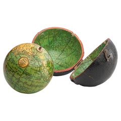
Even the small terrestrial globe is covered with printed paper: continents and oceans appear with numerous geographical markings indicating the most recent explorations.
In the Pacific Ocean, west of South America bears the following inscription:
GLOBE
TERRESTRIAL
à Paris
chez Delamarche Géog
Rue du Foin Jacques
Au Collège de
M.e Gervais
The North American coasts are well delineated and California appears correctly as a peninsula - reports from Spanish explorers in the region had given rise to confusion as to whether it was connected to the mainland or not. The geographical nature of California was confirmed after the explorations of Juan Bautista de Anza (1774-1776).
Alaska is not described and is only partially traced; it would become part of the United States in 1867.
Various Pacific islands are indicated.
Australia (the name definitely used from 1824) is called "Nouvelle Hollande."
Tasmania is still represented as a peninsula and this is an important detail for the dating of our armillary sphere.
The island is separated from Australia by Bass Strait, which was crossed by Matthew Flinders for the first time in 1798, showing that it was not a peninsula. Delamarche certainly would not have waited a long time to update such an important geographical datum: presumably he did so shortly after receiving the news.
Charles-François Delamarche (1740-1817) founded his laboratory around 1770 and, in a few years, he became the most famous French cartographer and globe maker between the 18th and 19th centuries. After having acquired the laboratory of the late Didier Robert de Vaugondy (1723-1786; himself a renowned cartographer who continued the family business founded by his grandfather Nicolas Sanson in the seventeenth century) and after having purchased, between 1788 and around 1800, the businesses of Jean-Baptiste Fortin (1750-1831) and Jean Lattré (around 1750-1800), he began to call himself "Successeur de MM. Sanson and Robert de Vaugondi, Géographes du Roi and de M. Fortin, Ingénieur-mécanicien du Roi pour les globes et les sphères."
Thus, at the end of the eighteenth century, Delamarche possessed the warehouse stocks, as well as the manufacturing skills of the globes of his main rivals in Paris.
In addition to this aggressive acquisition policy, the key to its success also lay in the combination of high-quality cartography combined with extremely attractive globes and armillary spheres; and, of course, its famous red paint finishing touch.
His laboratory was located on Rue de Foin St Jacques "au Collège Me. (or "Mtre") Gervais" in the Latin Quarter of Paris until around 1805, when he moved to rue du Jardinet No. 13.
On the death of Charles-François in 1817, the reins of the company passed to his son Félix (1779-1835), who continued to publish, often in collaboration with the engraver Charles Dien, Sr. In 1835 the company first moved to rue du Jardinet No. 12 and a little later to rue du Battoir No. 7.
Bibliography:
Dekker, Elly, et al. Globes at
Greenwich...