Taschen Prints
to
3
2
3
1
1
Height
to
Width
to
1
1
4
1
4
2
2
1
1
3
3
5
4
4
3
1
1
1
1
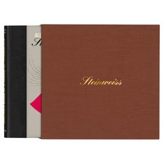
"Alex Steinweiss, The Inventor of the Modern Album Cover" Limited Edition Book
By Alex Steinweiss, Kevin Reagan, Steven Heller
Located in Los Angeles, CA
Music for the eyes.
The man who launched the Golden Age of album cover design.
No. 101-1,600, Collector’s Edition: Limited to 1,500 numbered copies, each signed by the artist. Also...
Category
21st Century and Contemporary Italian Books
Materials
Paper
Manly P Hall, the Secret Teachings of All Ages, First Edition Book & 4 Prints
By TASCHEN
Located in Los Angeles, CA
The classic encyclopedia of the arcane in an expanded edition.
Renowned philosopher and lecturer Manly P. Hall’s masterful encyclopedia of ancient symbols, hidden rituals, and arcane practices has remained a classic since first published in 1928. Hall’s densely detailed writings explore topics ranging from Hermeticism to Tarot, Egyptian mythology to Pythagorean theory. Each chapter is accompanied by the vivid illustrations of artist J. Augustus Knapp, with additional images by Mihran Serailian found in the companion volume, each taking their own unique approach to nearly 60 artworks depicting occult subject matter.
The initial concept for what became known as Hall’s “Great Book”, first began in 1923 when the young Los Angeles-based orator began a months-long trip around the globe. Circumnavigating by ship, Hall visited Egypt, China and India, immersing himself in the philosophical and religious history of each country. Upon his return he spent the next five years penning his massive compendium of philosophy and myth.
Nearly a century after its release, this iconic masterwork has been reproduced for the first time from the rare and extravagant original edition. This meticulously-restored version of Hall’s “Great Book” is also accompanied by an expansive companion book, featuring condensed summaries of each chapter of The Secret Teachings, alongside newly-discovered artworks, rare photography...
Category
21st Century and Contemporary Books
Materials
Foil
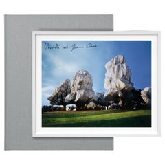
Christo and Jeanne-Claude. Wrapped Trees. Basel 1997–1998. Signed Book & Print
By TASCHEN, Christo and Jeanne-Claude, Wolfgang Volz
Located in Los Angeles, CA
Fondation Beyeler and Berower Park, Riehen, Basel, Switzerland, 1997-1998
In Autumn 1998, after the trees around Fondation Beyeler and in the Berower Park had shed their leaves, Christo and Jeanne-Claude wrapped 162 trees—some up to 25 meters high—with 55,000 square meters of polyester fabric and 23 kilometers of rope. The effect of light and weather on the translucent material created a kind of amorphous sculptural choreography, an ever-changing variety of shapes, surfaces, and colors. The fabric, used every winter in Japan to protect trees from frost and heavy snow, lent the trees the appearance of precious and fragile objects.
The Fondation Beyeler project was a pièce de résistance for Christo and Jeanne-Claude, and an extension and expansion of many years of interest in the concept of wrapped trees...
Category
Late 20th Century Books
Materials
Fabric, Paper
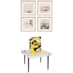
Gio Ponti, Art Edition, the Planchart Coffee Table and a Set of Four Art Prints
By TASCHEN, Molteni & C, Gio Ponti
Located in Los Angeles, CA
This numbered Art Edition of 1,000 copies (Hardcover book, 36 x 36 cm, 572 pages) is accompanied by an exclusive, square format reproduction of the Arlecchino coffee table designed b...
Category
2010s Italian Mid-Century Modern Coffee and Cocktail Tables
Materials
Steel
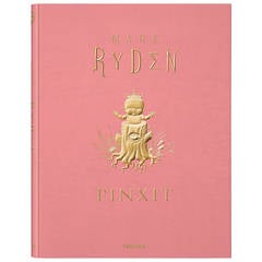
Mark Ryden Pinxit
By Mark Ryden
Located in Los Angeles, CA
Fuzzy bunnies, big-eyed girls, meat, magic and mystery.
Mark Ryden’s carnival of curiosities.
Collector’s edition: No. 51–1,050.
Limited to 1,000 individually numbered copies,...
Category
21st Century and Contemporary Italian Books
$1,250 / item
Related Items
Small Map of the United States, circa 1870
Located in Langweer, NL
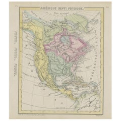
Antique map titled 'Amérique septe. Physique'. Small map of the United States. lithographed by C. Callewaert brothers in Brussels circa 1870.
Category
Antique Mid-19th Century Belgian Maps
Materials
Paper
Antique Map of Brabant 'The Netherlands' by N. Visscher, circa 1690
Located in Langweer, NL
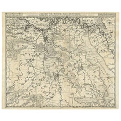
Antique map titled 'Brabantiae Batavae pars orientalis, comprehendens Tetrarchiam sive majoratum sylvaeducensem in ejusdem subjacentes ditiones (..)'. Map of the Dutch province 'Brab...
Category
Antique Mid-18th Century Maps
Materials
Paper
$572 Sale Price
20% Off
H 20.75 in W 24.41 in D 0.02 in
Botanical Treasures: Set of Four Antique Mycology Prints, 1875
Located in Langweer, NL
This set of four original antique mycology prints is a botanical treasure. Each print is a meticulous depiction of various mushrooms and other fungi, showcasing their intricate detai...
Category
Antique Late 19th Century German Prints
Materials
Paper
$514 Sale Price / set
20% Off
H 13.39 in W 9.06 in D 0.02 in
Engraving of a Map of Florida, the Gulf Coast, Caribbean & Central America, 1728
Located in Langweer, NL
This exceptional antique map, titled "Nouvelle Carte Marine de Toute les Cotes de l´Amerique" and alternatively known as "Nieuwe groote en seer Curieuse Paskaart van Geheel-WestIndie...
Category
Antique Mid-18th Century Dutch Maps
Materials
Paper
$16,329
H 24.61 in W 40.56 in D 0.02 in
Antique Map of Africa by Delamarche, 1806
Located in Langweer, NL
Antique map titled 'L'Afrique'.
Decorative map of Africa by Robert de Vaugondy, revised and published by Delamarche. Source unknown, to be determined.
Artists and Engravers: Charl...
Category
Antique 19th Century Maps
Materials
Paper
Antique Map of California, Utah, Nevada, Colorado, New Mexico & Arizona '1872'
Located in Langweer, NL
Antique map titled 'Johnson's California (..)'. Original map of California, Utah, Nevada, Colorado, New Mexico and Arizona. This map originates from ...
Category
Antique Late 19th Century Maps
Materials
Paper
$238 Sale Price
20% Off
H 18.12 in W 26.38 in D 0.02 in
Antique Print of a Jacobite Pincushion and a Silk Purse by Gibb, 1890
Located in Langweer, NL
Antique print titled 'Jacobite Pincushion - Silk Purse'. Chromolithographic plate originating from 'The Royal House of Stuart. Illustrated By a Series of Forty Plates in Colours Draw...
Category
Antique 19th Century European Prints
Materials
Paper
$101
H 15.75 in W 11.23 in D 0 in
Antique Map of Japan by W. G. Blackie, 1859
Located in Langweer, NL
Antique map titled 'Japan'. Original antique map of Japan. This map originates from ‘The Imperial Atlas of Modern Geography’. Published by W. G. B...
Category
Antique Mid-19th Century Maps
Materials
Paper
Antique Physical Chart of the Pacific Ocean by Johnston, '1850'
Located in Langweer, NL
Antique map titled 'Physical Chart of the Pacific Ocean showing the currents and temperature of the ocean'. Original antique chart of the Pacific Ocean. This map originates from 'The...
Category
Antique Mid-19th Century European Maps
Materials
Paper
Antique Map of the Cape of Good Hope by W. G. Blackie, 1859
Located in Langweer, NL
Antique map titled 'Cape of Good Hope'. Original antique map of the Cape of Good Hope. This map originates from ‘The Imperial Atlas of Modern Geography’. Published by W. G. Blackie, ...
Category
Antique Mid-19th Century English Maps
Materials
Paper
Antique Map of the City of Visby 'Sweden' by F. Hogenberg, 1598
Located in Langweer, NL
This is a wonderful bird's-eye plan/view of the oldest city in Sweden.
Visby, the largest city on the island of Gotland was an important Viking city and the main centre of the Hanseatic League...
Category
Antique 16th Century Maps
Materials
Paper
$2,336 Sale Price
20% Off
H 23.04 in W 27.96 in D 0.99 in
Antique Map of the Northern Part of South America by J. Tallis, circa 1851
Located in Langweer, NL
A decorative and detailed mid-19th century map of the northern part of South America (including modern day Venezuela, Colombia, Ecuador, Guyana, Suriname and French Guiana) which was drawn and engraved by J. Rapkin (vignettes by H. Winkles & W. Lacey) and published in John Tallis & Co.'s The Illustrated Atlas (London & New York: circa 1851).
The Illustrated Atlas, published from 1849 onwards, was the last decorative world atlas. The 'Venezuela, New Granada...' map was typical of the many Fine ones which appeared in this work with its decorative border and attractive vignettes. Illustrated are views of Mount Chimborazo, Ecuador; the 'Fall of the Bagota' (Tequendama Falls, Colombia); Rheas and a prospect of Paramaribo Harbour (Dutch Guiana...
Category
Antique Mid-19th Century English Maps
Materials
Paper
$446
H 10.6 in W 14.41 in D 0.01 in
