![[World War Two map] - Dunkirk to Berlin June 1940.](https://a.1stdibscdn.com/a_14192/a_122803621683893882824/108529_master.jpg?width=240)
[World War Two map] - Dunkirk to Berlin June 1940.
View Similar Items


Want more images or videos?
Request additional images or videos from the seller
1 of 3
Unknown[World War Two map] - Dunkirk to Berlin June 1940.1947
1947
About the Item
- Creation Year:1947
- Dimensions:Height: 38.78 in (98.5 cm)Width: 48.71 in (123.7 cm)Depth: 0.99 in (2.5 cm)
- Period:
- Condition:Framed and glazed with acrylic/perspex.
- Gallery Location:London, GB
- Reference Number:Seller: 1085291stDibs: LU1419212280362
About the Seller
5.0
Gold Seller
Premium sellers maintaining a 4.3+ rating and 24-hour response times
Established in 1979
1stDibs seller since 2020
17 sales on 1stDibs
Typical response time: 4 hours
Authenticity Guarantee
In the unlikely event there’s an issue with an item’s authenticity, contact us within 1 year for a full refund. DetailsMoney-Back Guarantee
If your item is not as described, is damaged in transit, or does not arrive, contact us within 7 days for a full refund. Details24-Hour Cancellation
You have a 24-hour grace period in which to reconsider your purchase, with no questions asked.Vetted Professional Sellers
Our world-class sellers must adhere to strict standards for service and quality, maintaining the integrity of our listings.Price-Match Guarantee
If you find that a seller listed the same item for a lower price elsewhere, we’ll match it.Trusted Global Delivery
Our best-in-class carrier network provides specialized shipping options worldwide, including custom delivery.More From This Seller
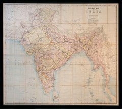
View AllRailway Map of India.
Located in London, GB
THUILLIER, Colonel Henry Ravenshaw.
Railway Map of India. Railways Brought up to October 1895. Scale 1 Inch = 48 miles or 1:3,041,280.
[Calcutta], Published under the direction of Colonel H. Thuillier, R.E., Surveyor General of India, October 1890.
A comprehensive railway map of British India, including the subcontinent and Burma, also displaying the main road networks, navigable canals, steamship routes, and telegraph connections across the peninsular. This publication by the Survey of India Office includes a useful ‘References’ key giving information on the differing gauges in use across the region, and a colour code highlighting the lands under direct British administration in pink, ‘Tributary States’ in yellow and ‘Independent & Foreign Possessions’ in Green. A notice records the price for colour as ‘Five Rupees’, as against ‘Four Rupees’ without.
Prepared under the direction of Colonel Henry Ravenshaw Thuillier, who as his father before him, served as Surveyor General of India from 1887 to 1895. Here Baluchistan is shown as an enclave of the British Raj. This strategically important territory lies in modern-day Pakistan, and is situated around the natural fort town of Quetta located high in the Chiltan mountains. It came under direct British rule in 1876, securing the vital Bolan Pass though which British troops under the command of General Michael Biddulph passed during the Second Anglo-Afghan War...
Category
1890s Other Art Style More Art
Materials
Lithograph
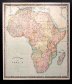
Philips’ New Map of Africa
Located in London, GB
[PHILIP, George]
Philips’ New Map of Africa
London & Liverpool George Philip & Son [1899]
Attractive large map of Africa by the firm founded by the Scottish cartographer George Ph...
Category
1890s Naturalistic More Art
Materials
Watercolor, Engraving
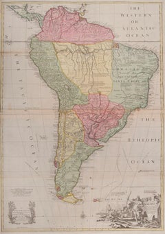
South America
By John Senex
Located in London, GB
South America
SENEX, John.
South America Corrected from the Observations Communicated to the Royal Society’s of London & Paris. By John Senex. To Edmund Halley. LLD. Savilian Professor of Geometry in Oxford and Fellow of the Royal Society. This Map corrected from His own Discoveries In gratefull Acknowledgement of his Ready assistance to Encourage this Designe is Humbly Dedicated.
John Senex, at the Globe against St Dunstans Church, Fleetstreet, London 1710 [-1728].
John Senex (1678-1740) was one of the foremost mapmakers in England in the early eighteenth century. He was also a surveyor, globemaker, and geographer. As a young man, he was apprenticed to Robert Clavell, a bookseller. He worked with several mapmakers over the course of his career, including Jeremiah Seller and Charles...
Category
1710s Naturalistic More Art
Materials
Watercolor, Engraving
$4,061
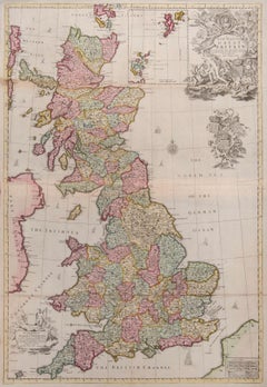
Great Britain
By John Senex
Located in London, GB
Great Britain
SENEX, John.
A New Map of Great Britain Corrected from the Observations communicated to the Royal Society at London. By John Senex F.R.S. To the Right Hono[ra]ble William Connelly ESQ. One of the Commissioners of His Maj[es]ties Revenue, Speakerof the Hono[a]ble House of Commons, and one of His Maj[es]ties most Hono[ra]ble Privy Council for Ye Kingdom of Ireland. This Map is dedicated by John Senex.
John Senex F.R.S. 1710 [-1728].
John Senex (1678-1740) was one of the foremost mapmakers in England in the early eighteenth century. He was also a surveyor, globemaker, and geographer. As a young man, he was apprenticed to Robert Clavell, a bookseller. He worked with several mapmakers over the course of his career, including Jeremiah Seller and Charles Price...
Category
1710s Naturalistic More Art
Materials
Watercolor, Engraving
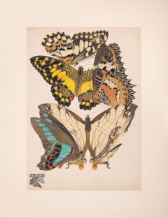
Papillons
By Eugene Alain Seguy
Located in London, GB
Seguy, E.A.
Papillons
Paris, Du Chartre et van Buggenhoudt [1929]
Each print is produced entirely by hand using a unique printing process called pochoir, which was popular in Fran...
Category
1920s Naturalistic Animal Prints
Materials
Gouache, Lithograph
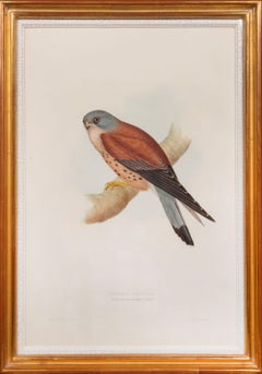
Lesser Kestril. Falco Tinnunculoïdes.
By John Gould
Located in London, GB
GOULD, John.
Lesser Kestril. Falco Tinnunculoïdes.
London, for the author 1832.
Plate 27 from the first edition of Gould's first multi-volume ornithological work: The Birds of Europe...
Category
1830s Naturalistic Animal Prints
Materials
Watercolor, Lithograph
You May Also Like
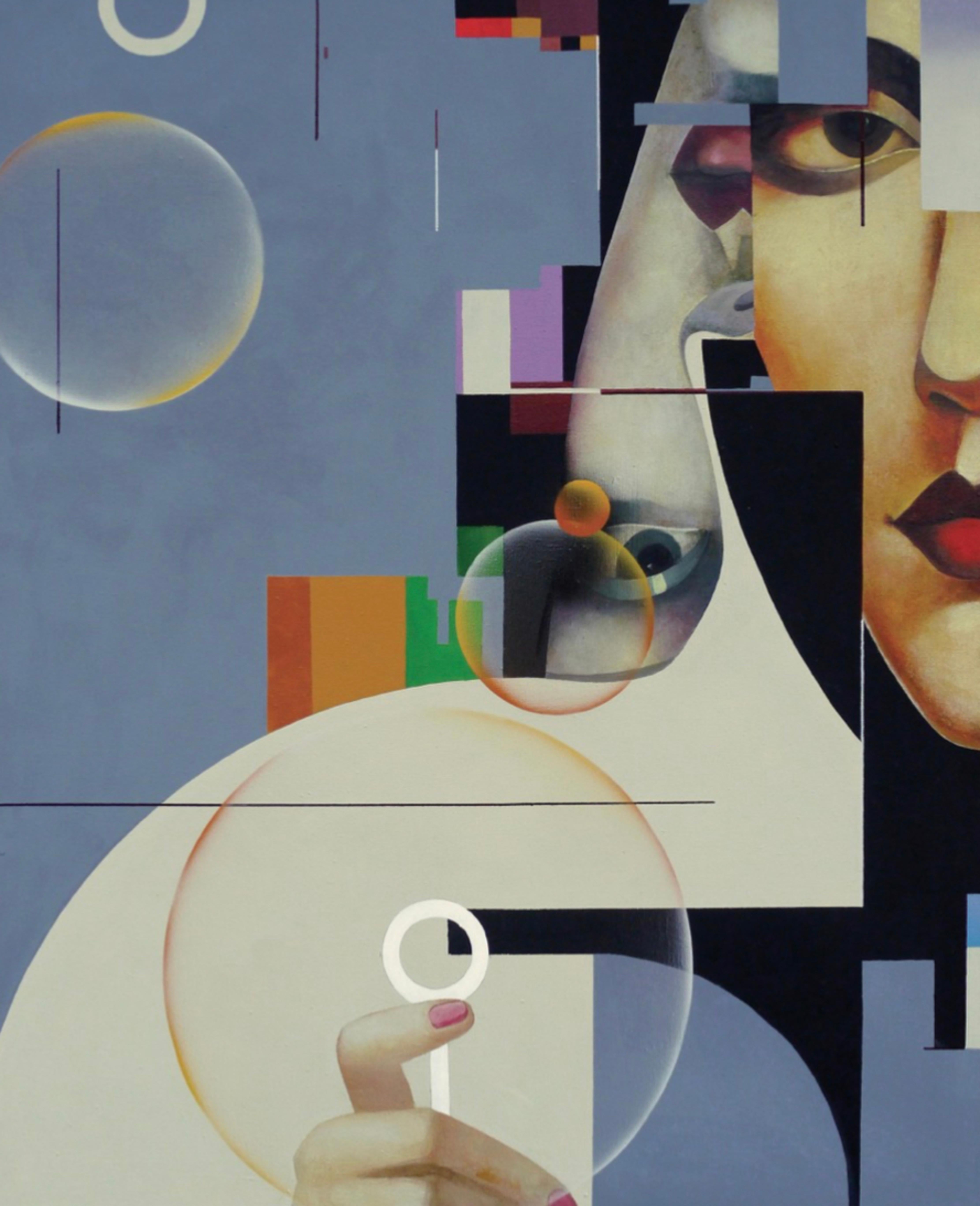
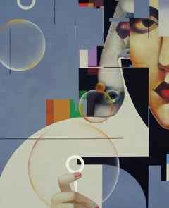
Talk. 110x90cm, acrylic on canvas
Located in Yerevan, AM
Talk. 110x90cm
Category
2010s Abstract More Art
Materials
Canvas, Acrylic
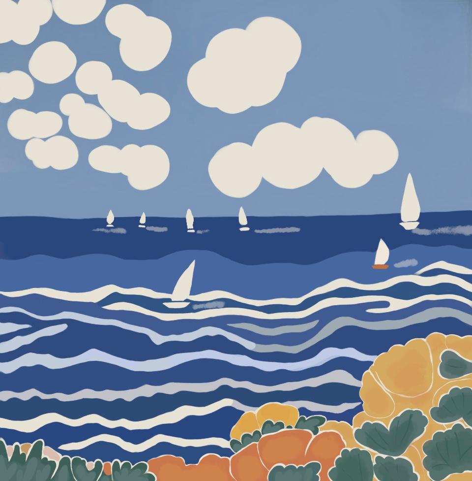
Seascape , 70x70cm, print on canvas
Located in Yerevan, AM
Seascape , 70x70cm, print on canvas
Category
2010s Pop Art More Art
Materials
Canvas, Color
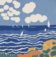
$250 Sale Price
50% Off
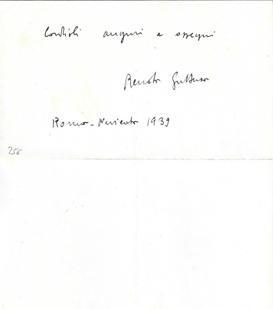
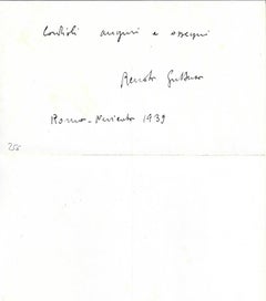
Christmas Greeting Card by Renato Guttuso - 1940
By Renato Guttuso
Located in Roma, IT
Christmas Greeting Card by Guttuso is an Autograph Signed by Renato Guttuso to the Countess Anna Laetitia Pecci Blunt. Rome, November 1939. In Italian. O...
Category
1940s Modern More Art
Materials
Paper, Ink
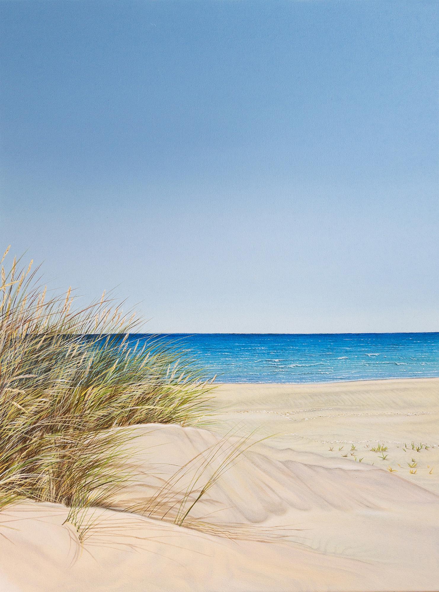
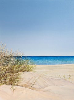
Reeds by the Shore - original realism seascape oil painting-contemporary Art
Located in London, Chelsea
This exceptional artwork is currently on display and available for sale at Signet Contemporary Art Gallery and online. Reeds by the Shore by Olga Calado evokes a sense of calm and qu...
Category
21st Century and Contemporary Photorealist Landscape Paintings
Materials
Canvas, Oil
The Sun and the Turtles, 100x70 cm, acrylic on canvas, pastel
Located in Yerevan, AM
The Sun and the Turtles, 100x70 cm, acrylic on canvas, pastel
Category
2010s More Art
Materials
Canvas, Pastel, Acrylic
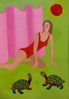
$975 Sale Price
25% Off
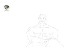
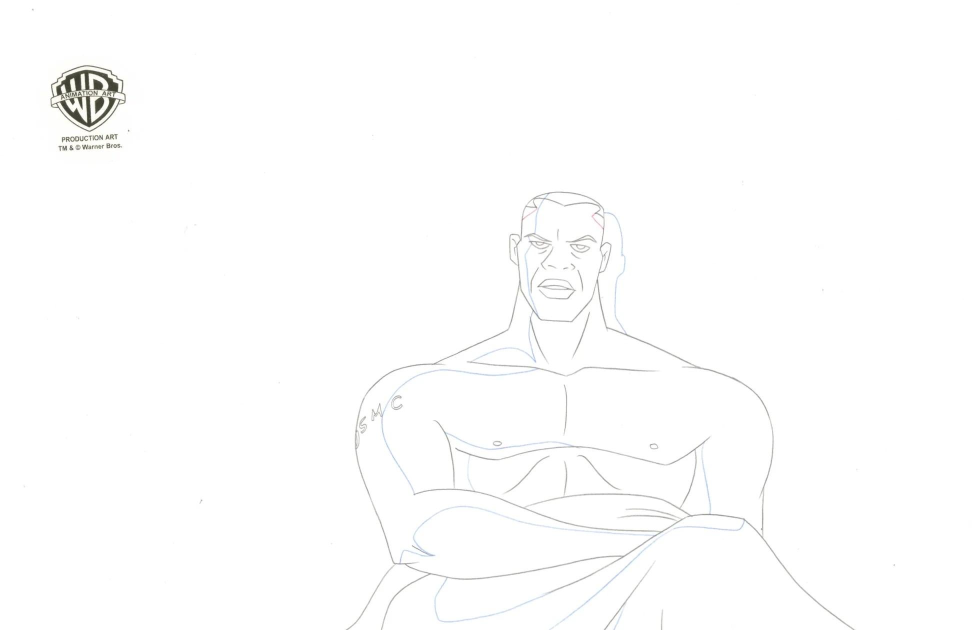
Justice League Unlimited Original Production Drawing: Green Lantern
Located in Los Angeles, CA
Green Lantern (John Stewart)
MEDIUM: Original Production Drawing
IMAGE SIZE: 14" x 9.5"
PRODUCTION: Justice League Unlimited
SKU: IFA10613
ABOUT THE IMAGE: Justice League Unlimited...
Category
1990s Pop Art More Art
Materials
Paint, Paper, Pencil