Items Similar to Antique Colourful Antique Map of Spain and Portugal, 1815

Want more images or videos?
Request additional images or videos from the seller
1 of 5
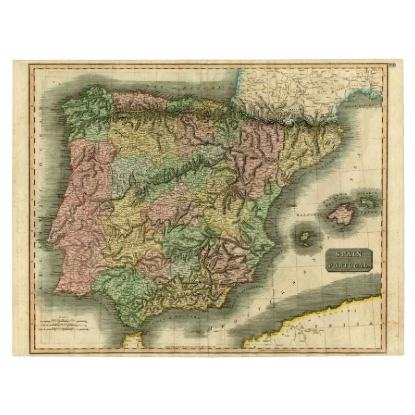
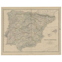
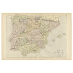
Antique Colourful Antique Map of Spain and Portugal, 1815
About the Item
Antique map of Spain and Portugal. Thomson's map includes both countries in full, with Spain being divided into its various semi-autonomous provinces. The Balearic Island of Minorca, Majorca, and Ibiza are prominent in the left hand quadrants of the map. Drawn & engraved for Thomson's New General Atlas.
Artists and Engravers: John Thomson (1777 - c. 1841) was a Scottish cartographer, publisher, and bookbinder active in Edinburgh during the early part of the 19th century. Thomson apprenticed under Edinburgh bookbinder Robert Alison.
Condition:
Very good, general age-related toning. Please study image carefully.
- Dimensions:Height: 20.87 in (53 cm)Width: 27.96 in (71 cm)Depth: 0 in (0.02 mm)
- Materials and Techniques:
- Period:
- Date of Manufacture:1815
- Condition:Condition: Very good, general age-related toning. Please study image carefully.
- Seller Location:Langweer, NL
- Reference Number:
About the Seller
5.0
Platinum Seller
These expertly vetted sellers are 1stDibs' most experienced sellers and are rated highest by our customers.
Established in 2009
1stDibs seller since 2017
1,946 sales on 1stDibs
Typical response time: <1 hour
- ShippingRetrieving quote...Ships From: Langweer, Netherlands
- Return PolicyA return for this item may be initiated within 14 days of delivery.
More From This SellerView All
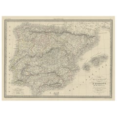
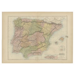
- Antique Map of Spain and Portugal by Thomson, 1815Located in Langweer, NLAntique map titled 'Spain & Portugal.' Map of Spain and Portugal. From Thomson's 'New General Atlas', 1815. Artists and Engravers: Made by 'J. & G. Menzies'. Publisher: John Thomson ...Category
Antique 19th Century Maps
MaterialsPaper
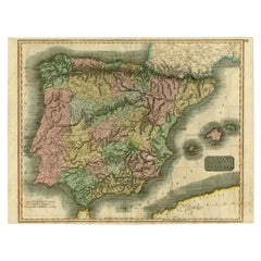
- Antique Map of Spain and Portugal, 1882Located in Langweer, NL"Antique map titled 'Spain & Portugal'. Old map of Spain and Portugal. This map originates from 'The Royal Atlas of Modern Geography, Exhibiting, in a S...Category
Antique 19th Century Maps
MaterialsPaper
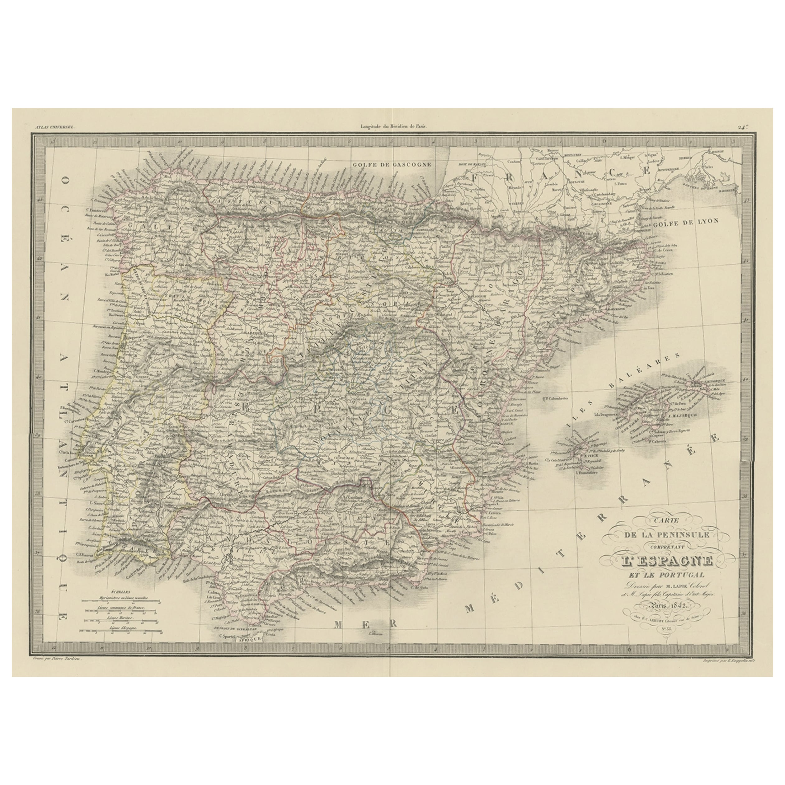
- Antique Decorative Map of Portugal and Spain, 1842Located in Langweer, NLAntique map titled 'Carte de la Peninsule comprenant l'Espagne et le Portugal'. Map of Spain and Portugal. This map originates from 'Atlas universel de géographie ancienne et mod...Category
Antique 1840s Maps
MaterialsPaper
- Original Antique Map of Spain and Portugal, 1882Located in Langweer, NLEmbark on a historical voyage with an original Antique Map of Spain and Portugal from the esteemed 'Comprehensive Atlas and Geography of the World,' meticulously crafted in 1882. Thi...Category
Antique 1880s Maps
MaterialsPaper
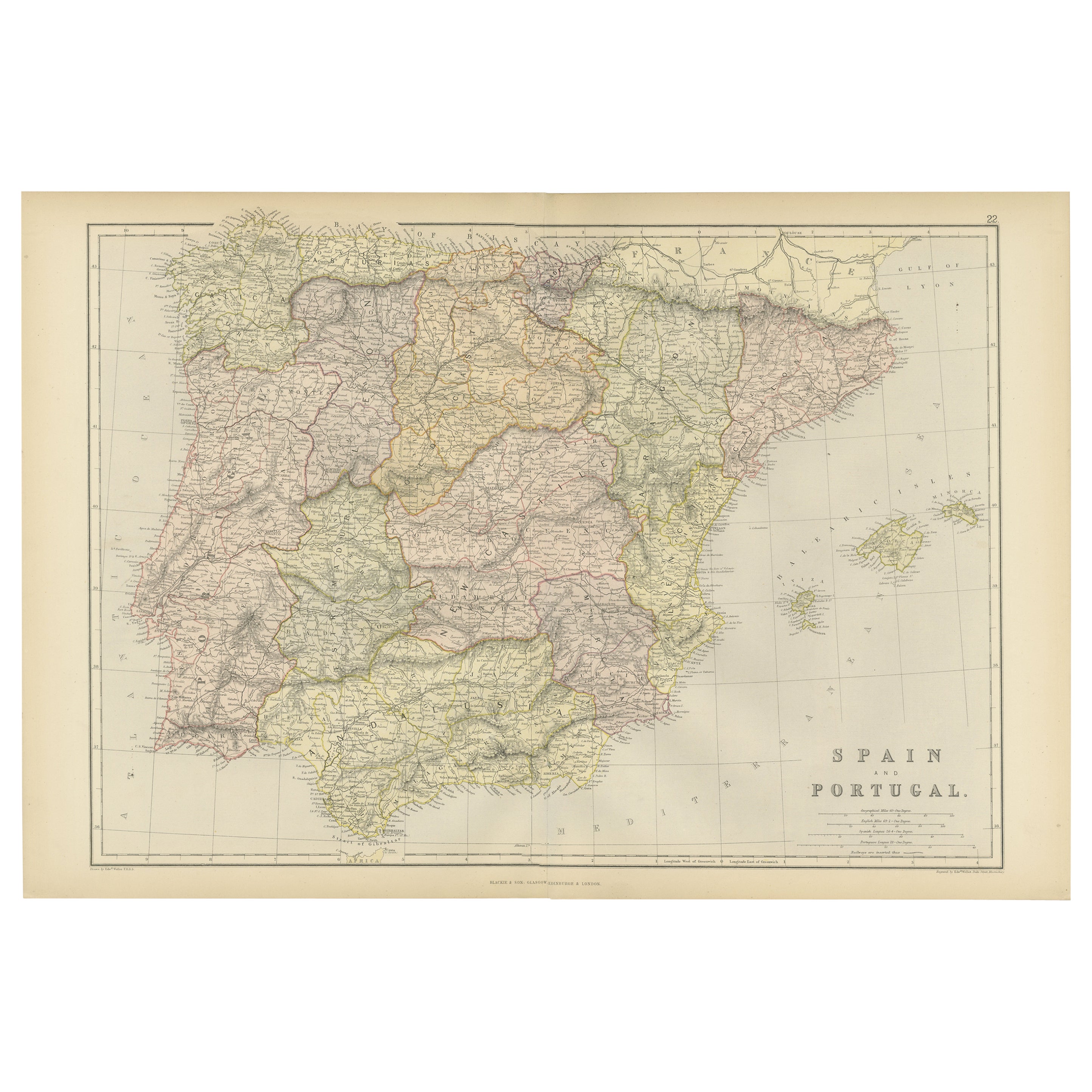
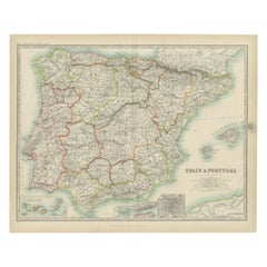
- Antique Map of Spain and Portugal by A & C. Black, 1870Located in Langweer, NLAntique map titled 'Spain and Portugal'. Original antique map of General map of Spain and Portugal with inset map of Gibraltar. This map originates from ‘Black's General Atlas of The...Category
Antique Late 19th Century Maps
MaterialsPaper
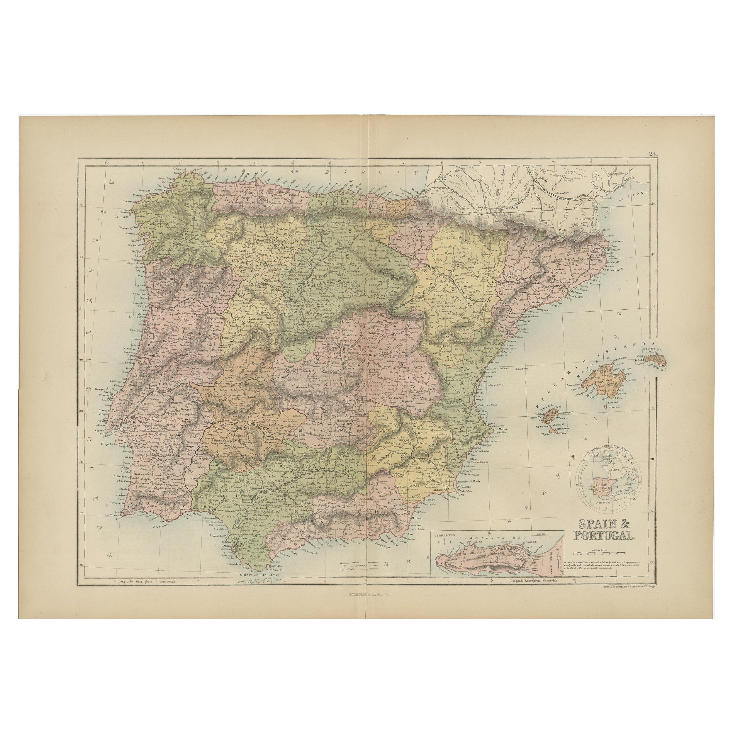
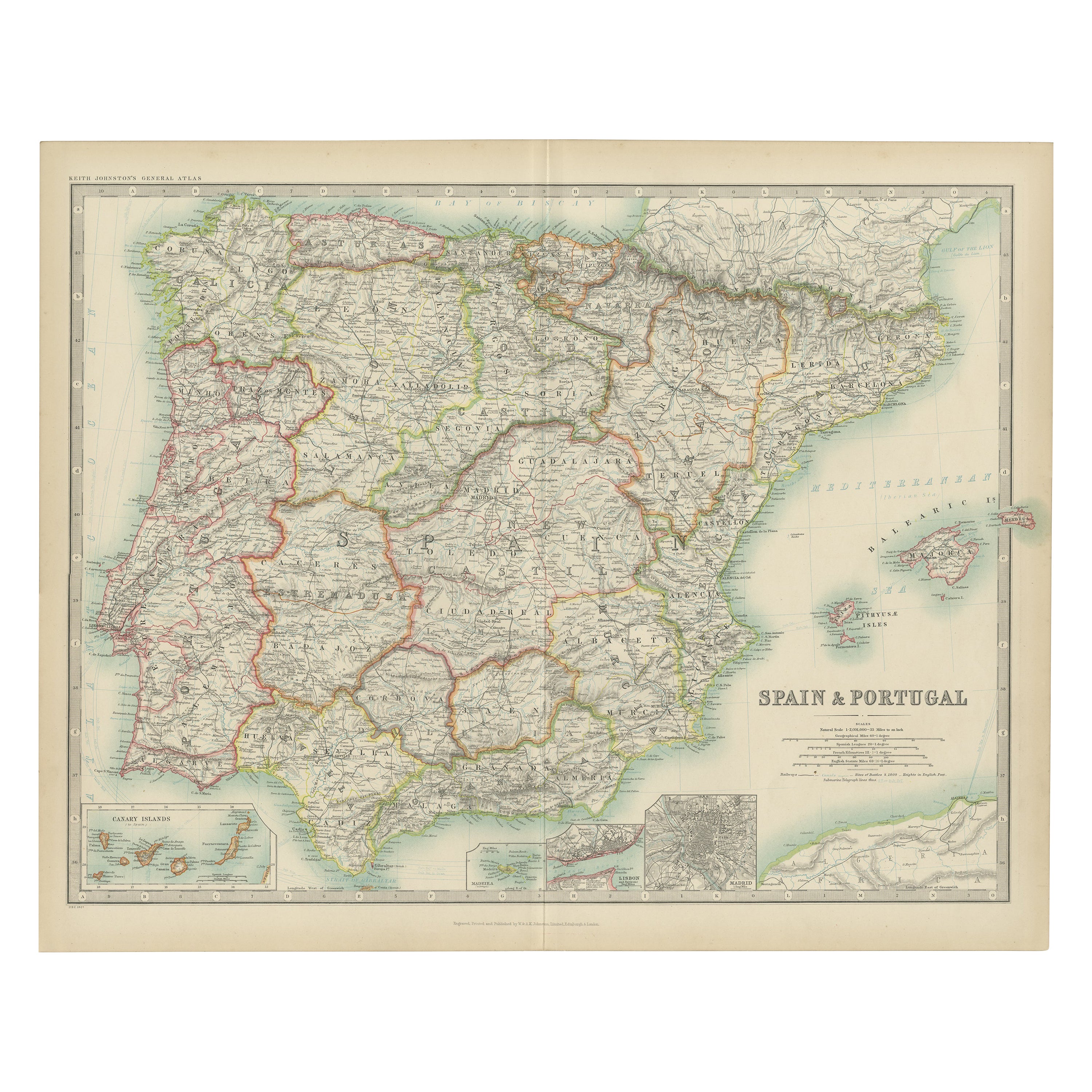
- Antique Map of Spain and Portugal by Johnston, '1909'Located in Langweer, NLAntique map titled 'Spain and Portugal'. Original antique map of Spain and Portugal. With inset maps of the Canary Islands, Madeira, Lisbon and Ma...Category
Early 20th Century Maps
MaterialsPaper
You May Also Like
- Original Antique Map of Spain and Portugal, circa 1790Located in St Annes, LancashireSuper map of Spain and Portugal Copper plate engraving by A. Bell Published, circa 1790. Unframed.Category
Antique 1790s English Other Maps
MaterialsPaper
- Original Antique Map of Spain and Portugal by Thomas Clerk, 1817Located in St Annes, LancashireGreat map of Spain and Portugal Copper-plate engraving Drawn and engraved by Thomas Clerk, Edinburgh. Published by Mackenzie And Dent, 1817 Unframed.Category
Antique 1810s English Maps
MaterialsPaper
- Original Antique Map of Spain and Portugal, Engraved By Barlow, 1806Located in St Annes, LancashireGreat map of Spain And Portugal Copper-plate engraving by Barlow Published by Brightly & Kinnersly, Bungay, Suffolk. 1806 Unframed.Category
Antique Early 1800s English Maps
MaterialsPaper
- 18th Century Hand Colored Map of Spain and Portugal by VisscherBy Nicolaes Visscher IILocated in Alamo, CAThis is an early 18th century map of Spain and Portugal, with attractive original hand-coloring, entitled "Hispaniae et Portugalliae Regna per Nicolaum Visscher cum Privilegio Ordinu...Category
Antique Early 18th Century Dutch Maps
MaterialsPaper
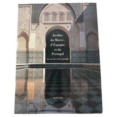
- Garden of Morocco, Spain and Portugal Hardcover Book French Ed.Located in North Hollywood, CAGarden of Morocco, Spain and Portugal Hardcover Book French Ed.Jardins du Maroc, d'Espagne et du Portugal : Un art de vivre partagé.French Edition by Mohammed El Faïz (Author), Manu...Category
21st Century and Contemporary Moroccan Moorish Books
MaterialsPaper
- 1815 Spanish Passport Hand Written on PaperLocated in Marbella, ES1815 Spanish passport hand written on paper. Part of a large collection.Category
Antique Early 19th Century Spanish Historical Memorabilia
MaterialsPaper


Recently Viewed
View AllMore Ways To Browse
Colourful Furniture
Furniture 1815
Century 19th Country Spanish
Maps Spain
Map Spain
Map Of Spain
19th C Country Antiques
Antique Apprentice
Antique Apprentice Furniture
Antique Quadrant
Hand Drawn Map
Scotland Map
Antique Map Scotland
Antique Map Of Scotland
Antique Maps Scotland
Antique Scotland Map
Scotland Antique Map
Antique Scottish Maps