Items Similar to Original Engraving of Rotterdam Island, Nowadays Nomuka, Kingdom of Tonga, c1800

Want more images or videos?
Request additional images or videos from the seller
1 of 5
Original Engraving of Rotterdam Island, Nowadays Nomuka, Kingdom of Tonga, c1800
About the Item
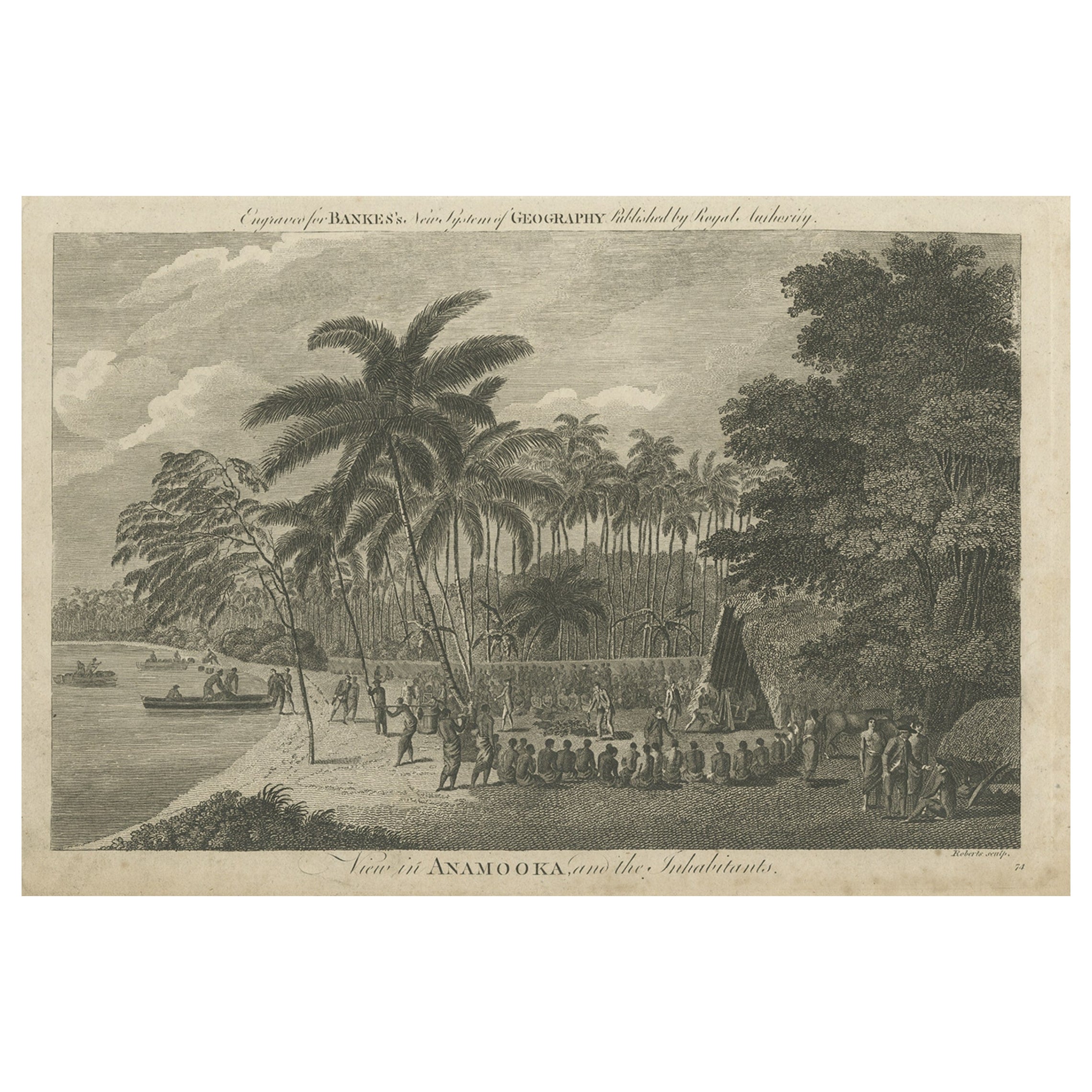
Antique print titled 'Gezigt op het eiland Rotterdam'.
View of Rotterdam Island, Pacific. Originates from 'Reizen Rondom de Waereld door James Cook (..)'.
Rotterdam or nowadays Nomuka is a small island in the southern part of the Ha?apai group of islands in the Kingdom of Tonga. It is part of the Nomuka Group of islands, also called the ?Otu Mu?omu?a.
Nomuka, is 7 square kilometres in area and contains a large, brackish lake (Ano Lahi) in the middle, and also three other smaller lakes—Ano Ha'amea, Ano Fungalei, and Molou. There are approximately 400-500 inhabitants who subsist on fishing, farming, and remittances from family members abroad. The island has a secondary school, two primary schools, and a kindergarten. It also has seven churches.
The island is accessible by boat only. Boats leave weekly from Nuku?alofa and Lifuka, Ha?apai. There is one guesthouse on the island, and three or four small fale koloa, or convenience stores. It is also home to the Royal Nomuka Yacht Club
Notable historic visitors include Abel Tasman, Captain Cook, Captain Bligh, and William Mariner. The Dutch Abel Tasman made the first European discovery of the island on 24 January 1643. A party went ashore to get water, and the description of the huge lake they brought back afterwards leaves little doubt about the identification. Tasman called it Rotterdam island, after the city of Rotterdam, a major port in the Netherlands, and noted in his maps the indigenous name of Amamocka, a misspelling of ?a Nomuka, ?a being a subject-indicating article. We also find the name of Amorkakij for Nomuka iki.[1] Captain Bligh in the Bounty spent 3 days wooding and watering at Nomuka in April 1789. The Mutiny on the Bounty occurred the day after they left.
Nomuka is known for raising up the greatest number of church leaders for the major Christian denominations in Tonga such as Rev. Sione Lepa To'a the former president of the Free Wesleyan Church of Tonga, Rev. Seluipepeli Mafi and his son Rev Dr Feke Mafi as both former presidents of the Church of Tonga, and Pastor Tetileti Pahulu, a former president of the Seventh Day Adventist Church. Apart from these former church presidents, there are also pastors (and former pastors) and Christian workers serving under different denominations and parachurch organisations in Tonga and overseas.
Artists and Engravers: Captain James Cook (1728 - 1779) was a British explorer, navigator, cartographer, and captain in the Royal Navy. Cook made detailed maps of Newfoundland prior to making three voyages to the Pacific Ocean, during which he achieved the first recorded European contact with the eastern coastline of Australia and the Hawaiian Islands, and the first recorded circumnavigation of New Zealand.
Condtion: Fair/good, general age-related toning. Original foldin lines, with a few small repairs. Blank verso, please study image carefully.
- Dimensions:Height: 11.62 in (29.5 cm)Width: 14.77 in (37.5 cm)Depth: 0 in (0.02 mm)
- Materials and Techniques:
- Period:
- Date of Manufacture:circa 1800
- Condition:Repaired: Original foldin lines, with a few small repairs. Original foldin lines, with a few small repairs.
- Seller Location:Langweer, NL
- Reference Number:Seller: PCT-5267 1stDibs: LU3054326824532
About the Seller
5.0
Recognized Seller
These prestigious sellers are industry leaders and represent the highest echelon for item quality and design.
Platinum Seller
Premium sellers with a 4.7+ rating and 24-hour response times
Established in 2009
1stDibs seller since 2017
2,442 sales on 1stDibs
Typical response time: 1 hour
- ShippingRetrieving quote...Shipping from: Langweer, Netherlands
- Return Policy
Authenticity Guarantee
In the unlikely event there’s an issue with an item’s authenticity, contact us within 1 year for a full refund. DetailsMoney-Back Guarantee
If your item is not as described, is damaged in transit, or does not arrive, contact us within 7 days for a full refund. Details24-Hour Cancellation
You have a 24-hour grace period in which to reconsider your purchase, with no questions asked.Vetted Professional Sellers
Our world-class sellers must adhere to strict standards for service and quality, maintaining the integrity of our listings.Price-Match Guarantee
If you find that a seller listed the same item for a lower price elsewhere, we’ll match it.Trusted Global Delivery
Our best-in-class carrier network provides specialized shipping options worldwide, including custom delivery.More From This Seller
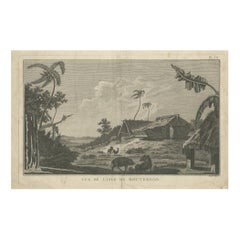
View AllAntique Print of Rotterdam Island, Nomuka, Tonga
Located in Langweer, NL
Antique print titled 'Vue de l'Isle de Rotterdam'. Antique engraving of Rotterdam Island (Nomuka Island) in the Ha?apai group of islands in the Kingdom of Tonga as seen by Captain Co...
Category
Antique Late 18th Century Prints
Materials
Paper
$240 Sale Price
20% Off
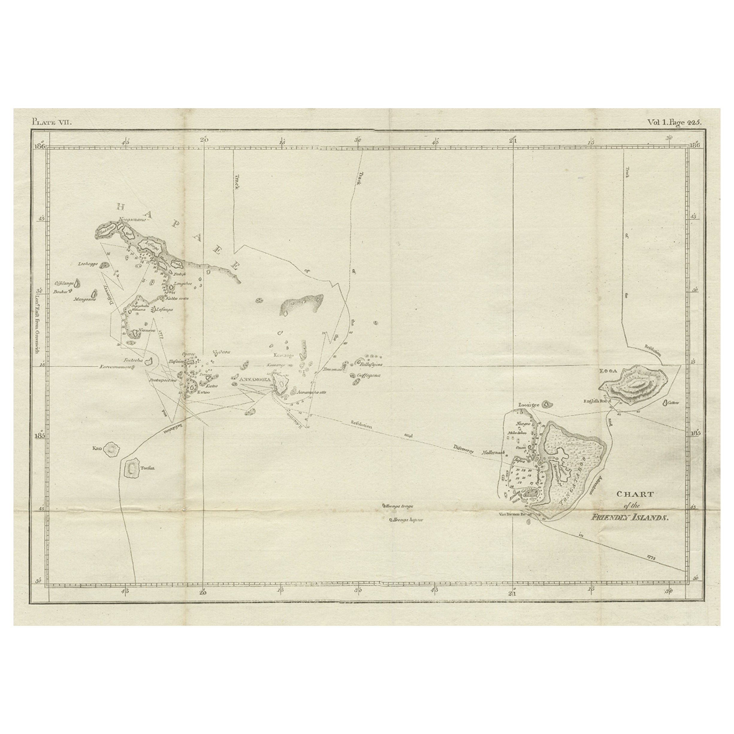
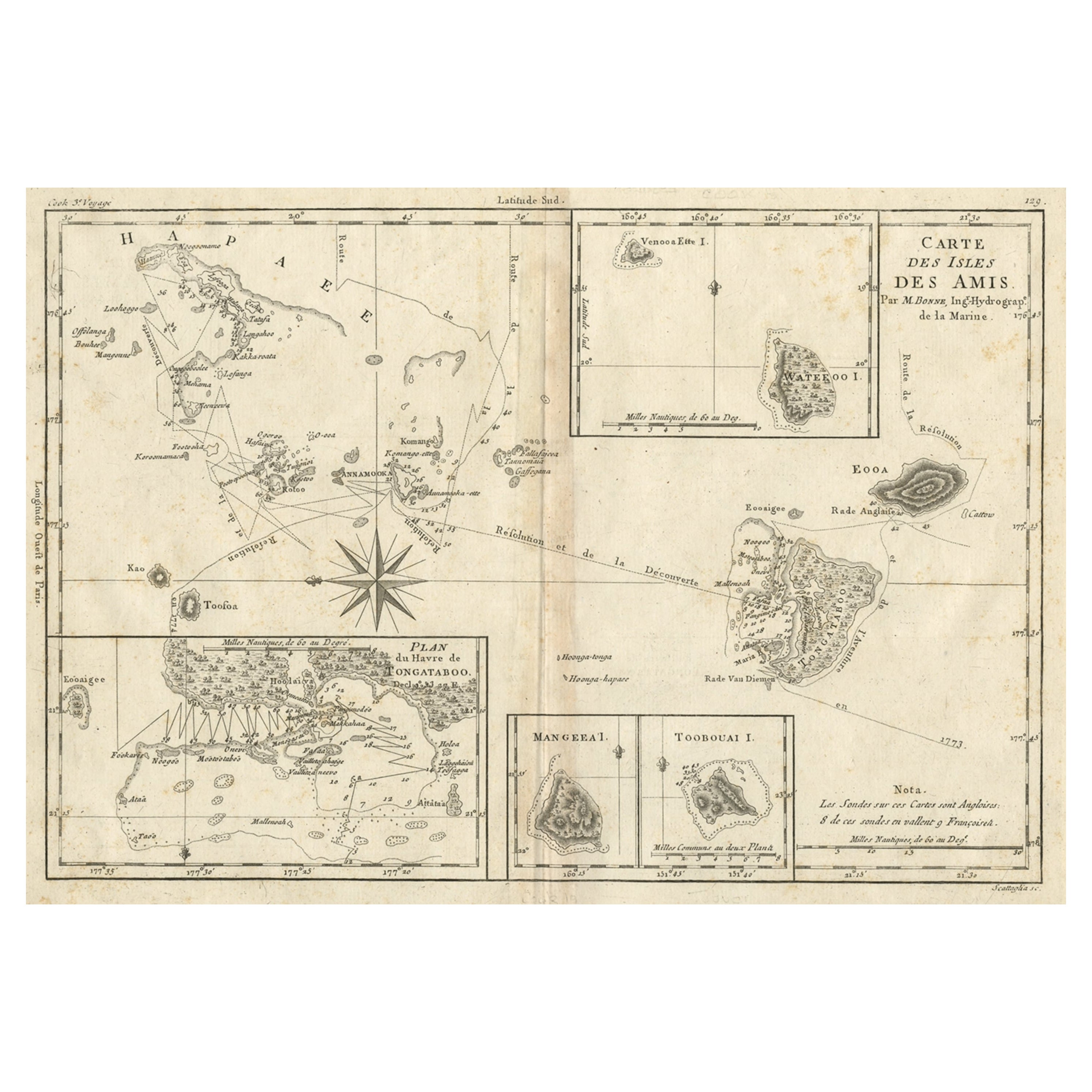
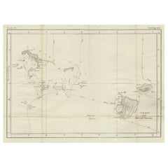
Antique Chart of the Friendly Islands or Nowadays Tonga, by Cook, 1784
By James Cook
Located in Langweer, NL
Antique print titled 'Chart of the Friendly Islands'. Antique map of the Friendly Islands depicting Rotterdam or Anamocka, Middelburg or Eaoowe and Amsterdam or Tongatabu. Originates...
Category
Antique 18th Century Prints
Materials
Paper
$314 Sale Price
20% Off
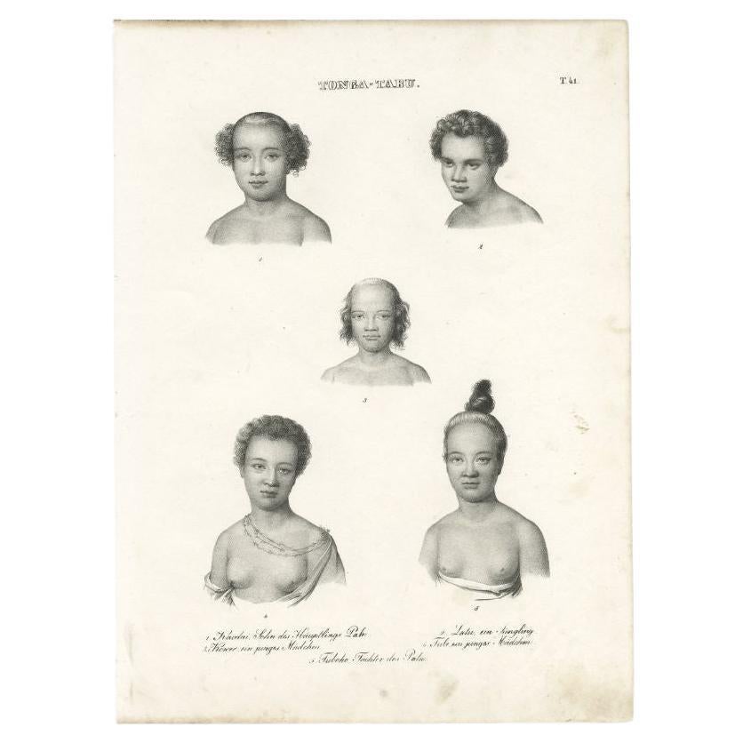
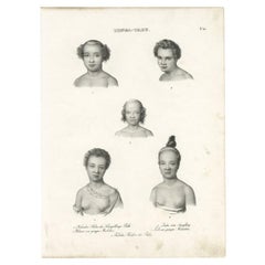
Original Antique Engraving of Inhabitants of Tonga Tabu, C.1836
Located in Langweer, NL
Antique print titled 'Tonga-Tabu'. Old print depicting various inhabitants of Tonga Tabu. This print originates from 'Entdeckungs, Reise der Franzosischen Corvette Astrolabe Unternomen auf Befehl Konig Karls...
Category
Antique 19th Century Prints
Materials
Paper
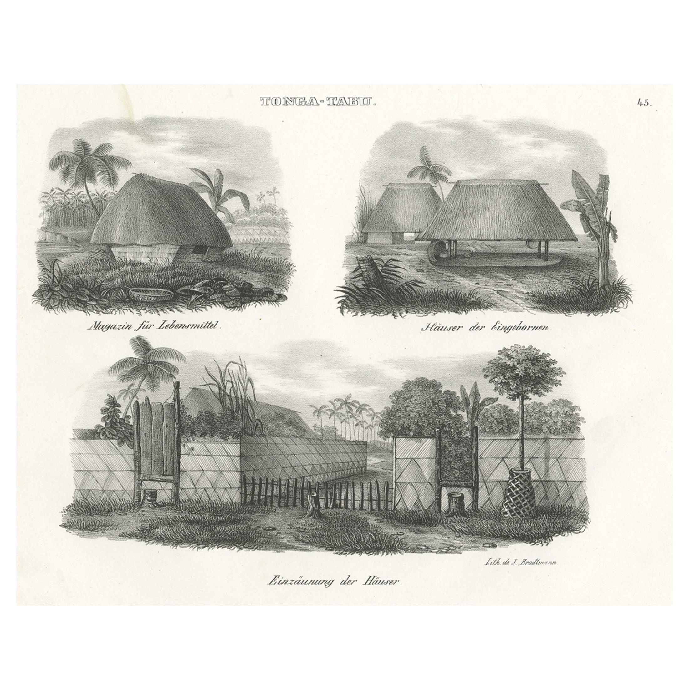
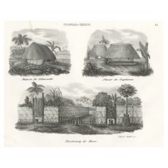
Original Antique Engraving of Various Houses of Tonga Tabu, c.1836
Located in Langweer, NL
Antique print titled 'Tonga-Tabu'. Old print depicting houses and a warehouse of Tonga Tabu. This print originates from 'Entdeckungs, Reise der Franzosischen Corvette Astrolabe Unter...
Category
Antique 19th Century Prints
Materials
Paper
$240 Sale Price
20% Off
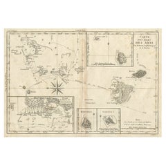
Old Map of the Kingdom of Tonga, Also Known as the Friendly Islands, ca.1780
Located in Langweer, NL
Antique print, titled: 'Carte des Isles des Amis.'
Map of the Kingdom of Tonga, also known as the Friendly Islands, and one of the last hereditary monarchies. Cook named this gro...
Category
Antique 1780s Maps
Materials
Paper
$240 Sale Price
20% Off
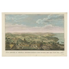
Beautiful and Rare Original Antique Engraving of a Village in Tonga, 1817
Located in Langweer, NL
Fete donnee au General Dentrecasteaux par Toubau, Roi des Iles des Amis
Original antique engraving showing the party given to General Dentrecasteaux by Toubau, King of the Friendl...
Category
Antique 1810s Prints
Materials
Paper
$592 Sale Price
20% Off
You May Also Like
1876 "Gettysburg, The Repulse of Longstreet's Assault." Engraving
Located in Colorado Springs, CO
Presented here is an 1876 engraving of John B. Bachelder and James Walker’s Gettysburg. The Repulse of Longstreet’s Assault. The engraved scene depicts the decisive battle on the final day of the Battle of Gettysburg. Researched by the photographer and topographer John B. Bachelder and painted by James Walker, the original painting was created in 1870. This detailed engraving was done by H. B. Hall Jr. and published by James Drummond Ball.
Otherwise called Pickett’s Charge, the battle occurred on July 3, 1863. Pickett’s corp commander, Lieutenant General James Longstreet was placed in charge of the attack despite his hesitations. Longstreet’s central role led to the title of the work, Repulse of Longstreet’s Assault. In an attempt to gain control of an important supply route, nine Confederate brigades charged across three-quarters of a mile of open ground against cannon fire to take Cemetery Ridge from the defending Union Army. Despite their overwhelming numbers, the Confederate forces were repelled with considerable casualties marking not only a decisive victory for the Union, but also the beginning of the slow defeat of Lee’s Army. The furthest the charging forces advanced before being repulsed would forever be known as the “High Water Mark of the Confederacy.” The Confederate army never recovered from the losses at Gettysburg and it effectively ended Lee’s campaign into Pennsylvania.
The engraving gives the perspective from the Union rear, one that encompasses most of the battlefield, from Big Round Top on the left to the northern reaches of Cemetery Ridge on the right. The Confederate lines at Seminary Ridge are in the far distance, partially obscured by bursting shells. The image centers on the main Confederate assault, in the vicinity of what today are known as "The Copse" and "The Bloody Angle." The composition has elemen...
Category
Antique 1870s American Prints
Materials
Paper

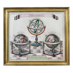
Framed Engraving By Matthaus Seutter Of Sphaerae Artificiales
Located in Essex, MA
Cartographer from Germany 1678-1757. Hand colored. Gilt wood frame. Estate of William Hodgins.
Category
Antique Early 1700s German Prints
Materials
Paper
“The Restaurant of the House of Representatives” Engraving by Harper's Weekly
Located in Colorado Springs, CO
This original wood engraving is titled “The Restaurant of the House of Representatives, Washington, DC.” It was published as a double-page image, in the August 12, 1893 issue of the famous 19th century newspaper Harper’s Weekly. The print was illustrated by Charles Stanley Reinhardt.
The House Restaurant, a unique part of life in the Capitol, has been in the same location since the 1857 Capitol Expansion. Congressional members’ busy work schedule made the availability of food on site a necessity. But the restaurant also served as an informal meeting spot for members to continue conversations and deal making.
This 1893 print illustrates the convivial atmosphere. Details including elegantly dressed tables...
Category
Antique 1890s American Prints
Materials
Paper

The Kingdom of Naples and Southern Italy: A Hand-Colored 18th Century Homann Map
By Johann Baptist Homann
Located in Alamo, CA
"Novissima & exactissimus Totius Regni Neapolis Tabula Presentis Belli Satui Accommo Data" is a hand colored map of southern Italy and the ancient Kingdom of Naples created by Johann...
Category
Antique Early 18th Century German Maps
Materials
Paper

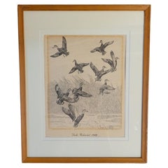
Rare Lynn Bogue Hunt Engraving of Ducks Unlimited, 1940
By Lynn Bogue Hunt
Located in Dallas, TX
Presenting a Rare Lynn Bogue Hunt engraving of ducks unlimited 1940.
This piece cam from a wealthy estate in Dallas, TX with the mansion being built...
Category
Mid-20th Century American Sporting Art Prints
Materials
Paper
“A Football Match, Scotland v. England” Antique Engraving, Proof Edition of 100
By Overend and Smythe
Located in Colorado Springs, CO
This is the 1889 William H. Overend (1851-1898) and Lionel Smythe (1839-1918) first edition, photogravure of the Calcutta Cup – a Rugby match between Scotland and England, that has been played over 100 times, the first match...
Category
Antique 19th Century English Prints
Materials
Paper
