Items Similar to Original Lithograph with a Scene of a Village and Harbour in New Guinea, c.1836


Want more images or videos?
Request additional images or videos from the seller
1 of 7
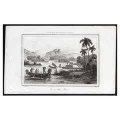
Original Lithograph with a Scene of a Village and Harbour in New Guinea, c.1836
About the Item
Antique print titled 'Ansicht des Dorfes Kuauï'. Im Dory Hafen.
Old print with a scene of a village and harbour in New Guinea. This print originates from 'Entdeckungs, Reise der Franzosischen Corvette Astrolabe Unternomen auf Befehl Konig Karls X'. These are the German titled views originally issued in Dumont d'Urville 'Voyage Autor du Monde'.
Artists and Engravers: Engraved by K.J. Brodtmann after L.A. de Sainson.
Condition: Good, some soiling. Blank verso, please study image carefully.
- Dimensions:Height: 9.85 in (25 cm)Width: 13.39 in (34 cm)Depth: 0 in (0.02 mm)
- Materials and Techniques:
- Period:
- Date of Manufacture:circa 1836
- Condition:Wear consistent with age and use.
- Seller Location:Langweer, NL
- Reference Number:
About the Seller
5.0
Platinum Seller
These expertly vetted sellers are 1stDibs' most experienced sellers and are rated highest by our customers.
Established in 2009
1stDibs seller since 2017
1,932 sales on 1stDibs
Typical response time: <1 hour
- ShippingRetrieving quote...Ships From: Langweer, Netherlands
- Return PolicyA return for this item may be initiated within 14 days of delivery.
More From This SellerView All
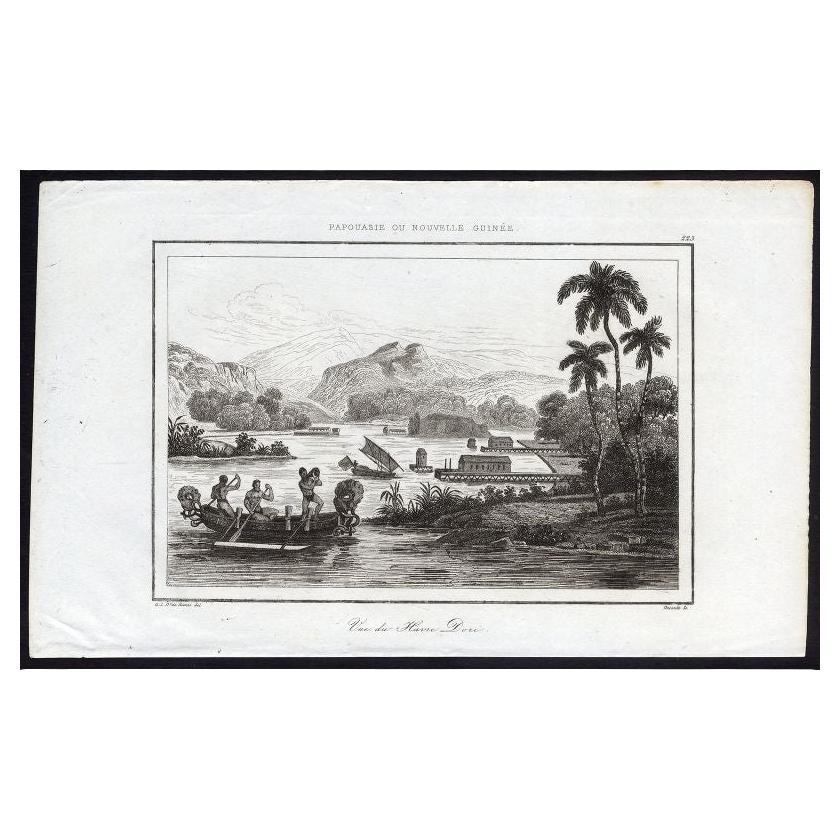
- Antique Print of Dory Harbour, New Guinea, 1836Located in Langweer, NLAntique print titled 'Vue de Havre Dori - 223, Papouasie ou Nouvelle Guinee'. View of Dory Harbour, New Guinea. This print originates from M.G.L. Domeny de Rienzi's 'Oceanie, ou Cinq...Category
Antique 19th Century Prints
MaterialsPaper
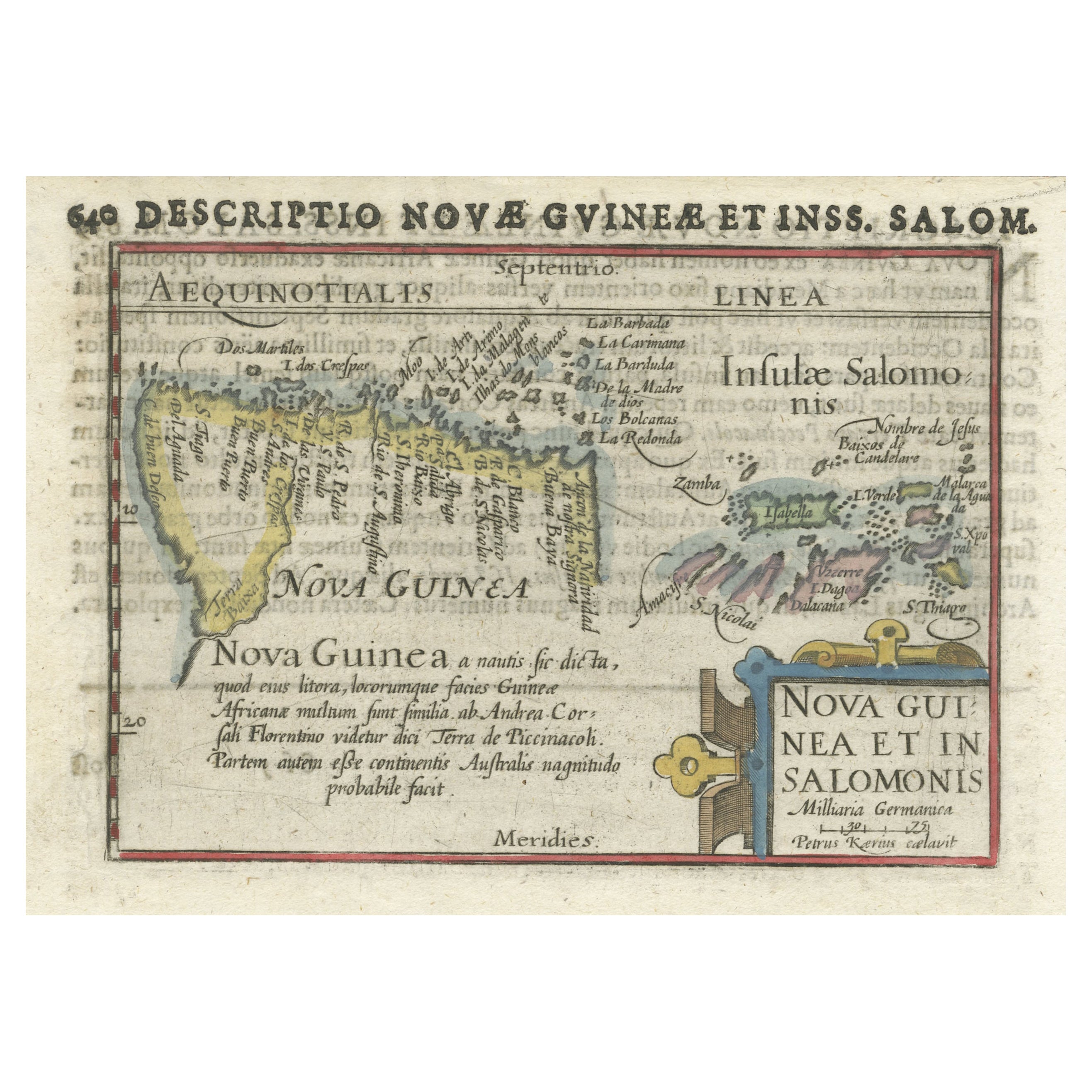
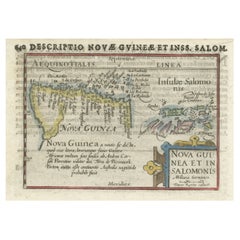
- Rare Original Miniature Map of Papua New Guinea and the Salomon Islands, 1600Located in Langweer, NLVery handsome original old coloured copper engraving of Papua and the Solomon Island. Title of the map 'Descriptio Novae Guneae et Inss. Salom. On the reverse text in Latin. Ve...Category
Antique Early 1600s Maps
MaterialsPaper
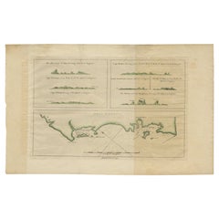
- Antique Map of New Guinea and New Britain by P. Carteret, circa 1773Located in Langweer, NLAntique map titled 'A chart of captn Carteret's Discoveries at New Britain'. Philip Carterets map of New Guinea and the islands of New Britain and New Ireland with the tracks of William Dampier...Category
Antique Late 18th Century Maps
MaterialsPaper
- Antique Map of New Ireland Island in the Bismarck Archipelago, New Guinea, 1772Located in Langweer, NLAntique map titled 'Nova Hibernia'. Antique map of New Ireland, an island in the Bismarck Archipelago, New Guinea. Lying just north of New Britain, from which it is separated by St. ...Category
Antique 18th Century Maps
MaterialsPaper
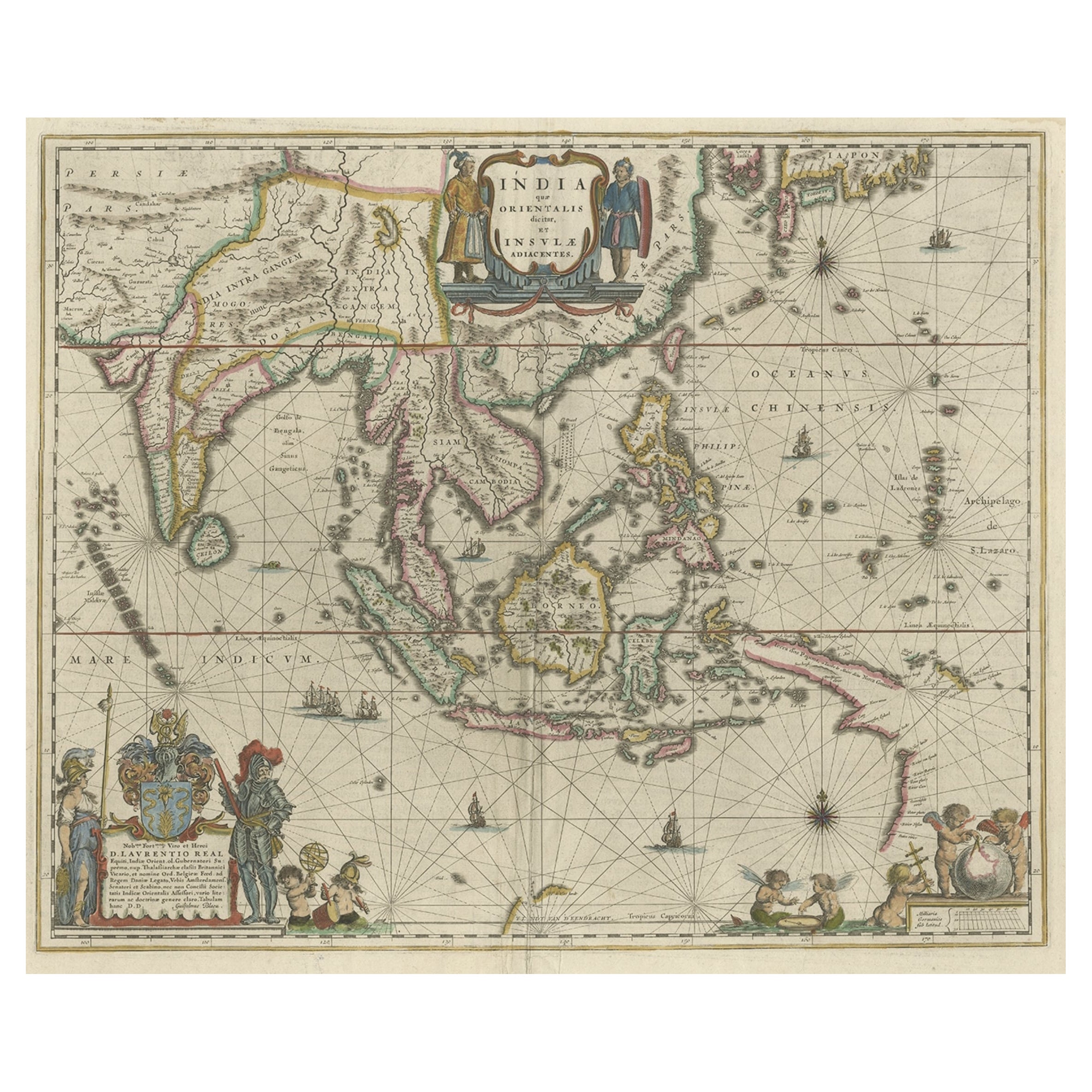
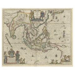
- Original Blaeu Map of Southeast Asia from India to Tibet and Japan to New GuineaLocated in Langweer, NLAntique map titled 'India quae Orientalis dicitur et Insulae Adiacentes'. Beautiful map of Southeast Asia, extending from India to Tibet to Japan to New Guinea. It was the first po...Category
Antique 1640s Maps
MaterialsPaper
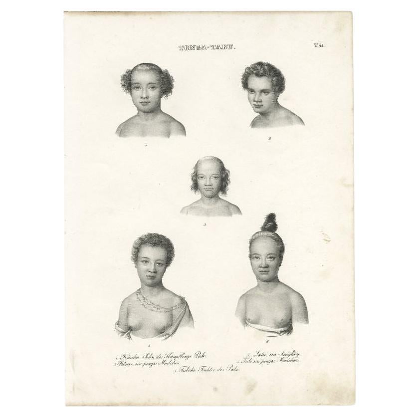
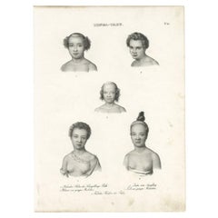
- Original Antique Engraving of Inhabitants of Tonga Tabu, C.1836Located in Langweer, NLAntique print titled 'Tonga-Tabu'. Old print depicting various inhabitants of Tonga Tabu. This print originates from 'Entdeckungs, Reise der Franzosischen Corvette Astrolabe Unternomen auf Befehl Konig Karls...Category
Antique 19th Century Prints
MaterialsPaper

You May Also Like
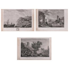
- Three French Empire Maritime Etchings of Ships and Workers in Village HarbourLocated in Big Flats, NYSet of three French Empire etchings depicting ships and workers in harbour setting include "Rue des Environs de Bayonne", "L'Entree D'Une Ville Maritime", and "Vue de Marseille", cir...Category
Antique 19th Century French Decorative Art
MaterialsPaper
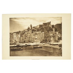
- Double Front and Back Lithograph Depicting Portovenere and Pisa in Italy, 1930sLocated in Milan, ITDouble front and back lithograph depicting Portovenere and Piazza dei Miracoli in Pisa, dating back to the thirties. Very good condition. Cm 21.5 x 27.5.Category
Vintage 1930s Italian Nautical Objects
MaterialsPaper
- West Coast of Africa, Guinea & Sierra Leone: An 18th Century Map by BellinBy Jacques-Nicolas BellinLocated in Alamo, CAJacques Bellin's copper-plate map entitled "Partie de la Coste de Guinee Dupuis la Riviere de Sierra Leona Jusquau Cap das Palmas", depicting the coast of Guinea and Sierra Leone in ...Category
Antique Mid-18th Century French Maps
MaterialsPaper
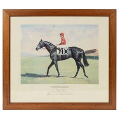
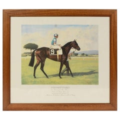
- Lithograph Depicting the Horse Winner of the Italian Derby in 1988Located in Milan, ITLithograph on paper made in the 1990s by the Salomone typography in Rome from a painting depicting Tisserand winner of the 1988 Italian Derby, ridden by V. Mezzatesta. With frame 66....Category
1990s Italian Sports Equipment and Memorabilia
MaterialsWood, Paper
- Lithograph Depicting the Horse Winner of the Italian Derby in 1989Located in Milan, ITLithograph on paper made in the 1990s by the Salomone typography in Rome from a painting depicting Prorutori winner of the 1989 Italian Derby, ridden by M.L. Roberts. With frame 66.5...Category
1990s Italian Sports Equipment and Memorabilia
MaterialsWood, Paper
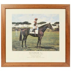
- Lithograph Depicting the Horse Winner of the Italian Derby in 1991Located in Milan, ITLithograph on paper made in the 1990s from a painting depicting Hailsham winner of the 1991 Italian Derby, ridden by Steve Cauthen. With frame 66.5x61 cm, frame thickness 1.5 cm. Ver...Category
1990s Italian Sports Equipment and Memorabilia
MaterialsWood, Paper

Recently Viewed
View AllMore Ways To Browse
Antique Auto
Antique Autos
Used Dory
L Konig
Wall Sculptures Plaque
Metal Display Cabinet
Main Door
Mid Century Carved Wood Door
American Antique Cabinet
Antique Built In Cabinets
Antique Built In Cabinet
Midcentury China Cabinet
Brass Cabinet Nightstand
Small Cupboard With Doors
Display Case 1900
Ebonized Kitchen Cabinet
Silver Midcentury Ring
Antique Jacket