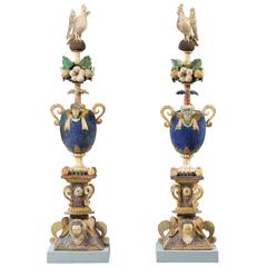
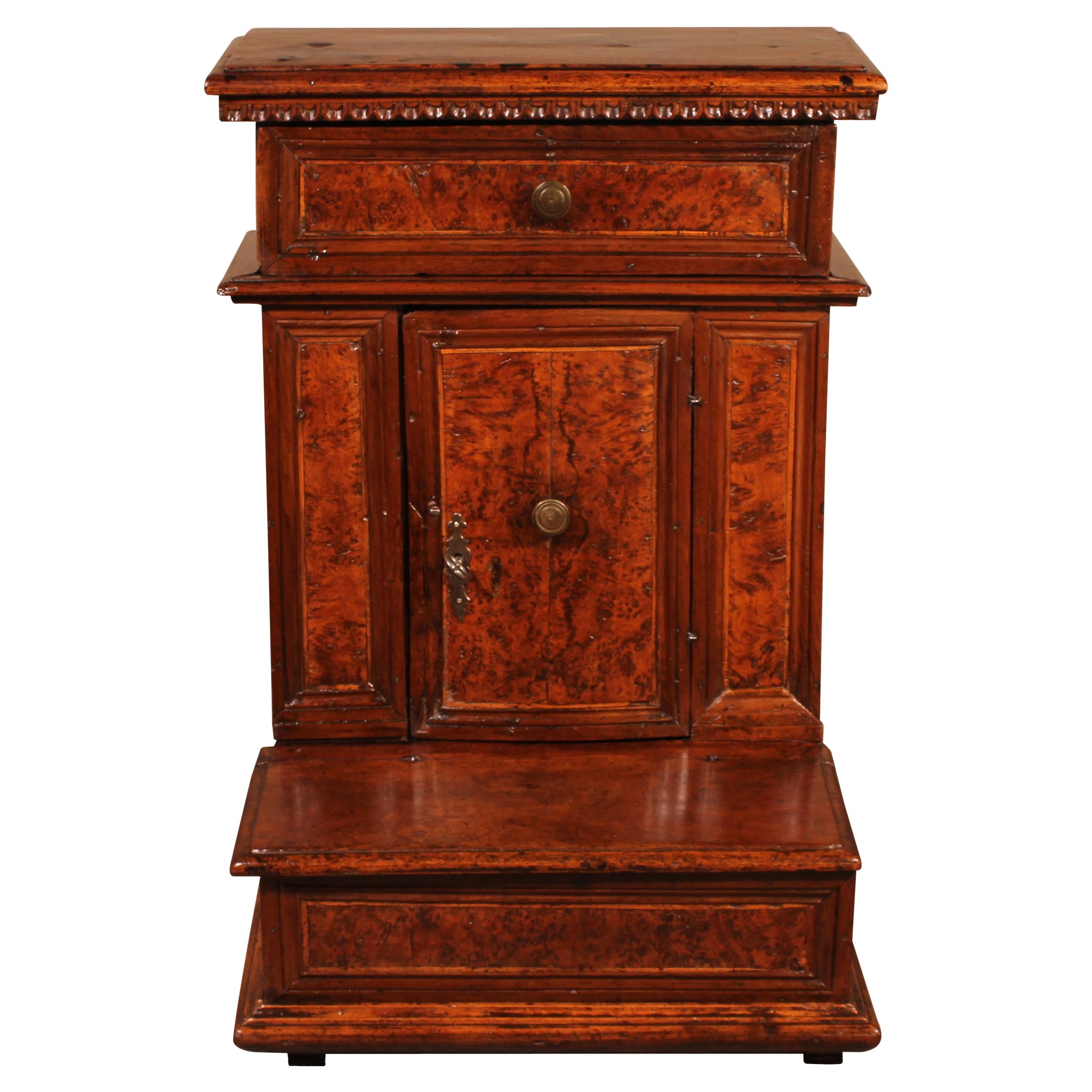
Pair of Earthenware Finials, Normandy, Pré d'Auge, circa 1600
View Similar Items


1 of 2
Pair of Earthenware Finials, Normandy, Pré d'Auge, circa 1600
About the Item
- Dimensions:Height: 61.42 in (156 cm)Width: 14.18 in (36 cm)Depth: 12.6 in (32 cm)
- Style:Folk Art (Of the Period)
- Materials and Techniques:
- Place of Origin:
- Period:Early 17th Century
- Date of Manufacture:circa 1600
- Condition:
- Seller Location:Paris, FR
- Reference Number:1stDibs: LU101945849933
You May Also Like
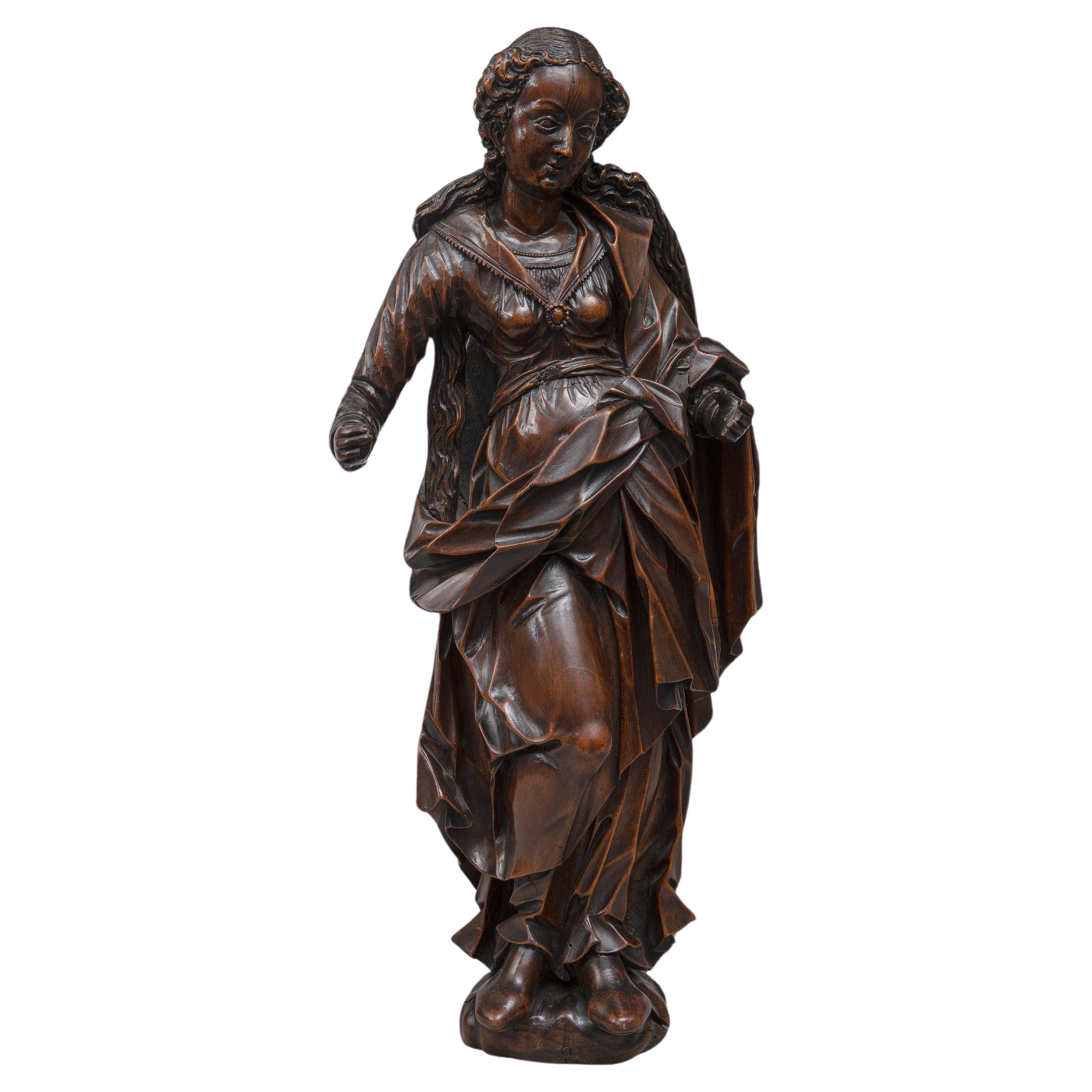
- Statuette of the Virgin, South German circa 1600Located in Bruxelles, BEStatuette of the Virgin South-German, circa 1600 sculpted wood circa 1600 (right arm restored) 52 cmCategory
Antique 17th Century German Renaissance Religious Items
MaterialsWood
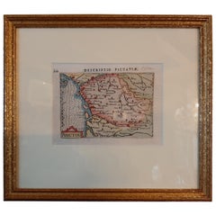
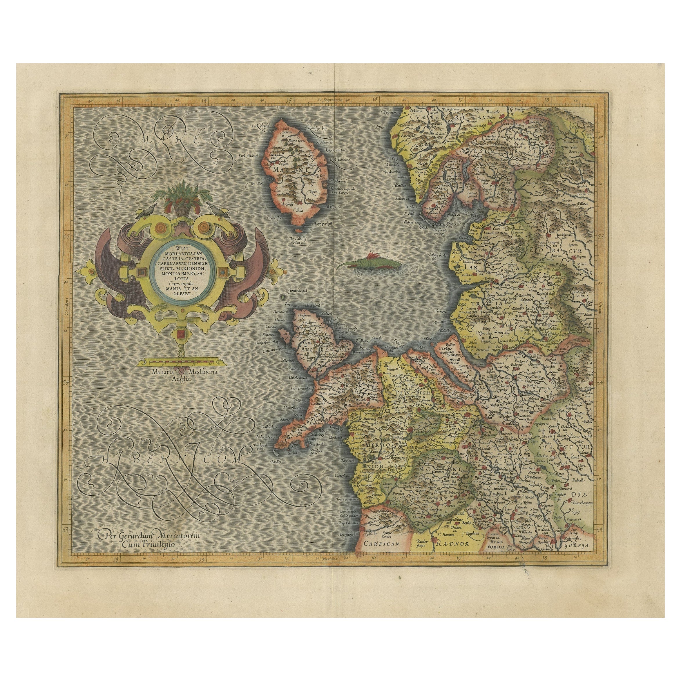
- Antique Map of England by Mercator/Hondius, circa 1600Located in Langweer, NLAntique map titled 'Westmorlandia, Lancastria, Caernvan, Denbigh, Flint, Merionidh, Dalopia cum issulis Mania et Anglesey'. Original antique map of England...Category
Antique 16th Century Maps
MaterialsPaper
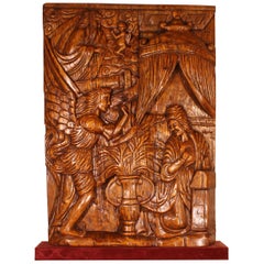
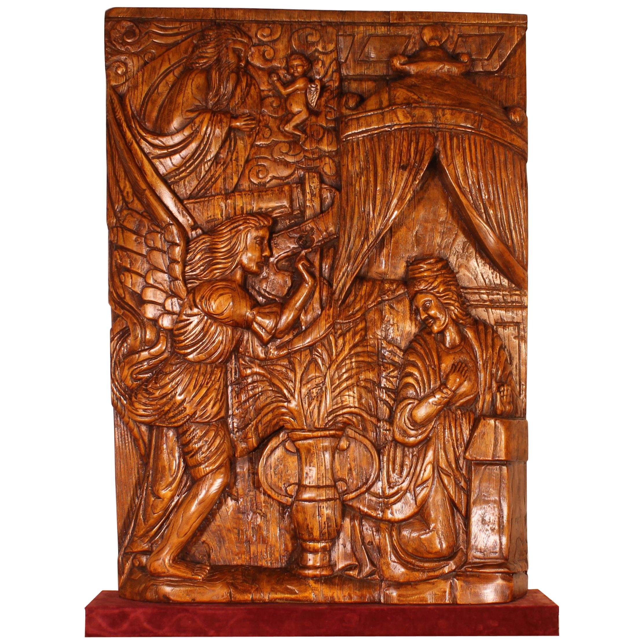
- Altarpiece Representing The Annunciation, North of Portugal, circa 1600Located in Brussels, BrusselsExceptional altarpiece representing the annunciation circa 1600, fruitwood rare altarpiece from the North of Portugal, unique due to its large size representing the scene of the annunciation, where the Archangel Gabriel (represented on the bottom left), sent by god (represented on the top left) announces to Marie (bottom right) that she will give birth to Jesus. Very good state of conservation, carved on three panels Dimension: Height 1m51 Width 1m03 Very nice colour and exceptional dimensions Restorations of use We placed the altarpiece on a red velvet base and a Spanish occasional...Category
Antique 17th Century Portuguese Renaissance Figurative Sculptures
MaterialsFruitwood
- Antique Map of the Region of Poitou by Ortelius, circa 1600Located in Langweer, NLAntique map titled 'Poictou'. Original antique map of the region of Poitou, a former province of west-central France whose capital city was Poitiers. Published by A. Ortelius, circa ...Category
Antique Early 17th Century Maps
MaterialsPaper
- Antique Miniature Map of the region of Poitou 'France' by Bertius, circa 1600Located in Langweer, NLAntique map titled 'Poictou'. Miniature map of the region of Poitou, France. Published by Pieter Bertius, circa 1600. Frame included. We carefully pack our framed items to ensure...Category
Antique Early 17th Century Maps
MaterialsPaper
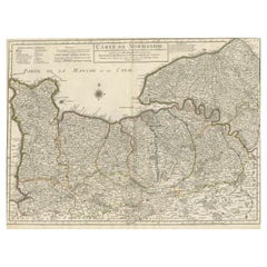
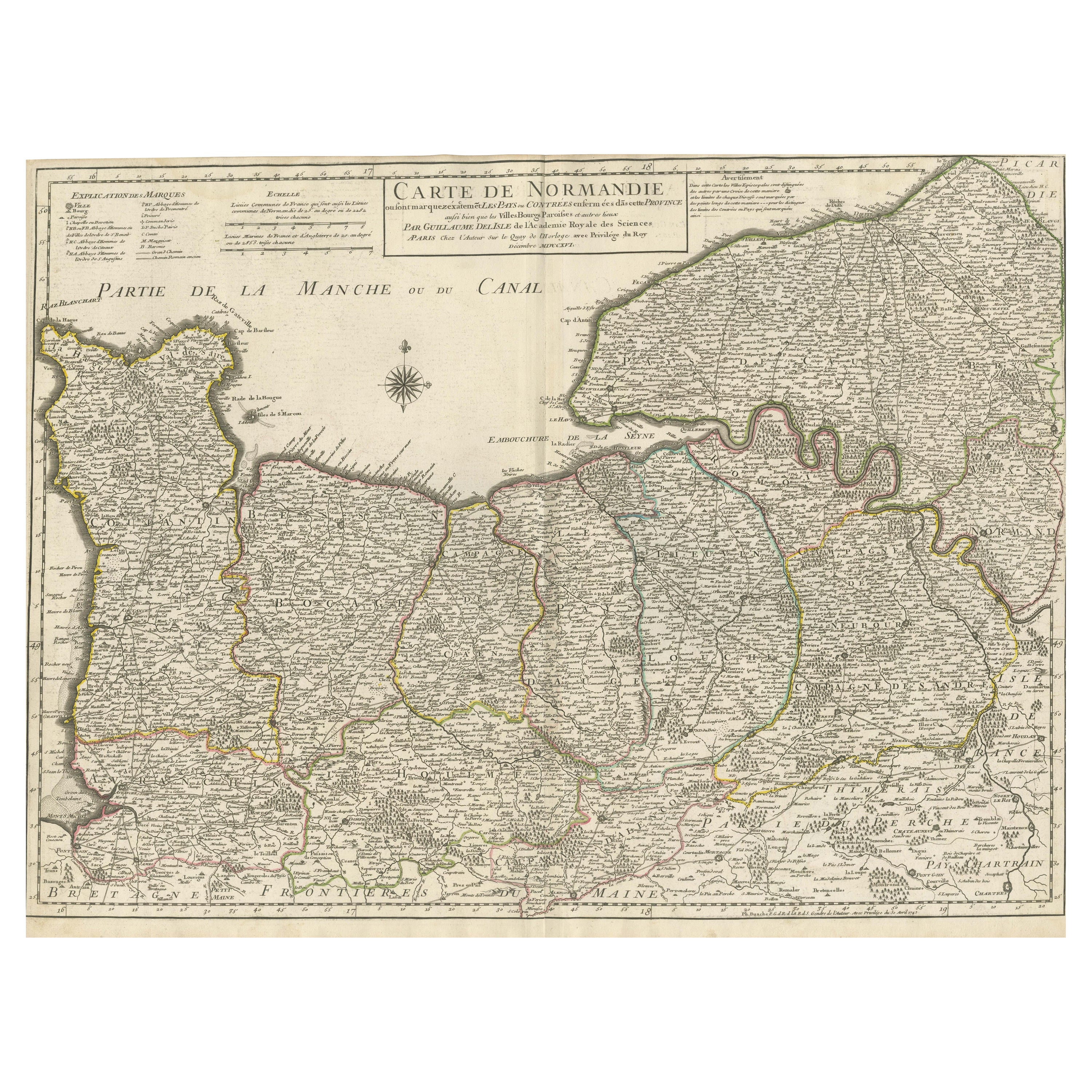
- Original Antique Map of Normandy, FranceLocated in Langweer, NLAntique map titled 'Carte de Normandie (..)'. Attractive map of Normandy, France. it depicts the former French Duchy of Normandy, covers the region fro...Category
Antique Mid-18th Century Maps
MaterialsPaper