Items Similar to Engraving of the British Victory over the Spanish Armada in 1588, Published 1787
Want more images or videos?
Request additional images or videos from the seller
1 of 5
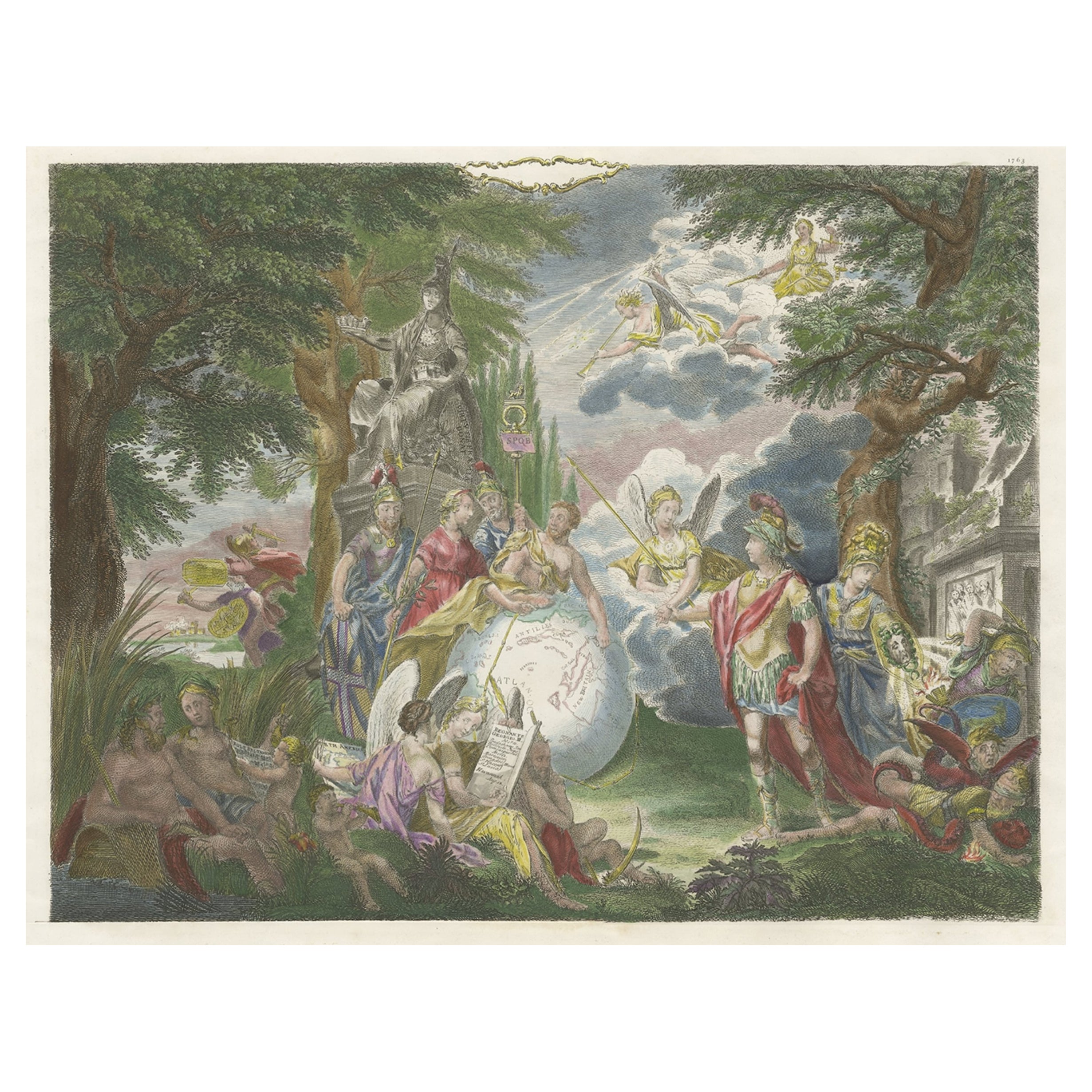
Engraving of the British Victory over the Spanish Armada in 1588, Published 1787
About the Item
Antique print titled 'Grand Victory over the formidable Spanish Armada by Lord Loward (..)'.
Engraving of the victory of the Spanish Armada in the year 1588. This print originates from 'A New, Universal and Impartial History of England from the Earliest Authentic Records, and most Genuine Historical Evidence, to Winter of Year 1784' by George Frederick Raymond.
Artists and Engravers: Engravings made after the original drawings by Metz, Stothard and Samuel Wale.
- Dimensions:Height: 13.78 in (35 cm)Width: 8.67 in (22 cm)Depth: 0 in (0.02 mm)
- Materials and Techniques:
- Period:1780-1789
- Date of Manufacture:circa 1787
- Condition:Condition: Very good, general age-related toning. Minor wear, blank verso. Please study image carefully.
- Seller Location:Langweer, NL
- Reference Number:
About the Seller
5.0
Platinum Seller
These expertly vetted sellers are 1stDibs' most experienced sellers and are rated highest by our customers.
Established in 2009
1stDibs seller since 2017
1,919 sales on 1stDibs
Typical response time: <1 hour
- ShippingRetrieving quote...Ships From: Langweer, Netherlands
- Return PolicyA return for this item may be initiated within 14 days of delivery.
More From This SellerView All
- Engraving of Allegorical Celebrations of the British Victories in America, 1880Located in Langweer, NLAntique print, untitled. Wonderful allegorical antique hand colored engraving depicting the celebrations of the British victories in America at the conclusion of the French & Indian ...Category
Antique 1880s Maps
MaterialsPaper
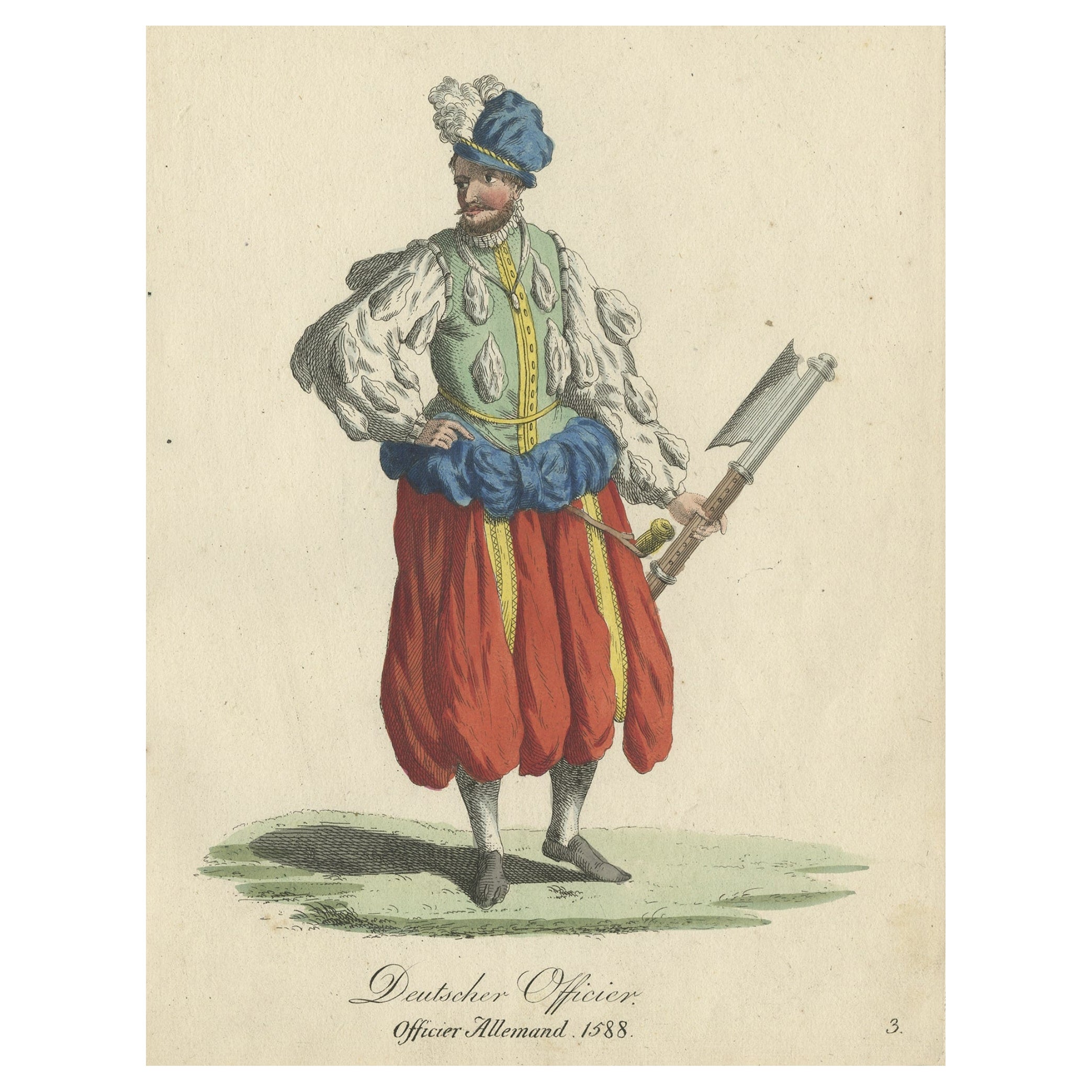
- Original Print of the Costume of a German Officer in 1588, Published in 1805Located in Langweer, NLAntique costume print titled 'Deutscher Officier - Officier Allemand 1588'. This print depicts a German officer. Originates from a rare costume bo...Category
Antique Early 1800s Prints
MaterialsPaper
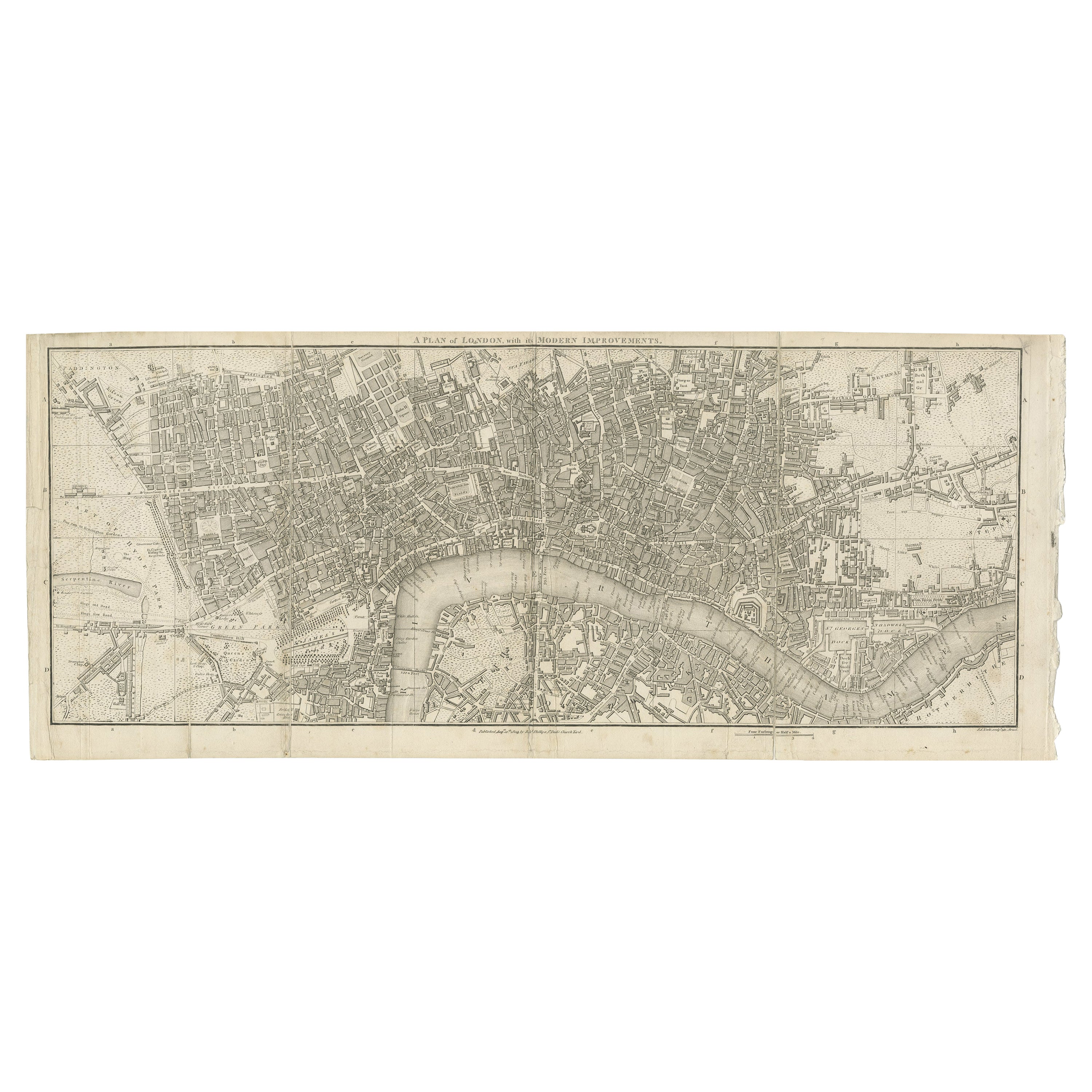
- Antique Copper Engraving of Folding Plan of London, Published in 1804Located in Langweer, NLThis rare map comes originally from the publication: Modern London: Being the History and Present State of the British Metropolis. It was published in London and Printed for Richard...Category
Antique Early 1800s Maps
MaterialsPaper
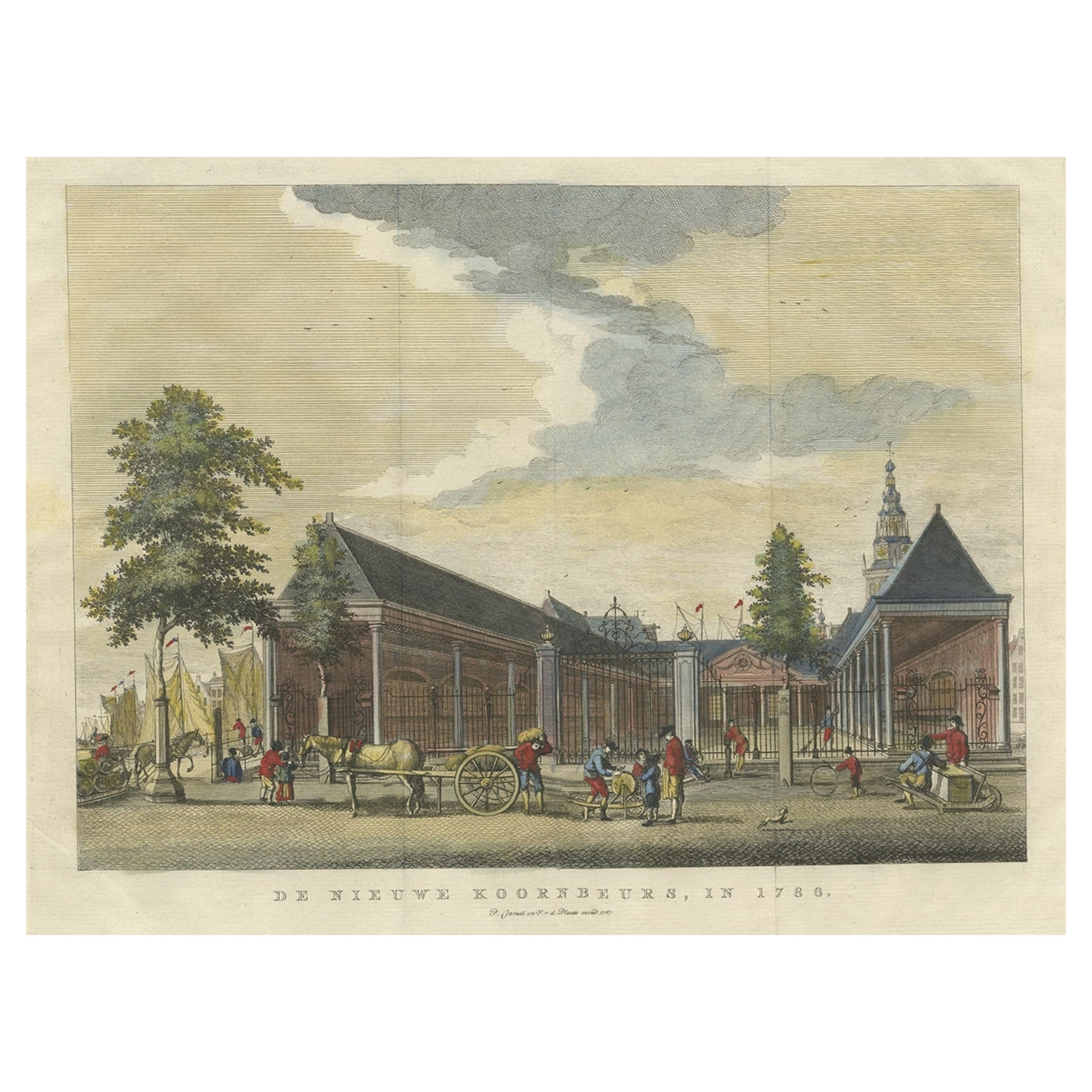
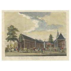
- Original Antique Print of the 'Korenbeurs' in Amsterdam, the Netherlands, 1787Located in Langweer, NLAntique print titled 'De Nieuwe Koornbeurs, in 1786'. Original antique print of the 'Korenbeurs' in Amsterdam, the Netherlands. The Korenbeurs ("grain bourse") was a 17th-century commodity market in Amsterdam where grain was traded. The building stood on the banks of the Amstel, on the western side (Nieuwezijde) of the Damrak. It was directly south of the Oude Brug bridge, on a spot now occupied by the former stock and commodity exchange Beurs van Berlage...Category
Antique 1780s Prints
MaterialsPaper
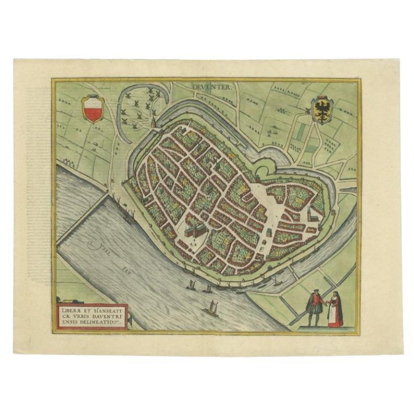
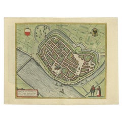
- Antique Original Map of the City of Deventer, the Netherlands, 1588Located in Langweer, NLAntique map titled 'Liberae et Hanseaticae urbis Daventriensis delineatio'. Original bird's eye plan of the Dutch hanseatic city Deventer, on the situated IJssel river. This map ...Category
Antique 16th Century Maps
MaterialsPaper
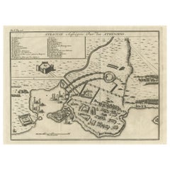
- Old Copper Engraving of the Siege of Syracuse, Sicily, Italy, Published, ca.1740Located in Langweer, NLAntique print titled 'Syracuse, Assiégée par les Atheniens'. Old print of the siege of Syracuse, Sicily, Italy. Source unknown, to be determined. The siege of Syracuse by the...Category
Antique 1740s Maps
MaterialsPaper


You May Also Like
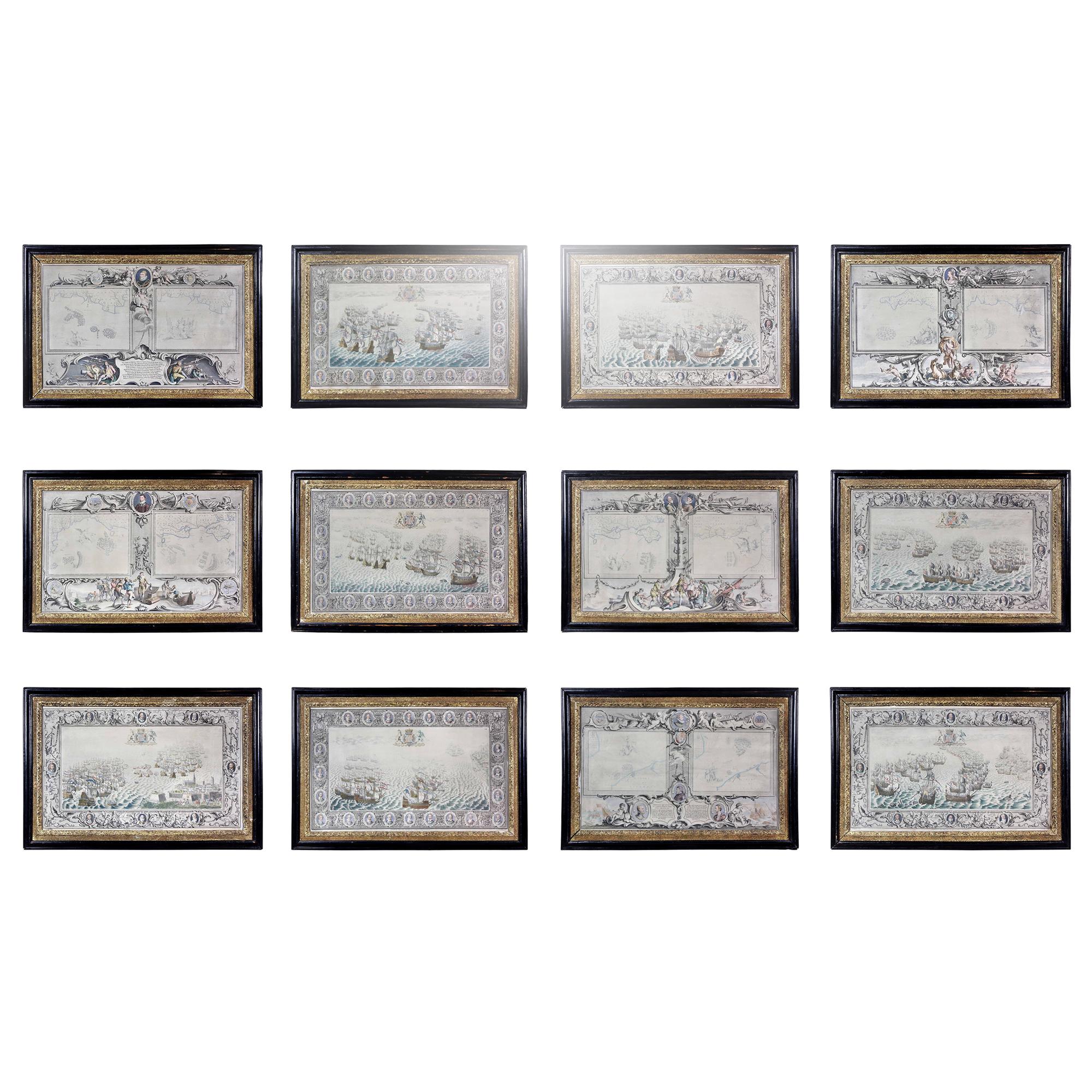
- Set of Twelve Colored Engravings of the Defeat of the Spanish Armada by J. PineLocated in Essex, MABy John Pine considered the foremost heraldic and decorative engraver of his generation. Depicting the defeat of the Spanish by the English Fleet in 1588. These are after a set of tapestries that hung in the House of Commons...Category
Antique 1740s English Prints
MaterialsPaper
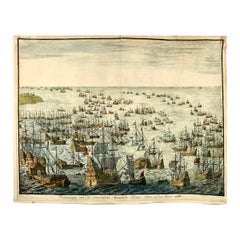
- Jan Luyken, Defeat of the Spanish Armanda in 1588By Matthäus Merian the ElderLocated in Norwich, GB"Vertooninge van de ontsachlyke Spaansche Krygs vloot, in den Jaare 1588." Issued in: Bor, Pieter: "Nederlandsche Oorlogen", Amsterdam (ca 1680) Measures: Leaf: ca. 28,5 x 36 cm View: ca. 26 x 34 cm Fine hand color. On fine watermarked laid paper. Copper engraving of the downfall of the Spanish Armada of the ‘Onoverwinnelijke Vloot’, between 31 July and 12 August 1588. Naval battle between the Spanish and combined English and Dutch fleets in the canal. In the foreground, there is a large Spanish frigate being shot at by a small Dutch ship with the banner of the city of Leiden; on the left, there is a galley. In particular, the engraving details shows the battle of Gravelines as the English sought to disrupt the Spanish fleet as it lay in wait for the army to board her ships. The fireships can be seen in the middle-right of the picture. It gives a feel for the compactness of the fleet and the disruption that the English hoped to cause in breaking it up. Johannes or Jan Luyken...Category
Antique 1680s Dutch Baroque Prints
MaterialsPaper
- “The Restaurant of the House of Representatives” Engraving by Harper's WeeklyLocated in Colorado Springs, COThis original wood engraving is titled “The Restaurant of the House of Representatives, Washington, DC.” It was published as a double-page image, in the August 12, 1893 issue of the famous 19th century newspaper Harper’s Weekly. The print was illustrated by Charles Stanley Reinhardt. The House Restaurant, a unique part of life in the Capitol, has been in the same location since the 1857 Capitol Expansion. Congressional members’ busy work schedule made the availability of food on site a necessity. But the restaurant also served as an informal meeting spot for members to continue conversations and deal making. This 1893 print illustrates the convivial atmosphere. Details including elegantly dressed tables...Category
Antique 1890s American Prints
MaterialsPaper
- Original Antique Map of Ancient Greece- Boeotia, Thebes, 1787Located in St Annes, LancashireGreat map of Ancient Greece. Showing the region of Boeotia, including Thebes Drawn by J.D. Barbie Du Bocage Copper plate engraving by P.F T...Category
Antique 1780s French Other Maps
MaterialsPaper
- 1876 "Gettysburg, The Repulse of Longstreet's Assault." EngravingLocated in Colorado Springs, COPresented here is an 1876 engraving of John B. Bachelder and James Walker’s Gettysburg. The Repulse of Longstreet’s Assault. The engraved scene depicts the decisive battle on the final day of the Battle of Gettysburg. Researched by the photographer and topographer John B. Bachelder and painted by James Walker, the original painting was created in 1870. This detailed engraving was done by H. B. Hall Jr. and published by James Drummond Ball. Otherwise called Pickett’s Charge, the battle occurred on July 3, 1863. Pickett’s corp commander, Lieutenant General James Longstreet was placed in charge of the attack despite his hesitations. Longstreet’s central role led to the title of the work, Repulse of Longstreet’s Assault. In an attempt to gain control of an important supply route, nine Confederate brigades charged across three-quarters of a mile of open ground against cannon fire to take Cemetery Ridge from the defending Union Army. Despite their overwhelming numbers, the Confederate forces were repelled with considerable casualties marking not only a decisive victory for the Union, but also the beginning of the slow defeat of Lee’s Army. The furthest the charging forces advanced before being repulsed would forever be known as the “High Water Mark of the Confederacy.” The Confederate army never recovered from the losses at Gettysburg and it effectively ended Lee’s campaign into Pennsylvania. The engraving gives the perspective from the Union rear, one that encompasses most of the battlefield, from Big Round Top on the left to the northern reaches of Cemetery Ridge on the right. The Confederate lines at Seminary Ridge are in the far distance, partially obscured by bursting shells. The image centers on the main Confederate assault, in the vicinity of what today are known as "The Copse" and "The Bloody Angle." The composition has elemen...Category
Antique 1870s American Prints
MaterialsPaper
- Original Antique Map of Ancient Greece, Phocis, Gulf of Corinth, 1787Located in St Annes, LancashireGreat map of Ancient Greece. Showing the region of Phocis, including the Gulf of Corinth Drawn by J.D. Barbie Du Bocage Copper plate engraving by P.F Tardieu Original hand c...Category
Antique 1780s French Other Maps
MaterialsPaper