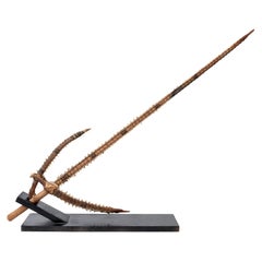
Shark Teeth Edged Sword from the Gilbert Islands Pre-Contact
View Similar Items


1 of 7
Shark Teeth Edged Sword from the Gilbert Islands Pre-Contact
About the Item
- Dimensions:Height: 38 in (96.52 cm)Width: 12 in (30.48 cm)Depth: 2 in (5.08 cm)
- Materials and Techniques:Bone,Palmwood
- Place of Origin:Kiribati
- Period:
- Date of Manufacture:1399
- Condition:Wear consistent with age and use.
- Seller Location:Stamford, CT
- Reference Number:Seller: FUNSTON ANTIQUES1stDibs: LU862327924032
You May Also Like
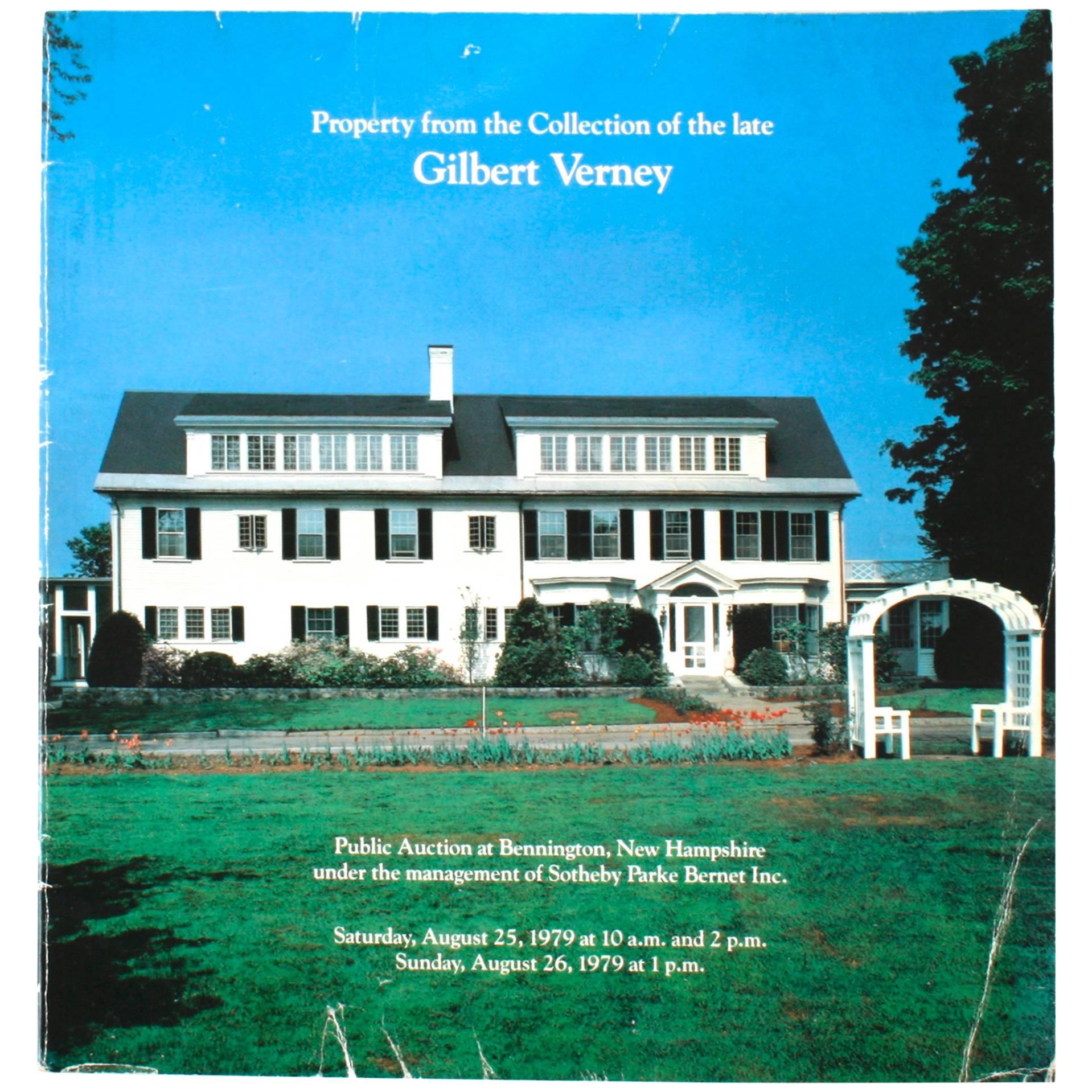
- Sotheby's: Property from the Collection of the Late Gilbert Verney, 1979Located in valatie, NYProperty from the Collection of the Late Gilbert Verney: At Bennington, New Hampshire, Including Property Removed from His Residence on Nantucket Island, Massachusetts. Softcover fir...Category
Vintage 1970s American Books
MaterialsPaper
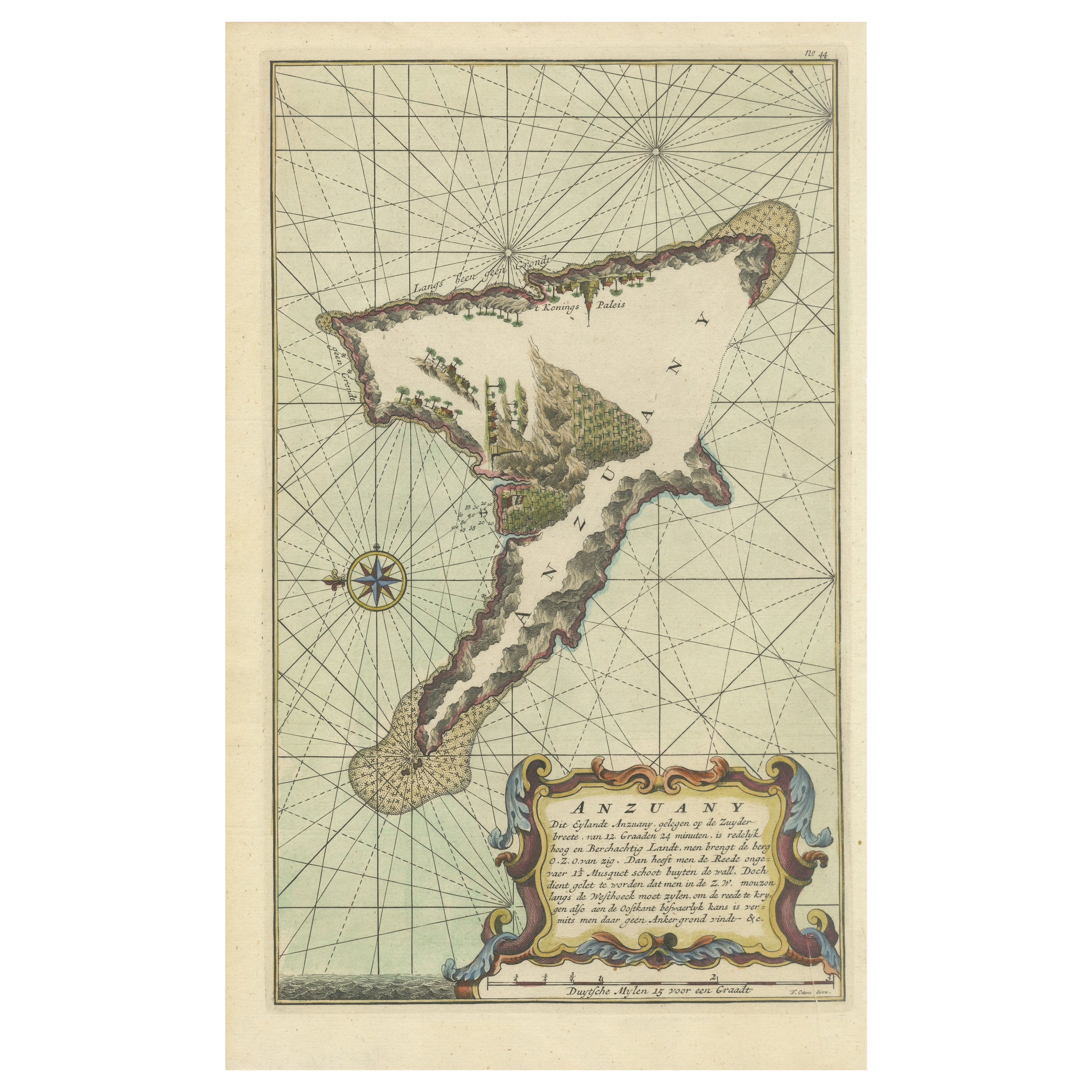
- Long Island Chart from 1828Located in Norwell, MARare original chart of Long Island Sound by E + G Blunt of New York, 179 Water St. "Surveyed in the years 1828, 29 & 30" Exceedingly rare and early chart, titled Long Island Sound fr...Category
Antique 1830s Nautical Objects
MaterialsPaper
- Antique Map of the Islands Within the Queen Charlotte's IslandsLocated in Langweer, NLAntique map titled 'Cote Septentrional de la plus grande des Isles de la Reine Charlotte (..)'. Map and coastal view of the islands within the Queen Charlotte's Islands (Santa Cruz I...Category
Antique Late 18th Century Maps
MaterialsPaper
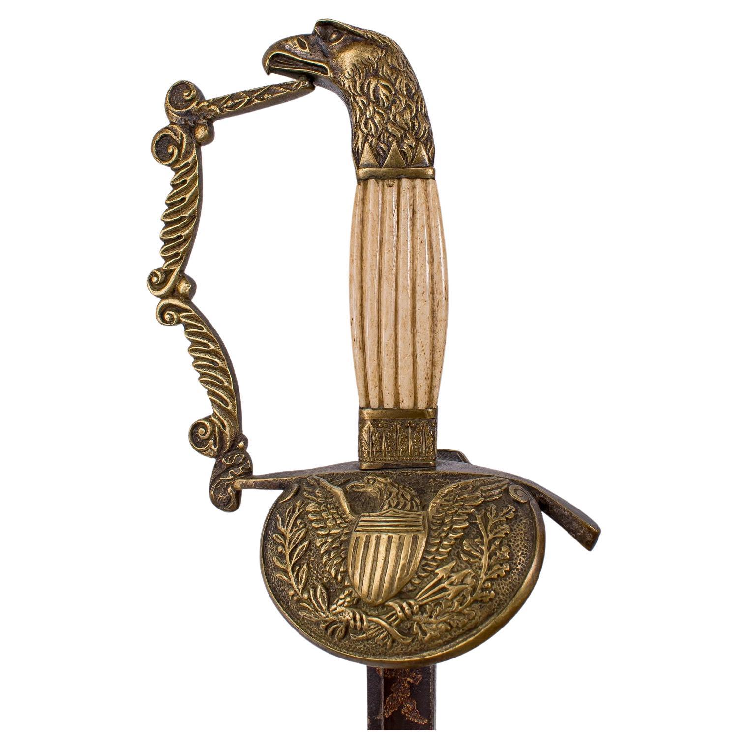
- Rare AMERICAN OFFICER'S SWORD - pre Civil WarLocated in TEYJAT, FRThis is a very rare American Officer's sword that dates back to the period before the American Civil War. The sword has a 79cm straight blade with a flat back, counter-edged and gut...Category
Antique Early 19th Century French Arms, Armor and Weapons
MaterialsMetal
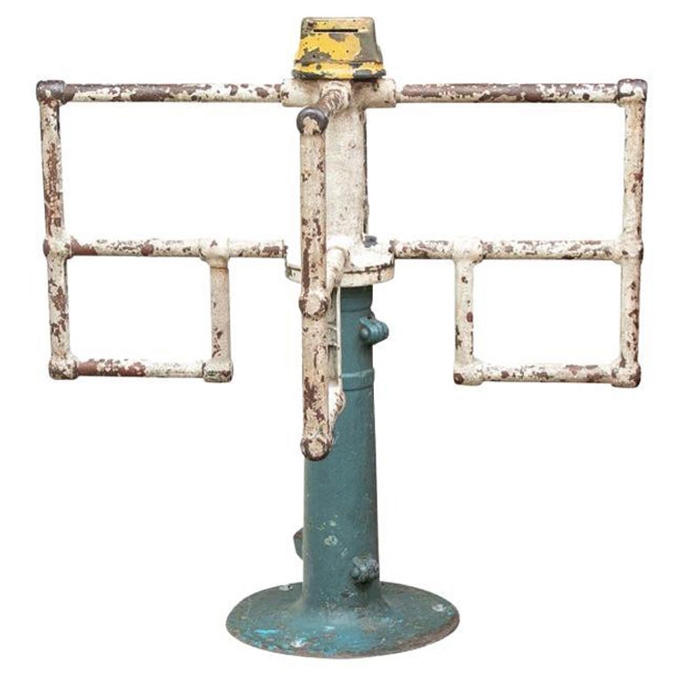
- Mounted Turnstile “To The Fun House” from Coney Island, New YorkLocated in Bridgeport, CTA rare and Historical Industrial Era Mounted Turnstile from the Fun House at Coney Island, New York, featuring original painted finishes mounted on wood plinth with label reading, “T...Category
Early 20th Century American Industrial Carnival Art
MaterialsSteel
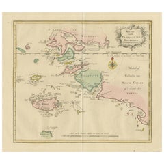
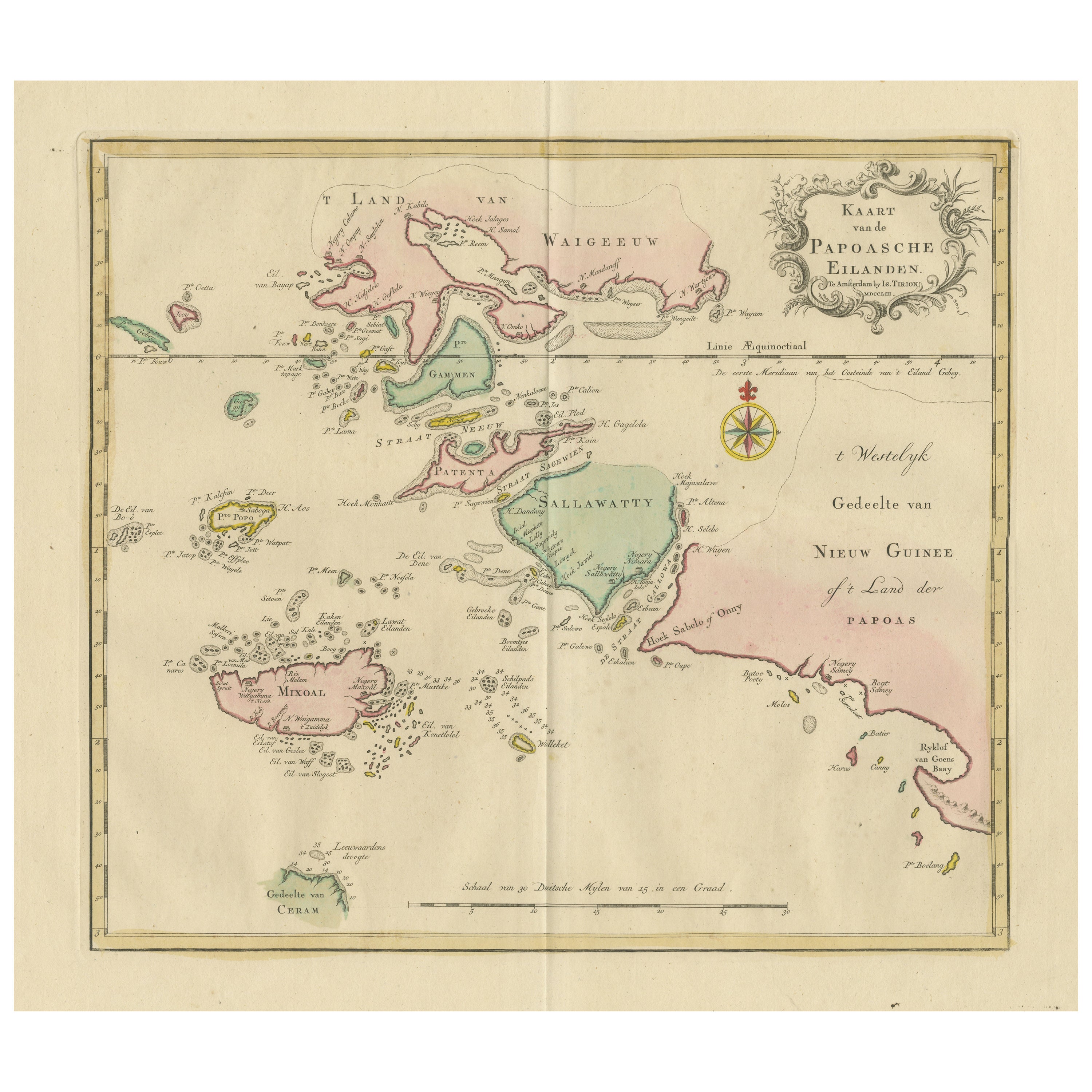
- Antique Map extending from the Spice Islands to the west of Papua New GuineaLocated in Langweer, NLAntique map titled 'Kaart van de Papoasche Eilanden'. Beautiful original old map extending from the Spice Islands (Sallawatty, Patenta, Gammen, Land van Waigeeuw, Popo, Misool, and part of Seram) to the western end of Papua New Guinea. Many smaller islands are detailed, and depth soundings are shown near Seram and to the east of Misool. This map originates from 'Nieuwe en Beknopte Hand-Atlas, bestaande in eene Verzameling van eenige der algemeenste en nodigste Landkaarten' by I. Tirion. Published circa 1770. Tirion was born in Utrecht in 1705. He moved to Amsterdam in 1725 and set up shop on Damrak as a book publisher. Tirion quick rose in prominence by publishing pamphlets, historical works, and, most importantly...Category
Antique Late 18th Century Maps
MaterialsPaper