Items Similar to Antique Map of China, Korea, Japan and the Northern Philippines, circa 1780


Want more images or videos?
Request additional images or videos from the seller
1 of 5
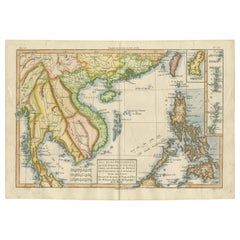
Antique Map of China, Korea, Japan and the Northern Philippines, circa 1780
About the Item
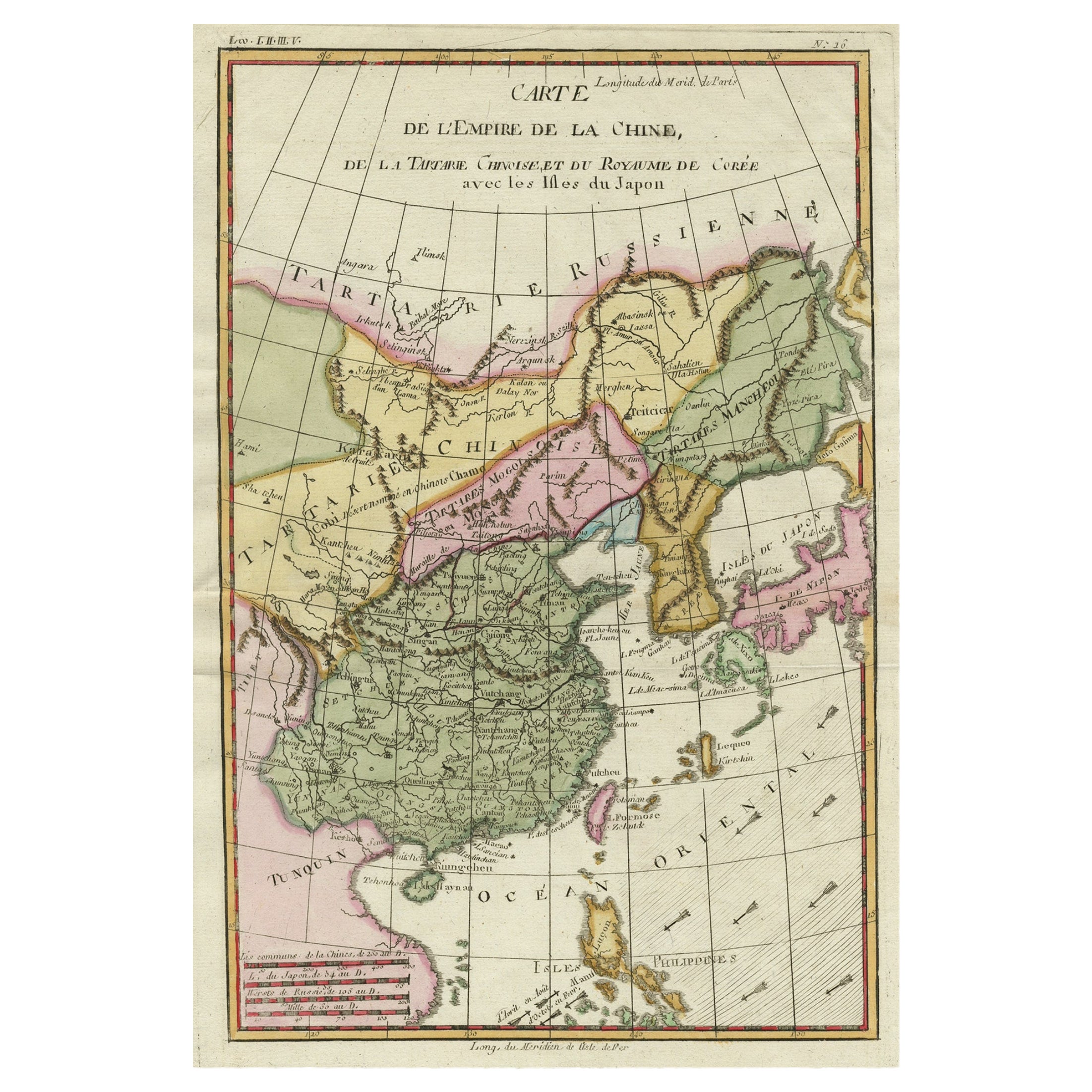
Antique map titled 'Carte de l'Empire de la Chine de la Tartarie Chinoise, et du Royaume de Corée'. Interesting and detailed map of China, Korea, Japan and the Northern Philippines. Published circa 1780.
- Dimensions:Height: 15.56 in (39.5 cm)Width: 9.85 in (25 cm)Depth: 0.02 in (0.5 mm)
- Materials and Techniques:
- Period:
- Date of Manufacture:circa 1780
- Condition:General age-related toning. Original folding line, blank verso. Please study image carefully.
- Seller Location:Langweer, NL
- Reference Number:
About the Seller
5.0
Platinum Seller
These expertly vetted sellers are 1stDibs' most experienced sellers and are rated highest by our customers.
Established in 2009
1stDibs seller since 2017
1,932 sales on 1stDibs
Typical response time: <1 hour
- ShippingRetrieving quote...Ships From: Langweer, Netherlands
- Return PolicyA return for this item may be initiated within 14 days of delivery.
More From This SellerView All
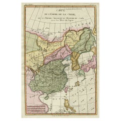
- Decorative Map of the Empire of China, Korea, Japan, Taiwan, Lucon, Macau, 1780Located in Langweer, NLAntique map titled 'Carte de L'Empire de la Chine.' Decorative map of the Empire of China, depicting China, Corea ( Korea ), Japan, Tonquin and the Philippine island Lucon. Source unknown, to be determined. Artists and Engravers: Rigobert Bonne (1727-1795 ) was one of the most important cartographers of the late 18th century. In 1773 he succeeded Jacques Bellin as Royal Cartographer to France in the office of the Hydrographer at the Depôt de la Marine. Working in his official capacity Bonne compiled some of the most detailed and accurate maps of the period. Bonne's work represents an important step in the evolution of the cartographic ideology away from the decorative work of the 17th and early 18th century towards a more detail oriented and practical aesthetic. With regard to the rendering of terrain Bonne maps...Category
Antique 1780s Maps
MaterialsPaper
- Antique Map of the Philippines, Taiwan and Surroundings by Bonne '1780'Located in Langweer, NLAntique map titled 'Les Isles Philippines, celle de Formose, le Sud de la Chine, les Royaumes de Tunkin, de Cochinchine, de Cambode, de Siam des Laos, avec partie de Pegu et D'Ava'. ...Category
Antique Late 18th Century Maps
MaterialsPaper
- Antique Map of the Northern Portion of the Philippines by J.N. Bellin, 1764Located in Langweer, NLDetailed map of the Northern portion of the Philippines, extending from Batanes and Babuyanes to Mindonoro and Masbate, and centered on Luzon. One of the most detailed maps of the pe...Category
Antique Mid-18th Century Maps
MaterialsPaper
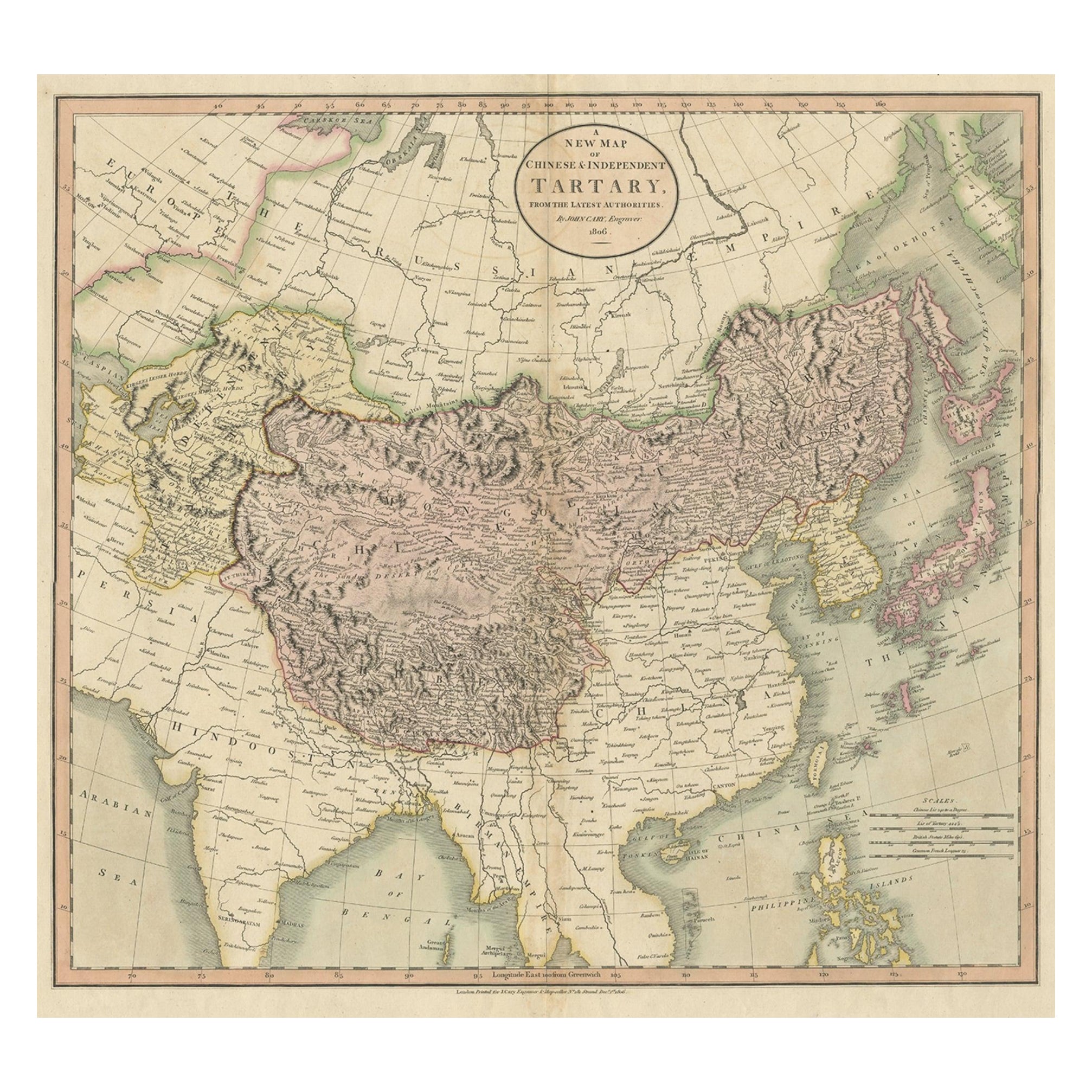
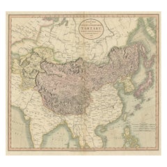
- Antique Map of Chinese and Independent Tartary, Korea and Japan, 1806Located in Langweer, NLAntique map titled 'A New Map of Chinese & Independent Tartary'. Beautiful map of Chinese Tartary, Korea and Japan. Artists and Engravers: John Cary (1755-1835) was a British car...Category
Antique 19th Century Maps
MaterialsPaper
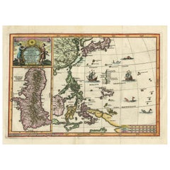
- Antique Map of the Philippines and Guam by Scherer, circa 1702Located in Langweer, NLAntique map titled 'Nova et Vera Exhibitio Geographica Insularum Marianarum (..)'. Rare and very attractive map of the Mariana Islands, Philippines, Ko...Category
Antique Early 18th Century Maps
MaterialsPaper
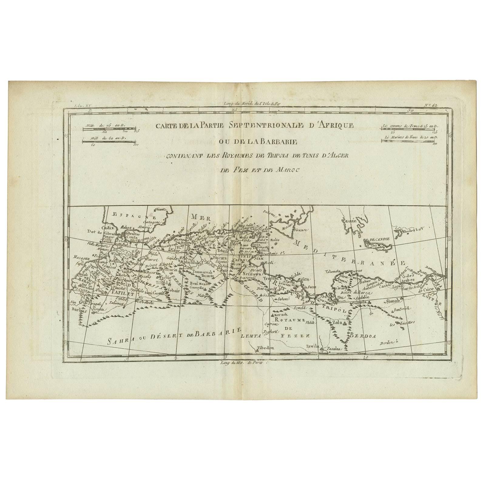
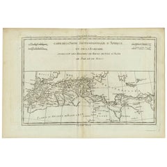
- Antique Map of Northern Africa "Barbary Coast" by R. Bonne, circa 1780Located in Langweer, NLA fine example of Rigobert Bonne and Guilleme Raynal’s 1780 map of northwestern Africa or the Barbary Coast. Includes the modern day countries of Morocco, Algeria, Tunisia, Libya, and parts of adjacent Spain, Italy and Greece. This map was made in response to European interest in the region due to coastal attacks and incursions by the Barbary Pirates...Category
Antique Late 18th Century Maps
MaterialsPaper

You May Also Like
- Original Antique Map of Italy. C.1780Located in St Annes, LancashireGreat map of Italy Copper-plate engraving Published C.1780 Unframed.Category
Antique Early 1800s English Georgian Maps
MaterialsPaper

- Original Antique Map of Asia. C.1780Located in St Annes, LancashireGreat map of Asia Copper-plate engraving Published C.1780 Two small worm holes to right side of map Unframed.Category
Antique Early 1800s English Georgian Maps
MaterialsPaper

- Original Antique Map of India. C.1780Located in St Annes, LancashireGreat map of India Copper-plate engraving Published C.1780 Three small worm holes to right side of map and one bottom left corner Unframed.Category
Antique Early 1800s English Georgian Maps
MaterialsPaper

- Original Antique Map of South America. C.1780Located in St Annes, LancashireGreat map of South America Copper-plate engraving Published C.1780 Two small worm holes to left side of map Unframed.Category
Antique Early 1800s English Georgian Maps
MaterialsPaper
- Original Antique Map of China, Arrowsmith, 1820Located in St Annes, LancashireGreat map of China Drawn under the direction of Arrowsmith Copper-plate engraving Published by Longman, Hurst, Rees, Orme and Brown, 1820 Unfr...Category
Antique 1820s English Maps
MaterialsPaper
- Original Antique Map of Spain and Portugal, circa 1790Located in St Annes, LancashireSuper map of Spain and Portugal Copper plate engraving by A. Bell Published, circa 1790. Unframed.Category
Antique 1790s English Other Maps
MaterialsPaper


Recently Viewed
View AllMore Ways To Browse
Filipino Furniture
Antique Empire De
Japanese Antique Collectables
Japan Antiques Collectables
Korean Japanese
Chinese Maps
China Map
Chinese Map
Map Of China
Japanese Filipino
Philippines Antique
Antique Philippines
Filipino Antique
Japanese Empire
Antique Filipino Furniture
Korea Antique Furniture
Korean Antiques
Japan Maps