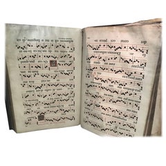
Valuable "Romanum Missale" Missal from Printed in 1633 outside to restaure
View Similar Items

![[MISSAL]. Paroissien romain contenant les offices. IN A MOTHER-OF-PEARL BINDING](https://a.1stdibscdn.com/missal-paroissien-romain-contenant-les-offices-in-a-mother-of-pearl-binding-for-sale/f_62142/f_392522221712955420094/f_39252222_1712955420906_bg_processed.jpg)
![[MISSAL]. Petit Paradis de L'ame Chretienne. IN A MOTHER-OF-PEARL BINDING](https://a.1stdibscdn.com/archivesE/upload/1121189/f_392520021713013108286/39252002_datamatics.jpg)

1 of 10
Valuable "Romanum Missale" Missal from Printed in 1633 outside to restaure
About the Item
- Creator:Simonis Belgrand (Manufacturer)
- Dimensions:Height: 22.05 in (56 cm)Width: 14.57 in (37 cm)Depth: 5.52 in (14 cm)
- Style:Baroque (Of the Period)
- Materials and Techniques:
- Place of Origin:
- Period:Early 17th Century
- Date of Manufacture:1633
- Condition:Minor structural damages.
- Seller Location:Diest, BE
- Reference Number:1stDibs: LU271437502133
You May Also Like
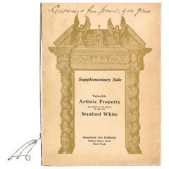
- Valuable Artistic Property Belonging to the Estate of the Late Stanford WhiteLocated in North Yorkshire, GBThis is the "Supplementary Sale" Catalogue of Valuable Artistc Property belonging to the Estate of Stanford White which took place on November 25th, 26th and 27th 1907 - Consisting o...Category
Early 20th Century Books
MaterialsPaper
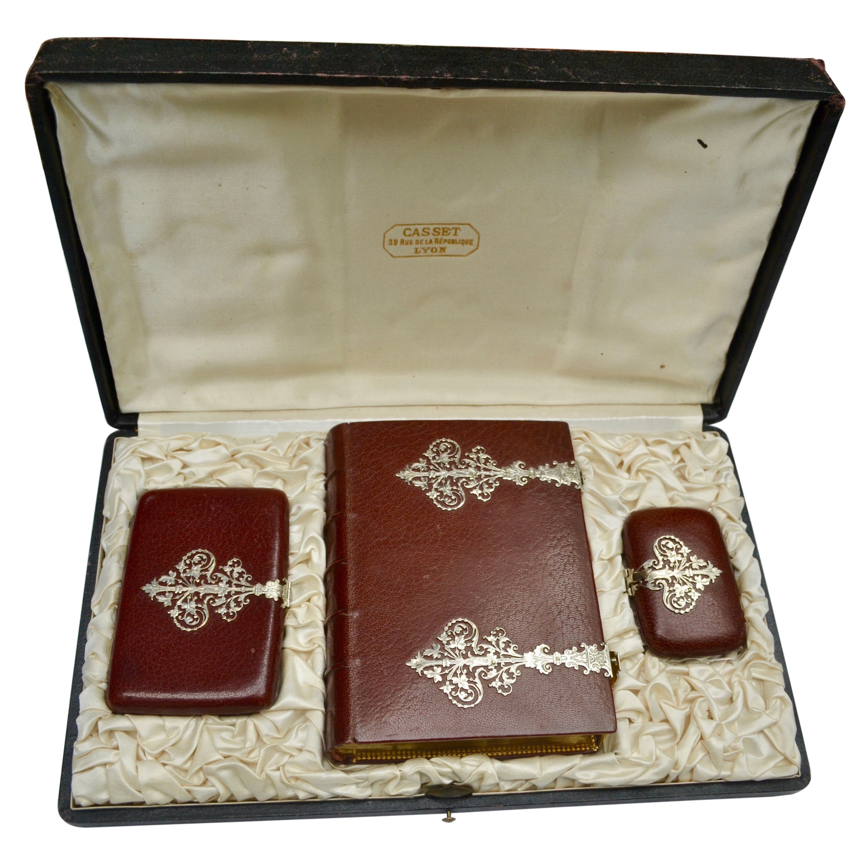
- [MISSAL]. Paroissien romain contenant les offices. IN A MOTHER-OF-PEARL BINDINGLocated in Hillsborough, NJAUTHOR: [MISSAL]. TITLE: Paroissien romain contenant les offices de tous les dimanches et des principales fetes de l'annee. (Roman Parishioner Containing the Services of All Sunday...Category
Antique 1880s British Books
MaterialsMother-of-Pearl
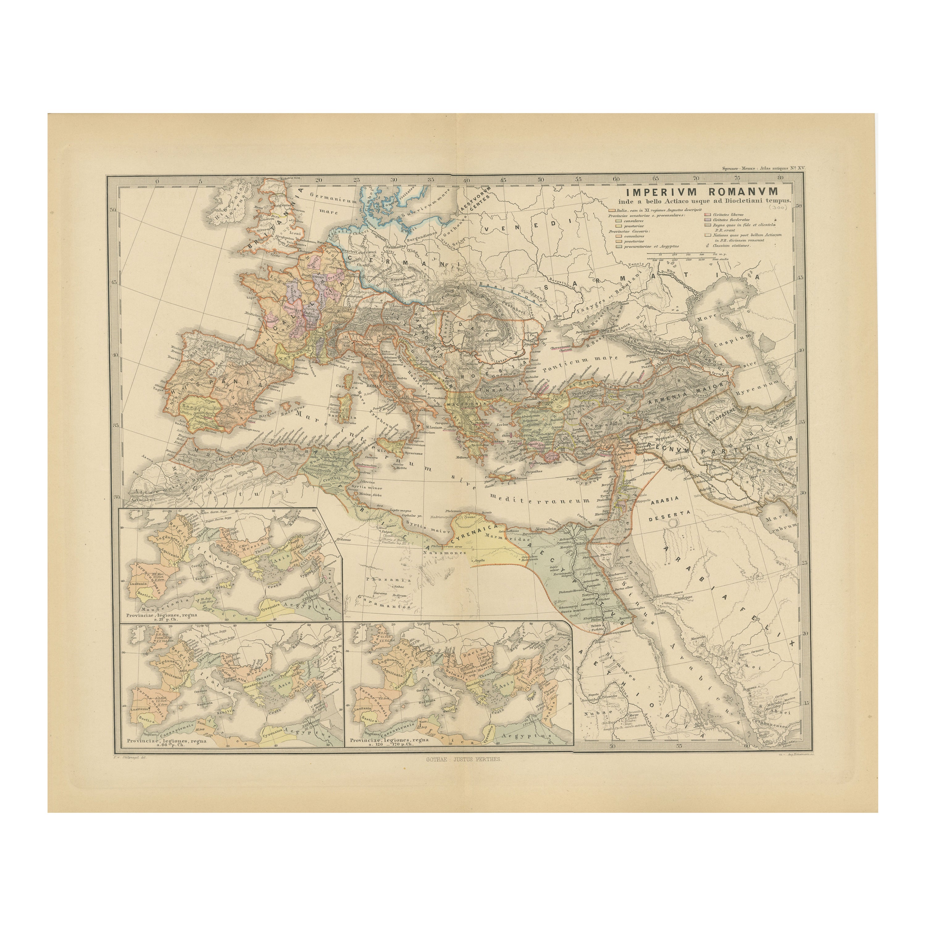
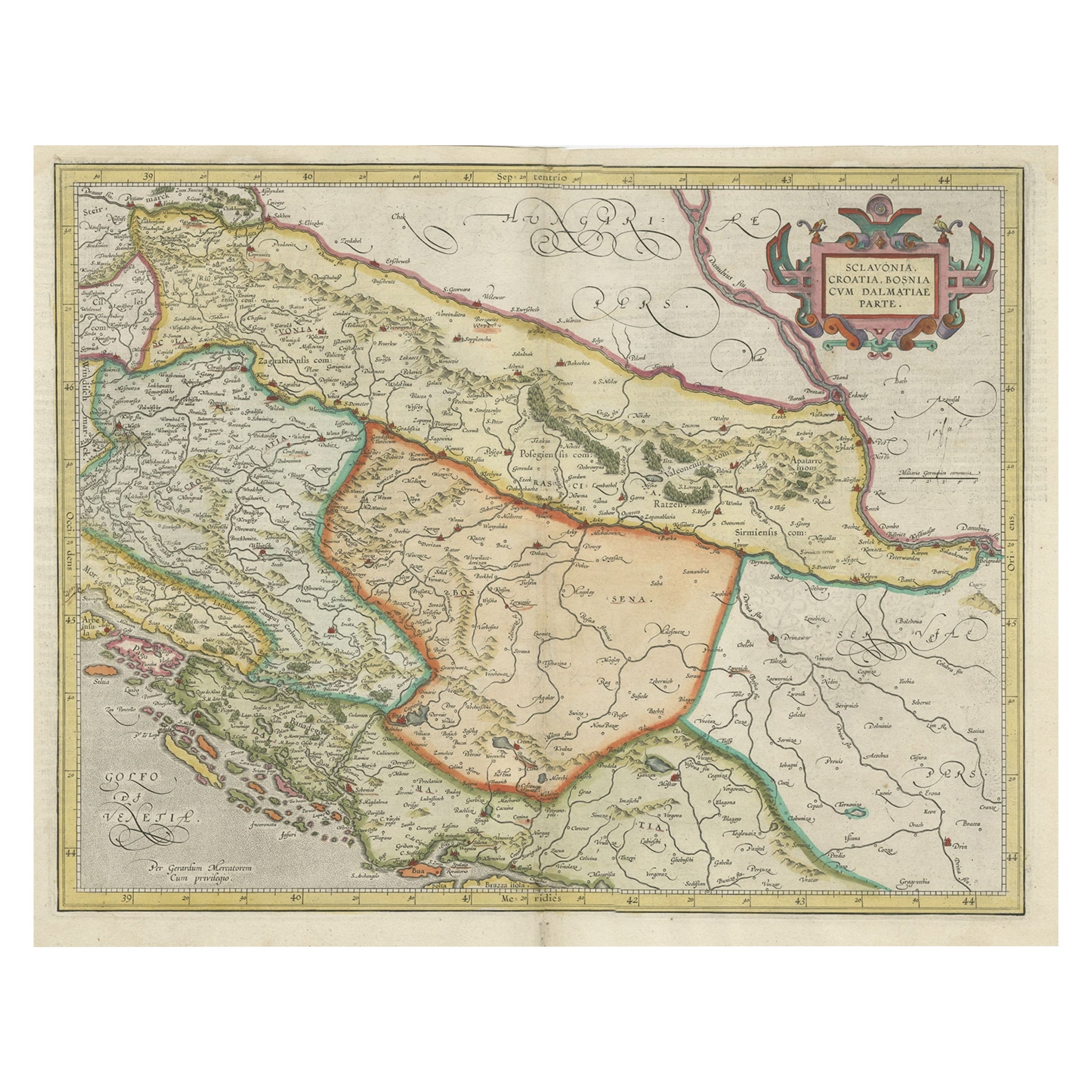
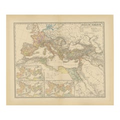
- Imperium Romanum: A Detailed Map of the Roman Empire in its Zenith, 1880Located in Langweer, NLThis original antique map, titled "IMPERIVM ROMANVM", is a detailed depiction of the Roman Empire at the height of its power. The main map encompasses the vast expanse of the Roman t...Category
Antique 1880s Maps
MaterialsPaper
- [MISSAL]. Petit Paradis de L'ame Chretienne. IN A MOTHER-OF-PEARL BINDINGLocated in Hillsborough, NJAUTHOR: [MISSAL]. TITLE: Petit Paradis de L'ame Chretienne. (Little Paradise of the Christian Soul). PUBLISHER: Turnhout: Turnhout, Brepols & Dierckx zoon, n.d. (c.1899) DESCRIPT...Category
Antique 1890s British Books
MaterialsMother-of-Pearl
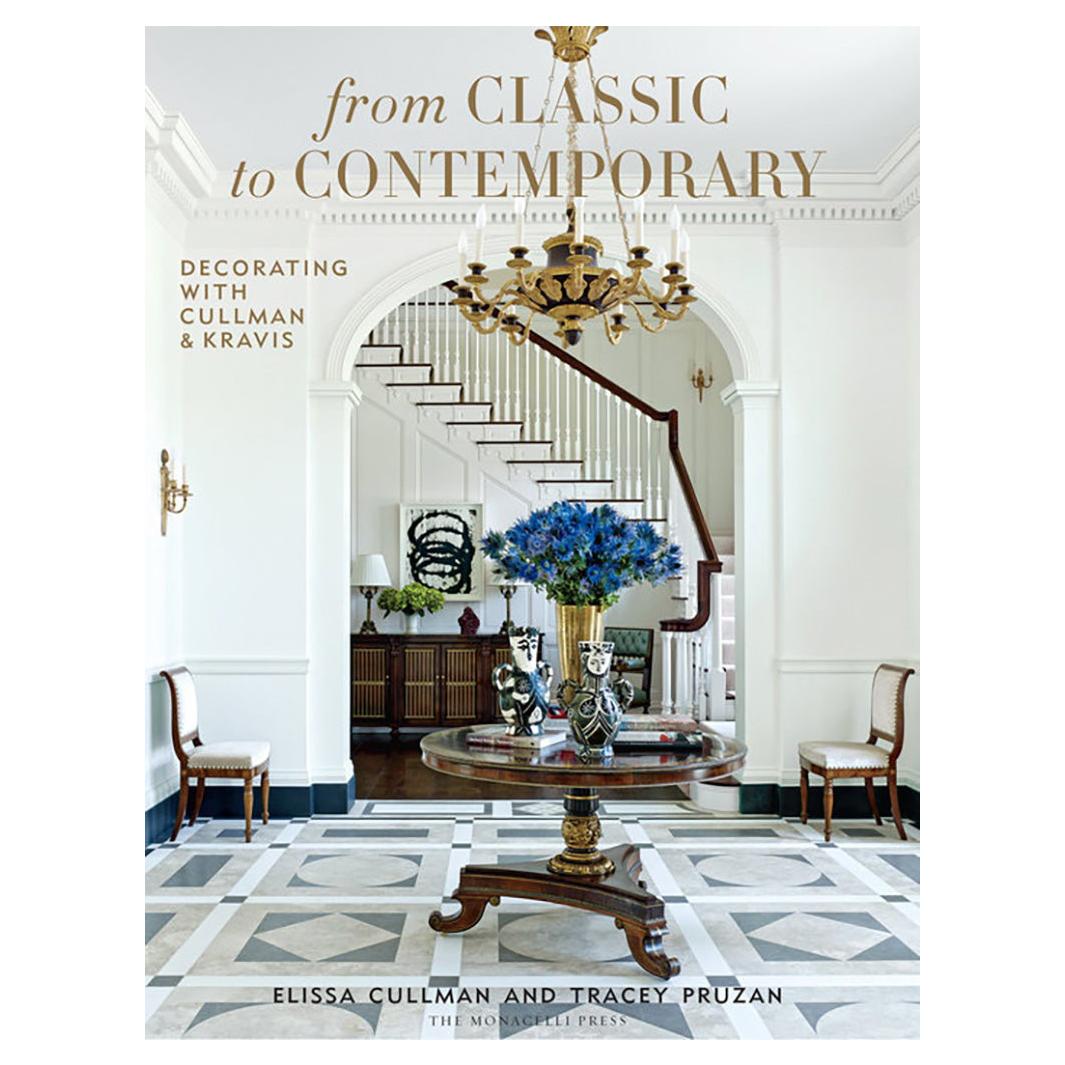
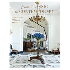
- From Classic to ContemporaryBy PhaidonLocated in New York City, NYInterior design firm Cullman & Kravis infuses traditional interiors with a modern perspective, embracing historicism and referencing a wide range of cultures and contemporary design ...Category
2010s Chinese Books
MaterialsPaper
 $65 / item
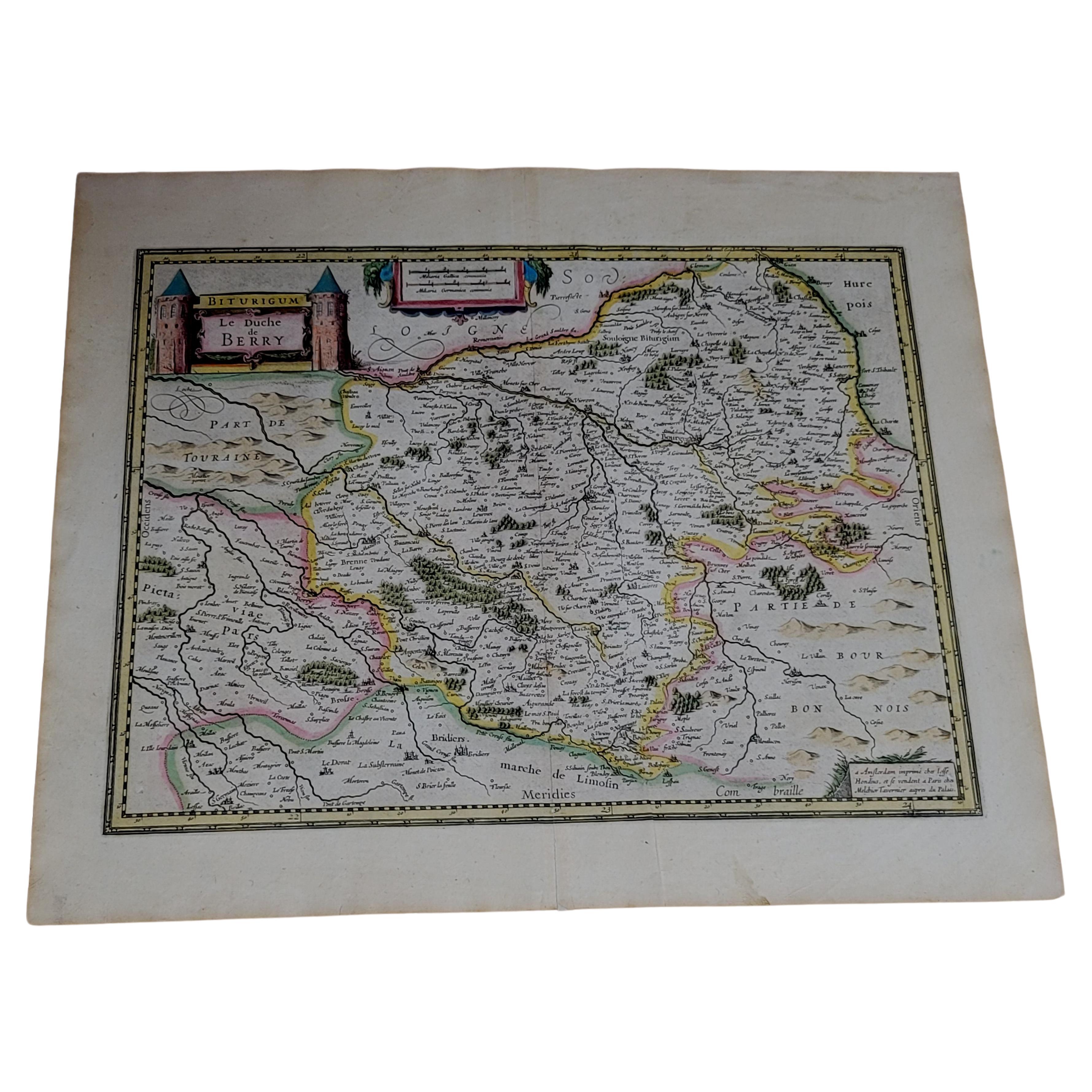
 - 1633 Map Entitled "Beauvaisis Comitatus Belova Cium, Ric.0002Located in Norton, MA1633 map entitled "Beauvaisis Comitatus Belova Cium," Hand Colored Ric.0002 Description: Cartographer : - Hondius, Henricus 1587-1638 Artists and Engravers:Jodocus Hondius, one of the most notable engravers of his time. He is known for his work in association with many of the cartographers and publishers prominent at the end of the sixteenth and the beginning of the seventeenth century. A native of Flanders, he grew up in Ghent, apprenticed as an instrument and globe maker and map engraver. In 1584, to escape the religious troubles sweeping the Low Countries at that time, he fled to London where he spent some years before finally settling in Amsterdam about 1593. In the London period he came into contact with the leading scientists and geographers of the day and engraved maps in The Mariner\\\\\\\\\\\\\\\'s Mirrour, the English edition of Waghenaer\\\\\\\\\\\\\\\'s Sea Atlas, as well as others with Pieter van den Keere, his brother-in-law. No doubt his temporary exile in London stood him in good stead, earning him an international reputation, for it could have been no accident that Speed chose Hondius to engrave the plates for the maps in The Theatre of the Empire of Great Britaine in the years between 1605 and 1610. In 1604 Hondius bought the plates of Mercator\\\\\\\\\\\\\\\'s Atlas which, in spite of its excellence, had not competed successfully with the continuing demand for the Ortelius Theatrum Orbis Terrarum. To meet this competition Hondius added about 40 maps to Mercator\\\\\\\\\\\\\\\'s original number and from 1606 published enlarged editions in many languages, still under Mercator\\\\\\\\\\\\\\\'s name but with his own name as publisher. These atlases have become known as the Mercator/Hondius series. The following year the maps were reengraved in miniature form and issued as a pocket Atlas Minor. After the death of Jodocus Hondius the Elder in 1612, work on the two atlases, folio and miniature, was carried on by his widow and sons, Jodocus II and Henricus, and eventually in conjunction with Jan Jansson in Amsterdam. In all, from 1606 onwards, nearly 50 editions with increasing numbers of maps with texts in the main European languages were printed. Summaries of these issues are given under the entry for Gerard Mercator. Jodocus Hondius the Elder * 1588 Maps in The Mariner\\\\\\\\\\\\\\\'s Mirrour (Waghenaer/Ashley) * 1590 World Map...Category
Antique 17th Century Dutch Maps
MaterialsPaper
![[MISSAL]. Paroissien romain contenant les offices. IN A MOTHER-OF-PEARL BINDING](https://a.1stdibscdn.com/missal-paroissien-romain-contenant-les-offices-in-a-mother-of-pearl-binding-for-sale/f_62142/f_392522221712955420094/f_39252222_1712955420906_bg_processed.jpg?width=240)
![[MISSAL]. Petit Paradis de L'ame Chretienne. IN A MOTHER-OF-PEARL BINDING](https://a.1stdibscdn.com/archivesE/upload/1121189/f_392520021713013108286/39252002_datamatics.jpg?width=240)

Recently Viewed
View AllMore Ways To Browse
Very Valuable
Antique Curiosities Prints
Valuable Antique Furniture
Valuable Italian
Antique Missal
Missale Romanum
Japanese Sample Book
Josephus Flavius
Sidney Paget
Vintage Leather Bound Bible
Purple Boon
Used Furniture Aurora Co
Tashen Books
Badminton Cabinet
Cocteau Ceramique
Dick Turpin
Ray Bradbury
Rene Herbst Book