Maps
1
to
1
1
1
1
48
34
15
9
7
6
5
5
4
2
1
1
1
1
1
1
1
1
1
Maps For Sale
Style: Empire
Style: Rococo
Ptolemaic Armillary Sphere Charles-François Delamarche Paris, 1805-1810 Circa
Located in Milano, IT
Charles-François Delamarche
Ptolemaic armillary sphere
Paris, circa 1805-1810
Wood and papier-mâché
covered with printed and partly hand-coloured paper
It measures 15.74” in height, ...
Category
Early 1800s French Empire Antique Maps
Materials
Paper, Wood
Related Items
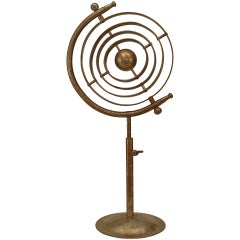
Italian Renaissance Chrome Armillary
Located in New York, NY
Italian Renaissance-style (20th Century) chrome armillary globe with a rust patina.
Category
20th Century American Renaissance Revival Maps
Materials
Chrome
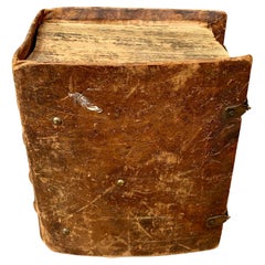
Antique Swedish Leather-Bound Bible Book, 1810
Located in Haddonfield, NJ
Swedish leather-bound Bible, with brass brackets decorated with two hearts and two anchors. According to the estate in Sweden where I purchased this book, it belonged to a Scandinavi...
Category
1810s Swedish Empire Antique Maps
Materials
Brass
Painted Dolls House, England circa 1810
Located in Culver City, CA
Painted Dolls House
England circa 1810
Georgian era dolls house with original paintwork.
19.5”L x 11.25”d x 17.75”h
Category
19th Century English Antique Maps
Materials
Wood
French Late 19th Century Bronze Armillary Sphere Depicting the Titan Atlas
Located in Atlanta, GA
A French bronze armillary sphere depicting Atlas carrying the world from the late 19th century with verdigris patina. Created in France during the last quarter of the 19th century, this bronze armillary sphere showcases a mythological theme depicting the famed Titan Atlas, condemned to carry the sky on his shoulders for eternity. How appropriate then, to choose him to carry effortlessly this armillary! Casually placing his left hand on his waist, Atlas raises the sphere made of various connecting rings...
Category
Late 19th Century French Antique Maps
Materials
Bronze
Impressive and Ancient Italian Armillary Sphere from Early 20th Century
Located in Madrid, ES
Impressive and Ancient Italian Armillary Sphere from early 20th century,
handcrafted in wood and metal/golden brass with a base on 3 solid wood legs.
Certificate of authenticity....
Category
Early 20th Century Italian Baroque Maps
Materials
Iron
Pair of Italian Armillary Spheres Vane began 20th Century H: 80cm
Located in Madrid, ES
Pair of Italian Armillary Spheres Vane began 20th Century
material: iron and stone
HEIGHT 80 cm
DIAMETER 60 cm
WIDTH 60 cm
DEPTH 85 cm
good conditions
Category
Early 20th Century Italian Modern Maps
Materials
Stone, Iron
Antique Map of Southern Europe by F. Delamarche, 1837
Located in Langweer, NL
Title: Géographie des Hébreux ou Tableau de la Dispersion des enfants de Noé
- **Origin**: From 'Atlas De La Géographie Ancienne' by F. Delamarche
- **Date of Publication**: 1837
D...
Category
Mid-19th Century Antique Maps
Materials
Paper
Antique Map of the Holy Land by Delamarche, 1806
Located in Langweer, NL
Antique map titled 'Judee ou Terre Sainte sous les Turcs.' This map shows the holy land under the Turcs. By Robert de Vaugondy, revised and published by ...
Category
19th Century Antique Maps
Materials
Paper
Exploring Ancient Persia: Ptolemaic Map of Iran and Iraq by Ptolemy and Mercator
Located in Langweer, NL
Claudius Ptolemy was a mathematician, astronomer and geographer who worked in Alexandria, then a part of the Roman Empire, in the 2nd century AD. One of the most learned and influent...
Category
1610s Antique Maps
Materials
Paper
H 13.71 in W 18.39 in D 0 in
Exclusive Antique Armillary Sphere
Located in Vlimmeren, BE
An armillary sphere is a model of objects in the sky consisting of a spherical framework of rings, centred on the Earth or the Sun, that represent lin...
Category
Mid-19th Century European Industrial Antique Maps
Materials
Metal
Original Opera and Theatre Costume Watercolor Design by Charles Betout, Paris
Located in New York, NY
Charles Betout was the principal costume designer for the Comedie-Francaise in Paris for twenty years until his death in 1939. This is costume was designed for the 1926 production of...
Category
Early 20th Century French Napoleon III Maps
Materials
Glass, Wood, Paper
Antique Map of Africa by Delamarche, 1806
Located in Langweer, NL
Antique map titled 'L'Afrique'.
Decorative map of Africa by Robert de Vaugondy, revised and published by Delamarche. Source unknown, to be determined.
Artists and Engravers: Charl...
Category
19th Century Antique Maps
Materials
Paper
Previously Available Items
Hand-Colored Astronomical Engravings by Louis Charles Desnos, 1766
By Louis Charles Desnos
Located in Kinderhook, NY
Collection of three hand-colored astronomical map engravings illustrating celestial spheres in ornate rococo borders by Louis Brion de la Tour (1743-...
Category
Mid-18th Century French Rococo Antique Maps
Materials
Glass, Wood, Paper
Rare 17th Century American Map of Virginia and Florida by Jan Janssonius
Located in Wiscasset, ME
In the 1630s, Janssonius formed a partnership with his brother in law Henricus Hondius, and together they published atlases as Mercator/Hondius/Janssonius. Under the leadership of Ja...
Category
18th Century and Earlier Dutch Rococo Antique Maps
H 25.25 in W 30.25 in D 2 in
Recently Viewed
View AllMore Ways To Browse
Antique Sailing Map
Antique Sailing Maps
Bay Area Antique Furniture
West Coat Of Arms
Greek Asia Minor
Hemisphere World Map
Speed Map
Antique Maps Canada
Antique Map Canada
Canada Antique Map
Malaysian Antique
West Indies Map
Blaeu World Map
Charing Cross
Antique Maps Of Canada
Bali Map
Antique Portuguese Plates
Map Of Brazil


