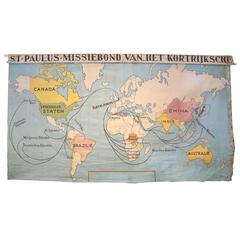
Antique Canvas World Wall Map of St. Paul's Church of Kortrijk, Belgium
View Similar Items


1 of 8
Antique Canvas World Wall Map of St. Paul's Church of Kortrijk, Belgium
About the Item
- Dimensions:Height: 77 in (195.58 cm)Width: 139 in (353.06 cm)Depth: 0.1 in (2.54 mm)
- Materials and Techniques:
- Place of Origin:
- Period:1910-1919
- Date of Manufacture:1910
- Condition:Wear consistent with age and use. Minor fading.
- Seller Location:Houston, TX
- Reference Number:Seller: 2017 Q1 Container #1211stDibs: f167121703036803883fs
You May Also Like
- Tiffany & Co. Sterling Silver St. Paul's Church Collector's SpoonBy Tiffany & Co.Located in Miami Beach, FLAn early 20th century Tiffany & Co. souvenir spoon for St. Paul's Church. There is a finely detailed depiction of Manhattan's St Paul's Church on handled and the back has additional ...Category
Early 20th Century American Sterling Silver
MaterialsSterling Silver
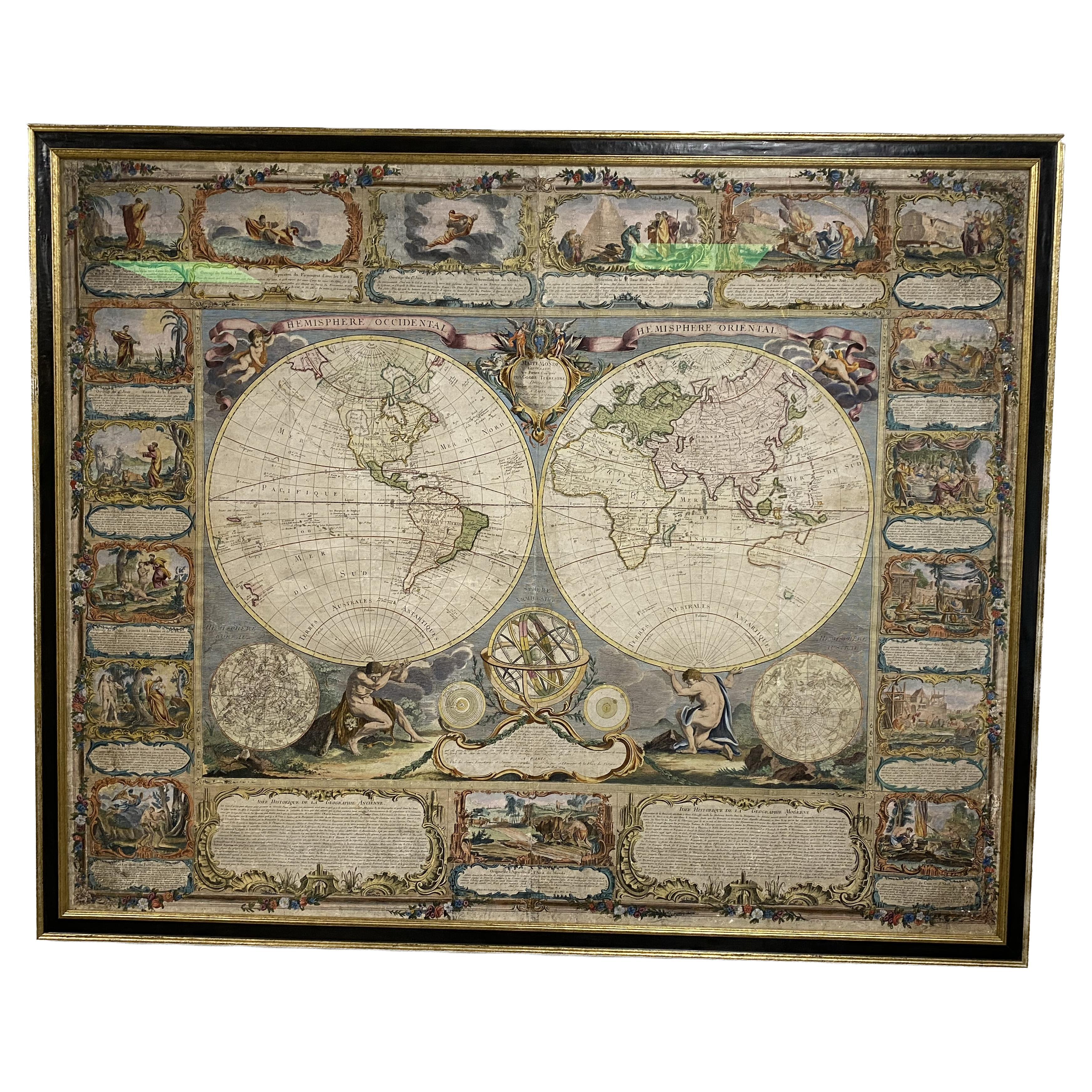
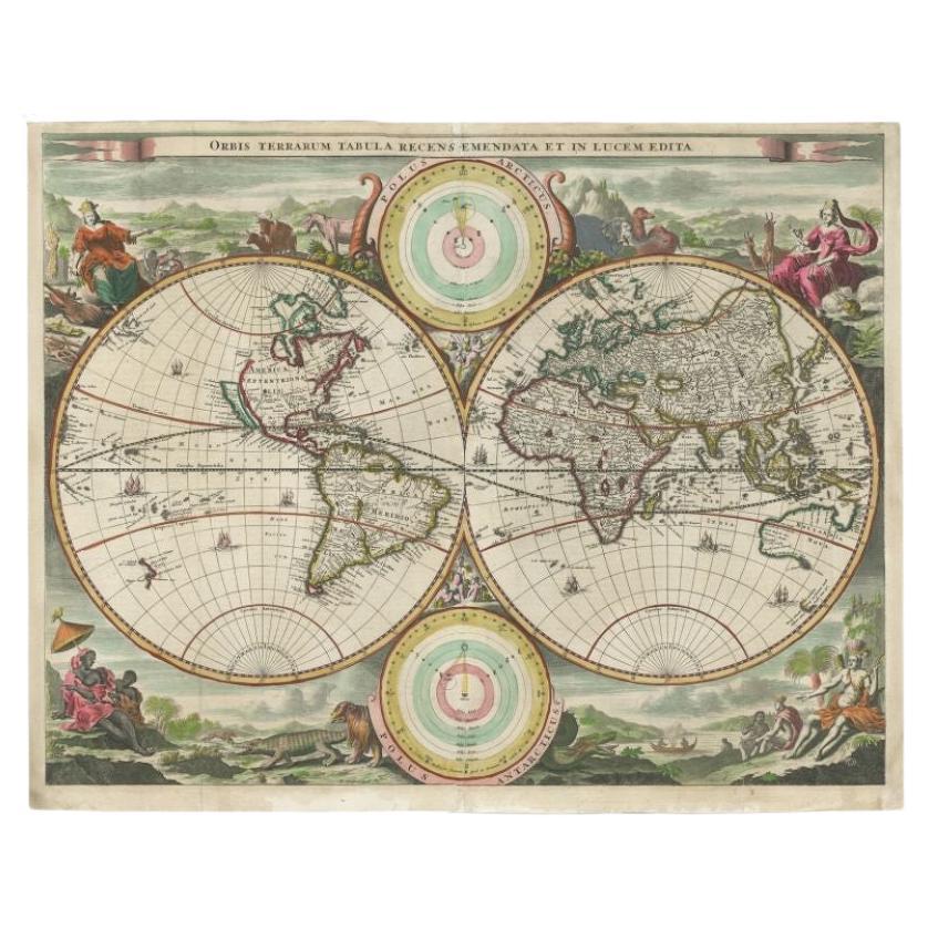
- Colored wall map of the WORLDBy ChambonLocated in ZWIJNDRECHT, NL“Mappe Monde, contenant les Parties Connues du Globe Terrestre” CHAMBON, Gobert-Denis (France, 17.. - 1781) Paris, Longchamps et Janvier, 1754 Size H. 115 x W. 145 cm. Gobert-Denis Chambon made copper engraving after the work of Guillaume De L’Isle, published in 1754 by Jean Janvier and S.G. Longschamps. A huge wall map of the world in two hemispheres printed on two sheets, depicting the Eastern and Western hemispheres supported by two male figures, decorated at the bottom right and left with two celestial hemispheres (boreal and southern) and at the bottom in the middle with an armillary sphere, in addition. This map is most notable for its depiction of the Sea of Japan labeled "Mer de Corée" and of "Mer de L'Ouest" or Sea of the West - a great sea, easily the size of the Mediterranean, to flow from the then-known Strait of Juan de Fuca...Category
Antique Mid-18th Century French French Provincial Maps
MaterialsWood, Paper

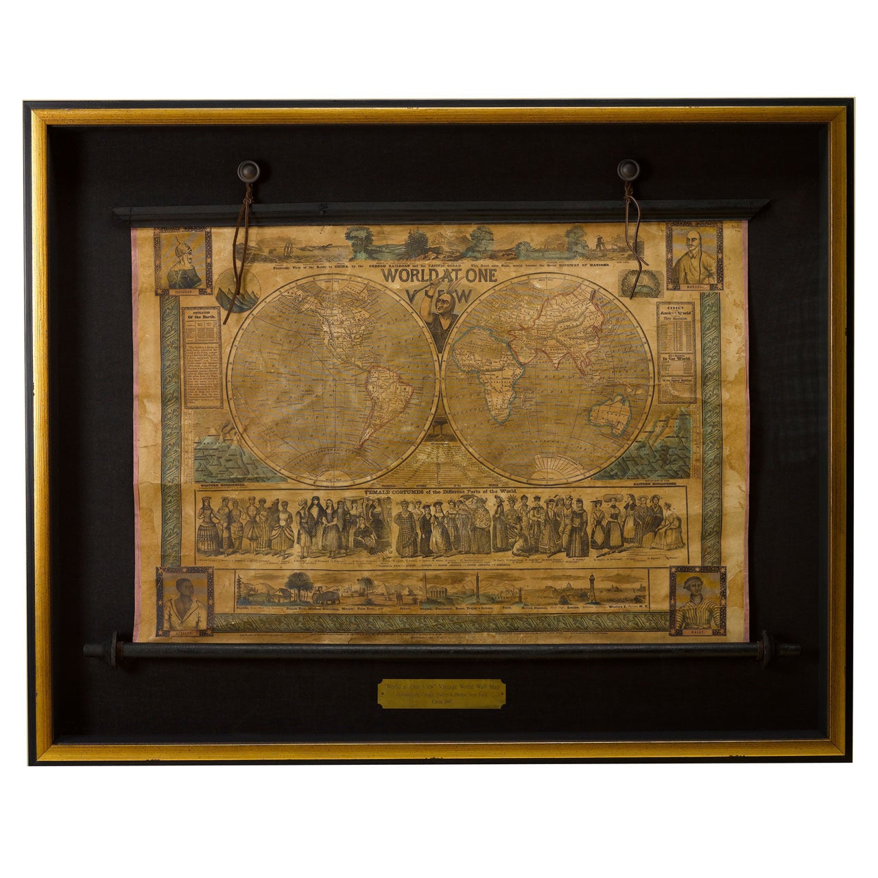
- 1847 “World at One View” Antique Hand-Colored Wall Map of the WorldLocated in Colorado Springs, COThis is a highly desirable hanging wall map of the "World at One View", published in 1847 by Ensign and Thayer, New York. This pictorial map was printed as a broadside and features...Category
Antique 19th Century American Maps
MaterialsPaper
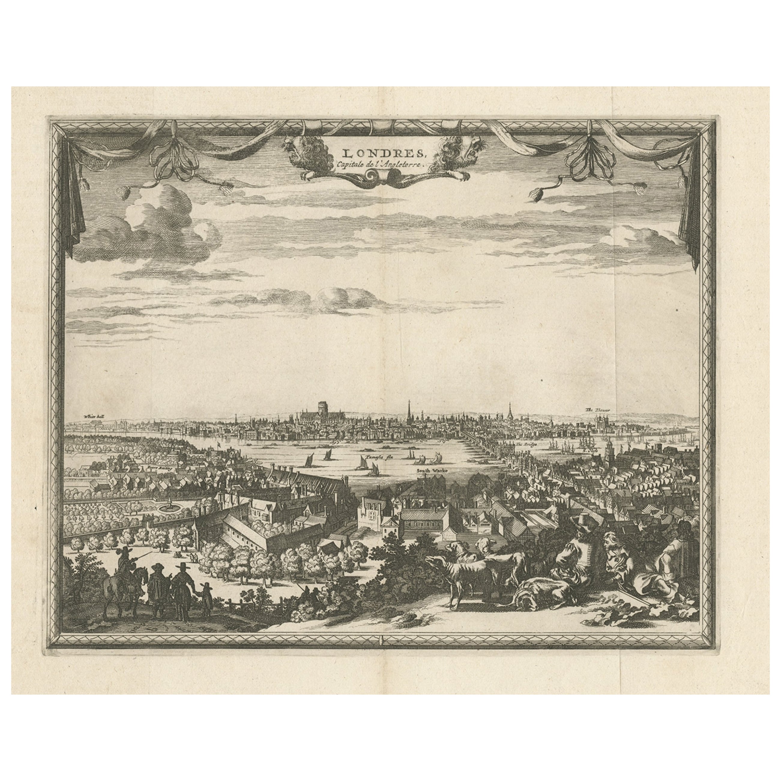
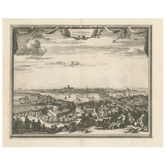
- Antique Print of London with St. Paul's Cathedral Before the Fire, ca.1725Located in Langweer, NLAntique print London titled 'Londres, capitale de l'Angleterre'. Antique print of London with St. Paul's Cathedral (before the fire) in the...Category
Antique 1720s Prints
MaterialsPaper
 $633 Sale Price20% Off
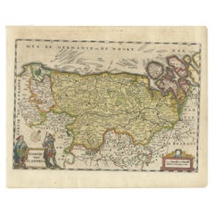
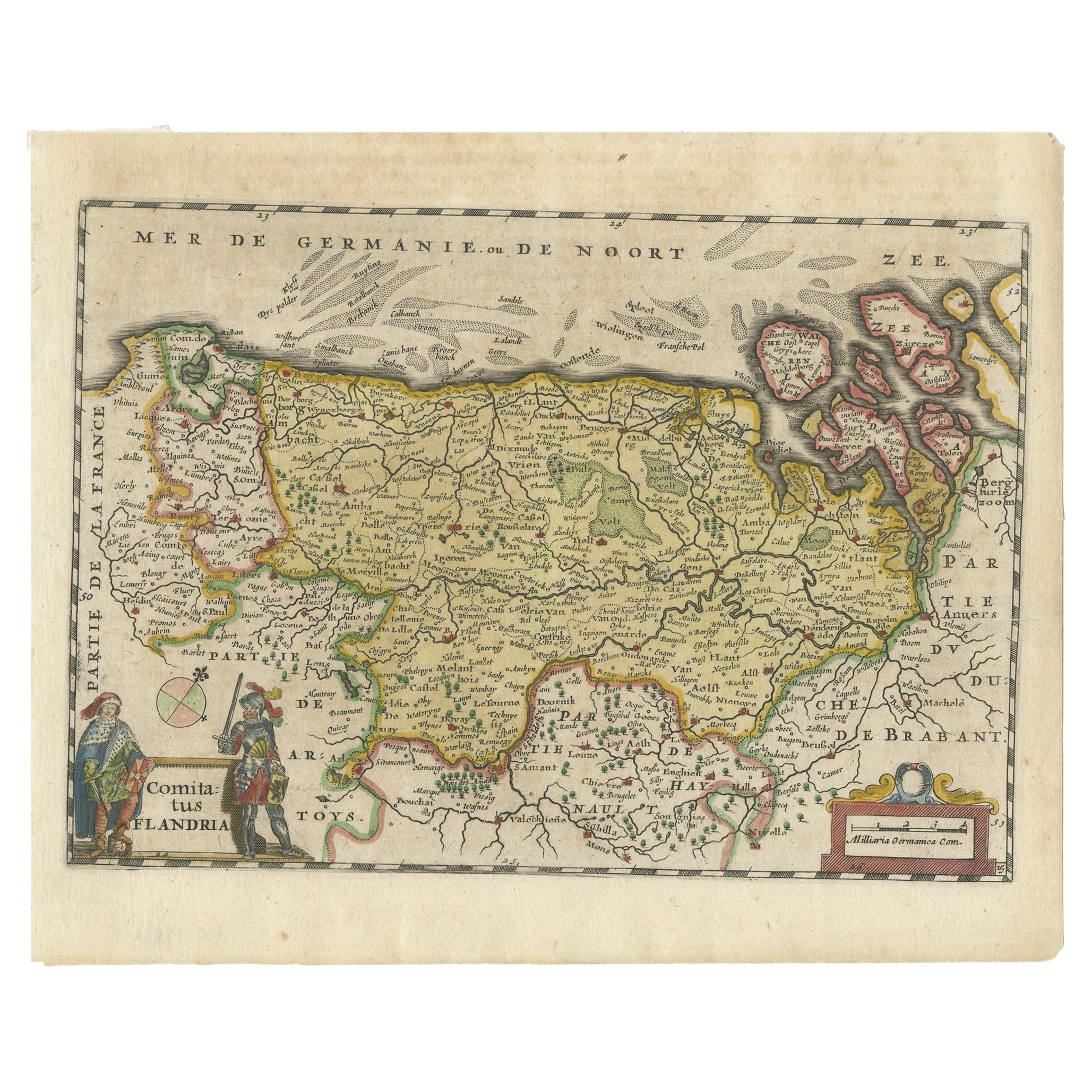
 - Antique Map of Flanders, Belgium, 1630Located in Langweer, NLAntique map titled 'Comitatus Flandria'. Original antique map of Flanders, Belgium. This map originates from 'Vyerige Colom verthonende de 17 Nederlandsche Provintien' published 1630...Category
Antique 17th Century Maps
MaterialsPaper
- Antique Map of Belgium and Surroundings, 1692Located in Langweer, NLAntique map titled 'Provincie Meridionali de Paesi Bassi Intese sotto nome di Fiandra overo Li Paesi Bassi Cattolici con li confini di Francia di Allemagna et di Hollanda'. Uncommon map of Belgium...Category
Antique 17th Century Maps
MaterialsPaper