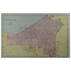
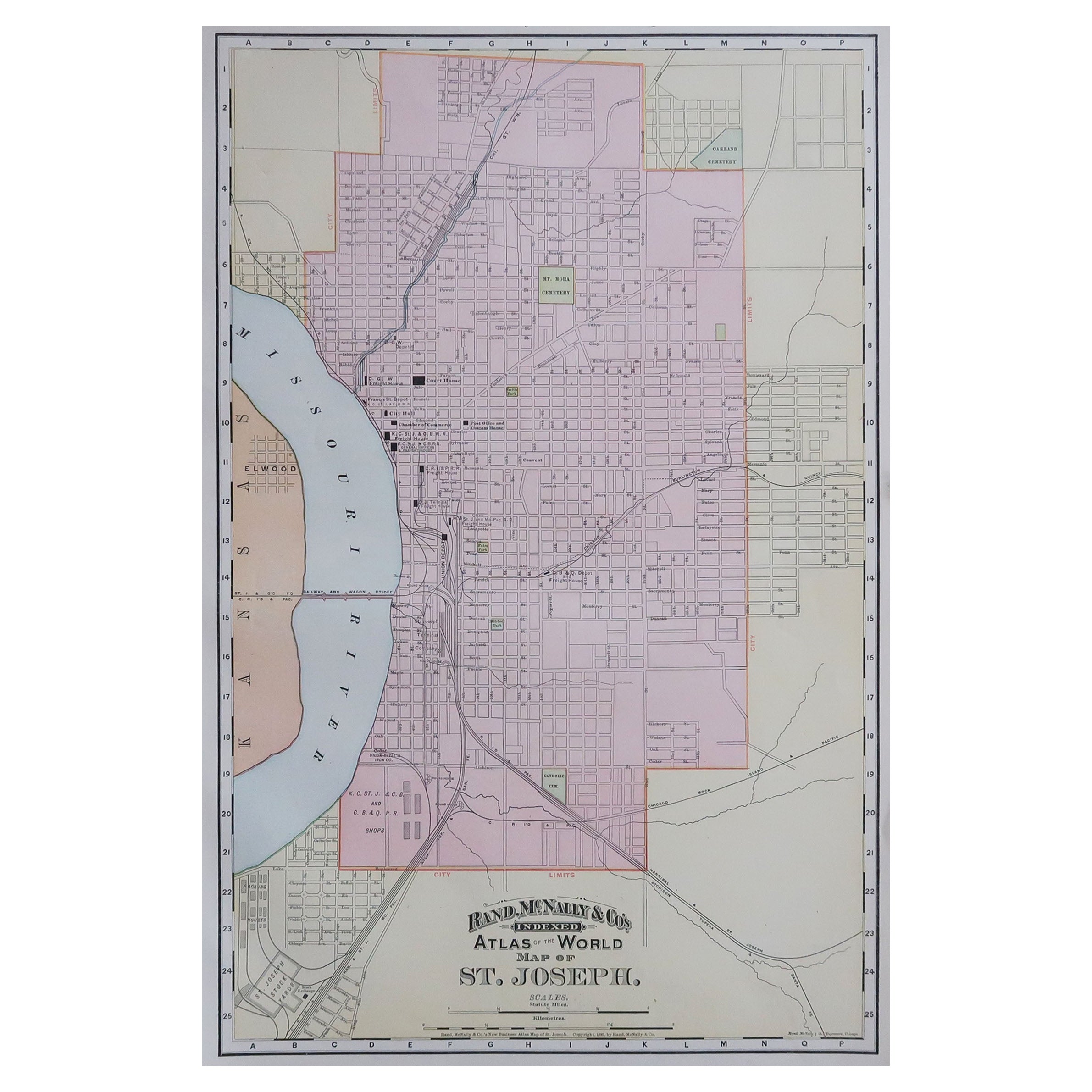
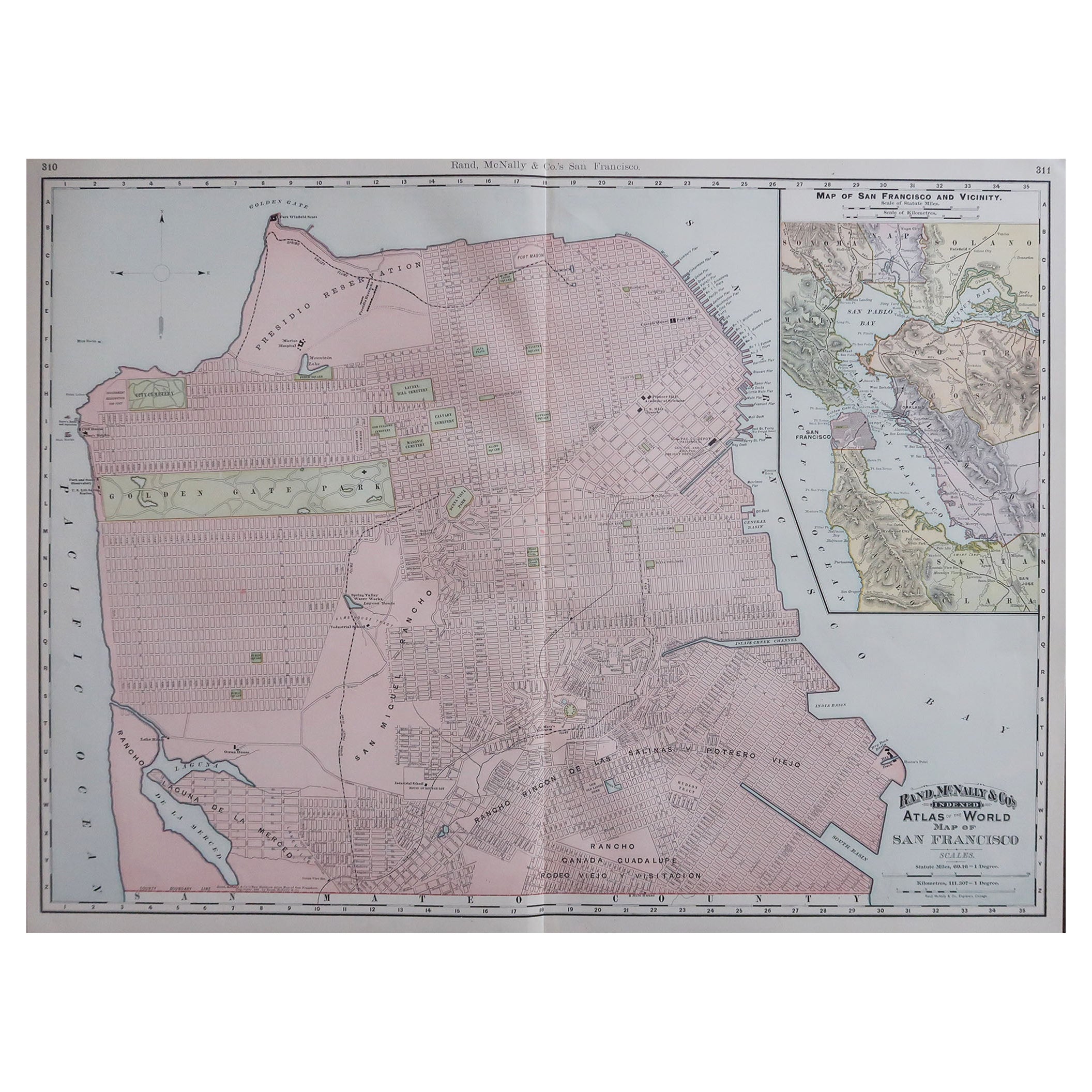
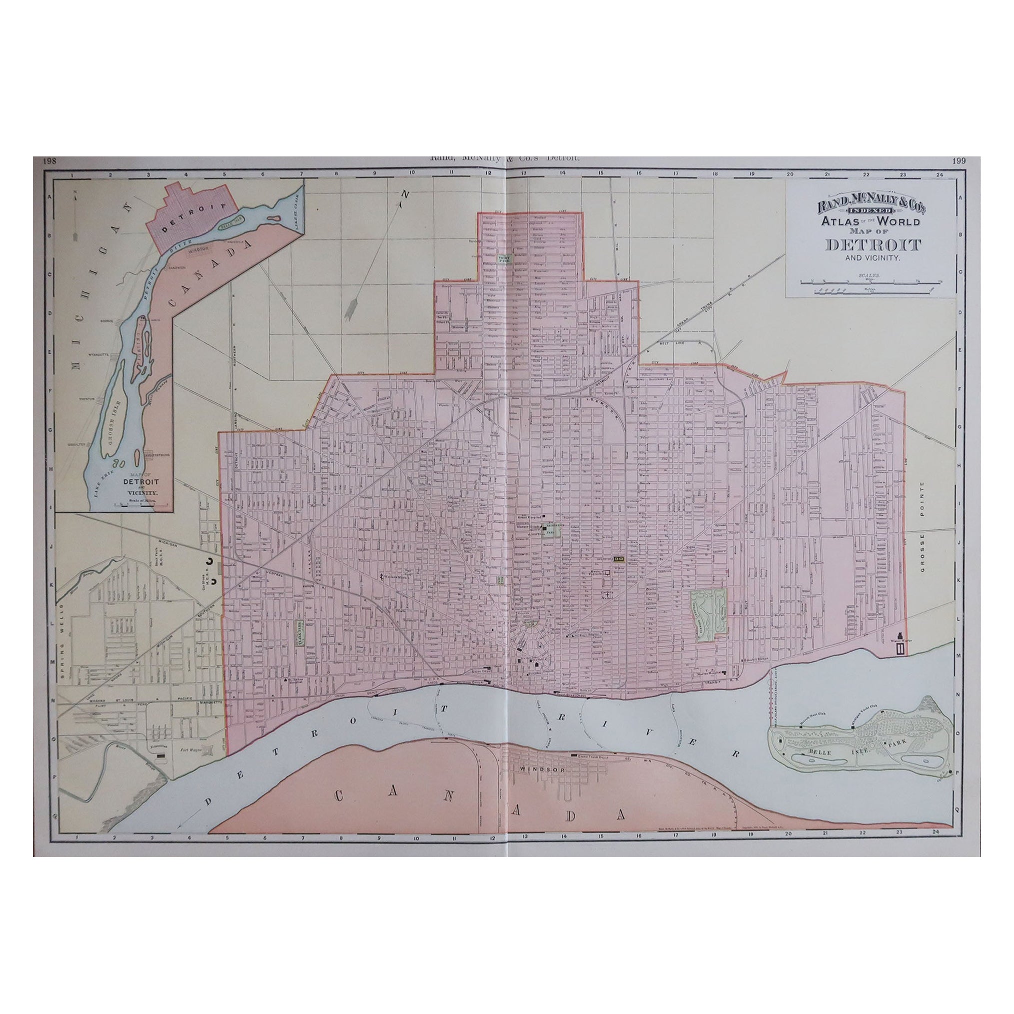
Original Antique City Plan of Cleveland, Ohio, USA, circa 1900
View Similar Items


Want more images or videos?
Request additional images or videos from the seller
1 of 5
Original Antique City Plan of Cleveland, Ohio, USA, circa 1900
About the Item
- Creator:Rand McNally & Co. (Maker)
- Dimensions:Height: 14 in (35.56 cm)Width: 20.5 in (52.07 cm)Depth: 0.07 in (1.78 mm)
- Materials and Techniques:Paper,Other
- Place of Origin:
- Period:1900-1909
- Date of Manufacture:1900
- Condition:Wear consistent with age and use. Minor edge tears.
- Seller Location:St Annes, GB
- Reference Number:1stDibs: LU1836322436202
About the Seller
4.9
Platinum Seller
These expertly vetted sellers are 1stDibs' most experienced sellers and are rated highest by our customers.
1stDibs seller since 2016
2,577 sales on 1stDibs
Associations
International Confederation of Art and Antique Dealers' Associations
More From This SellerView All
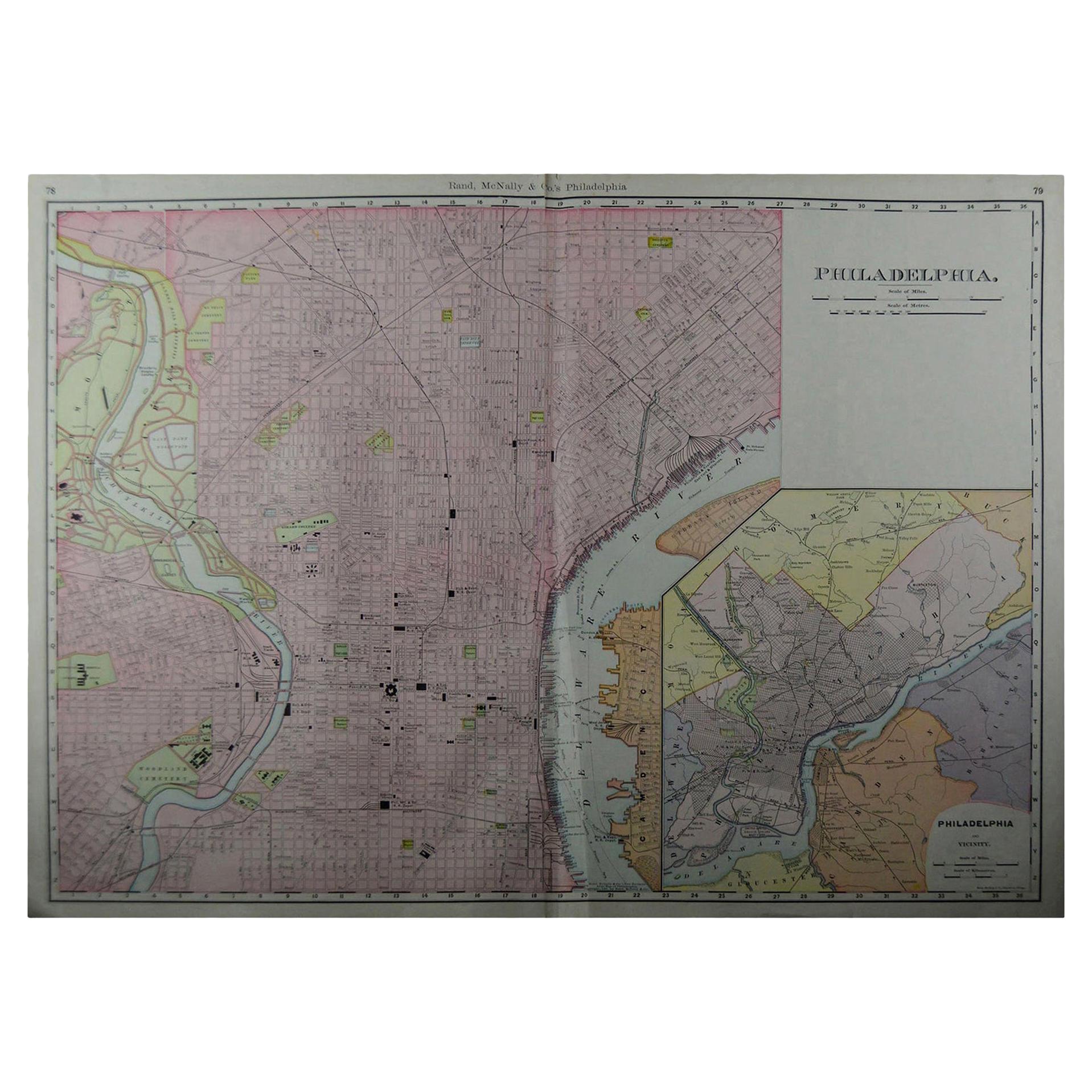
- Large Original Antique City Plan of Philadelphia, USA, circa 1900By Rand McNally & Co.Located in St Annes, LancashireFabulous colorful map of Philadelphia Original color By Rand, McNally & Co. Published, circa 1900. Unframed Free shipping.Category
Antique Early 1900s American Maps
MaterialsPaper
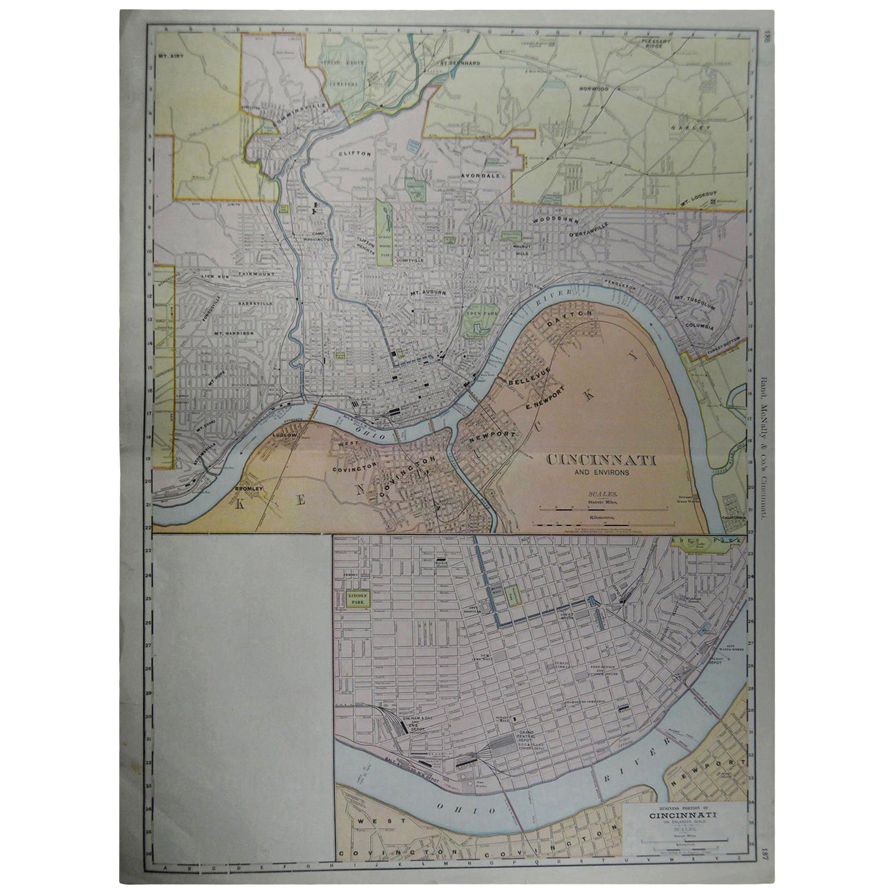
- Large Original Antique City Plan of Cincinnati, USA, circa 1900By Rand McNally & Co.Located in St Annes, LancashireFabulous colorful map of Cincinnati, Ohio. Original color By Rand, McNally & Co. Published, circa 1900 Unframed Free shipping.Category
Antique Early 1900s American Maps
MaterialsPaper
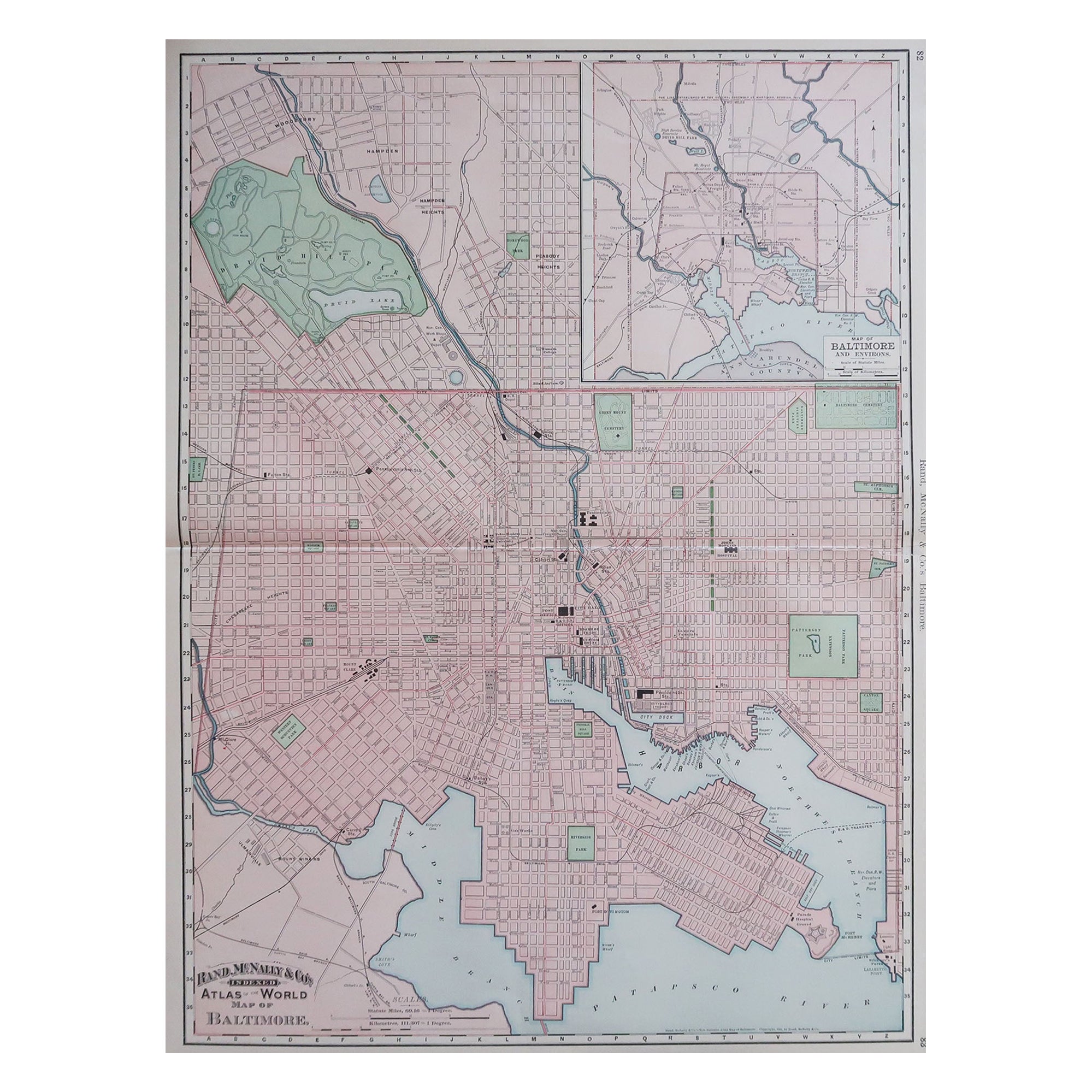
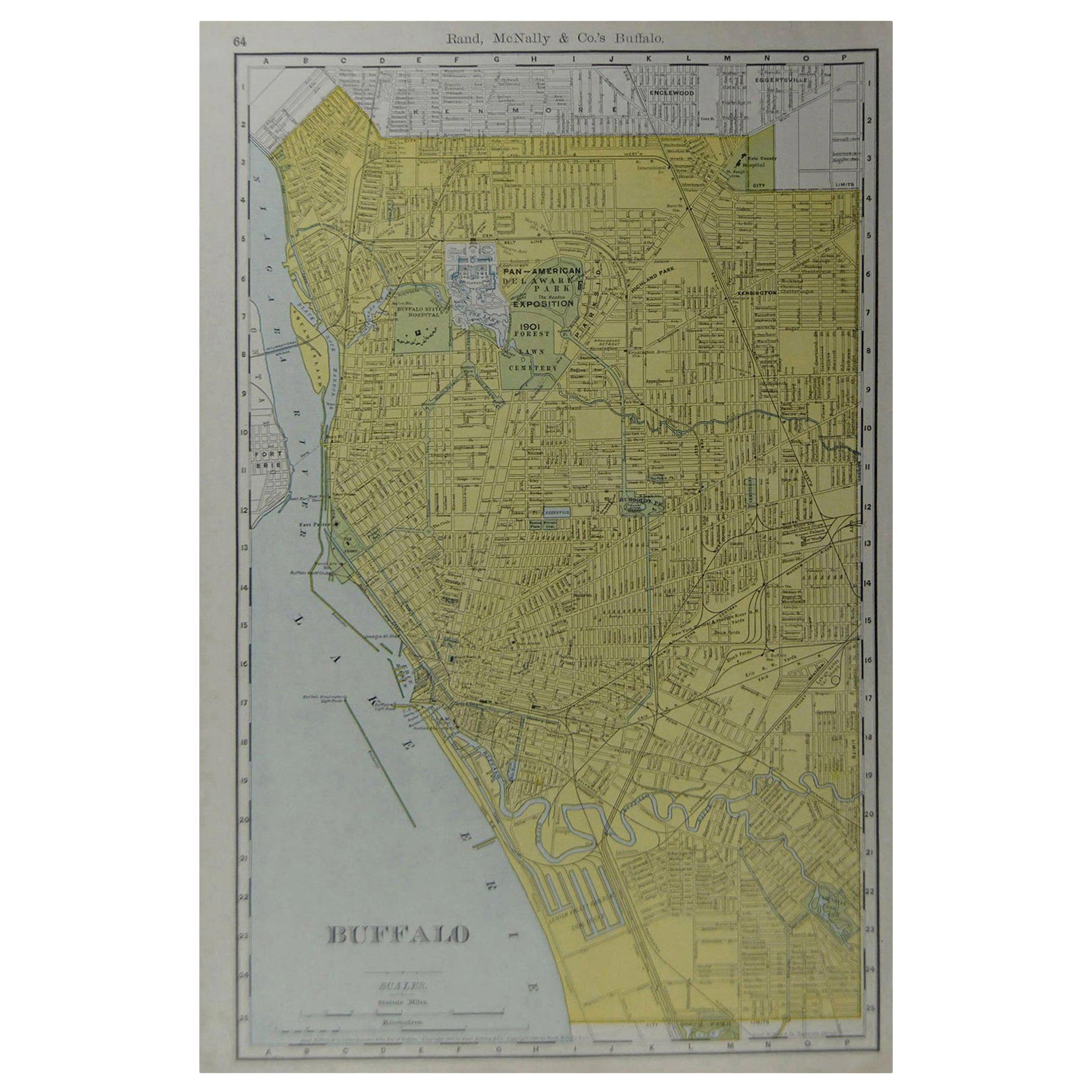
- Original Antique City Plan of Buffalo, New York, USA, circa 1900By Rand McNally & Co.Located in St Annes, LancashireFabulous colorful map of Buffalo Original color By Rand, McNally & Co. Published, circa 1900. Unframed Free shipping.Category
Antique Early 1900s American Maps
MaterialsPaper
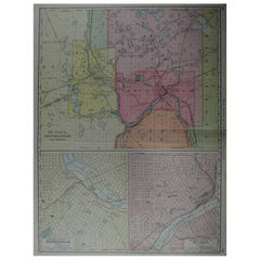
- Large Original Antique City Plan of Minneapolis and St Paul, USA, circa 1900By Rand McNally & Co.Located in St Annes, LancashireFabulous colorful map of Minneapolis and St Paul, Minnesota. Original color By Rand, McNally & Co. Published, circa 1900 Unframed Free shipping.Category
Antique Early 1900s American Maps
MaterialsPaper
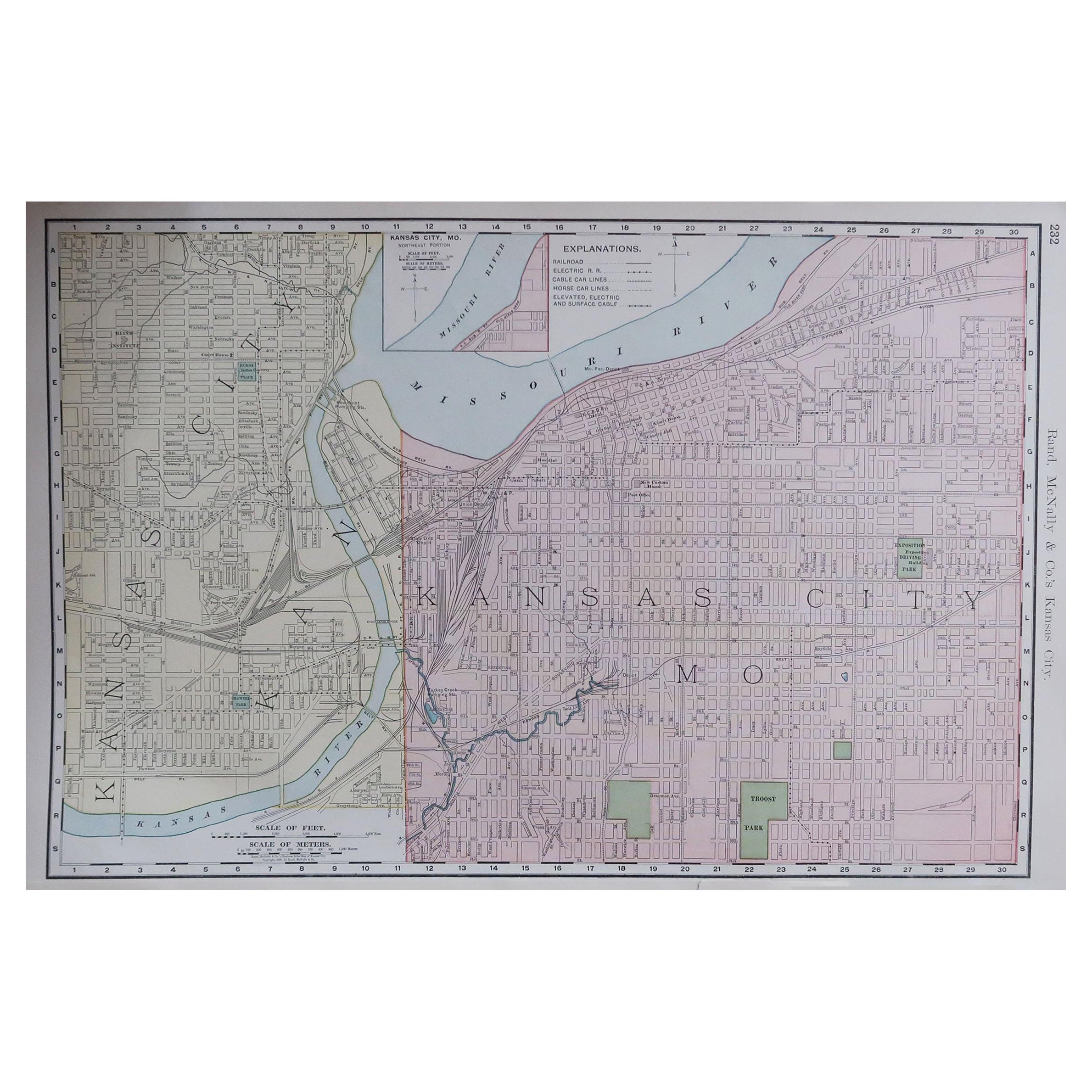
- Original Antique City Plan of Kansas City, USA. 1894By Rand McNally & Co.Located in St Annes, LancashireFabulous colorful map of Kansas City Original color By Rand, McNally & Co. Published, 1894 Unframed Slightly reduced bottom margin. Free shipping.Category
Antique 1890s American Maps
MaterialsPaper

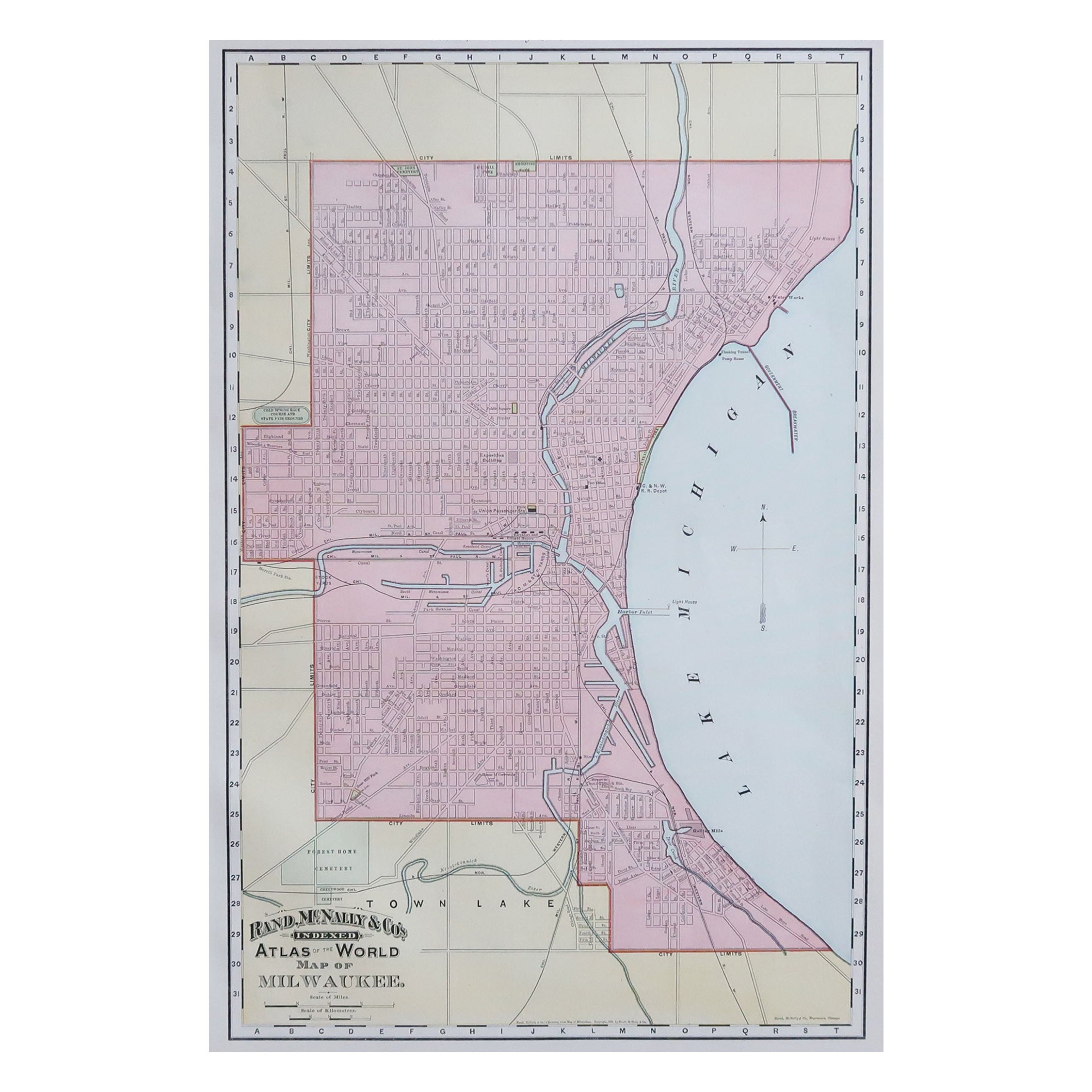
- Original Antique City Plan of Milwaukee, USA, 1894By Rand McNally & Co.Located in St Annes, LancashireFabulous colorful map of Milwaukee Original color By Rand, McNally & Co. Published, 1894 Unframed Free shipping.Category
Antique 1890s American Maps
MaterialsPaper


You May Also Like
- Antique Original Painted Russian Icons Painted on Wood Panels, circa 1900'sLocated in Round Top, TXPair, original painted Russian icons on wood. Portrayal of Saint George, Saint Simon and Saint Aviva Age related crackles, dings/scratches, scuffs/nick...Category
Antique Early 19th Century Russian Religious Items
MaterialsPaint, Wood
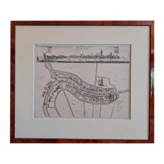
- Antique City View and Map of IJlst, City in Friesland, Holland, Framed, 1664Located in Langweer, NLAntique map titled 'Ylst'. Old map and city view of the city of IJlst, Friesland. This map originates from 'Beschrijvinge van de Heerlyckheydt van Frieslandt' by B. Schotanus à Sterr...Category
Antique 17th Century Maps
MaterialsPaper
 $438 Sale Price20% Off
 - Gold Leaf Foil Pictorial Plan Map of the West Country of England Antique StyleLocated in GBWe are delighted to offer for sale this lovely Antique style pictorial plan map of the West Country of England etched in gold leaf foil This is a very interesting and decorative p...Category
20th Century English Adam Style Maps
MaterialsGold Leaf
 $245 Sale Price30% Off
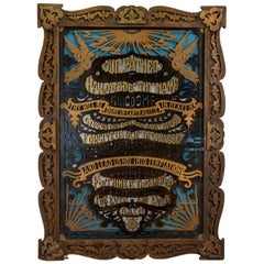
 - Circa 1900 Wood Cutout of "The Lord's Prayer"Located in Coeur d'Alene, IDWood cutout of the Lord's Prayer with frame. 23" x 32". Beautiful! A tad faded with age, but adds character to the already unique and never forgotten Lord'...Category
Antique Early 1900s American Decorative Art
MaterialsWood
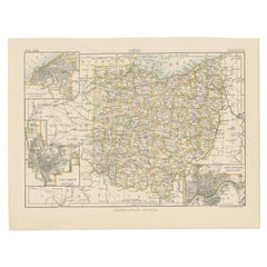
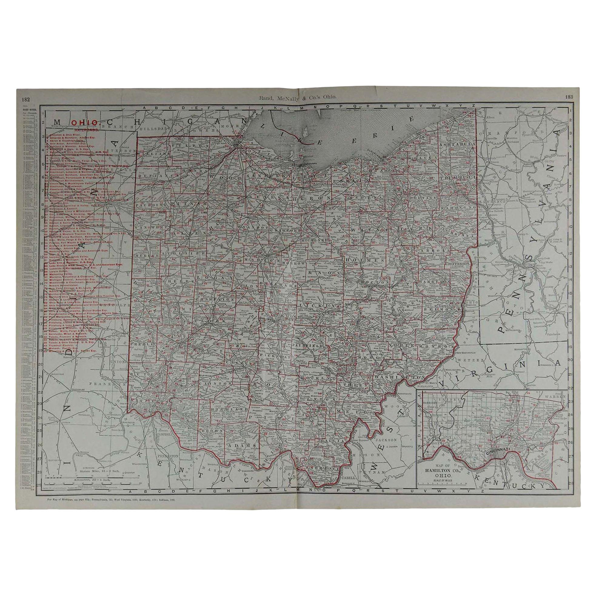
- Antique Map of Ohio, with Inset Maps of Cleveland, Columbus and CincinnatiLocated in Langweer, NLAntique map titled 'Ohio'. Original antique map of Ohio, United States. With inset maps of Cleveland, Columbus and Cincinnati. This print originates from 'Encyclopaedia Britannica', ...Category
Antique Late 19th Century Maps
MaterialsPaper
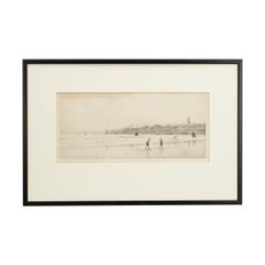
- Antique St Andrews Golf Etching by W.L. Wyllie, circa 1900Located in Oxfordshire, GBA very charming etching of two children playing golf on the beach at St Andrews, in the background is the town of St Andrews with the Castle & Cathedral prominent in the sky line. Fr...Category
Antique Early 1900s British Sporting Art Sports Equipment and Memorabilia
MaterialsWood, Paper