Items Similar to French topographic embossed map in three dimensions of ancient Jerusalem - 19th


Want more images or videos?
Request additional images or videos from the seller
1 of 8
French topographic embossed map in three dimensions of ancient Jerusalem - 19th
$17,245.18
£12,912
€14,500
CA$24,118.92
A$26,287.46
CHF 13,689.33
MX$317,177.66
NOK 172,080.34
SEK 161,543.42
DKK 110,462.53
About the Item
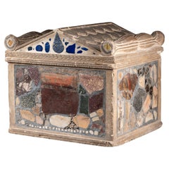
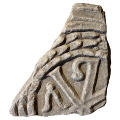
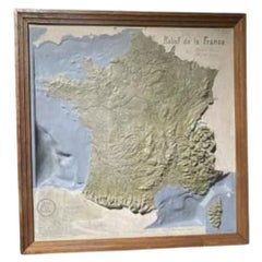
French topographic embossed map in three dimensions of Ancient Jerusalem
19th century
wood and hand-coloured plaster
10,5 x 43 x 58 cm
Provenance : Private collection UK
Wood and hand-coloured plaster / papier maché showing a plan of the Biblical city, annotated showing the key features and contours of the surrounding landscape, with a compass and a scale lower right. Art loss Certificate available.
- Dimensions:Height: 4.14 in (10.5 cm)Width: 16.93 in (43 cm)Depth: 22.84 in (58 cm)
- Style:Belle Époque (Of the Period)
- Materials and Techniques:
- Place of Origin:
- Period:
- Date of Manufacture:19th century
- Condition:Wear consistent with age and use.
- Seller Location:Bruxelles, BE
- Reference Number:1stDibs: LU6666241787442
About the Seller
5.0
Vetted Professional Seller
Every seller passes strict standards for authenticity and reliability
1stDibs seller since 2022
15 sales on 1stDibs
Typical response time: <1 hour
- ShippingRetrieving quote...Shipping from: Bruxelles, Belgium
- Return Policy
Authenticity Guarantee
In the unlikely event there’s an issue with an item’s authenticity, contact us within 1 year for a full refund. DetailsMoney-Back Guarantee
If your item is not as described, is damaged in transit, or does not arrive, contact us within 7 days for a full refund. Details24-Hour Cancellation
You have a 24-hour grace period in which to reconsider your purchase, with no questions asked.Vetted Professional Sellers
Our world-class sellers must adhere to strict standards for service and quality, maintaining the integrity of our listings.Price-Match Guarantee
If you find that a seller listed the same item for a lower price elsewhere, we’ll match it.Trusted Global Delivery
Our best-in-class carrier network provides specialized shipping options worldwide, including custom delivery.More From This Seller
View AllGrand Tour Cinerarium - 18th century
Located in Bruxelles, BE
18th century Grand Tour Cinerarium
Limestone, inlaid with Roman marble fragments and fresco's
Annotation of finding spot indistinctively written on the fragments ("forum trajan","for...
Category
Antique 18th Century Italian Grand Tour Urns
Materials
Limestone, Marble
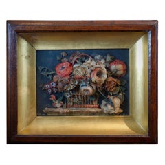
Wax Relief, Italy 19th Century
Located in Bruxelles, BE
Wax relief depicting a vase with flowers
Italy, mid-19th century
Signed "Scot. inv et fecit"
Measures: 37 x 44 x 7,5 cm.
Category
Antique Mid-19th Century Italian Early Victorian Wall-mounted Sculptures
Materials
Wood
$2,854 Sale Price
20% Off
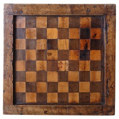
Wood and leather game box - Italy, 19th century
Located in Bruxelles, BE
Wood and leather game box for chess, Nine men’s morris and Backgammon
Italy, 19th century
33 x 33,3 x 11,2 cm
Nine men’s morris also known as mill game (merelles, from the Latin wor...
Category
Antique 19th Century Italian Arts and Crafts Games
Materials
Leather, Wood
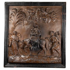
Large Terracotta Relief - Lombardy, First Half of 17th Century
Located in Bruxelles, BE
Large Terracotta relief of the flight into Egypt
Lombardy, first half of 17th century
Painted terracotta
91 x 85 x 11,5 cm
This event in the early life of Christ is recounted i...
Category
Antique 17th Century Italian Baroque Figurative Sculptures
Materials
Terracotta
$61,844 Sale Price
20% Off
Marble Roman relief representing a Christogram
Located in Bruxelles, BE
Marble Roman relief representing a Christogram
Roman relief - 4th century
25 x 22 x 8 cm
Provenance :
Collection of the Château de B. À Nevers by Georges C.S., scholar born in 1833 and deceased in 1909
The entire castle and its collections were acquired in 1938 by the current owners of the estate
A christogram is a monogram or combination of letters that forms an abreviation for the name of Jesus Christ.
This rare fragment combines chi (X) and rho (P), the first two letters of Christ's name in Greek and it is one of the oldest and most popular early christian symbol. The monogram of Christ, or chrismon, is also a powerful symbol of imperial victory: it appeared to Emperor Constantine the Great before his battle against Maxentius in ad 312, promising victory in the name of Christ. In Plato's Timaeus, it is explained that the two bands which form the "world soul" (anima mundi...
Category
Antique 15th Century and Earlier Italian Classical Roman Figurative Scul...
Materials
Marble
$3,491 Sale Price
30% Off
Turned, Engraved Openwork Box, Florence, 17th Century
Located in Bruxelles, BE
Turned, engraved and openwork box
Fruit wood
Florence, 17th century
Measures: Diameter 11cm
Height 4.4cm.
Category
Antique 17th Century Italian Renaissance Decorative Boxes
Materials
Wood
$761 Sale Price
20% Off
You May Also Like
Vintage Print Map of Jerusalem With Wooden Frame
Located in Seattle, WA
Historic Print of Original Oil Painting by Fr. & R. Stegmiller of Jerusalem in 1928. Primarily Red and Yellow Tones as Pictured. Vintage Condition Consistent with Age as Pictured.
D...
Category
Vintage 1970s Mid-Century Modern Paintings
Materials
Wood
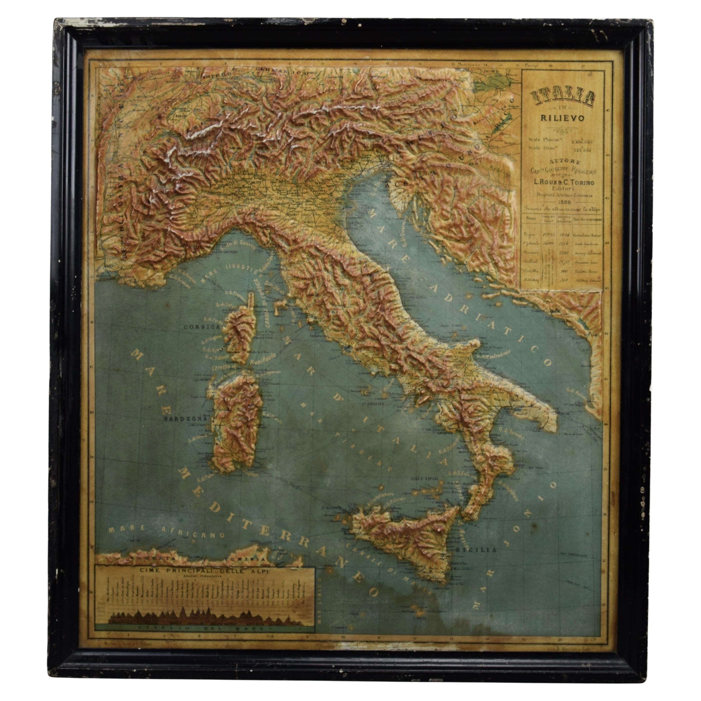
1889 Map of Italy in 3D Relief
Located in Weesp, NL
Introducing a true gem for collectors and history enthusiasts alike: this rare 1889 *"Italia in Rilievo"* map by L. Roux & Co. from Torino, a masterpiece of craftsmanship and cartogr...
Category
Antique 1880s European Maps
Materials
Paper

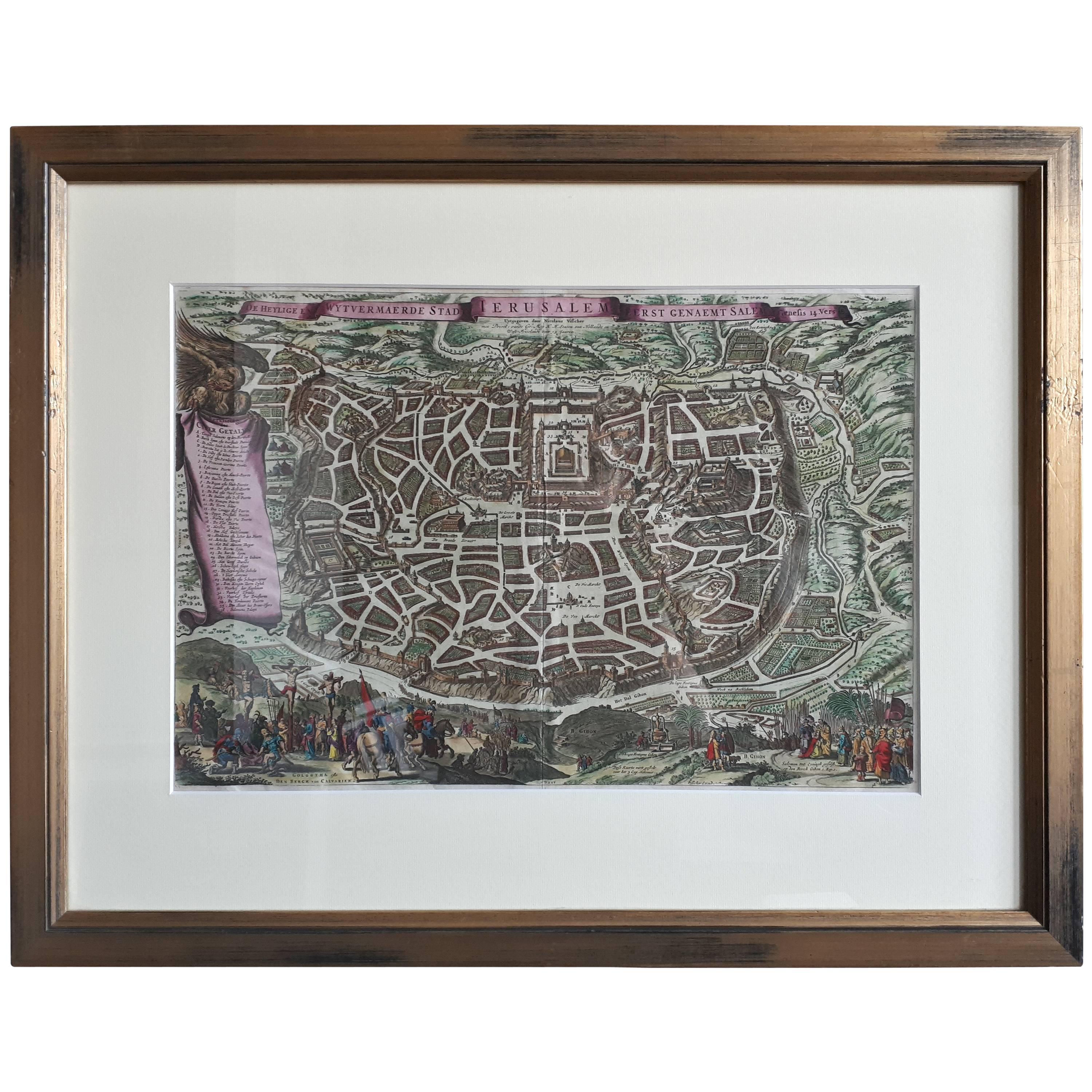
Antique Map of the City of Jerusalem by N. Visscher, 1702
Located in Langweer, NL
Antique map titled 'Die Heylige en Wytvermaerde stadt Jerusalem Eerst Genaemt Salem, Genesis 14 vers 18'. This map originates from 'Biblia. Ouden ende Nieuwen Testaments (..)'. Publi...
Category
Antique Early 18th Century Maps
Materials
Paper
$3,282 Sale Price
20% Off
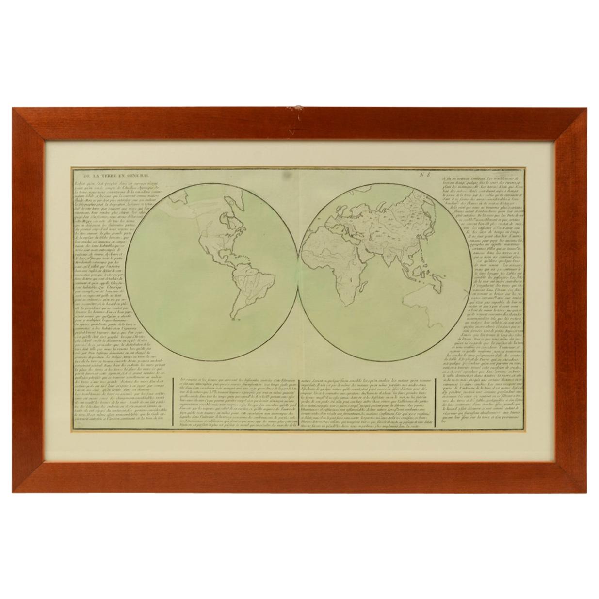
1850 Old French Map Depicting the Entire Earth's Surface Divided into Two Parts
Located in Milan, IT
Geographical map depicting the entire earth's surface divided into two parts that correspond to the two hemispheres or globes, the map deals with the earth in general. Detailed expla...
Category
Antique Mid-19th Century French Maps
Materials
Glass, Wood, Paper

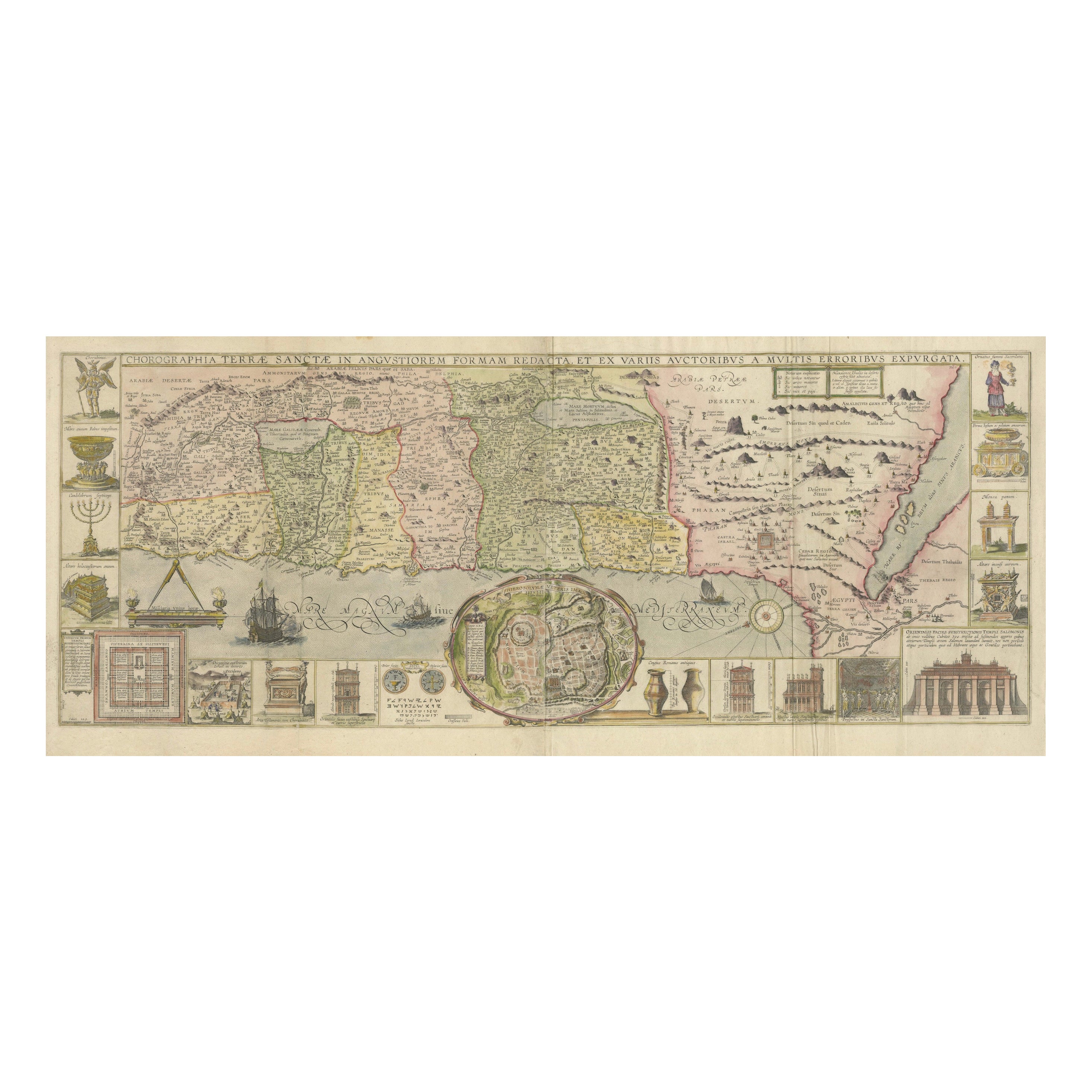
1632 Decorative Map of the Holy Land, Insets of Jerusalem and Biblical Artefacts
Located in Langweer, NL
Title: 1632 Decorative Map of the Holy Land with Insets of Jerusalem and Biblical Artefacts
Description: This richly detailed map of the Holy Land, published in 1632, offers a fa...
Category
Antique 1630s Prints
Materials
Paper

$1,522 Sale Price
20% Off
Map of France, 1934
Located in Andrézieux-Bouthéon, FR
Map of France, 1934
Vintage Design
Exceptional, map of France numbered 596 for the reliefs of France, scale 1/1,000,000
That it continues, small crack, visual, only to be noted ...
Category
20th Century French Modern Paintings
Materials
Stone
$1,077
More Ways To Browse
Dimensions Furniture
Jerusalem Furniture
Aluminum Rocket
Clipper Ship Model
Cold Painted Bronze Miniature
Large Model Boat
Mannequin 1940
Model Frigate
Stage Prop
William Hitchcock
Wooden Hat Forms
Antique Model Engines
Antique Press Machine
Chinese Quartz Flowers Cloisonne
Miniature Chinese Cabinet
Model Steam Engines
Sears Tower
Steam Boilers