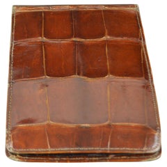
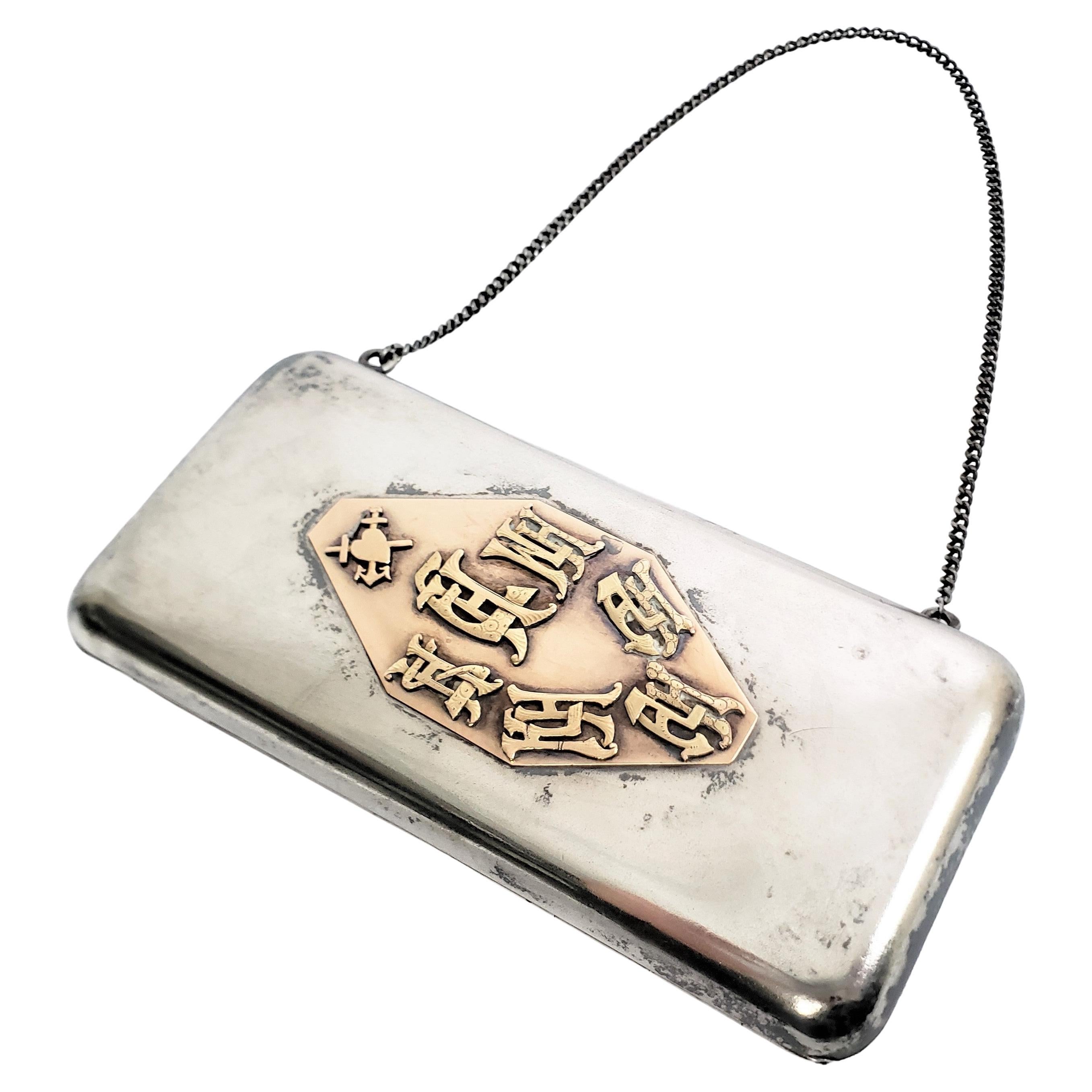
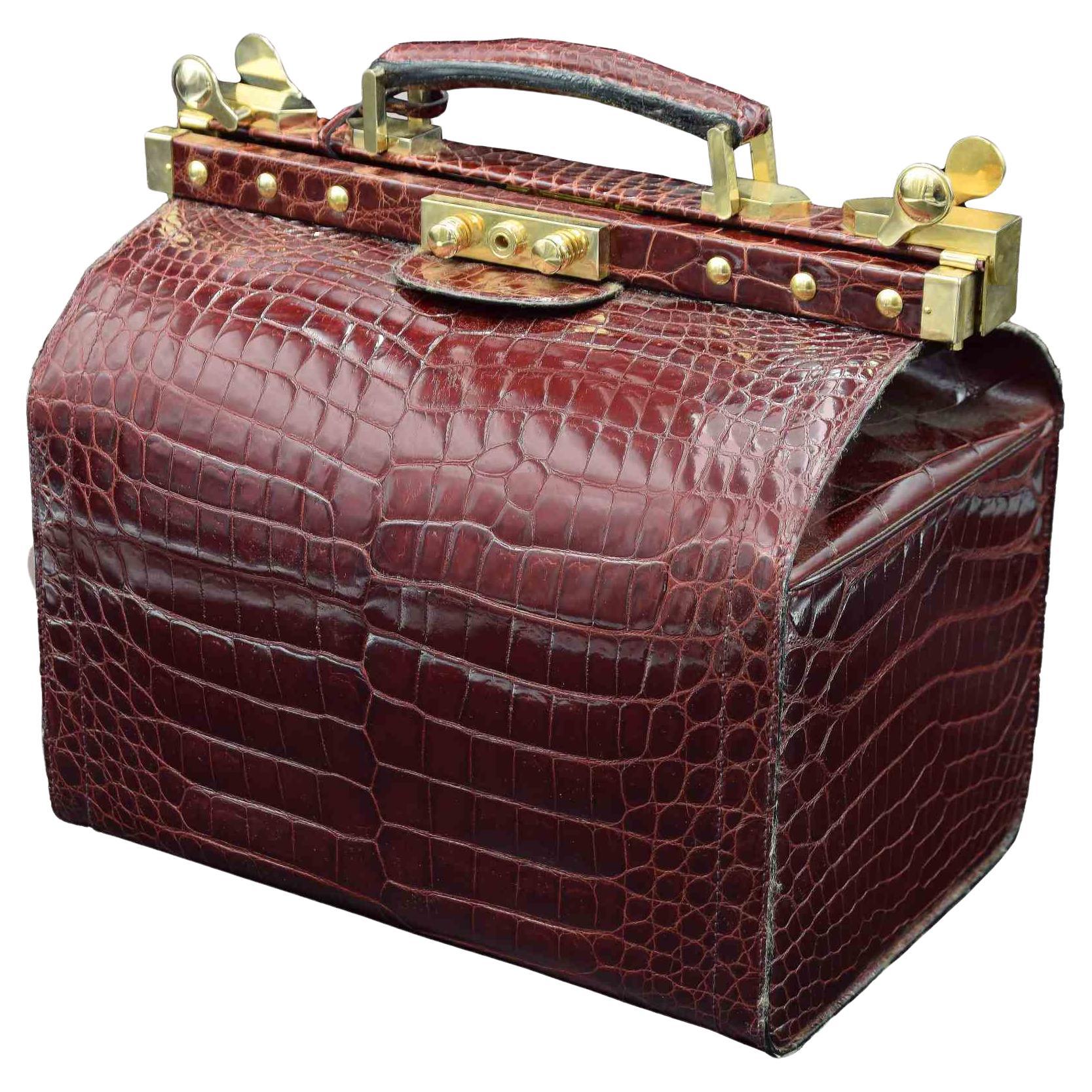
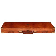
Antique Crocodile Cigar Case, English, circa 1910
View Similar Items
Want more images or videos?
Request additional images or videos from the seller
1 of 7
Antique Crocodile Cigar Case, English, circa 1910
About the Item
- Dimensions:Height: 0.25 in (6.35 mm)Width: 6.25 in (15.88 cm)Depth: 4.25 in (10.8 cm)
- Style:Edwardian (Of the Period)
- Materials and Techniques:
- Place of Origin:
- Period:1910-1919
- Date of Manufacture:1910
- Condition:Wear consistent with age and use.
- Seller Location:St Annes, GB
- Reference Number:Seller: 43911stDibs: LU1836313764522
About the Seller
4.9
Platinum Seller
Premium sellers with a 4.7+ rating and 24-hour response times
1stDibs seller since 2016
3,077 sales on 1stDibs
Associations
International Confederation of Art and Antique Dealers' Associations
Authenticity Guarantee
In the unlikely event there’s an issue with an item’s authenticity, contact us within 1 year for a full refund. DetailsMoney-Back Guarantee
If your item is not as described, is damaged in transit, or does not arrive, contact us within 7 days for a full refund. Details24-Hour Cancellation
You have a 24-hour grace period in which to reconsider your purchase, with no questions asked.Vetted Professional Sellers
Our world-class sellers must adhere to strict standards for service and quality, maintaining the integrity of our listings.Price-Match Guarantee
If you find that a seller listed the same item for a lower price elsewhere, we’ll match it.Trusted Global Delivery
Our best-in-class carrier network provides specialized shipping options worldwide, including custom delivery.More From This Seller
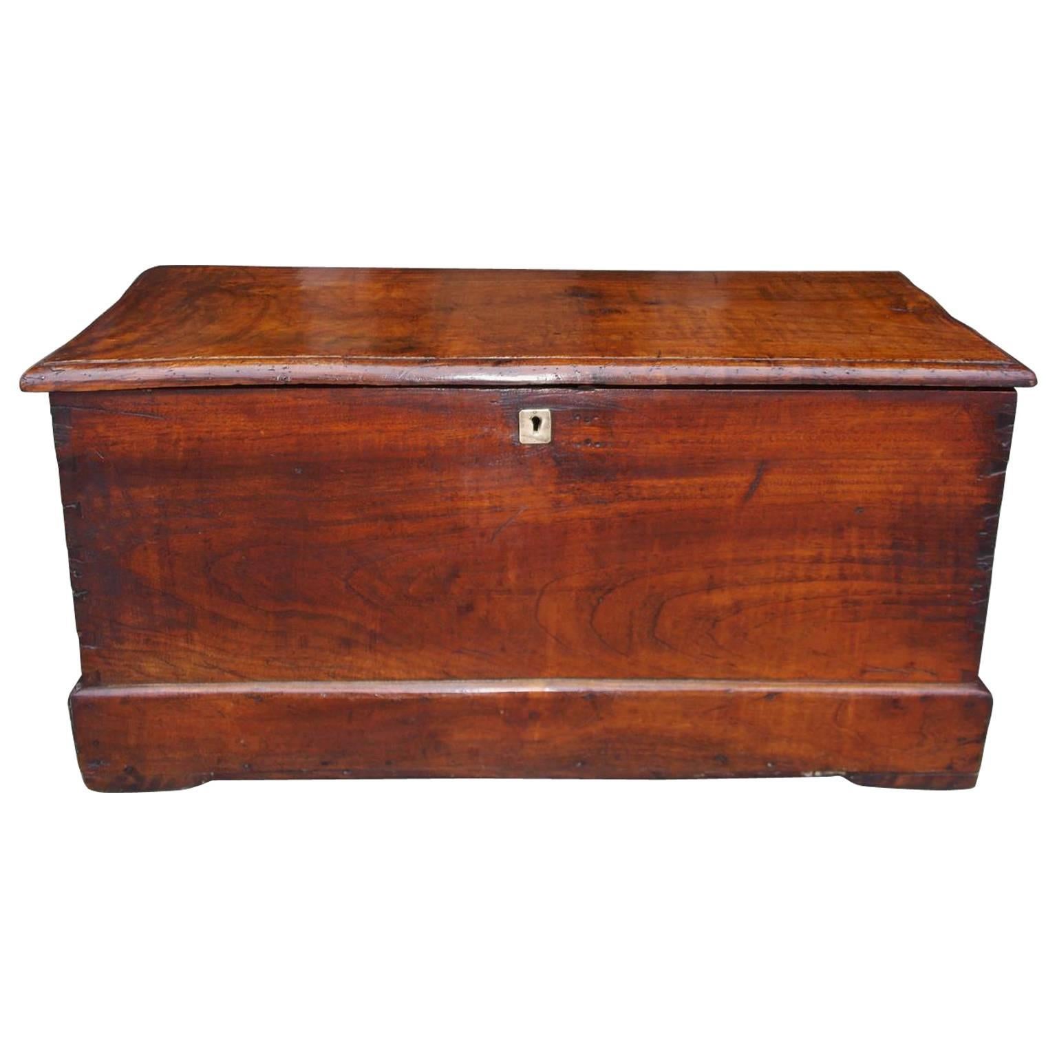
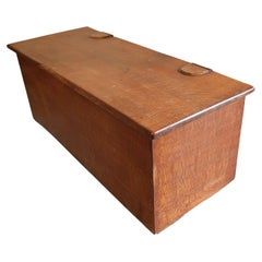
View AllArts and Crafts Oak Blanket Chest, English, Circa 1900
Located in St Annes, Lancashire
Wonderful oak chest or box.
This is a very special piece. The best quality of cabinet making and the finest choice of timber.
Probably made in the Cotswolds, England
The hinges ar...
Category
Antique Early 1900s English Arts and Crafts Blanket Chests
Materials
Oak
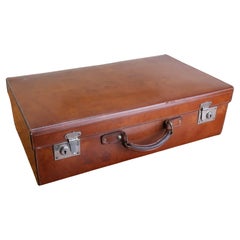
Vintage Tan Leather Suitcase. English C.1920
Located in St Annes, Lancashire
Lovely tan leather suitcase
Superb colour of leather
In very good condition
No makers marks
Clean canvas interior
Original patina to the nickel plated brass hardware
Weighs 10 ...
Category
Vintage 1920s English Edwardian Trunks and Luggage
Materials
Leather
Large Original Antique Map of Arkansas by Rand McNally, circa 1900
By Rand McNally & Co.
Located in St Annes, Lancashire
Fabulous monochrome map with red outline color
Original color
By Rand, McNally & Co.
Published, circa 1900
Unframed
Minor edge tears.
Category
Antique Early 1900s American Edwardian Maps
Materials
Paper

Original Antique Map of South Dakota by Rand McNally, circa 1900
By Rand McNally & Co.
Located in St Annes, Lancashire
Fabulous monochrome map with red outline color
Original color
By Rand, McNally & Co.
Published, circa 1900
Unframed
Minor edge tears.
Category
Antique Early 1900s American Edwardian Maps
Materials
Paper

Original Antique English County Map, Staffordshire, J & C Walker, 1851
Located in St Annes, Lancashire
Great map of Staffordshire
Original colour
By J & C Walker
Published by Longman, Rees, Orme, Brown & Co. 1851
Unframed.
Category
Antique 1850s English Other Maps
Materials
Paper
Original Antique English County Map, Herefordshire, J & C Walker, 1851
Located in St Annes, Lancashire
Great map of Herefordshire
Original colour
By J & C Walker
Published by Longman, Rees, Orme, Brown & Co. 1851
Unframed.
Category
Antique 1850s English Other Maps
Materials
Paper

You May Also Like
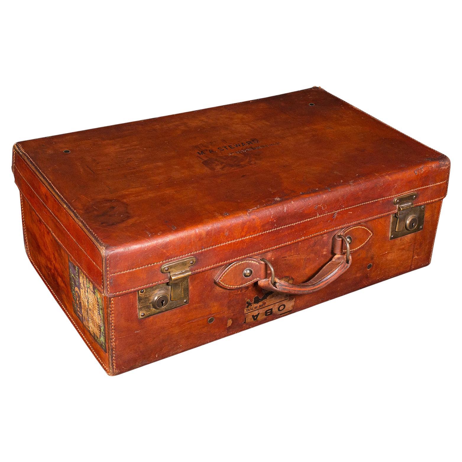
Antique Travel Suitcase, English, Leather Gentleman’s Case, Edwardian, C.1910
Located in Hele, Devon, GB
This is a fine antique travel suitcase, an English gentleman’s leather case, dating to the Edwardian period, circa 1910. A superb example with charming provenance and richly patinate...
Category
Early 20th Century British Edwardian Trunks and Luggage
Materials
Leather

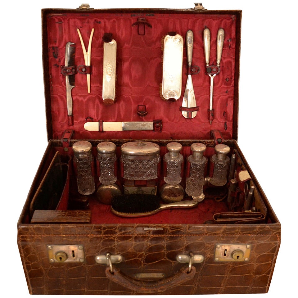
German Late 19th Century Crocodile And Silver Vanity Suitcase Case
Located in Copenhagen, K
Beautiful old crocodile vanity and necessaire case, with eight jars in facetted glass and silver lids, one box in silver, several brushes and combs in silver, inkwell in silver, perfume container in silver and glass, travel clock, lipstick container...
Category
Antique Late 19th Century German Trunks and Luggage
Materials
Silver

$2,499 Sale Price
34% Off
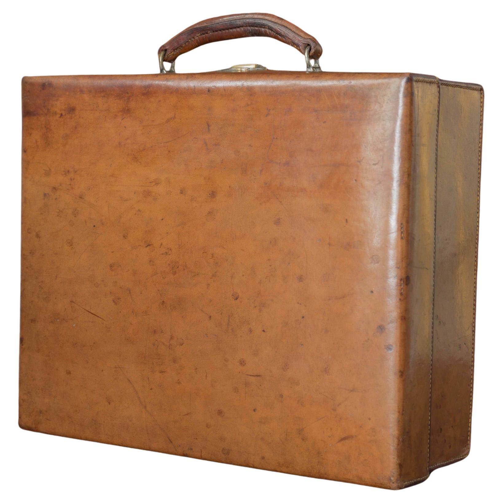
Tan Leather Case, circa 1910
Located in London, GB
An excellent sturdy tan leather case with solid brass catch and original leather lining with pockets and sleeves to accommodate fittings (now missing). The fittings that remain are t...
Category
Vintage 1910s British Trunks and Luggage
Materials
Brass

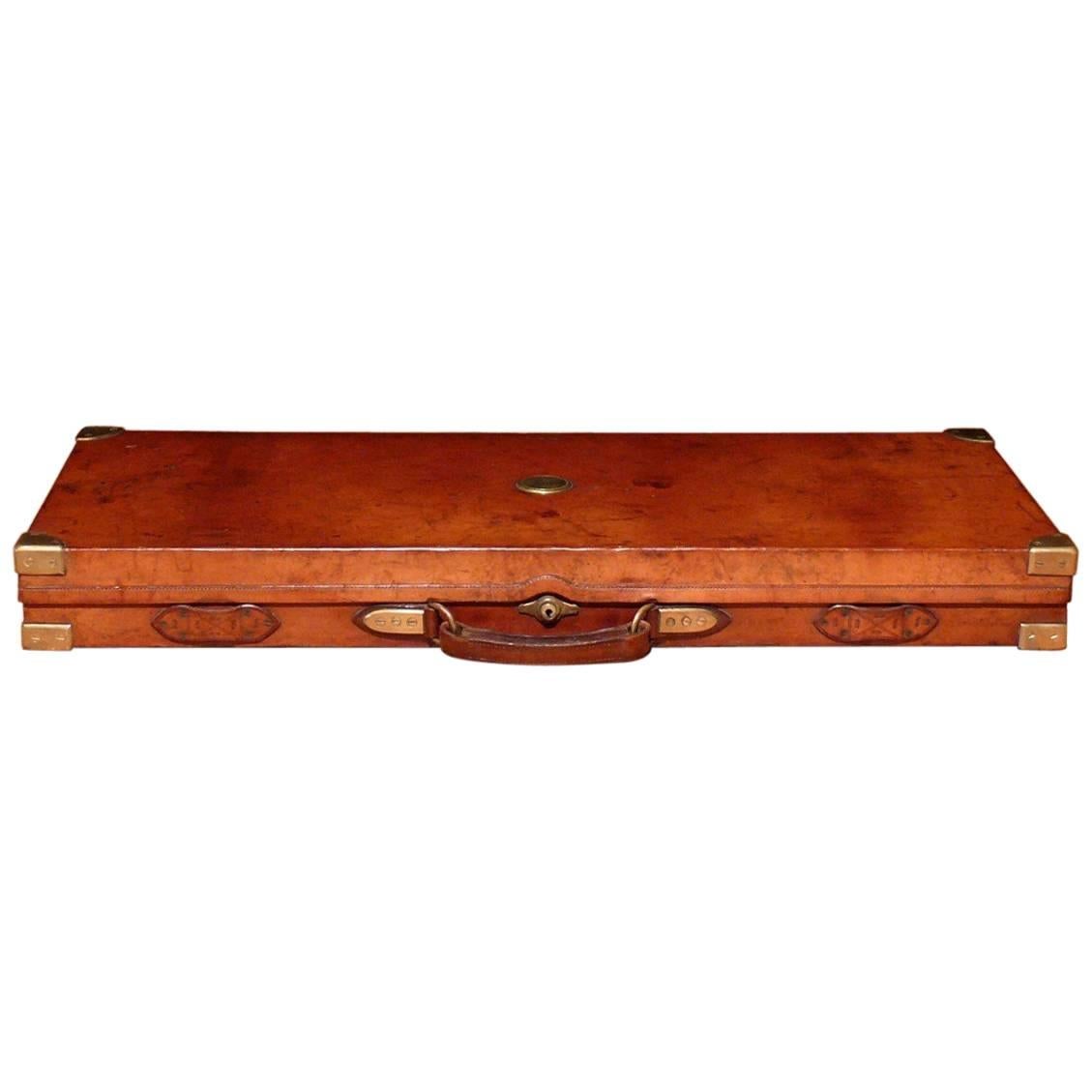
Holland and Holland Leather Double Gun Case, circa 1900
Located in London, GB
A beautiful leather on oak double gun case made to house a pair of side by side double barrel 12 bore shotguns. With original felt lined interior and elabora...
Category
Antique Early 1900s English Arms, Armor and Weapons
Materials
Brass
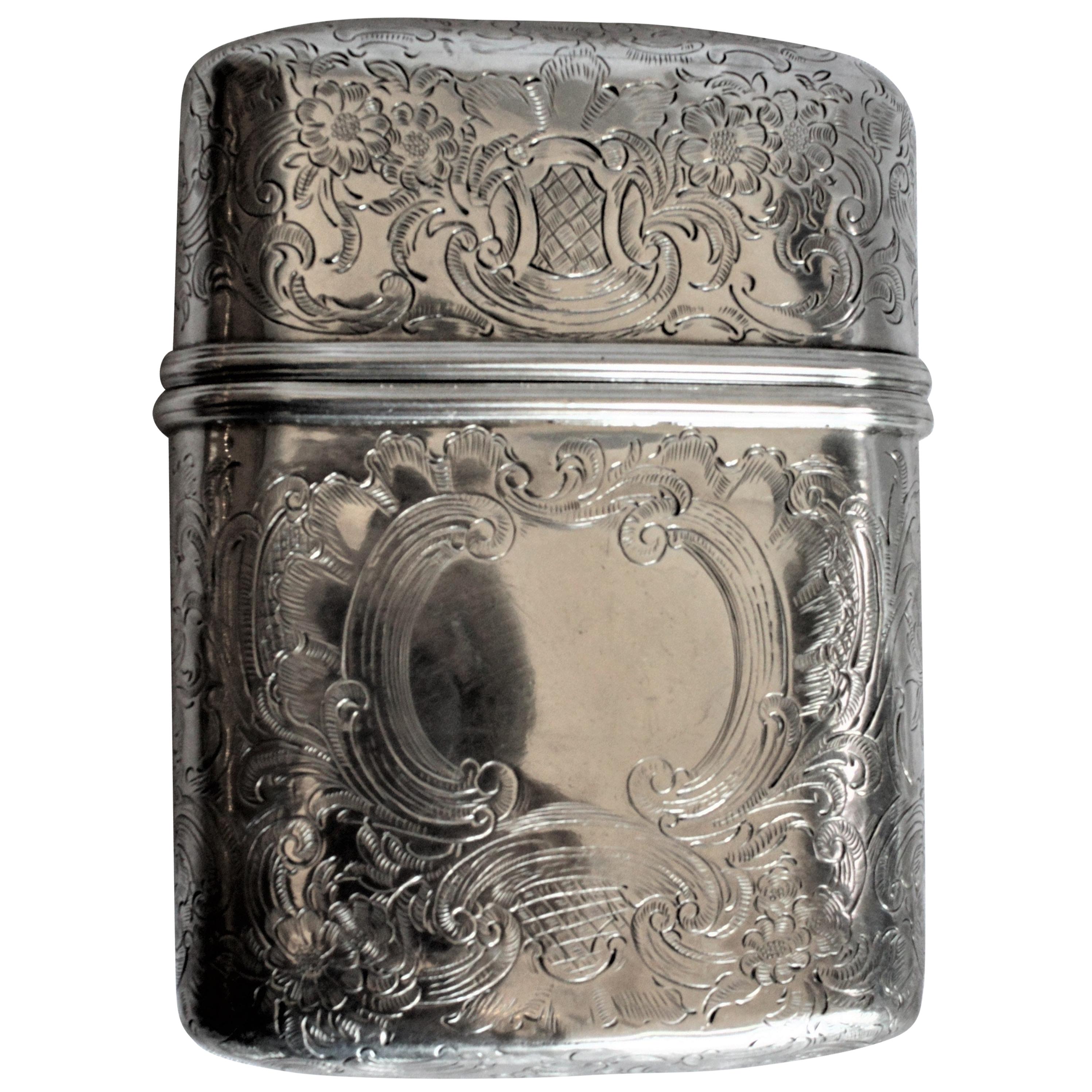
Antique English Georgian Sterling Silver Pocket Cigar Case
Located in Hamilton, Ontario
This sterling silver and intricately engraved cigar case was made in London England in circa 1831, during the reign of King George IV. The top and bottom are both ornately engraved w...
Category
Antique Early 19th Century English George III Tobacco Accessories
Materials
Sterling Silver

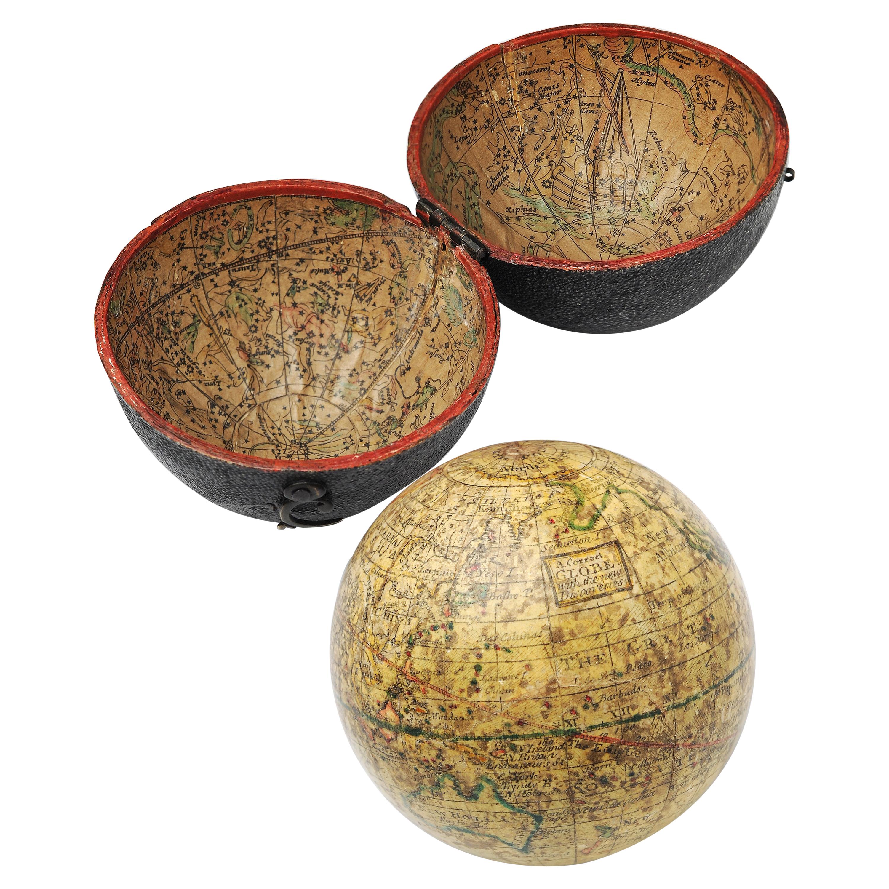
English Pocket Globe, London, Circa 1775-1798
By Herman Moll
Located in Milano, IT
Pocket globe
London, between 1775 and 1798
Re-edition of the globe of Hermann Moll (1678-1732) dated 1719
The globe is contained in its original case, which itself is covered in shark skin.
There are slight gaps in the original paint on the sphere. The case no longer closes.
The sphere measures 2.7 in (7 cm) in diameter whereas the case measures 2.9 in (7.4 cm) in diameter.
lb 0.22 (kg 0.1)
The globe is made up of twelve printed paper gores aligned and glued to the sphere.
In the North Pacific Ocean there is a cartouche with the inscription:
A Correct
Globe
with the new
Discoveries.
The celestial globe is depicted on the inside of the box and is divided into two hemispheres with the cartouche:
A correct globe
with ye new cons
relations of Dr.
Halley & c.
It shows the ecliptic divided into the days of the zodiacal calendar and the constellations represented as animals and mythological figures.
On the globe are delineated the equinoctial line, divided by degrees and hours, the ecliptic and the meridian (passing west of Greenwich). The continents are shaded and outlined in pink, green and yellow. It shows: the Cook routes; a wind rose in the Southern Indian Ocean; Antarctica without land; Africa with Negroland (Hermann Moll is considered the first geographer to name the West African region in his 1727 map. (Encyclopaedia Britannica, ed. 1902, under "States of Central Africa"); Tartary in Central Asia; the Mogul kingdom in northern India; in North America only New England, Virginia, Carolina, Florida, Mississippi are identified; California is already a peninsula; the northwest coast of America is "unknown parts" (Alaska is not described and it is only partially delineated, it was to become part of the United States in 1867); Mexico is named "Spain"; Central South America "Amazone America". Australia (which was to be so named after 1829) is called New Holland. The route of Admiral Anson is traced (1740) and the trade winds are indicated by arrows. (See Van der Krogt, P., Old Globes in the Netherlands, Utrecht 1984, p. 146 and Van der Krogt, P. - Dekker, E., Globes from the Western World, London 1993, pp. 115.)
Elly Dekker, comparing Moll’s 1719 globe and his re-edition (of which the one described above is a sample), identifies the differences between them: the two editions are quite similar to each other, but in the "anonymous" globe, compared to the previous globe of 1719, California looks like a proper peninsula - the reports of the Spanish explorers of the region had given rise to uncertainty over whether it was connected to the mainland or not. The geographical nature of California was confirmed after the explorations of Juan Bautista de Anza (1774-1776). The routes of Dampier's journey were partially erased and the route of Captain James Cook's first voyage was superimposed on them, and the geography of Australasia was adapted accordingly, including the denomination of the Cook Strait. See Dekker, Elly, Globes at Greenwich, 1999.
An important ante quem element is represented by Tasmania: it is not separated from Australia by the Bass Strait...
Category
Antique Late 18th Century English George III Globes
Materials
Shagreen, Paper

Recently Viewed
View AllMore Ways To Browse
Crocodile Cigar Case
Art Deco Cigarette Holder
Smoker Set
Cigarette Machine
Antique Cigar Cutter
High Striker
Ronson Lighter
Flint Lighter
Petrol Lighters Vintage
Dunhill Leather
Antique Wood Cutter
Austria Lighter
Dunhill Silver Lighter
Silver Cigar Cutter
Tobacco Cutter
Cigarette Holder Case
Petrol Lighter
Strike Lighter