Items Similar to Antique Framed Pen and Ink on Fabric Map of Cornwall from Early 19th Century
Want more images or videos?
Request additional images or videos from the seller
1 of 7
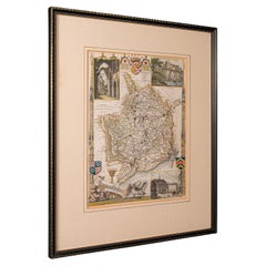
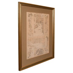
Antique Framed Pen and Ink on Fabric Map of Cornwall from Early 19th Century
$2,475
£1,866.40
€2,158.58
CA$3,472.41
A$3,859.80
CHF 2,023.23
MX$47,137.51
NOK 25,258.80
SEK 23,763.82
DKK 16,110.99
About the Item
This English fabric map of Cornwall, rendered in pen-and-ink, showcases exquisite hand-drawn details and charming faded sepia tones. Encased in a classic frame, this piece elegantly transforms a geographical document into a striking work of art, embodying both aesthetic appeal and historical intrigue.
England, circa 1810
Dimensions: 44.5W x 1D x 30.5H
- Dimensions:Height: 30.5 in (77.47 cm)Width: 44.5 in (113.03 cm)Depth: 1 in (2.54 cm)
- Materials and Techniques:
- Place of Origin:
- Period:
- Date of Manufacture:1810
- Condition:Wear consistent with age and use.
- Seller Location:Los Angeles, CA
- Reference Number:Seller: AN211stDibs: LU797216514592
About the Seller
4.7
Vetted Professional Seller
Every seller passes strict standards for authenticity and reliability
Established in 1989
1stDibs seller since 2004
223 sales on 1stDibs
Typical response time: 2 hours
- ShippingRetrieving quote...Shipping from: Montecito, CA
- Return Policy
Authenticity Guarantee
In the unlikely event there’s an issue with an item’s authenticity, contact us within 1 year for a full refund. DetailsMoney-Back Guarantee
If your item is not as described, is damaged in transit, or does not arrive, contact us within 7 days for a full refund. Details24-Hour Cancellation
You have a 24-hour grace period in which to reconsider your purchase, with no questions asked.Vetted Professional Sellers
Our world-class sellers must adhere to strict standards for service and quality, maintaining the integrity of our listings.Price-Match Guarantee
If you find that a seller listed the same item for a lower price elsewhere, we’ll match it.Trusted Global Delivery
Our best-in-class carrier network provides specialized shipping options worldwide, including custom delivery.More From This Seller
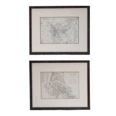
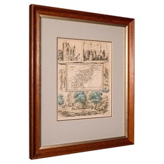
View AllMid 19th Century Pair of Framed English Maps of Oxford and Cambridge
Located in Los Angeles, CA
This pair of maps featuring Oxford and Cambridge is beautifully preserved in custom black wood frames. These hand-drawn maps showcase exquisite lettering and a remarkable level of de...
Category
Antique 19th Century English Victorian Prints
Materials
Paper, Wood
Map of Rome
Located in Los Angeles, CA
A beautifully reproduced antique map of Rome. A work of remarkable lithographic skill and artistry, the work features a delicate yet bold latin he...
Category
2010s American Victorian Drawings
Materials
Wood, Paper
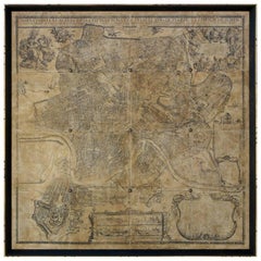
$2,875 / item
"Australia News From Home" Print in Gilt Frame
Located in Los Angeles, CA
This "Australia News From Home" lithograph by the celebrated English printmaker George Baxter exemplifies his mastery of color printing. Mounted in a tasteful gilt beveled frame and ...
Category
Antique 1840s English Prints
Materials
Wood

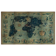
Four Reproduction Vintage Panels of Air France World Map
Located in Los Angeles, CA
Reproduction of beautiful blue and green mid-century Air France world map on four individual panels. The charming illustrations evoke an era of international jet-set style. May be pu...
Category
21st Century and Contemporary French Prints
Materials
Paper, Wood

Four Reproduction Vintage Panels of Air France World Map
Located in Los Angeles, CA
Reproduction of a beautiful green and blue mid-century Air France world map on four individual panels. The charming illustrations evoke an era of international jet-set style. May be ...
Category
21st Century and Contemporary French Prints
Materials
Wood, Paper
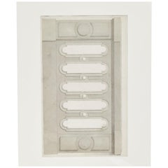
Early 20th Century Charcoal Architectural Drawing from France
Located in Los Angeles, CA
This early 20th-century French architectural study, potentially for a cabinet, door, or wall panel, showcases meticulous craftsmanship and a refined design ethos. Its muted color pal...
Category
Antique Early 1900s French Edwardian Drawings
Materials
Paper
You May Also Like
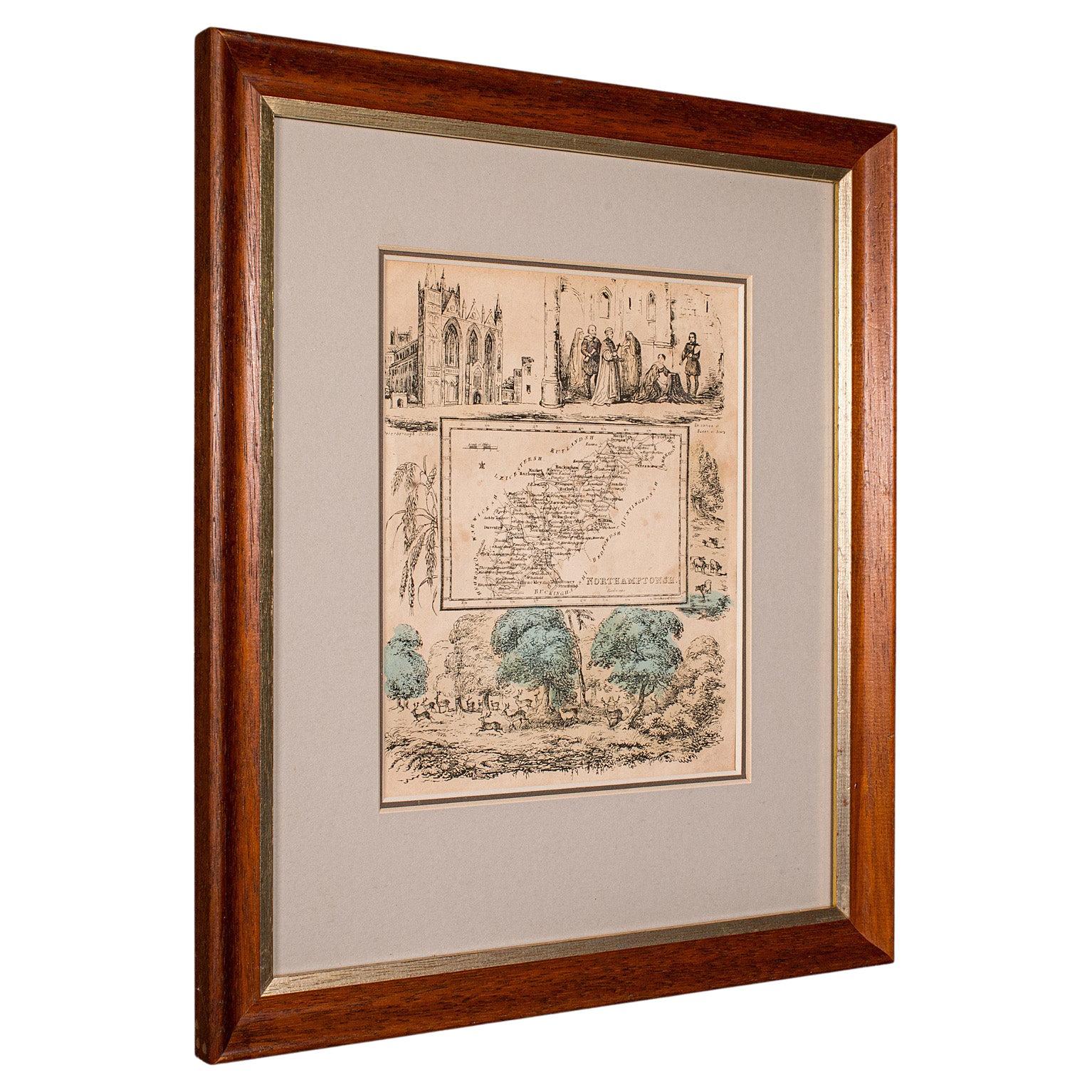
Small Antique County Map, Northamptonshire, English, Framed, Cartography, C.1850
Located in Hele, Devon, GB
This is a small antique county map of Northamptonshire. An English, framed atlas engraving of cartographic interest, dating to the mid 19th century and later.
Superb lithography of...
Category
Antique Mid-19th Century British Victorian Maps
Materials
Paper
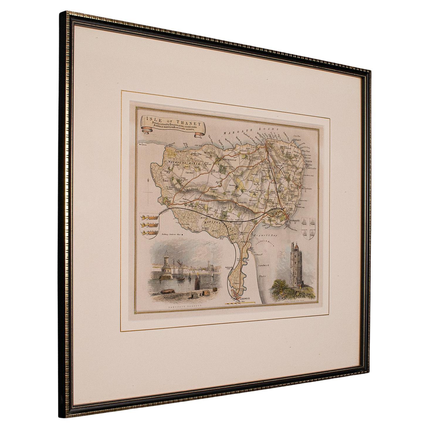
Antique Lithography Map, Isle of Thanet, Kent, English, Cartography, Victorian
Located in Hele, Devon, GB
This is an antique lithography map of The Isle of Thanet in Kent. An English, framed atlas engraving of cartographic interest, dating to the mid 19th century and later.
Superb litho...
Category
Antique Mid-19th Century British Victorian Maps
Materials
Wood

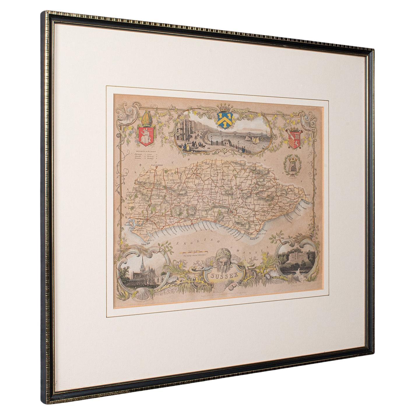
Antique County Map, Sussex, English, Framed Lithography, Cartography, Victorian
Located in Hele, Devon, GB
This is an antique lithography map of Sussex. An English, framed atlas engraving of cartographic interest, dating to the mid 19th century and later.
Superb lithography of Sussex an...
Category
Antique Mid-19th Century British Victorian Maps
Materials
Paper

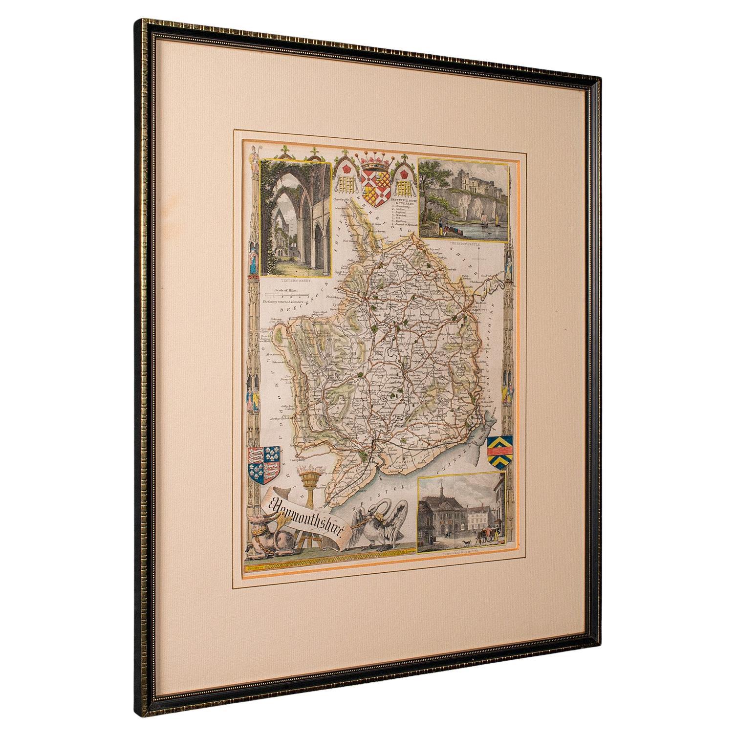
Antique Lithography Map, Monmouthshire, Framed, Welsh Cartography, Victorian
Located in Hele, Devon, GB
This is an antique lithography map of Monmouthshire. An English, framed atlas engraving of cartographic interest, dating to the mid 19th century and later.
Superb lithography of Mo...
Category
Antique Mid-19th Century British Victorian Maps
Materials
Glass, Wood, Paper
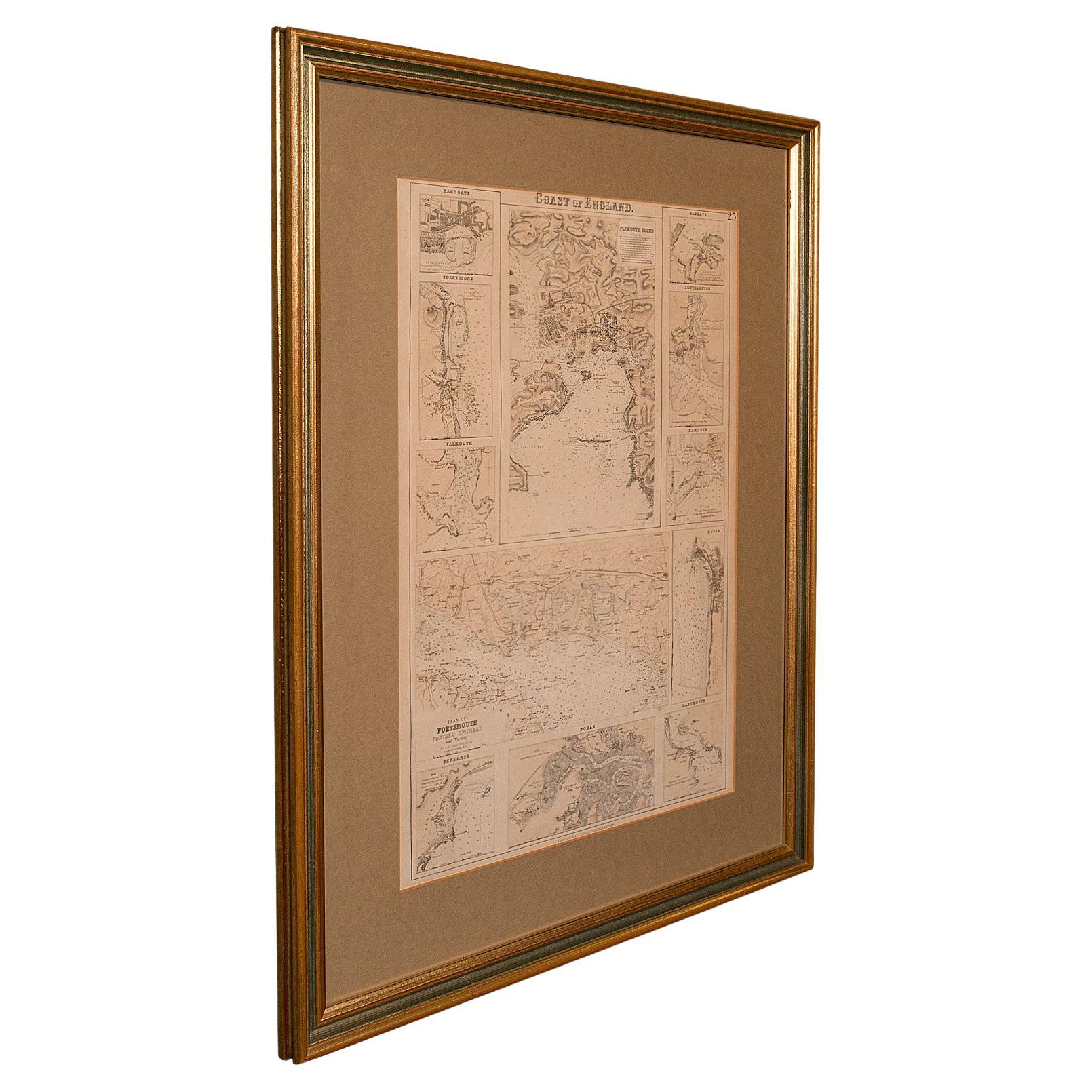
Antique Lithography Map, Coastal England, Framed Cartography Interest, Victorian
Located in Hele, Devon, GB
This is an antique lithography map of Coastal England. A Scottish, framed town engraving of cartographic interest, dating to the early Victorian period and later.
Superb lithograph...
Category
Antique Mid-19th Century British Early Victorian Maps
Materials
Glass, Wood
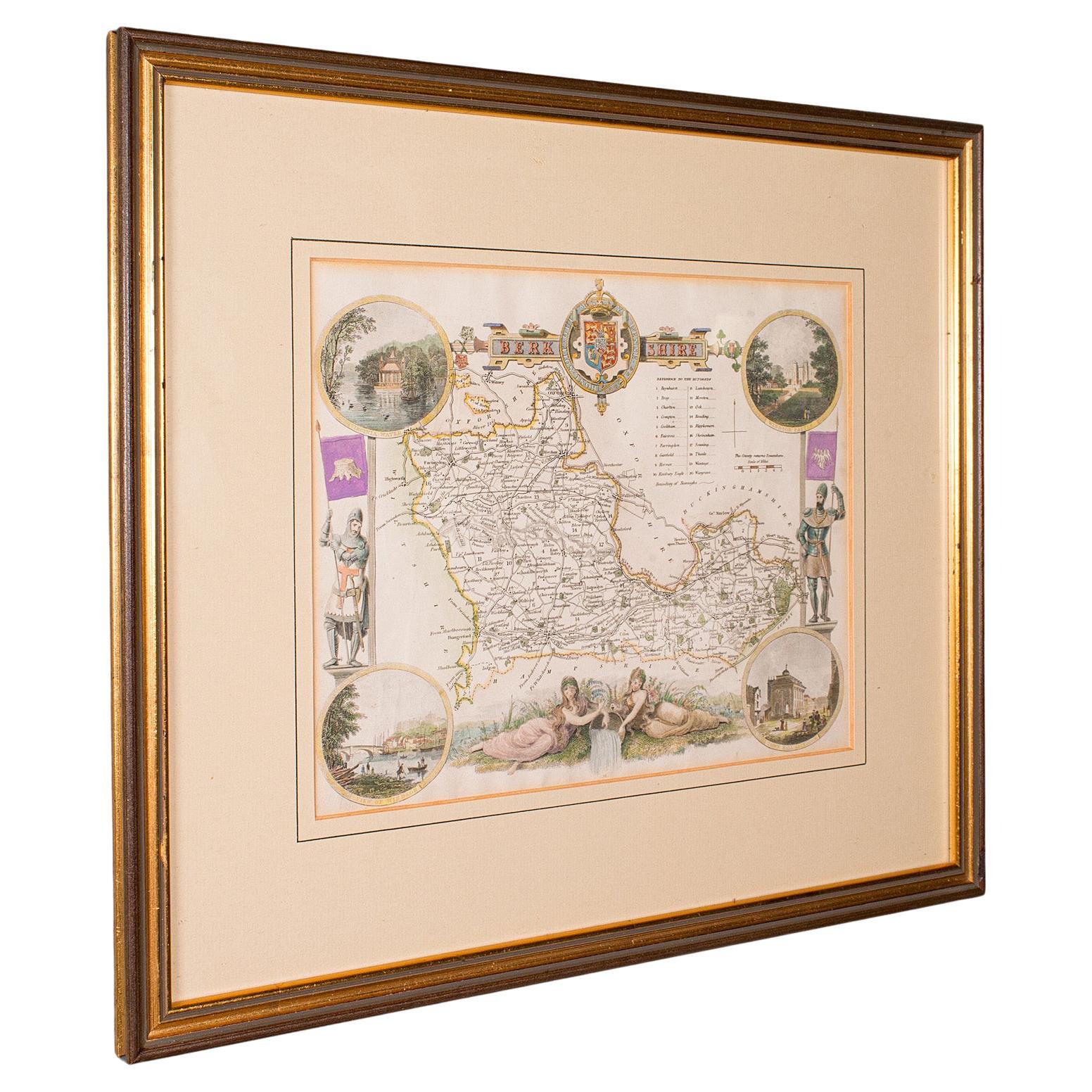
Antique Berkshire Map, English County, Framed Engraving, Cartography, Lithograph
Located in Hele, Devon, GB
This is an antique county map of Berkshire. An English, framed atlas engraving of cartographic interest, dating to the mid 19th century and later.
Superb lithography of Berkshire a...
Category
Antique Mid-19th Century British Victorian Maps
Materials
Glass, Wood, Paper
