Items Similar to Blacks Large Tourist Map of Scotland in Retractable Mahogany Case
Want more images or videos?
Request additional images or videos from the seller
1 of 4
Blacks Large Tourist Map of Scotland in Retractable Mahogany Case
$3,800
£2,870.15
€3,317.07
CA$5,330.08
A$5,928.42
CHF 3,102.81
MX$72,307.17
NOK 38,987.91
SEK 36,673.16
DKK 24,758.73
About the Item
A blacks large tourist map of Scotland in retractable mahogany case.
- Dimensions:Height: 90 in (228.6 cm)Width: 70 in (177.8 cm)Depth: 4 in (10.16 cm)
- Materials and Techniques:Mahogany,Paper
- Place of Origin:
- Period:
- Date of Manufacture:19th Century
- Condition:Wear consistent with age and use.
- Seller Location:Buchanan, MI
- Reference Number:1stDibs: LU81997004393
About the Seller
5.0
Vetted Professional Seller
Every seller passes strict standards for authenticity and reliability
Established in 1985
1stDibs seller since 2006
199 sales on 1stDibs
Typical response time: 1 hour
- ShippingRetrieving quote...Shipping from: Buchanan, MI
- Return Policy
Authenticity Guarantee
In the unlikely event there’s an issue with an item’s authenticity, contact us within 1 year for a full refund. DetailsMoney-Back Guarantee
If your item is not as described, is damaged in transit, or does not arrive, contact us within 7 days for a full refund. Details24-Hour Cancellation
You have a 24-hour grace period in which to reconsider your purchase, with no questions asked.Vetted Professional Sellers
Our world-class sellers must adhere to strict standards for service and quality, maintaining the integrity of our listings.Price-Match Guarantee
If you find that a seller listed the same item for a lower price elsewhere, we’ll match it.Trusted Global Delivery
Our best-in-class carrier network provides specialized shipping options worldwide, including custom delivery.More From This Seller
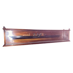
View AllFine 19th Century English Mahogany Schooner Steam Boad Model in Custom Case
Located in Buchanan, MI
Fine 19th century English mahogany schooner steam boad model in custom case. Great attention to detail. This came from a very prominent North Shore Estate.
Would look great displayed...
Category
Antique 19th Century English Adirondack Natural Specimens
Materials
Glass, Mahogany
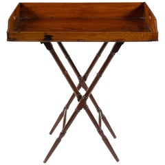
Geo III Mahogany Butlers Tray on Stand, Perfect for a Bar, Great Color, Patina
Located in Buchanan, MI
Geo III mahogany butlers tray on stand, perfect for a bar, great color, patina. Height to surface is 32" and to top of rail 37". Great bar tray or library drink holding tray
Category
Antique 18th Century English George III Carts and Bar Carts
Materials
Mahogany
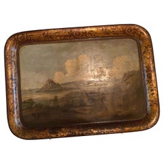
English Regency painted tole tray with a seaside village. Great scale.
Located in Buchanan, MI
An English Regency painted tole tray with a seaside village, great scale and patination.
Would look amazing displayed in a library or office
Category
Antique Early 19th Century English Regency Paintings
Materials
Metal
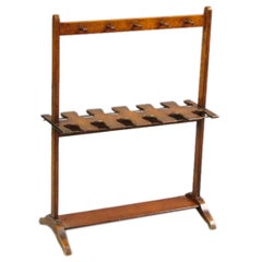
19th Century Mahogany Umbrella Stand, England
Located in Buchanan, MI
19th century mahogany umbrella stand, England.
Category
Antique 19th Century English Umbrella Stands
Materials
Mahogany
Engraving Depicting 16th Century Map of Terra Sancta
Located in Buchanan, MI
Abraham Ortelius (Flemish, 1527-1598) Terra Sancta.
Engraving depicting 16th century map of Terra Sancta. Site 15" x 19.5.
Category
Antique 18th Century and Earlier Maps
Materials
Paper

A George III Mahogany Bookcase, Great For Display And Storage. Nice Patina.
Located in Buchanan, MI
A George III Mahogany Bookcase, Two Glazed Doors Over Two Drawers Over Two Doors. Great For Display And Storage.
19th Century
Height 83 x width 44 1/4 x depth 15 1/2 inches. Base m...
Category
Antique 19th Century English George III Cabinets
Materials
Mahogany
You May Also Like
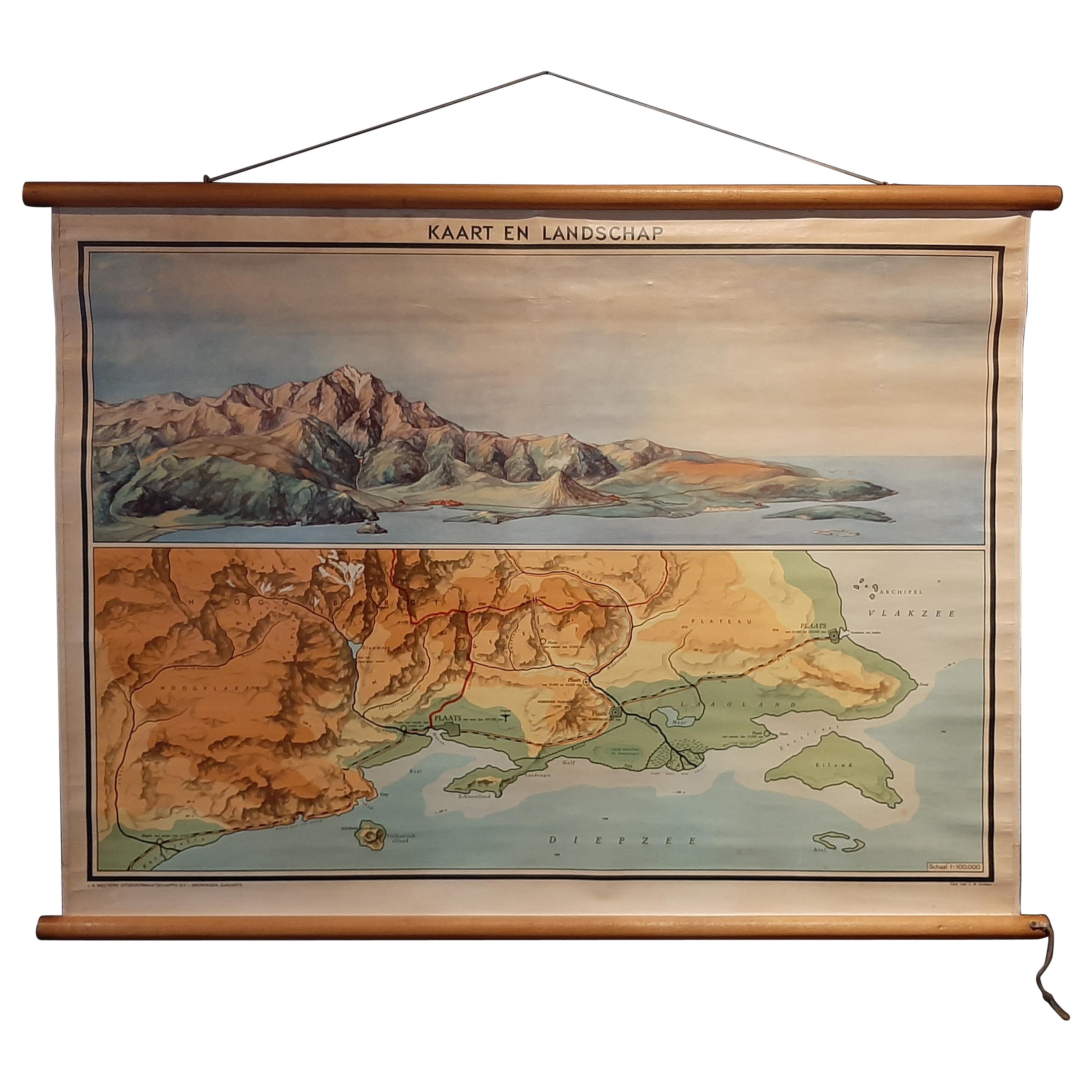
Vintage Wall Chart of a Landscape and Geographic Map, circa 1955
Located in Langweer, NL
Vintage wall chart titled 'Kaart en Landschap'. This wall chart shows a mountain range and geographic map. Published by J.B. Wolters, circa 1955.
Category
Mid-20th Century Prints
Materials
Paper

$572 Sale Price
20% Off
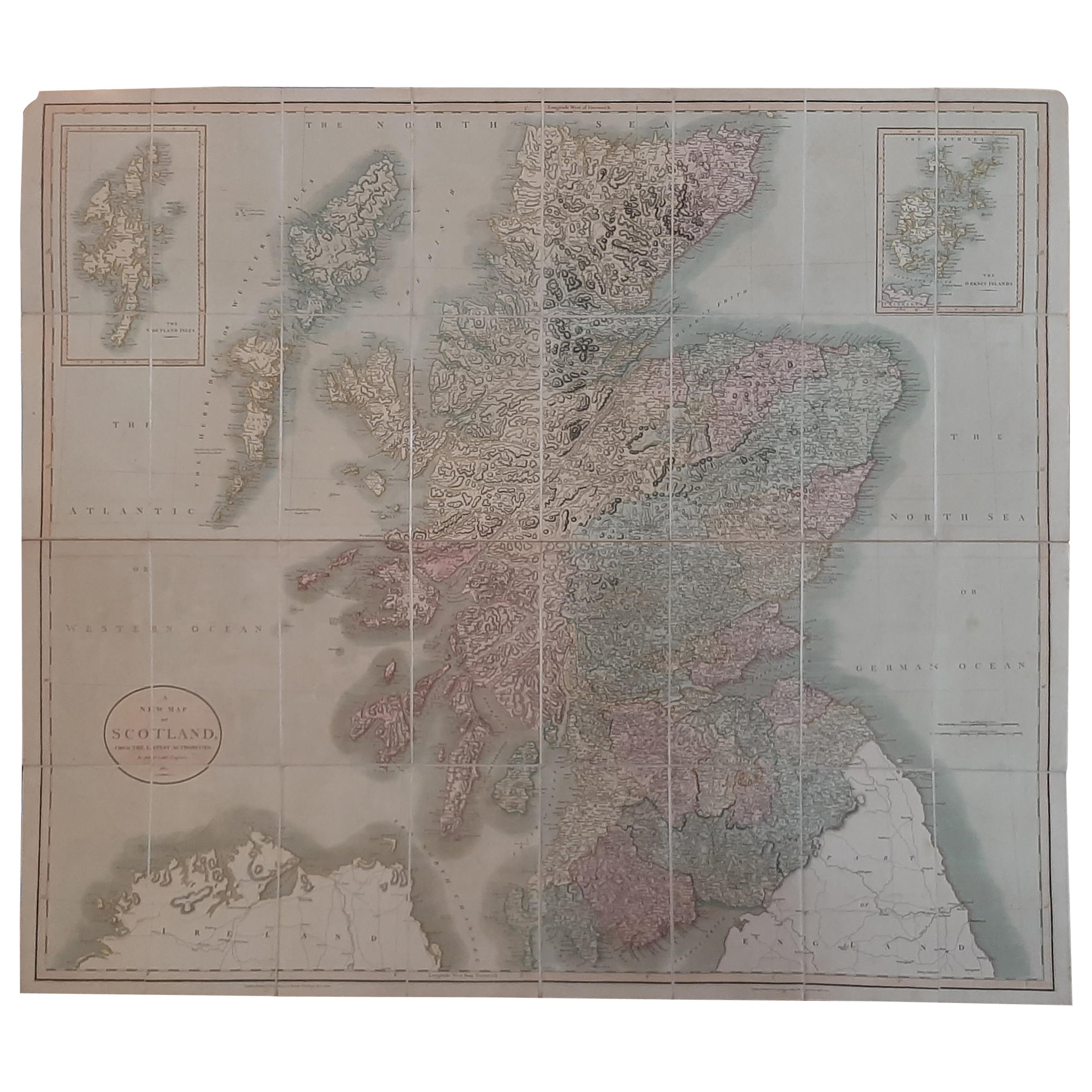
Antique Map of Scotland by Cary, '1811'
Located in Langweer, NL
Antique map titled 'A New Map of Scotland from the Latest Authorities':
**Title**: A New Map of Scotland from the Latest Authorities
**Publisher**: J....
Category
Antique Early 19th Century Maps
Materials
Linen, Paper

$762 Sale Price
20% Off
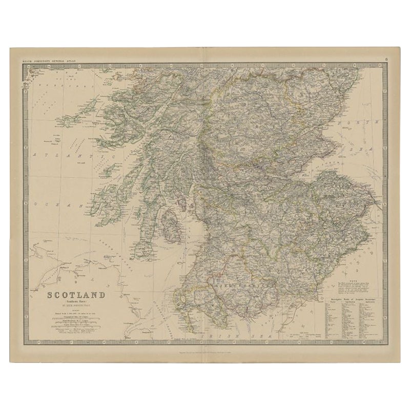
Antique Map of Southern Scotland by Johnston, 1882
Located in Langweer, NL
"Antique map titled 'Scotland'. Old map of Southern Scotland. This map originates from 'The Royal Atlas of Modern Geography, Exhibiting, in a Series of Entirely Original and Authenti...
Category
Antique 19th Century Maps
Materials
Paper
$128 Sale Price
20% Off
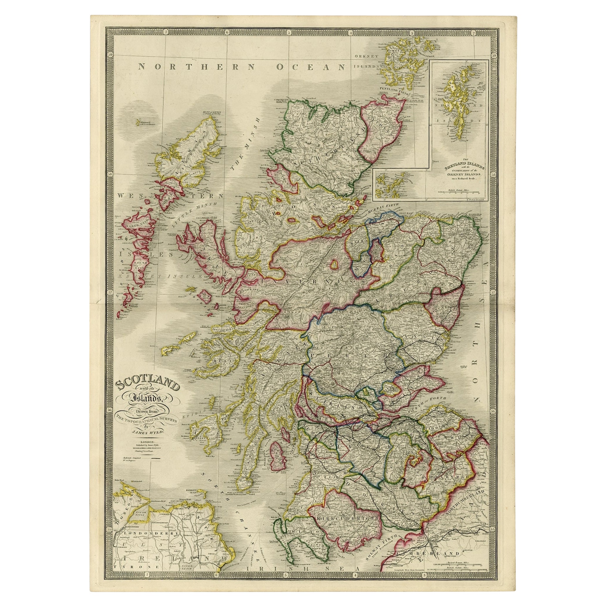
Antique Map of Scotland With an Inset Map of the Shetland Islands, 1854
Located in Langweer, NL
Stunning Map of Scotland that will look beautiful in any setting framed on the wall.
Description: Large Antique map titled 'Scotland with its Islands, drawn from the Topographical surveys...
Category
Antique 1850s Maps
Materials
Paper

$1,191 Sale Price
20% Off
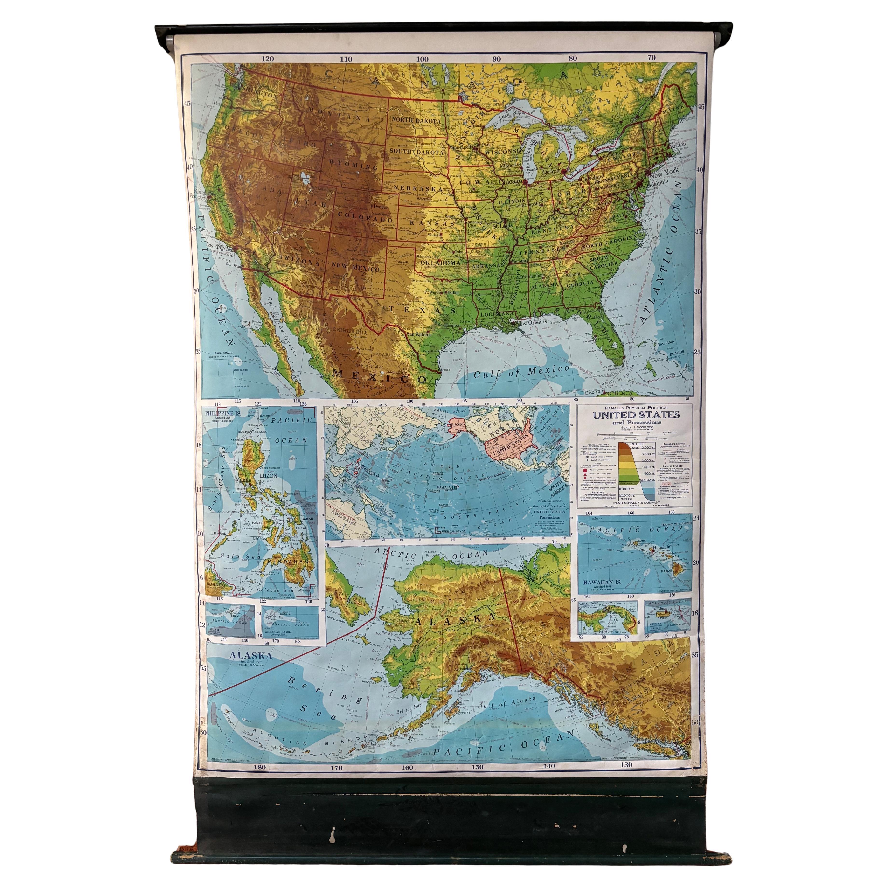
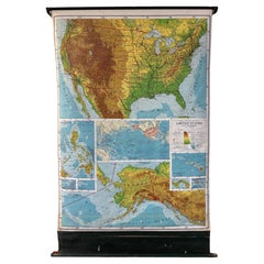
United States 50’s Roll Up Map
Located in Philadelphia, PA
United States Roll Up Map. In nice original condition. Roll-up Function even works! Great Colors! Some losses to edges, canvas backing shows edge wear.
Category
Vintage 1950s American Mid-Century Modern Posters
Materials
Metal
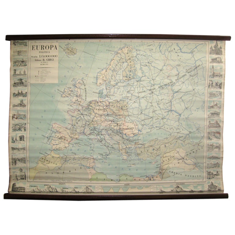
Map of Europe
Located in Los Angeles, CA
28 cities capitol drawings around the border of this Europe political map.
Category
Vintage 1950s Italian Mid-Century Modern Prints
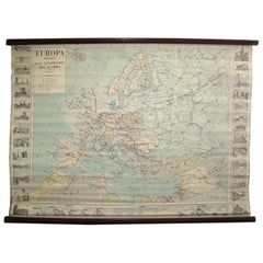
$500
More Ways To Browse
Map Case
Antique Map Case
Vintage Andre Agassi Poster
Vintage Nike Posters
When Harry Met Sally
Where Eagles Dare Poster
Willsons Leicester
Xanti Schawinsky
Alice Soulie
Alvin Ailey Poster
Alvin Cohen
Antique Motor Scooters
Bicycle Thief
Cbgb Club Flyer
Chagall Mermaid
Champagne Billecart
Chapeaux Mossant Poster
Charles Matton