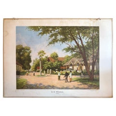
Collection of 8 Vintage School Charts of Indonesia, Early 20th Century
View Similar Items


Want more images or videos?
Request additional images or videos from the seller
1 of 9
Collection of 8 Vintage School Charts of Indonesia, Early 20th Century
About the Item
- Dimensions:Height: 29.53 in (75 cm)Width: 41.34 in (105 cm)Depth: 3.94 in (10 cm)
- Sold As:Set of 8
- Materials and Techniques:
- Place of Origin:
- Period:
- Date of Manufacture:1927
- Condition:Please study items carefully. A few have water damage or moisture spots and scratches, mostly in the margin outside the image. Corners often rubbed.
- Seller Location:Langweer, NL
- Reference Number:1stDibs: LU3054325946332
About the Seller
5.0
Platinum Seller
These expertly vetted sellers are 1stDibs' most experienced sellers and are rated highest by our customers.
Established in 2009
1stDibs seller since 2017
1,932 sales on 1stDibs
More From This SellerView All
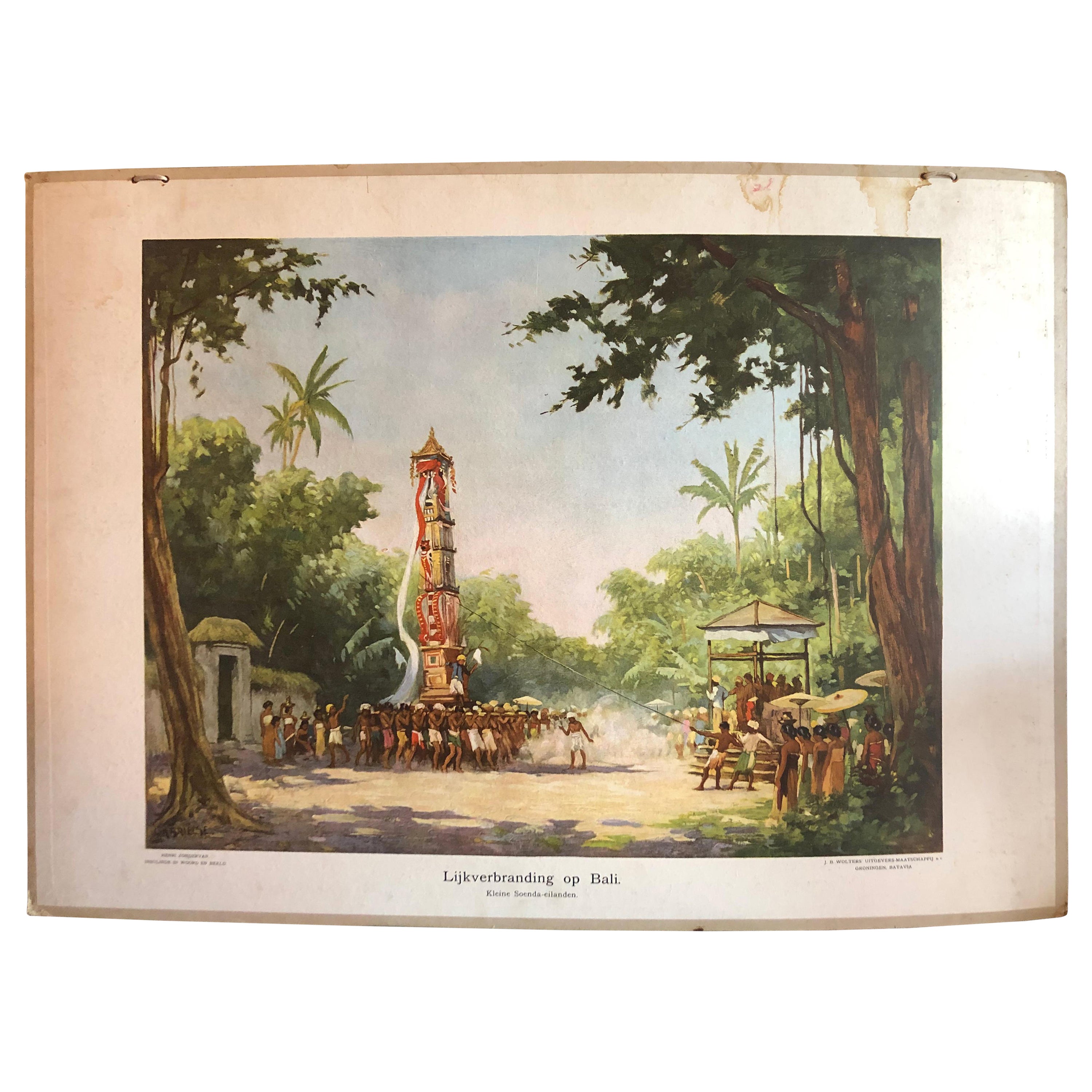
- Collection of 5 Vintage School-Charts of Indonesia, Incl Bali Ritual CremationLocated in Langweer, NLCollection of Old School Posters on cardboard of the early 20th century. Most of the images are still intact with bright colours, but the outer marg...Category
Early 20th Century Dutch Historical Memorabilia
MaterialsPaper
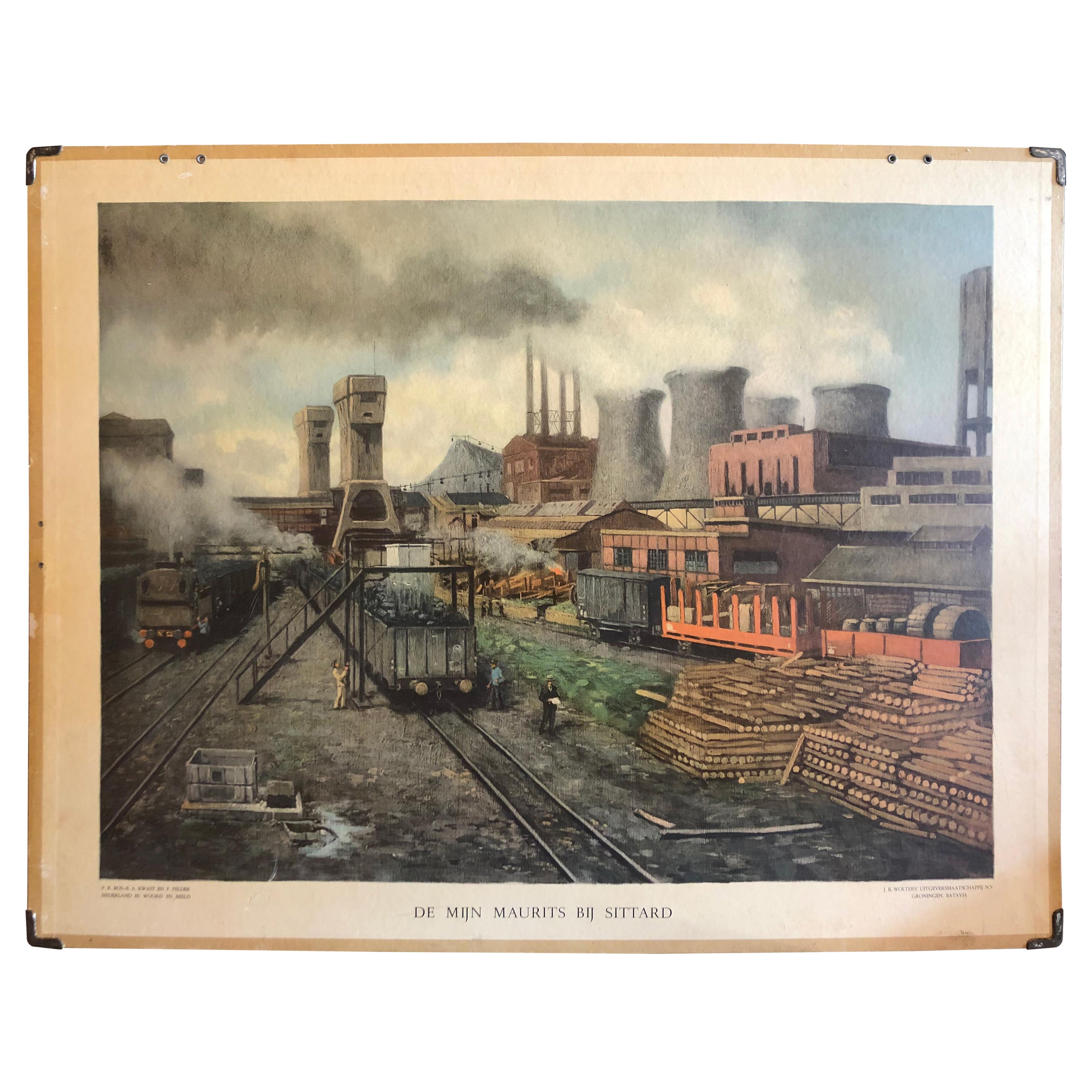
- Vintage School Chart of Coal Mining Operation Plus Cross Section on Verso, 1931Located in Langweer, NLTitle: De Mijn Maurits bij Sittard (The Maurits Mine near Sittard). On the verso 'Doorsnede van een kolen mijn in Limburg'. Translated: Cross Section of a Coalmine in Limburg (a province in the South of The Netherlands). Sittard is a city in the province of Limburg, in the south of Holland. In 1947 this coal mine was connected to another mine: the Emma Mine, by a 13 km straight tunnel. In the second half of the 1940s and in the 1950s the mine was expanded, and mining reached a depth of 810 m. A third shaft was completed in 1958. At the time of completion of the third shaft, the Maurits mine was the largest two-shafts mine in the world. It was the largest coal mine in the Netherlands. When in the beginning of the 1960s the economic tide for coal mining...Category
Early 20th Century European Posters
MaterialsOther
- Vintage Wall Chart of Balikpapan 'Indonesia'Located in Langweer, NLVintage wall chart titled 'Balikpapan'. View of Balikpapan, a seaport city in East Kalimantan, Indonesia. Published circa 1920. The vintage wall ch...Category
Early 20th Century Prints
MaterialsPaper
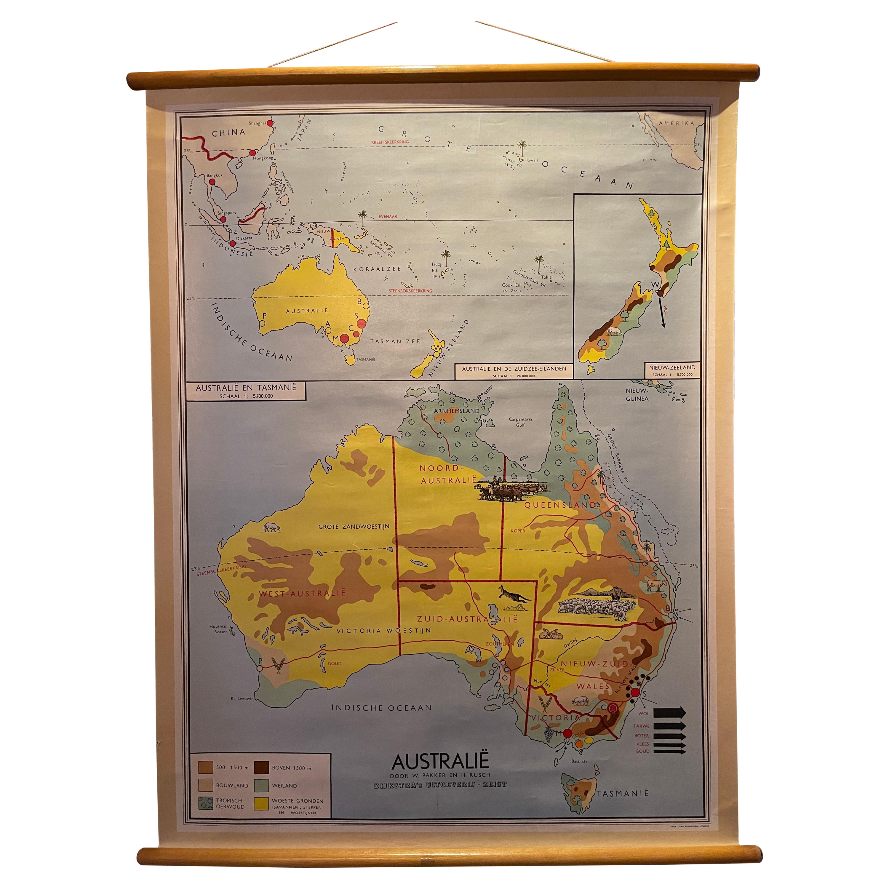
- Decorative Vintage Print, Dutch Chart of Australia, 1st Edition, 1952Located in Langweer, NLThe vintage school chart of Australia titled "Australië," created by W. Bakker & H. Rush and published in 1952: **Title**: Australië **Creators**: W. Bakker & H. Rush **Publication ...Category
Mid-20th Century European Maps
MaterialsCanvas
 $307 Sale Price20% Off
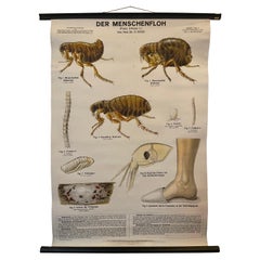
 - Vintage School Chart, a German Poster Depicting the Human Flea, Early 1900'sLocated in Langweer, NLThis school chart has been made by Dr. Schlüter & Dr. Mass. The German title of this poster is "Der Menschenfloh" Von Prof. Dr. A. Hase. Verlag von Paul Parey in Berlin. Early 1900's...Category
Early 20th Century European Posters
MaterialsLinen
- Early French Nautical Chart of the Northern Coast of of Java, Indonesia, C.1850Located in Langweer, NLAntique map titled Carte de la côte Nord de Java. Early French nautical chart of the northern coast of the island of Java, Indonesia. It includes Ci...Category
Antique 1850s Maps
MaterialsPaper


You May Also Like
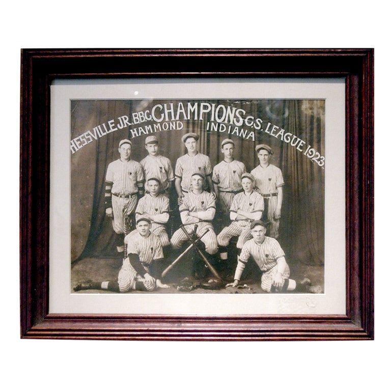
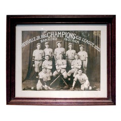
- COLLECTION OF EARLY 20TH CENTURY SPORTING PHOTO'SLocated in Buchanan, MICOLLECTION OF EARLY 20TH CENTURY SPORTING PHOTO'S BELIEVE THAT THESE ARE REPRINTSCategory
Early 20th Century American Photography
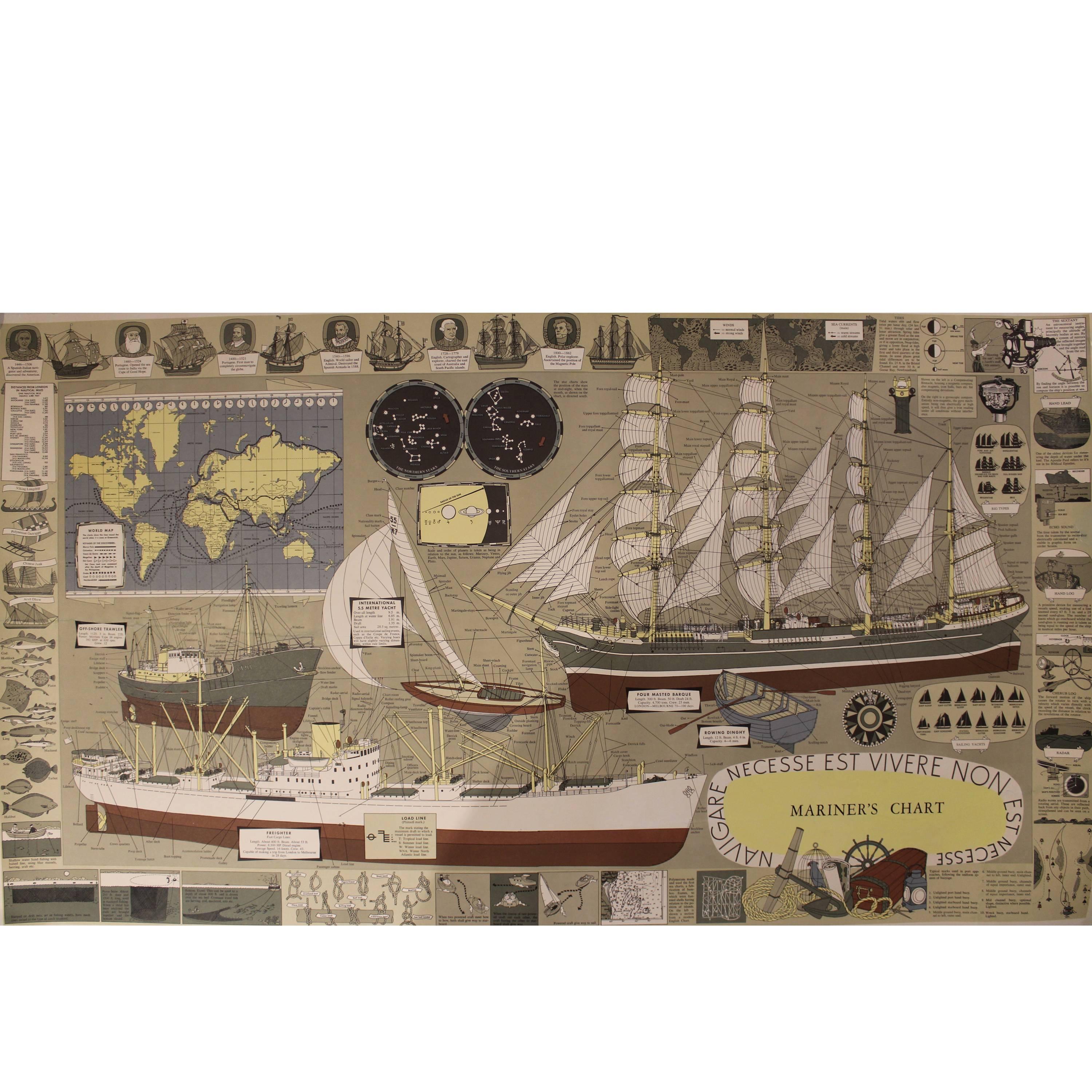
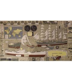
- Mariner's Chart PosterLocated in Hamilton, OntarioMariner's chart poster (nautical).Category
20th Century Posters
 $1,795 Sale Price20% Off
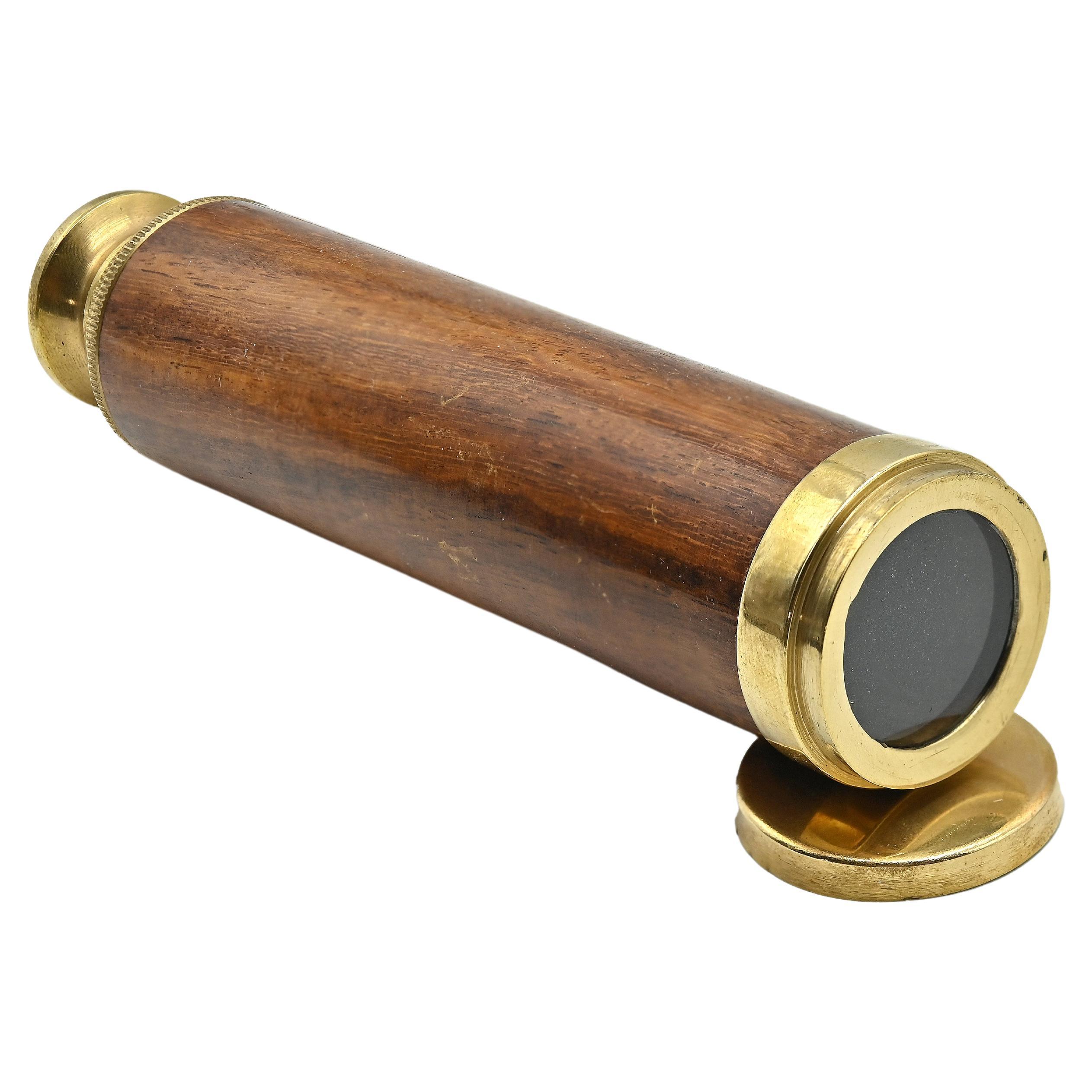
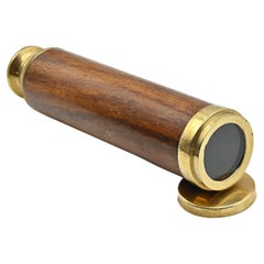
 - Vintage Telescope, Early 20th CenturyLocated in Roma, ITVintage Telescope is a scientific object realized in the early 20th Century. A bronze telescope with glass lenses and wooden grip, close up. Don't ...Category
Early 20th Century Italian Historical Memorabilia
MaterialsBronze
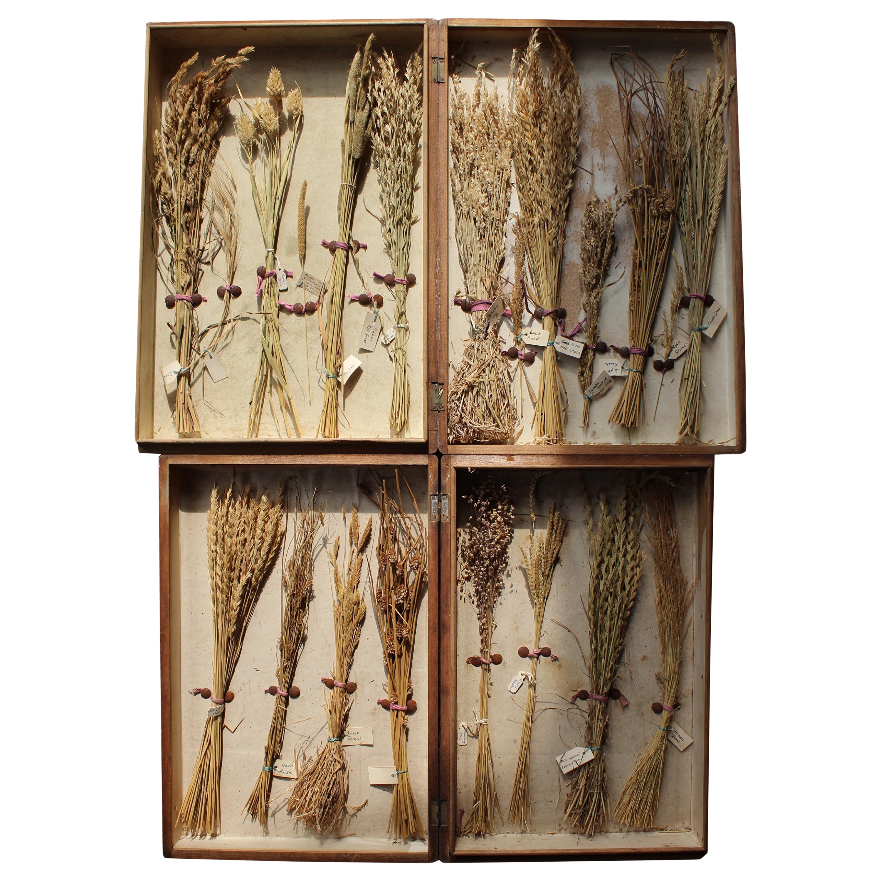
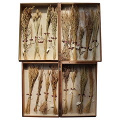
- Early 20th Century Edwardian Collection of Herbarium Grass SpecimensLocated in Lowestoft, GBA rare collection of early 20th century herbarium grass specimens, each example has its original hand written label and sits decoratively within its pine display case. Age related f...Category
Early 20th Century English Edwardian Taxidermy
MaterialsNatural Fiber, Pine
- Large University Chart “Physical Map of Africa” by BaconLocated in Chillerton, Isle of WightLarge university chart “Physical Map of Africa” by Bacon W&A K Johnston’s Charts of Physical Maps By G W Bacon, This is colorful Physical map of North America, it is large lithograph set...Category
Early 20th Century Folk Art Posters
MaterialsLinen
- Large University Chart “Political Map of North America” by BaconLocated in Chillerton, Isle of WightLarge University Chart “Political Map of North America” by Bacon W&A K Johnston’s Charts of Physical Maps By G W Bacon, This is colourful Physical map ...Category
Early 20th Century American Empire Posters
MaterialsLinen


Recently Viewed
View AllMore Ways To Browse
Antique School Chart
Indonesia Poster
Vintage Poster Indonesia
Original James Bond Vintage Posters
Horse Racing Vintage
Dees Used Furniture
Educational School Poster
United Kingdom Vintage Flag
Used Nightclub Furniture
Anatomy Chart
Plate Advertising
Star Wars Retro Movie Poster
Retro Skis For Decoration
Vintage Shoe Posters
Australia Vintage Travel Poster
Australian Vintage Travel Posters
French Poster Bicycle
Vintage James Bond Posters