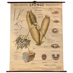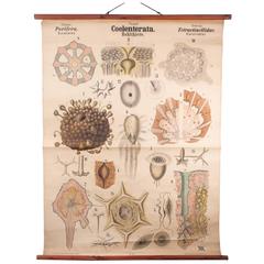
Antique 19th Century Wall Chart by Rudolf Leuckart, Coelenterata, Sea Sponges
View Similar Items


1 of 8
Antique 19th Century Wall Chart by Rudolf Leuckart, Coelenterata, Sea Sponges
About the Item
- Creator:Rudolf Leuckart (Author)
- Dimensions:Height: 58.27 in (148 cm)Width: 42.52 in (108 cm)Depth: 1.19 in (3 cm)
- Materials and Techniques:
- Place of Origin:
- Period:
- Date of Manufacture:circa 1880
- Condition:Wear consistent with age and use.
- Seller Location:Vienna, AT
- Reference Number:1stDibs: LU166523944243
You May Also Like
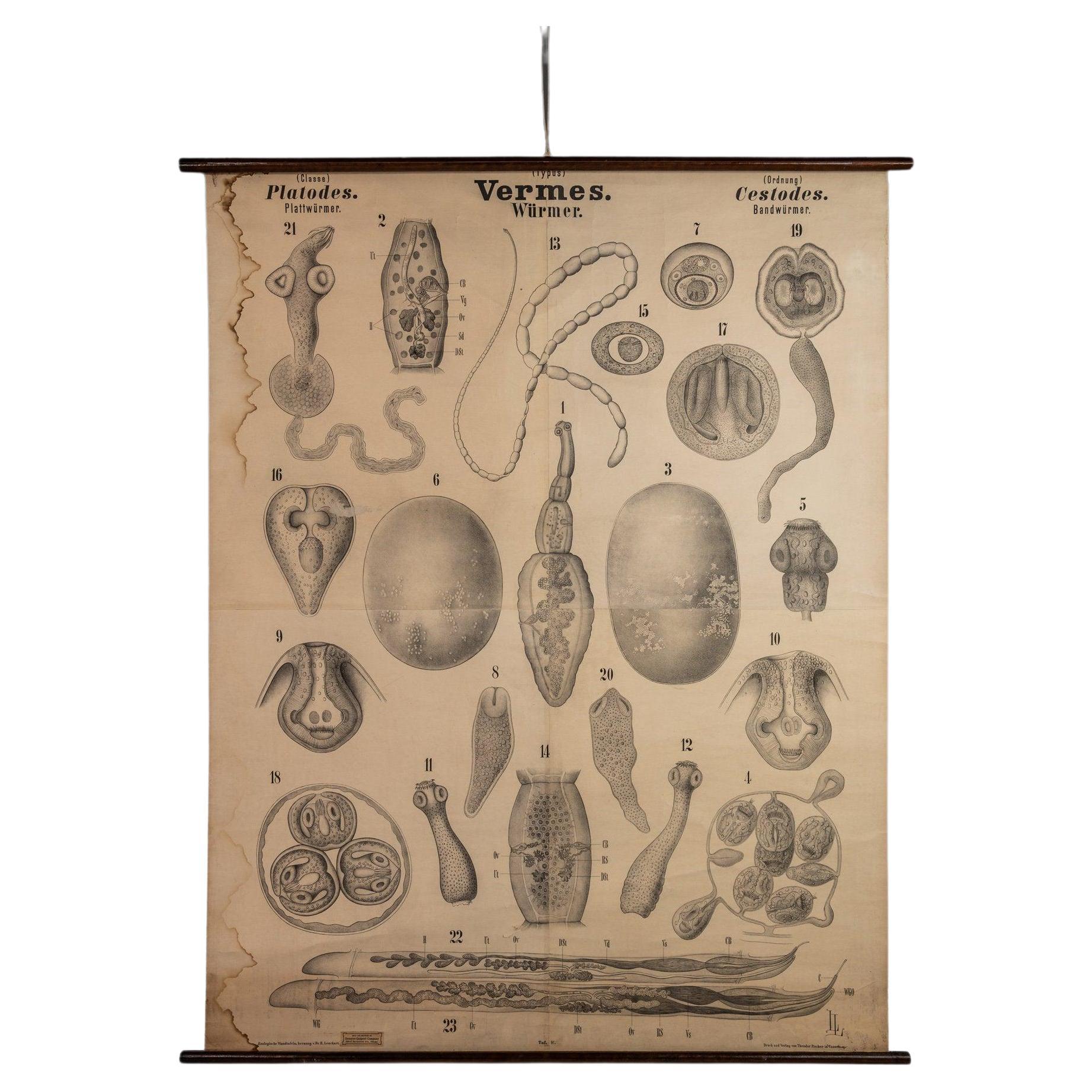
- Antique "Würmer" Worm Wall Chart by Rudolf Leuckart, 1885By Rudolf LeuckartLocated in Deland, FLRudolf Leuckart (1822 - 1898) was a German zoologist and a professor of comparative anatomy and physiology at the University of Greifswald (today: University of Greifswald). He is re...Category
Antique Late 19th Century German Victorian Posters
MaterialsPaper
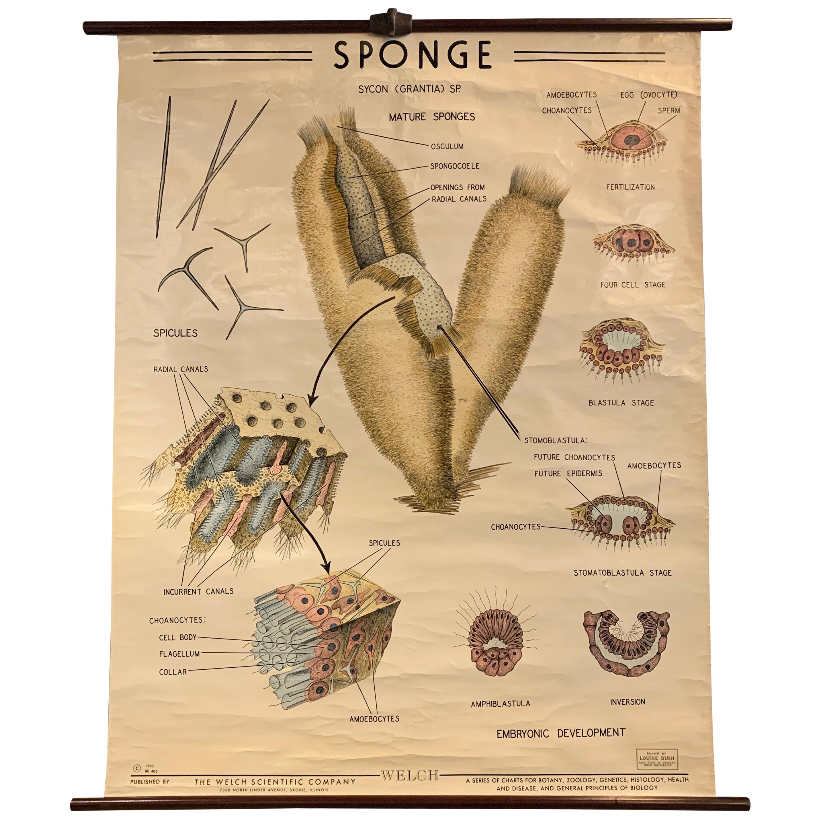
- Educational Zoological Marine Sponge Wall Chart, The Welch Scientific CompanyBy Sargent Welch Scientific CompanyLocated in Brooklyn, NYEducational, scientific, zoological, wall chart depicting the anatomy of marine sponges beautifully illustrated by Louise Bush, Assistant Professor of Zoology, Drew University for Th...Category
Mid-20th Century American Industrial Prints
MaterialsCanvas, Wood
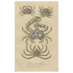
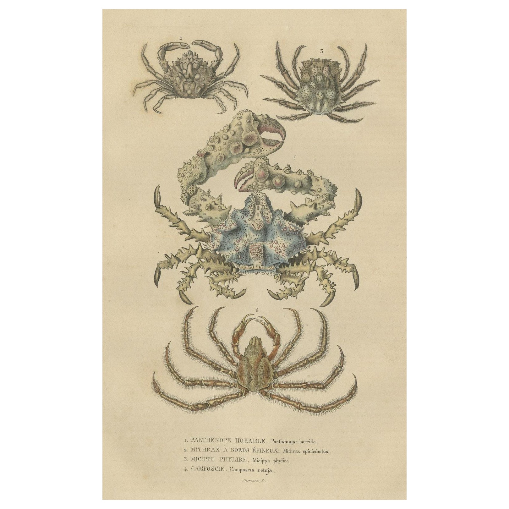
- 19th Century Antique Handcolored Print of Different Sea Crabs, 1845Located in Langweer, NLThese original hand-colored antique engravings by Pierre Auguste Joseph Drapiez offer a captivating glimpse into the world of marine life. Created with intricate detail and vibrant c...Category
Antique 1840s Prints
MaterialsPaper
- Antique Sea Chart of North America by Ottens, circa 1745Located in Langweer, NLAntique map titled 'Septemtrionaliora Americae a Groenlandia (..)'. Sea chart of the northern waters of North America, including the coast of Labrador and pa...Category
Antique Mid-18th Century Maps
MaterialsPaper

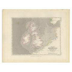
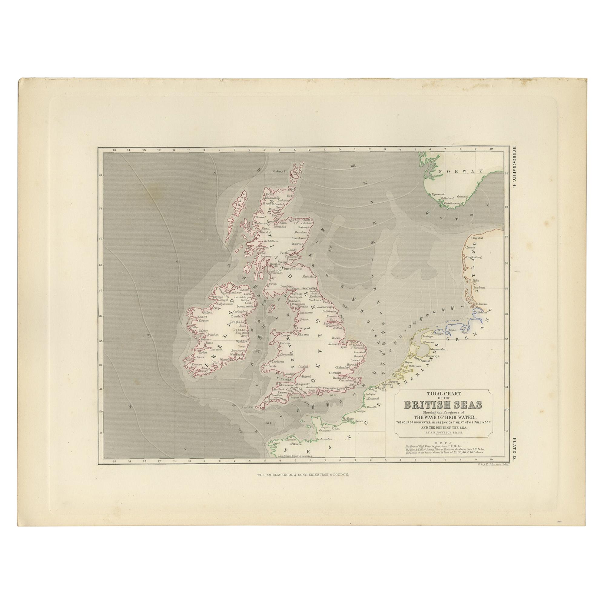
- Antique Tidal Chart of the British Seas by Johnston, '1850'Located in Langweer, NLAntique map titled 'Tidal Chart of the British Seas showing the progress of the wave of high water'. Original antique tidal chart of the British Seas. This map originates from 'The P...Category
Antique Mid-19th Century Maps
MaterialsPaper
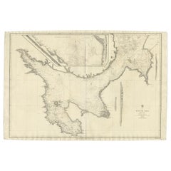
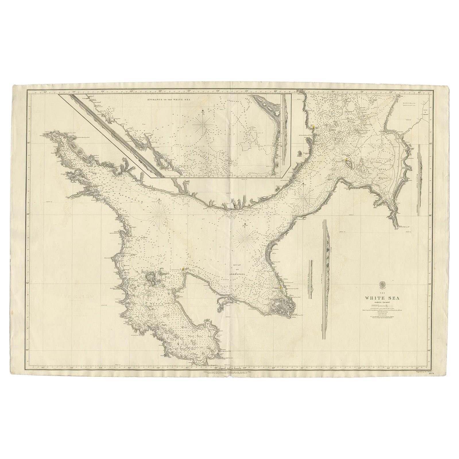
- Large Antique Chart of The White Sea, Russa 1854Located in Langweer, NLAntique map titled 'The White Sea Index Chart'. Large uncommon map of the White Sea with a smaller inset map of the entrance to the White Sea. The white sea is a southern inlet of th...Category
Antique 19th Century Maps
MaterialsPaper