Items Similar to Antique Engraving of Circus Flaminius, a Circular Area in Ancient Rome, 1704

Want more images or videos?
Request additional images or videos from the seller
1 of 5
Antique Engraving of Circus Flaminius, a Circular Area in Ancient Rome, 1704
$181.02
$226.2820% Off
£134.80
£168.4920% Off
€152
€19020% Off
CA$247.97
CA$309.9620% Off
A$276.51
A$345.6420% Off
CHF 144.27
CHF 180.3420% Off
MX$3,392.89
MX$4,241.1120% Off
NOK 1,836.34
NOK 2,295.4320% Off
SEK 1,739.90
SEK 2,174.8720% Off
DKK 1,157.12
DKK 1,446.4020% Off
Shipping
Retrieving quote...The 1stDibs Promise:
Authenticity Guarantee,
Money-Back Guarantee,
24-Hour Cancellation
About the Item
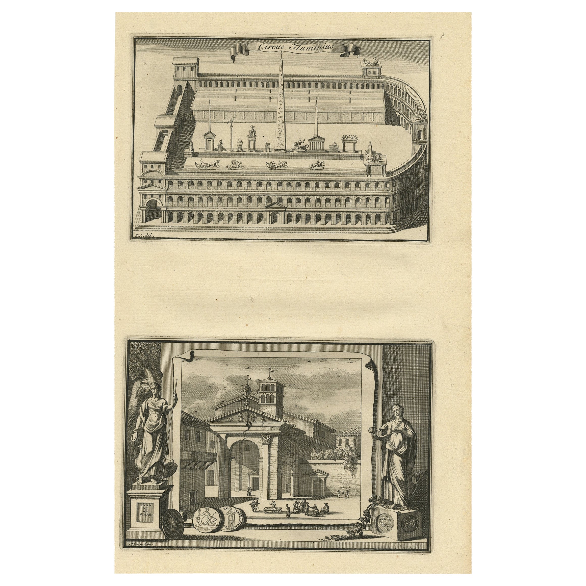
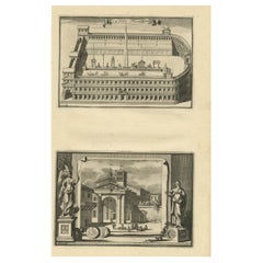
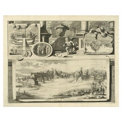
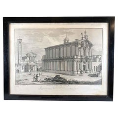
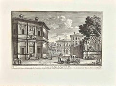
Description: Antique print, titled: 'Circus Flaminius (…)' -
This original old antique print shows a reconstruction of Circus Flaminius, a large, circular area in ancient Rome, located in the southern end of the Campus Martius near the Tiber River, Rome, Italy. Below another view of Rome. This original old antique print / plate originates from: 'Beschryving van Oud en Nieuw Rome. Verdeelt in drie Deelen. In 't Fransch beschreven door den Heer Francois Desseine. En in 't Nederduitsch vertaalt.', by Francois Desseine and published by Francois Halma in 1704, first published in French in 1690. Copies of this work are rarely complete as the maps and engravings are of high quality matching the work of Piranesi.
Artists and Engravers: Made by an anonymous engraver after 'Jan Goeree'.
Condition:
Good, given age. General age-related toning and/or occasional minor defects from handling. Please study scan carefully.
- Dimensions:Height: 14.18 in (36 cm)Width: 9.22 in (23.4 cm)Depth: 0 in (0.02 mm)
- Materials and Techniques:
- Period:1700-1709
- Date of Manufacture:1704
- Condition:
- Seller Location:Langweer, NL
- Reference Number:Seller: PCT-61839 1stDibs: LU3054326672932
About the Seller
5.0
Recognized Seller
These prestigious sellers are industry leaders and represent the highest echelon for item quality and design.
Platinum Seller
Premium sellers with a 4.7+ rating and 24-hour response times
Established in 2009
1stDibs seller since 2017
2,490 sales on 1stDibs
Typical response time: <1 hour
- ShippingRetrieving quote...Shipping from: Langweer, Netherlands
- Return Policy
Authenticity Guarantee
In the unlikely event there’s an issue with an item’s authenticity, contact us within 1 year for a full refund. DetailsMoney-Back Guarantee
If your item is not as described, is damaged in transit, or does not arrive, contact us within 7 days for a full refund. Details24-Hour Cancellation
You have a 24-hour grace period in which to reconsider your purchase, with no questions asked.Vetted Professional Sellers
Our world-class sellers must adhere to strict standards for service and quality, maintaining the integrity of our listings.Price-Match Guarantee
If you find that a seller listed the same item for a lower price elsewhere, we’ll match it.Trusted Global Delivery
Our best-in-class carrier network provides specialized shipping options worldwide, including custom delivery.More From This Seller
View AllCircus Flaminius (..), Anonymous, 1704
Located in Langweer, NL
Antique print, titled: 'Circus Flaminius (?)' - This original old antique print shows a reconstruction of Circus Flaminius, a large, circular area in ancient Rome, located in the sou...
Category
Antique 18th Century Prints
Materials
Paper
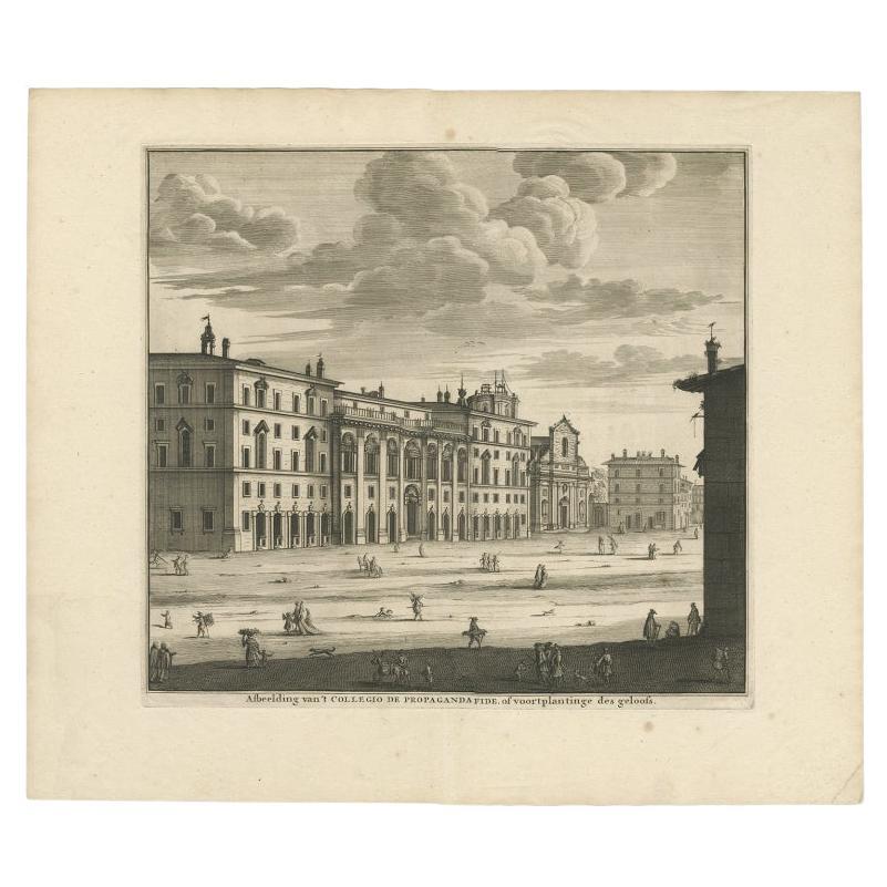
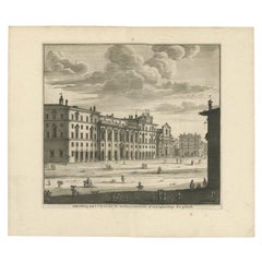
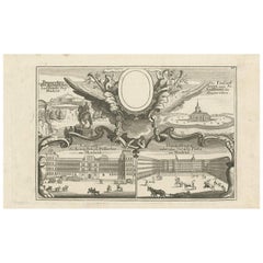
Antique Print Depicting the Collegio Di Propaganda Fide in Rome, 1704
Located in Langweer, NL
Antique print titled 'Afbeelding van 't Collegio de Propaganda Fide, of voortplantinge des Geloofs'. Antique print depicting the Collegio di Propaganda fide in Rome. This print origi...
Category
Antique 18th Century Prints
Materials
Paper
$304 Sale Price
20% Off
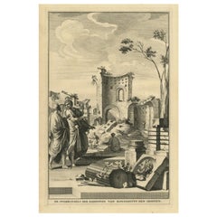
Antique Print Showing Remnants of Constantine I the Great's Baths, Rome, 1704
Located in Langweer, NL
Antique print, titled: 'De Overblyfzels der Badstoven van Konstantyn den Grooten' - This original old antique print shows the remnants of Constantine I the Great's baths in Rome, Ita...
Category
Antique 18th Century Prints
Materials
Paper
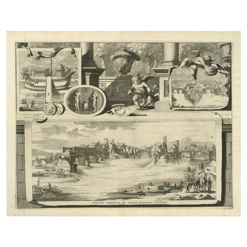
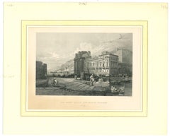
Antique Print of the Tiber River in Rome, Italy, 1704
Located in Langweer, NL
Antique print titled 'Insulae Tiberinae et Pontis Senatorii Vestigia'. This original antique print shows a view of the Tiber River in Rome with the Bridge 'Ponte dei Senatori'. Above more images of Rome. Originates from 'Beschryving van Oud en Nieuw Rome. Verdeelt in drie Deelen. In 't Fransch beschreven door den Heer Francois Desseine. En in 't Nederduitsch vertaalt.', by Francois Desseine and published by Francois Halma in 1704, first published in French in 1690. Copies of this work are rarely complete as the maps and engravings are of high quality matching the work of Piranesi.
Artists and Engravers: Jan Goeree (1670-1731) was a Dutch engraver and poet. He was the son of the Middelburg bookseller Willem Goeree. Born in Middelburg, but soon they moved to Amsterdam. Initially he focussed on painting, assumably a student of Gerard de Lairesse...
Category
Antique 18th Century Prints
Materials
Paper
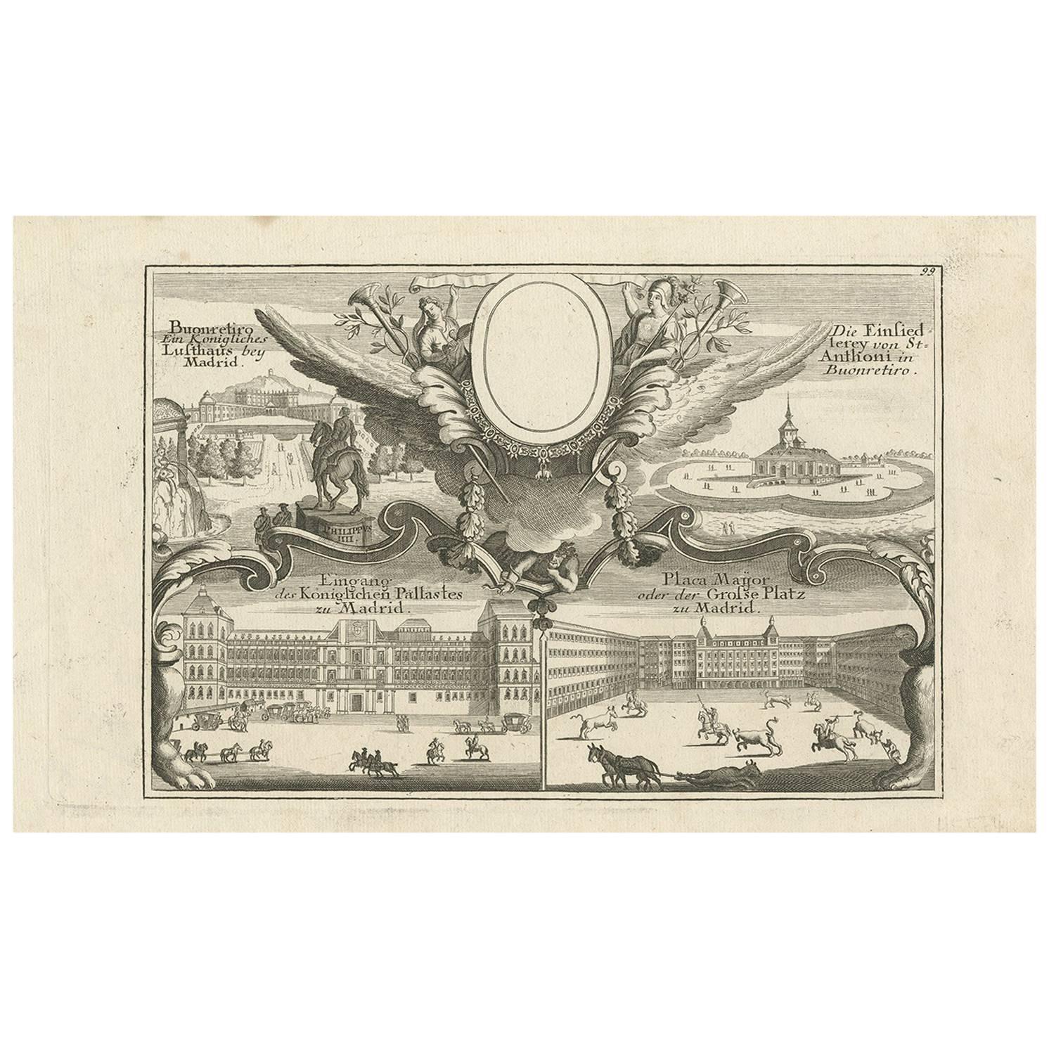
Original Antique Engraving of Buildings in Madrid in Spain, ca. 1700
Located in Langweer, NL
This fine engraving was published in Gabriel Bodenehr's famous serious "Europeans Macht und Pracht", a series of engravings depicting city views, plans, fortresses, and castles in Eu...
Category
Antique Early 18th Century Prints
Materials
Paper
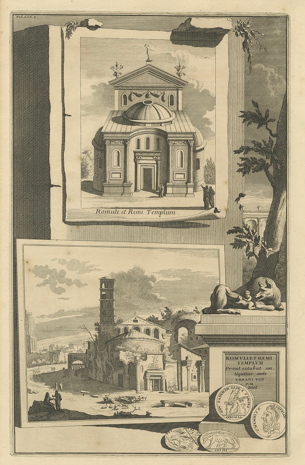
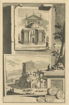
Antique Print of the Temple of Romulus in Rome, Italy C.1705
Located in Langweer, NL
Antique print titled 'Romuli et Remi Templum - Remuliet remi Templum'. This print shows the Temple of Romulus in Rome. Made by or after J. Goeree.
The antique print, titled 'Romuli...
Category
Antique 18th Century Prints
Materials
Paper
You May Also Like
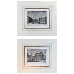
Pair of Fine Engravings of City of Rome, Italy, Matted, Printed in 1816
Located in Palm Springs, CA
A pair of rare and quite beautiful pair of engravings of the city of Rome, printed in 1816. Both are printed from original copper plate.
Custom handmade French mat in the 18th centu...
Category
Antique 1810s Italian Classical Roman Prints
Materials
Paper
$360 Sale Price / set
20% Off
18th Century Italian Milan View Etching by Aspari Domenico 1788
By Domenico Aspari
Located in Milano, MI
A rare view of Milan, an 18th century Italian etching and burin engraving with original ebonized walnut frame and glass depicting San Paolo delle Monache a Milan view, dated 1788, by...
Category
Antique Late 18th Century Italian Neoclassical Prints
Materials
Paper, Canvas, Walnut
Ancient View of Porta Felice and Marina- Lithograph on Paper - Mid-19th Century
Located in Roma, IT
Ancient View of Porta Felice and Marina is an original modern artwork realized in Italy in the first half of the 19th Century.
Original B/W Lithograph on Ivory Paper.
Inscripted ...
Category
1850s Figurative Prints
Materials
Lithograph
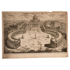
Veduta dell' famous Basilica Vaticana... PIRANESI, circa 1775
By Giovanni Battista Piranesi
Located in Madrid, ES
Veduta dell' famous Basilica Vaticana coll' wide Portico, and adjacent Piazza. Recorded. PIRANESI, Giovanni Battista. Rome, Italy, circa 1775.
It has faults.
Titled on a plate, th...
Category
Antique 18th Century European Neoclassical Prints
Materials
Other
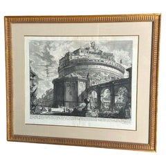
Early Giovanni Battista Piranesi Castel Sant'Angelo Veduti Di Roma Wall Decor
By Giovanni Battista Piranesi
Located in West Hollywood, CA
Early Giovanni Battista Piranesi Castel Sant'Angelo Veduti Di Roma Wall Decor . Large 18th Century Etching / Engraving Of The Ruins Of Rome An Early Print Of Castle Saint Angelo By G...
Category
Antique 18th Century Italian Prints
Materials
Paper, Wood
$6,640 Sale Price
20% Off
Casino della Vigna di Papa Giulio III - Etching by Giuseppe Vasi - 18th century
By Giuseppe Vasi
Located in Roma, IT
Casino della Vigna di Papa Giulio III is an original etching of the Late 18th century realized by Giuseppe Vasi.
Signed and titled on plate lower margin.
Good conditions.
Giusepp...
Category
18th Century Modern Figurative Prints
Materials
Etching
More Ways To Browse
Painted Indian Cabinets
Polychrome Chest Of Drawers
Samurai Armor
Sas Airlines
Scalloped Bed
Secretary Desk Burl
Silver Teapot Wooden Handle
Starburst Sculpture
Talavera De La Reina
Teak Secretary Desk
Terracotta Elephant
Thomas Germany Porcelain Vintage
Tibet Statue
Trunk Desk
Used Cross Stitch Patterns
Victorian Blue Sofa
Viking Red
Vintage Bakelite Knobs