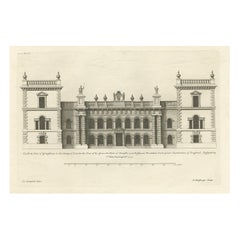
Antique Engraving of Grimsthorpe Castle in Lincolnshire, England, 1715
View Similar Items

Want more images or videos?
Request additional images or videos from the seller
1 of 5
Antique Engraving of Grimsthorpe Castle in Lincolnshire, England, 1715
About the Item
- Dimensions:Height: 13.78 in (35 cm)Width: 19.89 in (50.5 cm)Depth: 0 in (0.01 mm)
- Materials and Techniques:
- Period:
- Date of Manufacture:1715
- Condition:Wear consistent with age and use. Condition: Very good, general age-related toning. Blank verso, please study image carefully.
- Seller Location:Langweer, NL
- Reference Number:Seller: BG-12208-2201stDibs: LU3054326902892
About the Seller
5.0
Platinum Seller
These expertly vetted sellers are 1stDibs' most experienced sellers and are rated highest by our customers.
Established in 2009
1stDibs seller since 2017
1,947 sales on 1stDibs
More From This SellerView All
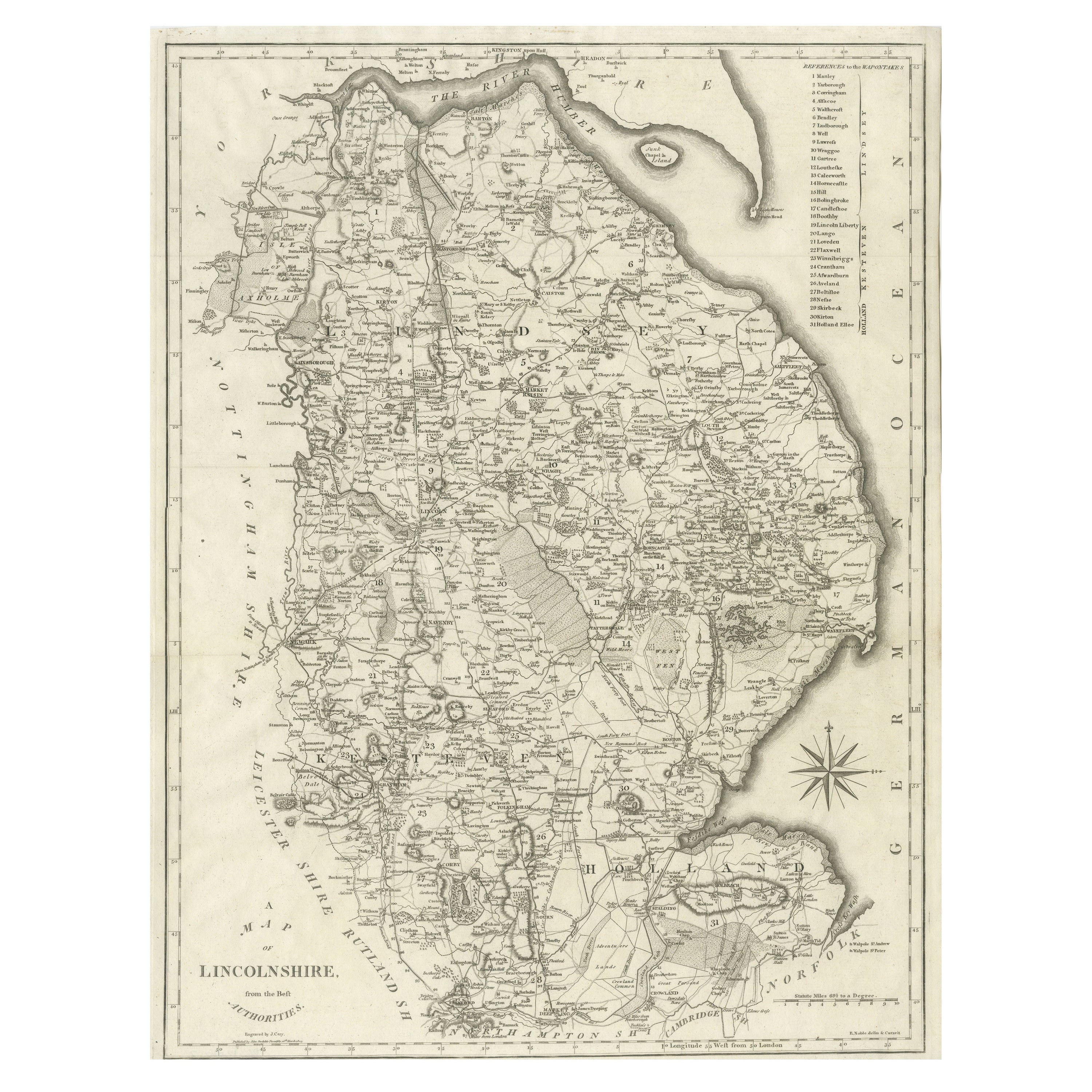
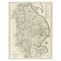
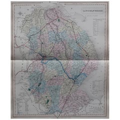
- Large Antique County Map of Lincolnshire, EnglandLocated in Langweer, NLAntique map titled 'A Map of Lincolnshire from the best Authorities'. Original old county map of Lincolnshire, England. Engraved by John Cary. Originates from 'New British Atlas' by ...Category
Antique Early 19th Century Maps
MaterialsPaper
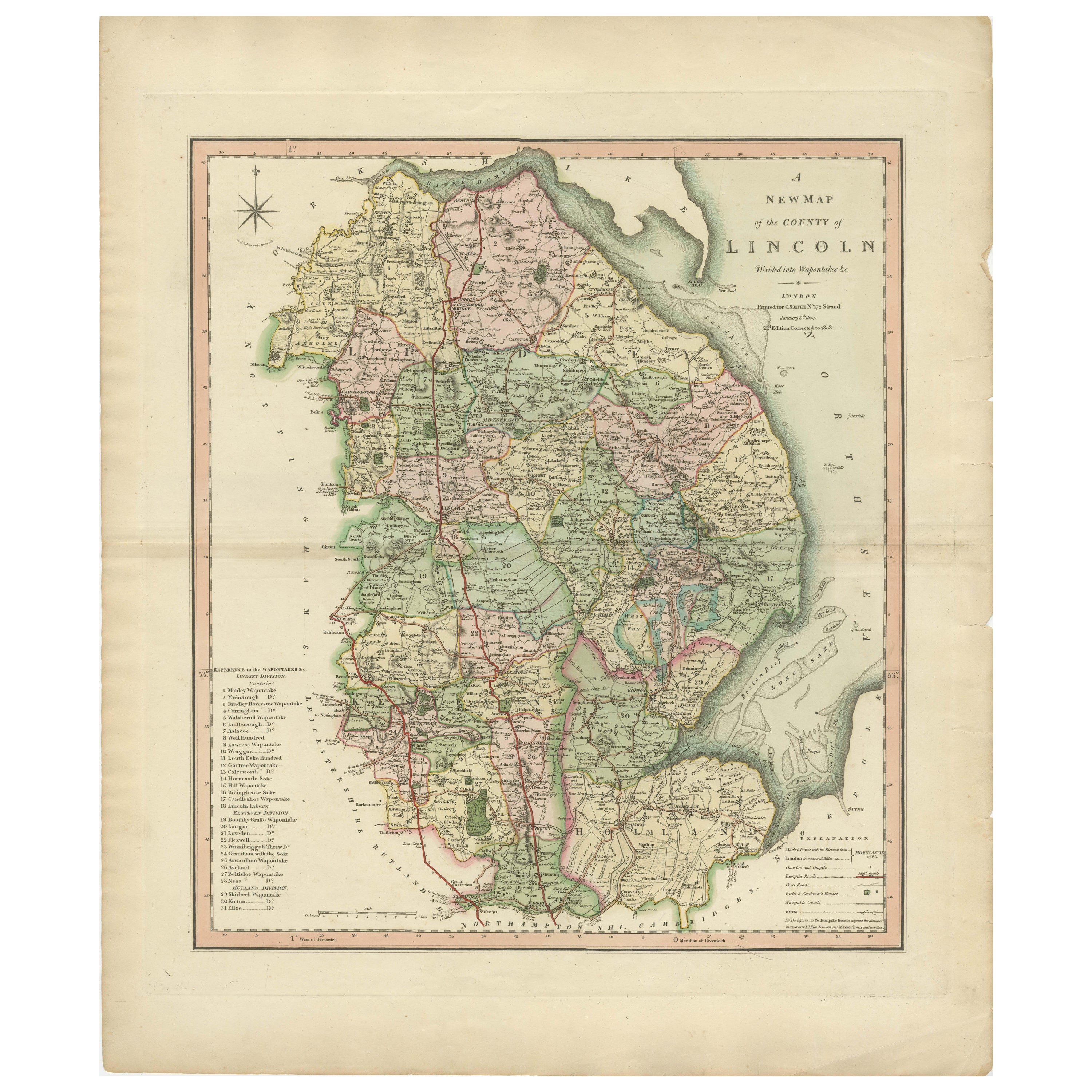
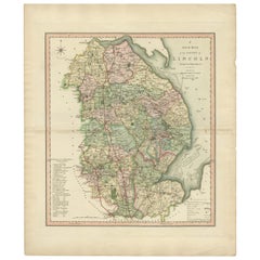
- Antique Decorative County Map of Lincolnshire, England, 1804Located in Langweer, NLAntique county map of Lincolnshire first published circa 1800 Cities illustrated include Grantham, Spalding, Boston, and Market Raisin. Charles Smith was a cartographer working in...Category
Antique Early 1800s Maps
MaterialsPaper
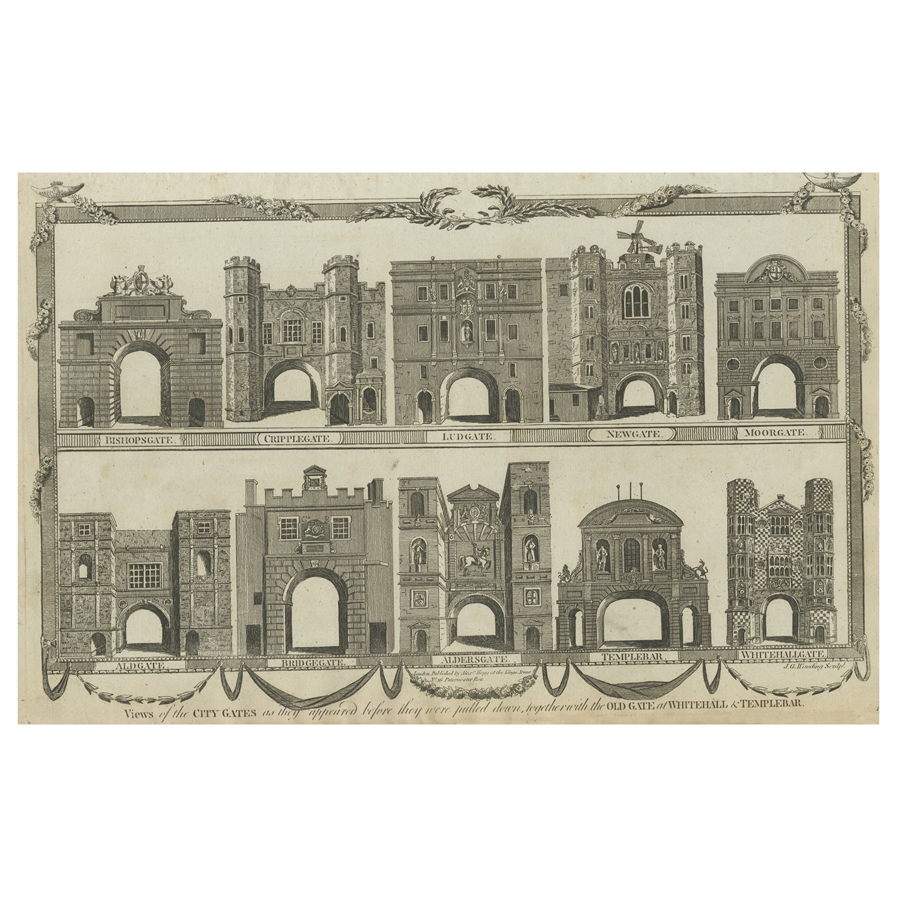
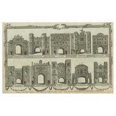
- Antique Engraving of a Number of City Gates in England, c.1800Located in Langweer, NLAntique print titled 'Views of the City Gates (..)'. Old print with views of the city gates as they appeared before they were pulled down, together with the Old Gate...Category
Antique 18th Century Prints
MaterialsPaper
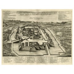
- Original Antique Engraving of the Mighty Imperial Osaka Castle in Japan, 1669Located in Langweer, NLAntique print, titled: 'Afbeeldinge vant Maghtich Keyserlyck Casteel Osacca geleegen int groot Ryck Jappan besuyden de Stadt Osacce inde provinsie Qioo.' - ('Image of the Mighty Imperial Castle Osaka'). A bird's eye view of Osaka Castle, Japan. Arnoldus Montanus' "Gedenkwaerdige Gesantschappen der Oost-Indische Maatschappy in 't Vereenigde Nederland aan de Kaisaren van Japan […]. Amsterdam: Jacob Meurs, 1669. Artists and Engravers: Made by an anonymous engraver after 'Arnoldus Montanus'. Condition: Very good, given age. Original middle fold, as issued. Some faint browning of the margin edges. A few small spots in the margins (from paper making...Category
Antique 1660s Maps
MaterialsPaper
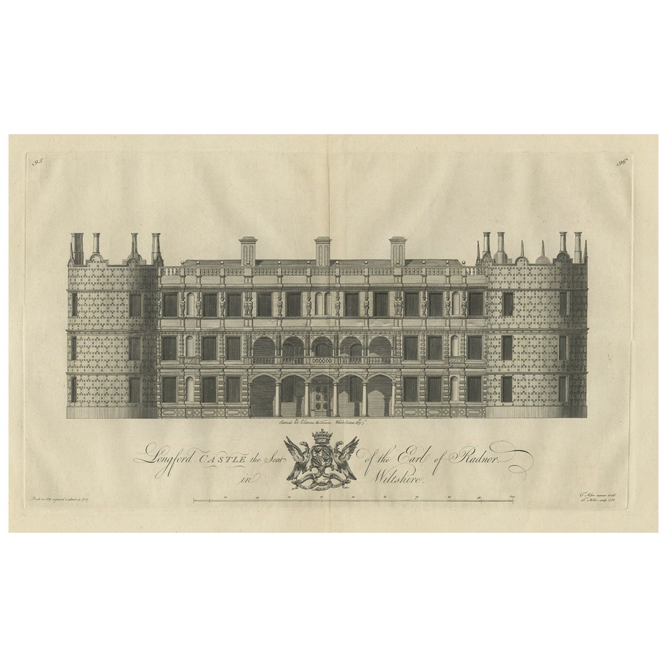
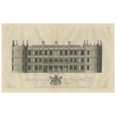
- Antique Print of Longford Castle, South of Salisbury, Wiltshire, England, 1766Located in Langweer, NLAntique print titled 'Longford Castle the Seat of the Earl of Radnor in Wiltshire'. Large engraving of Longford Castle, Wiltshire. Source unknown, to be determined. Artists and Engravers: Engraved by Miller. Longford Castle stands on the banks of the River Avon...Category
Antique 18th Century Prints
MaterialsPaper
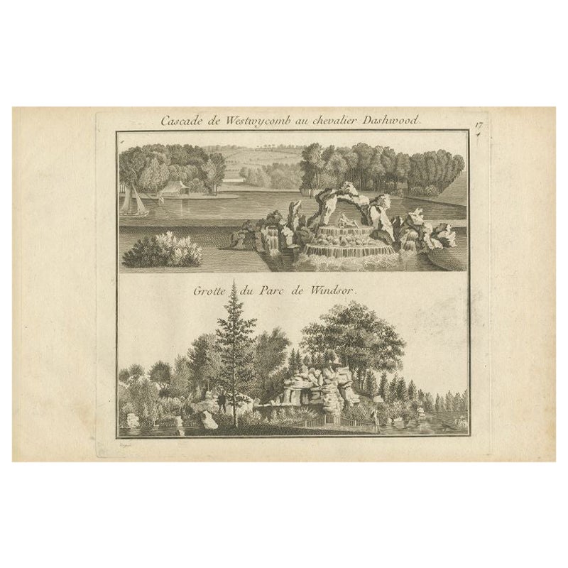
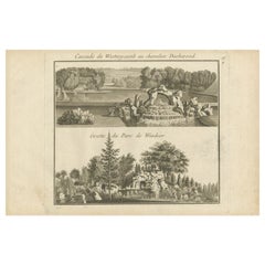
- Antique Engraving of West Wycombe Park and Windsor Park in England, ca.1785Located in Langweer, NLAntique print titled 'Cascade de Westwycob au chevalier Dashwood - Grotte du Parc de Windsor'. Copper engraving showing the waterfall of West Wycombe park and the cabe of Windsor Par...Category
Antique 18th Century Prints
MaterialsPaper
 $307 Sale Price15% Off
You May Also Like
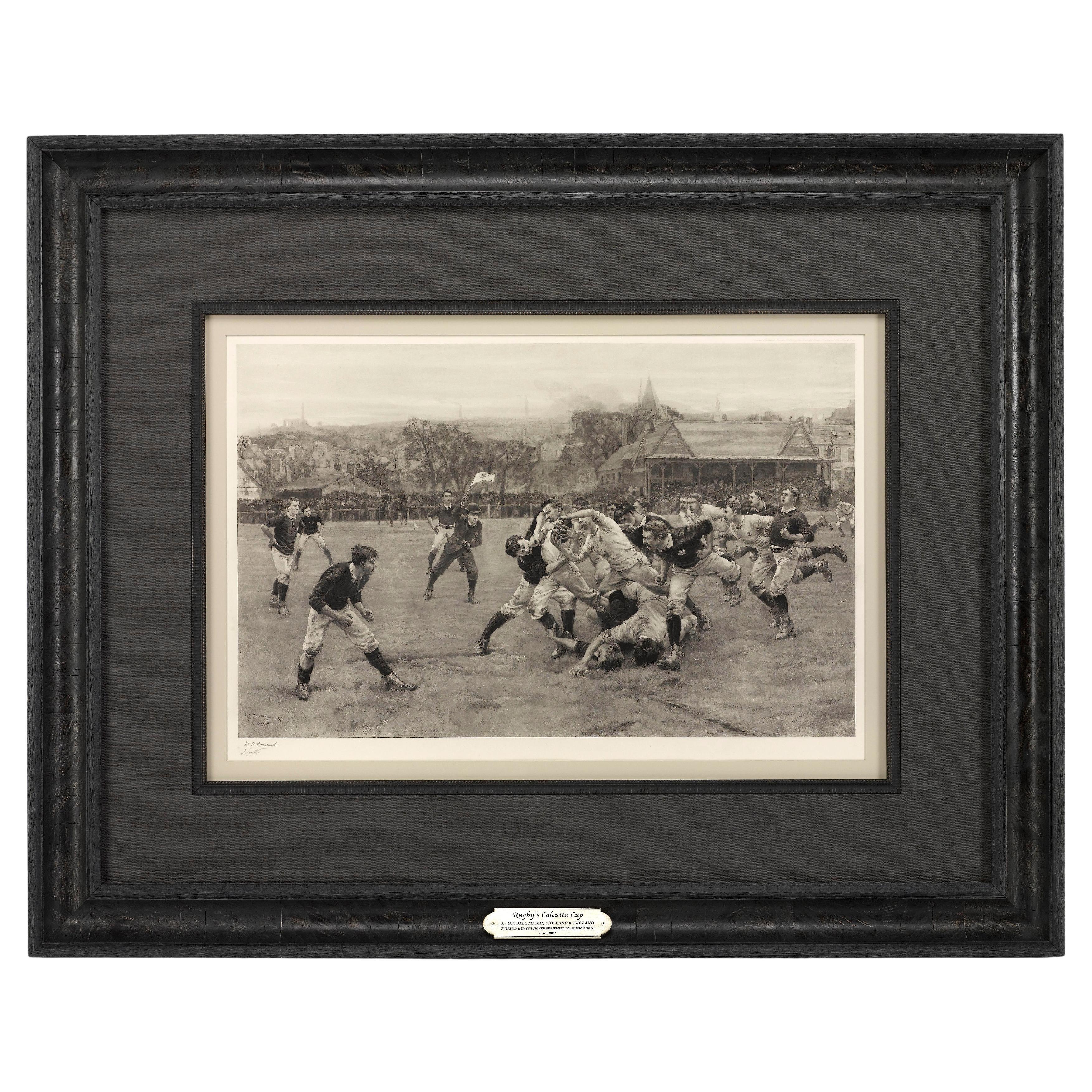
- “A Football Match, Scotland v. England” Antique Engraving, Proof Edition of 100By Overend and SmytheLocated in Colorado Springs, COThis is the 1889 William H. Overend (1851-1898) and Lionel Smythe (1839-1918) first edition, photogravure of the Calcutta Cup – a Rugby match between Scotland and England, that has been played over 100 times, the first match...Category
Antique 19th Century English Prints
MaterialsPaper
- Original Antique English County Map, Lincolnshire, J & C Walker, 1851Located in St Annes, LancashireGreat map of Lincolnshire Original colour By J & C Walker Published by Longman, Rees, Orme, Brown & Co. 1851 Unframed.Category
Antique 1850s English Other Maps
MaterialsPaper
- 1864 "Proclamation of Emancipation, " Antique Engraving by Charles ShoberLocated in Colorado Springs, COThis 1865 engraving features the Emancipation Proclamation in elaborate calligraphic text, with five patriotic vignettes and a small portrait...Category
Antique 1860s American Historical Memorabilia
MaterialsPaper
- Large Scale Antique Scroll Map of Lincolnshire, England, Dated 1778Located in St Annes, LancashireWonderful scroll map of Lincolnshire By Captain Armstrong, 1778 Copper plate engraving on paper laid on canvas Original ebonized wood frame with lo...Category
Antique 1770s English Georgian Maps
MaterialsWood, Paper

- Old Horizontal Map of EnglandBy TassoLocated in Alessandria, PiemonteST/520 - Old rare Italian map of England, dated 1826-1827 - by Girolamo Tasso, editor in Venise, for the atlas of M.r Le-Sage.Category
Antique Early 19th Century Italian Other Prints
MaterialsPaper
 $237 Sale Price20% Off
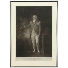
 - Antique Golf Engraving, Henry Callender ESQ, Golf MezzotintLocated in Oxfordshire, GBGolf mezzotint of 'Henry Callender Esq' (Captain of the society of Golfers at Blackheath) after Lemuel Francis Abbott (1760-1803). Henry Callend...Category
Antique 1810s British Sporting Art Sports Equipment and Memorabilia
MaterialsPaper


Recently Viewed
View AllMore Ways To Browse
Antique 18th Century Dress
English Castle Furniture
Metal Wall Cross
Castle Engraving
Capability Brown
Antique Classical Engraving
Wall Crosses Antique Brown
Pavilion Antiques
Antique Acres
Rolling Plater
Lake Decor
Antique Lincolnshire
Antique Furniture Lincolnshire
Rolling Pastures
Antique Drummond
Sculptures Wall Display
Tapestry Wall Hanging Used
Large Midcentury Wall Sculpture