Items Similar to Antique Print of Forts and Views of the East Indies by Chatelain (1719)

Want more images or videos?
Request additional images or videos from the seller
1 of 11
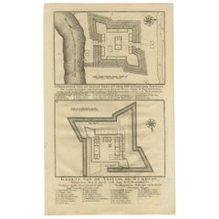
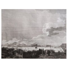
Antique Print of Forts and Views of the East Indies by Chatelain (1719)
$409.63
$585.1830% Off
£302.91
£432.7230% Off
€343
€49030% Off
CA$562.66
CA$803.8030% Off
A$625.65
A$893.7830% Off
CHF 327.54
CHF 467.9130% Off
MX$7,642.41
MX$10,917.7330% Off
NOK 4,115.84
NOK 5,879.7730% Off
SEK 3,871.77
SEK 5,531.1030% Off
DKK 2,611.68
DKK 3,730.9730% Off
About the Item
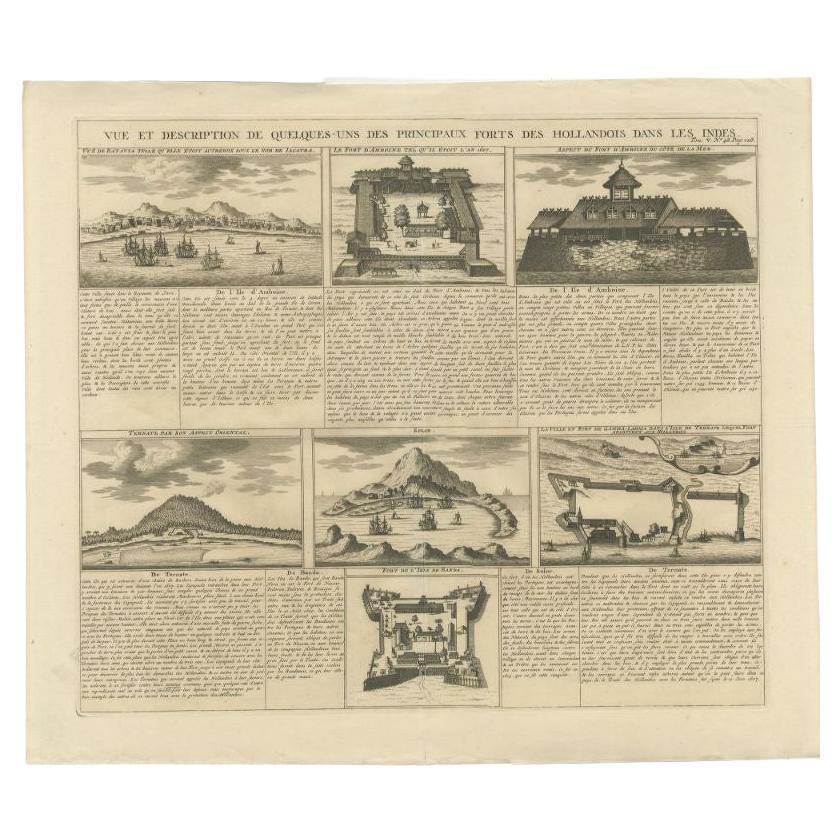
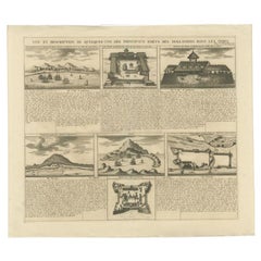
Antique print titled 'Vue et Description de Quelques-Uns des Principaux Forts des Hollandois dans les Indes'. Interesting sheet with seven detailed views illustrating the most important Dutch trading outposts and fortified colonial possessions in the East Indies, including four harbour views Batavia (Jakarta), Amboina, Ternate, and Solor, and three fort plans, with descriptive French text, from Chatelian's monumental seven volume Atlas Historique.
Artists and Engravers: Henri Abraham Chatelain (1684-1743), his father Zacharie Chatelain (d.1723) and Zacharie Junior (1690-1754), worked as a partnership publishing the Atlas Historique, Ou Nouvelle Introduction A L'Histoire under several different Chatelain imprints, depending on the Chatelain family partnerships at the time of publication.
Condition: Good, genearl age-related toning. Please study image carefully.
Date: 1719
Overall size: 51 x 43.5 cm.
Image size: 43 x 37 cm.
We sell original antique maps to collectors, historians, educators and interior decorators all over the world. Our collection includes a wide range of authentic antique maps from the 16th to the 20th centuries. Buying and collecting antique maps is a tradition that goes back hundreds of years. Antique maps have proved a richly rewarding investment over the past decade, thanks to a growing appreciation of their unique historical appeal. Today the decorative qualities of antique maps are widely recognized by interior designers who appreciate their beauty and design flexibility. Depending on the individual map, presentation, and context, a rare or antique map can be modern, traditional, abstract, figurative, serious or whimsical. We offer a wide range of authentic antique maps for any budget.
- Dimensions:Height: 17.13 in (43.5 cm)Width: 20.08 in (51 cm)Depth: 0 in (0.01 mm)
- Materials and Techniques:Paper,Engraved
- Place of Origin:
- Period:
- Date of Manufacture:1719
- Condition:Condition: Good, genearl age-related toning. Please study image carefully.
- Seller Location:Langweer, NL
- Reference Number:Seller: BG-113361stDibs: LU3054329586122
About the Seller
5.0
Recognized Seller
These prestigious sellers are industry leaders and represent the highest echelon for item quality and design.
Platinum Seller
Premium sellers with a 4.7+ rating and 24-hour response times
Established in 2009
1stDibs seller since 2017
2,604 sales on 1stDibs
Typical response time: <1 hour
- ShippingRetrieving quote...Shipping from: Langweer, Netherlands
- Return Policy
Authenticity Guarantee
In the unlikely event there’s an issue with an item’s authenticity, contact us within 1 year for a full refund. DetailsMoney-Back Guarantee
If your item is not as described, is damaged in transit, or does not arrive, contact us within 7 days for a full refund. Details24-Hour Cancellation
You have a 24-hour grace period in which to reconsider your purchase, with no questions asked.Vetted Professional Sellers
Our world-class sellers must adhere to strict standards for service and quality, maintaining the integrity of our listings.Price-Match Guarantee
If you find that a seller listed the same item for a lower price elsewhere, we’ll match it.Trusted Global Delivery
Our best-in-class carrier network provides specialized shipping options worldwide, including custom delivery.More From This Seller
View AllAntique Print of Forts and Views of the East Indies or Nowadays Indonesia, 1719
Located in Langweer, NL
Antique print titled 'Vue et Description de Quelques-Uns des Principaux Forts des Hollandois dans les Indes'. Interesting sheet with seven detailed views illustrating the most import...
Category
Antique 18th Century Dutch Prints
Materials
Paper
$468 Sale Price
20% Off
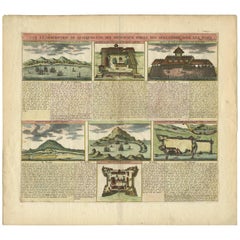
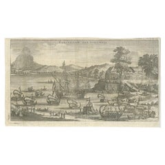
Antique Print of Dutch V.O.C. Trading Outposts and Forts in the East Indies
By Henri-Abraham Chatelain
Located in Langweer, NL
Antique print titled 'Vue et Description de quelques des principaux forts des Hollandois dans les Indes'. Hand-colored print with seven detailed views illustrating the most important...
Category
Antique Early 18th Century Prints
Materials
Paper
$472 Sale Price
20% Off
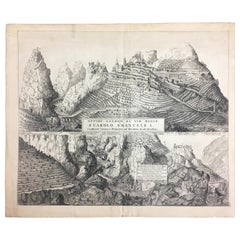
Antique Print of Fortresses in Indonesia by Valentijn '1726'
By F. Valentijn
Located in Langweer, NL
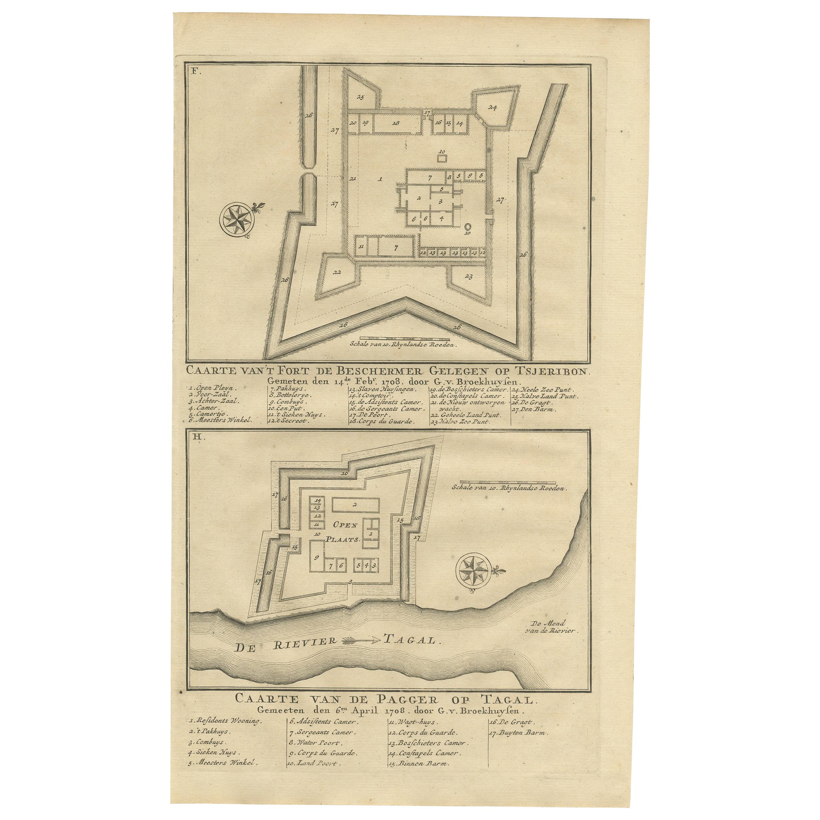
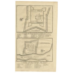
Antique print titled 'Caarte van het fort de Beschermer Gelegen op Tsjeribon. Caarte van de Pagger op Tagal'. A plan of the fortress 'de Beschermer' located on Cheribon (Java) and a ...
Category
Antique Early 18th Century Dutch Prints
Antique Print of Fortresses in the Banyumas Region by Valentijn, 1726
By F. Valentijn
Located in Langweer, NL
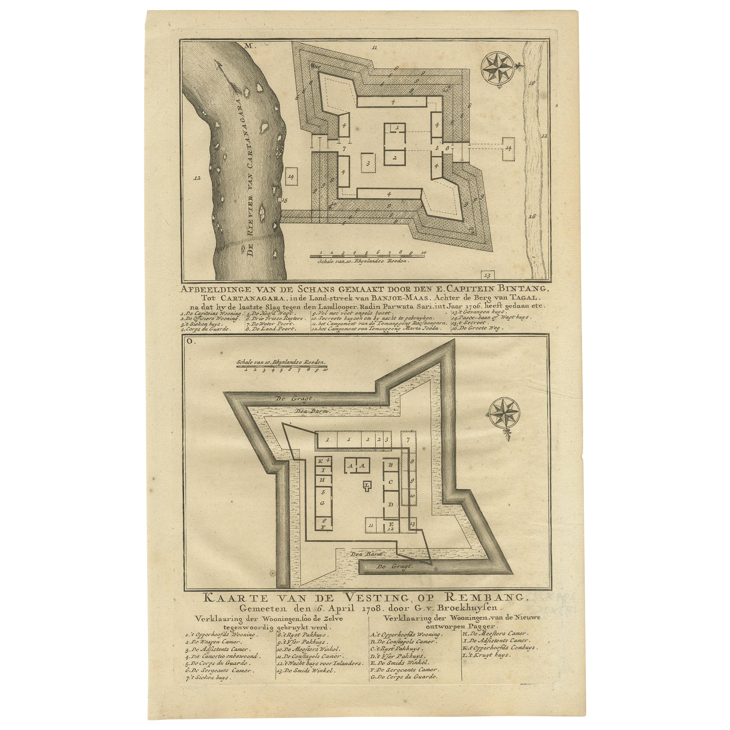
Antique print titled 'Kaarte van de Schans gemaakt door den E. Capitein Bintang. Kaarte van de Vesting op Rembang. ' A plan of the fort constructed by the Captain E. Bintang, in the ...
Category
Antique Mid-18th Century Prints
Materials
Paper
$114 Sale Price
20% Off
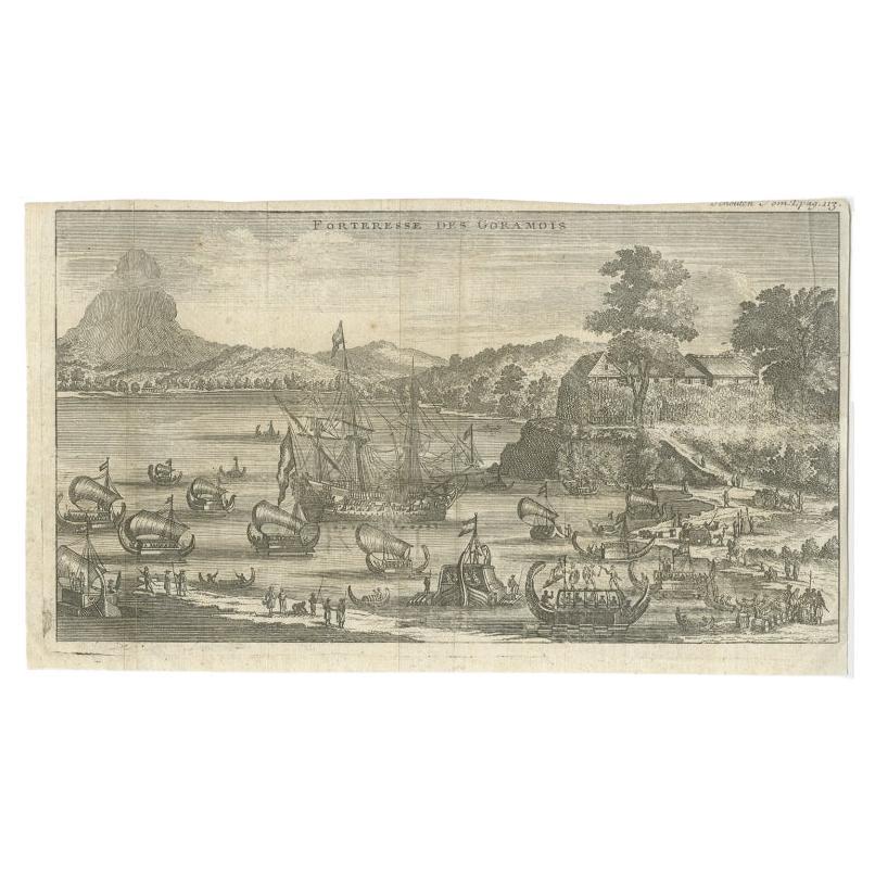
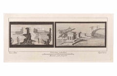
Antique Print of the Fortress of Goram by Schouten, 1725
Located in Langweer, NL
Antique print titled 'Forteresse des Goramois'. View of the fortress of Goram. Originates from 'Voyage de Gautier Schouten aux Indes Orientales (..)'.
...
Category
Antique 18th Century Prints
Materials
Paper
$124 Sale Price
20% Off
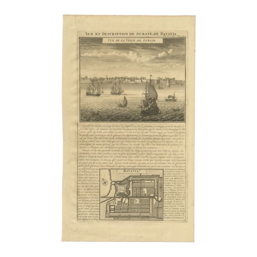
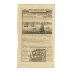
Antique Print of Surate and a Plan of Batavia in the Dutch East Indies, 1719
Located in Langweer, NL
Antique print titled 'Vue et Description de Surate et de Batavia'. Attractive view of the town and harbor of Surate on the northwest coast of India, and a bird's-eye city plan of Bat...
Category
Antique 18th Century Prints
Materials
Paper
$315 Sale Price
20% Off
You May Also Like
Antique Voc Print Holland Malaysia Old Map Melaka History, 1663
Located in Amsterdam, Noord Holland
From my own collection I offer this impressive Antique print of the city of Malakka
A very interesting piece for collectors . It is an museum piece from the Dutch Institute of Orien...
Category
Antique 17th Century European Paintings
Materials
Paper

$293 Sale Price
20% Off
17th-18th Century Siege of Graves Mapping Engraving By Willian III
Located in Kingston, NY
RARE French 17th-18th Century Enhanced Siege of Graves Mapping Engraving BY William III, also widely known as William of Orange,
The Siege of Grave in Dutch Brabant started by Monsie...
Category
Antique 17th Century French Prints
Materials
Paper

Seascapes with Monuments and Figures - Etching by Luigi Aloja - 18th Century
Located in Roma, IT
Seascapes With Monuments and Figures is an Etching realized by Luigi Aloja (1783-1837).
The etching belongs to the print suite “Antiquities of Herculaneum Exposed” (original title:...
Category
Late 18th Century Old Masters Figurative Prints
Materials
Etching
Original Antique Print of Macao, China. C.1810.
Located in St Annes, Lancashire
Great image of Macao
Copper-plate engraving.
Published by Sherwood, Neely & Jones . C.1810
Unframed.
Category
Antique 1810s English Prints
Materials
Paper
17th Century Italian Gravure, Theatrum Statuum Sabaudiae, circa 1682
By Joan (Johannes) Blaeu
Located in Miami, FL
17th century Italian Gravure/Cartography
Le Theatrum statuum Regiae Celsitudinis Sabaudiæ Ducis or at Theatrum Statum Sabaudiæ, is a representative and iconographic representation f...
Category
Antique 17th Century Italian Historical Memorabilia
Materials
Paper
$450 Sale Price
52% Off
Seascape with Monument and Figures - Etching by F. Cepparuli - 18th Century
By Francesco Cepparuli
Located in Roma, IT
Seascape With Monuments is an Etching realized by Francesco Cepparuli (1750-1767).
The etching belongs to the print suite “Antiquities of Herculaneum Exposed” (original title: “Le A...
Category
Late 18th Century Old Masters Figurative Prints
Materials
Etching
More Ways To Browse
Queen Storage Headboard
Ralph Lauren Cabinet
Rattan King Bed Frame
Red Ceramic Horse
Renaissance Nightstand
Salt Glaze Pot
Salter Scale
Scholars Chest
Secretary Desk 1950s
Shino Japan
Soap Bottle
Soda Table
Spain Silver Flatware
Spanish Oak Chest
Stained Glass Shield
Striped Cabinets
Sugar Cabinet
Swedish Gustavian Antiques