Antique Print of the Island of Gorée, close to Dakar, Senegal in Africa, c.1835
View Similar Items

Want more images or videos?
Request additional images or videos from the seller
1 of 5
Antique Print of the Island of Gorée, close to Dakar, Senegal in Africa, c.1835
About the Item
- Dimensions:Height: 13.19 in (33.5 cm)Width: 19.89 in (50.5 cm)Depth: 0 in (0.01 mm)
- Materials and Techniques:
- Period:
- Date of Manufacture:circa 1835
- Condition:Condition: Fair, various tears including a larger tear upper margin. Stamp below print, please study image carefully. Ask for more pictures if you like.
- Seller Location:Langweer, NL
- Reference Number:Seller: BG-11938-11stDibs: LU3054327828742
About the Seller
5.0
Recognized Seller
These prestigious sellers are industry leaders and represent the highest echelon for item quality and design.
Platinum Seller
Premium sellers with a 4.7+ rating and 24-hour response times
Established in 2009
1stDibs seller since 2017
2,442 sales on 1stDibs
Typical response time: 1 hour
Authenticity Guarantee
In the unlikely event there’s an issue with an item’s authenticity, contact us within 1 year for a full refund. DetailsMoney-Back Guarantee
If your item is not as described, is damaged in transit, or does not arrive, contact us within 7 days for a full refund. Details24-Hour Cancellation
You have a 24-hour grace period in which to reconsider your purchase, with no questions asked.Vetted Professional Sellers
Our world-class sellers must adhere to strict standards for service and quality, maintaining the integrity of our listings.Price-Match Guarantee
If you find that a seller listed the same item for a lower price elsewhere, we’ll match it.Trusted Global Delivery
Our best-in-class carrier network provides specialized shipping options worldwide, including custom delivery.More From This Seller
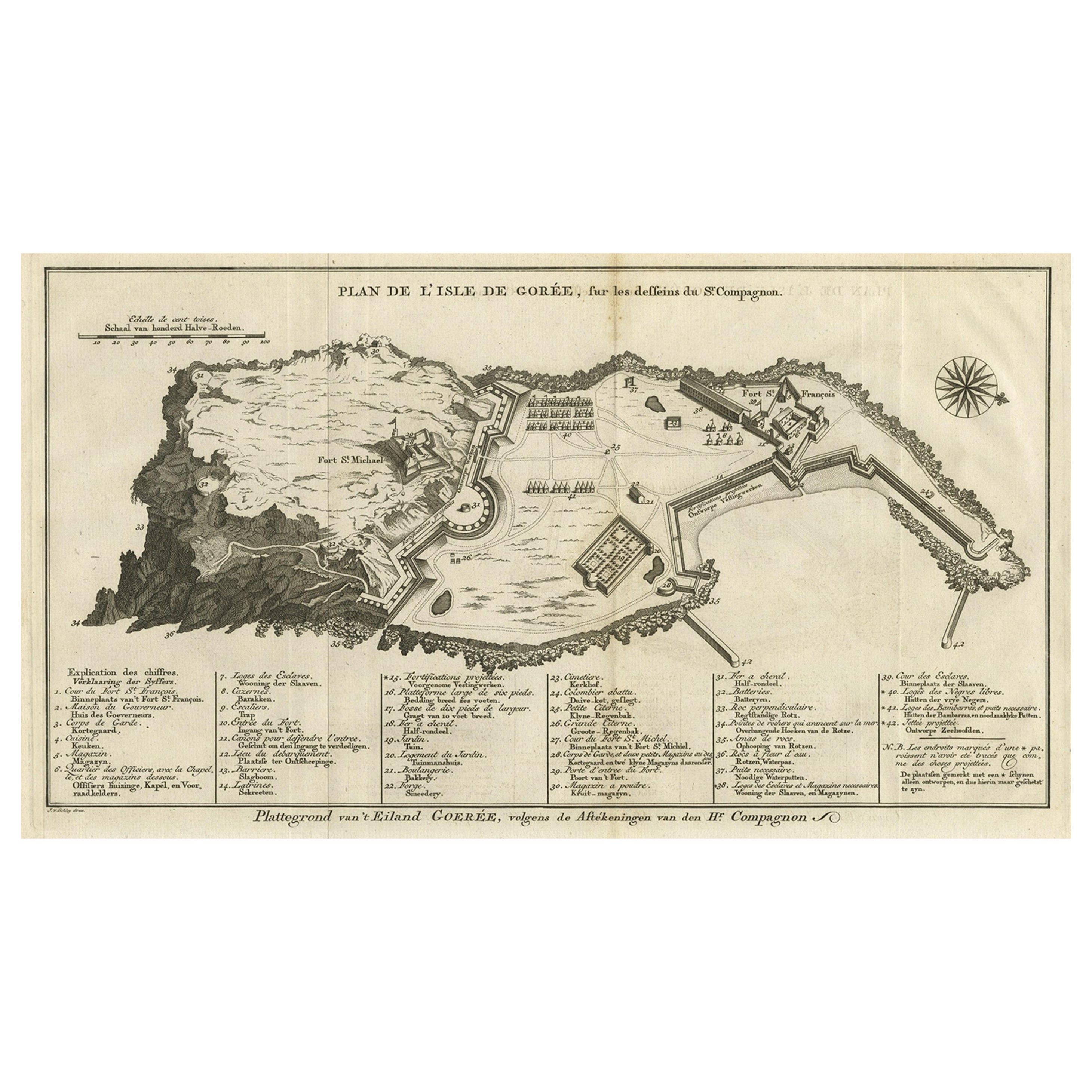
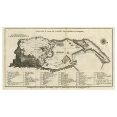
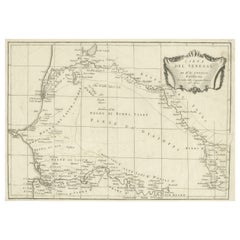
View AllDetailed Map of the Island of Gorée off of the Coast of Dakar, Senegal, 1747
Located in Langweer, NL
Antique plan titled 'Plan de l'Isle de Goree
The island of Gorée lies off the coast of Senegal, opposite Dakar. From the 15th to the 19th century, it was the largest slave-tradin...
Category
Antique 1740s Maps
Materials
Paper
$314 Sale Price
20% Off
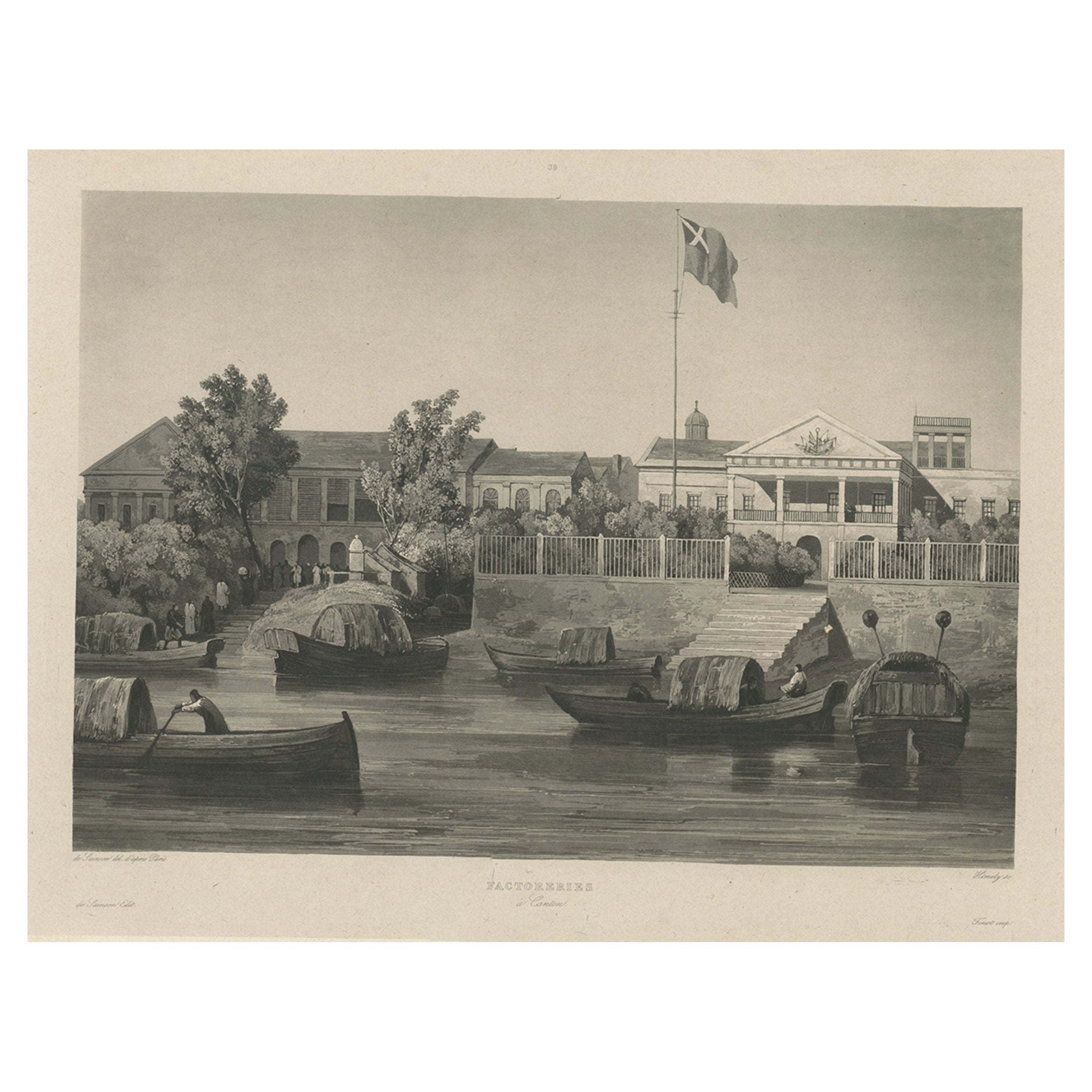
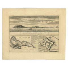
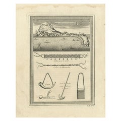
Antique Plan and Views of Gorée Island, Dakar, Senegal, 1746
Located in Langweer, NL
Antique print titled 'The Prospect of the Island of Goeree & The Fort Vermandois alias St. Michael (..)’. Plan and view of Gorée Island, Dakar, Senegal. This print originates from 'A...
Category
Antique 18th Century Prints
Materials
Paper
$333 Sale Price
20% Off
Antique Map of Gorée Island ‘Senegal’ by J.N. Bellin, 1764
Located in Langweer, NL
Nautical antique chart of Gorée Senegal including a letter key to the island's fortifications. Gorée is known as the location of the House of Slaves built by an Afro-French Métis fam...
Category
Antique Mid-18th Century Maps
Materials
Paper

$300 Sale Price
20% Off
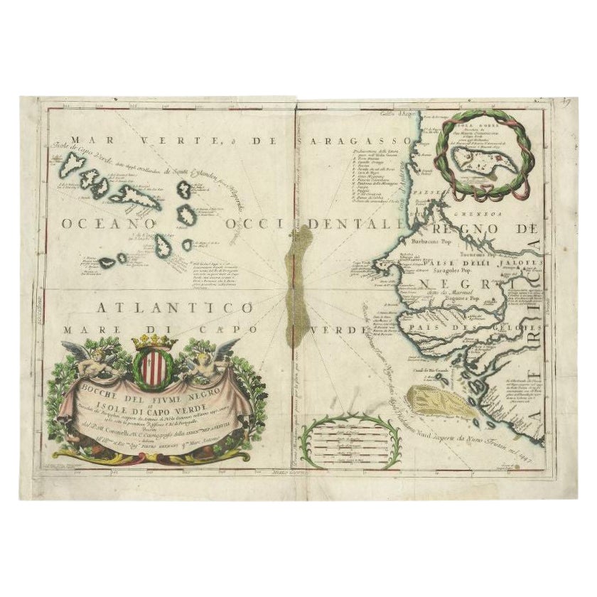
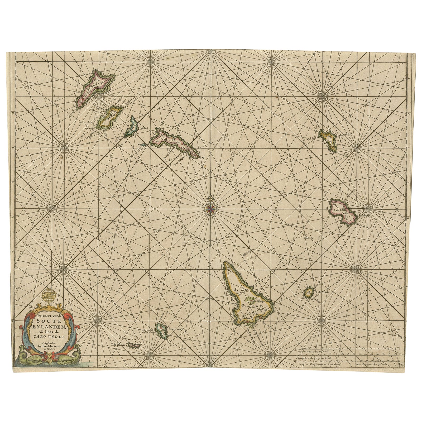
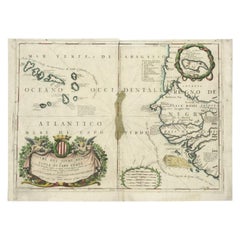
Antique Map of the Cape Verde Islands and Part of Senegal, West Africa, 1690
Located in Langweer, NL
Antique map titled 'Bocche del Fivme Negro et Isole di Capo Verde'. Beautiful double-page map of the Cape Verde Islands and part of the coast of Senegal, with large decorative cartou...
Category
Antique 17th Century Maps
Materials
Paper
$537 Sale Price
46% Off
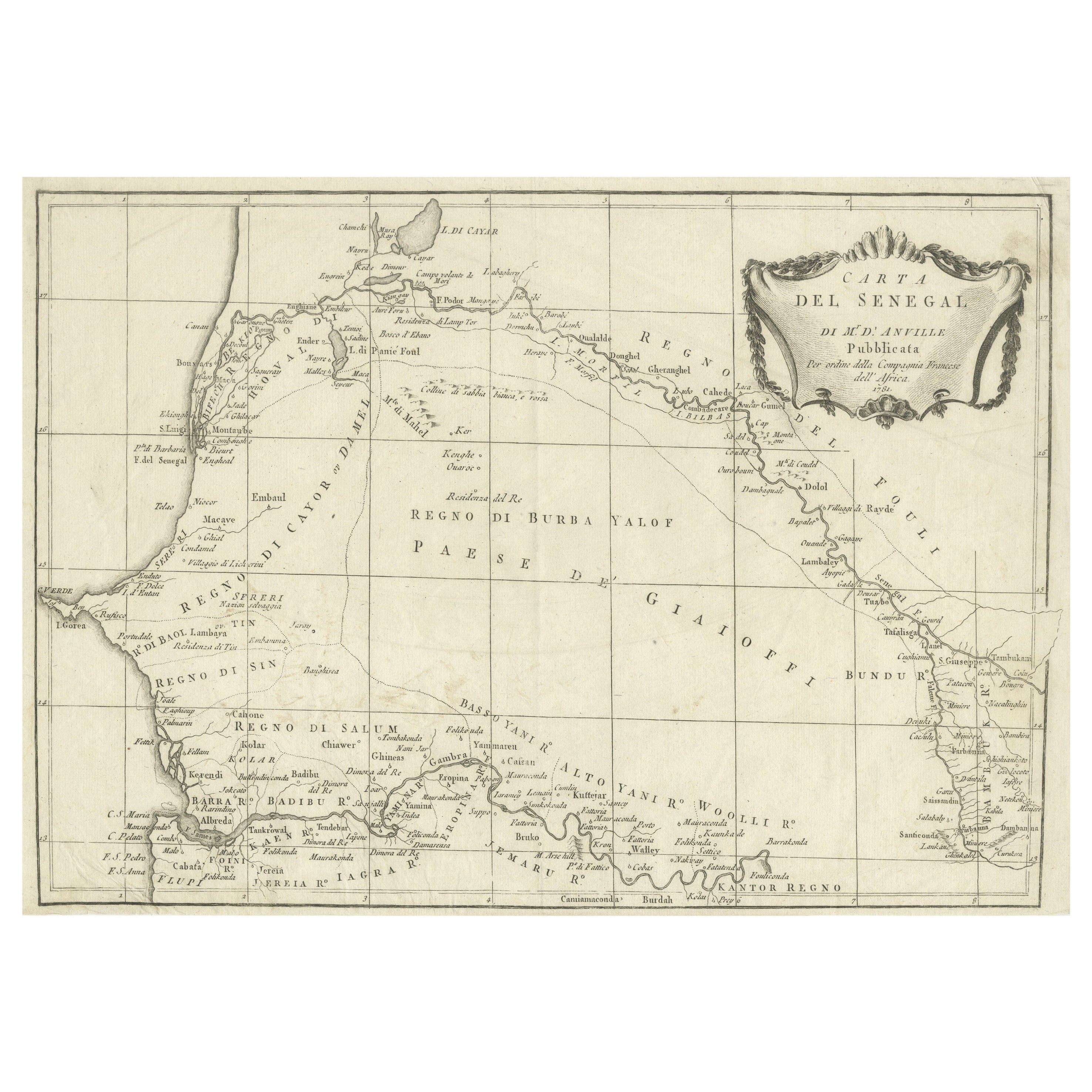
Antique Map of Senegal, West Africa
Located in Langweer, NL
Original antique map titled 'Carta del Senegal'. Antique map of Senegal, West Africa. This map originates from 'Compendio della storia generale dei viaggi (..)'. Published by De la Harpe...
Category
Antique Mid-18th Century Maps
Materials
Paper
$333 Sale Price
20% Off
Antique Print of the Island of Gorée by Bellin, c.1748
By Jacques-Nicolas Bellin
Located in Langweer, NL
Antique print Africa titled 'Vue de la Rade de l'Ile de Gorée'. Antique print depicting the island of Gorée, Senegal.
Artists and Engravers: ...
Category
Antique 18th Century Prints
Materials
Paper
$67 Sale Price
20% Off
You May Also Like
Original Antique Map of South Africa, Arrowsmith, 1820
Located in St Annes, Lancashire
Great map of South Africa.
Drawn under the direction of Arrowsmith.
Copper-plate engraving.
Published by Longman, Hurst, Rees, Orme and Br...
Category
Antique 1820s English Maps
Materials
Paper

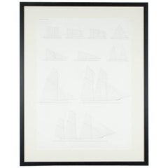
"Balance of Sail" Print by Day & Son, Lithographers to the Queen, Dated 1864
By Vincent Brooks, Day and Sons
Located in London, GB
A Victorian framed print of "Balance of Sail" by Day and Son, lithographers to the Queen.
The bottom of the print is inscribed: LONDON. PUBL...
Category
Antique Mid-19th Century European Prints
Hand-Colored 18th Century Homann Map of Denmark and Islands in the Baltic Sea
By Johann Baptist Homann
Located in Alamo, CA
An 18th century copper plate hand-colored map entitled "Insulae Danicae in Mari Balthico Sitae utpote Zeelandia, Fionia, Langelandia, Lalandia, Falstria, Fembria Mona" created by Joh...
Category
Antique Early 18th Century German Maps
Materials
Paper

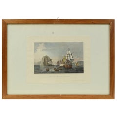
Antique Lithographic Print of the Diamond Rock Battle Early 1900s, Oakwood Frame
Located in Milan, IT
Lithographic print of the diamond rock battle, the main port of the island of Martinique, taken from the book Historical Gallery of Versailles 112. Chacoane is the engraver. Original...
Category
Early 20th Century French Nautical Objects
Materials
Paper
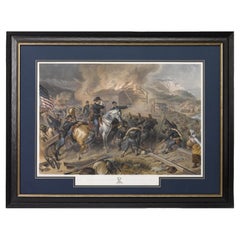
"On the March to the Sea" Print by Alexander Hay Ritchie, after F.O.C Darley
By Alexander Hay Ritchie
Located in Colorado Springs, CO
This color print of On The March to the Sea by Felix O.C. Darley, and engraved by A.H. Ritchie, is a stunning portrayal of William T. Sherman’s notorious Georgia Campaign. Originally...
Category
Antique 1860s American Prints
Materials
Paper
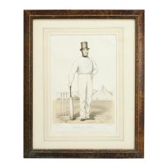
Antique Cricket Print of Joseph Guy of Nottingham
Located in Oxfordshire, GB
Cricket print of Joseph Guy of Nottingham.
A framed, tinted and hand colored lithographic portrait of the All- England cricketer Joseph Guy (1813 - 187...
Category
Antique 1850s British Sporting Art Sports Equipment and Memorabilia
Materials
Paper