Items Similar to Bird's-Eye Plan of Solomon's Temple to the West, Jerusalem in Israel, 1677
Want more images or videos?
Request additional images or videos from the seller
1 of 5
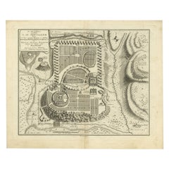
Bird's-Eye Plan of Solomon's Temple to the West, Jerusalem in Israel, 1677
About the Item
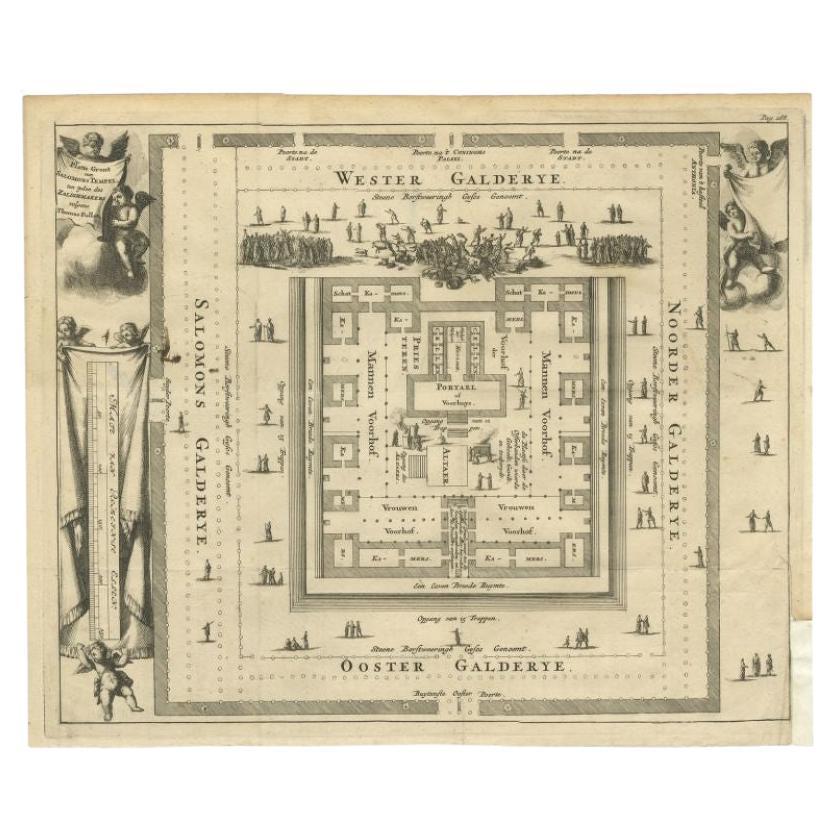
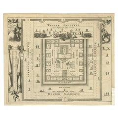
Antique print religion titled 'Platte gront van Salomons Tempel ten tijden des Zalighmakers volgens Thomas Fuller'.
Bird's-eye plan of Solomon's Temple, oriented to the west (Jerusalem, Israel). This print originates from 'Naukeurige Beschryving Van gantsch Syrie, en Palestyn of Heilige Lant (..)'.
Artists and Engravers: Olfert Dapper (c. 1635 - 1689) was a Dutch physician and writer. He wrote books about history and geography, although he never travelled outside Holland.
- Dimensions:Height: 12.21 in (31 cm)Width: 14.57 in (37 cm)Depth: 0 in (0.02 mm)
- Materials and Techniques:
- Period:1670-1679
- Date of Manufacture:1677
- Condition:Wear consistent with age and use. Condition: Good, general age-related toning. Minor defects from handling, please study image carefully.
- Seller Location:Langweer, NL
- Reference Number:
About the Seller
5.0
Platinum Seller
These expertly vetted sellers are 1stDibs' most experienced sellers and are rated highest by our customers.
Established in 2009
1stDibs seller since 2017
1,928 sales on 1stDibs
Typical response time: <1 hour
- ShippingRetrieving quote...Ships From: Langweer, Netherlands
- Return PolicyA return for this item may be initiated within 14 days of delivery.
More From This SellerView All
- Antique Print of Solomon's Temple in Jerusalem, 1717Located in Langweer, NLAntique print titled 'Platte gront van Salomons Tempel ten tijden des Zalighmakers volgens Thomas Fuller'. Bird's-eye plan of Solomon's Temple, oriented to the west (Jerusalem, Israe...Category
Antique 18th Century Prints
MaterialsPaper
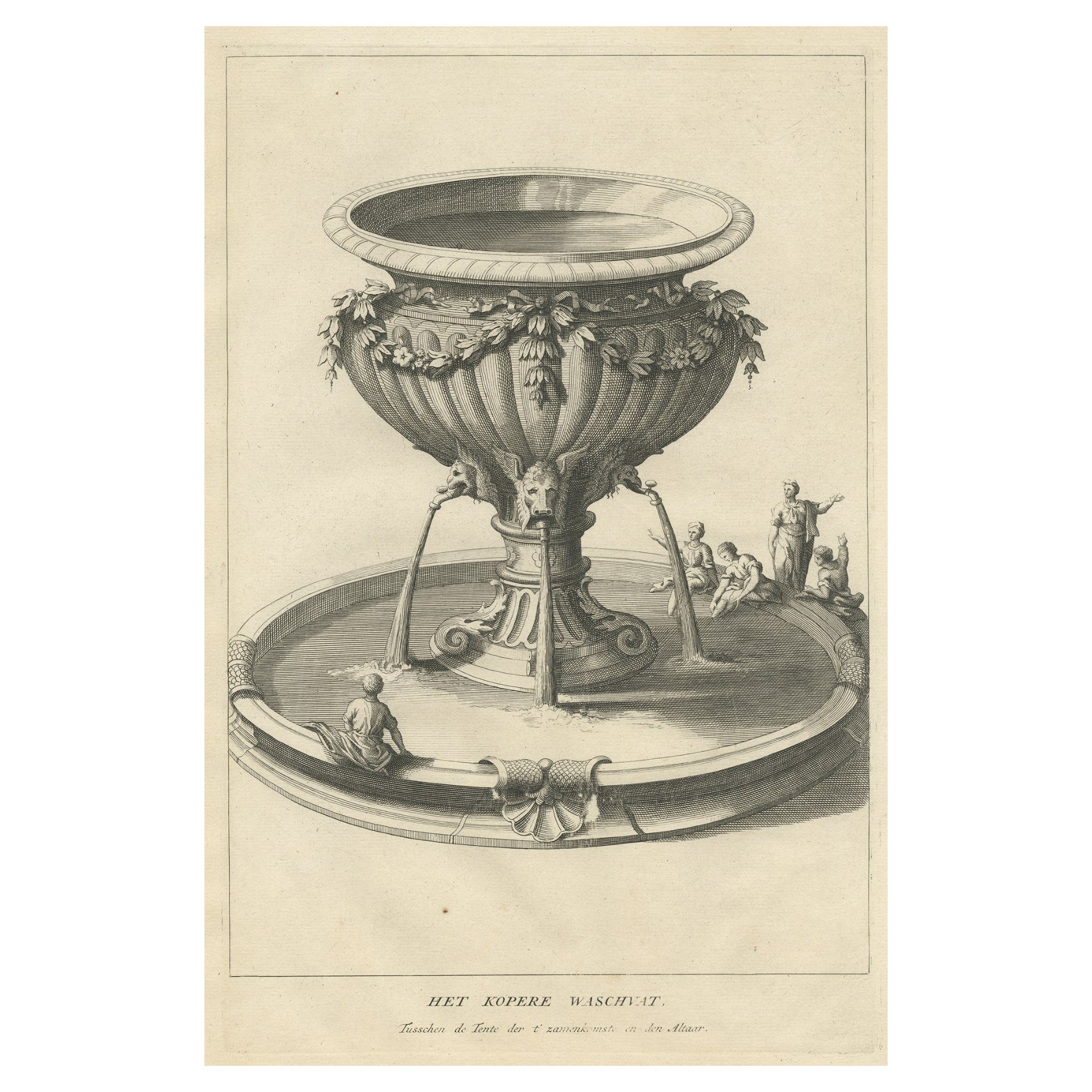
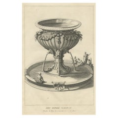
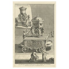
- Antique Engraving of the Brass Laver in Solomon's Temple, Jerusalem, ca.1725Located in Langweer, NLAntique religion print titled 'Het kopere Waschvat, Tusschen de Tente der t'zamenkomst en den altaar'. Antique print of the Brass Laver in Solomon's Temple. This print originates...Category
Antique 1720s Prints
MaterialsPaper
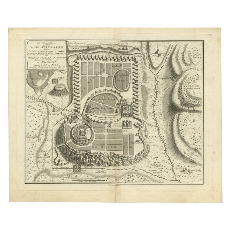
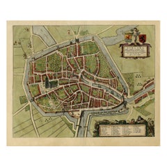
- Bird's-Eye Plan of Jerusalem in Israël, a Rare Original Engraving, 1750Located in Langweer, NLAntique map titled 'De VIIde Landkaart Verbeeldende de Stad Jerusalem Beneven de daar Omgelegen Bergen en Dalen (..).' Bird's-eye plan of Jerusalem in Israel. This map shows the mo...Category
Antique 18th Century Maps
MaterialsPaper
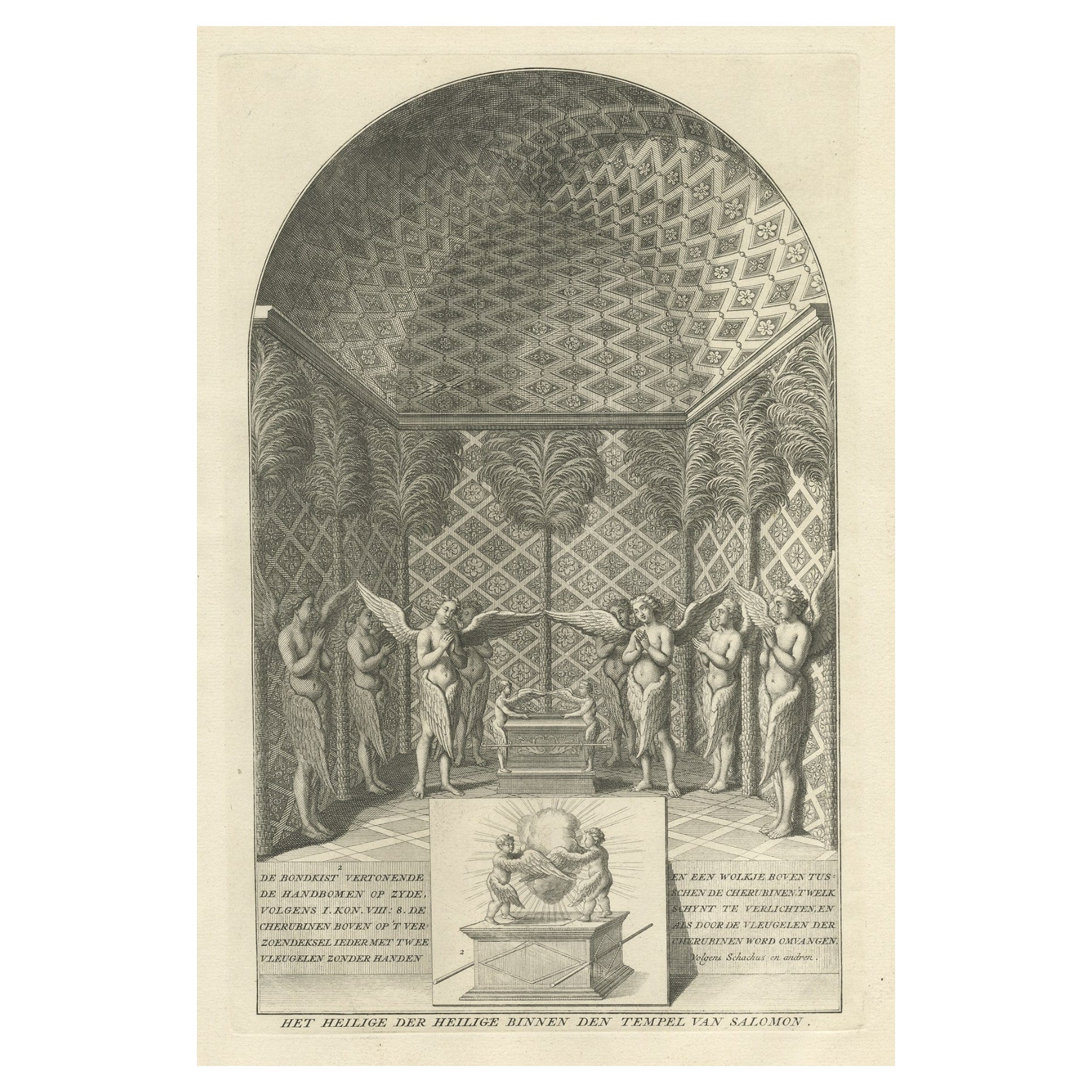
- Solomon's Temple, the Holy of Holies, Showing the Ark of the Covenant, c.1780Located in Langweer, NLAntique religion print titled 'Het Heilige der Heilige binnen den Tempel van Salomon'. This print depicts Solomon's Temple, the Holy of Holies, showing the Ark of the Covenant...Category
Antique 1780s Prints
MaterialsPaper
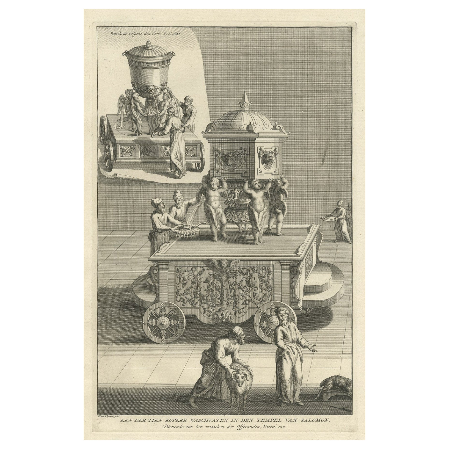
- Antique Engraving of One of the Ten Brass Lavers in Solomon's Temple, 1725Located in Langweer, NLAntique religion print titled 'Een der tien Kopere Waschvaten in den Tempel van Salomon'. This print depicts one of the ten Brass Lavers in Solomon's Temple. This print originate...Category
Antique 1720s Prints
MaterialsPaper
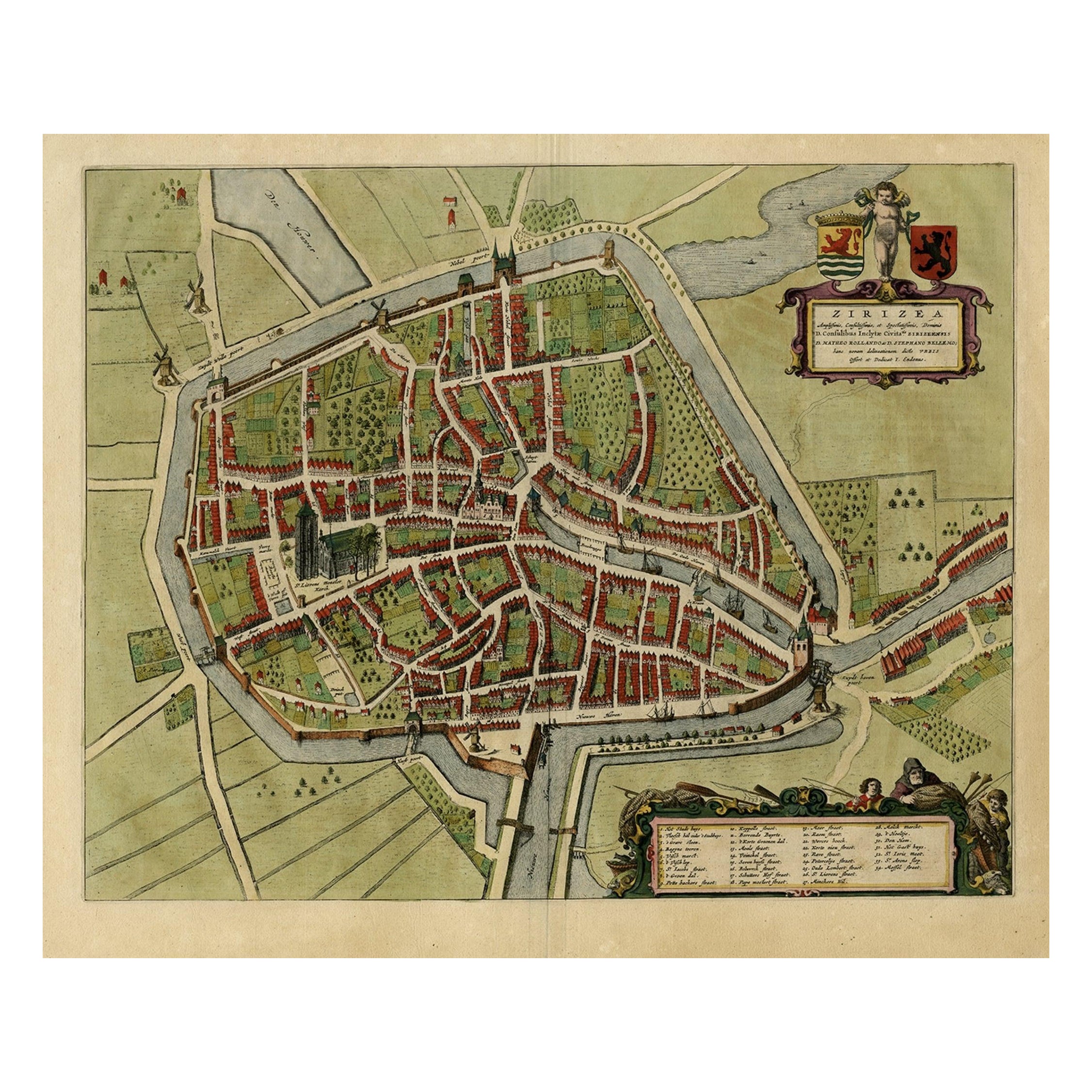
- Antique Bird's-eye View Plan of Zierikzee in Zeeland, The Netherlands, 1649Located in Langweer, NLAntique print, titled: 'Zirizea.' - A bird's-eye view plan of Zierikzee in The Netherlands, with key to locations and coats of arms. After Matheo Rollando and Stephano Bellemo. Latin tekst on verso. From the city Atlas: 'Toneel der Steeden' published by Joan Blaeu...Category
Antique 1640s Maps
MaterialsPaper

You May Also Like
- Germany West of the Rhine: A Hand-colored 18th Century Map by de WitBy Frederick de WitLocated in Alamo, CAThis original 18th century hand-colored map of the county of Moers, Germany entitled "Illustrissimo Celsissmo Principi GUILIELMO HENRICO D.G. Arausionum Principi Domino suo Clementis...Category
Antique Early 18th Century Dutch Maps
MaterialsPaper
- Golf Inspired Chess Set in White Bird's-Eye Maple by AgrestiBy AgrestiLocated in New York, NYWhite bird's-eye maple and erable. Hand-painted golf chessmen.Category
21st Century and Contemporary Italian Modern Games
MaterialsBirdseye Maple
- 17th Century Hand-Colored Map of a Region in West Germany by JanssoniusBy Johannes JanssoniusLocated in Alamo, CAThis attractive highly detailed 17th century original hand-colored map is entitled "Archiepiscopatus Maghdeburgensis et Anhaltinus Ducatus cum terris adjacentibus". It was published ...Category
Antique Mid-17th Century Dutch Maps
MaterialsPaper
- Catalogue of Engraved Views, Plans, Etc., Of New York City, 1st EdLocated in valatie, NYA catalogue of engraved views, plans, etc., Of New York City, (The Collection of Percy R. Pyne II). Privately Printed by The De Vinne Press, New York, 1912. Limited to 100 copies. Gr...Category
Early 20th Century American Books
MaterialsPaper
- Original Antique Map / City Plan of Brussels by Tallis, circa 1850Located in St Annes, LancashireGreat map of Brussels. Steel engraving. Published by London Printing & Publishing Co. (Formerly Tallis), C.1850 Free shipping.Category
Antique 1850s English Maps
MaterialsPaper
- Cricket Print, England v. West Indies at the Oval, by Arthur WeaverBy Arthur WeaverLocated in Oxfordshire, GB1990's Arthur Weaver Oval Cricket Ground Print, England v West Indies. A colourful cricket lithograph signed by the artist, Arthur Weaver, of the 'Final Test' at The Oval Cricket Gr...Category
1990s English Sporting Art Sports Equipment and Memorabilia
MaterialsPaper


Recently Viewed
View AllMore Ways To Browse
Temple Jerusalem
Solomons Temple
Domed Band
Used Corner Display Cabinet
Space Age Fashion
Antique Cabinet Grand
Pair Of Antique Wood Cabinets
Designer Tapestry
Ultra Vintage
Vintage Ultra
Symmetry Vintage
Tall Cabinet With Glass
Jere Metal Wall Sculpture
Carved Wooden Panels
Very Large Wall Sculptures
Wall Mounted Head
Vintage French Country Bedroom
Set Of Display Cabinets