Items Similar to Engraving of an 18th-Century Measuring Device, Based on Double Reflection, C1780

Want more images or videos?
Request additional images or videos from the seller
1 of 5
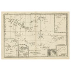
Engraving of an 18th-Century Measuring Device, Based on Double Reflection, C1780
About the Item
"Occasus Ortus"
This engraving illustrates an 18th-century measuring device.
The instrument, built after the principle of the double reflection, allowed precise observations with angular measurements up to 90°.
Source unknown, to be determined.
Artists and Engravers: Anonymous.
Condition: Good, given age. General age-related toning and/or occasional minor defects from handling. Please study scan carefully.
- Dimensions:Height: 10.67 in (27.1 cm)Width: 8.43 in (21.4 cm)Depth: 0 in (0.02 mm)
- Materials and Techniques:
- Period:1780-1789
- Date of Manufacture:ca.1780
- Condition:
- Seller Location:Langweer, NL
- Reference Number:
About the Seller
5.0
Platinum Seller
These expertly vetted sellers are 1stDibs' most experienced sellers and are rated highest by our customers.
Established in 2009
1stDibs seller since 2017
1,919 sales on 1stDibs
Typical response time: <1 hour
- ShippingRetrieving quote...Ships From: Langweer, Netherlands
- Return PolicyA return for this item may be initiated within 14 days of delivery.
More From This SellerView All
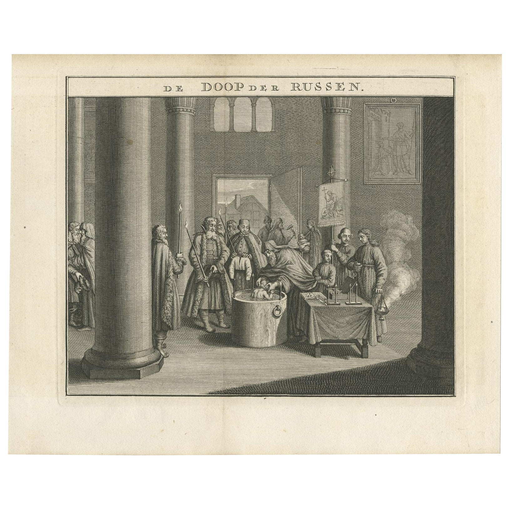
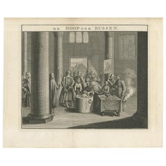
- Mid-18th Century Engraving Depicting The Baptism of Russians, 1735Located in Langweer, NLDescription: Antique print titled 'De Doop der Russen' (Dutch for 'Baptism of the Russians') Old print depicting the baptism of Russians. This print originates from 'Hedendaegsch...Category
Antique 1730s Prints
MaterialsPaper
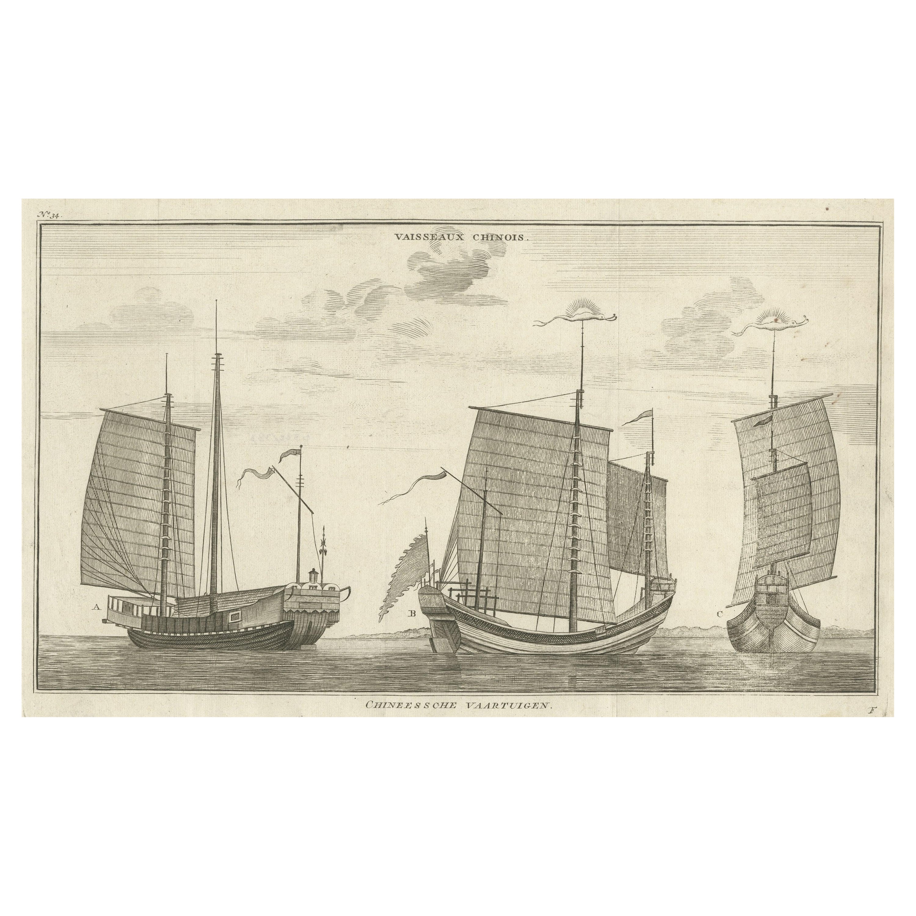
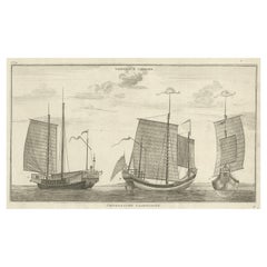
- Antique Original Engraving of Chinese Vessels in the 18th Century, 1765Located in Langweer, NLDescription: Plate no.34: 'Vaisseaux chinois.' (Chinese vessels.) This original auhentic plate originates from: 'Reize rondom de werreld, Gedaan in de jaaren 1740 tot 1744, door den ...Category
Antique 1760s Prints
MaterialsPaper
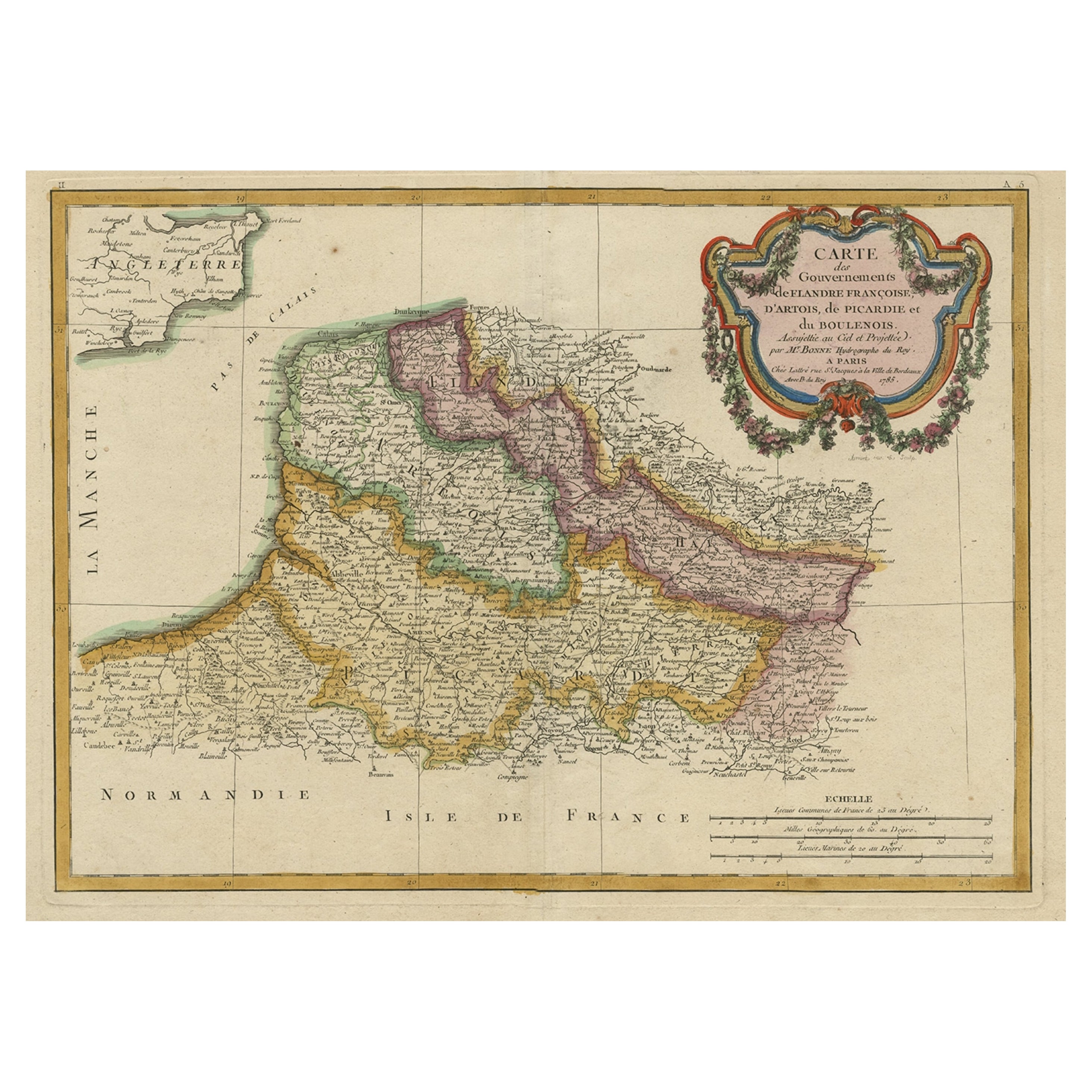
- Decorative Map of the French Regions of Picardy, Artois & French Flanders, c1780Located in Langweer, NLAntique map titled 'Carte des Gouvernements de Flandre Francoise, d'Artois, de Picardie et du Boulenois.' An attractive example of Rigobert Bonne's 1771 decorative map of the Fre...Category
Antique 1780s Maps
MaterialsPaper
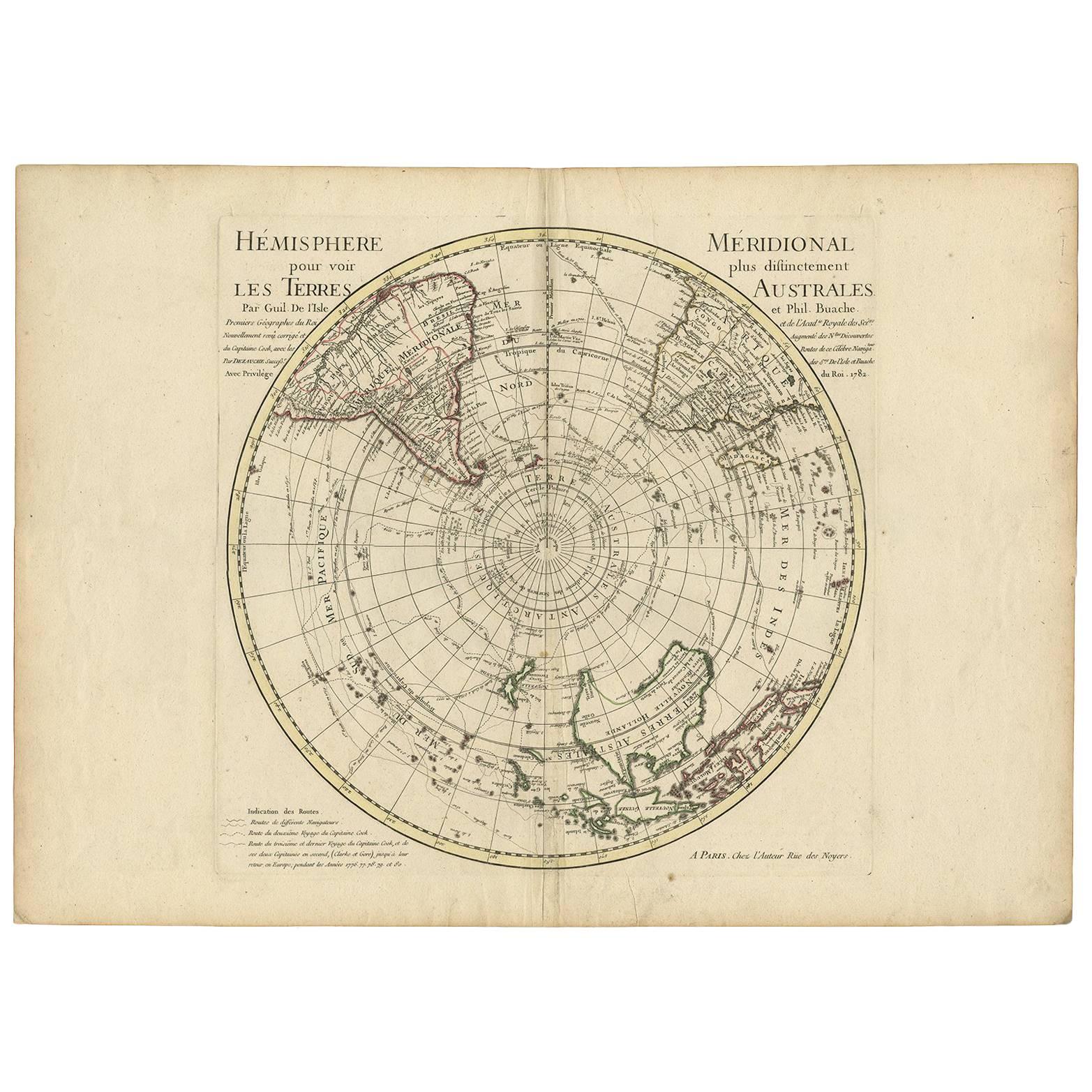
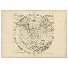
- 18th Century Antique Engraving of the Southern Hemisphere by G. de L'IsleBy Guillaume De L'IsleLocated in Langweer, NLAntique map titled 'Hemisphere Meridional pour voir plus distinctement Les Terres Australes'. Hemispherical map of the southern hemisphere centered on ...Category
Antique Late 18th Century Maps
MaterialsPaper
- Copper Engraved Map of Tierra del Fuego and the Strait of Magellan, c1780Located in Langweer, NLAntique map titled 'Extremite Meridionale de l'Amerique.' Copper engraved map of Tierra del Fuego and the Strait of Magellan with five detailed insets of the region showing soundings, anchorages, etc. Engraved by Andre. This map originates from 'Atlas de Toutes les Parties Connues du Globe Terrestre'. Artists and Engravers: Rigobert Bonne (1727-1795 ) was one of the most important cartographers of the late 18th century. In 1773 he succeeded Jacques Bellin as Royal Cartographer to France in the office of the Hydrographer at the Depôt de la Marine. Working in his official capacity Bonne compiled some of the most detailed and accurate maps of the period. Bonne's work represents an important step in the evolution of the cartographic ideology away from the decorative work of the 17th and early 18th century towards a more detail oriented and practical aesthetic. With regard to the rendering of terrain Bonne maps...Category
Antique 1780s Maps
MaterialsPaper
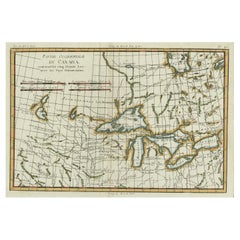
- Old Map of the Great Lakes and Upper Mississippi Valley, Northern America, c1780Located in Langweer, NLAntique map titled 'Partie Occidentale du Canada'. A fine example of Rigobert Bonne and Guilleme Raynal's 1780 map of the Great Lakes and upper Mississippi Valley. A map of c...Category
Antique 1780s Maps
MaterialsPaper

You May Also Like
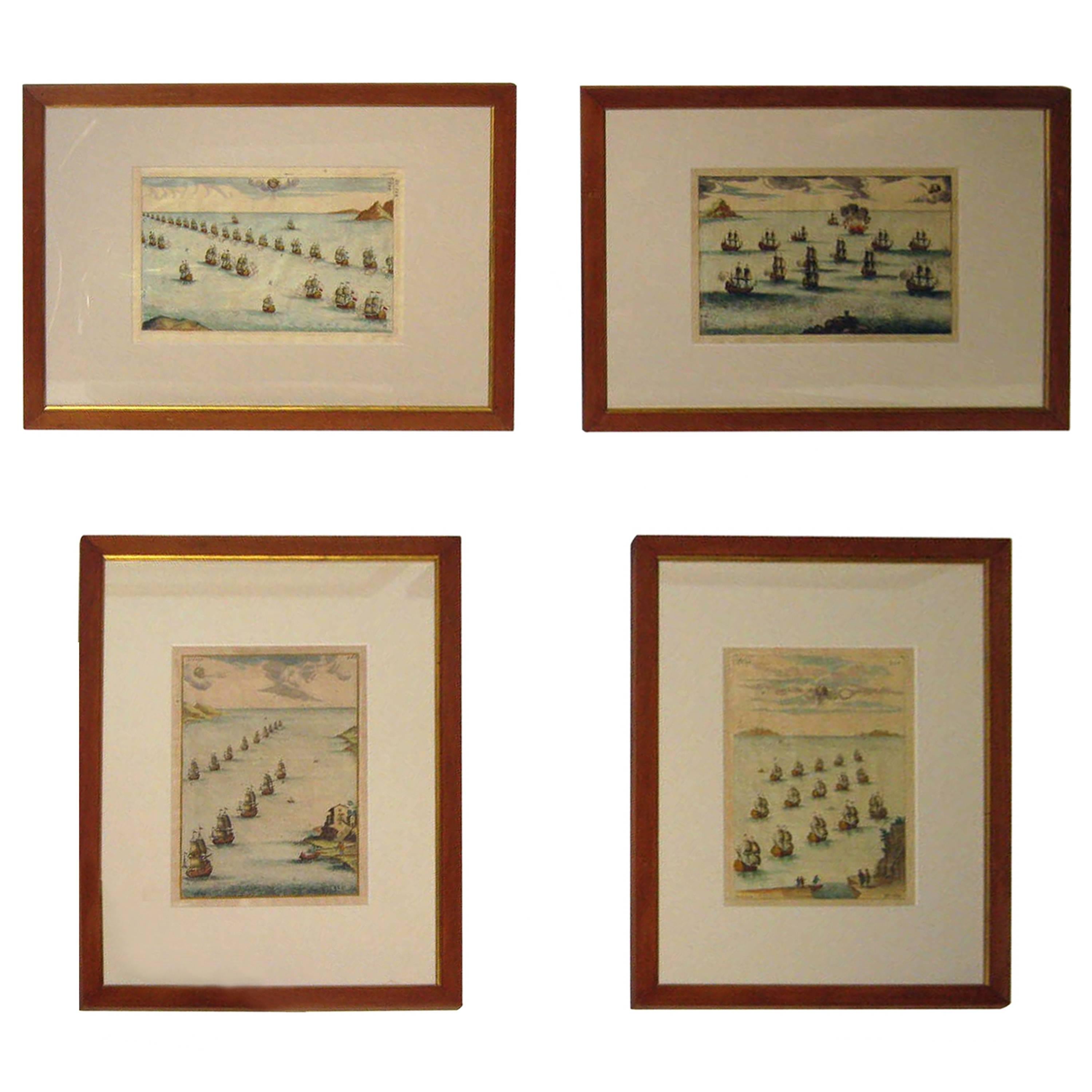
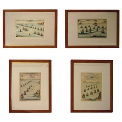
- 18th century Set Hand Colored Nautical EngravingsBy M. OgierLocated in Savannah, GASigned M. Ogier (Fecit:by), this set of four hand colored engravings is part of a larger edition of plates. These plates are numbered PL 16, 347, 365 and 386. The subject is probably...Category
Antique 18th Century Unknown Elizabethan Prints
MaterialsGlass, Wood, Paper
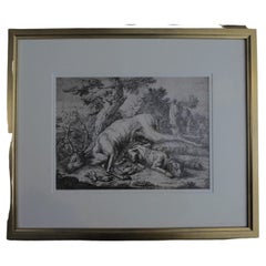
- Framed Johann Elias Ridinger Engraving, 18th Stag EngravingLocated in Perth, GBFine 18th century engraving of a stag, after the hunt, with a magnificient dog at rest, in a country scene, beautifully depicted.Category
Antique 18th Century Prints
MaterialsPaper
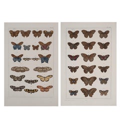
- Antique Albertus Seba Pair 18th Century Hand-Colored Engravings ButterflyBy Albertus Seba 1Located in Washington, DCRare pair of original hand-colored prints from Sir Albertus Seba's cabinet of natural curiosities. Prints come from published volumes in Amste...Category
Antique Mid-18th Century Dutch Prints
MaterialsPaper
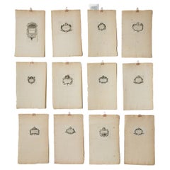
- Set of Twelve 18th century Printer's DevicesLocated in Toronto, CASet of twelve individual sheets with affixed printers' devices, each featuring individual designs along with wording in old french, dating from approximately 1700. Printers' devices ...Category
Antique Early 1700s French Louis XV Prints
MaterialsPaper
- West Coast of Africa, Guinea & Sierra Leone: An 18th Century Map by BellinBy Jacques-Nicolas BellinLocated in Alamo, CAJacques Bellin's copper-plate map entitled "Partie de la Coste de Guinee Dupuis la Riviere de Sierra Leona Jusquau Cap das Palmas", depicting the coast of Guinea and Sierra Leone in ...Category
Antique Mid-18th Century French Maps
MaterialsPaper
- City View of Nuremberg, Germany: An 18th Century Hand-Colored Map by M. SeutterBy Matthew SeutterLocated in Alamo, CAAn 18th century hand-colored city view of Nuremburg, Germany entitled "Geometrischer Grundris der des Heiligen Römischen Reichs Freyen Stadt Nürnberg" by Matthaus Seutter from his "A...Category
Antique Mid-18th Century German Maps
MaterialsPaper


Recently Viewed
View AllMore Ways To Browse
Chinese Glass Cabinet
Black Wallpaper
Display Cabinet With Mirrors
Retro Chinese Cabinets
Retro Chinese Cabinet
Large Flemish
China Cabinet Glass
Standing Kitchen Cabinet
China Cabinet Retro
Antique Tapestry Frame
6 Doors Cabinet
Panel Door Set
Modern Kilim Rug Black
Garden Dress
Small Tapestry
Textiles For Hanging
Vintage Tool Case
Mid Century Modern Metal Wall Sculptures