Items Similar to Italian Contemporary Handcolored Old Map Printed on Rough Canvas "The Globe"

Video Loading
Want more images or videos?
Request additional images or videos from the seller
1 of 21
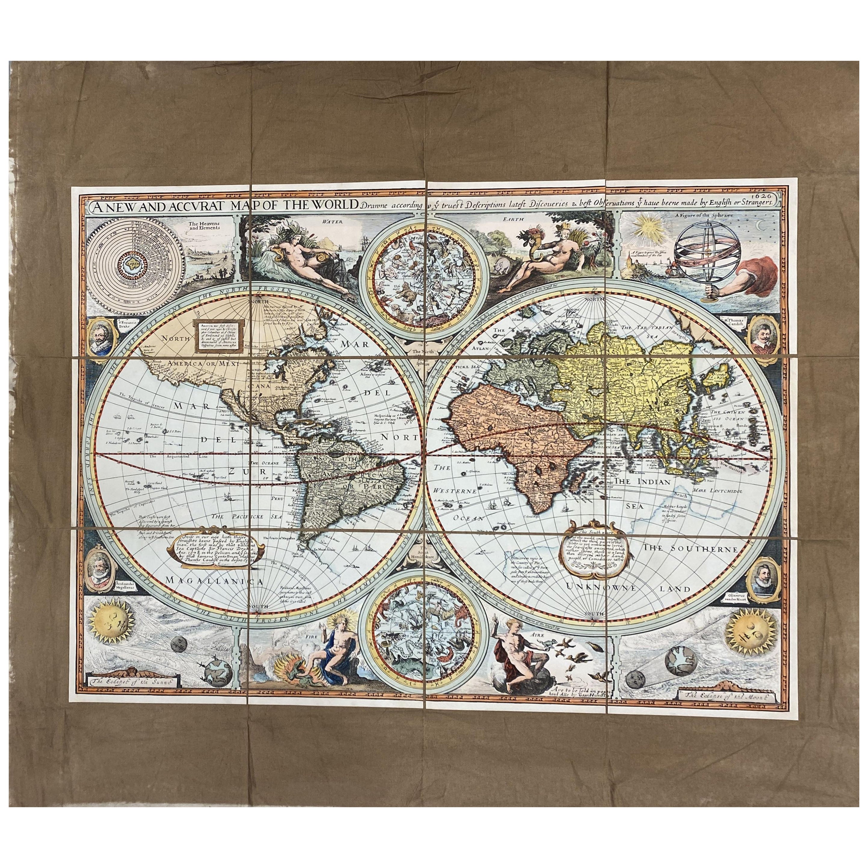
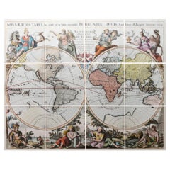
Italian Contemporary Handcolored Old Map Printed on Rough Canvas "The Globe"
About the Item
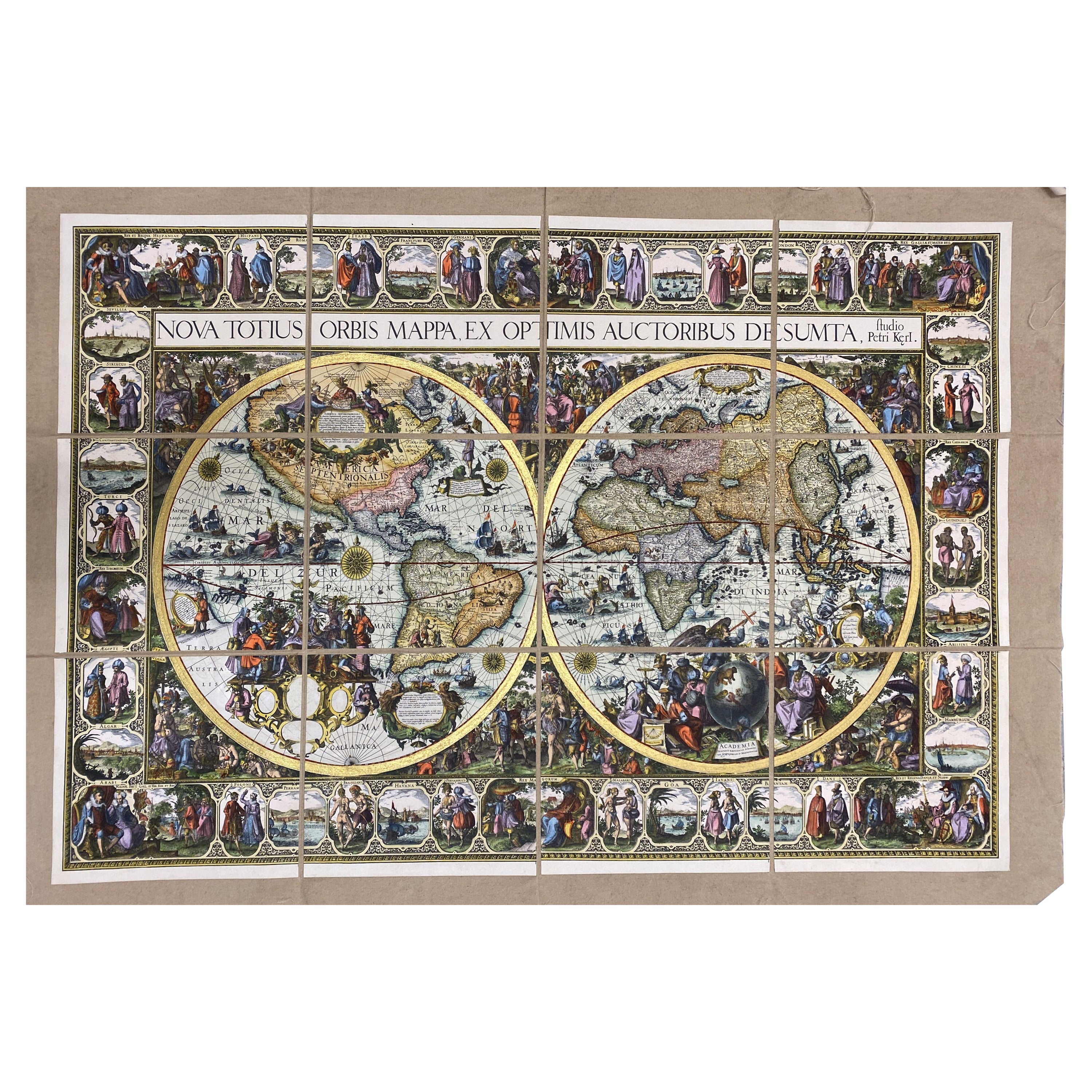
Beautiful reproduction of an antique French map showing the globe divided into the two hemispheres, made in Paris nl 1694 by H. Jaillot.
Internal measure: 85 x 68.5 cm
The technique of applying the print on a cotton canvas dates back to the eighteenth century.
The background, in hand-aged Ghinea cotton, acts as a backdrop for the hand-colored geography paper sectioned into various squares to form an unusual composition.
The geographic maps are copies of originals dated around the seventeenth century.The technique of applying the print on a cotton canvas dates back to the eighteenth century.
Hubert Jaillot, one of the most important French cartographers of the 17th century, was born 1632. He had a partnership with Nicolas Sanson's son and re-published and re-engraved many Sanson maps. The Atlases and map mainly have been printed by Pierre Mortier in Amsterdam but also in Paris. He died 1712 in Paris.
With an experience of over 40 years, Artecornici design create high quality handmade frames using precious woods and working various types of high quality finishes, lacquers and aging, offering a vast choice of models.
Each print is an artisanal Florentine product, reproducing images of the European eighteenth and nineteenth centuries with the same printing techniques (engraving with a star press), the golden age of prints, which are then finished and watercolored exclusively by hand .The richness of our work lies in the ability to make our customers' requests our own, creating products with personalized, unique and precious creations, renewing our collections year after year.
- Dimensions:Height: 32.68 in (83 cm)Width: 47.25 in (120 cm)Depth: 0.12 in (3 mm)
- Materials and Techniques:
- Place of Origin:
- Period:
- Date of Manufacture:2024
- Production Type:New & Custom(Current Production)
- Estimated Production Time:3-4 weeks
- Condition:
- Seller Location:Scandicci, IT
- Reference Number:1stDibs: LU4850239184872
About the Seller
4.9
Gold Seller
These expertly vetted sellers are highly rated and consistently exceed customer expectations.
Established in 1981
1stDibs seller since 2019
75 sales on 1stDibs
Typical response time: <1 hour
- ShippingRetrieving quote...Ships From: Scandicci, Italy
- Return PolicyA return for this item may be initiated within 14 days of delivery.
More From This SellerView All
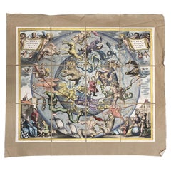
- Italian Contemporary Handcolored Old Map Printed Rough Canvas "Planisphere"Located in Scandicci, FlorenceBeautiful reproduction of an antique English map showing th Planisfere, with astral hemisfere, made in 1629. We can see with what mastery of joints and vivid colours the author depi...Category
21st Century and Contemporary Italian Prints
MaterialsCotton, Paper
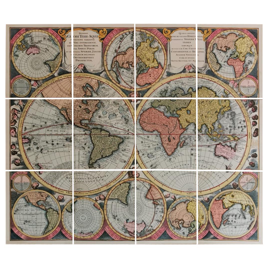
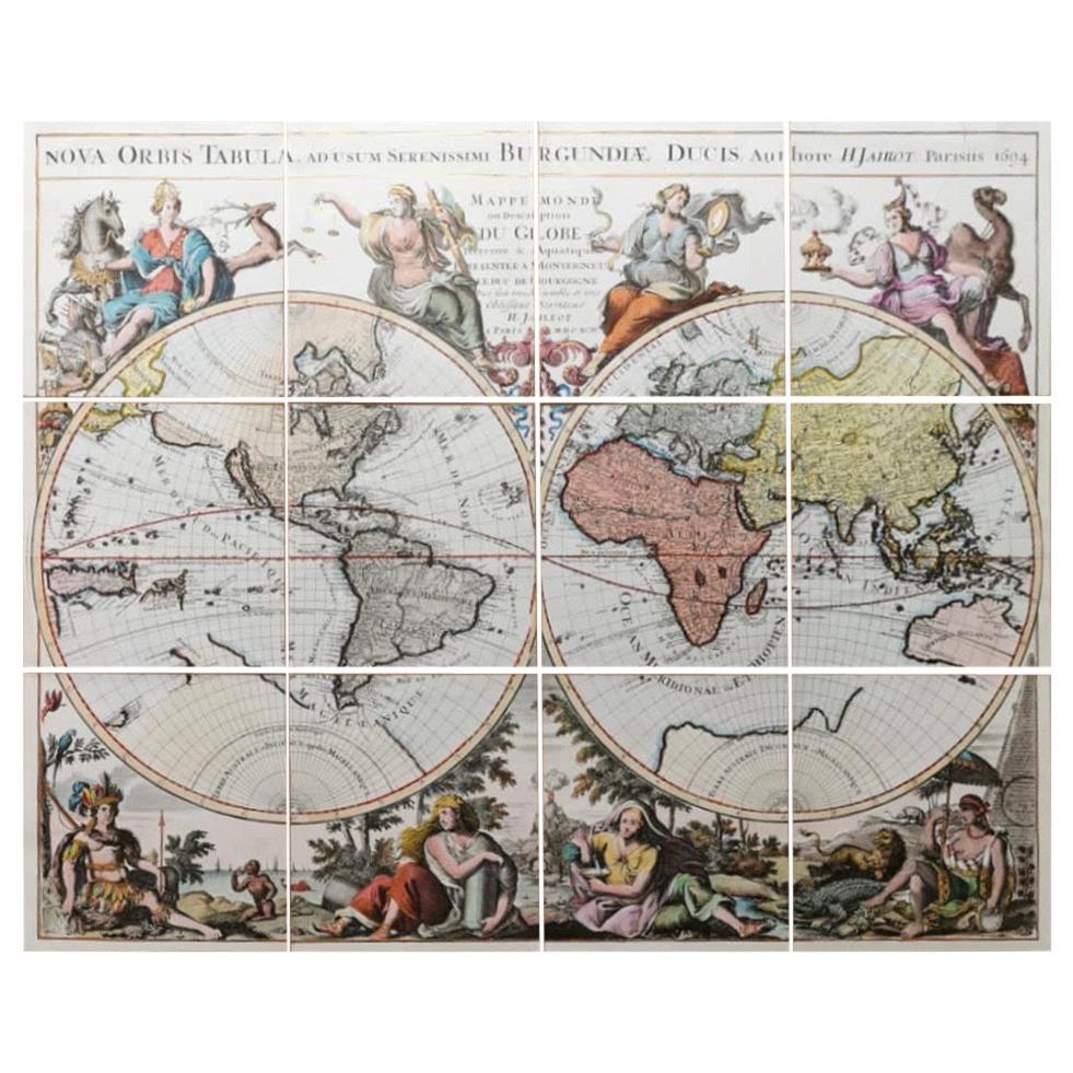
- Italian Handcolored Old Map Reproduction Printed on Rough CanvasLocated in Scandicci, FlorenceThe technique of applying the print on a cotton canvas dates back to the eighteenth century. The background, in hand-aged cotton, acts as a backdrop for the hand-colored geography pa...Category
21st Century and Contemporary Italian Prints
MaterialsCotton, Paper
- Italian Contemporary Handcolored Old Map Printed Rough Canvas "Astral Hemisper"Located in Scandicci, FlorenceBeautiful reproduction of an antique French map showing Astral Hemisfere, made around the age of the 17th century. We can see with what mastery of joints and vivid colours the autho...Category
21st Century and Contemporary Italian Prints
MaterialsCotton, Paper
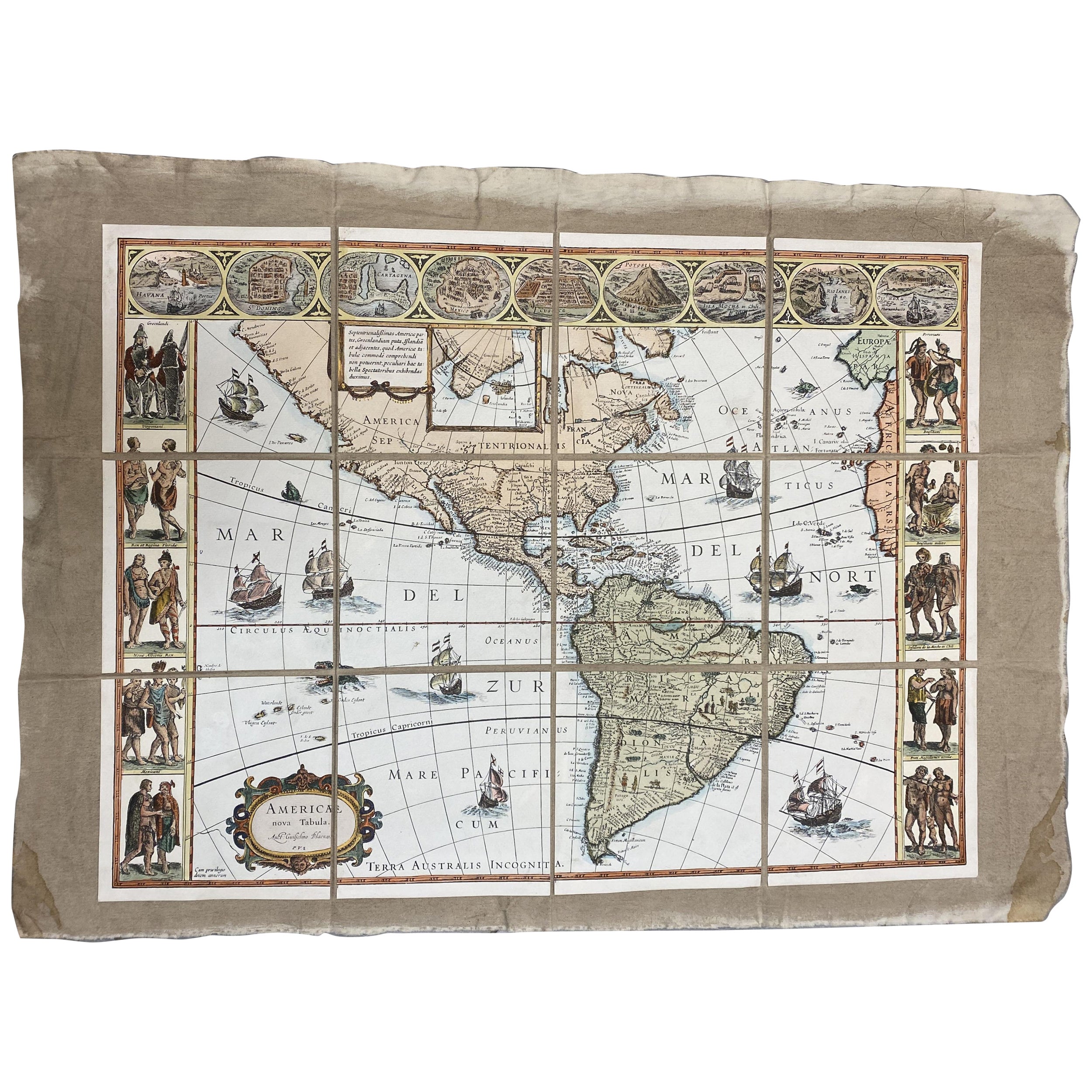
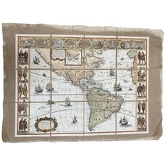
- Italian Contemporary Handcolored Old Map Printed on Canvas "The Americas"Located in Scandicci, FlorenceBeautiful reproduction of an antique map showing th Planisfere, with continets, lands and their populations. We can see with what mastery of joints and vivid colours the author depic...Category
21st Century and Contemporary Italian Prints
MaterialsCotton, Paper
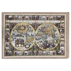
- Italian Contemporary Handcolored Old Map Printed on Canvas "Planisphere Ethnics"Located in Scandicci, FlorenceBeautiful reproduction of an antique English map showing th Planisfere, with continets, views of important cities and their population, made in 1602 By Petri Kerl. We can see with w...Category
21st Century and Contemporary Italian Prints
MaterialsCotton, Paper
You May Also Like
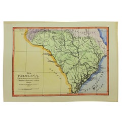
- Old Reproduction Handcolored Map of South Carolina, J. DraytonLocated in Charleston, SCVery fine old reproduction handcolored Map of Sud Carolina (South Carolina), the original from an early 19th century original by J. Drayton's Charte (1803) and the German Geographica...Category
Mid-20th Century American Paintings
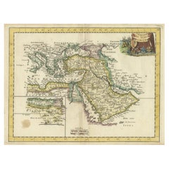
- Orginal Antique Handcolored Map of the Turkish Empire, 1748Located in Langweer, NLAntique map titled 'L'Empire des Turcs'. Old map of the Turkish Empire with an inset of the North African regions. Originates from 'Atlas Nouveau Portatif' by G.L. le Rouge. Artis...Category
Antique 18th Century Maps
MaterialsPaper
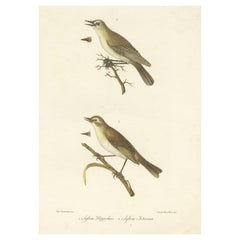
- Stunning Handcolored Old Bird Print of the Willow Wren & Icterine Warbler, 1832Located in Langweer, NLAntique bird print titled 'Sylvia Hippolais - Sylvia Icterina'. Old bird print showing the willow wren and icterine warbler. This print originates from 'Iconografia della fauna itali...Category
Antique 1830s Prints
MaterialsPaper
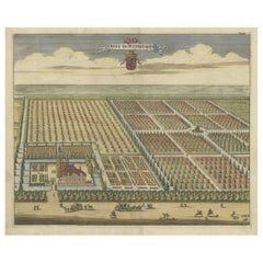
- Old Handcolored Print of the Watervliet Estate in East Flanders, Belgium, 1696Located in Langweer, NLAntique print titled 'Huys te Watervliet'. Copper engraving of the estate of Watervliet. This print originates from 'Nieuwe Cronyk van Zeeland' by Mattheus Smallegange. Artists a...Category
Antique 17th Century Prints
MaterialsPaper
- Old Handcolored Print of an Inhabitant of the Lowlands of Moravia, 1804Located in Langweer, NLOld print of an inhabitant of the Lowlands of Moravia. Moravia, traditional region in central Europe that served as the centre of a major medieval kingdom, known as Great Moravia, before it was incorporated into the kingdom of Bohemia in the 11th century. In the 20th century Moravia became part of the modern state of Czechoslovakia and subsequently of the Czech Republic. The region is bounded by Bohemia on the west and northwest, by Silesia on the northeast, by Slovakia on the east, and by Lower Austria on the south. This print originates from 'The Costume of the Hereditary States of the House of Austria' by William Miller. Artists and engravers: Engraved by William Ellis.Category
Antique Early 1800s Prints
MaterialsPaper
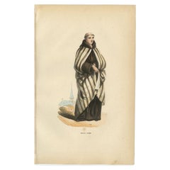
- Antique Print of a Carmelite Monk in Old Handcoloring, 1845Located in Langweer, NLAntique print titled 'Ancien Carme'. Print of a Carmelite. This print originates from 'Histoire et Costumes des Ordres Religieux'. Artists and Engravers: Author: Abbé Tiron. Co...Category
Antique 19th Century Prints
MaterialsPaper