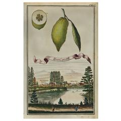
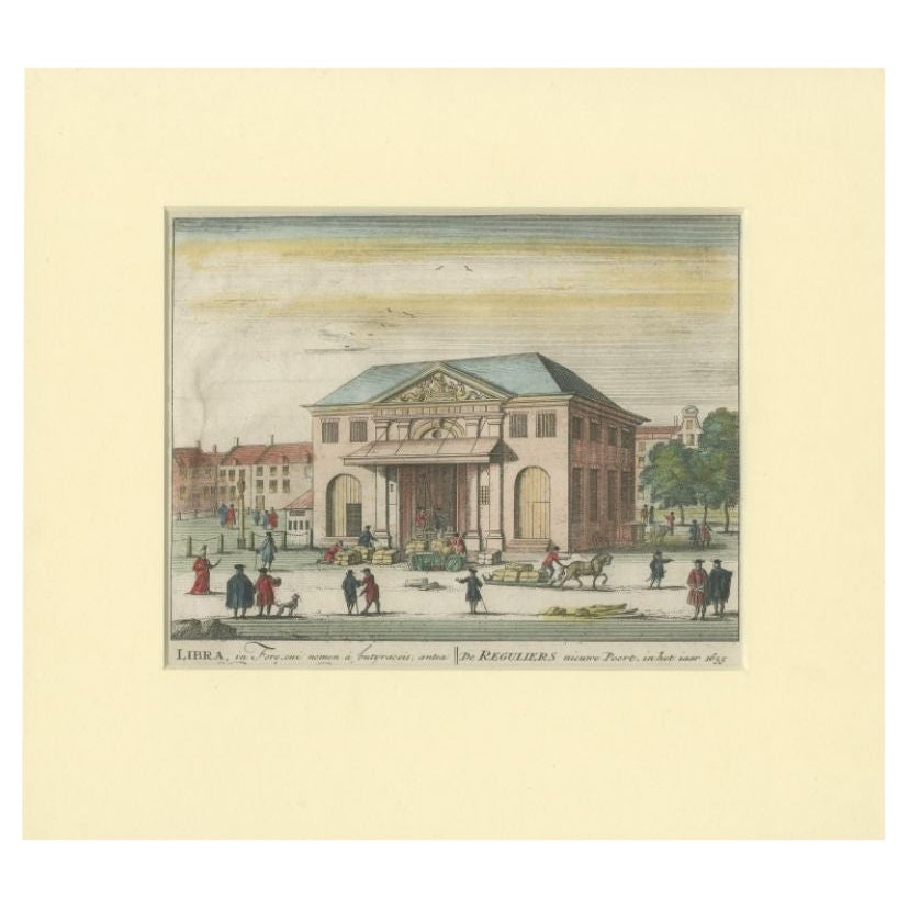
Limon Peretto, 1708
View Similar Items

1 of 1
Limon Peretto, 1708
About the Item
- Creator:Johann Christoph Volkamer (Artist)
- Dimensions:Height: 12.75 in (32.39 cm)Width: 8 in (20.32 cm)Depth: 0.2 in (5.08 mm)
- Place of Origin:
- Period:1700-1709
- Date of Manufacture:1708
- Condition:
- Seller Location:Houston, TX
- Reference Number:1stDibs: LU129323637682
Authenticity Guarantee
In the unlikely event there’s an issue with an item’s authenticity, contact us within 1 year for a full refund. DetailsMoney-Back Guarantee
If your item is not as described, is damaged in transit, or does not arrive, contact us within 7 days for a full refund. Details24-Hour Cancellation
You have a 24-hour grace period in which to reconsider your purchase, with no questions asked.Vetted Professional Sellers
Our world-class sellers must adhere to strict standards for service and quality, maintaining the integrity of our listings.Price-Match Guarantee
If you find that a seller listed the same item for a lower price elsewhere, we’ll match it.Trusted Global Delivery
Our best-in-class carrier network provides specialized shipping options worldwide, including custom delivery.You May Also Like
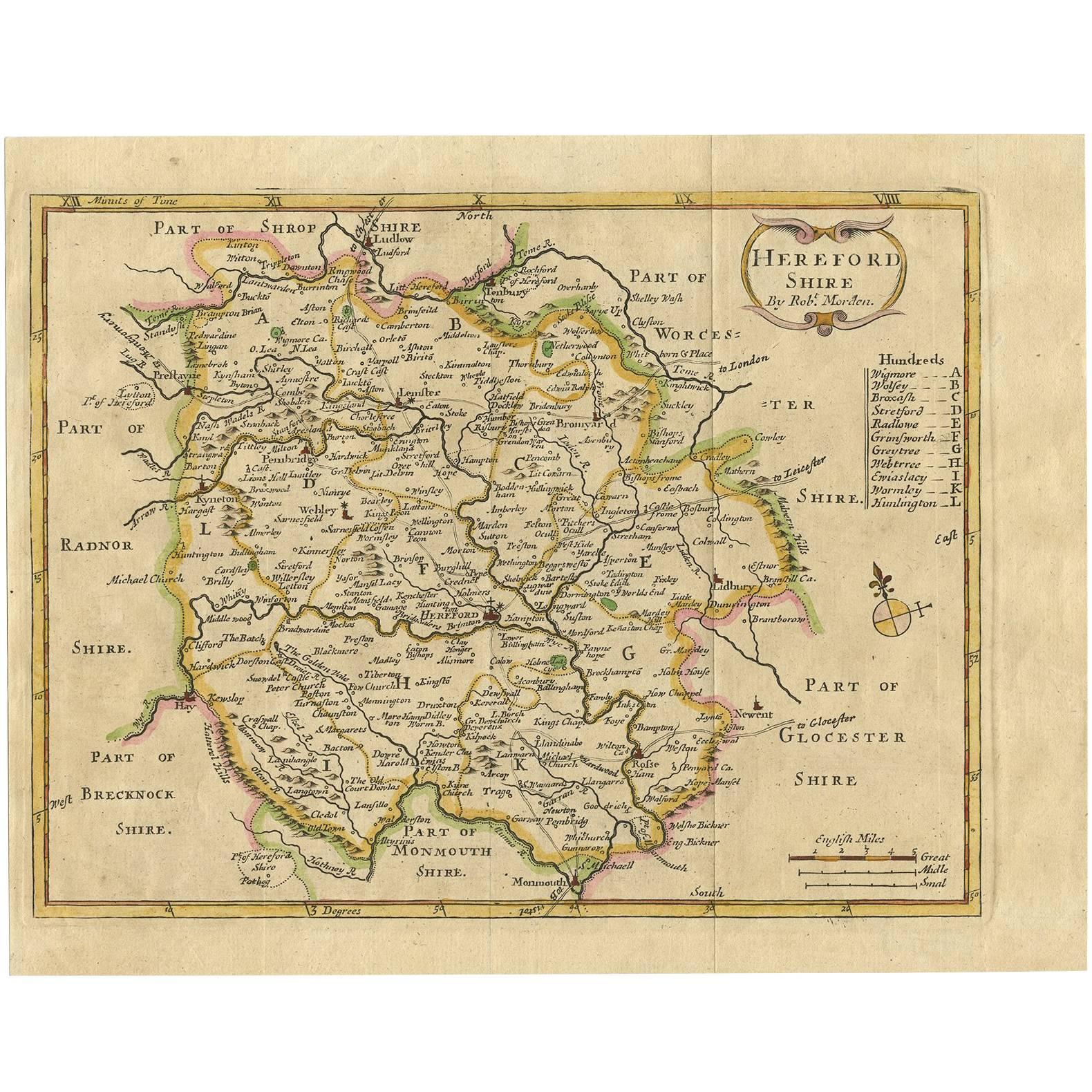
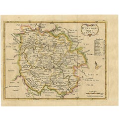
Antique Map of Herefordshire 'England' by R. Morden, 1708
Located in Langweer, NL
This antique County map of Herefordshire by Robert Morden was first published in 1701 in a work entitled 'The New Description and State of England'...
Category
Antique Early 18th Century Maps
Materials
Paper
$224 Sale Price
20% Off
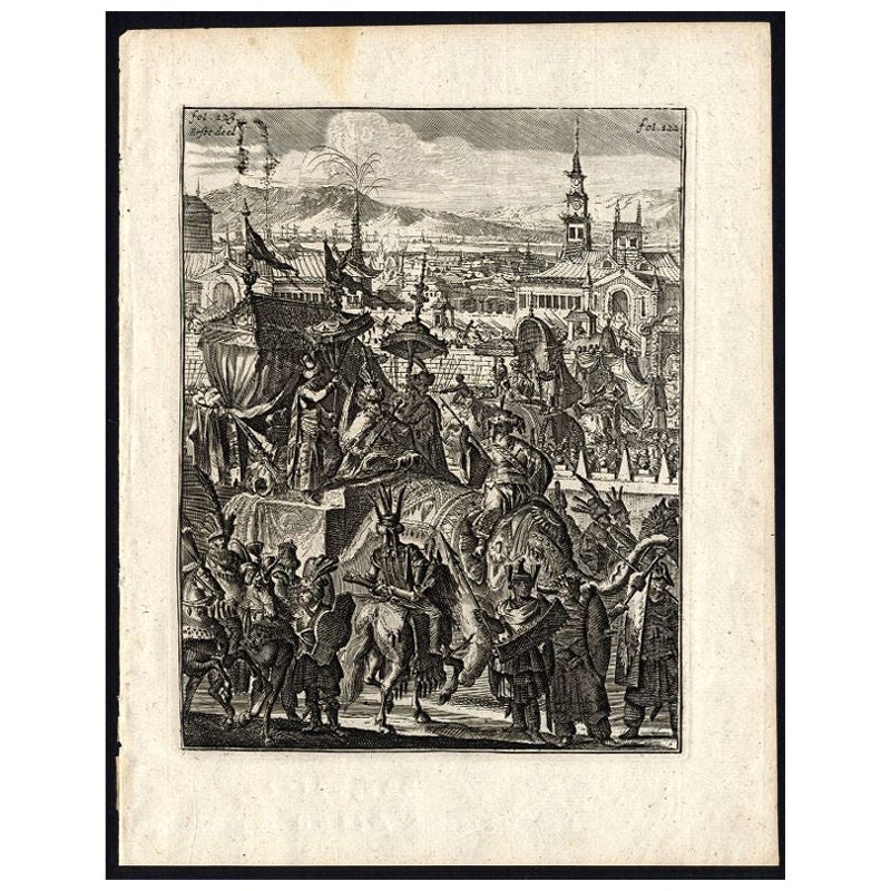
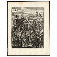
Antique Print of the King of Arrakan by Schouten, 1708
Located in Langweer, NL
Antique print titled 'Beschryving van de vijf-jarige verschijning des Koninks van Arakan, die met groote pragt en heerlikheyt geschiet.' View of the 5 yearly appearance of the King of Arrakan, with great beauty and display. Arrakan, present day Burma in 1660. This print originates from 'Wouter Schoutens, Reys-Togten naar en door Oost-Indien (..)', 2nd. edition, published by Andries van Damme, Amsterdam, 1708.
Artists and Engravers: Wouter Schouten (1638-1704) joined the Dutch VOC...
Category
Antique 18th Century Prints
Materials
Paper
$114 Sale Price
20% Off
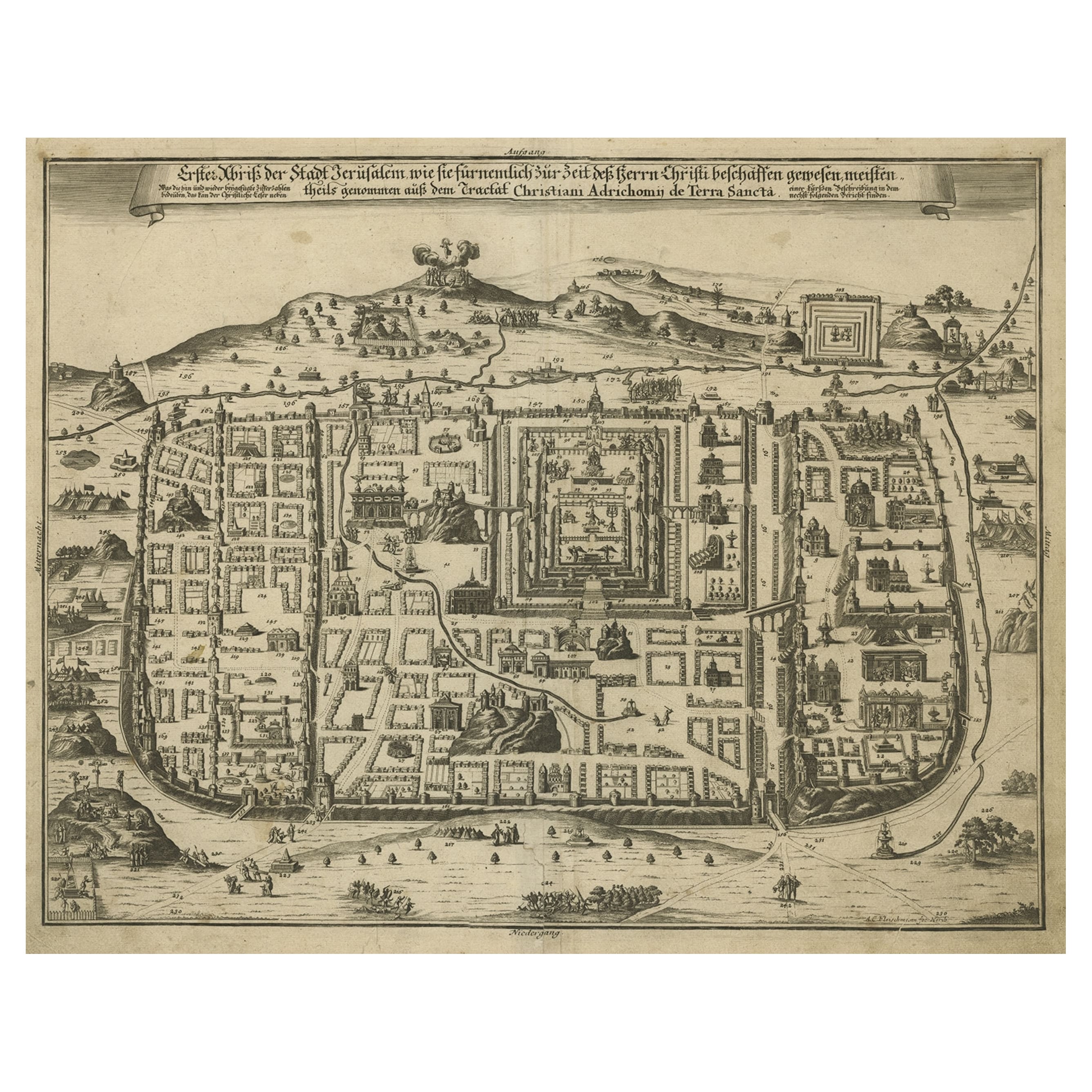
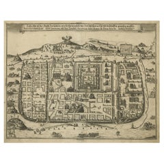
Spectacular Antique Original Engraving of a Town Plan of Jerusalem, 1708
Located in Langweer, NL
Description: Antique map titled 'Erster Abriss der Stadt Jerusalem wie sie Furnemblich zur Zeit des Hernn Christi beschaffen (..).'
Spectacular town plan...
Category
Antique Early 1700s Maps
Materials
Paper
$1,256 Sale Price
20% Off
Antique Map of the Eastern Hemisphere by Valk & Chenk '1708'
Located in Langweer, NL
Antique map titled 'Hemispherium Orbis Antiqui, Cumzonis Circulis, Et Sity populorum Diverso'. Decorative example of Andreas Cellarius's map of the Eastern Hemisphere, illustrating with climatic zones ranging from Frigida Borealis to Torrida, with planetary details superimposed. The elaborate border includes fine scrollwork, numerous putti, and additional diagrams showing armillary spheres and climatic zones. Andreas Cellarius was born in 1596 in Neuhausen and educated in Heidelberg. He emigrated to Holland in the early 17th century and 1637 moved to Hoorn, where he became the rector of the Latin School. Cellarius' best known work is his Harmonia Macrocosmica, first issued in 1660 by Jan Jansson, as a supplement to Jansson's Atlas Novus. The work consists of a series of Celestial Charts...
Category
Antique Early 18th Century Maps
Materials
Paper

$3,938 Sale Price
25% Off
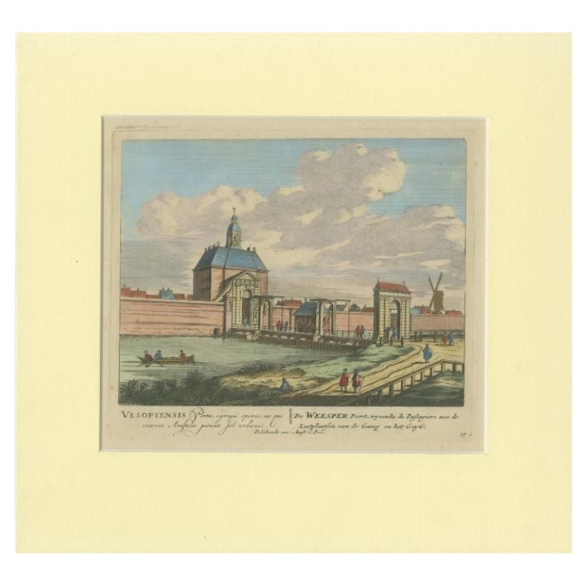
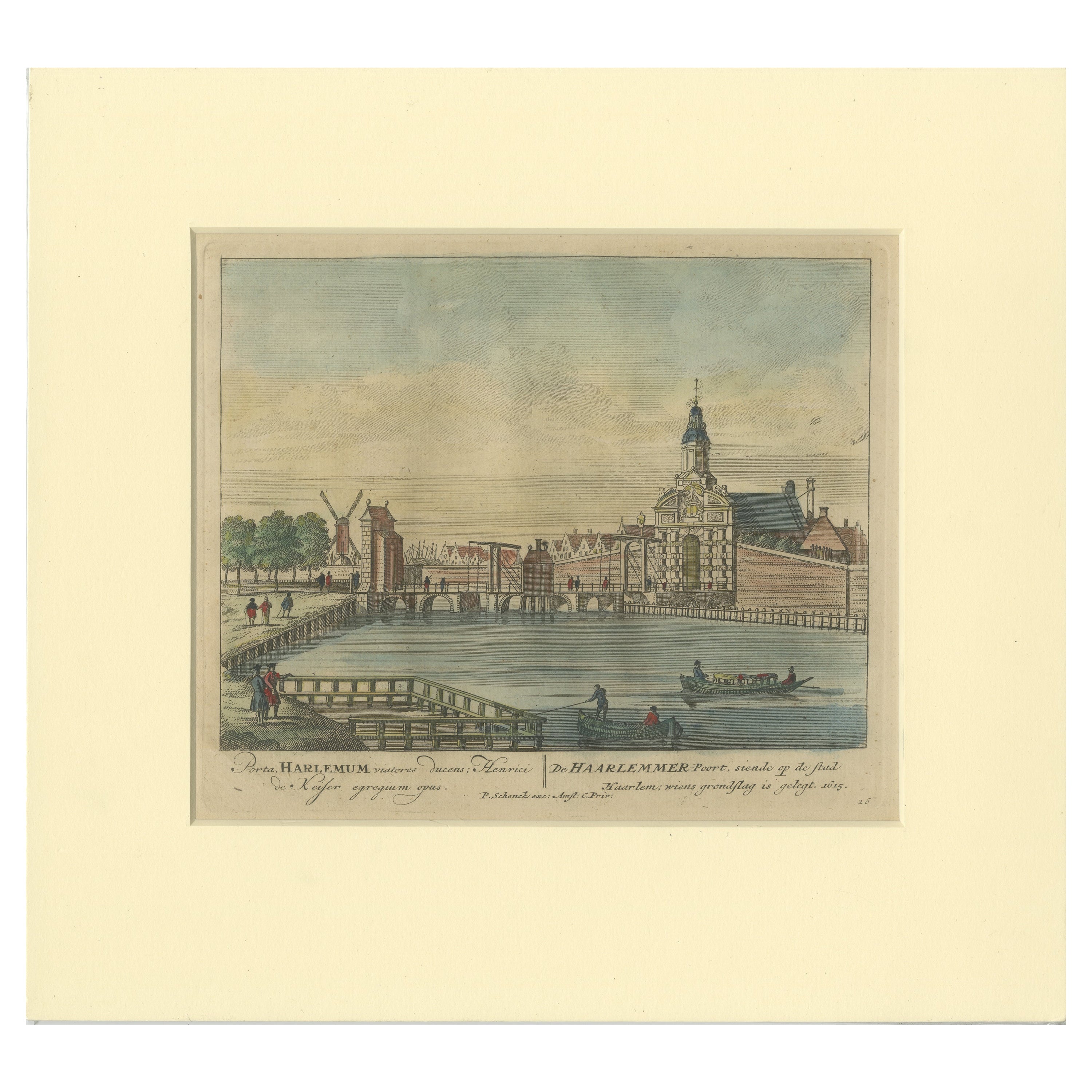
Antique Print of the 'Weesperpoort' in Amsterdam by Schenk, c.1708
Located in Langweer, NL
Antique print titled 'De Weesper Poort, wysende de passagiers naa de Lustplaatsen (..)'. View on the 'Weesperpoort' in Amsterdam, the Netherlands. This print originates from 'Afbeeld...
Category
Antique 18th Century Prints
Materials
Paper

$130 Sale Price
20% Off
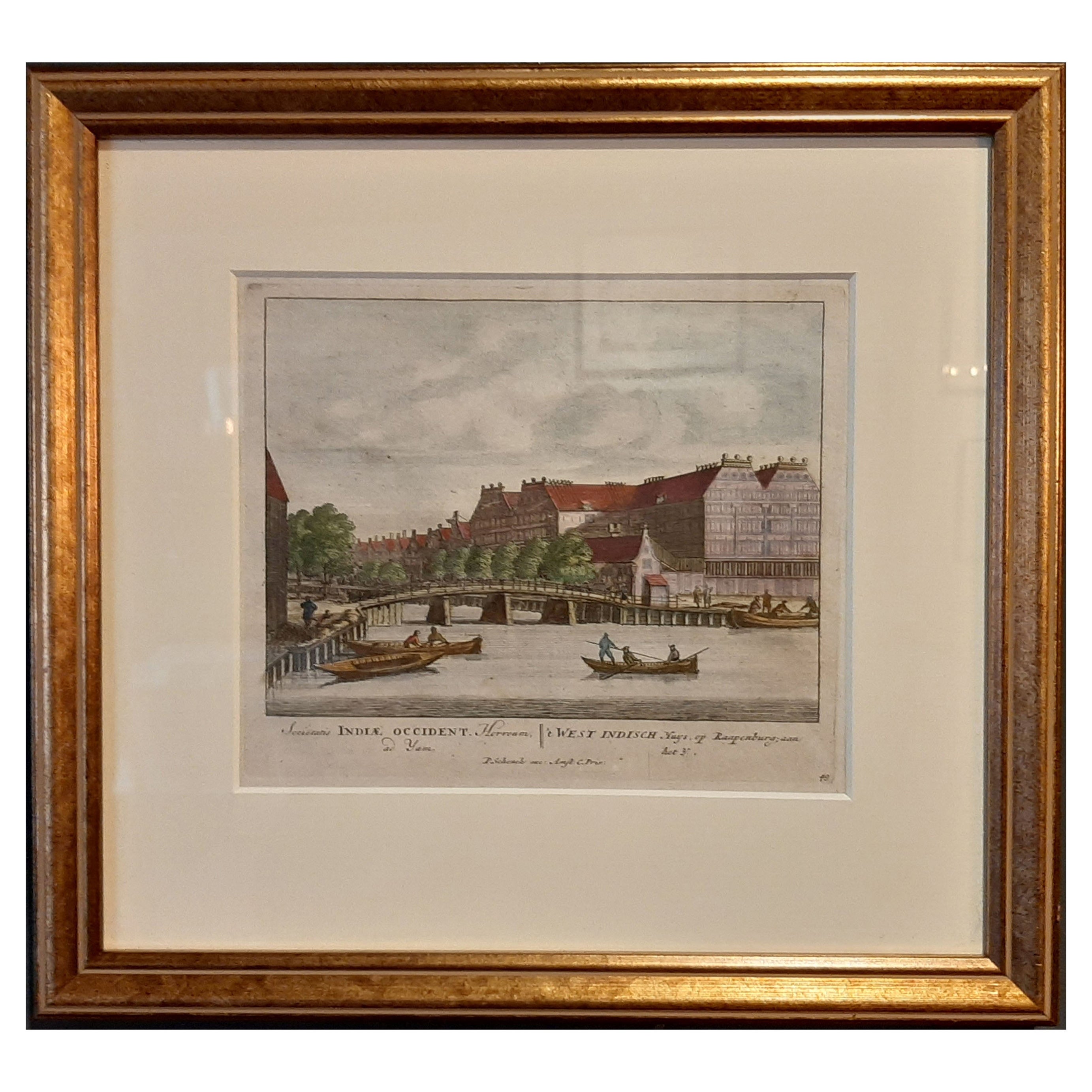
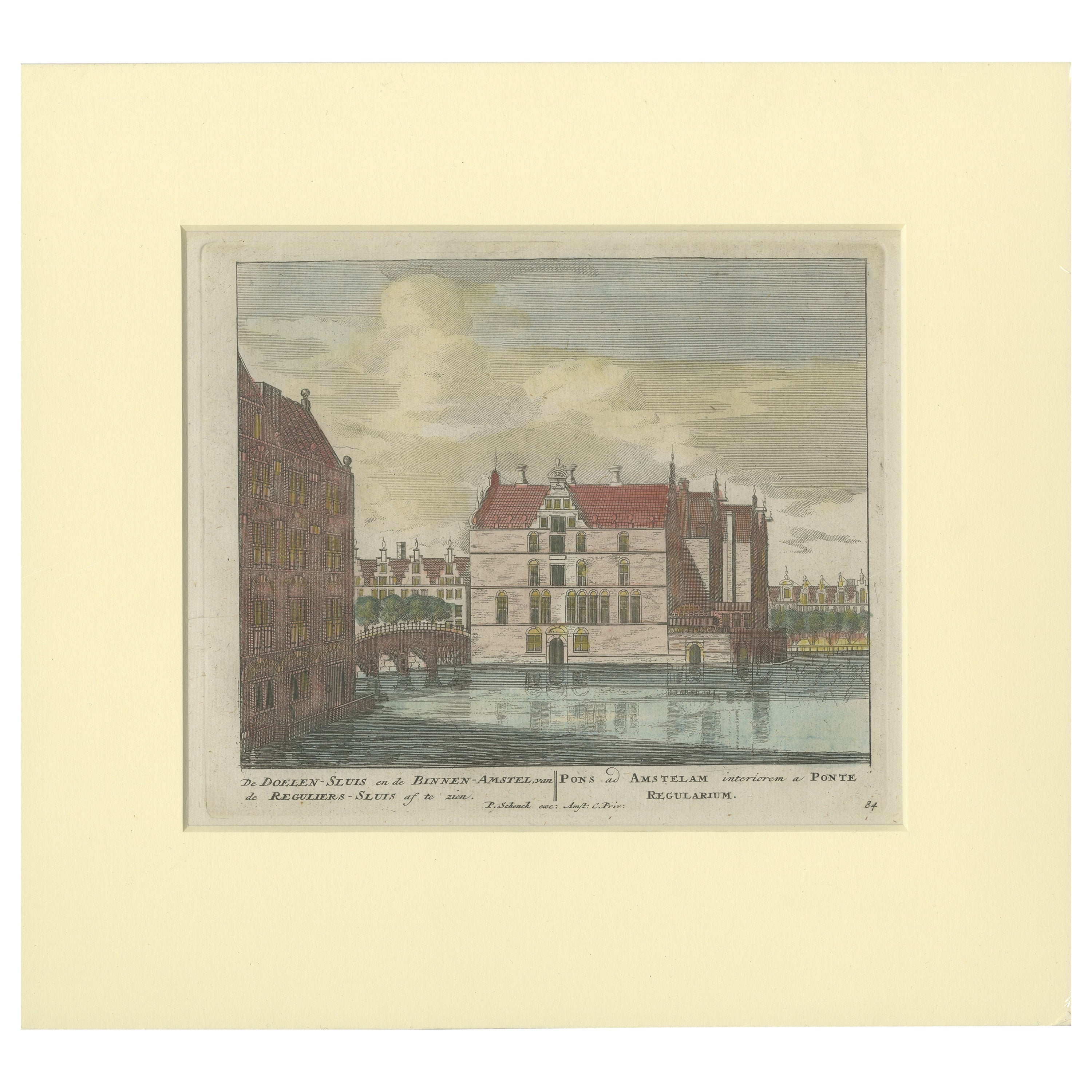
Framed View of the Brouwersgracht in Amsterdam, the Netherlands, 1708
Located in Langweer, NL
Antique print titled 'Societatis Indiae Occident (..) - West Indisch Huys op Raapenburg (..)'.
Despite the title suggesting this print is a view of the West-Indisch House in Amst...
Category
Antique Early 1700s Maps
Materials
Paper

$400 Sale Price
20% Off