
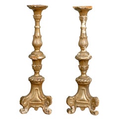
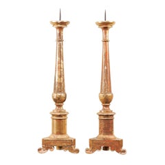
Pair of 18th Century French Framed Bernard Direx Astronomy / Geometric Rendering
View Similar Items


Want more images or videos?
Request additional images or videos from the seller
1 of 10
Pair of 18th Century French Framed Bernard Direx Astronomy / Geometric Rendering
$1,245List Priceper set
About the Item
- Creator:Bernard Direx (Maker)
- Dimensions:Height: 21 in (53.34 cm)Width: 16 in (40.64 cm)Depth: 0.75 in (1.91 cm)
- Sold As:Set of 2
- Materials and Techniques:
- Place of Origin:
- Period:
- Date of Manufacture:18th Century
- Condition:Wear consistent with age and use. Great condition considering age. Please see the various photos for further condition detail.
- Seller Location:Atlanta, GA
- Reference Number:Seller: Accessory #15471stDibs: LU87648567193
About the Seller
5.0
Platinum Seller
Premium sellers with a 4.7+ rating and 24-hour response times
Established in 1991
1stDibs seller since 2009
1,351 sales on 1stDibs
Authenticity Guarantee
In the unlikely event there’s an issue with an item’s authenticity, contact us within 1 year for a full refund. DetailsMoney-Back Guarantee
If your item is not as described, is damaged in transit, or does not arrive, contact us within 7 days for a full refund. Details24-Hour Cancellation
You have a 24-hour grace period in which to reconsider your purchase, with no questions asked.Vetted Professional Sellers
Our world-class sellers must adhere to strict standards for service and quality, maintaining the integrity of our listings.Price-Match Guarantee
If you find that a seller listed the same item for a lower price elsewhere, we’ll match it.Trusted Global Delivery
Our best-in-class carrier network provides specialized shipping options worldwide, including custom delivery.More From This Seller
View AllPair of Italian 18th Century Giltwood Altarsticks
Located in Atlanta, GA
A pair of Italian late 18th, early 19th century gilded altarsticks. This pair of Italian good sized altarsticks features gilding on all sides. The central column is carved with delic...
Category
Antique 18th Century Italian Candle Holders
Materials
Wood
Pair of Italian 19th Century Altar Sticks/Tall Gilded Candlesticks
Located in Atlanta, GA
Pair of Italian, 19th century gilded altar sticks. This pair of antique Italian altar sticks are more than 3 ft tall and each feature a beautifully turned central column which has been lifted up on a triangular-shaped base and three curved bracket feet. There is nicely aged gilt and old paint remnants along their front sides. The backsides of these altars are unfinished, making them best used with backs to a wall. This pair of 19th century Italian altar sticks...
Category
Antique 19th Century Italian Candlesticks
Materials
Metal
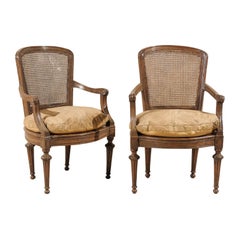
Pair of Italian 18th Century Wooden Armchairs
Located in Atlanta, GA
A pair of 18th century Italian wooden armchairs with cane seats and backs, tapered legs, scrolled arms and cushions.
Category
Antique 18th Century Italian Armchairs
Materials
Wood
$3,748 / set
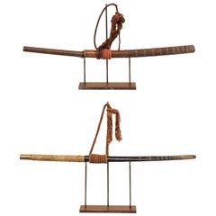
Laotian Pair of 19th Century Daab Swords Presented on Custom Stands
Located in Atlanta, GA
A pair of Laos swords from the late 19th century on custom stands. This pair of antique swords from Laos, often referred to as a daab or dha, were quick ...
Category
Antique Late 19th Century Laotian Arms, Armor and Weapons
Materials
Iron
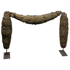
A Large Swedish 18th C. Tole Swag Architectural Element Mounted on Metal Stand
Located in Atlanta, GA
A Swedish 18th century large tole architectural swag mounted on an iron stand. This antique swag came from a building in Sweden. This unique piece consists of a rich foliage motif that appears to be draping on its stand. The general color of this unique piece is a moss-green tone. With its classical elegance, this 18th century Swedish architectural...
Category
Antique 18th Century Swedish Neoclassical Mounted Objects
Materials
Tôle, Metal
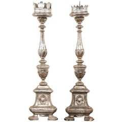
Pair of Tall Italian 19th Century Silver Gilt Candlesticks from Italian Church
Located in Atlanta, GA
A pair of large-sized 19th century Italian candlesticks. This pair of antique candlesticks, circa 1850, were originally displayed in an Italian church and feature silver gilt over exquisite hand-carved wood bodies. Each candlestick is approximately 3 foot tall...
Category
Antique 19th Century Italian Religious Items
Materials
Metal
You May Also Like
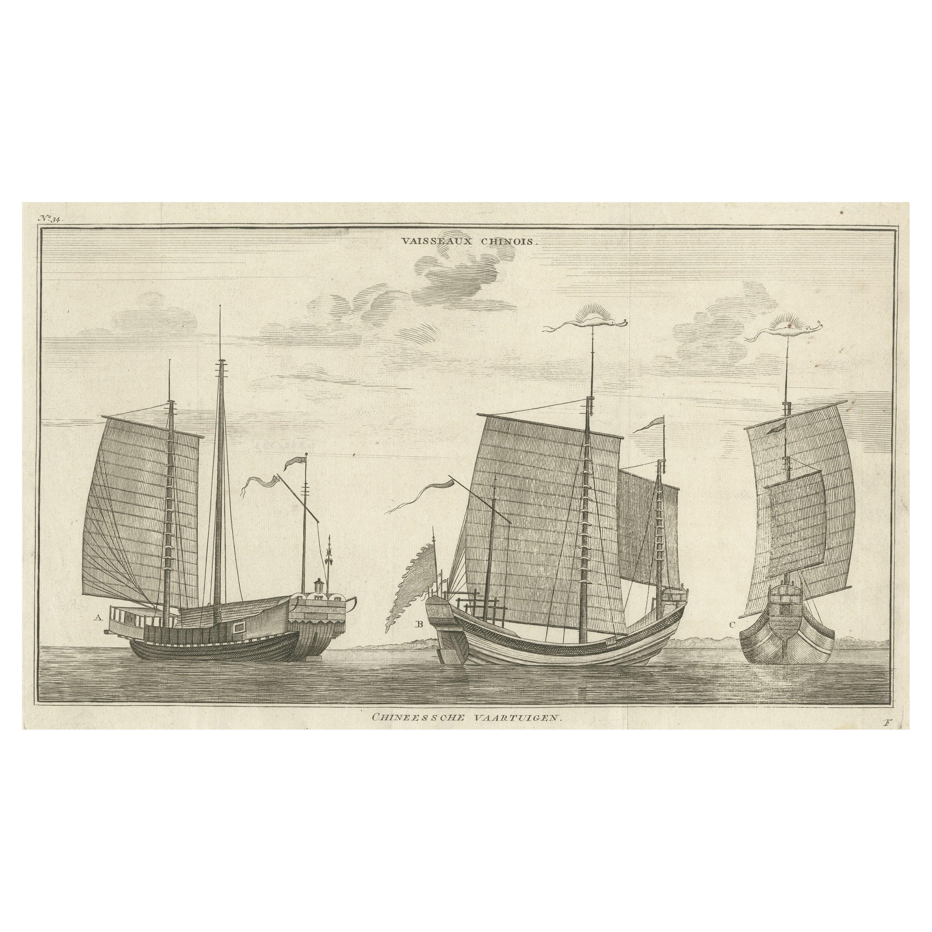
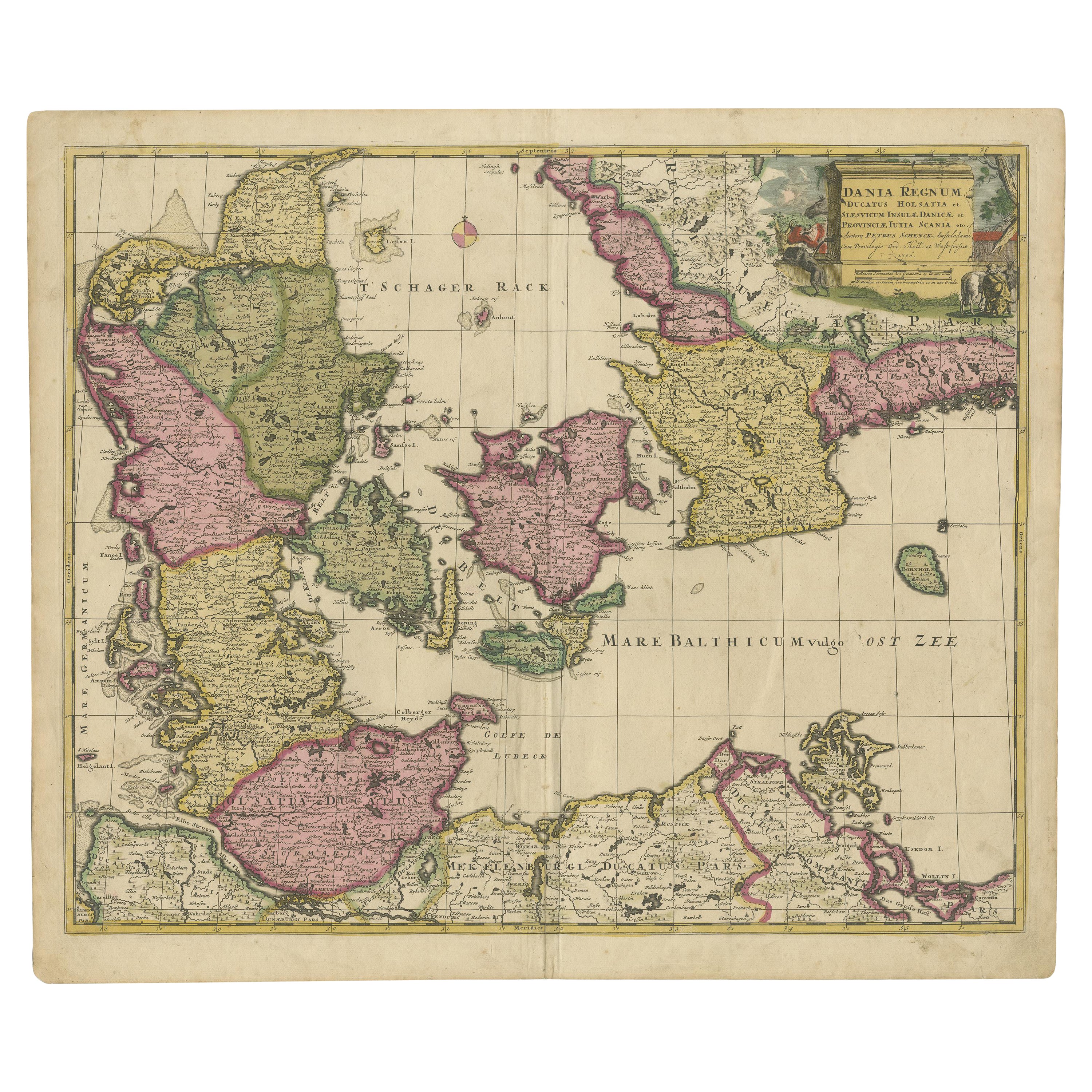
South America: Hand-colored 18th Century Framed Map by Thomas Jefferys
By Thomas Jefferys
Located in Alamo, CA
This detailed hand-colored map of South America by Thomas Jefferys was published in London in 1750. The map shows countries, early colonial possessions, towns, rivers, mountains, and...
Category
Antique Mid-18th Century English Maps
Materials
Paper

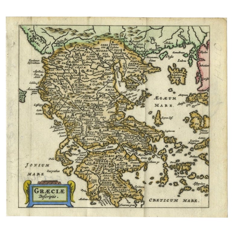
Charming 18th Century Miniature Map of Greece, 1685
Located in Langweer, NL
Antique map titled 'Graeciae Descriptio.' Charming miniature map of Greece from the pocket atlas 'Introductionis in Universam Geographiam tam Veterem qu...
Category
Antique 17th Century Maps
Materials
Paper
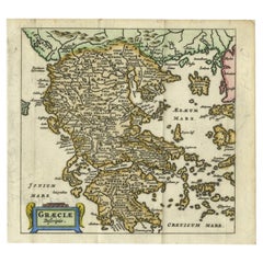
$333 Sale Price
20% Off
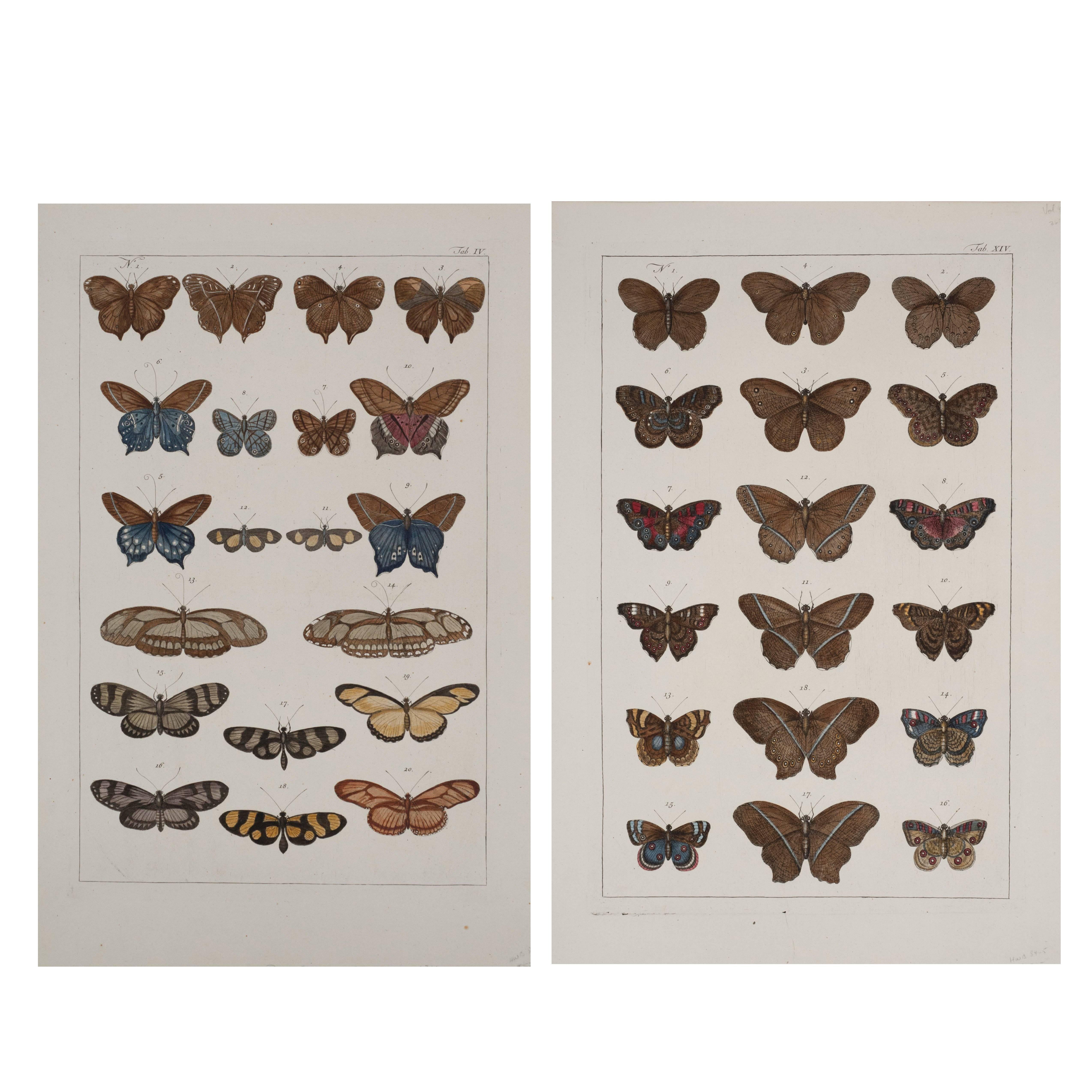
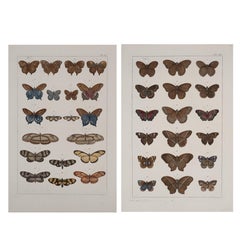
Antique Albertus Seba Pair 18th Century Hand-Colored Engravings Butterfly
By Albertus Seba 1
Located in Washington, DC
Rare pair of original hand-colored prints from Sir Albertus Seba's cabinet of natural curiosities. Prints come from published volumes in Amste...
Category
Antique Mid-18th Century Dutch Prints
Materials
Paper
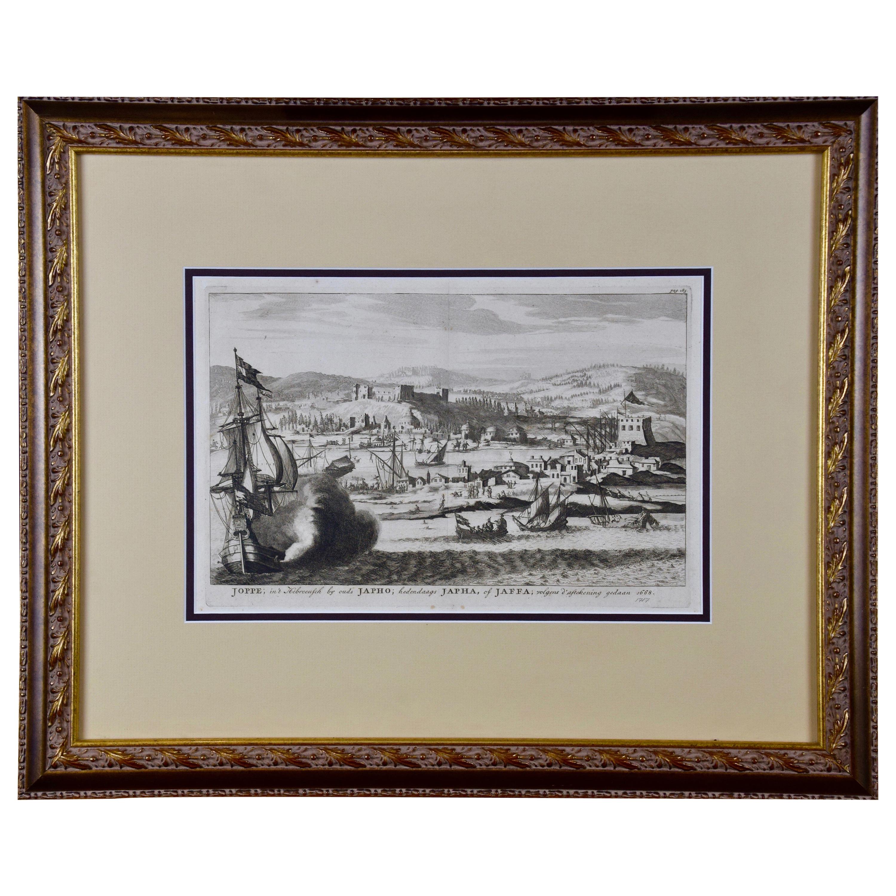
18th Century French Map and City View of Joppe/Jaffa 'Tel Aviv' by Sanson
By Nicolas Sanson
Located in Alamo, CA
An original antique engraving entitled "Joppe; in ’t Hebreeusch by ouds Japho; hedendaags Japha, of Jaffa; volgens d’aftekening gedaan 1668", by Nicholas Sanson d'Abbeville (1600 - 1667). This is a view of the city of Joppe (in Hebrew Japho), now called Japha or Jaffa, the harbor portion of modern day Tel Aviv, Israel as it appeared in 1668 . It depicts a very busy harbor with numerous boats. A large ship on the left appears to be firing its canons and a small ship on the right appears to be sitting very low in the water, either heavily loaded with cargo or sinking. The town is seen on the far shore with a fortress on a hill across in the background. The map is printed from the original Sanson copperplate and was published in 1709 by his descendants.
The map is presented in an ornate brown wood frame embellished by gold-colored leaves and gold inner trim with a double mat; the outer mat is cream-colored and the inner mat is black. There is a central vertical fold, as issued. There are two small spots in the lower margin and one in the upper margin, as well as two tiny spots adjacent to the central fold. 1717 is written below the date 1668 in the inscription. The map is otherwise in very good condition.
Another map of the "Holy Land" (by Claes Visscher in 1663), with an identical style frame and mat is available. This pair of maps would make a wonderful display grouping. Please see Reference #LU5206220653552. A discount is available for the purchase of the pair of maps.
Artist: Nicholas Sanson d'Abbeville (1600-1667) and his descendents were important French cartographer's active through the 17th century. Sanson started his career as a historian and initially utilized cartography to illustrate his historical treatises. His maps came to the attention of Cardinal Richelieu and then King Louis XIII of France, who became a supporter and sponsor. He subsequently appointed Sanson 'Geographe Ordinaire du Roi' the official map maker to the king. Sanson not only created maps for the king, but advised him on geographical issues and curated his map collection...
Category
Antique Early 18th Century French Maps
Materials
Paper

Antique 18th Century Map of the Province of Pensilvania 'Pennsylvania State'
Located in Philadelphia, PA
A fine antique of the colony of Pennsylvania.
Noted at the top of the sheet as a 'Map of the province of Pensilvania'.
This undated and anonymous map is thought to be from the Gentleman's Magazine, London, circa 1775, although the general appearance could date it to the 1760's.
The southern boundary reflects the Mason-Dixon survey (1768), the western boundary is placed just west of Pittsburgh, and the northern boundary is not marked.
The map has a number of reference points that likely refer to companion text and appear to be connected to boundaries. The western and southern boundaries are marked Q, R, S, for example. A diagonal line runs from the Susquehanna R to the Lake Erie P. A broken line marked by many letters A, B, N, O, etc., appears in the east.
There are no latitude or longitude markings, blank verso.
Framed in a shaped contemporary gilt wooden frame and matted under a cream colored matte.
Bearing an old Graham Arader Gallery...
Category
Antique 18th Century British American Colonial Maps
Materials
Paper

Mid-18th Century Engraving Depicting The Baptism of Russians, 1735
Located in Langweer, NL
Description: Antique print titled 'De Doop der Russen' (Dutch for 'Baptism of the Russians')
Old print depicting the baptism of Russians. This print originates from 'Hedendaegsch...
Category
Antique 1730s Prints
Materials
Paper
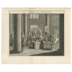
$343 Sale Price
20% Off
Recently Viewed
View AllMore Ways To Browse
Jewish Oil Lamp
Jockey On Bronze Horse
Jopeko Pottery
Knight Statue
La Borne Pottery
Lalique Art Deco Dish
Lalique Glass Panels
Lalique Rose
Lane Burl Wood
Lap Writing Desk Box
Large Blue And White Ginger Jar
Large Bronze Buddha Head
Laurel Hardy
Lawson Fenning Niguel
Leon Boucher
Libbey Glass Patterns Vintage
Liberty Leather Animals
Lily Of The Valley Vase