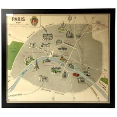
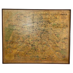
Vintage Paris Metro Area Map Print by Imprimerie Georges Lang Nicely Framed
View Similar Items

Want more images or videos?
Request additional images or videos from the seller
1 of 7
Vintage Paris Metro Area Map Print by Imprimerie Georges Lang Nicely Framed
About the Item
- Creator:Imprimerie Geoges Lang (Manufacturer)
- Dimensions:Height: 34 in (86.36 cm)Width: 38.75 in (98.43 cm)Depth: 1 in (2.54 cm)
- Style:Mid-Century Modern (In the Style Of)
- Materials and Techniques:
- Place of Origin:
- Period:
- Date of Manufacture:1950s
- Condition:Wear consistent with age and use.
- Seller Location:San Diego, CA
- Reference Number:1stDibs: LU93668220351
About the Seller
4.9
Platinum Seller
These expertly vetted sellers are 1stDibs' most experienced sellers and are rated highest by our customers.
Established in 2000
1stDibs seller since 2012
3,239 sales on 1stDibs
Typical response time: 1 hour
More From This SellerView All
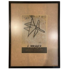
- Rare Framed Framed Lithograph by Georges Braque for Galerie MaeghtBy Georges BraqueLocated in San Diego, CAA very rare nicely framed original lithograph by Georges Braque for Galerie Maeght, circa 1950s.Category
20th Century French Mid-Century Modern Prints
MaterialsGlass
- Vintage "View of the Center of Paris Taken from the Air" Lithograph MapLocated in San Diego, CAA very stylish "View of the Center of Paris Taken from the Air" lithograph map published by the Paris Ministry of Tourism, circa early 1950s. The piece measures 27" x 43" and shows...Category
20th Century French Mid-Century Modern Prints
MaterialsPaper
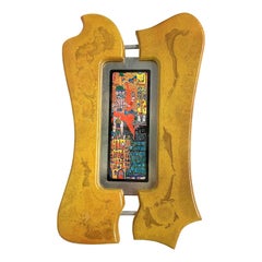
- Rare Print by Hundertwasser Yellow Frame, 1989By HundertwasserLocated in San Diego, CAA beautiful and rare print in its original biomorphic gray wood frame, circa late 1980s, in great condition.Category
Late 20th Century Austrian Prints
MaterialsPaper
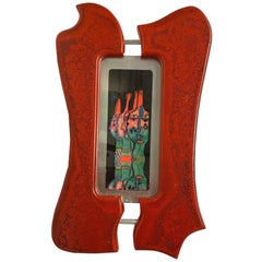
- Rare Print with Red Frame by Hundertwasser, 1989Located in San Diego, CAA beautiful and rare print in its original biomorphic gray wood frame, circa late 1980s, in great condition.Category
Late 20th Century Austrian Prints
MaterialsPaper
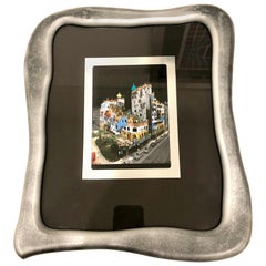
- Rare Print by Hundertwasser Haus in Aluminum Foil FramedBy HundertwasserLocated in San Diego, CAA beautiful and rare print in its original biomorphic silver frame, circa late 1980s, in great condition. A total of five by the artist are available, pl...Category
Late 20th Century Austrian Post-Modern Prints
MaterialsPaper
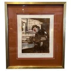
- 1970's Listed artist George Crionas Color Lithograph Signed A/P FramedBy George CrionasLocated in San Diego, CA"Play it Again Willie" - Artist Proof Color Lithograph by George Crionas, Signed and Framed Discover the captivating charm of "Whimsical Reverie," an artist proof lithograph craft...Category
20th Century American Mid-Century Modern Prints
MaterialsAluminum

You May Also Like
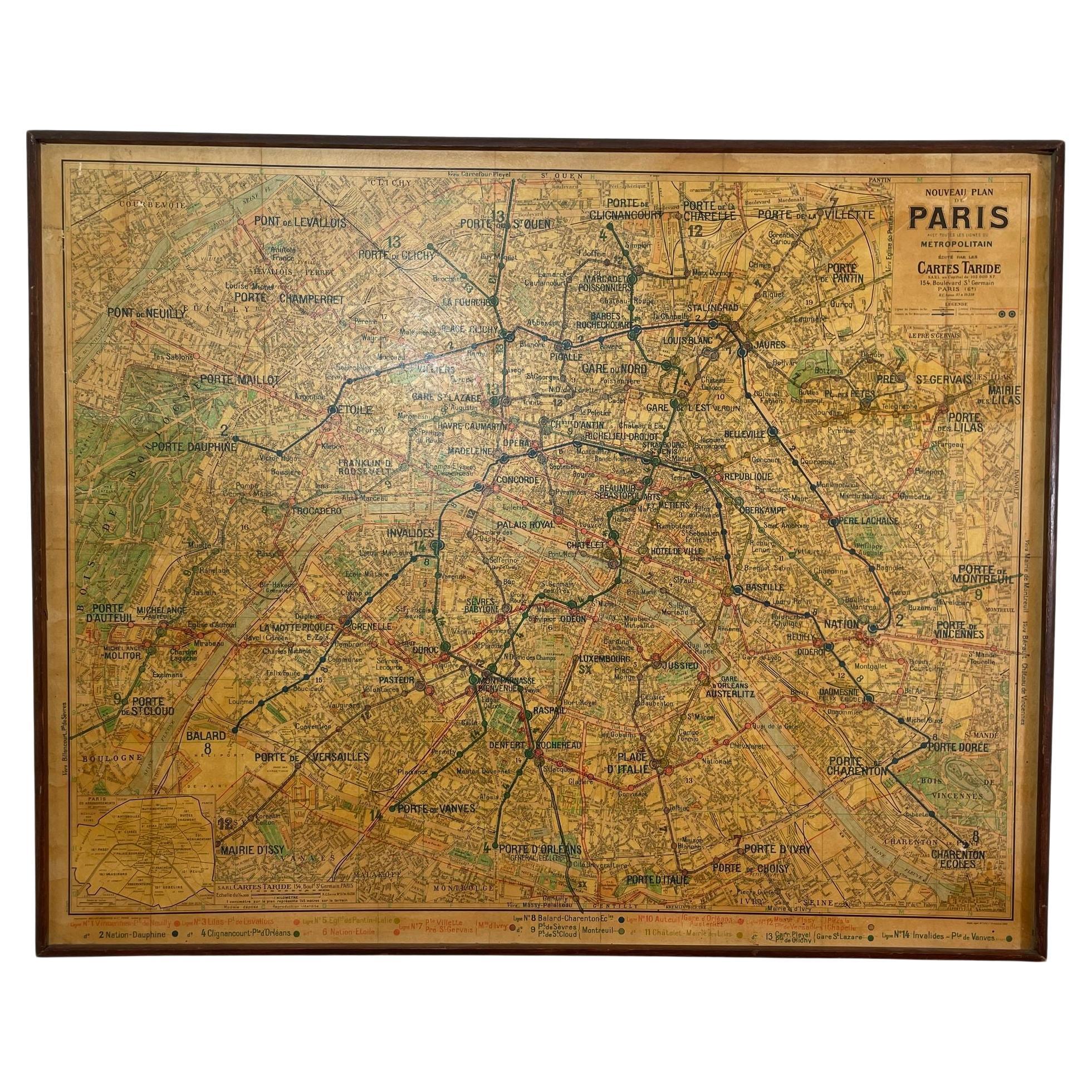
- Large French Paris Metro Map 1960sLocated in North Hollywood, CALarge French Paris Metro Map 1960s. A large Vintage French framed map of the Parisian Metro from the mid-20th century. Featuring a Paris metro map from the midcentury period showing ...Category
Mid-20th Century French Industrial Prints
MaterialsWood, Paper
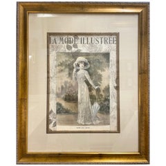
- La Mode Illustree Print Nicely Framed and MattedLocated in Stamford, CTLa Mode Illustree, French fashion magazine published in the 1800s, print La Mode Illustrée, was a French fashion magazine, published between 1860 ...Category
Mid-20th Century Belle Époque Prints
MaterialsPaper
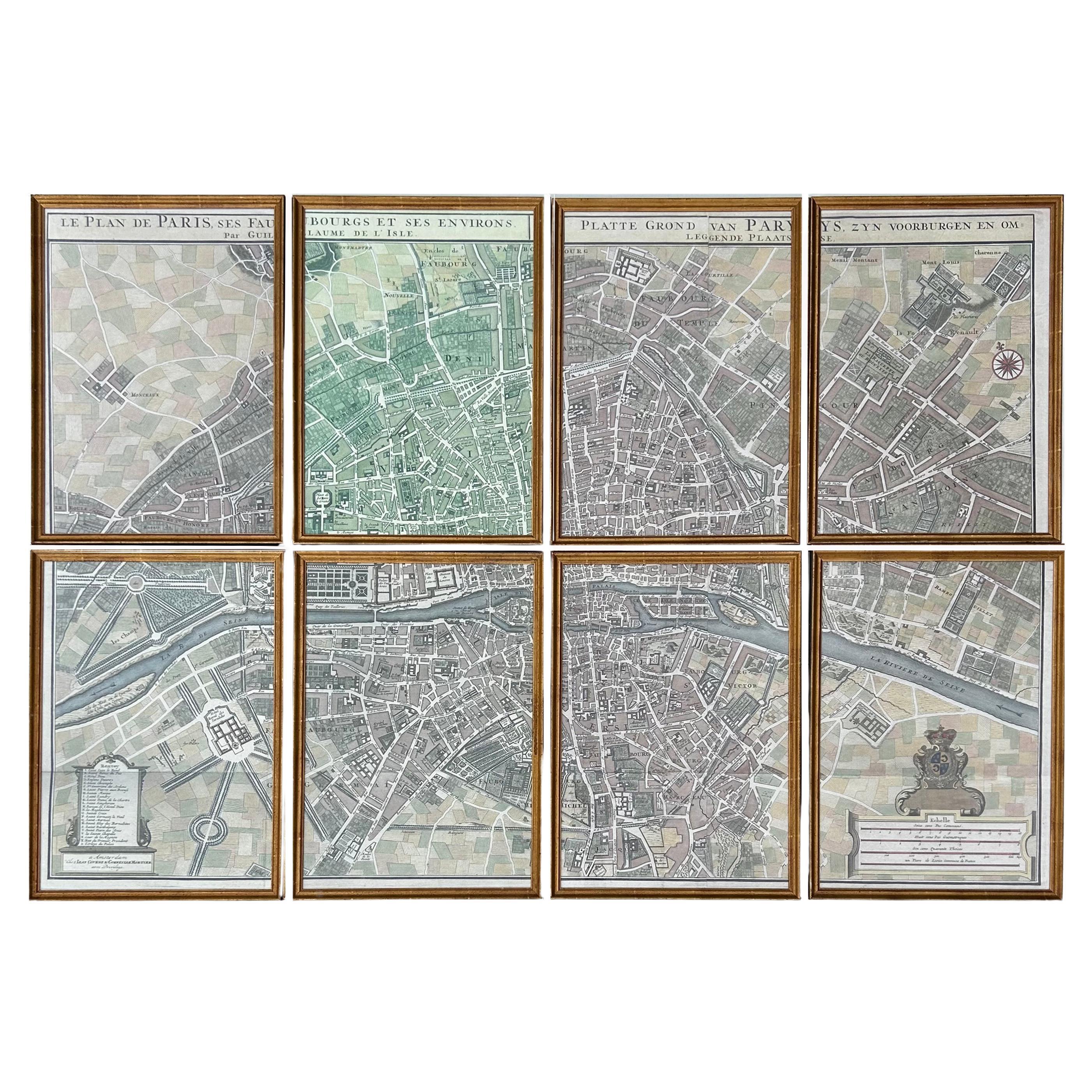
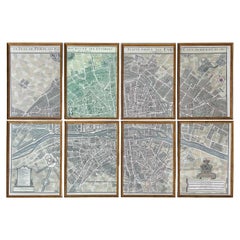
- Map of Paris "Le Plan des Paris Ses Faubourgs et Environs", 8 Framed PrintsBy HenredonLocated in Miami, FLMap of Paris "Le Plan des Paris Ses Faubourgs et Environs", 8 Framed Prints Offered for sale is a map of the city of Paris divided into quadrants and presented in eight framed sec...Category
20th Century French Prints
MaterialsGlass, Giltwood, Paper
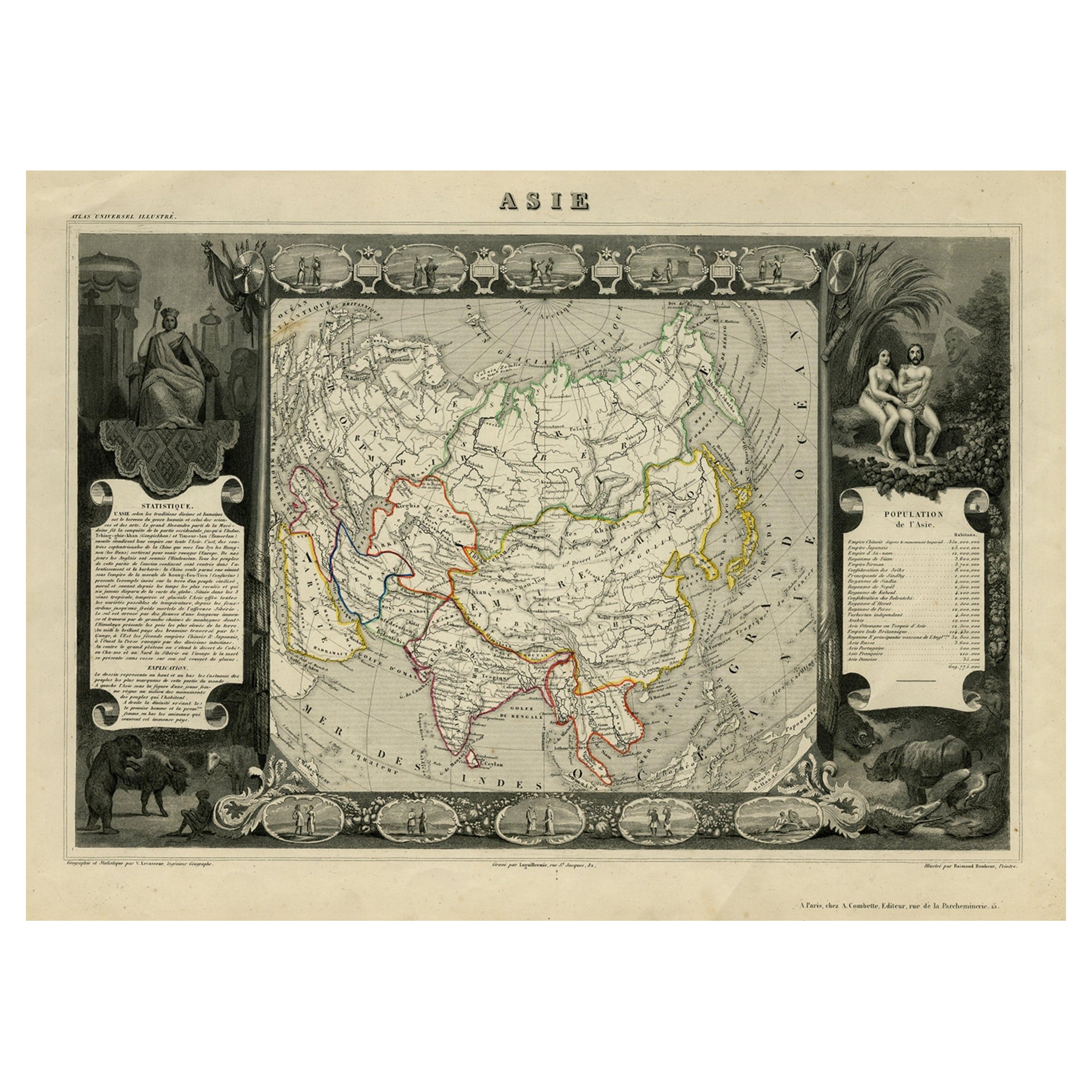
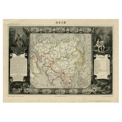
- Nicely Decorated Antique Map of Asia, incl Population Figures, 1854Located in Langweer, NLAntique map titled 'Asie'. Map of the main Asian continent. The decorated border shows various images, as well as two blocks of statistical text on the continent, including populatio...Category
Antique 19th Century Maps
MaterialsPaper
 $395 Sale Price20% Off
 - Vintage Framed Numbered PrintLocated in Seattle, WAVintage framed numbered print Dimensions. 25 1/4 W ; 1 D ; 18 H.Category
Vintage 1970s Mid-Century Modern Prints
MaterialsWood
 $316 Sale Price20% Off
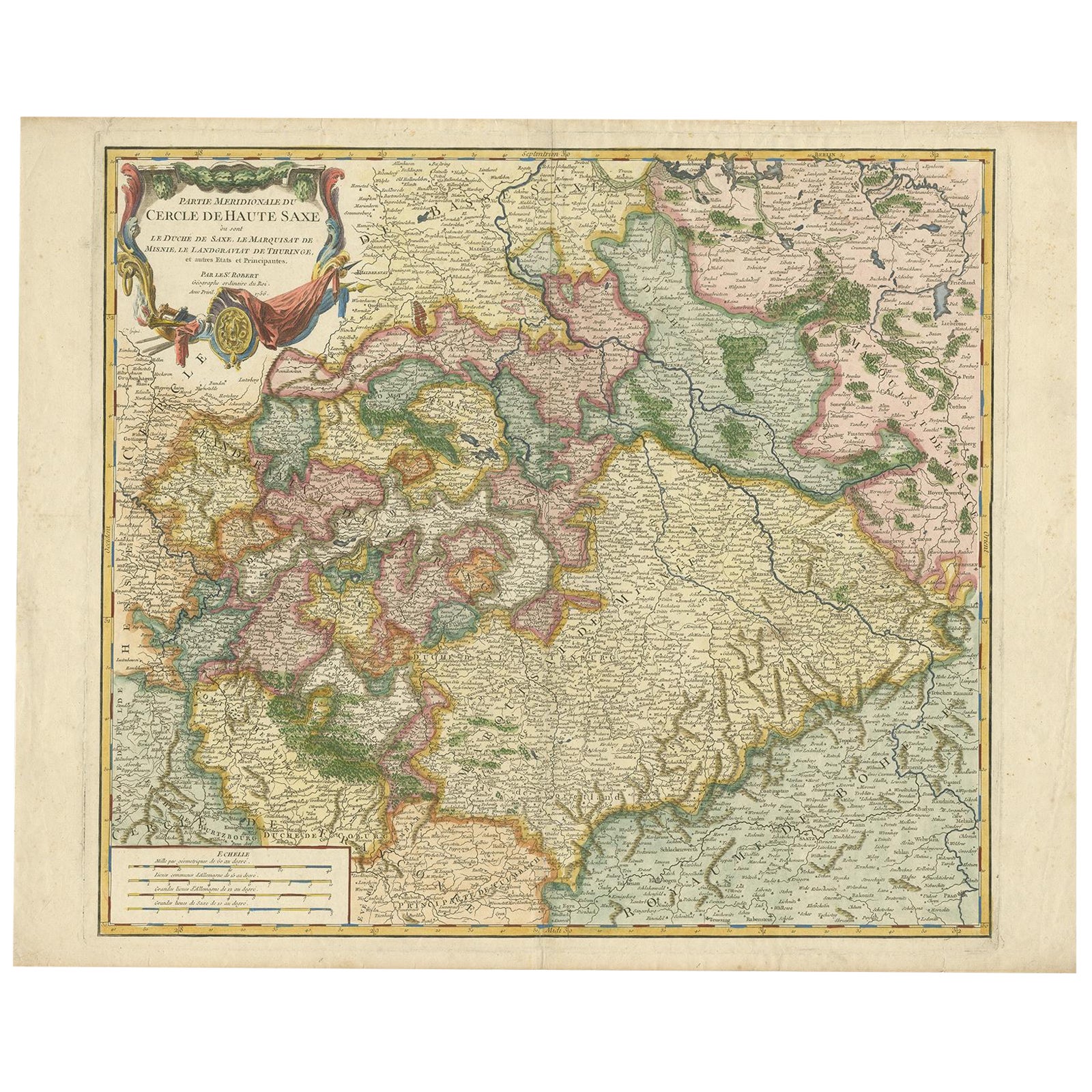
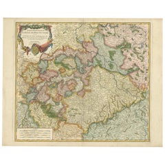
 - Nicely Colored Original Antique Map of Upper Saxony, Middle Germany, 1756Located in Langweer, NLAntique map titled 'Partie Meridionale du cercle de Haute Saxe (..)'. Original antique map of upper Saxony, Germany. It was the name given to the majority of the German lands held by the House of Wettin, in what is now called Central Germany. Artists and Engravers: Gilles Robert de Vaugondy (1688 - 1766), also known as Le Sieur or Monsieur Robert, and his son, Didier Robert de Vaugondy (c.1723 - 1786), were leading mapmakers in France during the 18th century. In 1757, they published The Atlas Universel, one of the most important atlases of the 18th century. To produce the atlas, the Vaugondys integrated older sources with more modern surveyed maps...Category
Antique 1750s Maps
MaterialsPaper
Recently Viewed
View AllMore Ways To Browse
Vintage Map Framed
Framed Vintage Maps
Metro Map
The Miller Company 1940s
Small Carved Wood Panel
Sweden Travel Poster
Swedish Travel Poster
American Drew Chairs
Aalto Children
Antique Bedside Chests
Antique Bedside Chest
Leather Door Pulls
Antique French Side Chest
Antique Oak Chest On Chest
Antique Blue Kitchen Cabinets
Alvar Aalto 100
Lions Carved Oak
Display Case For Wall