Items Similar to Map of Palestine or Judea, Illustrating the History of the New Testament
Want more images or videos?
Request additional images or videos from the seller
1 of 2
Rev. Nathan B. RogersMap of Palestine or Judea, Illustrating the History of the New Testament1843
1843
$75,000
£58,130.67
€65,817.77
CA$107,356.28
A$117,061.98
CHF 60,842.82
MX$1,401,388.20
NOK 771,732
SEK 722,871.45
DKK 491,573.70
About the Item
Pen and ink on paper, laid down on canvas, mounted to wooden scroll bars
Signed and dated lower right: “Drawn by N. B. Rogers August. 1843”
Inscribed with an ownership inscription on the verso: Rev. E. D. Daniels, Palmer, Mass.
Provenance:
Rev. Eugene Davidson Daniels, Palmer, Massachusetts, 1871
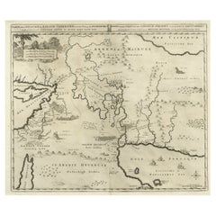
This extraordinary manuscript map is a rare survivor of the devotional and educational culture of New England in the first half of the nineteenth century. Although at first glance resembling a large-scale engraving or printed publication, this precisely rendered wall map was entirely drawn by hand, the product of meticulous research by a minister working in isolation in rural Maine. The map shows New Testament era cities, towns, tribal areas, and political borders as well as physical features such as rivers, lakes, mountains, and hills (indicated by half-tone cross-hatching). On to this geographically accurate rendering of the Holy Land, Rogers has located and inscribed significant locales mentioned in the Gospels and has annotated these places with relevant citations from the Bible. He further records these by plotting the travels of Jesus on what resemble a series of trails across the Holy Land. Each is distinguished by a different pattern of dots and dashes – correlated to an explanatory table at the lower right. From this we know that these lines document the “Flight into Egypt and return,” “Travels of Christ from Nazareth to Jerusalem and return,” “Travels from the commencement of his Ministry to the first Passover,” “Travels from the first and the second Passover,” “Travels from Jerusalem to Galilee after the 2nd Passover,” and “Travels from the third Passover to the Crucifixion.”
An inset map of “Jerusalem and its Environs” appears at the upper left, again meticulously inscribed with buildings and sites from the time of Christ. Below that is a “Plan of the Temple with its court,” again thoroughly annotated.
For its time the map is geographically accurate. Rogers appears to have used printed maps of modern Palestine as a basis for his imagining of the ancient Holy Land, which he then augmented with information gleaned from the biblical chronicles. At the same time he subtracted modern roads, borders, and recent settlements. The map is thus an attempt to incorporate faith with science by plotting biblical stories in the idiom of modern cartography.
Presumably other large-format manuscript maps of this type were made in the nineteenth century. If so, they have not survived or have not been located. In scale and ambition, the Rogers map appears to be a pioneering effort in the field — the first produced in the United States, the first to focus on New Testament landscape, and possibly the first large hand-drawn map of this new scientific/biblical type anywhere. (Thus far our research has not found a larger hand-drawn Palestine map of any kind, or found an earlier printed one of this new type published in the U.S.) Contemporary with its creation were the first American archeological expeditions in the Middle East undertaken in the mid-19th century. These were privately funded by church groups intent on proving the scientific accuracy of the Bible. (As these expeditions often brought back objects, today from time to time a major Near Eastern antiquity will appear with a provenance from a small Midwestern church.) Of course, to plan such expeditions one must first consult a map.
The Rogers Palestine or Judea map is a unique achievement — an eloquent illustration of the mindset of the era, a fortunate survival of a large paper document, and a seamless marriage of science and faith.
About its Author and later Owner:
We have scant information about Reverend Nathan B. (“N.B.”) Rogers. He was born in 1828 and graduated Dartmouth College in the Class of 1844. He was married to Lydia G. Bailey, Mount Holyoke College, Class of 1844, and he died in 1849 at the age of 28 of typhoid fever. He completed our map of Palestine at the age of 22. Of his ecclesiastic career we know only that he had “had his own church” in Hallowell, Maine, for only 11 months, having been appointed to this position when another Dartmouth graduate retired. A (collective) obituary about the deaths of ministers in October 1849 briefly discusses N.B. Rogers:
"Died at Hallowell, Maine, after a short illness, of typhoid fever, Reverend Nathan Rogers, aged 28. Mr. Rogers was pastor of the Orthodox Church at Hallowell, recently under the charge of Reverend Mr. Thurston, and has been settled 11 months, and in that time won the respect and affection of all with whom he came in contact, of every denomination. He was married only three weeks before his death."
Rogers’s widow Lydia Bailey lived to be over 80 years old (b. 1819), and was still listed as living in New Hampshire in the U.S. Census of 1900. Unfortunately she did not make it to age 90 and a consequent listing in the U.S. Census of 1910.
The map’s later owner, Rev. E. D. Daniels (Eugene Davidson), was Pastor of the Second Baptist Church of Palmer, Mass., in 1871, having been previously Pastor in Leverett, Mass. In later life Daniels was Minister of the New Jerusalem Church (Swedenborgian) in Berlin, Ontario. Daniels was a biblical scholar and author of The divine order of degrees in man: exemplified in the order of the four Gospels (Boston: Alfred Mudge & Son, 1877). There is also mention of a publication by E. B. Daniels titled Historical Evidences of the Last Judgment -- but we have not been successful in locating a copy of this work.
- Creator:Rev. Nathan B. Rogers (1821 - 1849, American)
- Creation Year:1843
- Dimensions:Height: 50 in (127 cm)Width: 40 in (101.6 cm)
- Medium:
- Period:
- Condition:
- Gallery Location:New York, NY
- Reference Number:1stDibs: LU1026198572
About the Seller
5.0
Recognized Seller
These prestigious sellers are industry leaders and represent the highest echelon for item quality and design.
Established in 1997
1stDibs seller since 2012
24 sales on 1stDibs
Typical response time: 7 hours
- ShippingRetrieving quote...Shipping from: New York, NY
- Return Policy
More From This Seller
View AllThe 1564 Medici Danti Map of California
By Fra Egnazio Danti
Located in New York, NY
Florentine, Probably Seventeenth Century
Titled
L’ultime parti note nel Indie occidentali
Dated on the edge of the cartouche: “M.D. LXIII. M.AG” [1564…the month of August]
In the 1560s Cosimo I de’Medici, the powerful Duke of Florence, undertook a major renovation of the Palazzo Vecchio, the venerable palace that to this day dominates the city at the Piazza della Signoria. For the Sala della Guardaroba, literally the wardrobe room, but in fact the storeroom of the Duke’s most precious holdings, Cosimo conceived of a grand decorative project that was to reflect in one space the entire cosmos --both an indication of the Duke’s ambition and an allusion to his name. The plan, supervised by Giorgio Vasari, involved the construction of walnut cabinets to contain the Medici treasures, on the outside doors of which were to be placed large hand-painted maps specially commissioned to document and illustrate the current knowledge of the world. Portraits of famous men were to decorate the tops of the cabinets and two large globes –one representing the terrestrial world, the other celestial—were to descend from openings in the ceiling. The commission for the maps, inspired by Ptolemy’s Geographia, was given to the celebrated mathematician and cosmographer, Fra Egnazio Danti (Perugia 1536-1585 Alatri). Fifty-three maps were ultimately created. Thirty were conceived and executed by Danti between 1563 and 1575. The remaining twenty-three were completed by Stefano Bonsignori between 1576 and 1686. They remain in place in Florence in the room for which they were created.
The present work is an exact-size painted, drawn and inscribed copy of Danti’s map of California...
Category
17th Century Old Masters Drawings and Watercolor Paintings
Materials
Canvas, Paper, Ink, Watercolor, Gouache, Pen
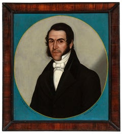
Portrait of Dr. Juan Ignacio Galves
Located in New York, NY
Signed and dated, along the bottom of the oval:
Dõr. Juan Ygnacio Galves nació el año de 1797. / Por J. Celestino Figueroa año de 1841.
Provenance: Luis Alberto Acuña (1904–1994), ...
Category
1840s Portrait Paintings
Materials
Canvas, Oil
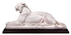
The Princeton Tiger
Located in New York, NY
Provenance: The artist; thence by descent to his granddaughter:
Rhoda Knight Kalt; from whom acquired by:
Private Collection, Pennsylvania, 1995–2025.
Literature: Richard Milner, Ch...
Category
1940s Figurative Sculptures
Materials
Plaster
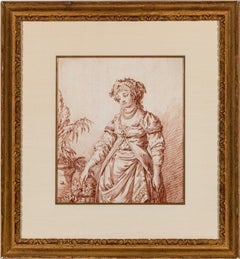
Woman in Fantasy Costume (pair)
By Jean Baptist Le Prince
Located in New York, NY
The pair consists of the present work and an engraving after it by the hand of Giles DeMarteau (Liège 1722 – 1776 Paris) titled Woman in Fantasy Costume, after Jean Baptiste Le Prince, and measuring, 10 ⅜ x 8 ⅝ inches (26.5 x 22 cm).
DeMarteau's engraving is inscribed at the bottom:
Le Prince inv. del. / Demarteau sc. / A Paris ches Demarteau Graveur du Roi, rue de la Pelterie à la Cloche...
Category
18th Century Drawings and Watercolor Paintings
Materials
Paper, Chalk, Engraving
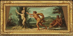
Seven Scenes from the Life of Apollo
By Jacopo Guarana
Located in New York, NY
Attributed to
Jacopo Guarana
(Verona 1720 – 1808 Venice)
Canvas, unsigned
The Deeds of Apollo
Provenance: Suida-Manning Collection
These seven scenes are brilliant evocations o...
Category
18th Century and Earlier Baroque Figurative Paintings
Materials
Oil
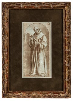
Study of a Franciscan Saint, probably San Diego de Alcalá
Located in New York, NY
Provenance: Ivan E. Phillips, Montreal and New York, until 2023.
The brothers Bartolomé Carducho and Vicente Carducho, both born and trained in Florence, settled in Spain where they made their careers. Vicente worked on numerous commissions for both the church and the Spanish court...
Category
17th Century Old Masters Drawings and Watercolor Paintings
Materials
Paper, Chalk, Ink, Pen
You May Also Like
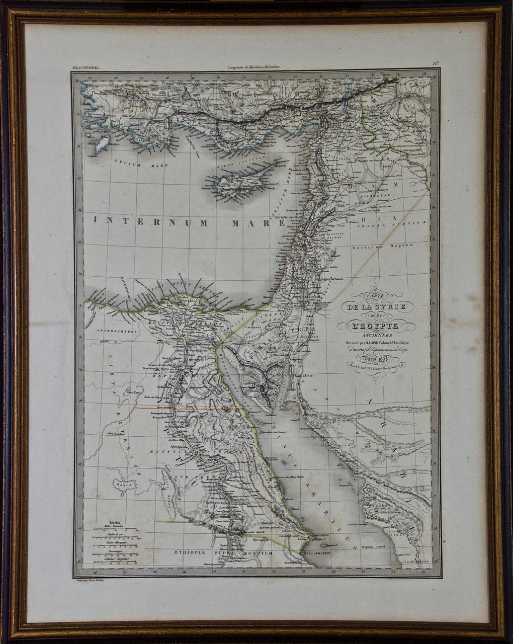
Map of the Holy Land "Carte de la Syrie et de l'Egypte" by Pierre Lapie
By Pierre M. Lapie
Located in Alamo, CA
This is an early 19th century map of ancient Syria and Egypt entitled "Carte de la Syrie et de l'Egypte anciennes/dressée par M. Lapie, Colonel d'Etat M...
Category
1830s Landscape Prints
Materials
Engraving

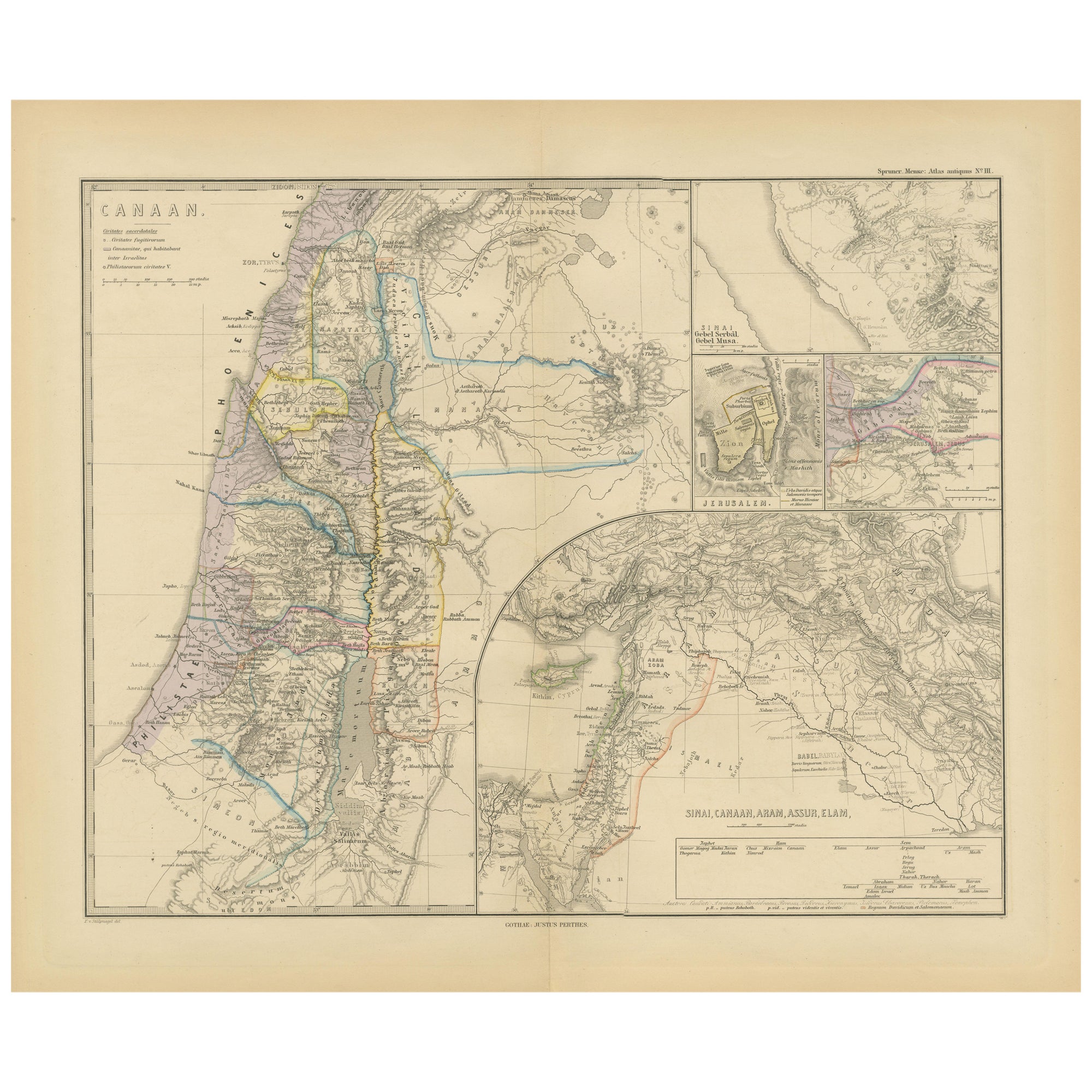
Historical Map of Canaan with Insets of Jerusalem and Surrounding Regions, 1880
Located in Langweer, NL
The map titled "CANAAN" depicts the historical region known as Canaan, located in the Levant, which corresponds to modern-day Israel, Palestinian territories, Lebanon, and parts of S...
Category
Antique 1880s Maps
Materials
Paper
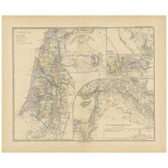
$350 Sale Price
20% Off
Free Shipping
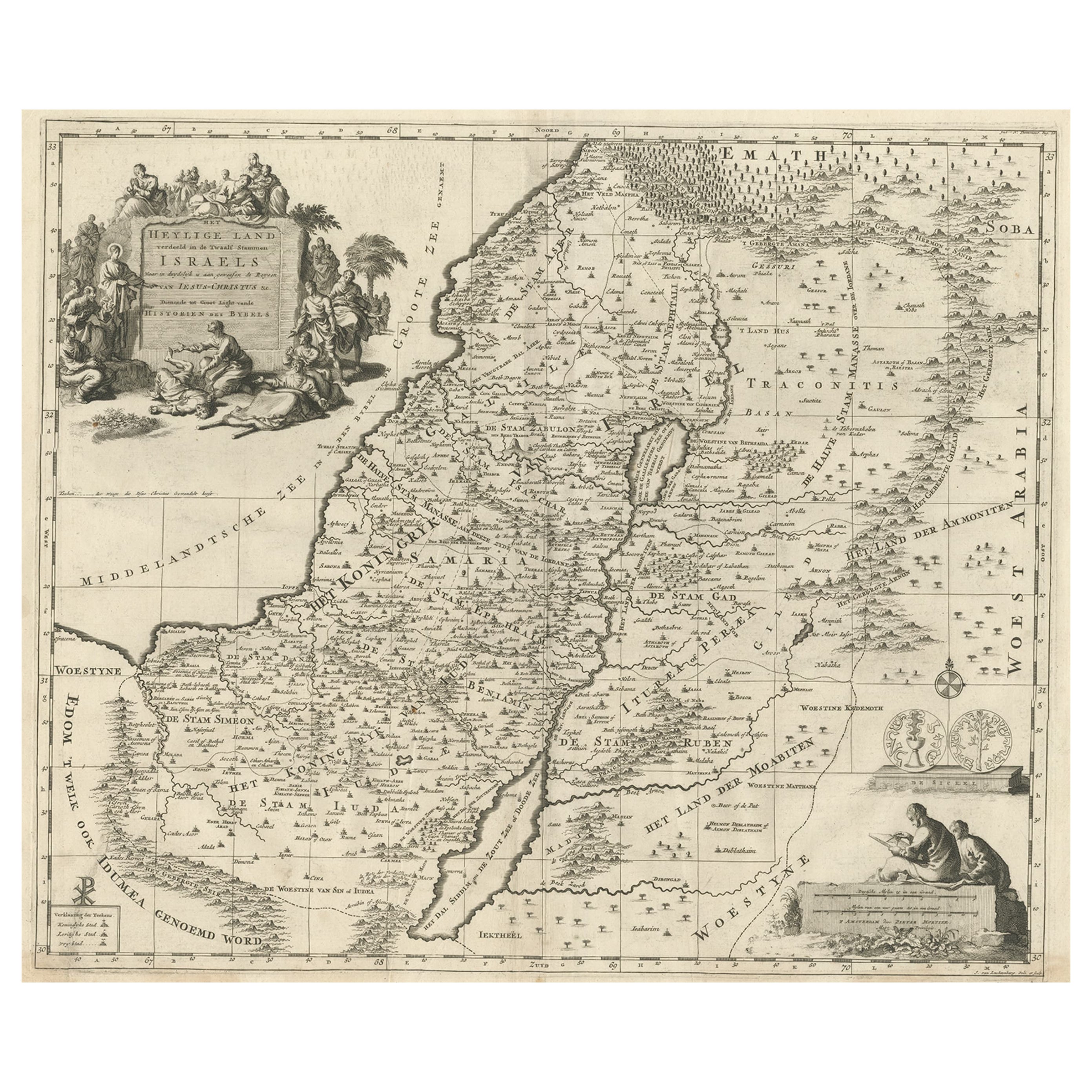
Map of the Holy Land Divided into 12 Tribes, the Travels of Jesus Christ, 1700
Located in Langweer, NL
Antique map titled 'Het Heylige Land verdeeld in de Twaalf Stammen Israels (..)'.
Decorative and detailed map of the Holy Land divided into 12 Tribes, sh...
Category
Antique Early 1700s Maps
Materials
Paper
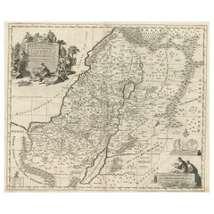
$463 Sale Price
20% Off
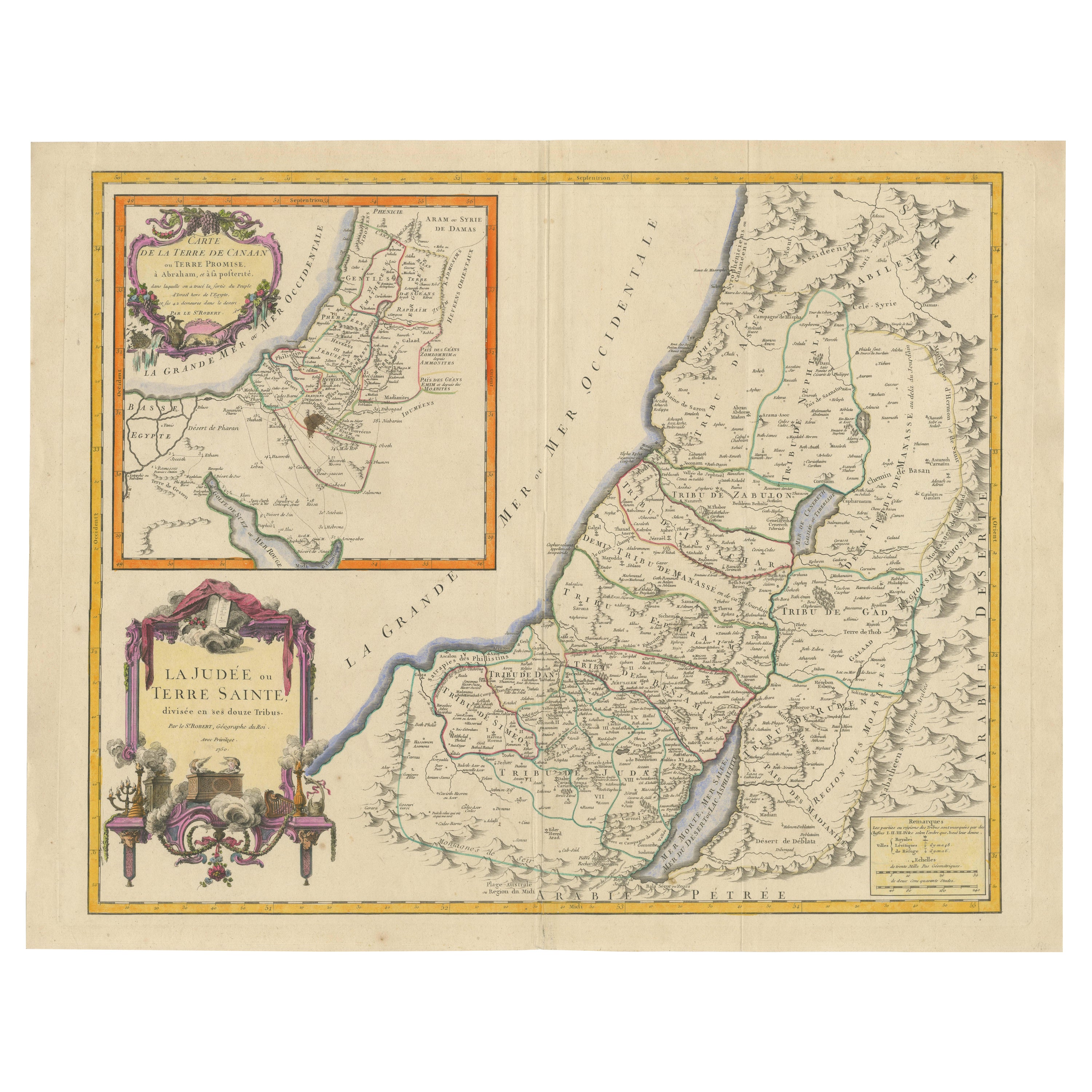
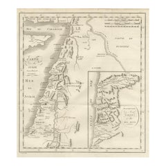
1750 Map of the Holy Land: The Land of Canaan and the Twelve Tribes
Located in Langweer, NL
Carte de la Terre de Canaan ou Terre Promise
Cartographer: Le St. Robert
Date of Publication: 1750
This exquisite 18th-century map, 'Carte de la Terre de Canaan ou Terre Promise', w...
Category
Antique 1750s French Maps
Materials
Paper

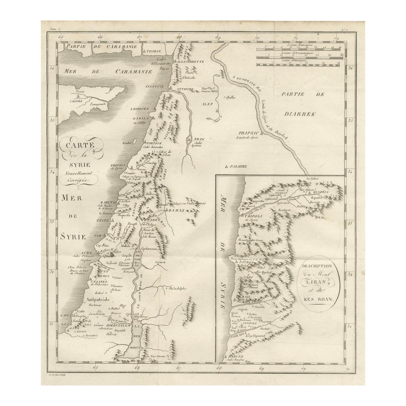
Antique Map of Syria, Mount Lebanon and Palestine – circa 1760
Located in Langweer, NL
Map of Syria and Mount Lebanon – “Carte de la Syrie”, c.1760
This finely engraved 18th-century map, titled Carte de la Syrie nouvellement corrigée, presents the region of Syria and ...
Category
Antique Mid-18th Century French Maps
Materials
Paper
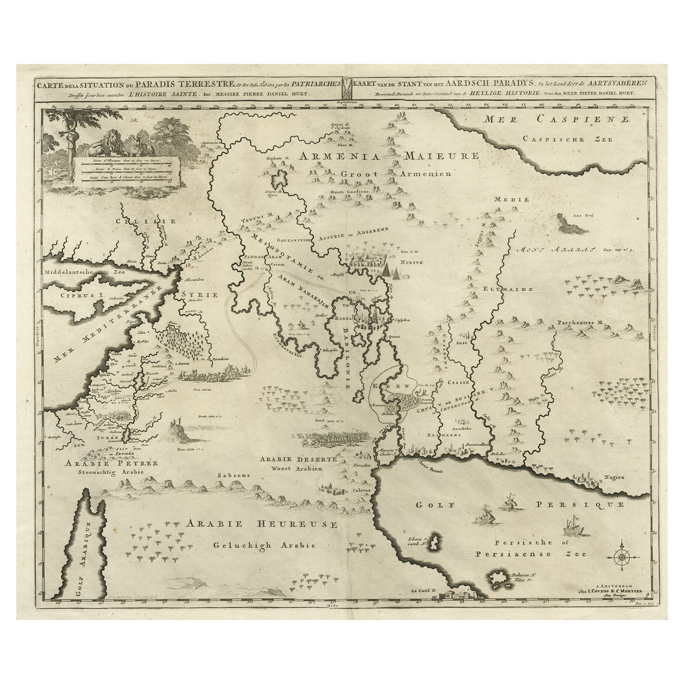
Biblical Map of the Region from the Mediterranean through the Persian Gulf, 1720
Located in Langweer, NL
Antique map titled 'Carte de la Situation du Paradis Terrestre, Et des Pais Habitez par les Patriarches Dressee pour bien entendre l'Histoire Sainte, Par Messire Pierre Daniel Huet.'
This interesting map covers the region from the Mediterranean through the Persian Gulf. Detail is omitted in favor of Biblical depictions including the Sermon on the Mount...
Category
Antique 1720s Maps
Materials
Paper
$455 Sale Price
20% Off
More Ways To Browse
Antique Rogers
Antique Paper Documents
Flight Into Egypt
Antique Map Of Jerusalem
Hand Drawn Map
Antique Map Palestine
Map Of Palestine
Shipibo Pot
Spouter Inn
Takahashi Bird
Takashi Murakami Pillow
Tatyana Vafina
Ted Smith
Tiffany And Co X Spalding Basketball
Tiffany Basketball
Tiffany Studio New York Belt Buckles
Tintin Rocket
Tyrannosaurus Rex Tooth