Items Similar to Christ and His Disciples Harvesting on the Sabbath
Want more images or videos?
Request additional images or videos from the seller
1 of 5
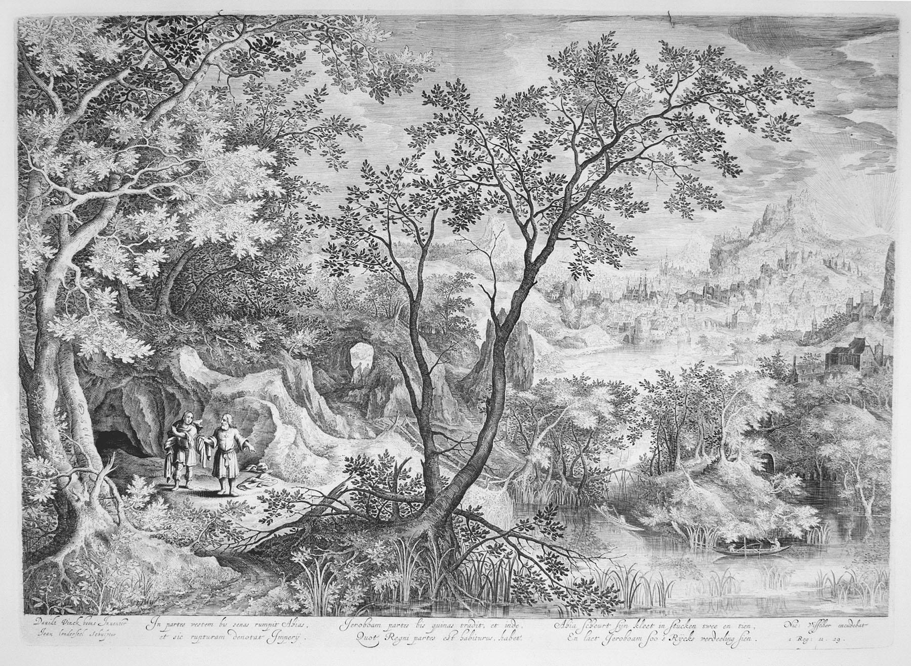
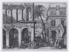
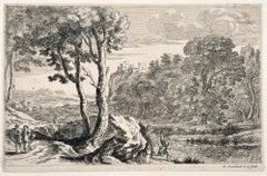
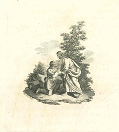
(After) David VinckboonsChrist and His Disciples Harvesting on the Sabbathc. 1600 - 1610
c. 1600 - 1610
Price Upon Request
Price Upon Request
Price Upon Request
Price Upon Request
Price Upon Request
Price Upon Request
Price Upon Request
Price Upon Request
Price Upon Request
Price Upon Request
About the Item
Engraving after David Vinckboons (Malines 1576-1629 Amsterdam), executed by Jan van Londerseel (Antwerp c. 1570-1624/25 Rotterdam)
- Creator:(After) David Vinckboons (1576 - 1629)
- Creation Year:c. 1600 - 1610
- Dimensions:Height: 13.75 in (34.93 cm)Width: 19 in (48.26 cm)
- Medium:
- Movement & Style:
- Period:
- Condition:
- Gallery Location:Chicago, IL
- Reference Number:1stDibs: LU36535746382
About the Seller
5.0
Recognized Seller
These prestigious sellers are industry leaders and represent the highest echelon for item quality and design.
Established in 1955
1stDibs seller since 2016
15 sales on 1stDibs
Typical response time: Several days
Associations
International Fine Print Dealers Association
- ShippingRetrieving quote...Shipping from: Chicago, IL
- Return Policy
More From This Seller
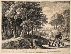
View AllLandscape with the Prophets Ahias and Jerobeam
Located in Chicago, IL
Engraving after David Vinckboons (Malines 1576-1629 Amsterdam), executed by James Van Londerseel (Antwerp c. 1570 - 1624/25 Rotterdam)
Category
17th Century Old Masters Prints and Multiples
Materials
Engraving
Shepherd Leading his Herd
Located in Chicago, IL
A very fine impression
Category
Mid-17th Century Landscape Prints
Materials
Etching
The Birth of Christ - With the Praying Shepherds
Located in Chicago, IL
A fine impression. With the address of P. Giffart. Mauperche produced over fifty engravings.
Category
17th Century Landscape Prints
Materials
Etching
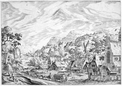
River Scene with Village and Church
By Hans Bol
Located in Chicago, IL
A very fine, well contrasted impression of the 1st State, before the addition of the number, present when the work later was included in Bol’s River Series.
Category
16th Century Landscape Prints
Materials
Etching
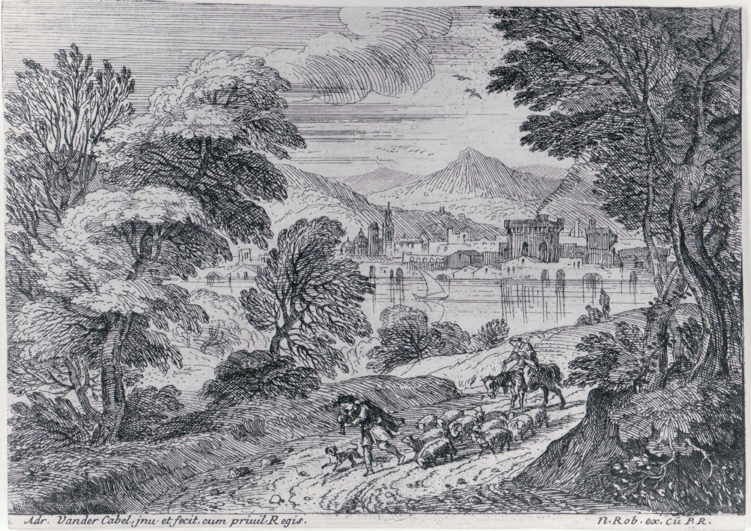
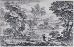
Landscape with a Maiden and her Dog
By Adriaen van der Cabel
Located in Chicago, IL
A very fine impression
Category
Mid-17th Century Landscape Prints
Materials
Etching
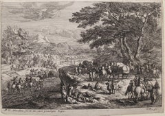
Landscape with Marching Soldiers
By Jan van Huchtenburg
Located in Chicago, IL
Etching from the Six Landscapes
Category
18th Century Landscape Prints
Materials
Etching
You May Also Like
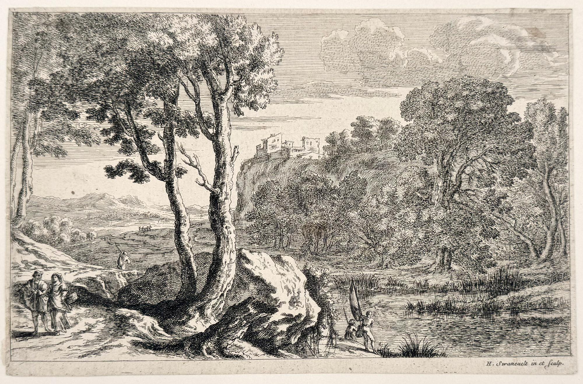
The Anglers
By Herman van Swanevelt
Located in Middletown, NY
Etching with engraving on cream laid paper with a large unidentified alphabetic watermark, 6 1/2 x 9 7/8 inches (165 x 251 mm), the full sheet. In good condition with handling wear a...
Category
Early 17th Century Old Masters Landscape Prints
Materials
Laid Paper, Engraving, Etching
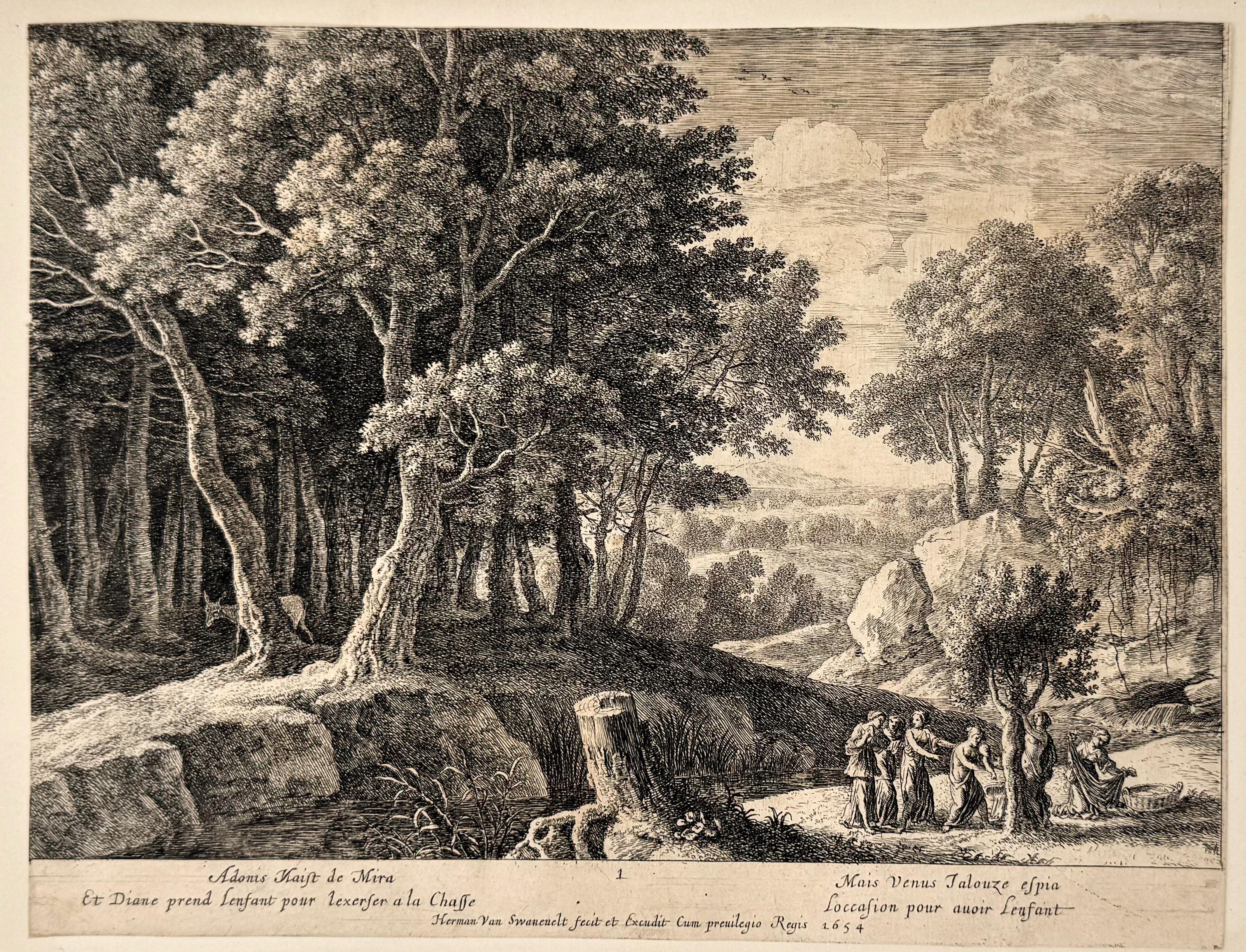
The Birth of Adonis; Plate 1 from The Story of Adonis
By Herman van Swanevelt
Located in Middletown, NY
Etching with engraving on thin laid paper with an early and large unidentified heraldic watermark with a windmill, and the collector's stamp of Count F. J. von Enzenberg (1802-1879),...
Category
Early 17th Century Old Masters Landscape Prints
Materials
Laid Paper, Engraving, Etching
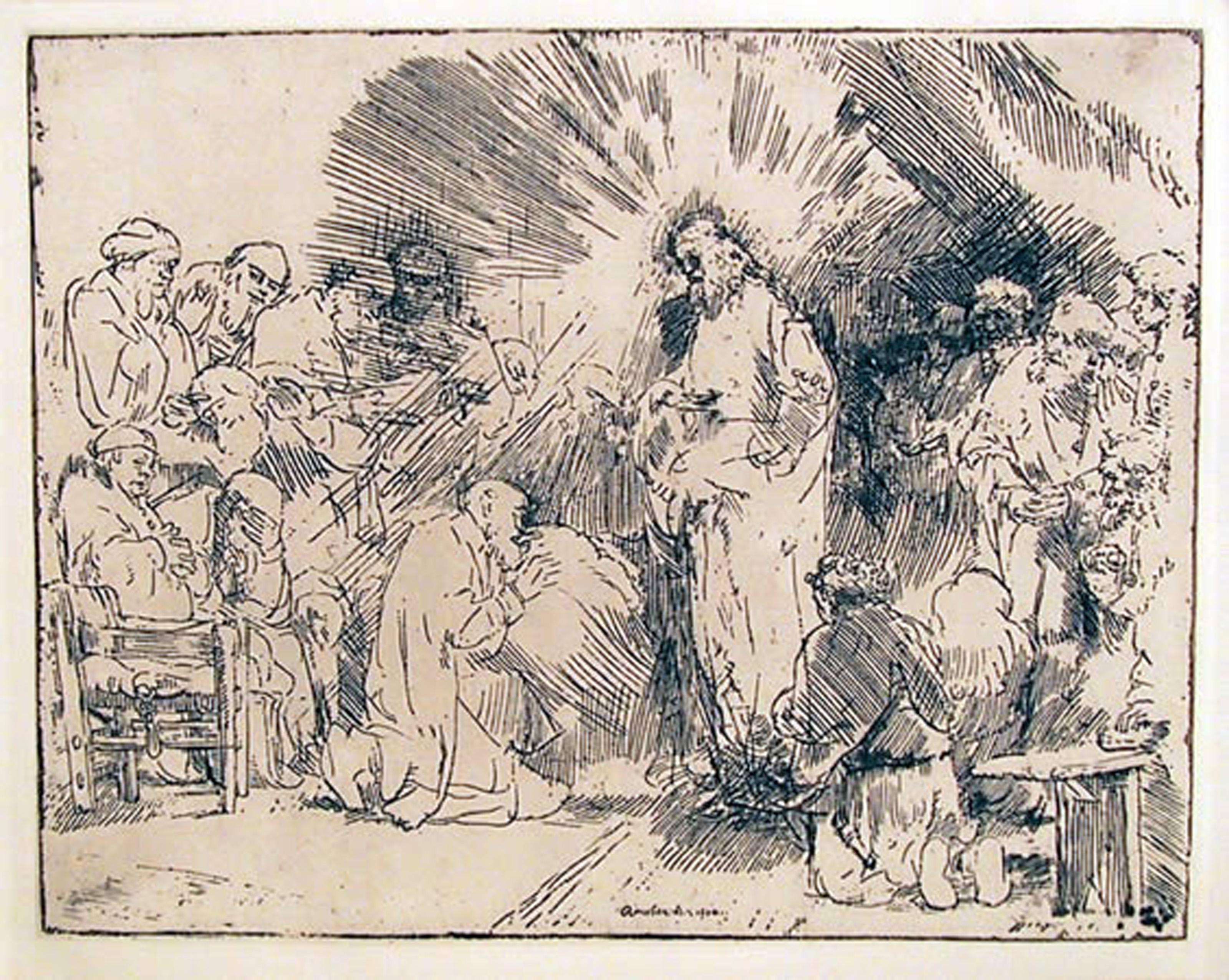
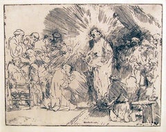
Christ Appearing to the Apostles, Etching by Rembrandt van Rijn
By Rembrandt van Rijn
Located in Long Island City, NY
Rembrandt van Rijn, After by Amand Durand, Dutch (1606 - 1669) - Christ Appearing to the Apostles, Year: Of Original 1656, Medium: Etching, Image Size: 6.5 x 8.25 inches, Size: 14 ...
Category
Late 18th Century Prints and Multiples
Materials
Etching
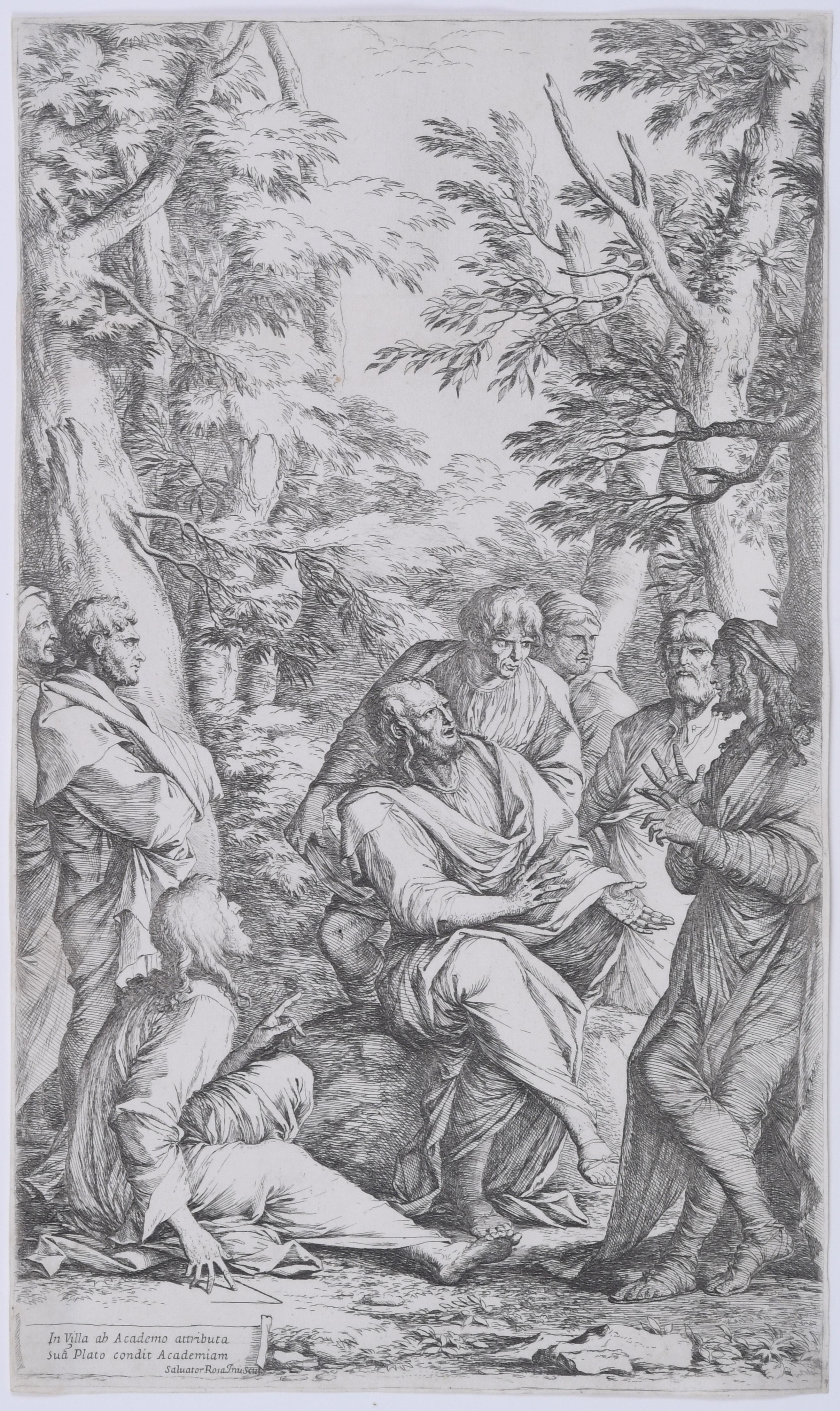
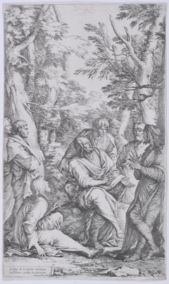
The Academy of Plato Plato and His Disciples
By Salvator Rosa
Located in Fairlawn, OH
The Academy of Plato
Plato and His Disciples
Etching and drypoint
c. 1662, printed c. 1710
Signed in the plate lower left
Inscribed lower left: 'In villa ab Academo attributa sua[m]...
Category
1660s Old Masters Figurative Prints
Materials
Etching
Scene from the Gospel - Original Etching by Philip Audinet - 1810
By Philip Audinet
Located in Roma, IT
Scene from the Gospel is an original artwork realized by Philip Audinet for J.C. Lavater's "Essays on Physiognomy, Designed to promote the Knowledge and the Love of Mankind", London,...
Category
1810s Modern Figurative Prints
Materials
Etching
Allegory of Summer - 17th Century Italian Sepia and Watercolor Drawing
Located in Stockholm, SE
A fine Italian watercolor and sepia drawing, an allegory of summer. People harvesting, eating and drinking in a hilly landscape, probably by Antonio Grano (c.1669-1718). In the fron...
Category
Late 17th Century Italian School Figurative Drawings and Watercolors
Materials
Paper, Ink, Watercolor
More Ways To Browse
Antique Harvest
Vintage Lido Posters
Vintage Pin Up Posters
Wallpaper Friezes
Watercolor Prints Trees
80s Pop Art
Alex Katz Vivien
Alex Katz Yellow Flags
Andrew Wyeth Lithograph
Andrew Wyeth Poster
Antique Prints Sydney
Antique Stone Grinder
Art Deco Exhibition Posters
Bruce Ricker
Cathelin Lithograph
Christian Signed Prints
Churchill Vintage Prints
Clinton Adams