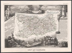
Items Similar to Circa 1950 original map poster of Calvados, designed by André Lesot - Normandy
Want more images or videos?
Request additional images or videos from the seller
1 of 8
André LesotCirca 1950 original map poster of Calvados, designed by André Lesot - NormandyCirca 1950
Circa 1950
$951.24
£713.50
€800
CA$1,327.92
A$1,438.30
CHF 761.79
MX$17,401.25
NOK 9,576.83
SEK 8,927.64
DKK 6,094.26
About the Item
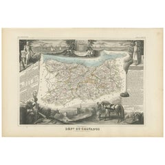
This circa 1950 original map poster of Calvados, designed by André Lesot, is a beautifully detailed representation of this historic region in Normandy, France. Produced by Éditions Géographiques André Lesot, Paris, the map showcases the department’s intricate road networks, railways, and topographical features, offering a fascinating glimpse into mid-20th-century cartography.
The design reflects the precision and artistry of traditional French mapmaking, with finely drawn borders, color-coded routes, and carefully labeled towns and cities. Caen, the capital of Calvados, is prominently highlighted, along with other significant locations such as Lisieux, Bayeux, and Honfleur. The coastline along the English Channel (La Manche) is also beautifully rendered, emphasizing the region’s geographical importance.
During the 1950s, maps like this were essential tools for travelers, geographers, and historians, serving both practical and educational purposes. This particular edition captures the post-war landscape of Calvados, a region deeply affected by World War II, especially during the D-Day landings of 1944.
Today, this map stands as a collector’s piece, valued for its historical significance, aesthetic appeal, and meticulous craftsmanship. Whether displayed as a decorative artwork or used for research, it remains a remarkable tribute to the rich heritage and geography of Calvados.
Map - Tourism - Normandy - France
Printed by Gaillac Monrocq et cie in Paris
- Creator:André Lesot
- Creation Year:Circa 1950
- Dimensions:Height: 21.26 in (54 cm)Width: 30.32 in (77 cm)
- Medium:
- Period:
- Condition:Good condition, traces of folds, on linen.
- Gallery Location:PARIS, FR
- Reference Number:1stDibs: LU1792215820872
About the Seller
5.0
Gold Seller
Premium sellers maintaining a 4.3+ rating and 24-hour response times
Established in 2021
1stDibs seller since 2022
194 sales on 1stDibs
Typical response time: 3 hours
- ShippingRetrieving quote...Shipping from: PARIS, France
- Return Policy
More From This Seller
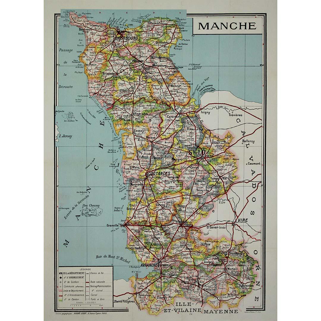
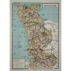
View AllCirca 1950 original illustrated map by André Lesot for "Carte de la Manche"
Located in PARIS, FR
The circa 1950 original illustrated map by André Lesot for "Carte de la Manche" is a significant piece that highlights both artistic design and geographic representation. Created dur...
Category
1950s Prints and Multiples
Materials
Linen, Paper, Lithograph
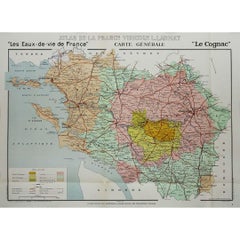
1947 original map "Les eaux-de-vie de France - Le Cognac" by Larmat
Located in PARIS, FR
The 1947 original map Atlas de la France vinicole - Les eaux-de-vie de France - Le Cognac, created by Louis Larmat and printed by Dorel in Paris, is a fascinating and detailed cartog...
Category
1940s Prints and Multiples
Materials
Paper, Lithograph
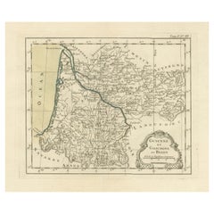
1947 original map Gouvernement Généraux du Poitou, du Pays d'Aunis
Located in PARIS, FR
The 1947 original map Gouvernement Généraux du Poitou, du Pays d'Aunis et de Saintonge Angoumois, created by Louis Larmat and printed by Dorel in Paris, is a beautifully detailed cartographic representation of a historically significant region in western France. This map, part of Larmat’s extensive body of work, is known for its artistic craftsmanship and geographical precision, offering a comprehensive view of the historical administrative regions of Poitou, Aunis, Saintonge, and Angoumois, which played key roles in the political and cultural history of France.
Louis Larmat is celebrated for his contributions to cartography, particularly for his ability to merge historical context, topographical detail, and aesthetic elegance in his maps. His works, especially those focusing on the vinicultural regions of France, are highly respected for their accuracy and artistry. This particular map, although focusing on a more political and historical aspect rather than the wine regions he is most famous for, continues his tradition of detailed regional documentation. Larmat’s cartographic works often transcended the realm of simple geographical depiction, becoming historical documents that encapsulate the cultural essence of the regions they portray.
This map illustrates the general governments (administrative divisions) of the provinces of Poitou, Aunis, Saintonge, and Angoumois, regions that are steeped in history. These areas, situated along France’s western coastline, have been integral to the country’s political, economic, and cultural development over centuries. The region of Poitou, for example, is historically known as the birthplace of Eleanor of Aquitaine...
Category
1940s Prints and Multiples
Materials
Paper, Lithograph

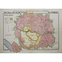
1947 original map "Les eaux-de-vie de France - Le Cognac fins bois" by Larmat
Located in PARIS, FR
The 1947 original map Atlas de la France Vinicole - Les Eaux-de-vie de France - Le Cognac Fins Bois, created by Louis Larmat and printed by Dorel in Paris, is an exquisite piece that...
Category
1940s Prints and Multiples
Materials
Paper, Lithograph
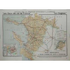
1947 original map "Le Cognac Bois ordinaires & Bois communs" by Larmat
Located in PARIS, FR
The 1947 original map Atlas de la France Vinicole - Les Eaux-de-vie de France - Le Cognac Bois Ordinaires & Bois Communs dits à Terroir, created by Louis Larmat and printed by Dorel ...
Category
1940s Prints and Multiples
Materials
Paper, Lithograph
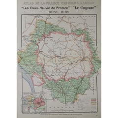
1947 original map "Les eaux-de-vie de France - Le Cognac Bons Bois" by Larmat
Located in PARIS, FR
The 1947 original map Atlas de la France Vinicole - Les Eaux-de-vie de France - Le Cognac Bons Bois, created by Louis Larmat and printed by Dorel in Paris, is a beautifully crafted c...
Category
1940s Prints and Multiples
Materials
Paper, Lithograph
You May Also Like
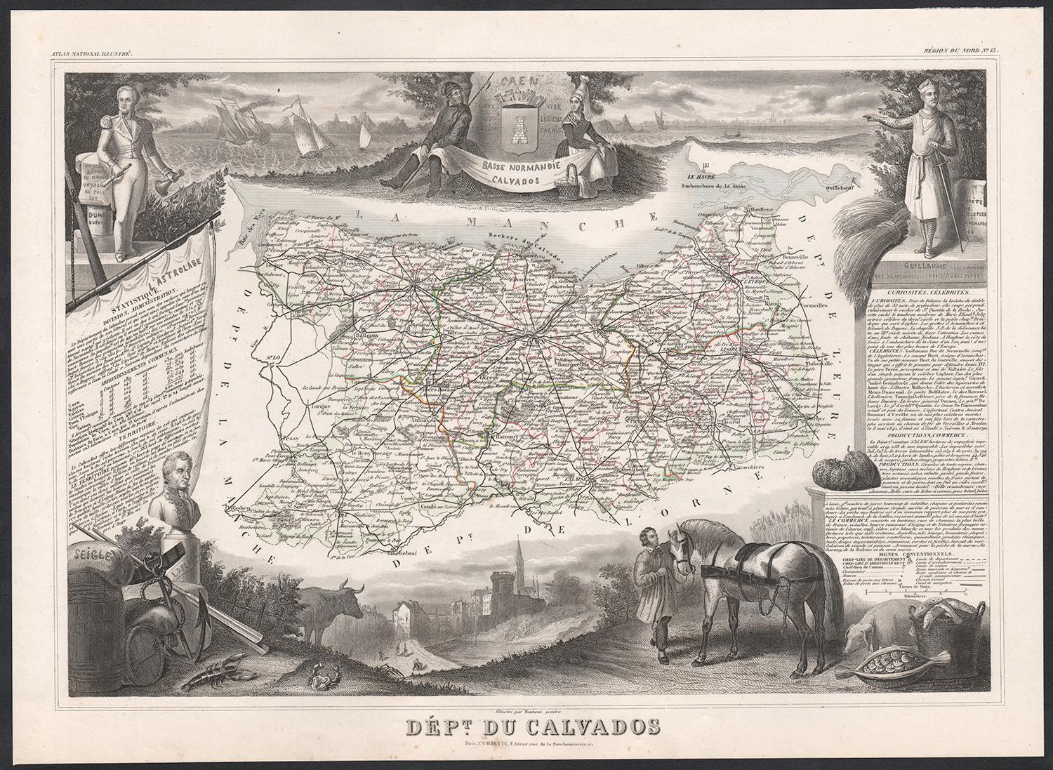
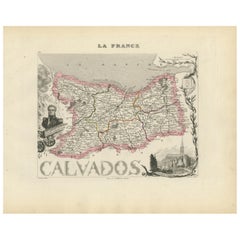
Calvados, France. Antique map of a French department, 1856
By Victor Levasseur
Located in Melbourne, Victoria
'Dept. du Calvados', steel engraving with original outline hand-colouring., 1856, from Levasseur's 'Atlas National Illustre'.
This area of France is known for its production of Cal...
Category
19th Century Naturalistic Landscape Prints
Materials
Engraving
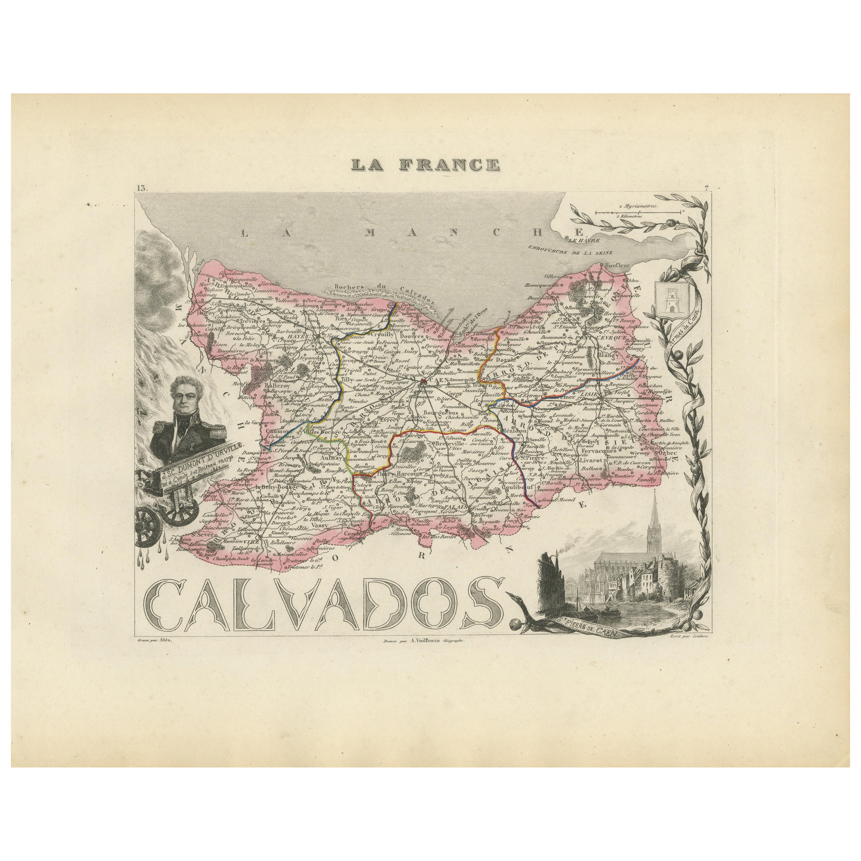
Map of Calvados France with Caen and Cider-Brandy Region, 19th Century
Located in Langweer, NL
Map of Calvados France with Caen and Cider-Brandy Region, 19th Century
Description:
This finely engraved 19th-century map of the Calvados department in Normandy, northwestern France...
Category
Antique Mid-19th Century French Maps
Materials
Paper
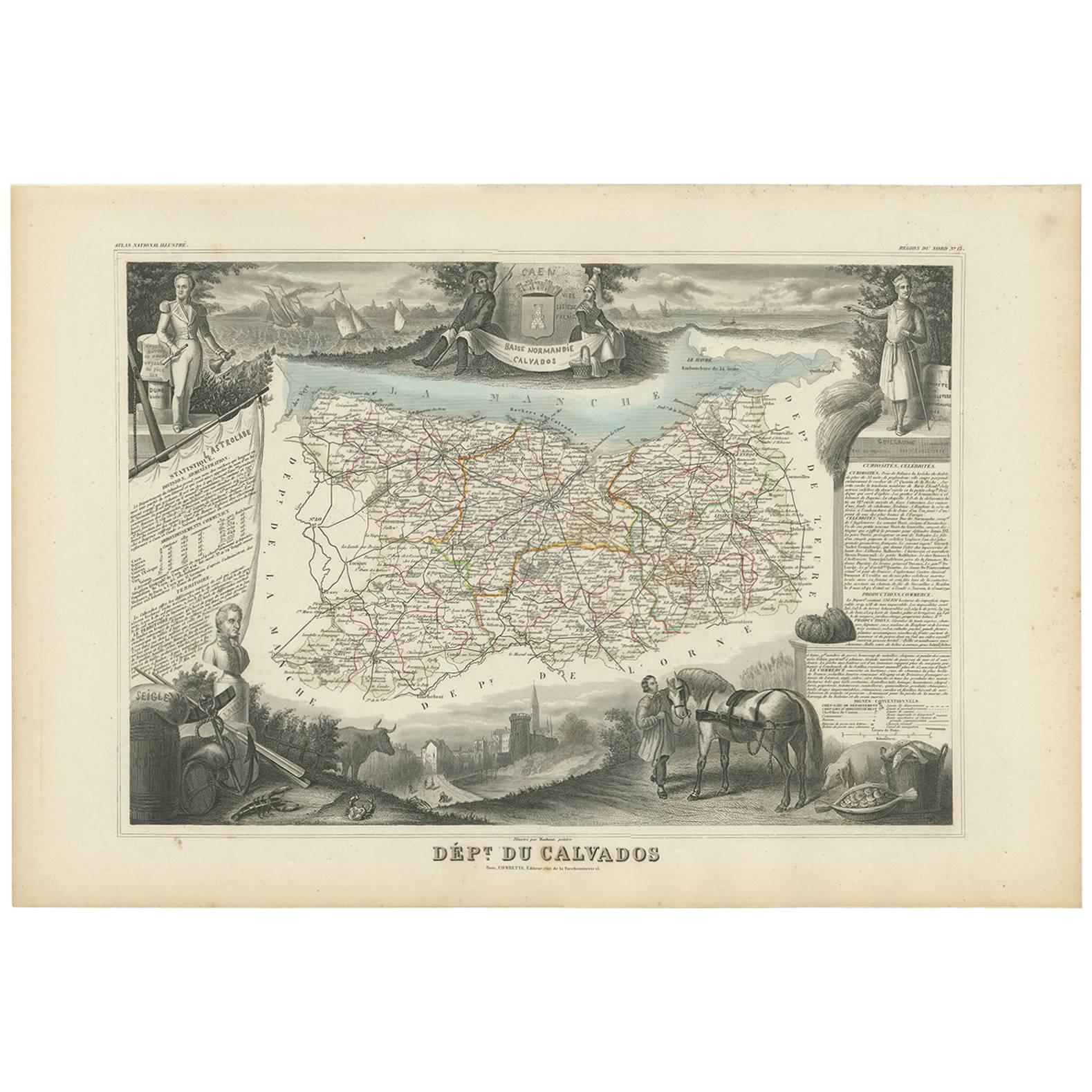
Antique Map of Calvados ‘France’ by V. Levasseur, 1854
By Victor Levasseur
Located in Langweer, NL
Antique map titled 'Dépt. du Calvados'. Map of the French department of Calvados, France. This area of France is known for its production of Calvados, the world's fines apple brandy....
Category
Antique Mid-19th Century Maps
Materials
Paper
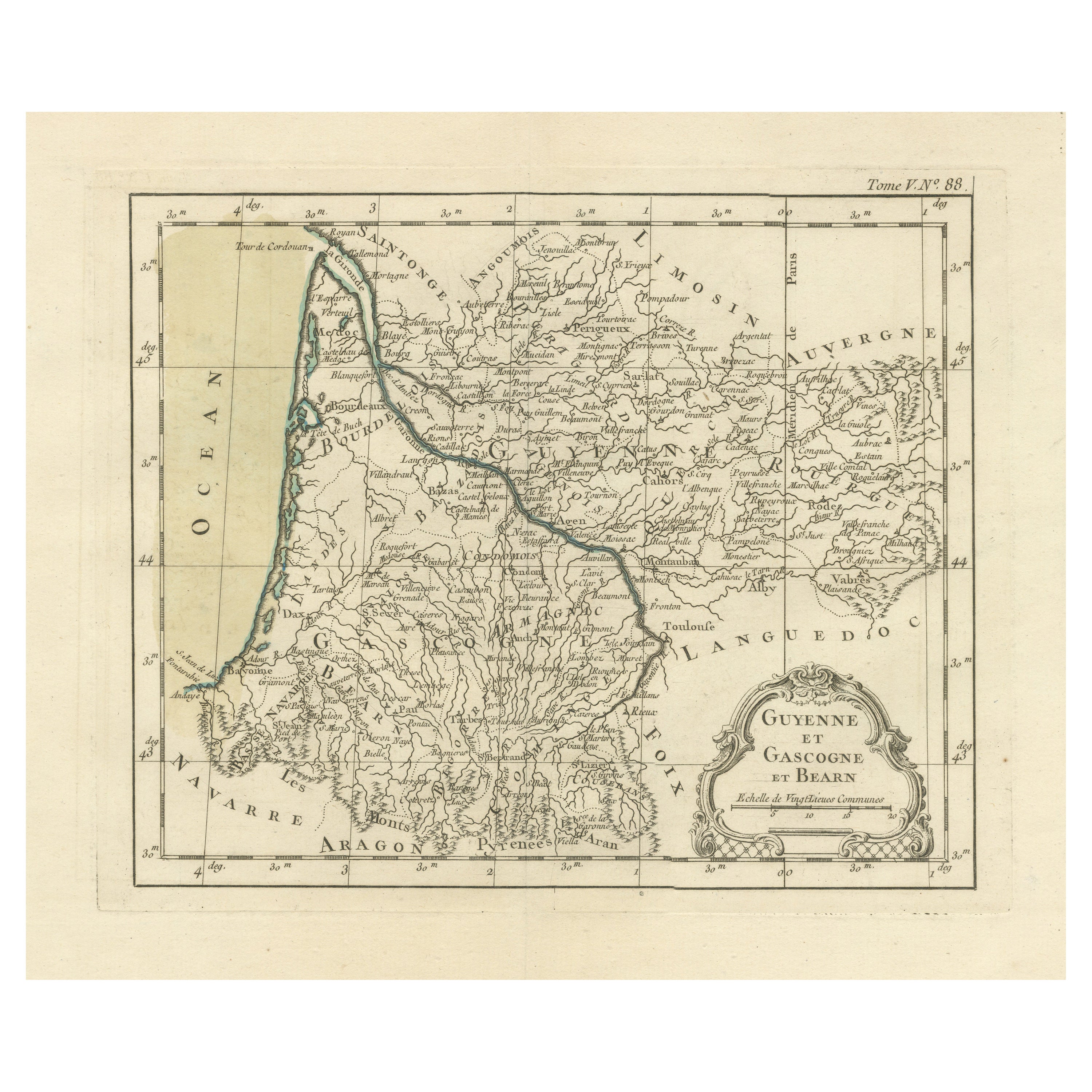
Antique Map of Guyenne, Gascony and Béarn, France
Located in Langweer, NL
Antique map titled 'Guyenne et Gascogne et Bearn'. Original old map of Guyenne (or Guienne), Gascony and Béarn, France. This map originates from 'Le Petit Atlas Maritime Recueil De C...
Category
Antique Mid-18th Century Maps
Materials
Paper
$247 Sale Price
20% Off
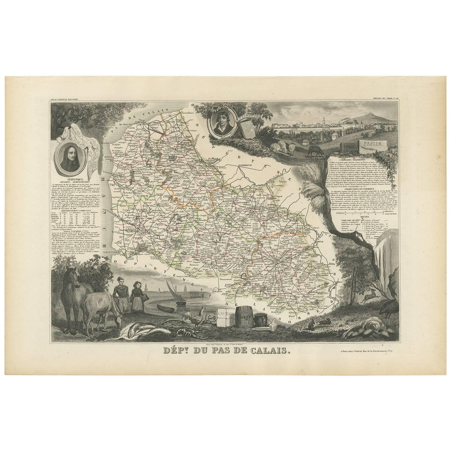
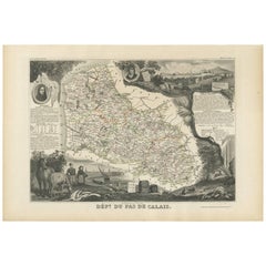
Antique Map of Calais ‘France’ by V. Levasseur, 1854
By Victor Levasseur
Located in Langweer, NL
Antique map titled 'Dépt. du Pas de Calais'. Map of the French department of Calais, France. This area is known for producing Maroilles, a soft cheese made from cow’s milk and with a...
Category
Antique Mid-19th Century Maps
Materials
Paper
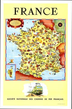
Original Societe Nationale des Chemin Map France, 1953 vintage poster on linen
Located in Spokane, WA
Original French vintage travel poster: "FRANCE, Société Nationale des Chemins de Fer Français." Printed in France by the French National Railroads. Original linen-backed poster; read...
Category
1950s American Modern Landscape Prints
Materials
Lithograph
More Ways To Browse
Vintage French Map
Map Stand
Vintage Original Posters Normandy
Salvador Dali The Twelve Apostles
Tintin Art
Tokyo Poster
Vintage Apple Poster
Vintage Bull Matador
Vintage Kitchen Art Prints
Vintage Kitchen Posters
Vintage Posters Salvador Dali
Vintage Train Print
Warhol Flower Prints
Andy Warhol Ladies And Gentlemen
Antique German Lithographs
Beto De La Rocha
Billy The Artist
Bread And Puppet