Items Similar to Map Of The Island Of Antigua

Want more images or videos?
Request additional images or videos from the seller
1 of 11
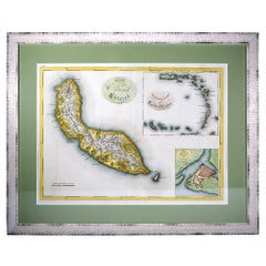
Eman BowenMap Of The Island Of Antigua
$750
£578.16
€657.15
CA$1,068.64
A$1,162.57
CHF 613.47
MX$13,981.91
NOK 7,738.69
SEK 7,202.08
DKK 4,907.83
About the Item
Classic colour plate depicting a 'Map of the Island of Antigua' by Eman Bowen
Print Sz: 13 1/2"H x 10"W
Frame Sz: 20"H x 16 1/2"W
w/ grey mat & green lacquer frame
Emanuel Bowen (1694 – 8 May 1767) was a Welsh map engraver, who achieved the unique distinction of becoming Royal Mapmaker to both to King George II of Great Britain and Louis XV of France. Bowen was highly regarded by his contemporaries for producing some of the largest, most detailed and most accurate maps of his era. He is known to have worked with most British cartographic figures of the period including John Owen and Herman Moll.
- Creator:Eman Bowen
- Dimensions:Height: 20 in (50.8 cm)Width: 16.5 in (41.91 cm)
- Medium:
- Period:
- Condition:
- Gallery Location:Bristol, CT
- Reference Number:Seller: 225471stDibs: LU1260114037172
About the Seller
4.8
Vetted Professional Seller
Every seller passes strict standards for authenticity and reliability
Established in 2000
1stDibs seller since 2019
137 sales on 1stDibs
Typical response time: 2 hours
- ShippingRetrieving quote...Shipping from: Bristol, CT
- Return Policy
More From This Seller
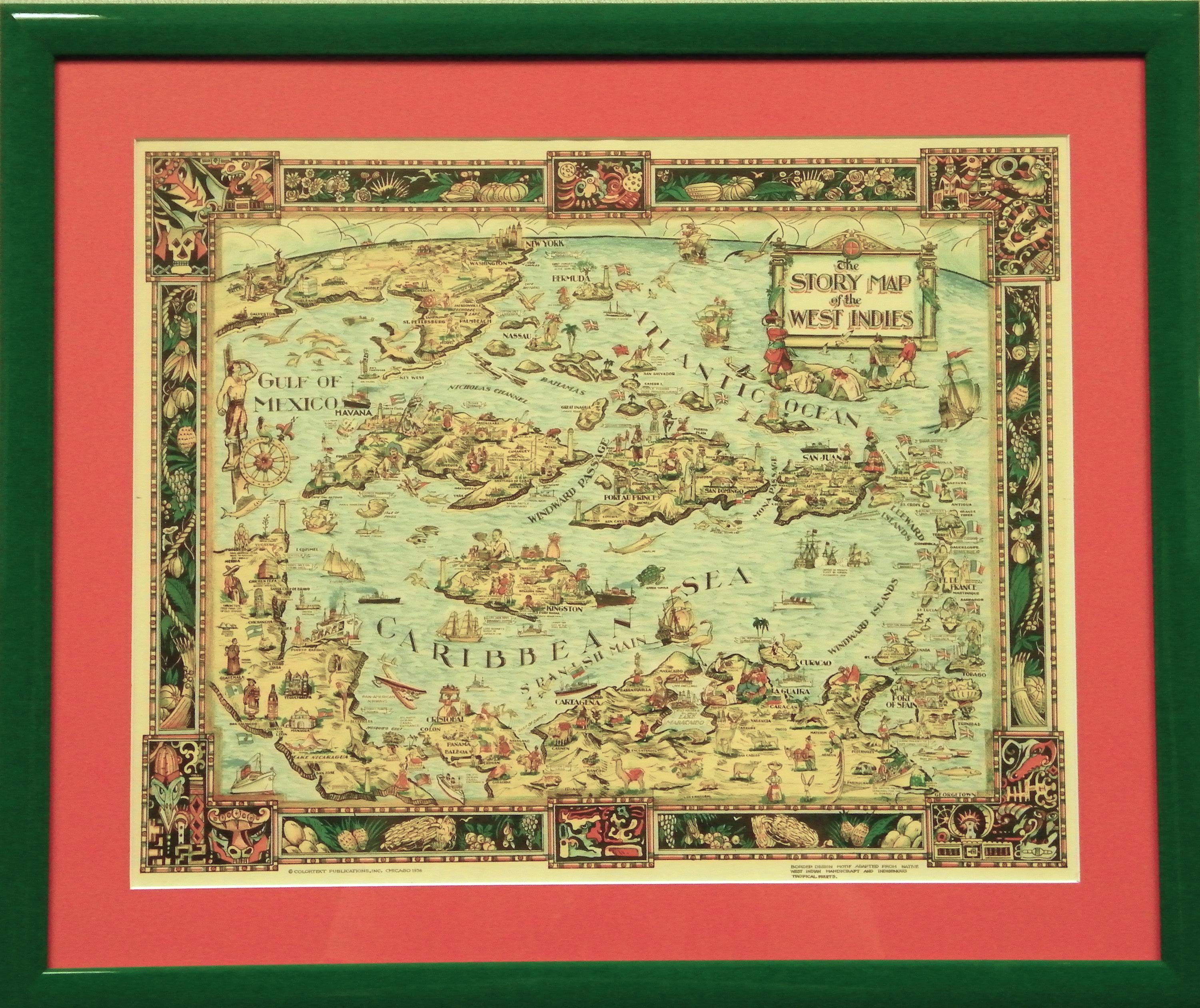
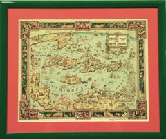
View All"The Story Map Of The West Indies" 1936
Located in Bristol, CT
Framed colour map of the West Indies published 1936 w/ border design motif adapted from native West Indian handicraft and indigenous tropical fruits
Colorte...
Category
1930s More Prints
Materials
Paper
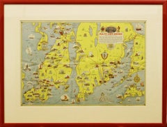
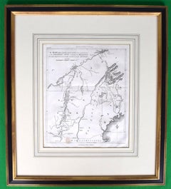
"Rhode Island Map, 1933"
Located in Bristol, CT
Classic c1933 colour (12 fold) red framed map of Rhode Island designed by H.W. Hetherington from Narragansett Bay to Buzzard's Bay
Map Sz: 17 3/8"...
Category
1930s Prints and Multiples
Materials
Lithograph
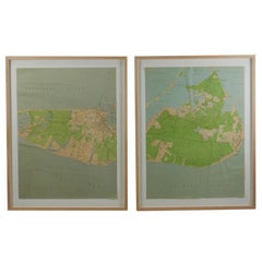
Maps of Nantucket Sound and Harbor Provenance: The Susie Hilfiger Collection
Located in Bristol, CT
Map Sz: 22 1/2"H x 17"W
Frame Sz: 26 1/2"H x 20 3/4"W
*w/ age toning/ slight creasing/ waving to mounted maps*
Provenance: The Susie Hilfiger Collection
From "Point of View", the...
Category
20th Century Drawings and Watercolor Paintings
Materials
Paper
American Revolution Map Drawn For John Marshall's "Life Of Washington" First Acc
Located in Bristol, CT
A Map Of The Country Which Was The Scene Of Operations Of The Northern Army: Including The Wilderness Through Which Gerneral Arnold Marched To Attack Plate VI
Map Sz: 11"H x 9 1/4"W...
Category
Early 1800s Prints and Multiples
Materials
Paper, Engraving
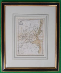
Plan Of The Northern Part Of New Jersey Showing The Positions Of The American &
By Richard Phillips
Located in Bristol, CT
After Crossing The North River in 1776
Map Sz: 9 7/8"H x 7 1/4"W
Frame Sz: 18 5/8"H x 15 3/4"W
Engraved by J Yeagen
Uncolored map of Northern New Jersey, Staten Island and the lo...
Category
Early 1800s Prints and Multiples
Materials
Lithograph
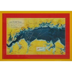
A Map Of Western Long Island Sound Showing Yacht Clubs, Aids To Navigation...
Located in Bristol, CT
Classic color map/ nautical chart (by Nolf Klep '39) of the North Shore of Long Island Sound
for members of the Larchmont Yacht Club (see verso)
Map Sz: 13 ...
Category
1930s More Prints
Materials
Paper
You May Also Like
Curaçao map - C. van Baarsel en zoon
Located in UTRECHT, UT
“Kaart van het eiland Curaçao.”, “Algemeene kaart der Caraïbische eilanden”, “Plan van het fort Amsterdam op Curaçao” from the atlas “Atlas der overzeesche bezittingen van Zijne Maje...
Category
Antique 1810s Dutch Other Maps
Materials
Paper
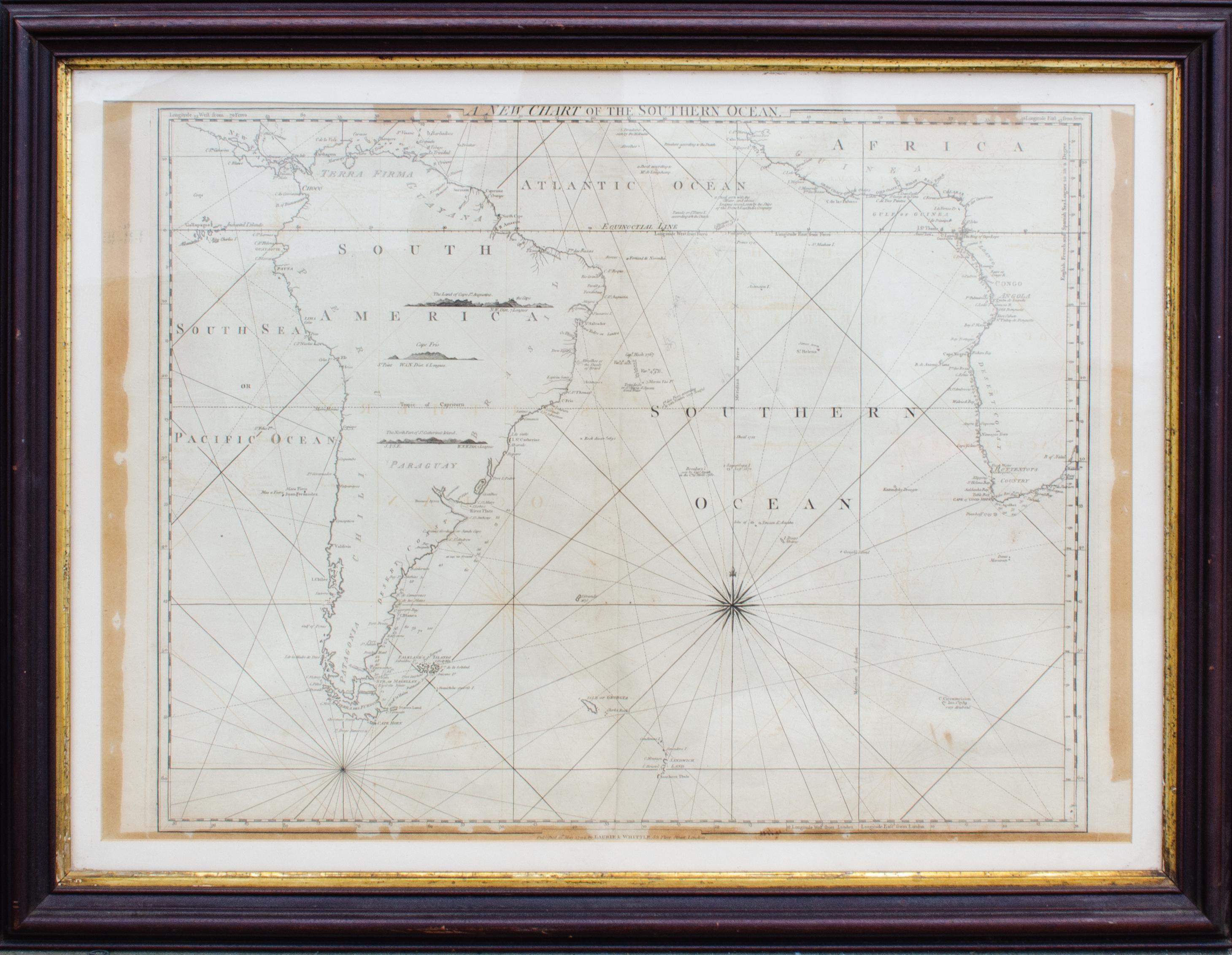
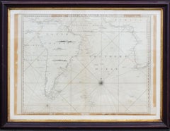
Antique Map of the Southern Oceans, South America and Africa
Located in New York, NY
Antique Map of the South Atlantic, c. 1800s
Engraving
20 x 28 in.
Framed: 25 3/4 x 33 3/4 in.
Category
19th Century Realist Figurative Prints
Materials
Engraving
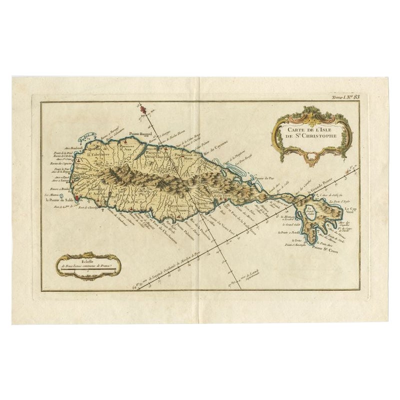
Old Map of the island of Saint Christopher or St. Kitts in the Caribbean, c.1765
Located in Langweer, NL
Antique map titled 'Carte de l'Isle de Saint-Christophe'.
A detailed map of the island of Saint Christopher or St. Kitts showing mountain ranges, port towns and parishes. This map ...
Category
Antique 18th Century Maps
Materials
Paper

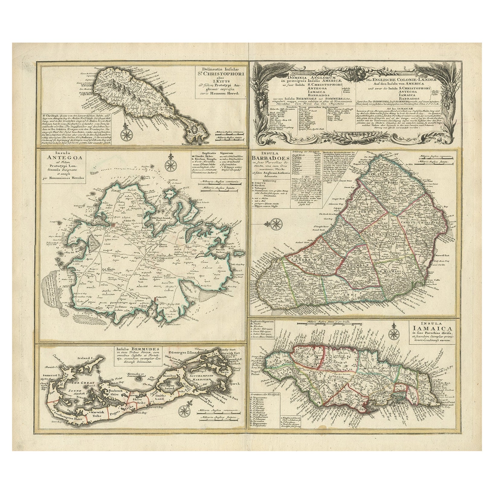
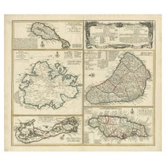
Original Old Map of St Kitts, Antigua, Bermuda, Barbados, and Jamaica, ca.1745
Located in Langweer, NL
Antique map titled 'Dominia Anglorum in praecipuis Insulis Americae ut sunt Insula S. Christophori, Antegoa, Iamaica, Barbados nec non Insulae Bermudes vel Sommers dictae. Die Englis...
Category
Antique 1740s Maps
Materials
Paper
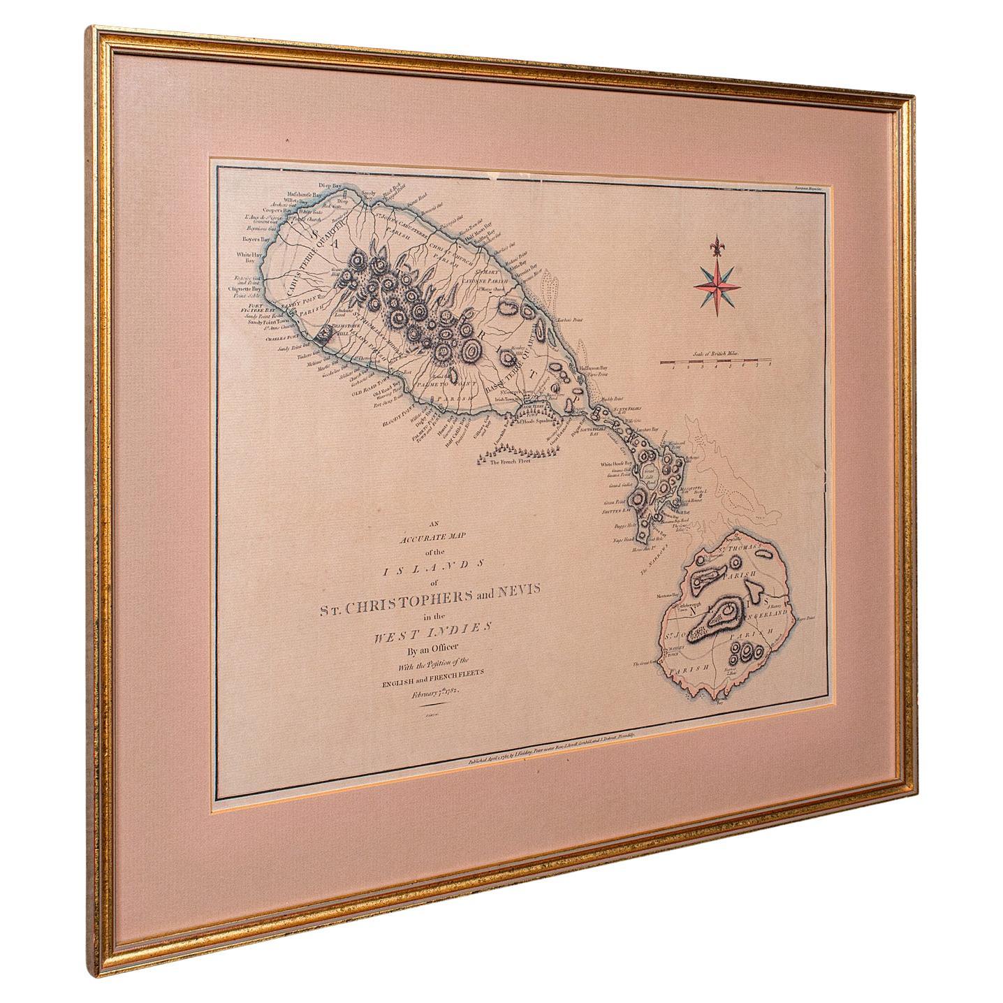
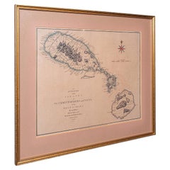
Antique St Christopher & Nevis Map, English, Caribbean Cartography, Georgian
Located in Hele, Devon, GB
This is a superb antique map of St Christopher and Nevis. An English, framed Caribbean island cartography engraving, dating to the Georgian period and later, circa 1780. A fascinatin...
Category
Antique 1780s British Georgian Maps
Materials
Glass, Paper
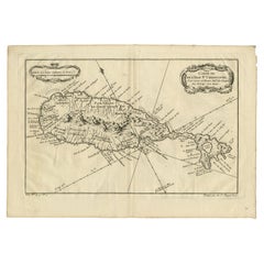
Antique Map of the Caribbean Island of St Kitts, ca.1750
Located in Langweer, NL
Description: Antique map titled 'Carte de l'Isle St. Christophe pour Servir a l'Histoire Genle. des Voyages.'
Detailed map of the Island of St. Kitts, showing the Parishes, towns, ...
Category
Antique 1750s Maps
Materials
Paper
More Ways To Browse
King George Ii
Robe Feather
Robert Indiana Silkscreen
Rodo Graciela Boulanger
Romare Bearden Signed
Salvador Dali Dante
Vintage Astrology Art
Vintage Boy Scout
Vintage Cross Country Skis
Vintage India Print
Vintage Womens Hats 1940s Womens Hats
Vladimir Lenin
Wunderlich Lithograph
16th Century Woodcuts
1984 Olympic Poster
19th Century Signed Etchings
Alsace Art
American Indian Artists