Items Similar to Map of Groningen - Etching by George Braun - Late 16th Century
Want more images or videos?
Request additional images or videos from the seller
1 of 6
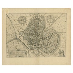
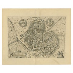
George BraunMap of Groningen - Etching by George Braun - Late 16th CenturyLate 16th Century
Late 16th Century
$590.80
£449.61
€500
CA$827.03
A$911.32
CHF 472.69
MX$10,838.90
NOK 5,979.34
SEK 5,601.37
DKK 3,808.93
About the Item
This map of Groninga is an original etching realized by George Braun and Franz Hogenberg, and part of the series "Civitates Orbis Terrarum".
The state of preservation of the artwork is aged with diffused foxings and the middle lne on the folding had been cut and is partially repaired.
Sheet dimension :33.5 x 49.5
Interesting B/W etching on coeval paper, this artwork represents skilfully a detailed view of the city ofGroninga through confident strokes. "Groninga" is printed on the lower left.
The “Civitates Orbis Terrarum” (Atlas of Cities of the World) was the second oldest printed atlas in the history of world cartography and the first atlas totally dedicated to topographical views. The first volume of this collection was published in Cologne in 1572; the others in 1575, 1581, 1588, and 1598. The sixth and final volume appeared in 1617, just before the extensive devastation wreaked by the Thirty Years’ War.
- Creator:George Braun
- Creation Year:Late 16th Century
- Dimensions:Height: 13.19 in (33.5 cm)Width: 19.49 in (49.5 cm)Depth: 0.04 in (1 mm)
- Medium:
- Period:
- Framing:Framing Options Available
- Condition:Insurance may be requested by customers as additional service, contact us for more information.
- Gallery Location:Roma, IT
- Reference Number:Seller: M-1132781stDibs: LU65037308142
About the Seller
4.9
Platinum Seller
Premium sellers with a 4.7+ rating and 24-hour response times
1stDibs seller since 2017
7,815 sales on 1stDibs
Typical response time: 1 hour
- ShippingRetrieving quote...Shipping from: Grasse, France
- Return Policy
More From This Seller
View AllMap of the Netherlands - Etching by G. Braun and F. Hogenberg -Late 16th Century
By Franz Hogenberg
Located in Roma, IT
Map of the Netherlands is an original etching realized by George Braun and Franz Hogenberg, as part of the "Civitates Orbis Terrarum".
The “Civitates Orbis Terrarum” (Atlas of Citi...
Category
16th Century Figurative Prints
Materials
Etching

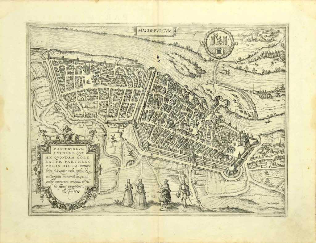
Map of Magdeburg - Etching by G. Braun e F. Hogenberg - Late 16th Century
By Franz Hogenberg
Located in Roma, IT
This map of Magdebvrgvm is an original etching realized by George Braun and Frans Hogenberg, as part of the famous series "Civitates Orbis Terrarum" (Atlas of the Cities of the Worl...
Category
16th Century Figurative Prints
Materials
Etching
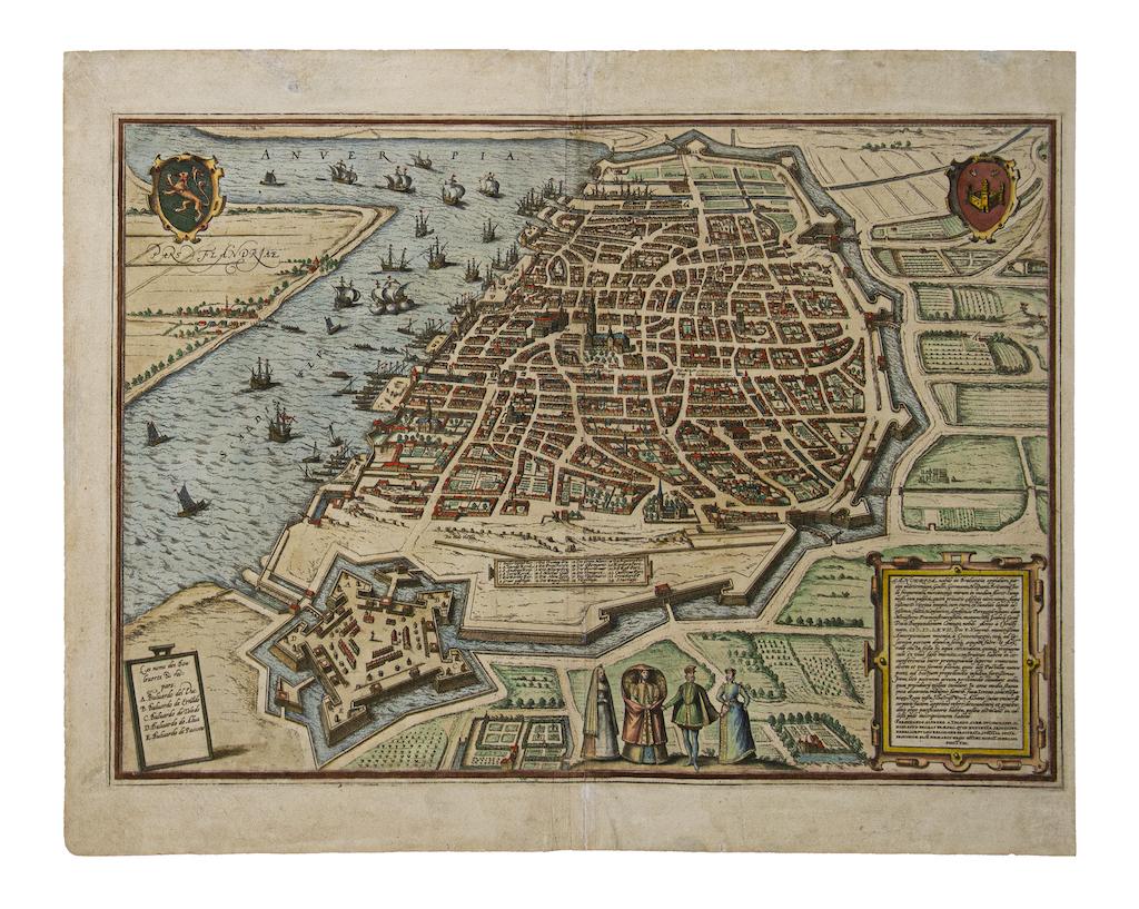
Map of Antwerp - Etching by G.Braun and F. Hogenberg -Late 16th century
By Franz Hogenberg
Located in Roma, IT
This Map of Anverpia is an original etching hand colored realized by George Braun and Franz Hogenberg as part of the famous Atlas "Civitates Orbis Ter...
Category
16th Century Old Masters Figurative Prints
Materials
Etching

Map of Augsburg - Etching by G. Braun e F. Hogenberg - Late 16th Century
By Franz Hogenberg
Located in Roma, IT
This map of Avgvsta is an original etching realized by George Braun and Franz Hogenberg, as part of the famous series "Civitates Orbis Terrarum (Atlas of the Cities of the World).
...
Category
16th Century Figurative Prints
Materials
Etching
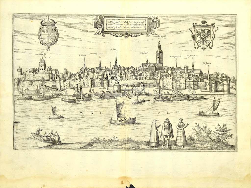
Map of Nijmegen - Etching by G. Braun and F. Hogenberg - Late 16th Century
By Franz Hogenberg
Located in Roma, IT
This map of Noviomagvs is an original etching realized by Georg Braun and Franz Hogenberg as part of the famous series "Civitates Orbis Terrarum".
The state of preservation of the ...
Category
16th Century Figurative Prints
Materials
Etching

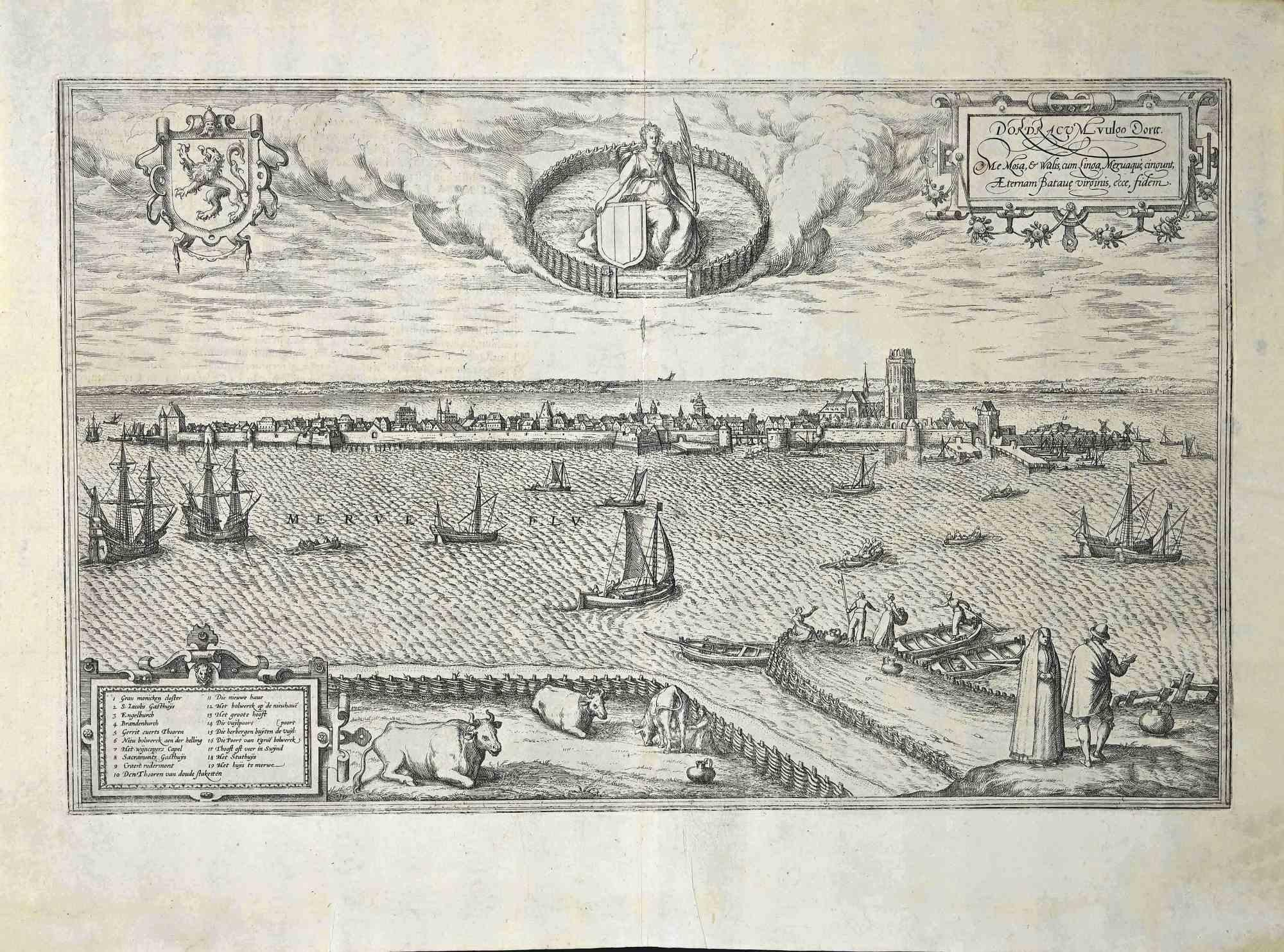
Map of Dordrecht - Etching by G. Braun/F. Hogenberg - Late 16th Century
Located in Roma, IT
Map od Dordrecht is an artwork realized by Braun and Hogemberg in the late 16th century.
Hand watercolored etching.
40x54 cm.
Good conditions.
Braun Hoghemberg (1541-1622) was a ...
Category
16th Century Old Masters Figurative Prints
Materials
Etching

You May Also Like
Rare Antique Map of Leeuwarden, Friesland, The Netherlands, by P. Bast, 1603
By P. Bast
Located in Langweer, NL
Very rare plan of Leeuwarden, Friesland, The Netherlands. With several cartouches and coat of arms. With a legend and compass rose at bottom right. Made by 'Pieter Bast' after the su...
Category
Antique Early 17th Century Maps
Materials
Paper

$3,456 Sale Price
35% Off
Map of Cambridge, engraving Pieter van der Aa after David Loggan
By Pieter Van Der Aa
Located in London, GB
Pieter van der Aa (1659 - 1733), after David Loggan (1634 - 1692)
Map of Cambridge
Engraving
12 x 16 cm
An eighteenth-century view of Cambridge, engraved by Pieter van der Aa after ...
Category
Early 18th Century Realist Prints and Multiples
Materials
Engraving

Antique Map of the City of Zutphen by Guicciardini, 1613
Located in Langweer, NL
Antique map Zutphen titled 'Zutphen'. This map depicts the city of Zutphen, Gelderland, The Netherlands. Originates from 'Discrittione di tutti i Paesi Bassi'.
Artists and Engrav...
Category
Antique 17th Century Maps
Materials
Paper
Antique Map of the City of Zutphen by Guicciardini, 1612
Located in Langweer, NL
Antique map Zutphen titled 'Zutphen'. This map depicts the city of Zutphen, Gelderland, The Netherlands. Originates from 'Beschryvinghe van alle de Neder-landen anderssins ghenoemt N...
Category
Antique 17th Century Maps
Materials
Paper
18th Century Map Engraving - Mechlin, or Malines
Located in Corsham, GB
A map of Mechelen, known as Malines in French and Mechlin in English, a city and municipality in the province of Antwerp in the Flemish Region of Belgium. A birds-eye view plan of th...
Category
18th Century More Prints
Materials
Engraving

$269 Sale Price
20% Off
Antique Map of the City of Leeuwarden by Bast, 1603
Located in Langweer, NL
Antique map titled 'Leeuwerden de hooft stadt van Frislant. Leoverdia Metropolis Frisiae (…) 1603.' Very rare plan of Leeuwarden, Friesland, The Netherlands. With several carouches a...
Category
Antique 17th Century Maps
Materials
Paper
More Ways To Browse
Dali Illustrates Casanova
Dali Man Of La Mancha
Dali Othello
Dali Pig And Pepper
Dali Purgatory Signed
Dali Saba
Dali Signed Ecstatic
Dali Skeleton
Dali Spinning Man
Dali The Annunciation
Dali Thus Was Earth Created
Dame Laura Knight On Sale
Danos Flower Shop
Daumier Actualites
David Ham
David Schluss Serigraph
David Shrigley You Are Special
Degas Poster