Items Similar to 'Government Accounts Registry & War Record' original chromolithograph

Want more images or videos?
Request additional images or videos from the seller
1 of 14
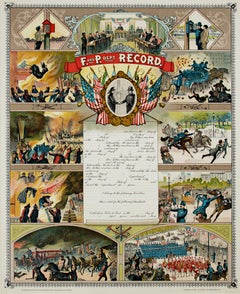
J.M. Vickroy & Co.'Government Accounts Registry & War Record' original chromolithograph1896
1896
$6,000
£4,616.36
€5,275.36
CA$8,587.43
A$9,364.44
CHF 4,919.38
MX$112,238.42
NOK 62,382.63
SEK 58,052.91
DKK 39,401.14
About the Item
The present lithograph, a certificate of Government Accounts Registry and War Record, was produced by the publishing company owned and operated by James M. Vickroy. The certificate was never used and has not been filled with the information of a veteran. Surrounding the text are various vignettes, arranged chronologically, of important moments of the Civil War, including the Battles of Gettysburg, Fort Sumter, Shiloh, as well as the Surrender of General Lee. It includes also portraits of United States presidents, generals and war heroes. Given primacy among these are Presidents Washington, Lincoln and Harrison. President McKinley's portrait was added by the publisher after printing.
24.75 x 18.5 inches, print
34.5 x 28.63 inches, frame
Copyrighted 'Entered According to Act of Congress in the Year 1888 by J.M. Vickroy, in the Office of the Library of Congress at Washington D.C.' in the stone, lower left
Marked 'Published by J.M. Vickroy & Co. Terre Haute, Indiana' in the stone, lower right
Marked 'IV. Edition 1896' in the stone, lower center
Framed to conservation standards using 100 percent rag matting and Museum Glass, all housed in a gold-lined cherry wood moulding.
Some toning to edges of paper. Small tear top center. Otherwise excellent condition with no signs of fading.
J.M. Vickroy & Co. published books and certificates, often catering to fraternal organizations, veterans of war, and genealogical interests. James M. Vickroy, born in Pennsylvania, had various occupations before he entered the publishing business. Sometime before 1880, he was working for the M.C. Lilly Co. of Columbus, Ohio, which produced swards and certificates for fraternal organizations. Such fraternal groups were a major social and political force in the US in the nineteenth century, as well as a lucrative source of income for a publishing house. In 1885, he and his wife Elizabeth Elnora Boore moved to Terre Haute, Indiana where they began to produce large certificates catering to these fraternal groups. The first lithograph was for the Independent Order of Odd Fellows (IOOF), and by 1904, he was the exclusive publisher of these charts for no less than 28 fraternal organizations. His company also extended out to publish pictorial war records for veterans, prints for local groups, fraternal textbooks, and genealogical certificates including “Family Record” and “Afro-American History Record.” James died in 1913 and the company continued to operate under his daughter Pearl for another two decades.
Source: McCormick, Mike. "James M. Vickroy catered to organizations." Tribune-Star (Terre Haute, IN) 7 April 2019.
- Creator:
- Creation Year:1896
- Dimensions:Height: 34.5 in (87.63 cm)Width: 28.63 in (72.73 cm)
- Medium:
- Period:
- Condition:Some toning to edges of paper. Small tear top center. Otherwise excellent condition with no signs of fading.
- Gallery Location:Milwaukee, WI
- Reference Number:Seller: 7727g1stDibs: LU60536112992
About the Seller
4.9
Gold Seller
Premium sellers maintaining a 4.3+ rating and 24-hour response times
Established in 1966
1stDibs seller since 2017
452 sales on 1stDibs
Typical response time: 1 hour
- ShippingRetrieving quote...Shipping from: Milwaukee, WI
- Return Policy
More From This Seller
View All"Fire and Police Department Record, " Chromolithograph by J.M. Vickroy & Co
By J.M. Vickroy & Co.
Located in Milwaukee, WI
"Fire and Police Department Record" is a chromolithograph by J.M. Vickroy & Co. It features scenes of a Fire and Police department doing civic servic...
Category
Early 1900s Other Art Style Figurative Prints
Materials
Lithograph
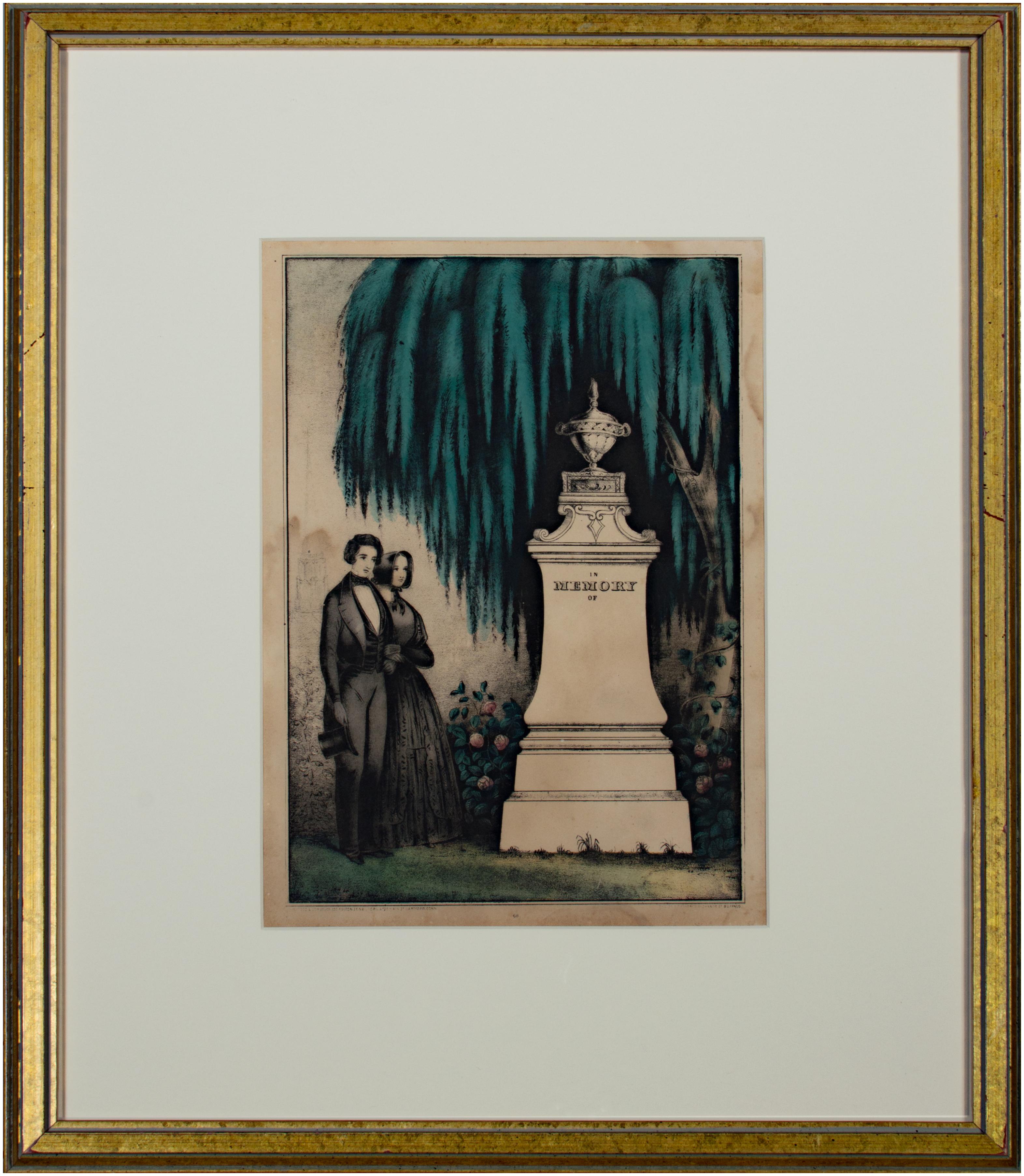
'In Memory of (66)' original Kellogg & Comstock hand-colored mourning lithograph
Located in Milwaukee, WI
The present hand-colored lithograph was produced as part of the funeral and mourning culture in the United States during the 19th century. Before the printmaking boom of the 1830s, however, such inexpensive memorial images were not widely available. These prints became popular as ways of remembering loved ones, an alternative to portraiture of the deceased or to meticulous hand-embroidered memorials often made by female academy students. In the image, the urn-topped monument contains a space where a family could inscribe the name and death dates of a deceased loved one, though this example was never used. In the variations of this image type produced by the Kellogg...
Category
Mid-19th Century Romantic Figurative Prints
Materials
Lithograph, Watercolor

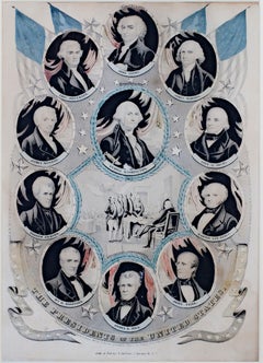
19th century color lithograph portraits patriotic American stars flags
By Nathaniel Currier
Located in Milwaukee, WI
"The Presidents of the U.S." is an original hand-colored lithograph by Nathaniel Currier. It features the first eleven presidents of the United States.
14" x 10" art
23" x 19 1/8" frame
Nathaniel Currier was born March 27, 1813 to Nathaniel and Hannah Currier in Roxbury, Massachusetts. At the age of fifteen he was apprenticed to William S. and John Pendleton of Boston who had set up the first lithographic establishment in America. His apprenticeship served him well as he went on to be the largest publisher of lithographs. Mr. Maurer described Nat Currier as being very gentlemanly and liberal. As is evident to the success of the firm of Currier & Ives he was very devoted to his business.
Nat Currier had many friends including Horace Greely and P.T. Barnum. He was well known for his sense of humor and Harry T. Peters tells one story about P. T. Barnum. "Currier had heard that one day his friend, the great showman, had rushed into the barber shop of the old Park Hotel, at Beekman and Nassau Streets, to get a shave. Barnum had hurried up to Tom Higginson, the barber, and said, 'Tom, I'm in a hurry.' 'Sorry for it,' said Tom, 'but it's that gentleman's turn next.' 'That gentleman' was an unshaven irshman waiting for a ten-cent shave. Barnum turned to him and said, 'My friend, if you will let me have your turn, I'll pay for what you have done.' The gentleman consented, and, as Barnum found out later, had a full job done - absolutely everything the house had. The check was for a dollar and sixty cents. When Currier heard this story he found the very Irishman and had him pose. The result was the famous cartoon, "The Man that Gave Barnum 'His Turn.'"
Nathaniel was married twice; his first wife was Miss Eliza West of Boston. He had one son with Eliza, Edward West Currier. In 1847 he married Miss Laura Ormsbee of Vermont. Laura and Nathaniel are memorialized in the famous N. Currier lithograph The Road Winter...
Category
1840s Academic Portrait Prints
Materials
Lithograph
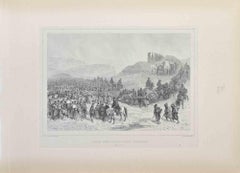
'Distribution of Goods to the Gros Ventres' lithograph by John Mix Stanley
By John Mix Stanley
Located in Milwaukee, WI
In the mid-nineteenth century, the United States government set out to survey and document its newly acquired lands and territories west of the Mississippi. The goals of these surveys were manifold: to produce topographical maps, to document flora and fauna, and to document natural resources to build the emerging US economy. These surveys, and the images from them, also functioned to build the new sense of American identity with the landscape, condensing vistas into the 'picturesque' tradition of European image making. Thus, the entire span of US territory could be seen as a single, cohesive whole.
This lithograph comes from one of six surveys commissioned by the Army's Topographic Bureau in 1853, which sought to find the best route to construct a transcontinental railroad. The result was a thirteen-volume report including maps, lithographs, and technical data entitled 'Explorations and Surveys to ascertain the most practicable and economical route for a Railroad from the Mississippi river to the Pacific Ocean.' In particular, the print comes from the northern survey, commanded by Isaac Stevens, which explored the regions between the 47th and 49th parallels.
In this image, Stanley documented the encounter with the Gros Ventre people at Milk River. The explorers were invited to the Gros Ventres camp and the two groups exchanged gifts in friendship. The Stevens Party provided "... blankets, shirts, calico, knives, beads, paint, powder, shot, tobacco, hard bread, etc." The image likewise alludes to how, in 1855, Isaac Stevens, concluded a treaty (Stat., L., XI, 657) to provide peace between the United States and the Blackfoot, Flathead and Nez Perce tribes. The Gros Ventres signed the treaty as part of the Blackfoot Confederacy, whose territory near the Three Fork area became a common hunting ground for the Flathead, Nez Perce, Kootenai, and Crow Indians.
5.75 x 8.75 inches, image
6.5 x 9.25 inches, stone
17 x 20 inches, frame
Artist 'Stanley Del.' lower left
Entitled 'Distribution of Goods to the Gros Ventres' lower center margin
Publisher 'Sarony, Major & Knapp. Lith.s 449 Broadway N.Y.' lower right
Inscribed 'U.S.P.R.R. EXP. & SURVEYS — 47th & 49th PARALLELS' upper left
Inscribed 'GENERAL REPORT — PLATE XXI' upper right
Framed to conservation standards using 100 percent rag matting with French accents; glazed with UV5 Plexiglas to inhibit fading; housed in a gold reverse ogee moulding.
Print in overall good condition; some localized foxing and discoloration; minor surface abrasions to frame.
John Mix...
Category
1850s Romantic Landscape Prints
Materials
Lithograph
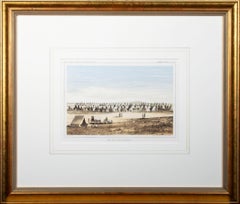
'Camp Red River Hunters' original lithograph by John Mix Stanley
By John Mix Stanley
Located in Milwaukee, WI
In the mid-nineteenth century, the United States government set out to survey and document its newly acquired lands and territories west of the Mississippi. The goals of these surveys were manifold: to produce topographical maps, to document flora and fauna, and to document natural resources to build the emerging US economy. These surveys, and the images from them, also functioned to build the new sense of American identity with the landscape, condensing vistas into the 'picturesque' tradition of European image making. Thus, the entire span of US territory could be seen as a single, cohesive whole.
This lithograph comes from one of six surveys commissioned by the Army's Topographic Bureau in 1853, which sought to find the best route to construct a transcontinental railroad. The result was a thirteen-volume report including maps, lithographs, and technical data entitled 'Explorations and Surveys to ascertain the most practicable and economical route for a Railroad from the Mississippi river to the Pacific Ocean.' In particular, the print comes from the northern survey, commanded by Isaac Stevens, which explored the regions between the 47th and 49th parallels.
In this image, Stanley shows an encampment of the people known as the Red River of the North hunters. They were generations of European and mixed-race trappers who lived on the frontier and had Indian wives and mixed-race children. They had come to the area for bison hunting, as the herds were still vast on the prairies. In the image, the figures and their encampment are dwarfed by the vast landscape around them, indicating the sublimity of these new American territories.
5.75 x 8.75 inches, image
6.5 x 9.25 inches, stone
17 x 20 inches, frame
Artist 'Stanley Del.' lower left
Entitled 'Camp Red River Hunters' lower center margin
Publisher 'Sarony, Major & Knapp. Lith.s 449 Broadway N.Y.' lower right
Inscribed 'U.S.P.R.R. EXP. & SURVEYS — 47th & 49th PARALLELS' upper left
Inscribed 'GENERAL REPORT — PLATE XII' upper right
Framed to conservation standards using 100 percent rag matting with French accents; glazed with UV5 Plexiglas to inhibit fading; housed in a gold reverse ogee moulding.
Print in overall good condition; some localized foxing and discoloration; minor surface abrasions to frame.
John Mix Stanley...
Category
1850s Romantic Landscape Prints
Materials
Lithograph
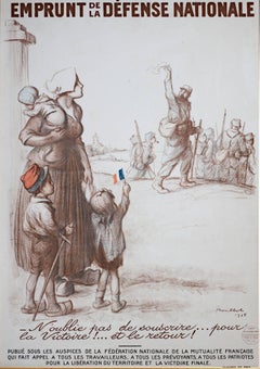
20th century color lithograph poster military wartime figurative print French
By Francisque Poulbot
Located in Milwaukee, WI
"Emprunt de la Defense Nationale" is an original lithograph poster by Francisque Poulbot. It depicts a mother with three young children saying goodbye to her husband as he leaves for war. This was an advertisement for French people to donate to the war effort during the first world war.
43 1/2" x 30 1/4" art
48" x 34 1/2" frame
Emprunt de la Défense Nationale [National Defence Loan]
WW1 French...
Category
1910s Modern Figurative Prints
Materials
Lithograph
You May Also Like
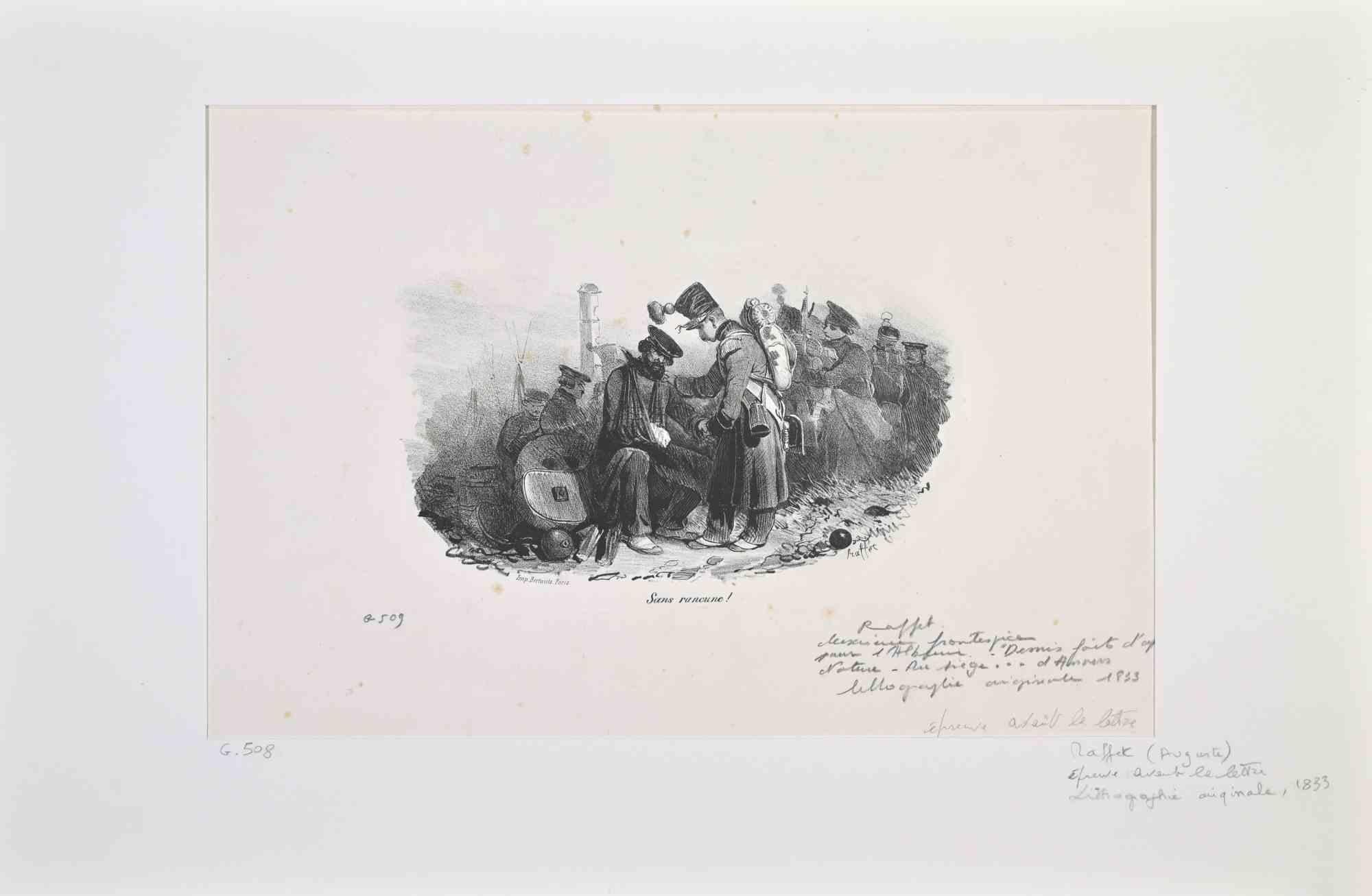
Solidarity with Soldiers - Lithograph by Auguste Raffet - Late 19th Century
Located in Roma, IT
Solidarity with Soldiers is a Lithograph realized by Auguste Raffet in 1833.
Signed on the plate.
Good condition with foxing.
Category
Late 19th Century Modern Figurative Prints
Materials
Lithograph

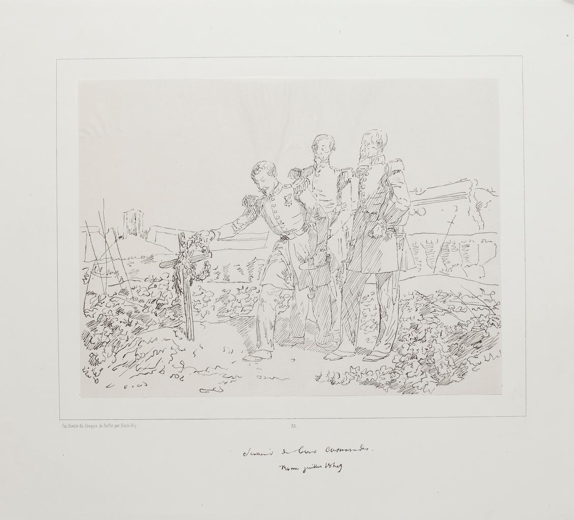
Commemoration - Lithograph by D'apres Raffet - 19th Century
Located in Roma, IT
Commemoration is an original lithograph on paper applied on cardboard realized by D'apres Auguste Raffet.
the status of preservation is very good except for some folding at the top ...
Category
19th Century Figurative Prints
Materials
Lithograph
$165 Sale Price
30% Off
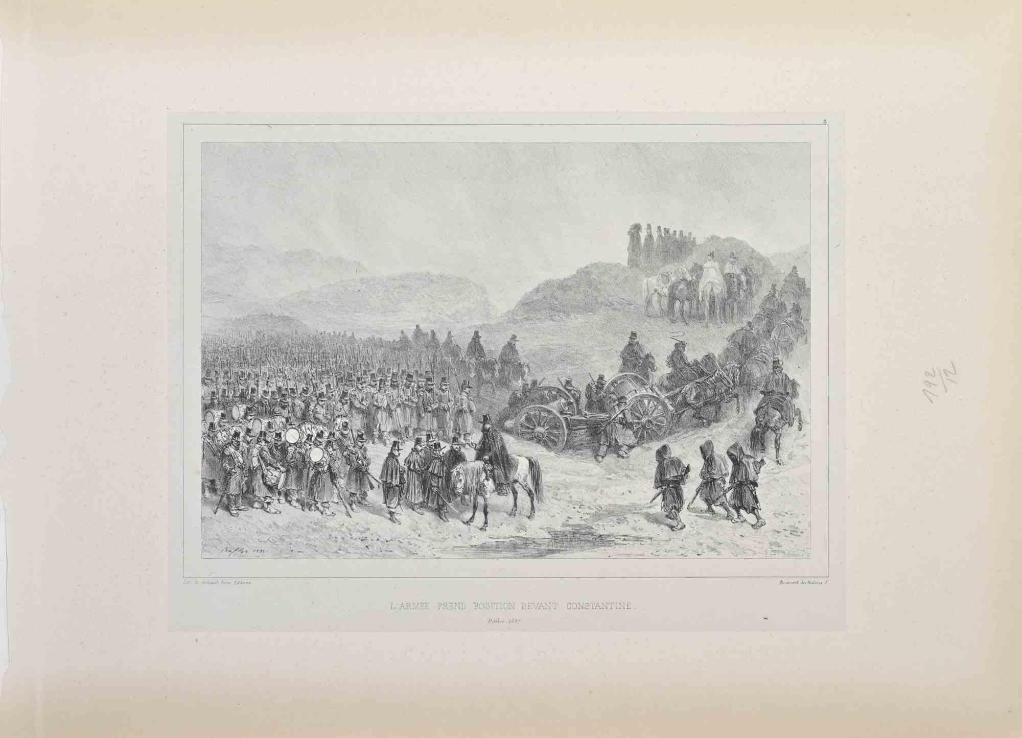
Army Gets Position - Lithograph by Auguste Raffet - 1837
Located in Roma, IT
Army gets position is a Lithograph realized by Auguste Raffet in 1837.
Signed in the plate.
Good condition
Category
1830s Modern Figurative Prints
Materials
Lithograph
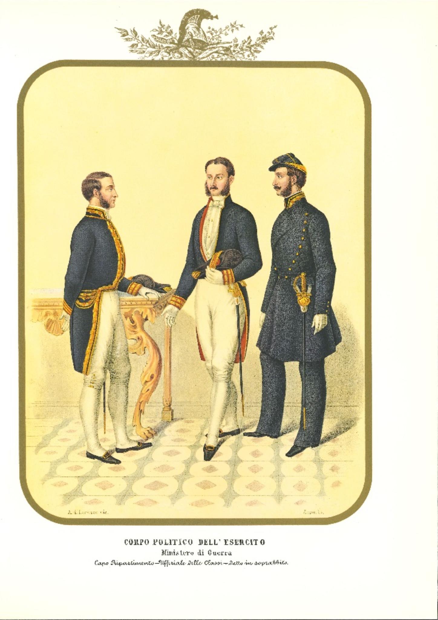
Political Corps of the Army - Lithograph by Antonio Zezon - 1850s
By Antonio Zezon
Located in Roma, IT
Political Corps of the Army is an original lithograph by Antonio Zezon.
Interesting colored lithograph which describes some members of the Army: on the left, a Head of Department ;...
Category
1850s Modern Figurative Prints
Materials
Lithograph

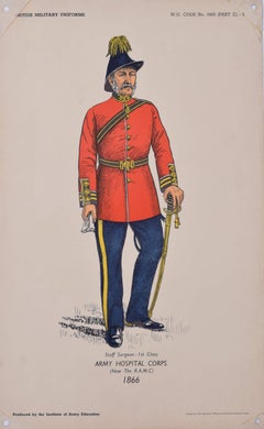
Army Hospital Corps Surgeon Institute of Army Education uniform lithograph
Located in London, GB
Army Hospital Corps Surgeon - 1st Class 1866 uniform
Lithograph
50 x 31 cm
Produced for the Institute of Army Education. Printed for HM Stationery Office by I A Limited, Southall 51...
Category
1950s Portrait Prints
Materials
Lithograph
Royal Veterans Regiment - Lithograph by Antonio Zezon - 1854
By Antonio Zezon
Located in Roma, IT
Royal Veterans Regiment is an original lithograph by Antonio Zezon. Naples 1854.
Interesting colored lithograph which describes some members of the Army: An Officer and a sub-Office...
Category
1850s Modern Figurative Prints
Materials
Lithograph
More Ways To Browse
Antique Records
Odd Fellows
Antique Odd Fellows
Nude Flask
Nude With Garter Dali
Odilon Redon On Sale
Oli Epp
Original Etching Roman Emperor
Ota Masamitsu
Oyvind Fahlstrom On Sale
Pablo Picasso Signed Aquatint
Pablo Picasso The Kiss
Parc Monceau Harold Altman
Pegge Hopper Print
Peter Max 1972
Peter Max Angels Signed
Peter Max Liberty And Justice For All
Peter Max Seasons