Items Similar to Map of Haute Vienne - Original Lithograph - 19th Century

Want more images or videos?
Request additional images or videos from the seller
1 of 2
UnknownMap of Haute Vienne - Original Lithograph - 19th Century19th Century
19th Century
$545.42
£414.52
€460
CA$765.31
A$835.12
CHF 433.48
MX$9,991.52
NOK 5,502.21
SEK 5,153.85
DKK 3,504.77
About the Item
Map of Haute Vienne is an original lithograph artwork realized by an Anonymous engraver of the 19th century.
Printed in the series of "France Pittoresque".
Titled "France Pittoresque".
The state of preservation of the artwork is good except for some foxing and humidity.
- Creation Year:19th Century
- Dimensions:Height: 6.7 in (17 cm)Width: 9.06 in (23 cm)Depth: 0.08 in (2 mm)
- Medium:
- Movement & Style:
- Period:
- Framing:Framing Options Available
- Condition:Insurance may be requested by customers as additional service, contact us for more information.
- Gallery Location:Roma, IT
- Reference Number:Seller: T-1266481stDibs: LU65039413412
About the Seller
4.9
Platinum Seller
Premium sellers with a 4.7+ rating and 24-hour response times
1stDibs seller since 2017
7,802 sales on 1stDibs
Typical response time: 1 hour
- ShippingRetrieving quote...Shipping from: Monaco, Monaco
- Return Policy
More From This Seller
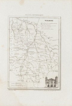
View AllMap of Vienne - Original Etching - 19th Century
Located in Roma, IT
Map of Vienne is an original etching realized by an anonymous engraver of the 19th Century.
Belongs to the Series of "France Pittoresque" at the top center.
The state of preservati...
Category
19th Century Figurative Prints
Materials
Etching
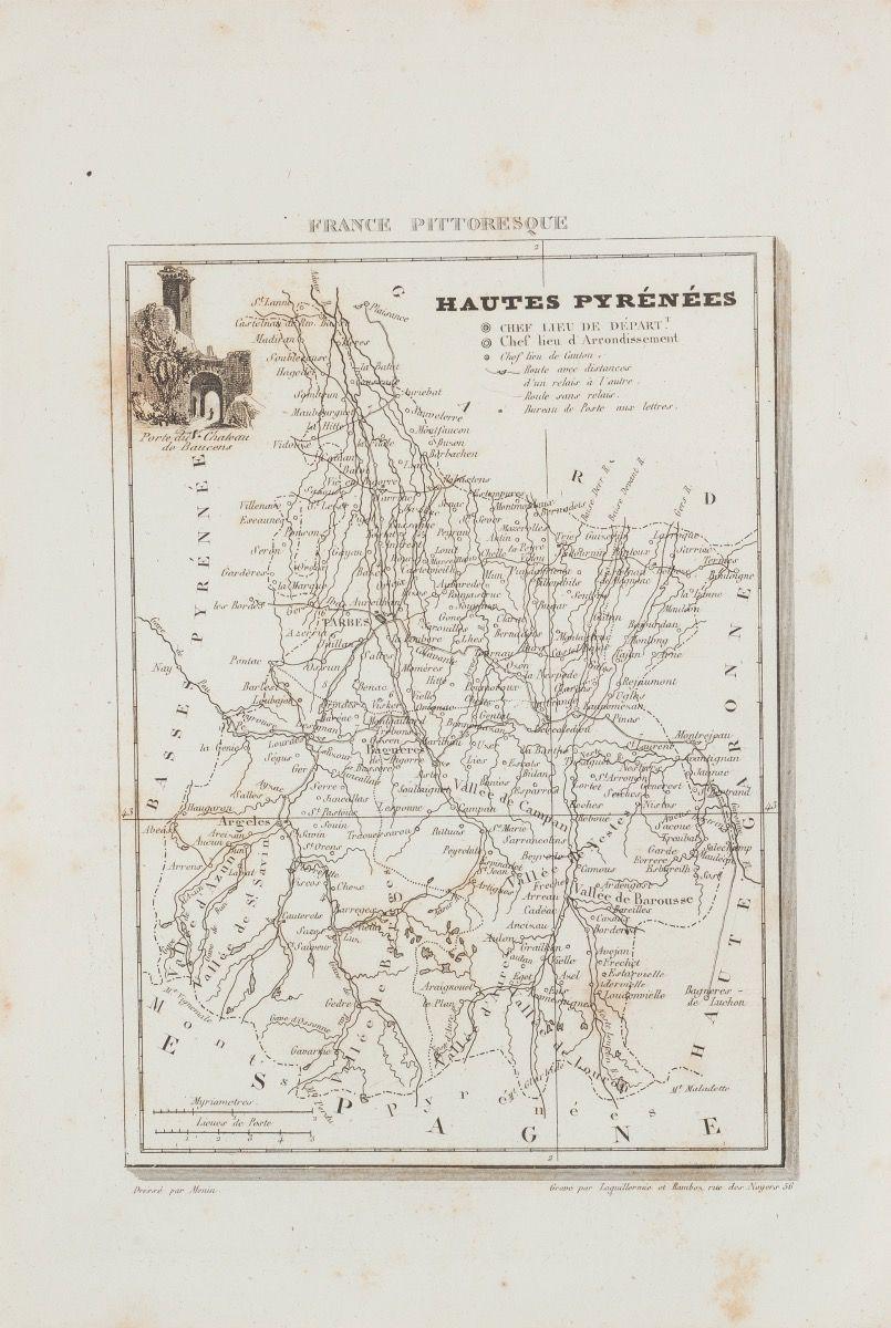
Hautes-Pyrénées Map - Original Lithograph - 19th Century
Located in Roma, IT
Hautes-Pyrénées Map is an original lithograph realized by an Anonymous engraver of the 19th Century.
Printed in series of "France Pittoresque" at the top center.
The state of prese...
Category
19th Century Modern Figurative Prints
Materials
Paper, Lithograph

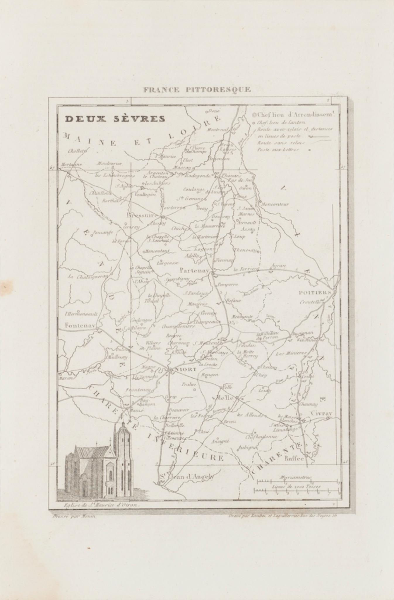
Map of Deux Sèvres - Original Etching - 19th Century
Located in Roma, IT
Map of Deux Sèvres is an original antique etching realized by an anonymous engraver of the 19th Century.
Printed in series of "France Pittoresque" at the top center.
The state of p...
Category
19th Century Modern Figurative Prints
Materials
Etching

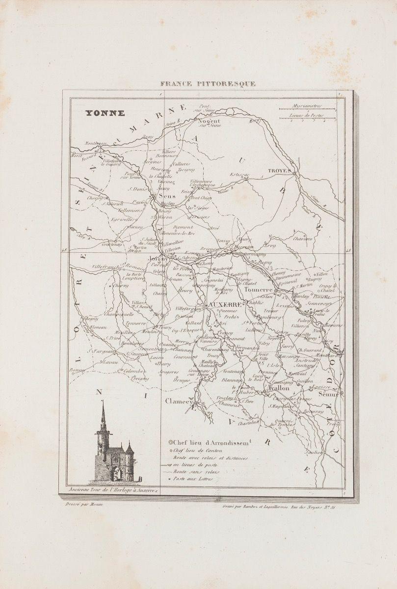
Yonne Map - Original Lithograph - 19th Century
Located in Roma, IT
Yonne Map is an original lithograph map realized by an Anonymous engraver of the 19th Century.
Printed in series of "France Pittoresque" at the top center.
The state of preservation of the artwork is good with some foxing.
An interesting piece of art in this geographical map...
Category
19th Century Modern Figurative Prints
Materials
Paper, Lithograph

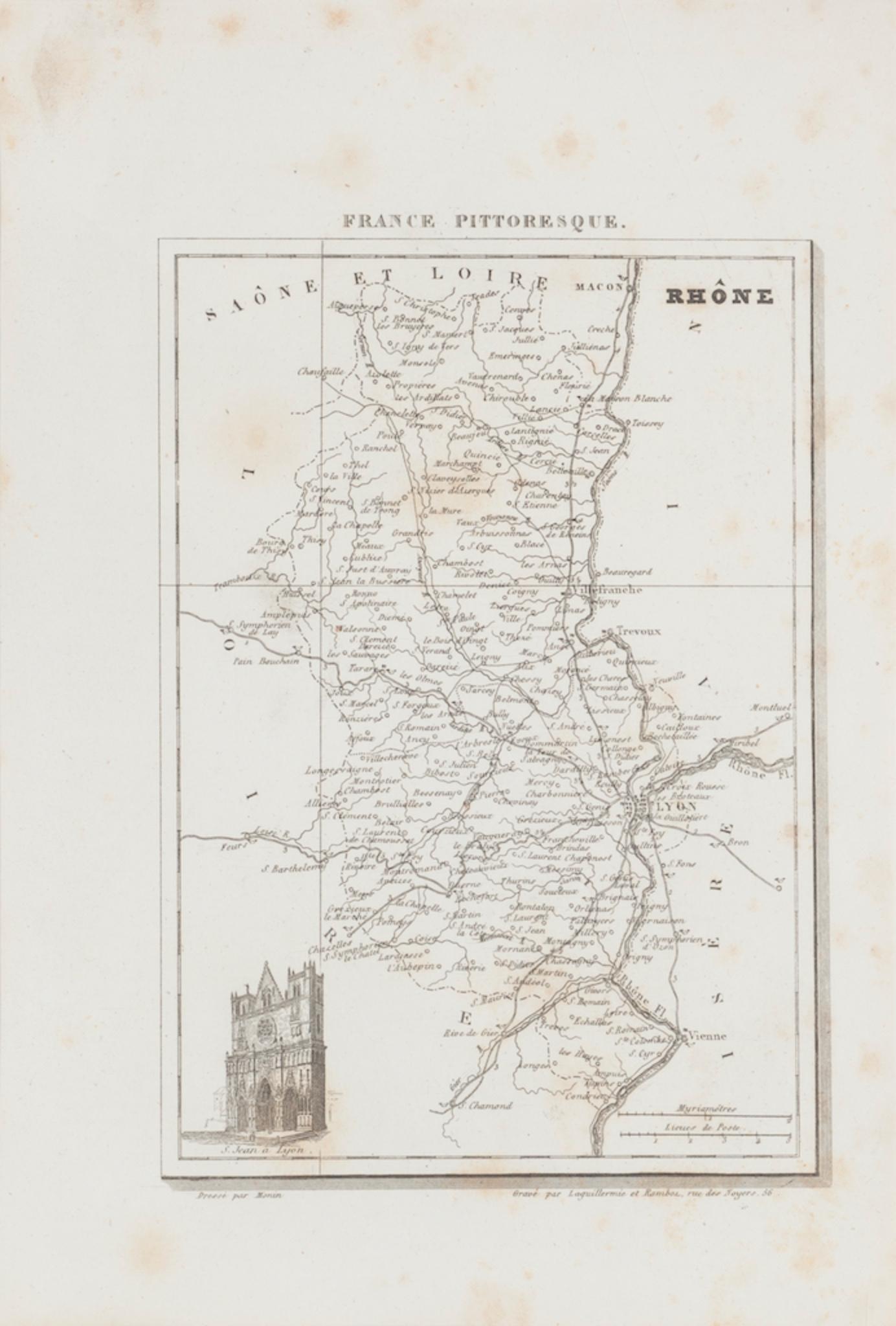
Map of Rhône - Original Etching - 19th Century
Located in Roma, IT
Map of Rhône is an original antique etching realized by an anonymous engraver of the 19th Century.
Printed in series of "France Pittoresque" at the top center.
The state of preserv...
Category
19th Century Modern Figurative Prints
Materials
Etching

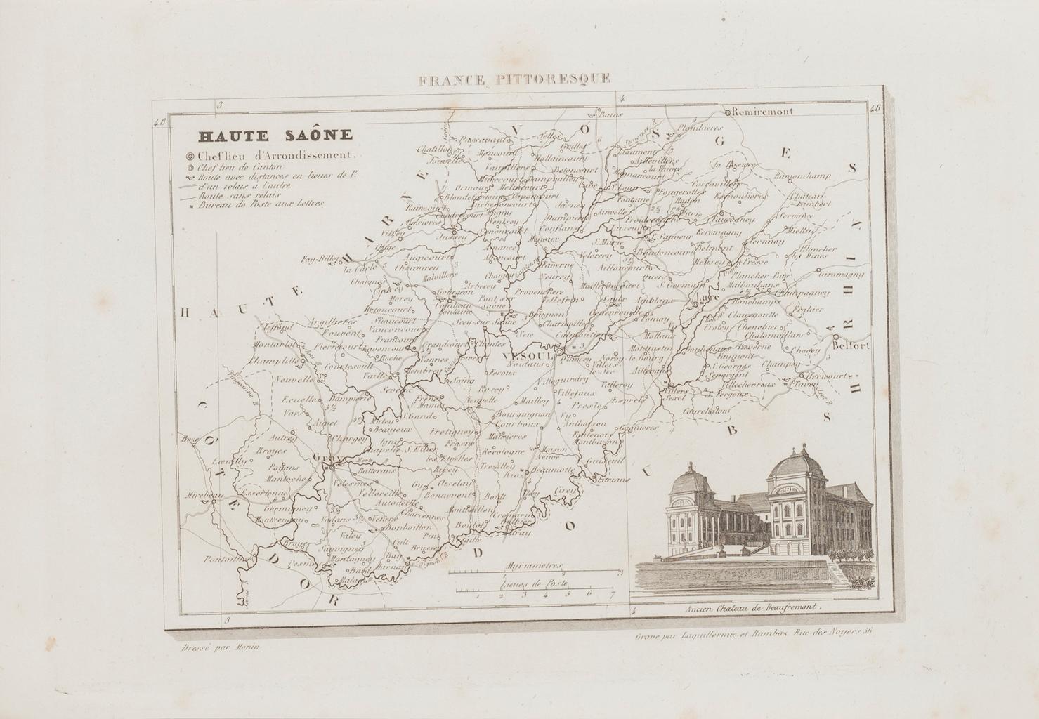
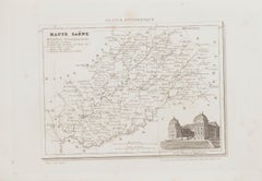
Map of Haute-Saône - Original Etching - 19th Century
Located in Roma, IT
Map of Haute-Saône is an original antique etching realized by an anonymous engraver of the 19th Century.
Printed in series of "France Pittoresque" at the top center.
The state of p...
Category
19th Century Modern Figurative Prints
Materials
Etching
You May Also Like
Antique Map of Marne, France – Engraved by Levasseur, 1850s
Located in Langweer, NL
Antique Map of Marne, France – Engraved by Levasseur, 1850s
This beautifully detailed 19th-century engraved map of the Marne department in northeastern France was created by the ren...
Category
Antique Mid-19th Century French Maps
Materials
Paper

Antique Map of Vienne 'France' by V. Levasseur, 1854
By Victor Levasseur
Located in Langweer, NL
Antique map titled 'Dépt. de la Vienne'. Decorative antique map of the French Department of Vienne, with its capital of Poitiers and small engraved vignette of the battle of Poitiers...
Category
Antique Mid-19th Century Maps
Materials
Paper

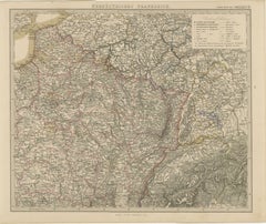
Antique Map of Northeastern France – Alsace, Lorraine & Champagne, 1858
Located in Langweer, NL
Antique Map of Northeastern France – Alsace, Lorraine & Champagne, 1858
Detailed 19th-century engraved map titled "Nordöstliches Frankreich", drawn by Friedrich von Stülpnagel and p...
Category
Antique Mid-19th Century German Maps
Materials
Paper
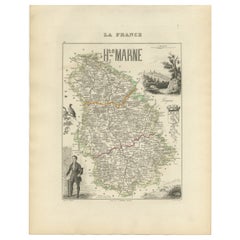
Antique Map of Haute-Marne France by Vuillemin with Decorative Insets, 1850s
Located in Langweer, NL
Antique Map of Haute-Marne France by Vuillemin with Decorative Insets, 1840s
This finely engraved and hand-colored map of Haute-Marne, a historical department in northeastern France...
Category
Antique Mid-19th Century French Maps
Materials
Paper
France, Northern Part. Century Atlas antique map
Located in Melbourne, Victoria
'The Century Atlas. France, Northern Part.'
Original antique map, 1903.
Inset maps of 'France in Provinces' and 'Paris and Vicinity'.
Central fold as issued. Map name and number pr...
Category
Early 20th Century Victorian More Prints
Materials
Lithograph

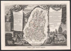
Haut Rhin, France. Antique map of a French department, 1856
By Victor Levasseur
Located in Melbourne, Victoria
'Dept. du Bas Rhin', steel engraving with original outline hand-colouring., 1856, from Levasseur's Atlas National Illustre.
This mountainous area is part of the Alsace wine region ...
Category
19th Century Naturalistic Landscape Prints
Materials
Engraving