Items Similar to Map of Vallombrosa - Florence 1926


Want more images or videos?
Request additional images or videos from the seller
1 of 5
UnknownMap of Vallombrosa - Florence 19261926
1926
$295.55
£225.21
€250
CA$414.01
A$450.76
CHF 236.01
MX$5,410.56
NOK 2,978.58
SEK 2,792.93
DKK 1,904.25
About the Item
This Map of Vallombrosa is a vintage offset print realized by an anonymous author in 1926.
The state of preservation of the artwork is aged with some small diffused stains and the artwork is prepared on the folding line in the middle.
Sheet dimension: 32.5 x 46 cm.
At the top of the paper, the inscription “Vallombrosa e dintorni'"
- Creation Year:1926
- Dimensions:Height: 11.03 in (28 cm)Width: 15.36 in (39 cm)Depth: 0.04 in (1 mm)
- Movement & Style:
- Period:
- Framing:Framing Options Available
- Condition:Insurance may be requested by customers as additional service, contact us for more information.
- Gallery Location:Roma, IT
- Reference Number:Seller: M-1141251stDibs: LU65037483112
About the Seller
4.9
Platinum Seller
Premium sellers with a 4.7+ rating and 24-hour response times
1stDibs seller since 2017
7,797 sales on 1stDibs
Typical response time: 1 hour
- ShippingRetrieving quote...Shipping from: Roma, Italy
- Return Policy
More From This Seller
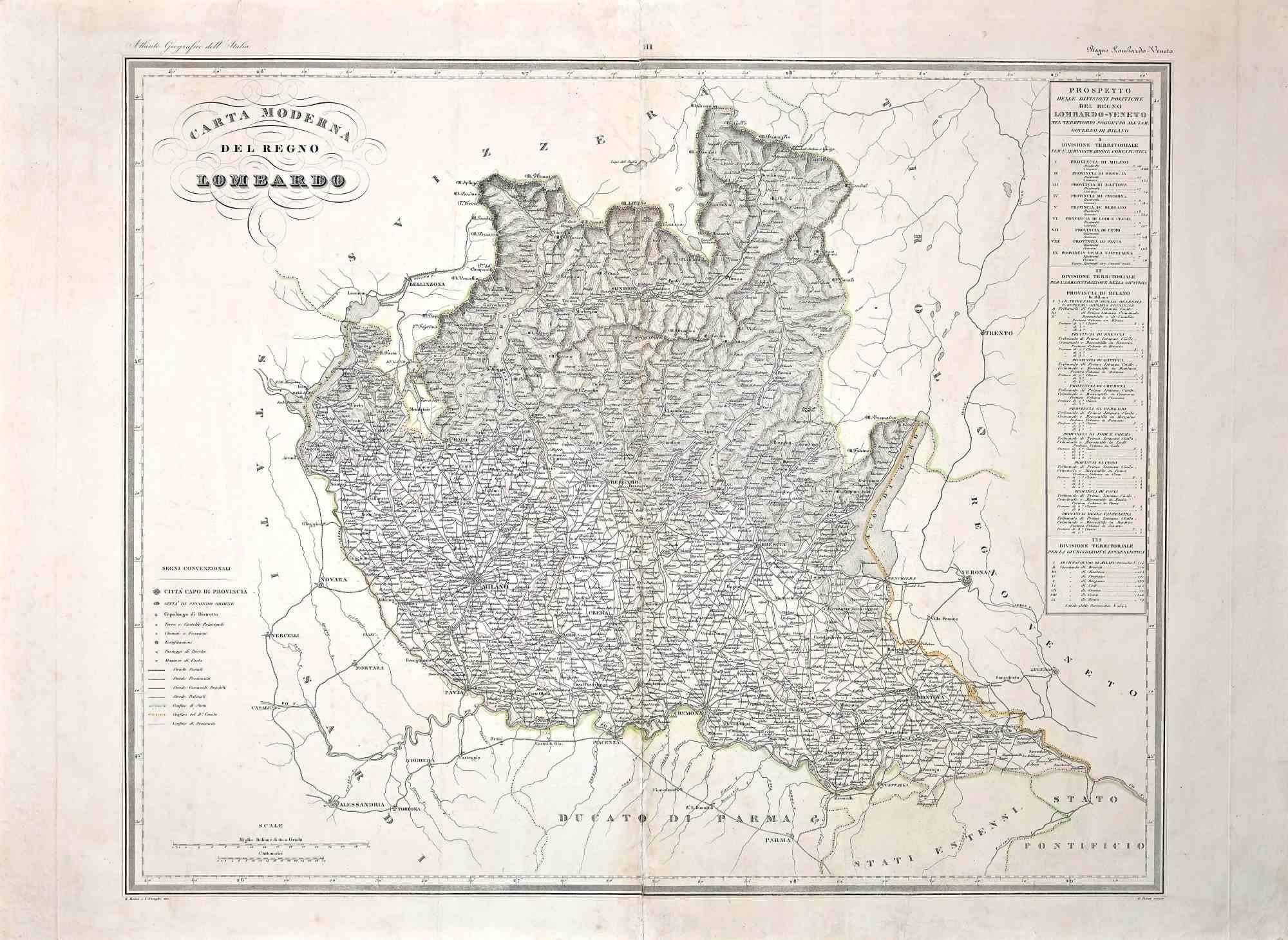
View AllMap of Lombardy - Original Etching - 19th Century
Located in Roma, IT
The Map of Lombardy is an original etching realized by an anonymous artist.
Fair conditions, the folding line of the middle is repaired.
The artwork represents the map of Lombardo....
Category
19th Century Modern Figurative Prints
Materials
Etching
Map of Eastern Roman Empire -Vintage Offset Print - Early 20th Century
Located in Roma, IT
This map of Eastern Roman Empire is a vintage offset print realized in the early 20th Century.
The state of preservation of the artwork is aged with dif...
Category
Early 20th Century Figurative Prints
Materials
Offset

Li Governi di Borgogna - Ancient Map - 1777
Located in Roma, IT
Li Governi di Borgogna is an original black and white etching on paper, printed by Antonio Zatta in Venice, 1777.
Original Title: Li Governi di Borgogna della Franca Contea e del Ly...
Category
1770s Modern Landscape Prints
Materials
Etching

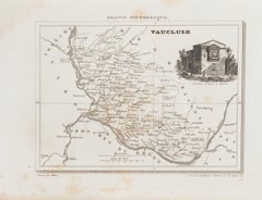
Map of Vaucluse - Etching - 19th Century
Located in Roma, IT
Map of Vaucluse is an original antique etching realized by an anonymous engraver of the XIX century.
Printed in series of "France Pittoresque" at the top center.
The state of prese...
Category
19th Century Modern Figurative Prints
Materials
Etching
Map of the War -Vesfaglia and Lower Saxony - Etching - 19th Century
Located in Roma, IT
Map of the War -Vestaglia and Lower Saxony is an etching realized during the 19th century.
Good condition.
Category
Early 19th Century Modern Figurative Prints
Materials
Etching

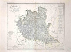
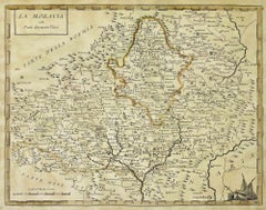
Map of Moravia - Etching - 19th Century
Located in Roma, IT
The Map of Moravia is an etching map realized in the 19th century.
Good conditions.
Category
19th Century Modern Figurative Prints
Materials
Etching
You May Also Like
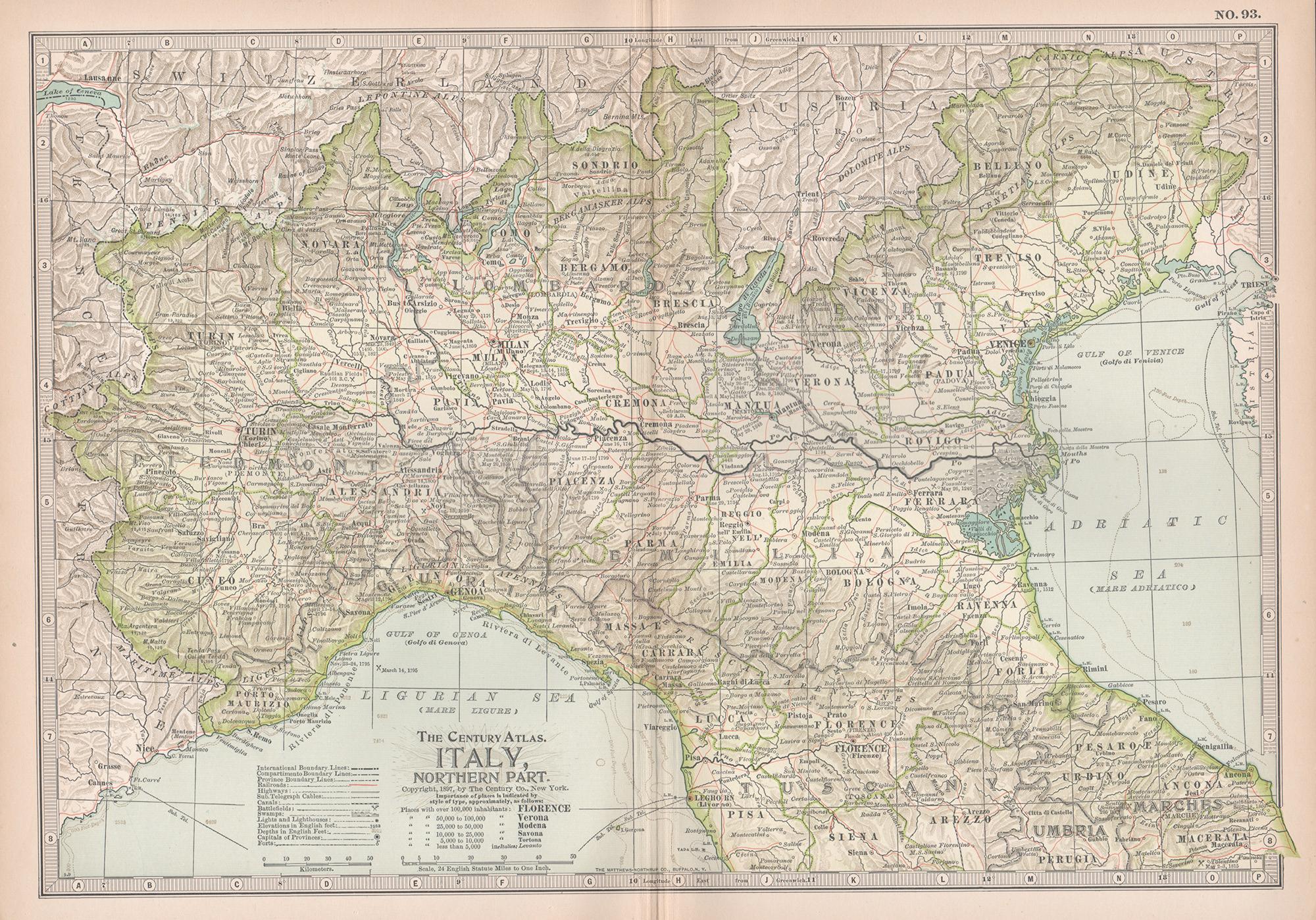
Italy, Northern Part. Century Atlas antique vintage map
Located in Melbourne, Victoria
'The Century Atlas. Italy, Northern Part.'
Original antique map, 1903.
Central fold as issued. Map name and number printed on the reverse corners.
Sheet 29.5cm by 40cm.
Category
Early 20th Century Victorian More Prints
Materials
Lithograph

Antique Map of Northern Italy by J. Tallis, circa 1851
Located in Langweer, NL
A highly decorative mid-19th century map of Northern Italy which was drawn and engraved by John Rapkin (vignettes by A. H. Wray & J. B. Allen) and published in John Tallis & co.'s Th...
Category
Antique Mid-19th Century British Maps
Materials
Paper

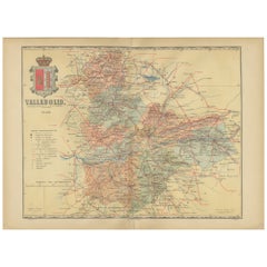
Anrtique Map of the Province of Valladolid, Central Spain, 1902
Located in Langweer, NL
A historical or archival map of the province of Valladolid, Spain, from the year 1902. Valladolid is a province located in the central part of Spain, within the autonomous community ...
Category
Antique Early 1900s Maps
Materials
Paper
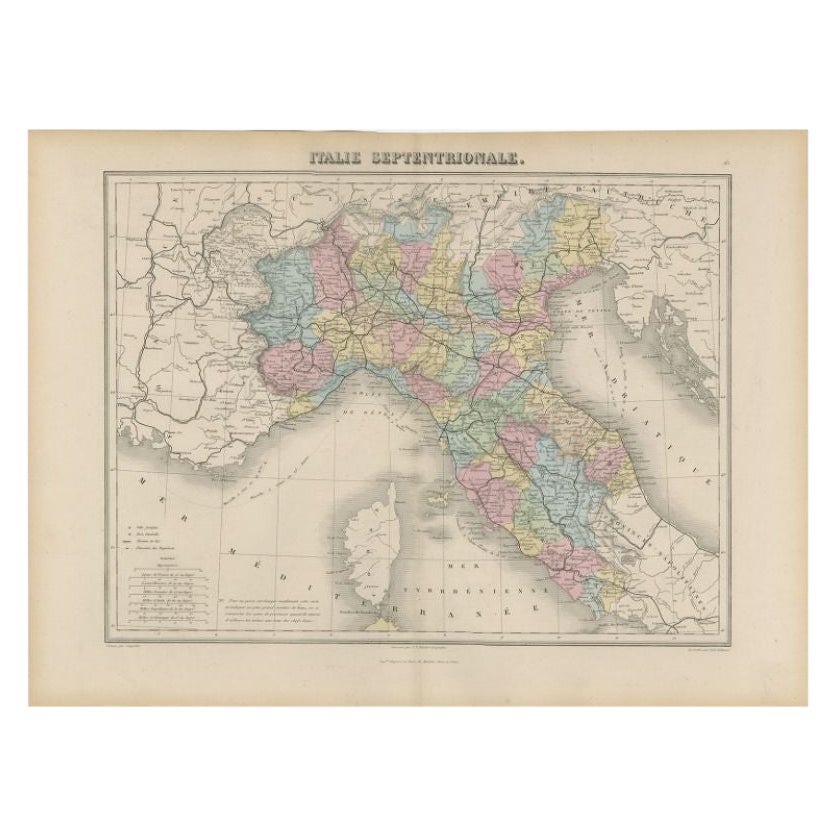
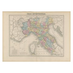
Antique Map of Northern Italy by Migeon, 1880
Located in Langweer, NL
Antique map titled 'Italie Septentrionale'. Old map of the northern part of Italy. This map originates from 'Géographie Universelle Atlas-Migeon' by J. Migeon. Artists and Engravers:...
Category
Antique 19th Century Maps
Materials
Paper
$99 Sale Price
20% Off
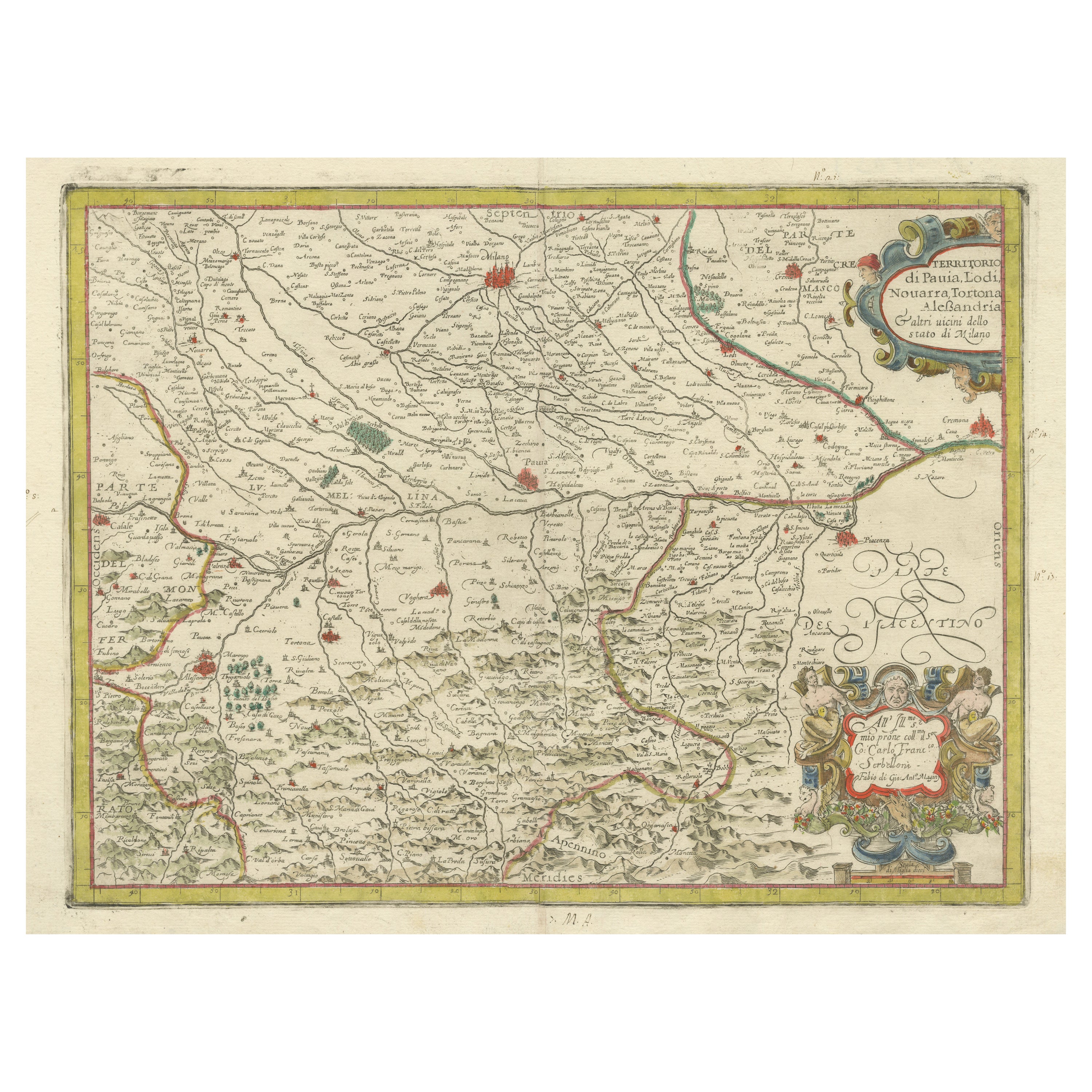
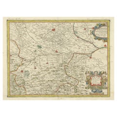
Antique Map of the Region of Pavia, Lodi, Novara, Tortona & Alessandria, Italy
Located in Langweer, NL
Antique map titled 'Territorio di Pavia, Lodi, Novarra, Tortona, Alessandria e altri vicini dello Stato di Milano'. Original old map of the region of Pavia, Lodi, Novara, Tortona and...
Category
Antique Early 17th Century Maps
Materials
Paper
$936 Sale Price
20% Off
Italy, Central and Southern Part. Century Atlas antique map
Located in Melbourne, Victoria
'The Century Atlas. Italy, Central and Southern Part.'
Original antique map, 1903.
Inset maps of Sicily and Naples.
Central fold as issued. Map name an...
Category
Early 20th Century Victorian More Prints
Materials
Lithograph

More Ways To Browse
Antique Florence
Frank Cassara
Fred Larson
Frederic Remington Lithographs
Frederic Vidalens
Fritz Eichenberg. On Sale
Fudo Myoo
Fuller Potter
G Hoffman
Gaetano Dura On Sale
George Grosz On Sale
George Jo Mess
Giovanni Battista Piranesi Vaso Di Marmo Antico Che Si Vede Nel Museo Capitolino Etching 1778
Grace Albee
Gustave Adolph Hoffman On Sale
H Hargrove
H Otsuka
Helen Hyde On Sale