Items Similar to Map of Vendée - Etching - 19th Century
Want more images or videos?
Request additional images or videos from the seller
1 of 2
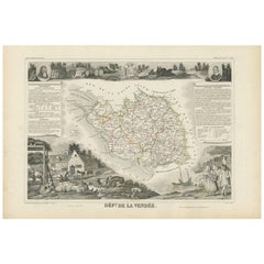
UnknownMap of Vendée - Etching - 19th Century19th Century
19th Century
$477.87
£357.14
€400
CA$659.25
A$722.08
CHF 380.17
MX$8,617.76
NOK 4,844.98
SEK 4,429.04
DKK 3,048.86
About the Item
Map of Vendée is an etching realized by an anonymous engraver of the 19t century.
Printed in series of "France Pittoresque" at the top center.
The state of preservation of the artwork is good except for diffused foxing due to timing.
A fascinating piece of history and a beautiful piece of art represented in this geographical map, with precise borders and names of places.
- Creation Year:19th Century
- Dimensions:Height: 6.7 in (17 cm)Width: 9.45 in (24 cm)Depth: 0.04 in (1 mm)
- Medium:
- Movement & Style:
- Period:
- Framing:Framing Options Available
- Condition:Insurance may be requested by customers as additional service, contact us for more information.
- Gallery Location:Roma, IT
- Reference Number:Seller: M-1155391stDibs: LU65037607042
About the Seller
4.9
Platinum Seller
Premium sellers with a 4.7+ rating and 24-hour response times
1stDibs seller since 2017
7,862 sales on 1stDibs
Typical response time: 1 hour
- ShippingRetrieving quote...Shipping from: Grasse, France
- Return Policy
More From This Seller
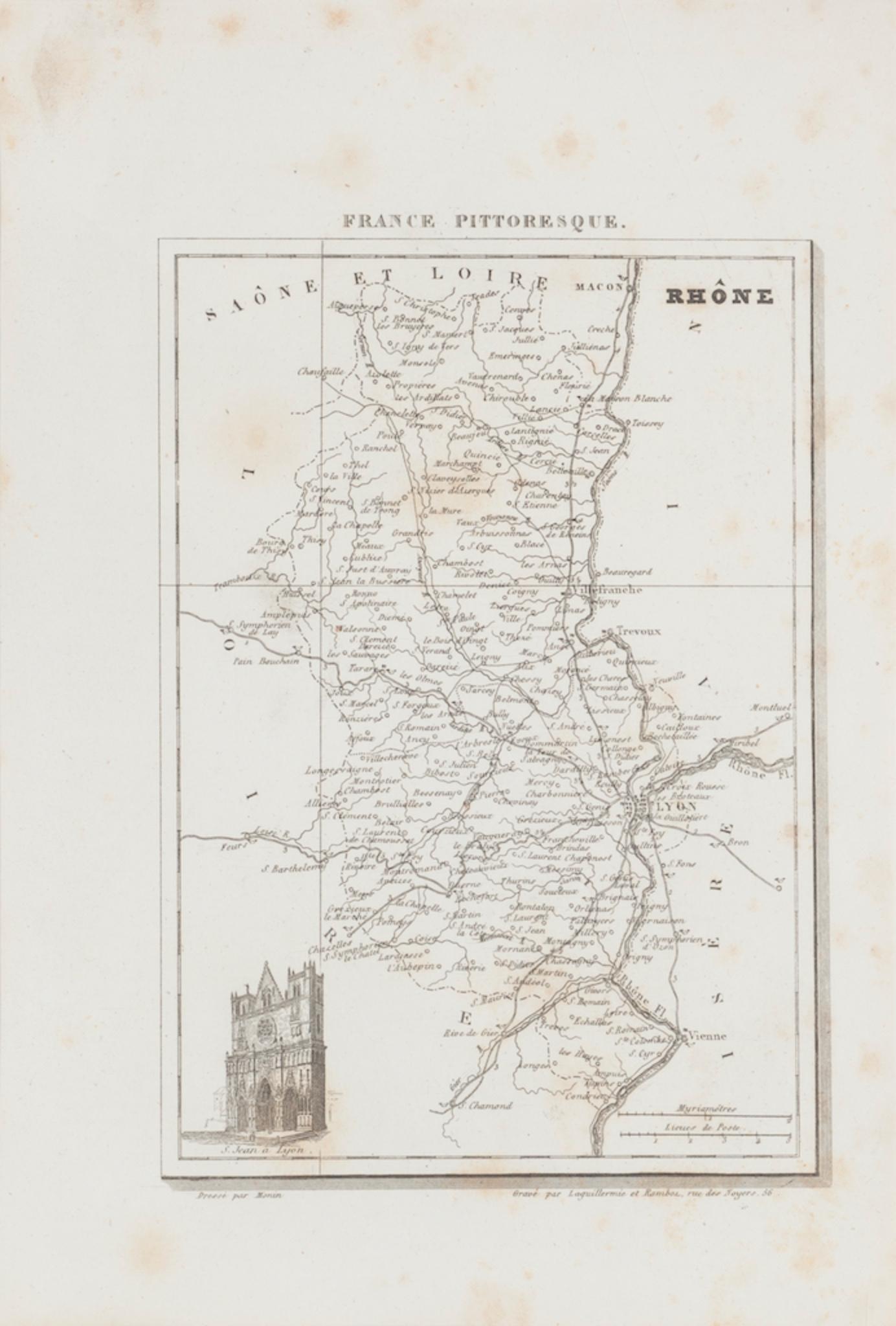
View AllMap of Rhône - Original Etching - 19th Century
Located in Roma, IT
Map of Rhône is an original antique etching realized by an anonymous engraver of the 19th Century.
Printed in series of "France Pittoresque" at the top center.
The state of preserv...
Category
19th Century Modern Figurative Prints
Materials
Etching

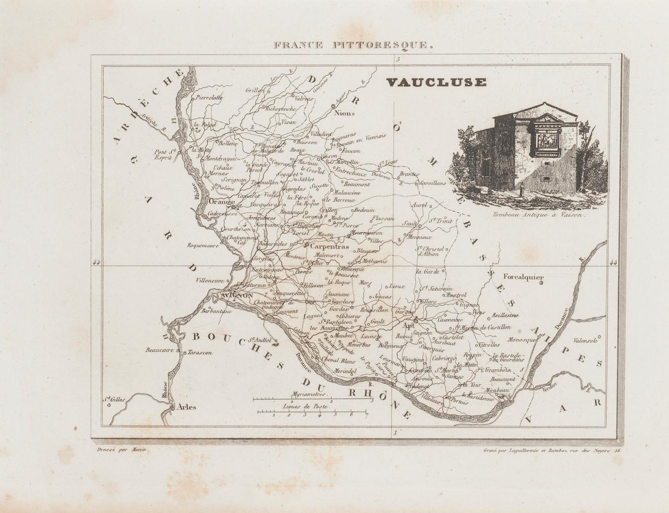
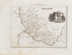
Map of Vaucluse - Etching - 19th Century
Located in Roma, IT
Map of Vaucluse is an original antique etching realized by an anonymous engraver of the XIX century.
Printed in series of "France Pittoresque" at the top center.
The state of prese...
Category
19th Century Modern Figurative Prints
Materials
Etching
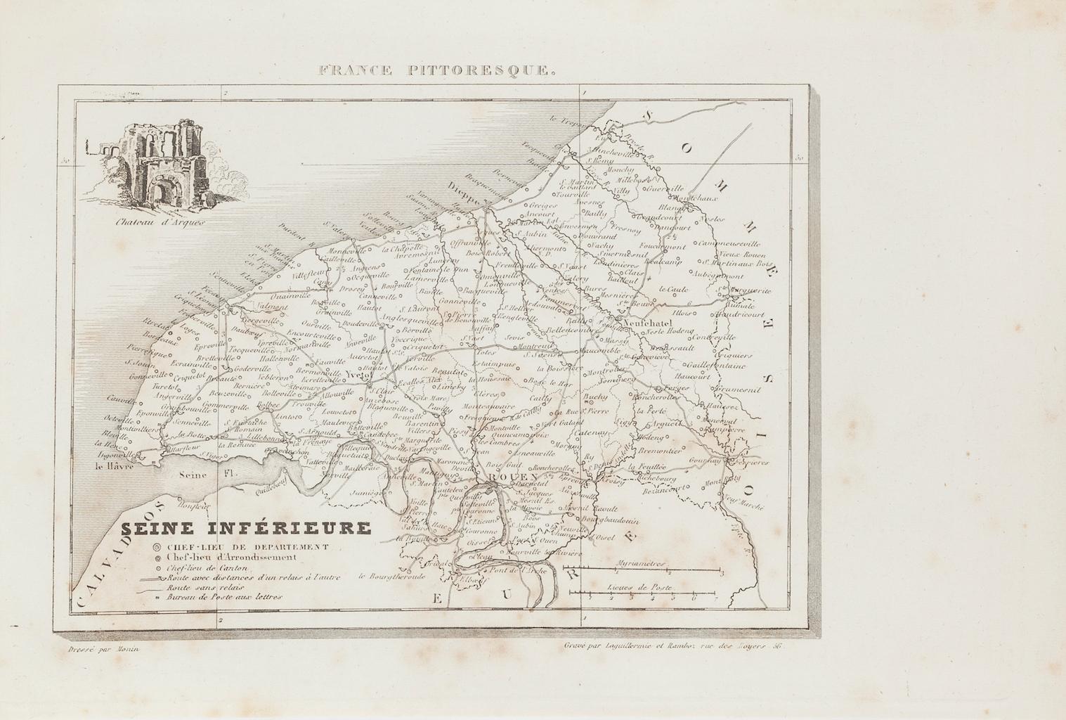
Map of Seine - Original Etching - 19th Century
Located in Roma, IT
Map of Seine is an original etching realized by an anonymous engraver of the XIX century.
Printed in series of "France Pittoresque" at the top center.
The state of preservation of ...
Category
19th Century Figurative Prints
Materials
Etching
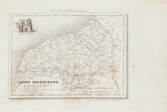
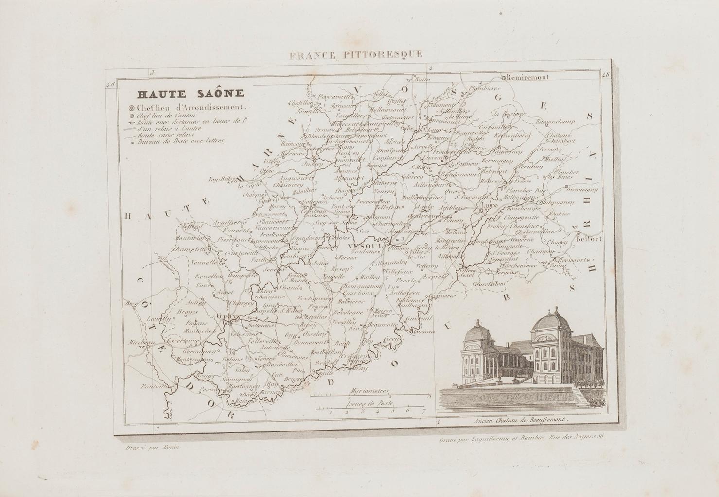
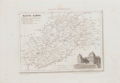
Map of Haute-Saône - Original Etching - 19th Century
Located in Roma, IT
Map of Haute-Saône is an original antique etching realized by an anonymous engraver of the 19th Century.
Printed in series of "France Pittoresque" at the top center.
The state of p...
Category
19th Century Modern Figurative Prints
Materials
Etching
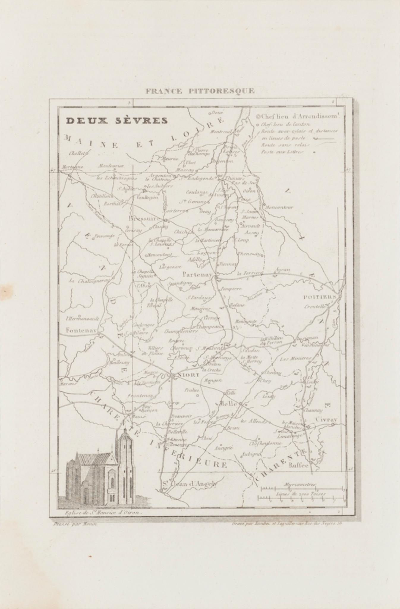
Map of Deux Sèvres - Original Etching - 19th Century
Located in Roma, IT
Map of Deux Sèvres is an original antique etching realized by an anonymous engraver of the 19th Century.
Printed in series of "France Pittoresque" at the top center.
The state of p...
Category
19th Century Modern Figurative Prints
Materials
Etching

Map of France - Etching - 1820
Located in Roma, IT
Map of France is an Original Etching realized by an unknown artist of 19th century in 1820.
Very good condition on two sheets of white paper joined at t...
Category
1820s Modern Figurative Prints
Materials
Etching

You May Also Like
Antique Map of Vendée ‘France’ by V. Levasseur, 1854
By Victor Levasseur
Located in Langweer, NL
Antique map titled 'Dépt. de la Vendée'. Map of the French department of Vendee, France.
Vendee is home to a number of small vineyards around the communes of Vix, Brem, Pissotte an...
Category
Antique Mid-19th Century French Maps
Materials
Paper
Var, France. Antique map of a French department, 1856
By Victor Levasseur
Located in Melbourne, Victoria
'Dept. du Var', steel engraving with original outline hand-colouring., 1856, from Levasseur's Atlas National Illustre.
Var covers the heart of the French Riviera or Cote d'Azur., and includes the resort cities of Cannes, Nice and San Tropez...
Category
19th Century Naturalistic Landscape Prints
Materials
Engraving

Aude, France. Antique map of a French department, 1856
By Victor Levasseur
Located in Melbourne, Victoria
'Dept. de L' Aude', steel engraving with original outline hand-colouring., 1856, from Levasseur's 'Atlas National Illustre'.
This area of France is famous for its wide variety of v...
Category
19th Century Naturalistic Landscape Prints
Materials
Engraving

La Gironde, France. Antique map of a French department, 1856
By Victor Levasseur
Located in Melbourne, Victoria
'La Gironde', steel engraving with original outline hand-colouring., 1856, from Levasseur's 'Atlas National Illustre'.
This coastal department is the seat of the Bordeaux wine regi...
Category
19th Century Naturalistic Landscape Prints
Materials
Engraving

L'Isere, France. Antique map of French department, 1856
By Victor Levasseur
Located in Melbourne, Victoria
'Dept. de L'Isere', Steel engraving with original outline hand-colouring., 1856, from Levasseur's 'Atlas National Illustre'.
This area is known for its production of Bleu du Vercor...
Category
19th Century Naturalistic Landscape Prints
Materials
Engraving

Antique Map of Vienne 'France' by V. Levasseur, 1854
By Victor Levasseur
Located in Langweer, NL
Antique map titled 'Dépt. de la Vienne'. Decorative antique map of the French Department of Vienne, with its capital of Poitiers and small engraved vignette of the battle of Poitiers...
Category
Antique Mid-19th Century Maps
Materials
Paper

More Ways To Browse
Jean Carlu 1937
Jean Michel Basquiat Flexible
Jennifer Mack Watkins
Jerry Garcia Signed
John Baldessari Nose Prints
John Hampton Bronze
John Noble Print
Jose Francisco Borges
Jose Royo Serigraph
Joze Ciuha
Julian Opie Paper Heads
Kalman Kubinyi
Karl Gerich
Karl Neumann
Katarina Vavrova
Keith Haring Untitled D
Large Erte
Large Signed Picasso Prints