Items Similar to Tarn et Garonne Map - Original Lithograph - 19th Century

Want more images or videos?
Request additional images or videos from the seller
1 of 2
UnknownTarn et Garonne Map - Original Lithograph - 19th Century19th Century
19th Century
$235
£179.95
€200
CA$330.29
A$362.31
CHF 189.57
MX$4,312.25
NOK 2,394.36
SEK 2,245.95
DKK 1,523.59
About the Item
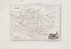
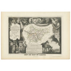
Tarn et Garonne Map is an original lithograph realized by an Anonymous artist of the 19th Century.
Printed in series of "France Pittoresque" at the top center.
The state of preservation of the artwork is good.
An interesting piece of art in this geographical map, with precise borders and names of places.
- Creation Year:19th Century
- Dimensions:Height: 6.7 in (17 cm)Width: 9.85 in (25 cm)Depth: 0.04 in (1 mm)
- Medium:
- Movement & Style:
- Period:
- Framing:Framing Options Available
- Condition:Insurance may be requested by customers as additional service, contact us for more information.
- Gallery Location:Roma, IT
- Reference Number:Seller: M-1193031stDibs: LU65038073002
About the Seller
4.9
Platinum Seller
Premium sellers with a 4.7+ rating and 24-hour response times
1stDibs seller since 2017
7,815 sales on 1stDibs
Typical response time: 1 hour
- ShippingRetrieving quote...Shipping from: Grasse, France
- Return Policy
More From This Seller
View AllMap of Tarn - Original Lithograph - 19th Century
Located in Roma, IT
Map of Tarn is an original lithograph realized by an Anonymous artist of the 19th Century.
Printed in series of "France Pittoresque" at the top center.
The state of preservation of...
Category
19th Century Modern Figurative Prints
Materials
Paper, Lithograph
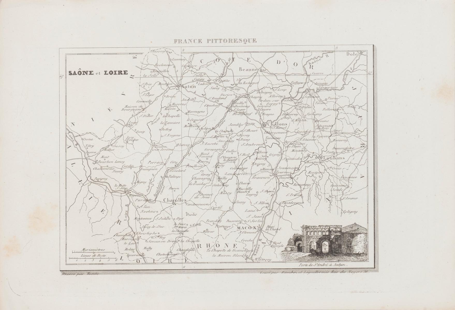
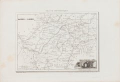
Salon et Loire Map - Original Lithograph - 19th Century
Located in Roma, IT
Salon et Loire Map is an original lithograph map realized by an Anonymous artist of the 19th Century.
Printed in series of "France Pittoresque" at the top center.
The state of preservation of the artwork is good.
An interesting piece of art in this geographical map...
Category
19th Century Modern Figurative Prints
Materials
Paper, Lithograph
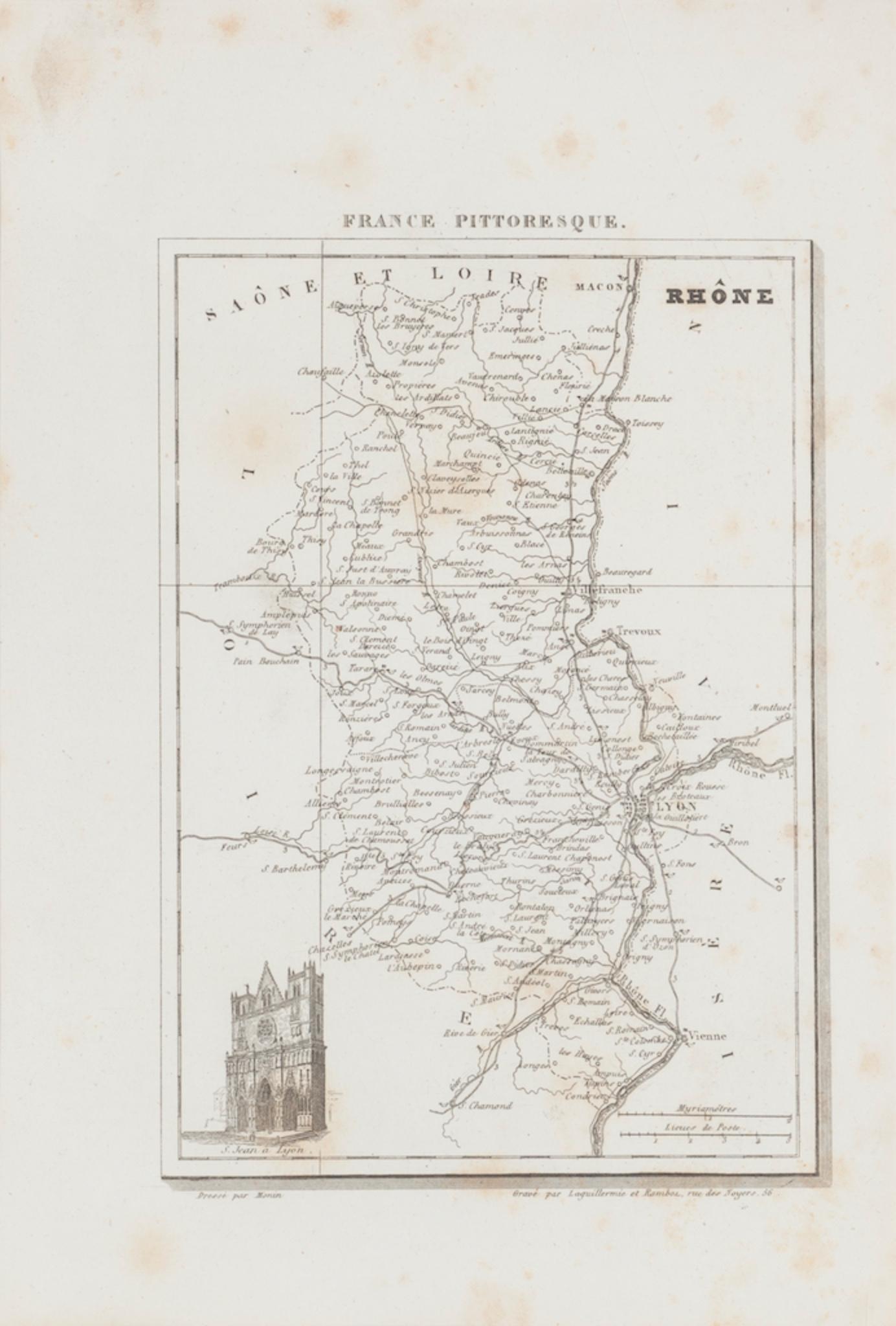
Map of Rhône - Original Etching - 19th Century
Located in Roma, IT
Map of Rhône is an original antique etching realized by an anonymous engraver of the 19th Century.
Printed in series of "France Pittoresque" at the top center.
The state of preserv...
Category
19th Century Modern Figurative Prints
Materials
Etching

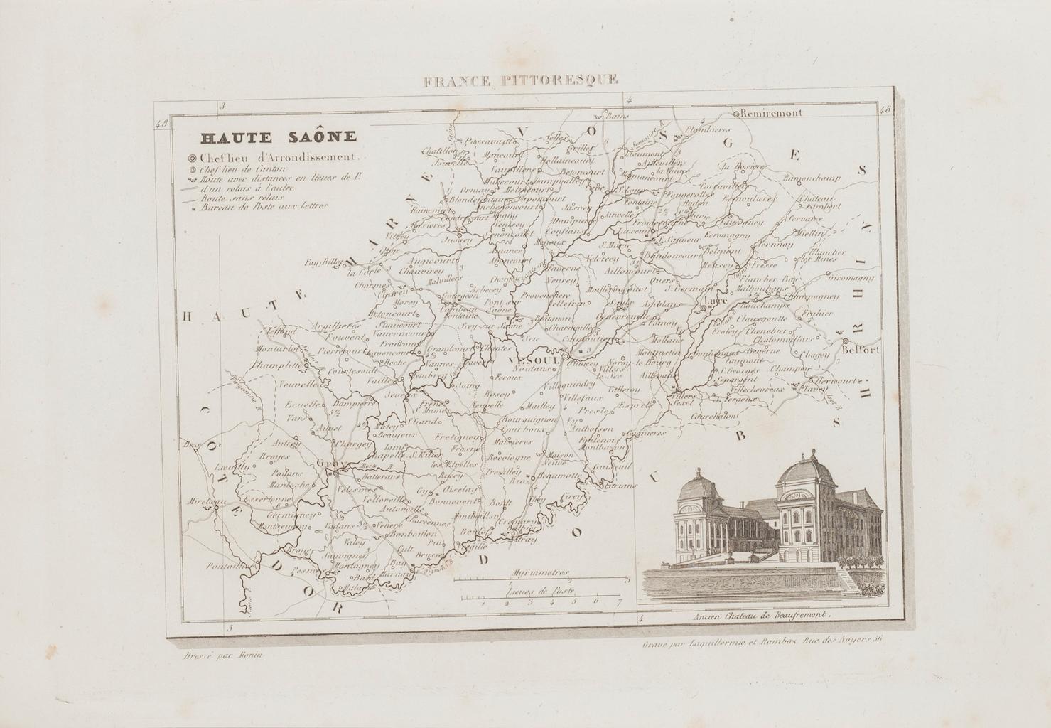
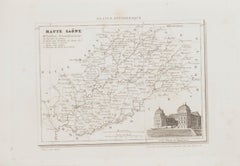
Map of Haute-Saône - Original Etching - 19th Century
Located in Roma, IT
Map of Haute-Saône is an original antique etching realized by an anonymous engraver of the 19th Century.
Printed in series of "France Pittoresque" at the top center.
The state of p...
Category
19th Century Modern Figurative Prints
Materials
Etching
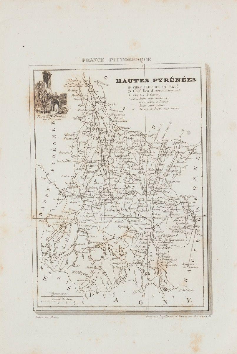
Hautes-Pyrénées Map - Original Lithograph - 19th Century
Located in Roma, IT
Hautes-Pyrénées Map is an original lithograph realized by an Anonymous engraver of the 19th Century.
Printed in series of "France Pittoresque" at the top center.
The state of prese...
Category
19th Century Modern Figurative Prints
Materials
Paper, Lithograph

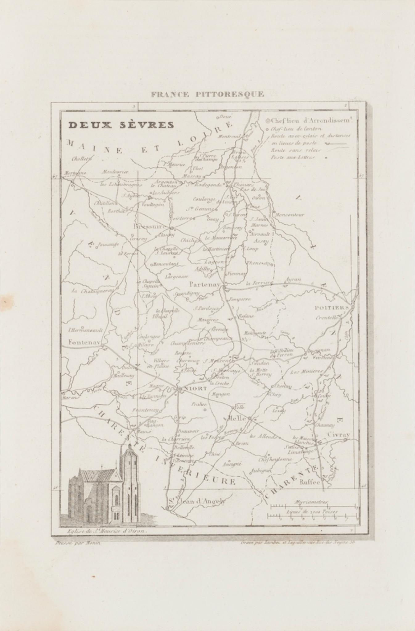
Map of Deux Sèvres - Original Etching - 19th Century
Located in Roma, IT
Map of Deux Sèvres is an original antique etching realized by an anonymous engraver of the 19th Century.
Printed in series of "France Pittoresque" at the top center.
The state of p...
Category
19th Century Modern Figurative Prints
Materials
Etching

You May Also Like
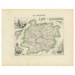
Antique Map of Lot et Garonne ‘France’ by V. Levasseur, 1854
Located in Langweer, NL
Antique map titled 'Dépt. de Lot et Garonne'. Map of the French department of Lot et Garonne, France. This area of France is known for its production of Buzet wines and Cabécou d’Ant...
Category
Antique Mid-19th Century Maps
Materials
Paper
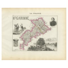
Map of Haute-Garonne France with Toulouse and Garonne River by Vuillemin, c.1850
Located in Langweer, NL
Map of Haute-Garonne France with Toulouse and Garonne River by Vuillemin, 19th c
Description:
This finely engraved 19th-century map of the department of Haute-Garonne, located in so...
Category
Antique Mid-19th Century French Maps
Materials
Paper
Antique Department Map – Lot-et-Garonne, France by Levasseur, c.1850
Located in Langweer, NL
Antique Department Map – Lot-et-Garonne, France by Levasseur, c.1850
This decorative and historically significant map of the French department Lot-et-Garonne was created by Victor L...
Category
Antique Mid-19th Century French Maps
Materials
Paper
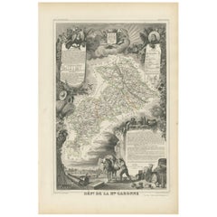
Antique Map of Haute-Garonne ‘France’ by V. Levasseur, 1854
Located in Langweer, NL
Antique map titled 'Dépt. de la Hte. Garonne'. Map of the French department of Haute-Garonne, France. This area of France produces the delicious but lesser known Buzet wines, and ten...
Category
Antique Mid-19th Century Maps
Materials
Paper
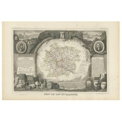
Antique Map of Tarn and Garonne in France, 1854
By Victor Levasseur
Located in Langweer, NL
Antique map titled 'Dépt. de Tarn et Garonne'. Map of the French department of Tarn et Garonne, France. This map is centered around the city of Moissac, which is known for its fine d...
Category
Antique Mid-19th Century Maps
Materials
Paper
Map of Gard France with Pont du Gard and Wine Regions by Vuillemin, 19th c
Located in Langweer, NL
Title: Map of Gard France with Pont du Gard and Wine Regions by Vuillemin, 19th c
Description:
This finely engraved 19th-century map of the department of Gard in southern France was...
Category
Antique Mid-19th Century French Maps
Materials
Paper

More Ways To Browse
Picasso Bacchus
Picasso Eau Forte
Picasso Erotic Art
Picasso Etching Femme Assise
Picasso Lamb
Picasso Lithograph Don Quixote
Picasso Verve Suite
Pierre Bonnard Nude Sketch
Pierre Bonnard Sketch
Piscines De Papier
Pool Of Tears Dali
Public Theater Poster
Punk Queen Prints
Roamcouch Brooklyn Bridge
Robert Hodgell
Robert Overman Hodgell
Rockwell Kent On Sale
Roger Medearis On Sale