Items Similar to 1948 original map titled La Vallée de la Dordogne de Bordeaux à la Bourboule


Want more images or videos?
Request additional images or videos from the seller
1 of 7
Jean Moles1948 original map titled La Vallée de la Dordogne de Bordeaux à la Bourboule1948
1948
$1,372.80
£1,018.69
€1,150
CA$1,914.65
A$2,074.04
CHF 1,092.07
MX$25,174.57
NOK 13,619.45
SEK 12,876.87
DKK 8,756.78
About the Item
The 1948 original map titled La Vallée de la Dordogne de Bordeaux à la Bourboule was created by the French artist and cartographer Jean Moles. This map serves as both a geographical guide and a work of art, capturing the charm and complexity of one of France’s most picturesque regions—the Dordogne Valley.
Jean Moles was known for his ability to blend cartographic precision with artistic flair, producing maps that are both functional and aesthetically pleasing. His 1948 map of the Dordogne Valley exemplifies this fusion of art and science. It showcases the region stretching from Bordeaux in the west to La Bourboule, a well-known spa town in the Massif Central, depicting the river’s winding course through the rich, varied landscape of southwestern France.
The Dordogne River Valley is celebrated for its natural beauty, historic villages, and important prehistoric sites. Moles’ map highlights these features with intricate detail, marking the key towns, natural landmarks, and routes that make this area a favorite destination for both tourists and historians. The region’s deep connection to French history is also evident in the map’s design, which pays homage to the historical architecture, including medieval castles and Romanesque churches scattered throughout the valley.
In addition to its practical use as a travel guide, Moles’ map serves as a cultural snapshot of post-war France, a time when the country was beginning to rebuild and promote its heritage. The map’s aesthetic design reflects the optimism and renewed appreciation for French regional culture that characterized this period.
One of the distinguishing features of Moles’ work is his use of vibrant colors and fine lines, which help bring the Dordogne Valley to life on paper. The map is not only a representation of the physical terrain but also an invitation to explore the unique cultural landscape of the region. His meticulous attention to detail ensures that every curve of the river and every hilltop village is depicted with accuracy, while his artistic sensibility imbues the map with a sense of adventure and discovery.
The 1948 map of La Vallée de la Dordogne by Jean Moles remains a cherished piece of cartographic art, valued not only for its historical significance but also for its artistic merit. It reflects the enduring allure of the Dordogne region and stands as a testament to Moles’ talent in combining the technical demands of mapmaking with the creative expression of an artist.
Original Poster
Map - Geography - Dordogne
Printed by S. A. Courbet in Paris
- Creator:Jean Moles
- Creation Year:1948
- Dimensions:Height: 31.5 in (80 cm)Width: 47.25 in (120 cm)
- Medium:
- Period:
- Condition:Good condition, slight creases.
- Gallery Location:PARIS, FR
- Reference Number:1stDibs: LU1792214986722
About the Seller
5.0
Gold Seller
Premium sellers maintaining a 4.3+ rating and 24-hour response times
Established in 2021
1stDibs seller since 2022
182 sales on 1stDibs
Typical response time: 2 hours
- ShippingRetrieving quote...Shipping from: PARIS, France
- Return Policy
Authenticity Guarantee
In the unlikely event there’s an issue with an item’s authenticity, contact us within 1 year for a full refund. DetailsMoney-Back Guarantee
If your item is not as described, is damaged in transit, or does not arrive, contact us within 7 days for a full refund. Details24-Hour Cancellation
You have a 24-hour grace period in which to reconsider your purchase, with no questions asked.Vetted Professional Sellers
Our world-class sellers must adhere to strict standards for service and quality, maintaining the integrity of our listings.Price-Match Guarantee
If you find that a seller listed the same item for a lower price elsewhere, we’ll match it.Trusted Global Delivery
Our best-in-class carrier network provides specialized shipping options worldwide, including custom delivery.More From This Seller
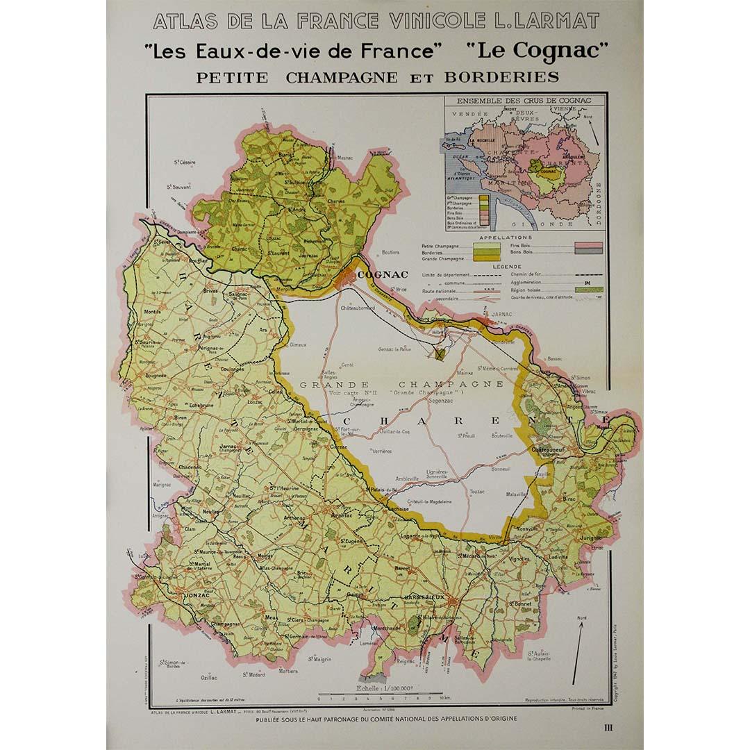
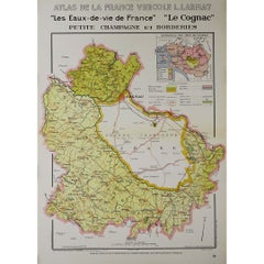
View All1947 original map "Les eaux-de-vie de France - Le Cognac petite Champagne"
Located in PARIS, FR
The 1947 original map Atlas de la France Vinicole - Les eaux-de-vie de France - Le Cognac Petite Champagne et Borderies, created by Louis Larmat and printed by Dorel in Paris, is a d...
Category
1940s Prints and Multiples
Materials
Lithograph, Paper
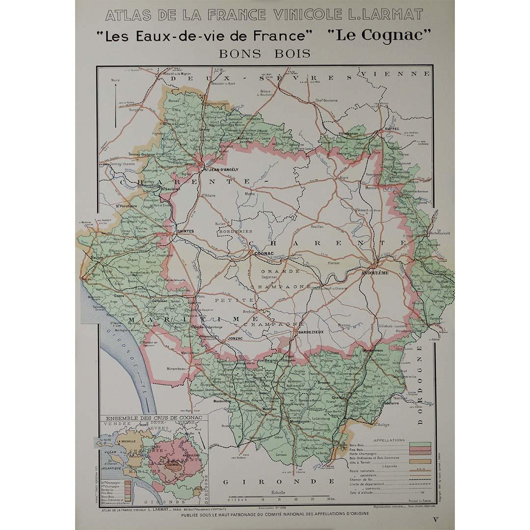
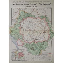
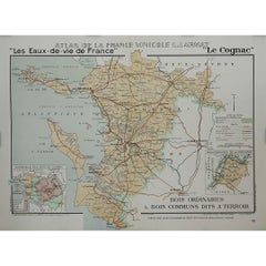
1947 original map "Les eaux-de-vie de France - Le Cognac Bons Bois" by Larmat
Located in PARIS, FR
The 1947 original map Atlas de la France Vinicole - Les Eaux-de-vie de France - Le Cognac Bons Bois, created by Louis Larmat and printed by Dorel in Paris, is a beautifully crafted c...
Category
1940s Prints and Multiples
Materials
Lithograph, Paper
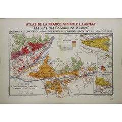
1946 original map "Les vins des côteaux de la Loire - Bourgueil" by Larmat
Located in PARIS, FR
The 1946 original map Atlas de la France Vinicole - Les Vins des Côteaux de la Loire: Bourgueil, St Nicolas-de-Bourgueil, Chinon, Montlouis, Jasnières, created by Louis Larmat and pr...
Category
1940s Prints and Multiples
Materials
Lithograph, Paper
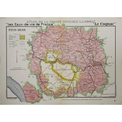
1947 original map "Les eaux-de-vie de France - Le Cognac fins bois" by Larmat
Located in PARIS, FR
The 1947 original map Atlas de la France Vinicole - Les Eaux-de-vie de France - Le Cognac Fins Bois, created by Louis Larmat and printed by Dorel in Paris, is an exquisite piece that...
Category
1940s Prints and Multiples
Materials
Lithograph, Paper
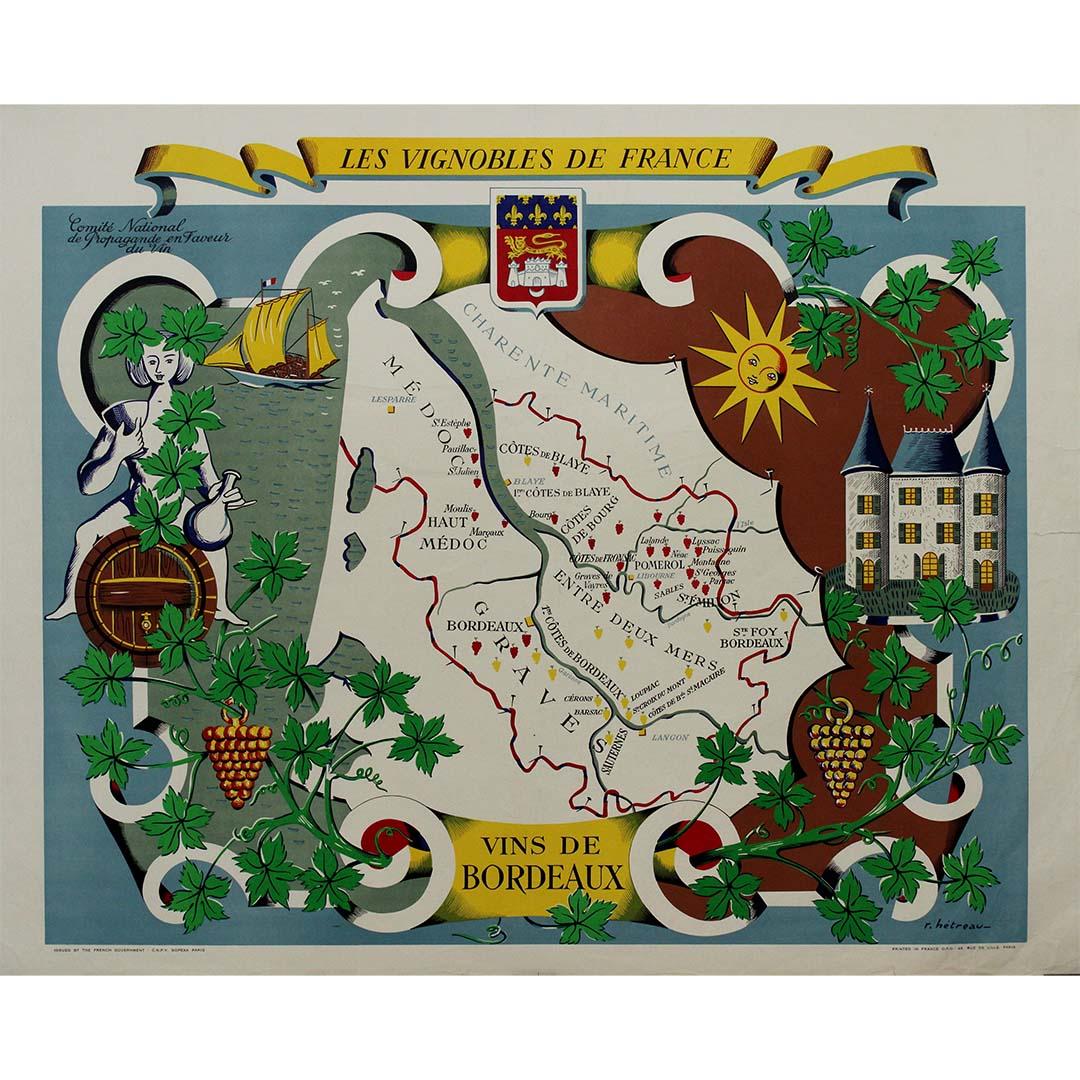
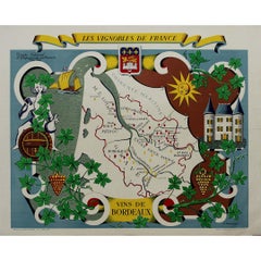
Stunning illustrated wine map by French artist Rémy Hétreau in the 1950s
Located in PARIS, FR
This stunning illustrated wine map, created by French artist Rémy Hétreau in the 1950s, is a beautifully detailed tribute to the legendary Bordeaux wine region. Commissioned by the Comité National de Propagande en Faveur du Vin, the poster is both an artistic masterpiece and an educational tool, showcasing the vineyards, terroirs, and appellations that define Bordeaux’s winemaking heritage.
At the center of the composition, a finely drawn map of Bordeaux highlights its most famous wine-growing areas, including:
🍷 Médoc – Home to prestigious wines from Pauillac, Margaux, and Saint-Estèphe.
🍷 Saint-Émilion & Pomerol – Renowned for their rich, elegant reds.
🍷 Graves & Sauternes – The birthplace of world-famous sweet wines.
🍷 Entre-Deux-Mers – Known for its crisp white wines.
Surrounding the map is a whimsical, decorative border featuring grapevines, a château, a sunlit vineyard, and a sailing ship, reflecting Bordeaux’s rich viticultural history and its connection to trade and maritime commerce. The Bordeaux coat of arms sits proudly at the top, reinforcing the region’s centuries-old winemaking tradition.
Rémy Hétreau (1913–2001), a celebrated French illustrator and designer, was known for his elegant, hand-drawn maps that brought the cultural and geographic identity of France to life. His work on this poster captures the romance, craftsmanship, and prestige of Bordeaux’s wine industry in a timeless mid-century style.
Today, this vintage wine map is highly sought after by collectors of French wine memorabilia...
Category
1950s Prints and Multiples
Materials
Paper, Lithograph
1947 original map "Le Cognac Bois ordinaires & Bois communs" by Larmat
Located in PARIS, FR
The 1947 original map Atlas de la France Vinicole - Les Eaux-de-vie de France - Le Cognac Bois Ordinaires & Bois Communs dits à Terroir, created by Louis Larmat and printed by Dorel ...
Category
1940s Prints and Multiples
Materials
Lithograph, Paper
You May Also Like
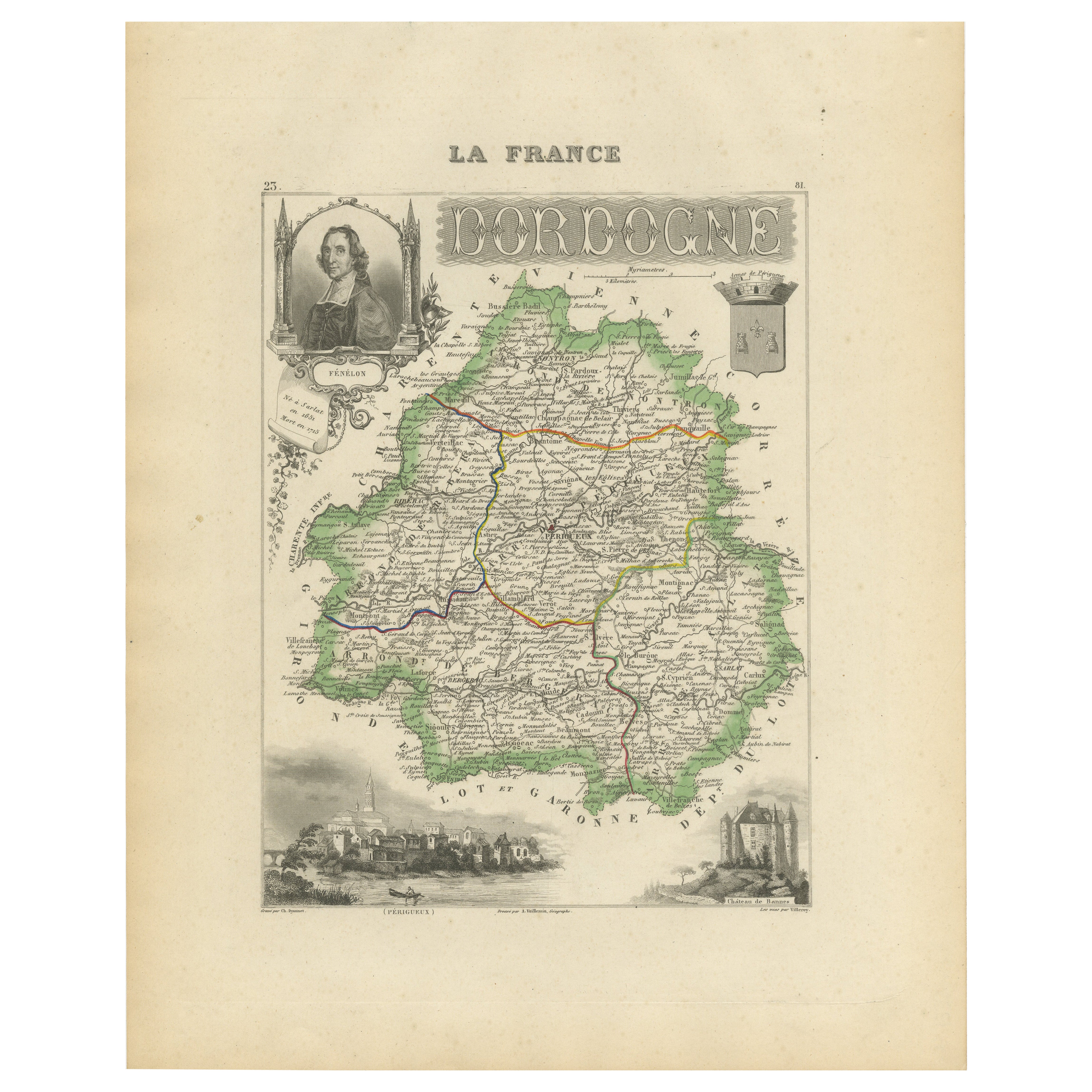
Map of Dordogne France with Périgueux and Château de Jumilhac, 19th Century
Located in Langweer, NL
Map of Dordogne France with Périgueux and Château de Jumilhac, 19th Century
Description:
This richly detailed 19th-century map of the Dordogne department in southwestern France was ...
Category
Antique Mid-19th Century French Maps
Materials
Paper
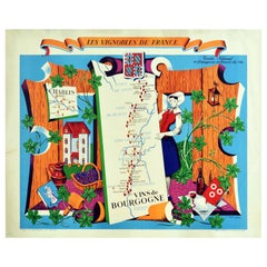
Original Vintage Poster Vignobles De France Vins De Bourgogne Burgundy Wine Map
Located in London, GB
Original vintage drink advertising poster promoting French wines (one of a series issued by the Comite National de Propagande en Faveur du Vin national committee for the promotion of...
Category
Vintage 1950s French Posters
Materials
Paper
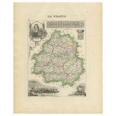
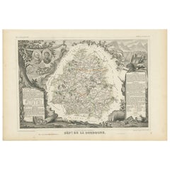
Antique Map of the Dordogne ‘France’ by V. Levasseur, 1854
Located in Langweer, NL
Antique map titled 'Dépt. de la Dordogne'. Map of the French department of Dordogne, France. This area is best known for its production of Monbazillac, a sweet white wine, and Cabéco...
Category
Antique Mid-19th Century Maps
Materials
Paper
$191 Sale Price
20% Off
Map of Ardèche France with Annonay and Vineyards by Vuillemin, 19th c
Located in Langweer, NL
Map of Ardèche France with Annonay and Vineyards by Vuillemin, 19th c
This beautifully engraved 19th-century map of Ardèche, a department in southeastern France, comes from Alexandr...
Category
Antique Mid-19th Century French Maps
Materials
Paper

Map of Côte-d'Or France with Dijon and Burgundy Wine Region, 19th Century
Located in Langweer, NL
Map of Côte-d'Or France with Dijon and Burgundy Wine Region, 19th Century
Description:
This beautifully engraved 19th-century map of Côte-d'Or, located in the historic region of Bur...
Category
Antique Mid-19th Century French Maps
Materials
Paper

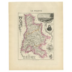
Map of Drôme France with Valence and Rhône Valley Wine Region, 19th Century
Located in Langweer, NL
Map of Drôme France with Valence and Rhône Valley Wine Region, 19th Century
Description:
This beautifully engraved 19th-century map of the Drôme department in southeastern France wa...
Category
Antique Mid-19th Century French Maps
Materials
Paper
More Ways To Browse
Medieval Castle
Prints By Courbet
Bordeaux Map
Michelangelo Original
Nara Lithograph
New Coke
Notre Dame Etching
Original Intaglio
Original Vintage Bicycle Posters
Paul K
Picasso 50
Picasso Le Peintre
Queen Elizabeth Pop Art
Robert Longo Lithographs
Snow White Disney
Takashi Murakami Dob
Takashi Murakami Superflat
Twa Vintage Print