Items Similar to Circa 1950 original illustrated map "Carte des Montagnes Suisses"


Want more images or videos?
Request additional images or videos from the seller
1 of 8
L. KollerCirca 1950 original illustrated map "Carte des Montagnes Suisses"Circa 1950
Circa 1950
$537.18
£398.62
€450
CA$749.21
A$811.58
CHF 427.33
MX$9,850.92
NOK 5,329.35
SEK 5,038.77
DKK 3,426.57
About the Item
The circa 1950 original illustrated map "Carte des Montagnes Suisses" by L. Koller is a beautifully crafted representation of Switzerland's mountainous regions, combining geographical precision with artistic elements. Produced during the mid-20th century, this map focuses on the mountainous terrain of Switzerland, highlighting the iconic Alps and other notable peaks.
Switzerland's mountains, particularly in the southern regions, have long been central to the country's identity. The map offers a detailed view of these landscapes, showcasing key regions that attract tourists and mountaineers alike. Famous locations like Zermatt, Grindelwald, and Montreux, as well as significant peaks like the Matterhorn and Jungfrau, are typically highlighted in such maps, contributing to the cultural and natural understanding of the country.
During the 1950s, Switzerland's tourism industry was thriving, with an emphasis on hiking, skiing, and exploring the vast natural beauty of the Swiss Alps. Illustrated maps like this one played an important role in promoting these outdoor pursuits, both as functional tools for navigating the terrain and as aesthetic representations of the country’s majestic mountain landscapes.
The map serves as a valuable historical and cultural artifact, reflecting the mid-20th century's approach to cartography and design, as well as the continued global fascination with Switzerland's natural beauty. It remains an important collectible for those interested in Swiss geography, mountaineering, and mid-century cartographic art.
Illustrated document
Ski - Switzerland - Mountain
- Creator:L. Koller
- Creation Year:Circa 1950
- Dimensions:Height: 13.39 in (34 cm)Width: 16.54 in (42 cm)
- Medium:
- Period:
- Condition:Good condition, folds, on linen.
- Gallery Location:PARIS, FR
- Reference Number:1stDibs: LU1792215440382
About the Seller
5.0
Gold Seller
Premium sellers maintaining a 4.3+ rating and 24-hour response times
Established in 2021
1stDibs seller since 2022
182 sales on 1stDibs
Typical response time: 2 hours
- ShippingRetrieving quote...Shipping from: PARIS, France
- Return Policy
Authenticity Guarantee
In the unlikely event there’s an issue with an item’s authenticity, contact us within 1 year for a full refund. DetailsMoney-Back Guarantee
If your item is not as described, is damaged in transit, or does not arrive, contact us within 7 days for a full refund. Details24-Hour Cancellation
You have a 24-hour grace period in which to reconsider your purchase, with no questions asked.Vetted Professional Sellers
Our world-class sellers must adhere to strict standards for service and quality, maintaining the integrity of our listings.Price-Match Guarantee
If you find that a seller listed the same item for a lower price elsewhere, we’ll match it.Trusted Global Delivery
Our best-in-class carrier network provides specialized shipping options worldwide, including custom delivery.More From This Seller
View AllCirca 1950 original poster by Hugo Wetli - Printemps au lac des quatres cantons
By Hugo Wetli
Located in PARIS, FR
A stunning tribute to Switzerland’s pastoral charm, this original lithographic poster by Hugo Wetli, created around 1950, captures the serene beauty of springtime on Lake Lucerne (La...
Category
1950s Prints and Multiples
Materials
Paper, Lithograph
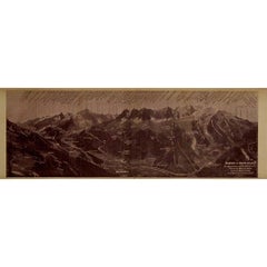
Circa 1910 illustrated document by Paillon - Panoramic view of the Mont Blanc
Located in PARIS, FR
This rare circa 1910 illustrated document by Maurice Paillon presents a detailed panoramic view of the Mont Blanc Massif, one of the most legendary and awe-inspiring mountain ranges in the world. Capturing the majesty of Western Europe’s highest peak (4,809m) and its surrounding summits, glaciers, and valleys, this historical document serves as both an artistic masterpiece and a valuable mountaineering reference.
At the time of its creation, alpinism was flourishing, with climbers from across Europe eager to conquer Mont Blanc and its neighboring peaks. The illustration, likely derived from photographic and topographic studies, offers a remarkably accurate relief representation of the range. Every major peak, ridge, and glacier is meticulously labeled, providing an invaluable geographical guide to the region.
The sepia-toned print evokes the early 20th-century aesthetic, blending scientific precision with artistic craftsmanship. The inclusion of key locations such as Chamonix, Aiguille du Midi, Dôme du Goûter, and the Vallée...
Category
1910s Prints and Multiples
Materials
Lithograph, Paper, Linen
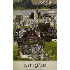
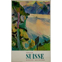
Circa 1950 poster Switzerland's iconic landscapes Saint Gotthard railway line
Located in PARIS, FR
The À travers la belle Suisse: Ligne du Saint Gothard travel poster, created by Katharina Anderegg circa 1950, captures the breathtaking beauty of Switzerland's iconic landscapes and...
Category
1950s Prints and Multiples
Materials
Lithograph, Paper
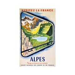
1952 original poster Visit the Alps - French National Railway Company
Located in PARIS, FR
Antique tourist poster for the promotion of the French National Railway Company, SNCF. The poster is based on an original staging: the image suggests that the landscape is seen from the window of a train crossing the Alps...
Category
1950s Prints and Multiples
Materials
Lithograph, Paper
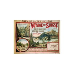
Original poster of the Chemins de fer de l'Est promoting travel in Switzerland
Located in PARIS, FR
Original old poster of the Chemins de fer de l'Est promoting travel in Switzerland, illustrated by E. Bourgeois. Eugène Victor Bourgeois (1855 - 1909) was a French painter, illustrator and poster artist.
Self-taught painter, Eugene Victor Bourgeois began at the Salon of 1874. He exhibited there in 1880, as well as at the Salon des artistes français in 1881 where he obtained a medal of honor that year, then a 3rd class medal in 18851. He won a bronze medal at the Universal Exhibition of 1889 and at the one of 1900.
The Compagnie des chemins de fer de l'Est was a limited company created in 1845 under the name Compagnie du chemin de fer de Paris à Strasbourg. The name was changed in 1854 after other companies were bought out and new concessions were obtained. It was one of the six major French railroad companies nationalized on January 1, 1938 to form the Société nationale des chemins de fer français.
Chemins de Fer de l'Est
Switzerland, Gorges de...
Category
Early 1900s Prints and Multiples
Materials
Paper, Linen, Lithograph
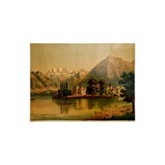
Circa 1900 Chromolithography The Lake of Thun Lac de Thoune Swiss Tourism
Located in PARIS, FR
Very beautiful chromolithography of the beginning of the XXth century representing the Lake of Thun.
The lake of Thun is an alpine lake located in the Bernese Oberland region in Switzerland. Its shores are dotted with towns, including Thun, and Romanesque churches. In the old town of Thun, the 12th century Thun Castle houses a museum with prehistoric and medieval artifacts...
Category
Early 20th Century Prints and Multiples
Materials
Lithograph, Paper
You May Also Like
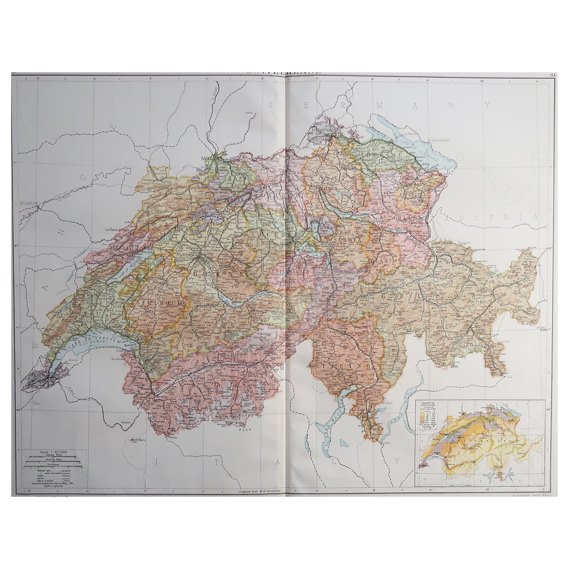
Large Original Vintage Map of Switzerland, circa 1920
Located in St Annes, Lancashire
Great map of Switzerland
Original color.
Good condition
Published by Alexander Gross
Unframed.
Category
Vintage 1920s English Maps
Materials
Paper
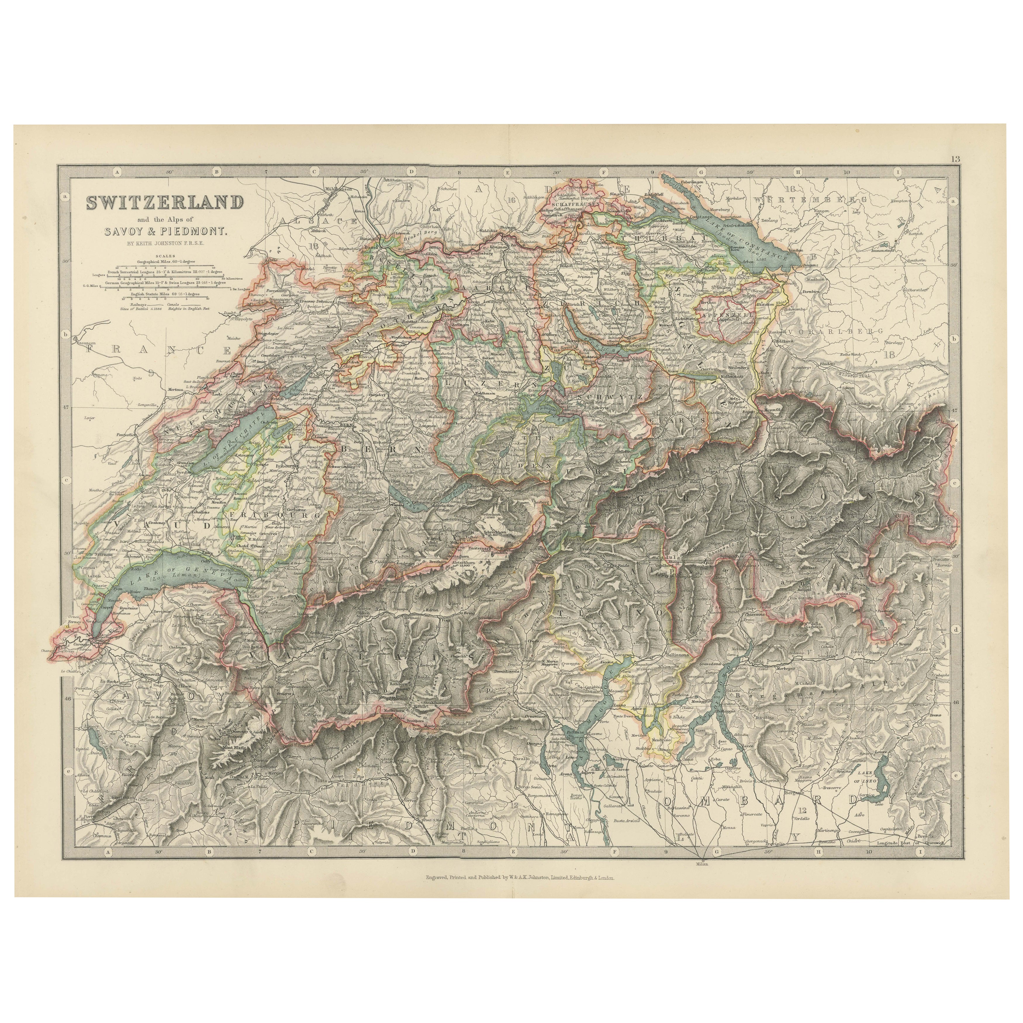
Antique Map of Switzerland and the Alps of Savoy & Piedmont, 1903 Edition
Located in Langweer, NL
Title: Antique Map of Switzerland and the Alps of Savoy & Piedmont, 1903, with Intricate Topographical Detail
Description:
This beautifully engraved antique map, titled "Switzerland...
Category
Early 20th Century Maps
Materials
Paper
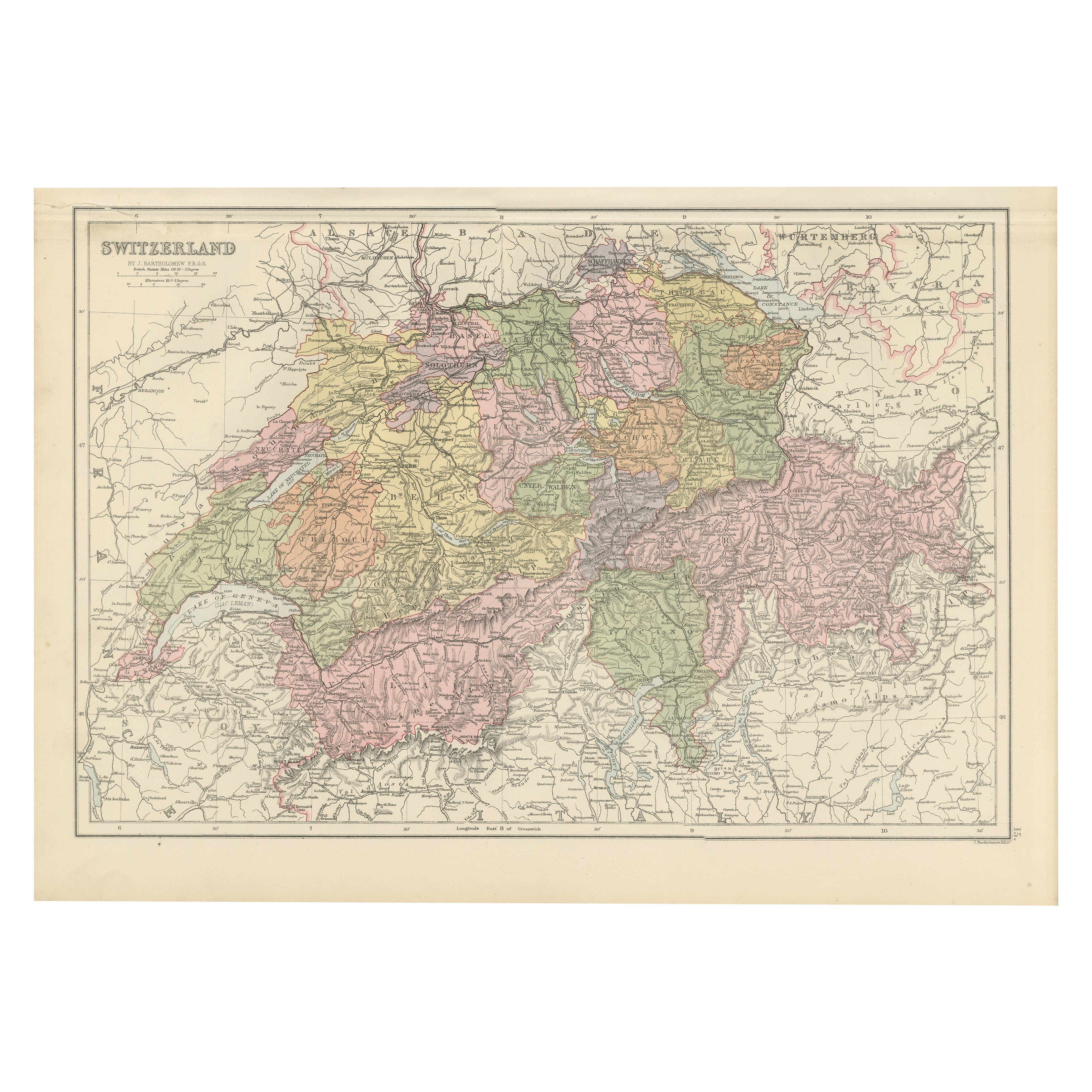
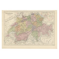
Antique Map of Switzerland by Johnston, 1882
Located in Langweer, NL
Antique map titled 'Switzerland and the Alps of Savoy and Piedmont'. Old map of Switzerland and the Alps of Savoy and Piedmont. This map originates from 'The Royal Atlas of Modern Ge...
Category
Antique 19th Century Maps
Materials
Paper

$124 Sale Price
20% Off
1884 Antique Map of Switzerland – Canton Divisions, Victorian Wall Art
Located in Langweer, NL
Antique Map of Switzerland with Cantons – Black’s Atlas, 1884
This beautifully engraved and hand-colored map of Switzerland was published in the New and Revised Edition of Black’s G...
Category
Antique 1880s Scottish Maps
Materials
Paper
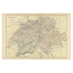
Original Antique Map of Switzerland, 1882
Located in Langweer, NL
Embark on a historical journey with an original Antique Map of Switzerland from the renowned 'Comprehensive Atlas and Geography of the World...
Category
Antique 1880s Maps
Materials
Paper
$219 Sale Price
20% Off
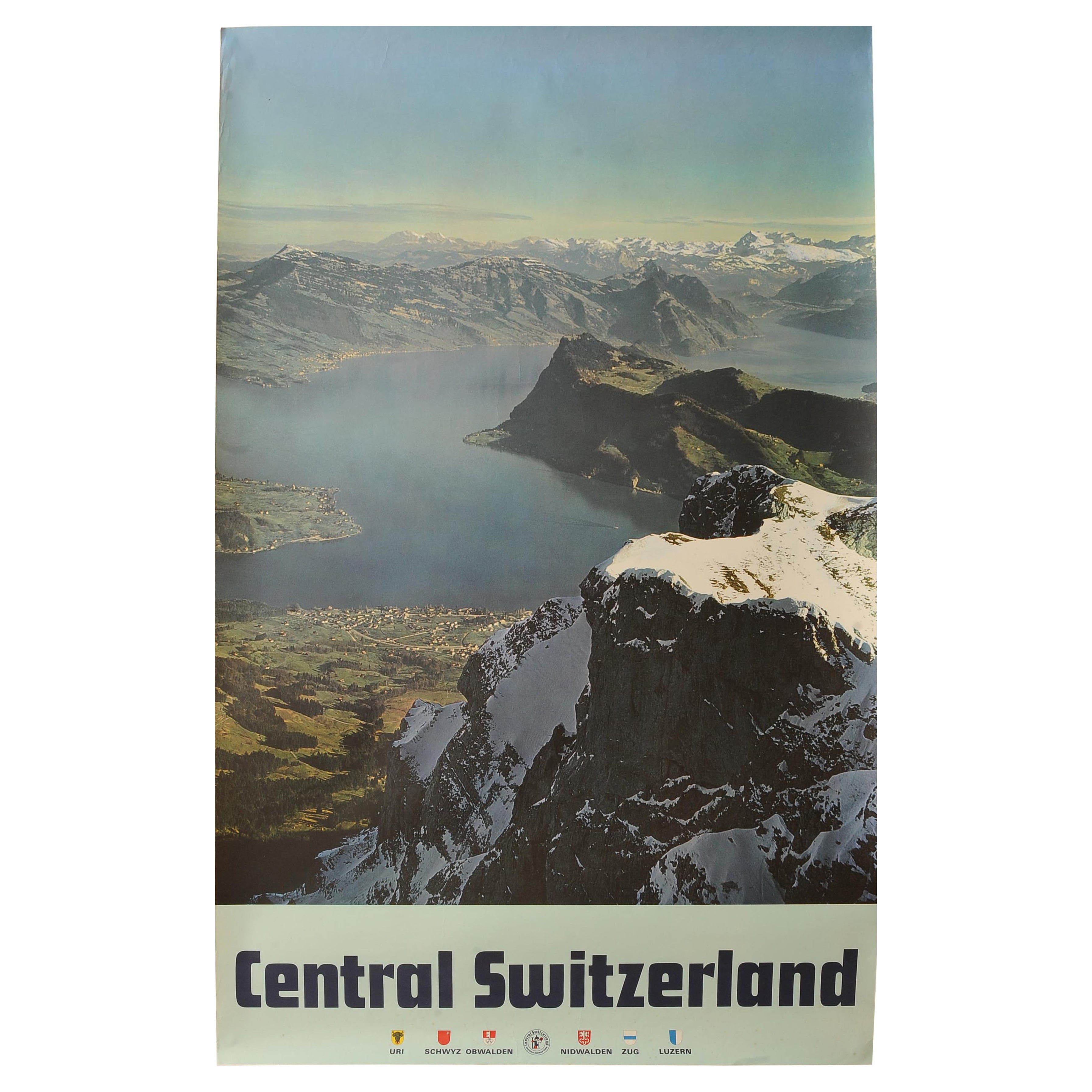
Original Vintage Swiss Travel Poster for Central Switzerland
Located in Reading, Berkshire
"Central Switzerland - Anytime Holiday Time" An Exquisite Swiss Travel Colour Photo Lithograph Poster Print from the 1960's
Dimensions 102 x 64 cm
Category
Vintage 1960s Swiss Mid-Century Modern Posters
Materials
Paper
