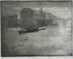
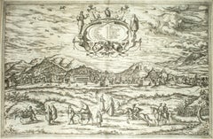
Marseille, Antique Map from "Civitates Orbis Terrarum"
View Similar Items

Want more images or videos?
Request additional images or videos from the seller
1 of 5
Franz HogenbergMarseille, Antique Map from "Civitates Orbis Terrarum"1575
1575
About the Item
- Creator:Franz Hogenberg (1540 - 1590, Flemish)
- Creation Year:1575
- Dimensions:Height: 16.03 in (40.7 cm)Width: 20.67 in (52.5 cm)Depth: 0.08 in (2 mm)
- Medium:
- Period:
- Condition:Good. Insurance may be requested by customers as additional service, contact us for more information.
- Gallery Location:Roma, IT
- Reference Number:Seller: J-718941stDibs: LU65032705081

Franz Hogenberg
Braun and Hogenberg's 'The Civitates Orbis Terrarum' was the second atlas of maps ever published and the first atlas of cities and towns of the world. It is one of the most important books published in the 16th century. Most of the maps in the atlas were engraved by Franz Hogenberg and the text, with its descriptions of the history and additional factual information of the cities, was written by a team of writers and edited by Georg Braun. The work contained 546 bird-eye views and map views of cities and towns from all over the world. It gave graphic representation of the main features of the illustrated cities and towns, including the buildings and streets. Although the ordinary buildings are stylized, the principal buildings are reproduced from actual drawings created on location. The principal landmarks and streets can still be recognized today. In addition, the maps often include the heraldic arms of the city, the nature of the surrounding countryside, the important rivers, streams and harbors, even depicting stone bridges, wooden pontoons, flat-bottomed ferries, ships and working boats, wharves and jetties, as well as land-based activities, including horsemen, pedestrians, wagons, coaches, and palanquins. Small vignettes are often included which illustrate the trade, occupations and habits of the local inhabitants, such as agriculture, paper-making and textiles, as well as local forms of punishment, such as gibbets, wheels, floggings etc. Large figures dressed in their local costume are often presented out of proportion in the foreground. The aim of the authors was to give as much information as possible in a pleasing visual form. They succeeded in creating maps that were both informative and decorative works of art. The atlas is a wonderful glimpse of life in medieval Europe. Georg Braun (1541-1622) was German Catholic cleric who was born and who died in Cologne, Germany. He was the principal editor of 'The Civitates Orbis Terrarum', acquiring the tables, hiring the artists, and composing the texts. Abraham Ortelius, whose Theatrum Orbis Terrarum of 1570 was the first atlas of maps ever published, assisted Braun in his compilation of the details and maps for the atlas. The Civitates was intended as a companion for the Ortellius' Theatrum, as suggested by the similarity in the titles. Braun was the only survivor of the original team to live to see the publication of last volume (VI) in 1617. Franz Hogenberg (1535-1590) was a Flemish and German painter, engraver, and mapmaker. He was born in Mechelen (also known as Malines) in Flanders, the son of an engraver. After being expelled from Antwerp by the Duke of Alva, he moved to London and then eventually to Cologne, Germany, where he met Georg Braun and Abraham Ortellius. He engraved most of the plates for Ortelius's Theatrum and the majority of those in the Civitates. Many believe that he was responsible for originating the Civitates project.
About the Seller
4.9
Platinum Seller
These expertly vetted sellers are 1stDibs' most experienced sellers and are rated highest by our customers.
1stDibs seller since 2017
6,753 sales on 1stDibs
Typical response time: 2 hours
More From This SellerView All
- Duomo TurkenBy Harry HenrikssonLocated in Roma, ITHenrikson Harry, Duomo Turken B/W Aquatint and Drypoint on paper. Image Dim: cm 36x39; Dim: cm 40x45. Hand-signed, hand-dated and hand-numbered with pencil on lower-left margin "H. Henriksson 1960 n 3/10". In back a blue ink stamp "II Biennale della Grafica, Palazzo Strozzi, Firenze, 30 aprile, 29 Giugno 1970". Wonderful printing proof...Category
1960s Landscape Prints
MaterialsAquatint
- The Domes - Lithograph by Felice Ludovisi - 1968Located in Roma, ITThe Domes is a modern artwork realized by Felice Ludovisi in 1968. China and penmarker drawing on paper. Hand signed and dated on the lower margin. ...Category
1980s Contemporary Figurative Prints
MaterialsPaper, Aquatint
- Landscape in Winter - Etching by André Hambourg - 1950sBy André HambourgLocated in Roma, ITLandscape in Winter is a etching and drypoint print on ivory-colored cardboard realized by André Hambourg, in the 1950s. Hand-signed on the Plate and lower. Good conditions. The a...Category
1950s Modern Landscape Prints
MaterialsAquatint, Etching
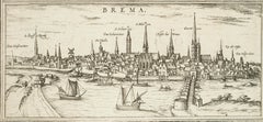
- Bremen, Map from "Civitates Orbis Terrarum" - by F.Hogenberg - 1572-1617By Franz HogenbergLocated in Roma, ITBraun G. and Hogenberg F., Brema, from the collection "Civitates Orbis Terrarum", Cologne, T. Graminaeus, 1572-1617. Image dimensions: 10.5 x 23.5 cm. Dimensions: 15 x 26 cm. Very f...Category
16th Century Figurative Prints
MaterialsEtching, Aquatint
- Granada, Map from "Civitates Orbis Terrarum" - by F.Hogenberg - 1575By Franz HogenbergLocated in Roma, IT"Granada", from the collection "Civitates Orbis Terrarum", Cologne, T. Graminaeus, 1575. Very nice B/W Aquatint, representing a View of Granada, from the East, which was perhaps t...Category
16th Century Figurative Prints
MaterialsEtching, Aquatint
- Bilbao, Antique Map from "Civitates Orbis Terrarum" - by F.Hogenberg - 1572-1617By Franz HogenbergLocated in Roma, ITBraun G., Hogenberg F., "Bilbao", from the collection "Civitates Orbis Terrarum", Cologne, T. Graminaeus, 1572-1617. Dim Image: cm 26 x 49. Very nice B/W Aquatint showing a view of ...Category
16th Century Figurative Prints
MaterialsAquatint, Etching
You May Also Like
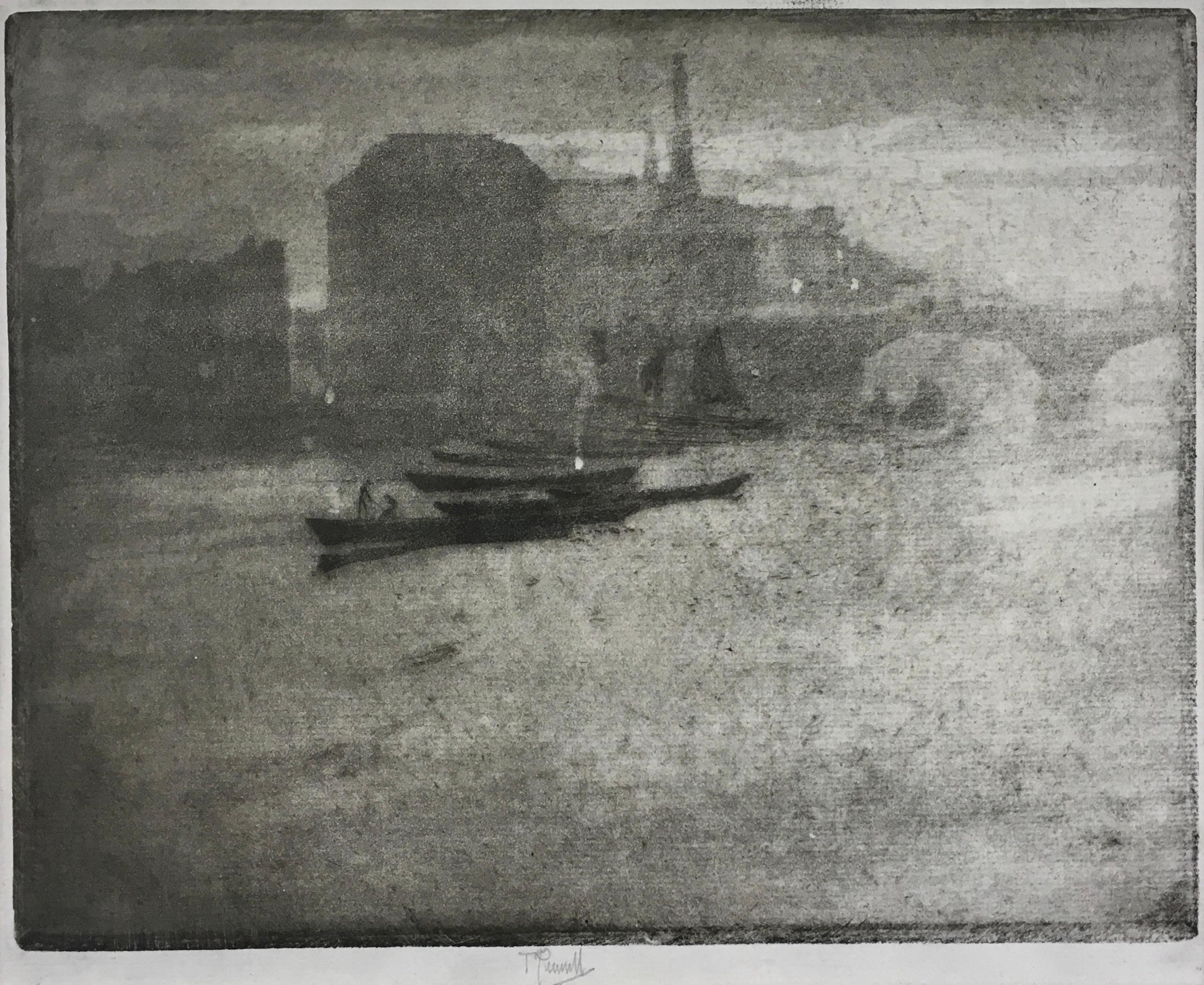
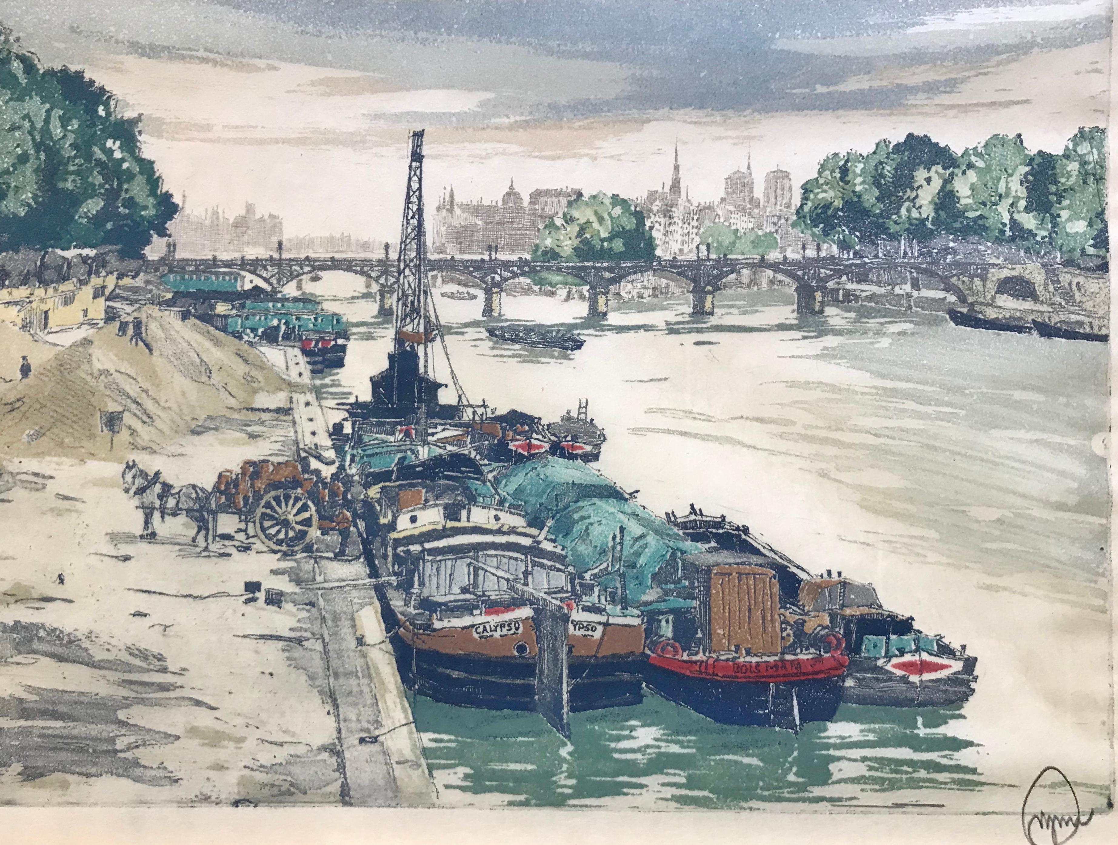
- The Thames, 1894 - Victorian aquatint etching of London by Joseph PennellBy Joseph PennellLocated in London, GBJOSEPH PENNELL (1857-1926) The Thames, 1894 Signed Aquatint Plate size 20.5 by 26.5 cm., 8 by 10 ½ in. (frame size 42 by 46 cm., 16 ½ by 18 in.) Pennell was born in Philadelphia where he studied at School of Industrial Art and the Academy of Fine Arts. In 1884 he was commissioned by the Century Magazine to supply a series of drawings of London...Category
1890s Realist Landscape Prints
MaterialsAquatint
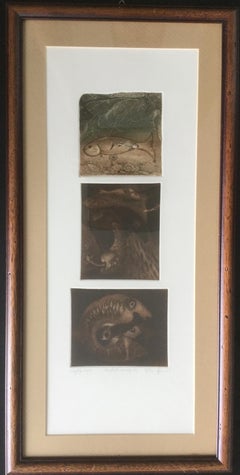
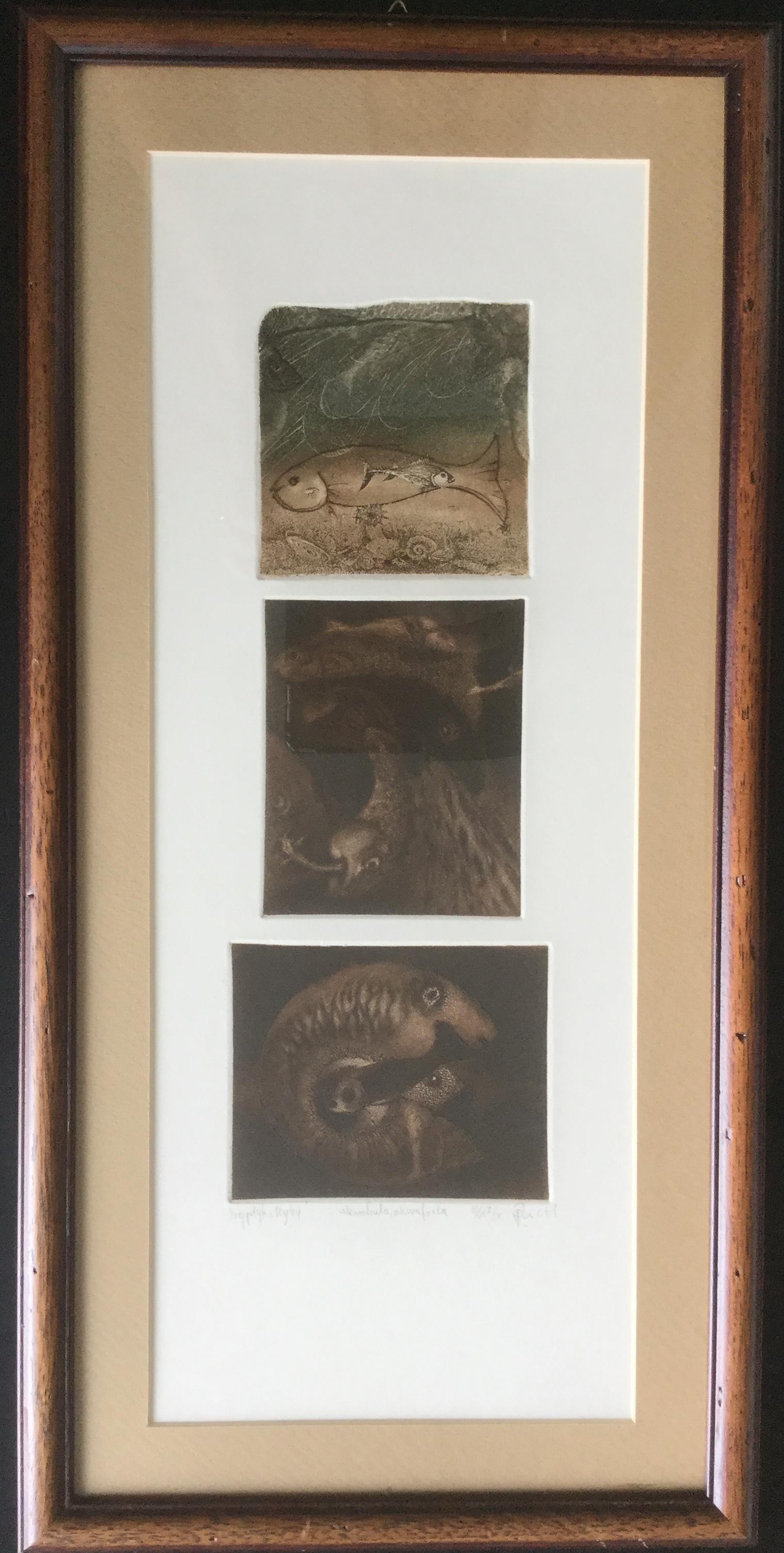
- Fish Triptych - XX century, Figurative Etching Aquatint Print, small edition 7/XBy Andrzej JuchniewiczLocated in Salzburg, ATThe graphic is already framed. About Andrzej Juchniewicz - 1967–1972 Secondary School of Fine Arts in Gdynia-Orłowo. 1978–1983 studies at the Acad...Category
1990s Contemporary Landscape Prints
MaterialsPaper, Aquatint, Etching
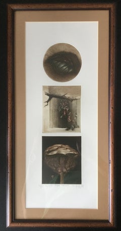
- Leaves, Twigs and Trees Triptych - Figurative Mixed Med Print, small edition 2/XBy Andrzej JuchniewiczLocated in Salzburg, ATThe graphic is already framed. About Andrzej Juchniewicz - 1967–1972 Secondary School of Fine Arts in Gdynia-Orłowo. 1978–1983 studies at the Acad...Category
1990s Contemporary Landscape Prints
MaterialsPaper, Aquatint, Etching, Mixed Media
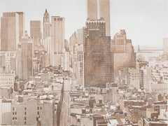
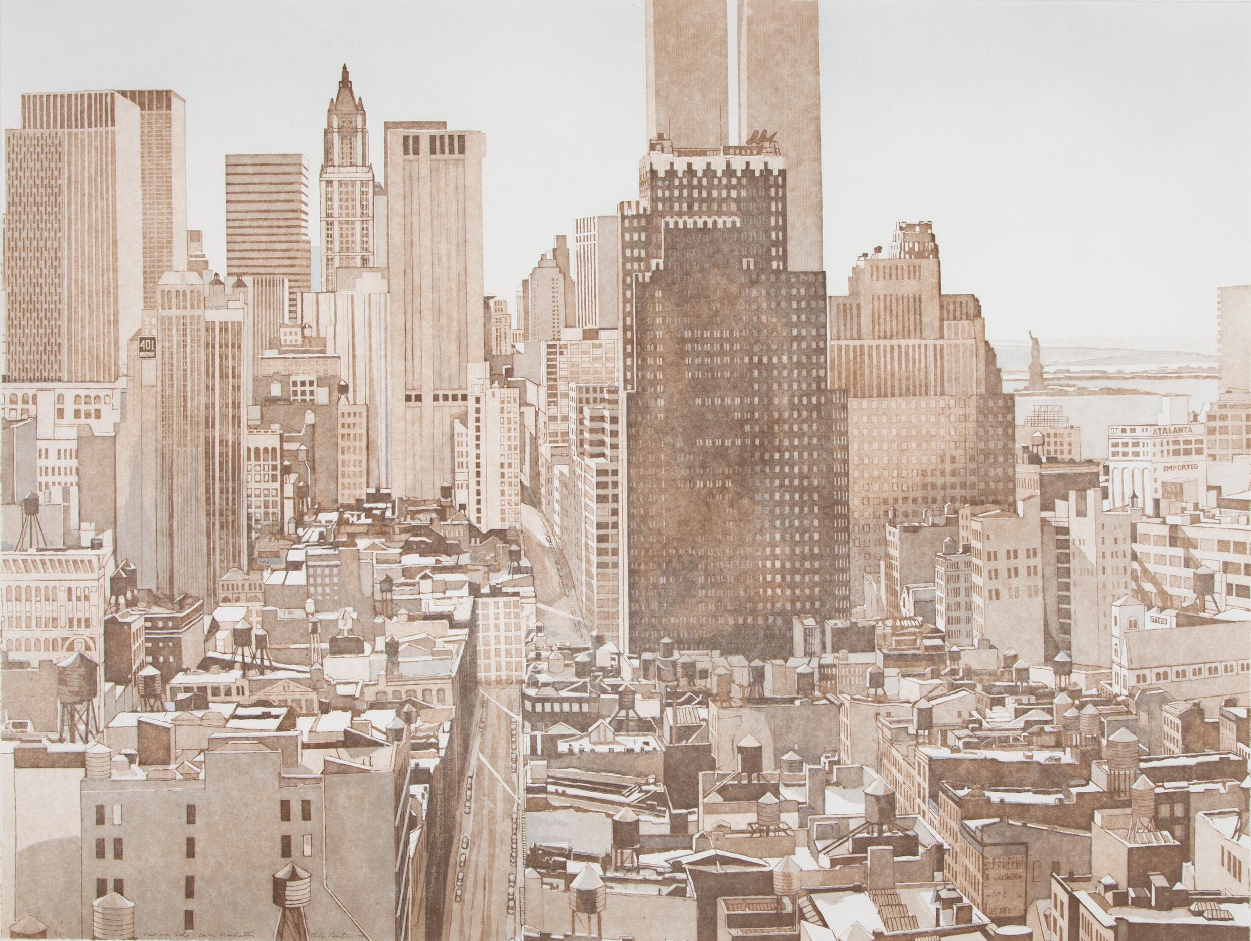
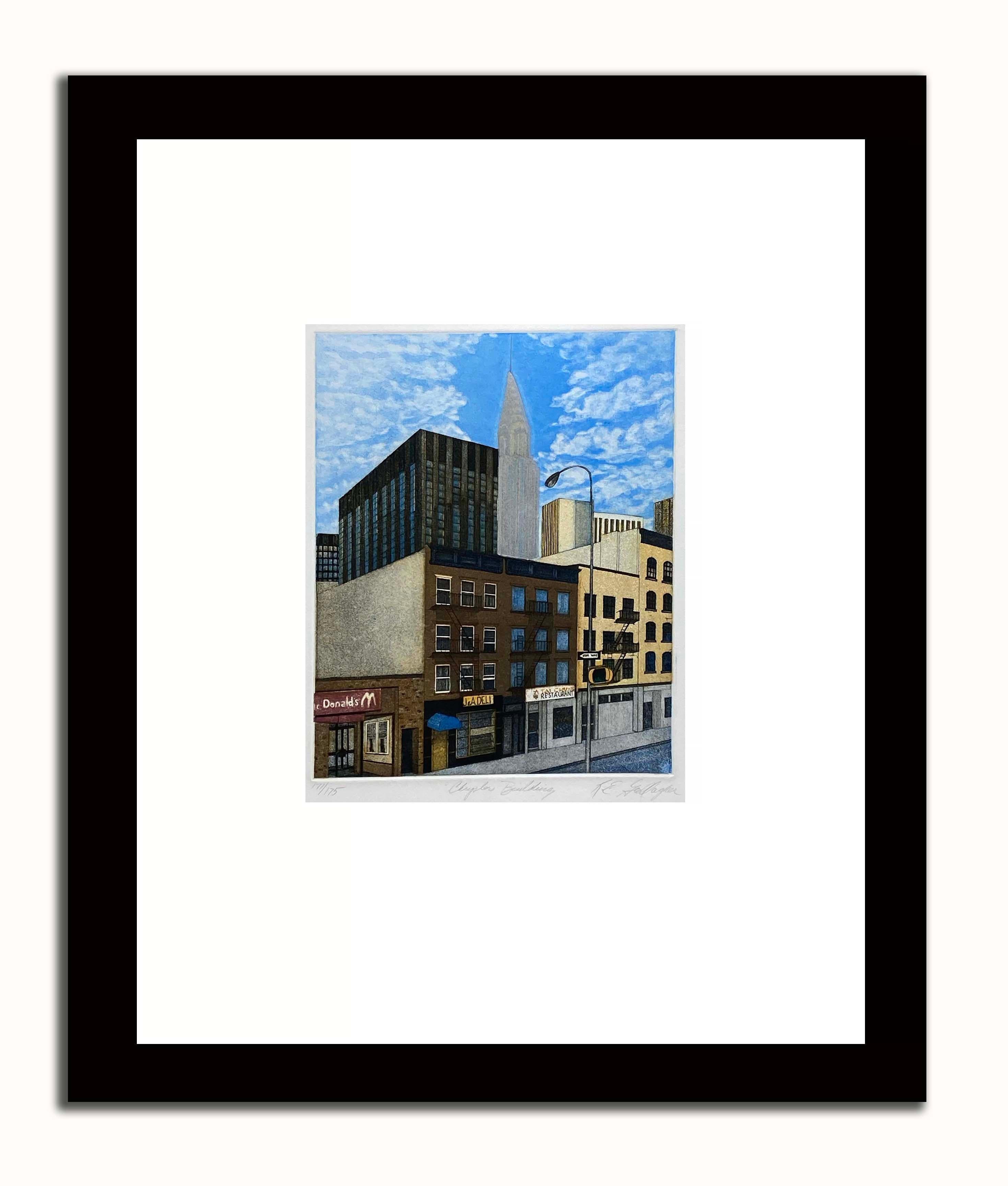
- Philip Pearlstein 'View Over Soho, Lower Manhattan' NYC signed, printBy Philip PearlsteinLocated in San Rafael, CAPhilip Pearlstein (1924-2022) View Over Soho, Lower Manhattan, 1977 Aquatint in colors on wove paper Edition 7/41 Signed, editioned and titled in pencil lower left Printed by the Orl...Category
1970s Realist Landscape Prints
MaterialsAquatint
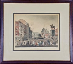
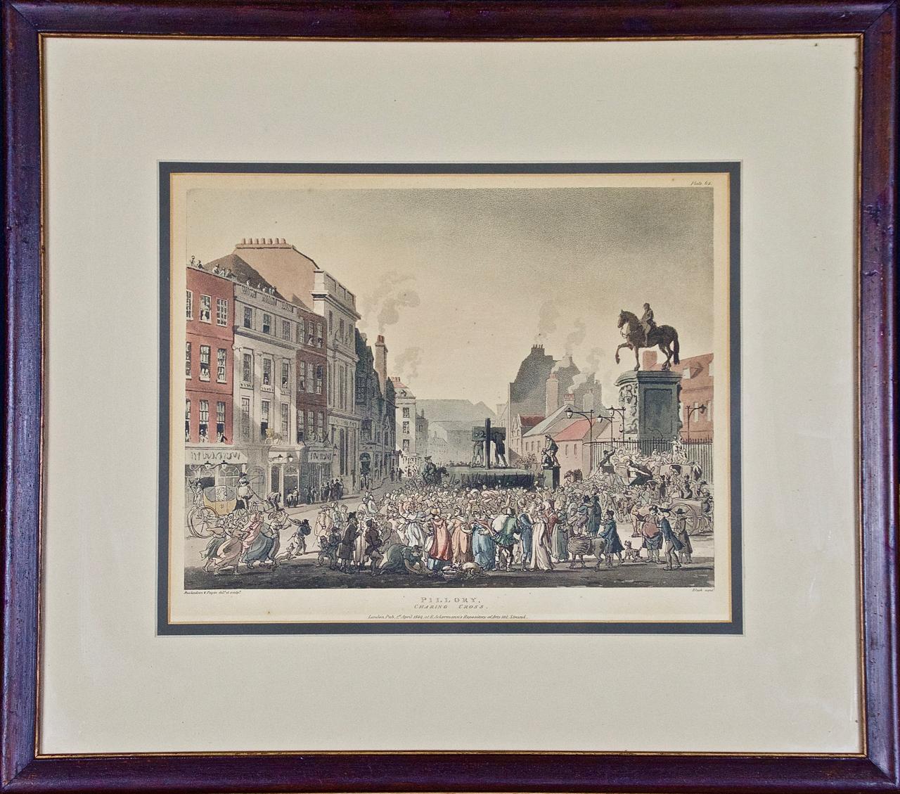
- "Pillory, Charing Cross" by Rowlandson from "The Microcosm of London"By Thomas RowlandsonLocated in Alamo, CA"Pillory, Charing Cross" is an illustration (Plate 62) from "The Microcosm of London", published in London in 1809 by R Ackermann's Repository of Arts. The scene was created by one of the most famous British satirists and caricaturists of the late 18th and early 19th centuries' Georgian Period, Thomas Rowlandson, who drew the figures, while Augustus Charles Pugin drew the architecture. The plate was then created by Hill, Stadler and Bluck using a combination of aquatint and etching and was then hand colored with watercolor. Scenes illustrated in "The Microcosm of London" gives an accurate and often comical view of everyday life in London during the Regency Period of the early 19th century. While Pugin’s excellent architectural drawings capture the size and shape of the exterior as well as the interior of London’s principal buildings, Thomas Rowlandson’s insightful and often whimsical and satirical view of the city's inhabitants depicts the color and vitality of the late Georgian society, both rich and poor alike. This print depicts the "Pillory, Charing Cross", where criminals were brought and placed on display while secure in the stocks, as are seen in this print. A crowd is present in the square jeering at the prisoners. A statue of Charles I on horseback stands atop a very large pillar to the right. Shops with apartments are seen on the left. Young wealthy people frolic around and on a carriage on the right in front of the statue of King...Category
Early 1800s Other Art Style Landscape Prints
MaterialsEtching, Aquatint
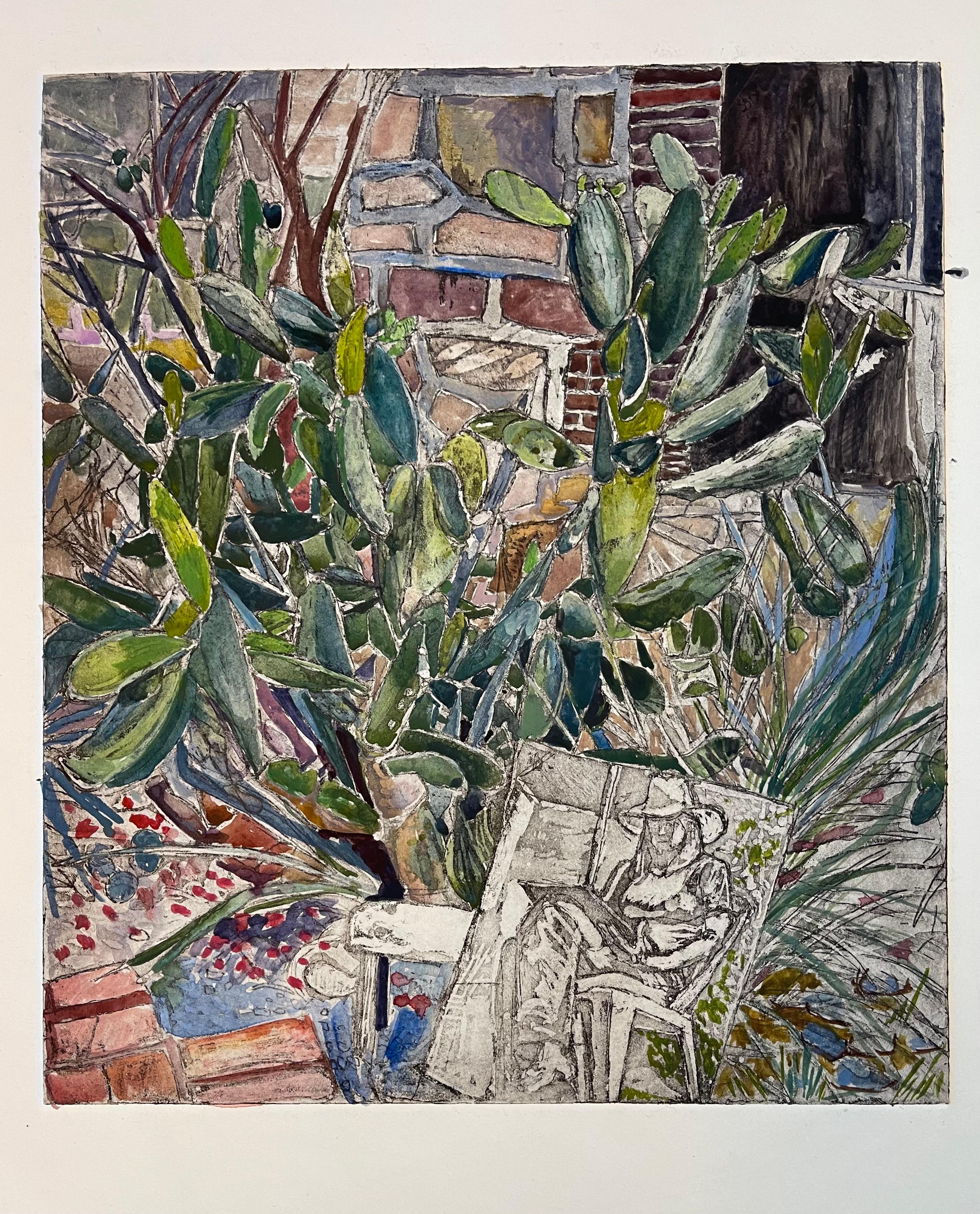
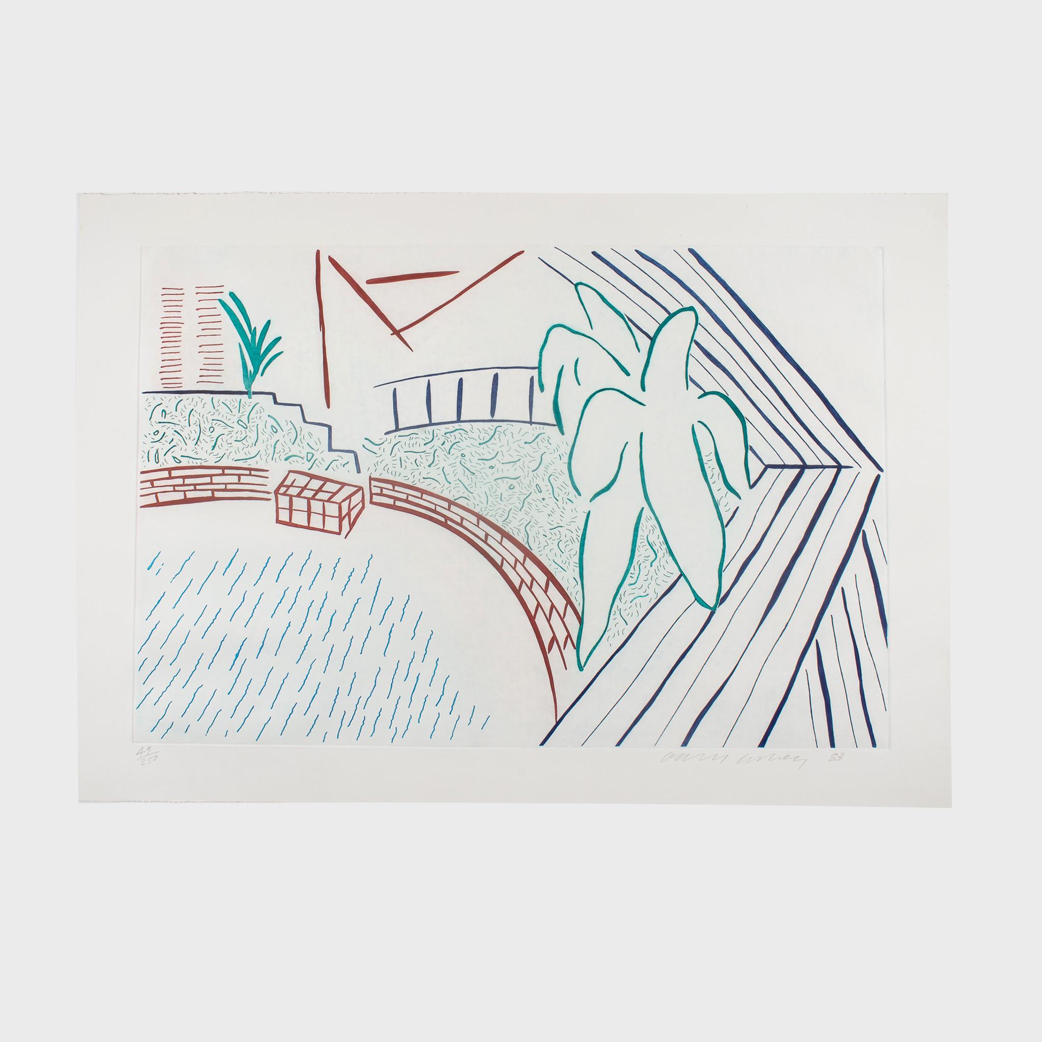
- Mexican Garden TangleBy Jenny TothLocated in Brooklyn, NYThis is an artist proof (one of a kind) aquatint and watercolor depicting a cactus-filled Mexican garden, a mirror tilted up and an image of the artist s...Category
2010s Contemporary Figurative Prints
MaterialsPaper, Ink, Archival Ink, Aquatint, Watercolor